Having visited many a locale in both states previously, my buddy, Coop, and I decided to visit this new, two-state area, with the hopes of catching some views and good times.
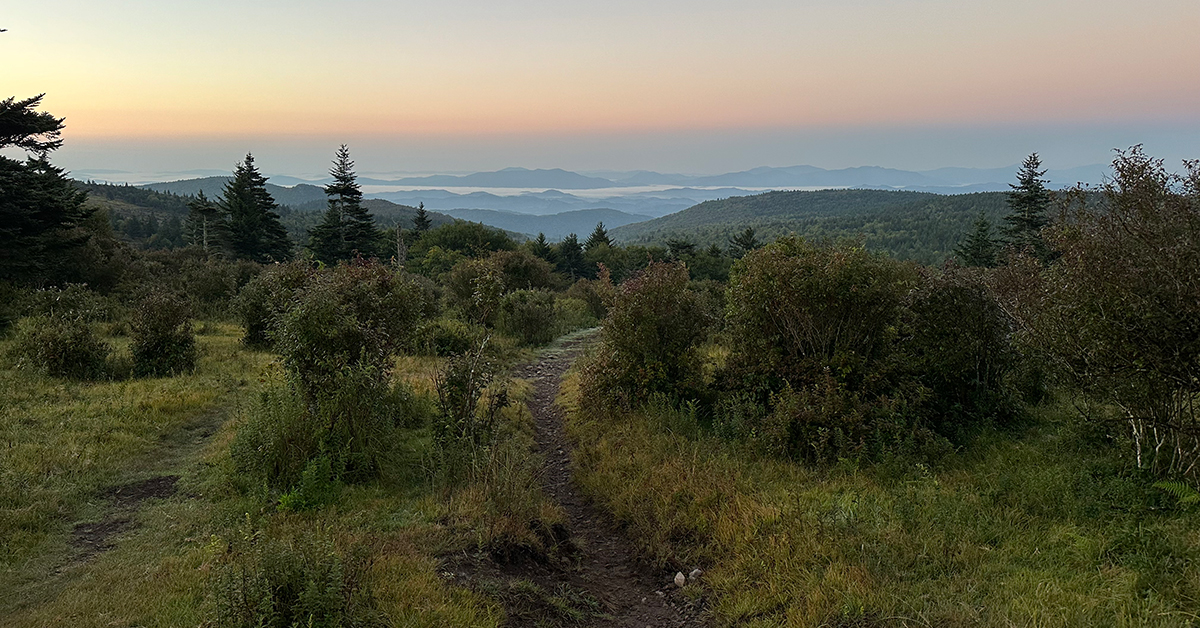
A three-day, two-night backpacking trip my son and I took to Grayson Highlands in August 2024 starting from Fox Creek Trailhead parking lot off Fairwood Road (VA603) near Mouth of Wilson, Virginia.
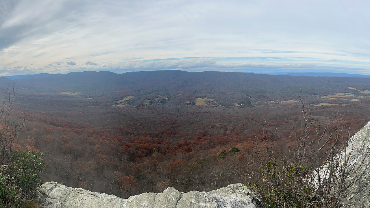
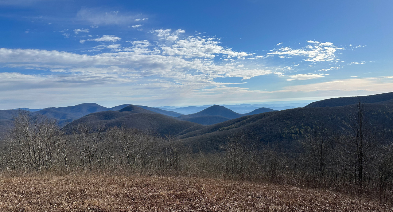
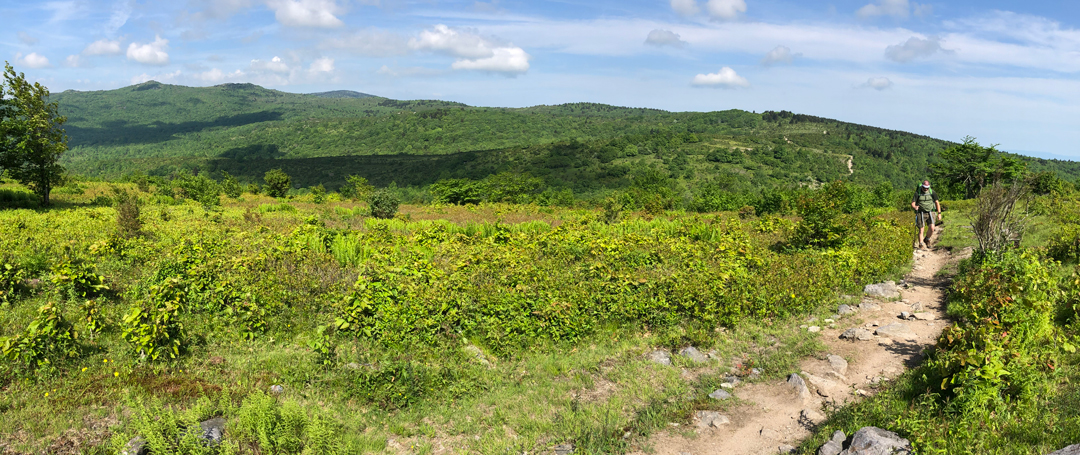
View of Grayson Highlands from Crest Trail near Pine Mountain/AT junction
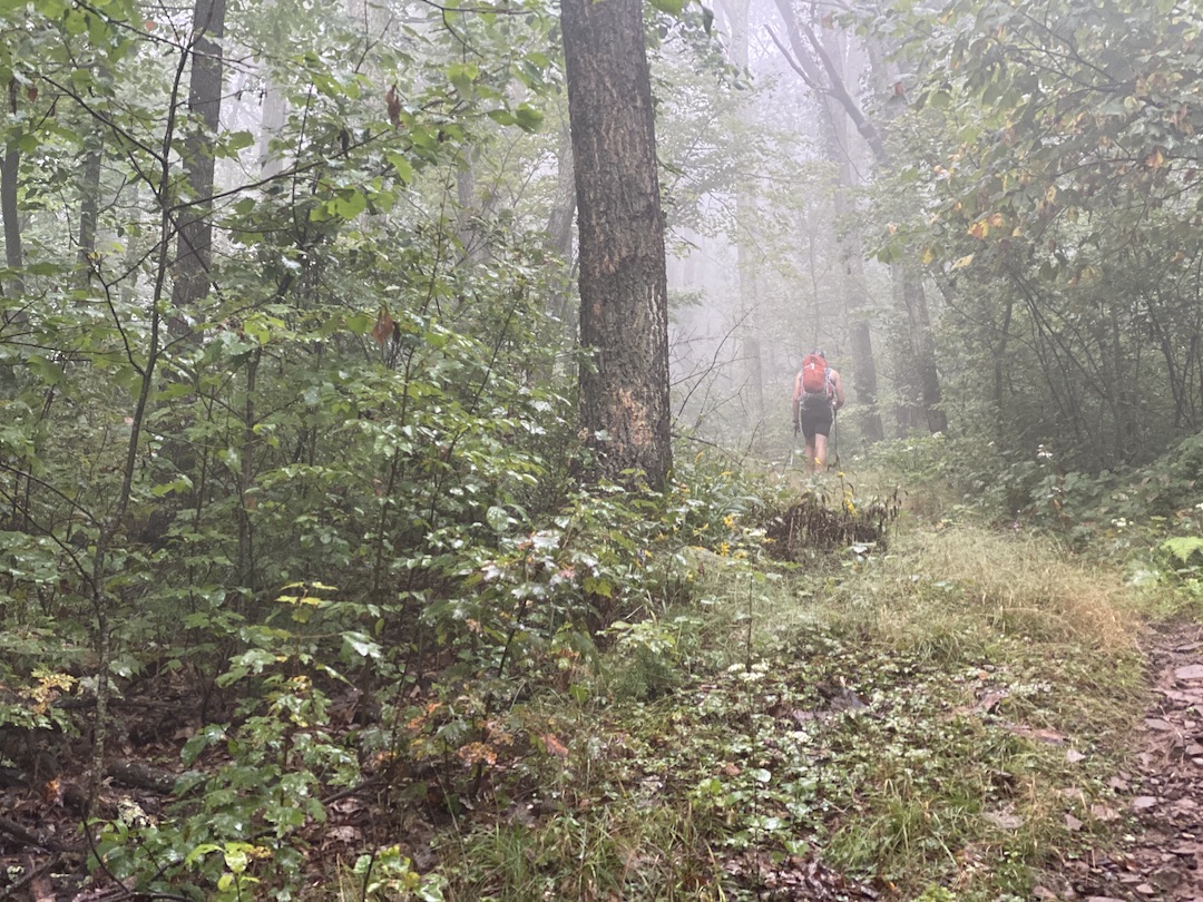
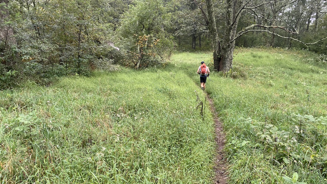
The summertime is a great time to hit the trails. The best! Well, except for the heat, dried up water sources, things that bite, things that fly and bite, and the heat. Did I mention the heat? Man, I am not a fan of the heat. When my nephew, Joaquin, came to town I wanted to take him on his first backpacking trip and needed to find a location where the conditions were just right (i.e. the aforementioned exceptions could be managed). Enter the Iron Mountain Trail (IMT).
The yellow-blazed Iron Mountain Trail spans 47 miles from Highway 91 near Tennessee in the south to VA16 at Iron Mountain Gap in the north. Up until 1972, the IMT was part of the Appalachian Trail (AT) when it was relocated to the south to accommodate communication towers and power lines in order to maintain the secluded experience hikers have come to expect from the AT.
I hiked the IMT previously and figured its solitude, milder temperatures, and close proximity to Grayson Highlands made it the perfect place to take my nephew.
In November 2019, I ran the Mountain Masochist 50-mile trail run from Monroe to Montebello, Virginia with my buddy, Coop. During the race, we completed a 5-ish mile loop around Mt. Pleasant, an aptly named national scenic area with picturesque views. As we finished the race, and for the next couple of years, we talked about returning to the area with backpacks, but we never did, until we did.
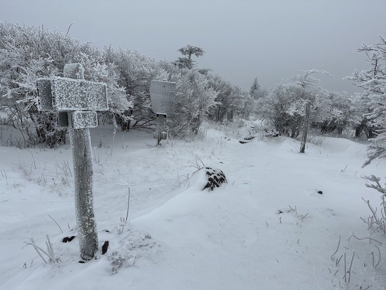
The Mount Rogers National Recreation Area (NRA), a nearly 200,000 acre National Forest in southwestern Virginia is one of my favorite backpacking destinations. Sure the terrain can be challenging and the weather is often unpredictable, but there are wild ponies, the Appalachian Trail (AT) runs through the area, the views are magnificent, and it can be exceptionally peaceful when there is snow on the ground. It’s a place I keep coming back to and a place I thought I’d take a friend of a friend, Rodrigo, for his first winter backpacking trip in the southeast.
When my buddy, Coop, suggested we hit the trails for a February backpacking trip we kicked around some ideas: Cold Mountain and Mt. Mitchell in NC, Cranberry Wilderness in WV, and Mt. Pleasant and Apple Orchard in VA. To refine the list, he put together a handful of options in each location before we ultimately decided on the James River Face Wilderness in Jefferson National Forest between the James River on the north and Blue Ridge Parkway to the south.
The James River Face Wilderness is an 8,907-acre area located near Natural Bridge, Virginia that includes several well-maintained trails including the iconic Appalachian Trail (AT) which passes over the 623 foot James River Foot Bridge, and the Belfast Trail which leads to the Devil’s Marbleyard and its colossal, car-sized Antietam Quartzite boulders.
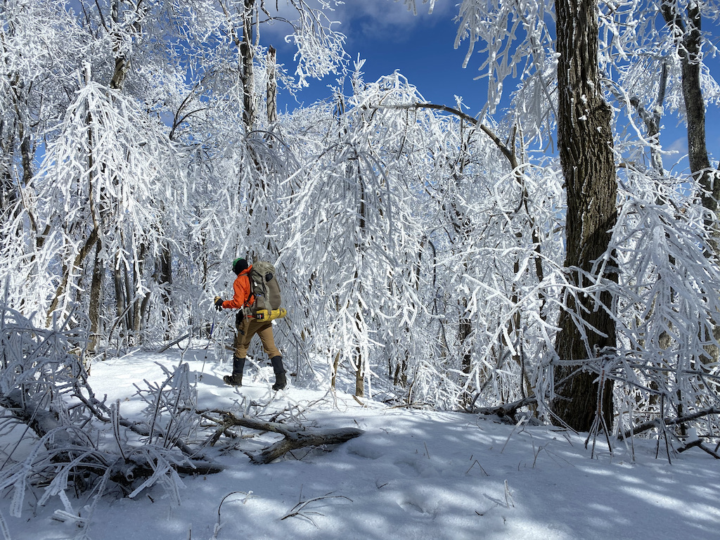
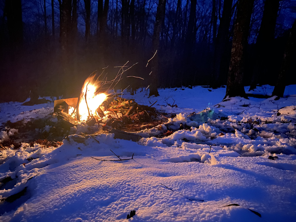
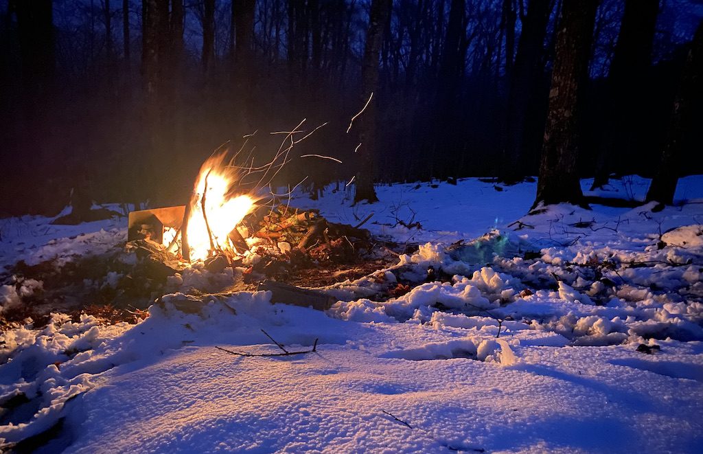
Winter is arguably the best season for backpacking. Top 4 for certain. Sure, I shake uncontrollably between the fire and my sleeping bag, and my nose runs like an open spigot, and I generally cannot feel my toes, but it’s also peaceful, quiet, and serene. Oh, and let’s not forget about the snow. Man I love snow!
With COVID-19 still running amuck, my brother-in-law, Ken, and I were desperate to stave off cabin fever and get outside. Our only criteria: water and fire. Looking around, we considered Pisgah National Forest, Mt. Rogers National Recreation Area, and Monongahela National Forest before deciding on Mt. Rogers and its nearly 200,000 acres of National Forest in southwestern Virginia.
When COVID-19 shut things down and my work switched to remote, I challenged myself to run a 10K a day. Months later, my buddy, Coop, suggested we hit the trails. I asked if we could fastpack (trail running + backpacking) so I could keep my streak alive, and he agreed wholeheartedly; even suggested Wild Oak Trail, a location we had visited previously back in November 2019.
Designated as a National Recreation Trail in 1979, the Wild Oak National Recreation Trail (TWOT) is a 27-mile loop offering 7,000′ of elevation gain within the George Washington National Forest just west of Staunton, Virginia. It’s a hot spot for mountain bikers, backpackers, and ultrarunners, and the perfect place for our first foray into fastpacking.
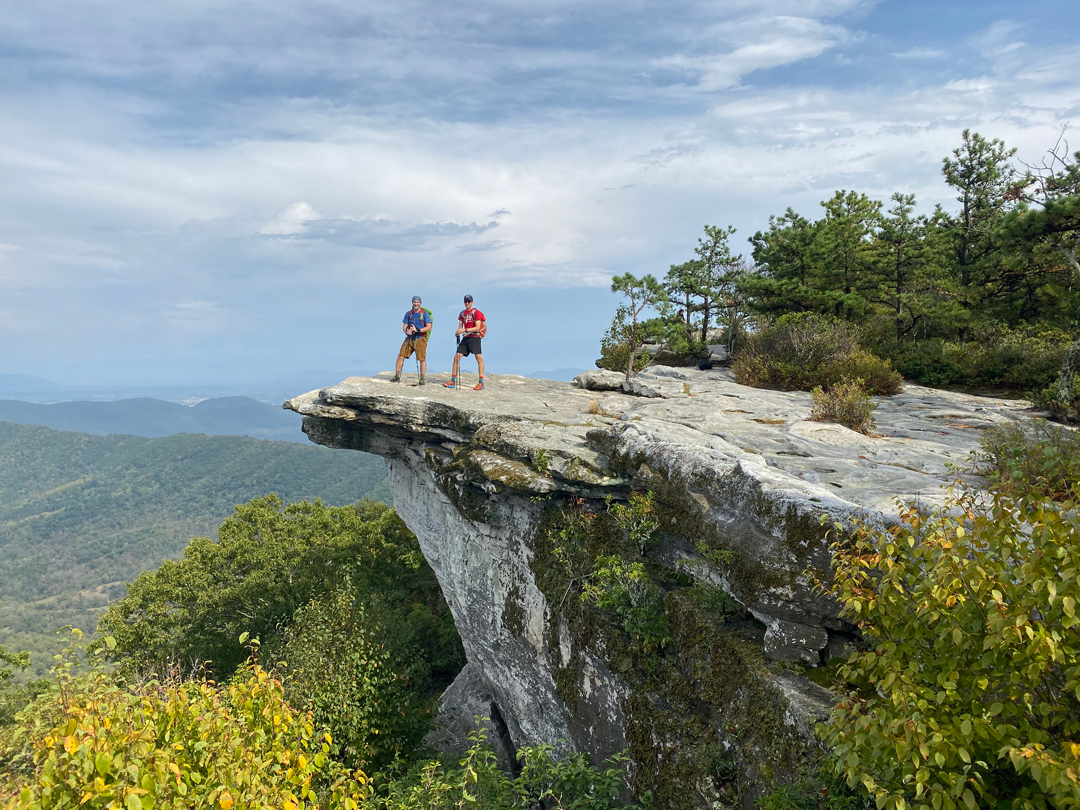
If you’ve hiked the Appalachian Trail (AT) or seen photos of other people hiking the AT chances are you’ve seen Virginia’s Triple Crown. Located in the Roanoke Valley in Virginia’s Blue Ridge Mountains, the Triple Crown is comprised of three legs: Tinker Cliffs, McAfee Knob, and Dragon’s Tooth. As a loop, the Triple Crown is 35.1 miles long with almost ~8,000′ of gain making for a challenging day hike or a manageable 2- or 3-day trip.
I considered the Triple Crown for a trip back in August, but opted for Linville Gorge due to 100° heat indices and lack of available water sources. With temps on the decline, my buddy, Coop, and I prayed for rain and started planning our trip.
Located in southwest Virginia, the Mount Rogers National Recreation Area (NRA), Grayson Highlands State Park, and surrounding National Forest lands are popular destinations for hikers and backpackers looking to log a few miles, take in breathtaking views, and observe wildlife of all types. In the past year or so, particularly along the Appalachian Trail (AT), the area has also become popular among black bears.
According to the Appalachian Trail Conservancy’s 2018 Bear Incident report, black bears have successfully retrieved more than 70 food bags hung in trees and damaged packs and tents as far south as Thomas Knob Shelter. As a result, the Forest Service closed the area for a time and, with the help of the Mount Rogers Appalachian Trail club, installed bear boxes at 6 sites: Thomas Knob Shelter, Rhododendron Gap between the AT and the Crest Trail, Wise Shelter, Old Orchard Shelter, Hurricane Mountain Shelter, and Trimpi Shelter.
With this in mind, my brother-in-law, Ken, and I decided to assume the risks and brave the crowds and bears for a Memorial Day weekend backpacking trip to the Mount Rogers National Recreation Area.