When COVID-19 shut things down and my work switched to remote, I challenged myself to run a 10K a day. Months later, my buddy, Coop, suggested we hit the trails. I asked if we could fastpack (trail running + backpacking) so I could keep my streak alive, and he agreed wholeheartedly; even suggested Wild Oak Trail, a location we had visited previously back in November 2019.
Designated as a National Recreation Trail in 1979, the Wild Oak National Recreation Trail (TWOT) is a 27-mile loop offering 7,000′ of elevation gain within the George Washington National Forest just west of Staunton, Virginia. It’s a hot spot for mountain bikers, backpackers, and ultrarunners, and the perfect place for our first foray into fastpacking.
THE PLAN
Since we visited Wild Oak previously, we rechecked our original maps using GAIA GPS, Garmin Connect, and AllTrails, and then I built out a route based on our first experience. This time around we planned to skip the Lookout Mountain section in favor of the North River Gorge Trail down below. The only issue, for me anyway, was the length of the third leg. In order to get a minimum 10K (6.2 miles), I’d need to add 1.8 miles somewhere. I threw out some options and we decided to figure it out when we got there.
Next up, the weather. Ten days out the forecast called for rain all day on Saturday with a slight chance for thunderstorms Sunday evening, and temperatures were predicted to be between 57°F and 82°F each of the three days. Seven days out, rain chances were mostly limited to Saturday, with a slight chance for showers on Sunday. Two days out, rain was limited to 40% on Saturday, and Sunday and Monday were supposed to be cloudy and cool. No complaining here.
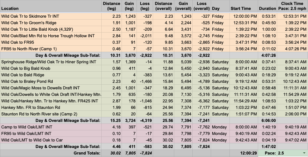
With route and weather information in hand, I built out the trip in our spreadsheet based on a 2.5MPH pace…
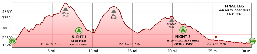
…created an elevation profile using Google Earth
…dropped in the route
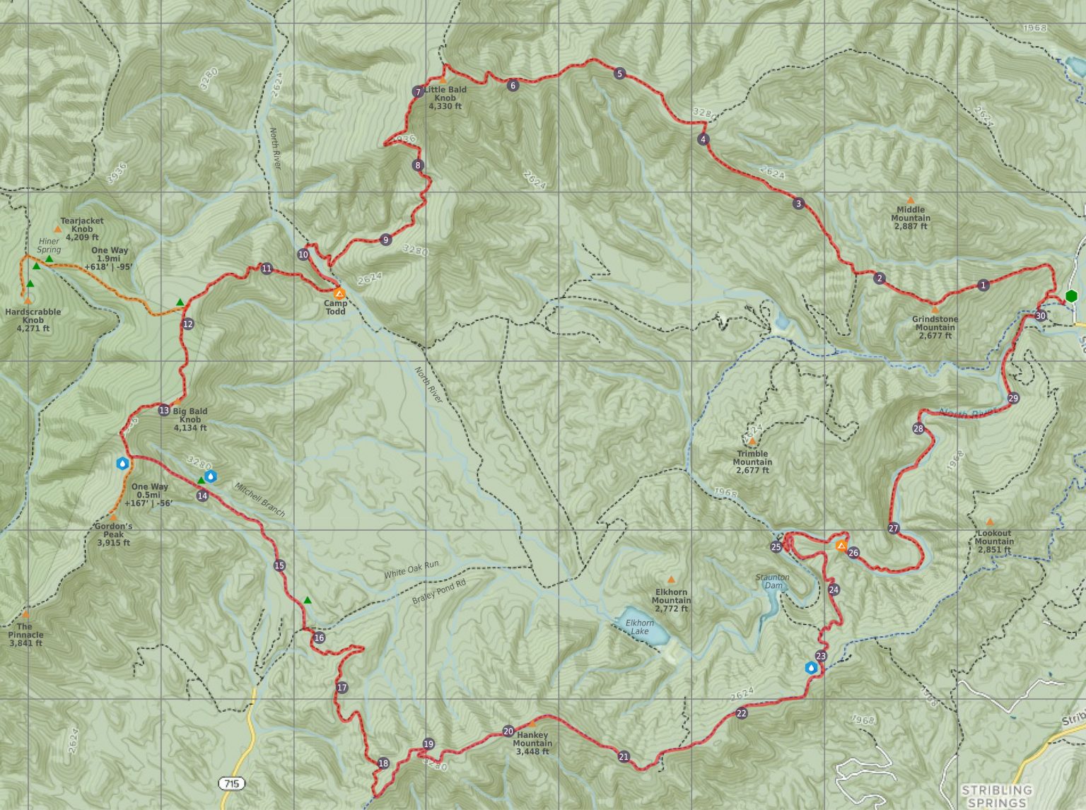
…and packaged it all in a map I printed on TerraSlate paper.
PACKING IT IN
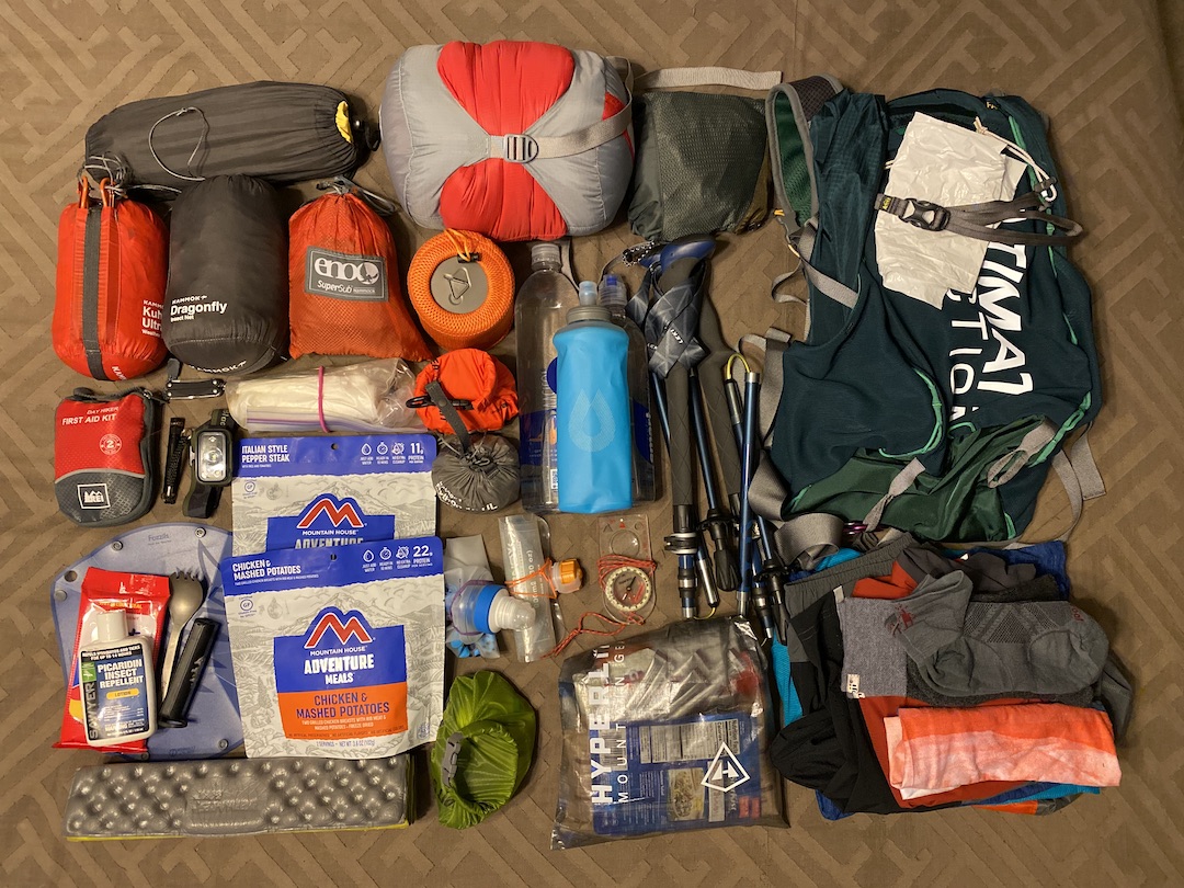
Prior to this trip, my lightest pack weight was for an overnight trip where I brought along 23 pounds. My lightest 2-night pack came in around 24 pounds. For this trip to work, I needed my pack to weigh under 20 pounds. Where to begin?
For starters, I didn’t pack the luxury items (chair, pillow, tripod, etc.). Total no-brainers. Then, I looked at my actual backpack options: 18L (1.77 pounds), 34L (2.75 pounds), and 50L (4 pounds). Hmm, perhaps I could find something lighter and built for running. I did a bit of research and decided on an Ultimate Direction 35L Fastpack (1.56 pounds).
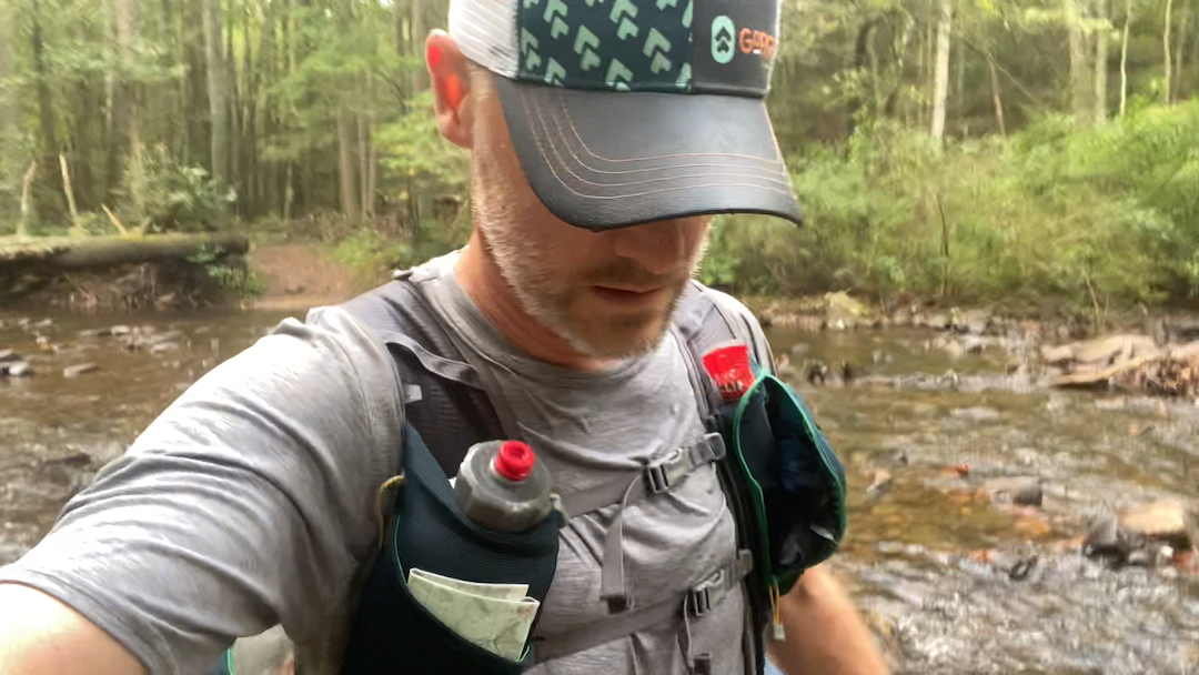
Next, I focused on clothing. Instead of hiking shorts, wool shirts, boxers, and hiking socks, I opted for 5″ running shorts, lightweight running shirts, and low-cut socks. With rain a potential issue, I brought my Salomon Bonatti rain jacket, a pair of Outdoor Research Helium rain pants, and my Dirty Girl gaiters. And, since I’d be doing a mix of running and hiking as well as navigating river crossings, I brought along collapsible Leki poles.
Knowing that consumables tend to make up a good deal of pack weight and that I needed a lot of calories to keep moving, I packed a combination of GUs, Blocks, and Tailwind along with high-calorie, low-weight snack options, some dehydrated food, a bottle of spirits, and 3.5 pounds of water (1 UD 20 oz Flex Form bottle and 2, 23.7 oz Smart Water bottles).
To help a bit more, Coop and I decided to split up some gear to lighten our respective loads which resulted in me not having to bring a saw or fuel canister.
So, after much deliberation and effort, my Ultimate Direction 35L weighed in at 18 lbs. 14.1 oz (12 lbs 0.2 oz pack weight and 6 lbs. 13.9 oz of food/water). My lightest pack ever!
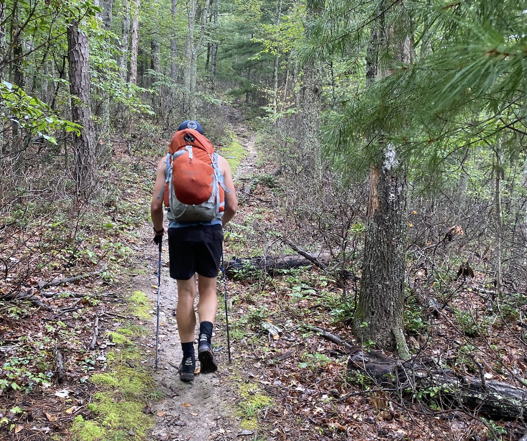
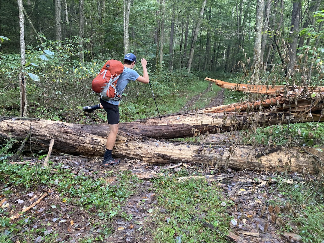
DAY 1 (10.79 MI | +3,537′ GAIN | -2,772′ LOSS)
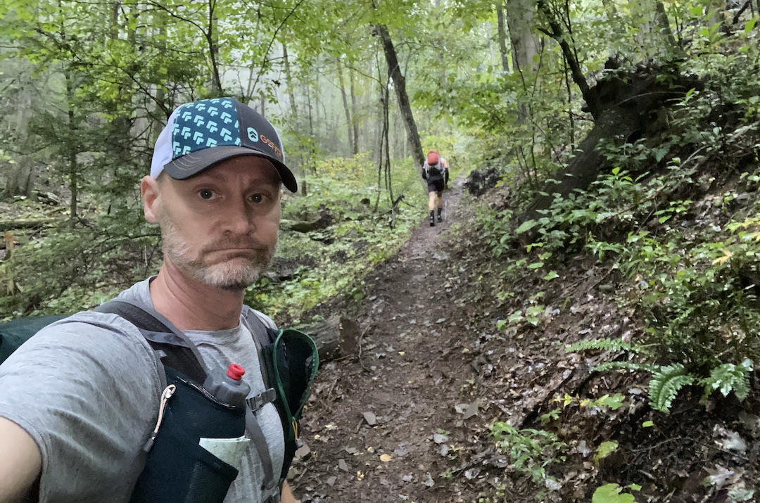
We pulled into the parking lot off FR95 around 11AM and loaded up. The air was cool, but humid, and the skies were layered with clouds. Without any signs of rain, we left our rain gear in our packs and took off up the trail. Within a quarter mile we were off course after crossing a road we knew we shouldn’t have and turning on a trail towards North River which we shouldn’t see until Monday.
We quickly realized our mistake—we were looking down instead of up which is a habit associated with trail running. We righted our wrong, made a left at the split (where Wild Oak Trail runs north towards Little Bald and straight back to the parking lot), and made our way up the hill towards Skidmore Trail continuing to run for a bit longer.
A half mile up, we slowed our pace to a hike. I did a quick check of the UD pack. The hip belt was doing a good job of preventing the pack from bouncing and shifting, and the foam insert seemed to provide structure to a pack filled with many items. These two observations ran contrary to what reviewers had suggested: remove the hip belt and the padding because they aren’t really necessary and totally not worth the weight. Thus far, I begged to differ.
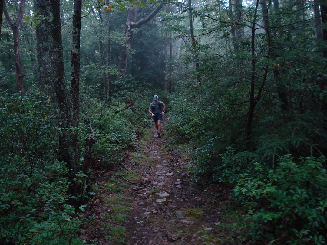
We reached the top of Grindstone after 49 minutes (and 0.5 miles of misdirection) which put us slightly faster than 3MPH. We took advantage of the downhill and ran 0.75 miles to the Wild Oak/Skidmore Trail intersection where Skidmore runs from the southwest/left to northwest/right and Wild Oak continues northeast/straight.

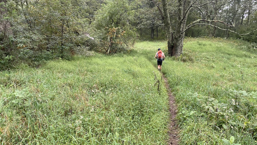
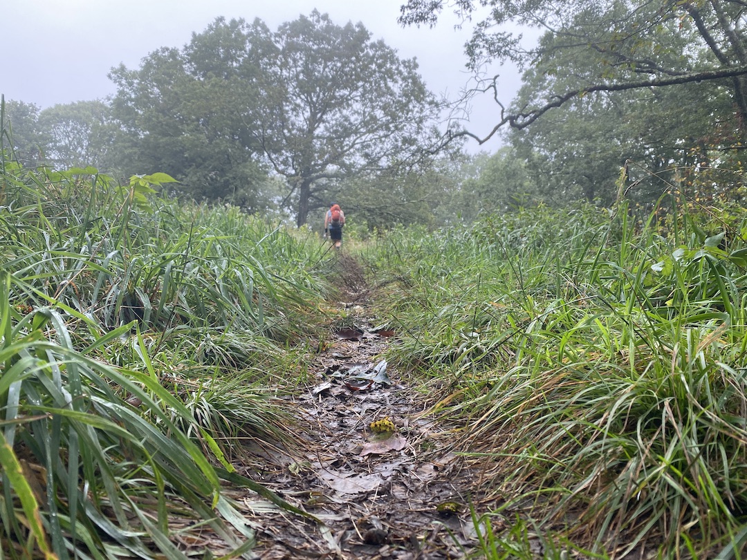
From Skidmore, we hiked, ran, and jogged up 1,000′ over 2 miles en route to Groom’s Ridge, a trail that runs off to the northeast. Little Bald was a mere 2.6 miles and 1,110′ of gain away. For most of it, we were able to run and hike. But we transitioned to all hike once we hit the final 0.75 climb to the top.
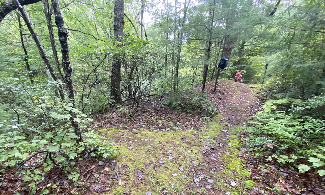
At the summit, the trail split to the west (Wild Oak) and to the north (Bald Mountain Road). Just past the intersection, a clearing housed two campsites with serious lightning potential. We stopped for a bit, adjusted our packs, chomped some snacks, and downed a bit of water.
My shoulder blades were tight so I adjusted the shoulder straps and loosened the chest straps which proved most helpful. We then hiked down the road to check out an invisible pond obscured by the fog, then made our way back to the clearing slightly disappointed.
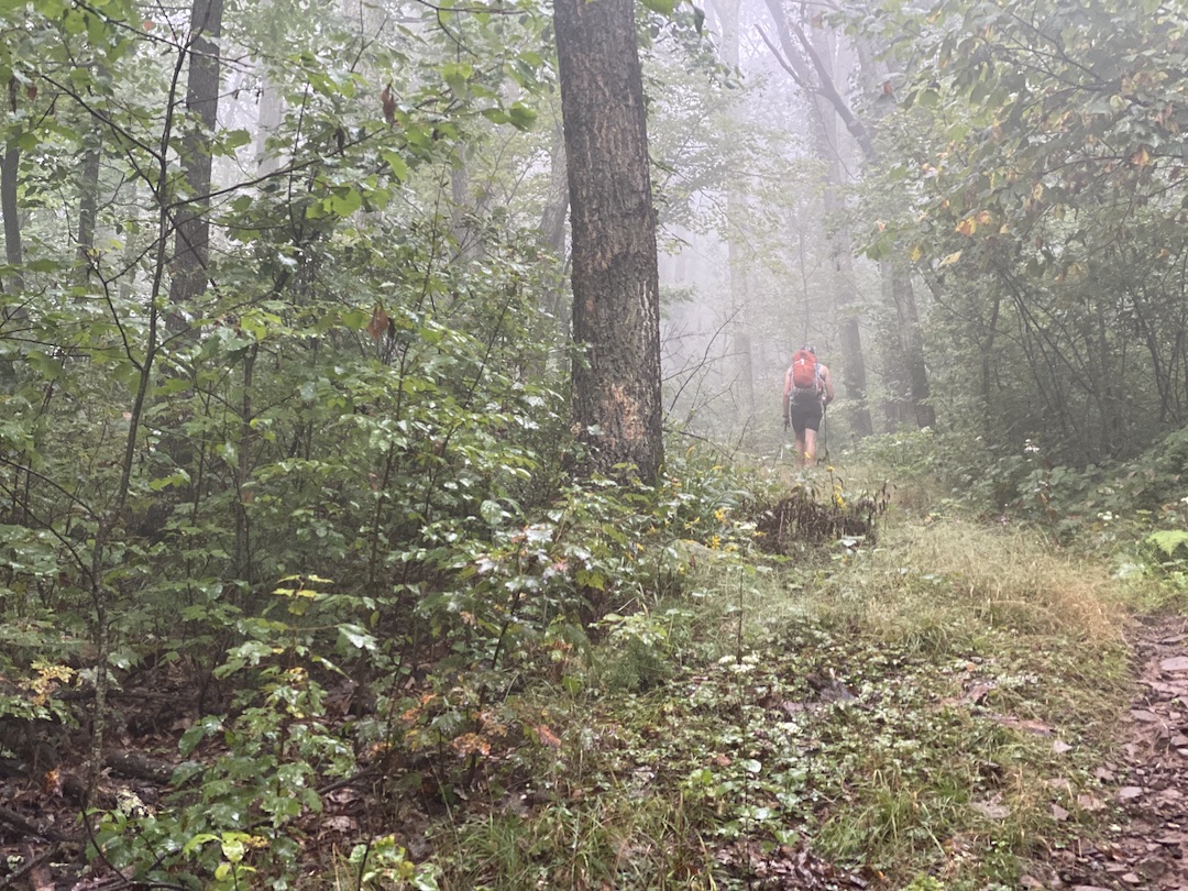
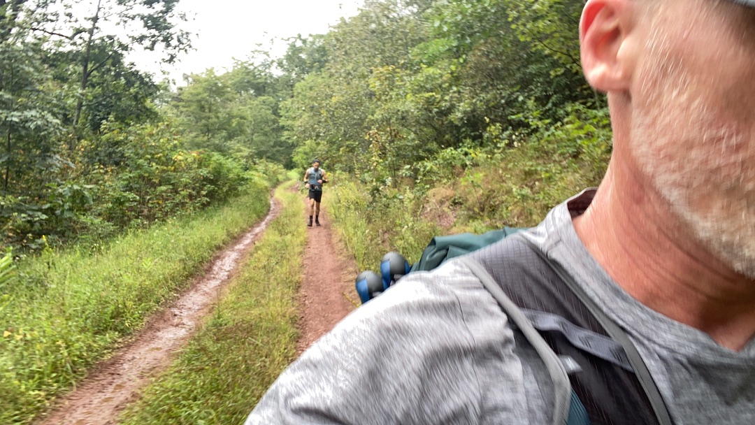
The short walk back to the intersection was chilly on account of A) we were no long running, and B) the wind was picking up. Happy to get warmth back in my body, we began the 3-mile, 2,000′ descent to Camp Todd. As we did, we passed a runner on his way up (jumping into the woods to keep our distance social), got spooked by two a-hole grouse, and ripped our legs and arms to shreds thanks to the thorns lining the trail.
Around 2:45PM we were able to lessen the fire in our quads with a quick break at a fork in the trail. To the southeast/straight, the trail continued for a quarter mile before crossing North River on the way to Camp Todd. To the northwest/right, the trail wound around to FR95 for 0.4 mile followed by a quarter mile of road to get to Camp Todd, but without a river crossing. We turned right/northwest, ran to the road, then ran to the Camp Todd; arriving in 3 hours and 33 min (or about 2 hours less than the first time we visited…and with 0.5 miles more distance).
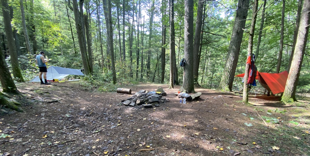
Camp Todd has several places to camp. There’s a spot just beyond the bridge on the north side of the road, then a second, larger area on the north side about 0.3 miles from the first. If you keep hiking up the road you’ll see a third area on the north (where the secondary trail crosses the river) and a fourth on the south (just before you hit the Springhouse Ridge/Wild Oak Trail trailhead). We chose the second.
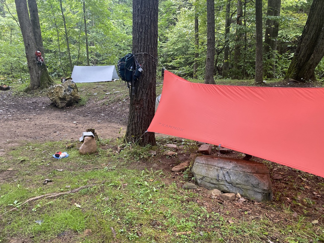
Apart from the 100+ scratches and burning muscles, my legs felt pretty good. My shoulders were a bit pinched going up to Little Bald, but they, too, felt surprisingly good after making adjustments to my pack. The biggest, most noticeable difference was my energy level. I was spent. But, before I could deal with the hunger, I had to set up my hammock since the rain was starting in.
Through the now drizzling rain, Coop and I set up our shelters, refilled water, ate snacks, made dinner, ate more snacks, then sat around under my tarp before hanging our food and turning in around 8:30PM.
Day 1 Complete
DAY 2 (15.31 MI | +3,163′ GAIN | -3,770′ LOSS)
I woke at my usual 4AM and had to force myself to fall back asleep until first light, our agreed upon wake-up time. Eventually I was successful. Once formally awake, I broke everything down from under my tarp to avoid the falling droplets from the trees above, and then put that away as well. After packing, I switched focus to a two-pack oatmeal breakfast and a 3-packet pot of Joe.
We headed out at 8:22AM, walked a tenth of a mile down the road to the Springhouse Ridge/Wild Oak Trail trailhead, and turned right/southwest on our way up a nasty hill en route to Big Bald. Make no mistake, we did not run up this hill.
Coop and I have run a couple of ultras together, and we both know the price paid for running when you should walk. And, since we weren’t shooting for an FKT of any kind, we took the slow road.
To that end, we mostly walked the mile and a half of 1,300′ of elevation to the Hiner Spring intersection (which leads to Hardscrabble Knob in the Ramsey’s Draft Wilderness) before mostly running the 400′, mile-long ascent to the top of Bald Ridge.
When the trail leveled off, I grabbed my camera to shoot a bit of running footage. I watched my feet navigate the rocks. I watched as Coop ran ahead of me some 20 yards. What I didn’t see was a fallen branch hanging over the trail at eye level. It wasn’t a “before it was too late” scenario. That would’ve been a great end to this anecdote. Instead, my forehead smacked the branch at full speed causing me to fall straight onto my back WWF style. Holy balls that hurt.
Once I confirmed I had movement in all my parts, I picked myself up off the ground, grabbed hold of my pride, and Coop and I continued down the mountain towards the intersection of Gordon’s Peak Trail and Dividing Ridge/Wild Oak.
The descent to the intersection was very technical and required several heart-to-hearts with my knees. Once down, we walked past a nasty pond, slogged through foul-smelling muck, and continued running down the trail towards Braley Pond Road.
The next mile was steep. Much steeper than the backside of Little Bald. My legs and knees were screaming and my toes were cramming into the tips of my shoes with every step (R.I.P. big toenail).
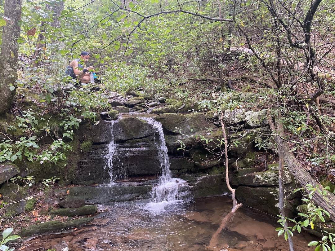
At the mile-ish mark, we saw a spur trail shoot off down to Mitchell Branch, a spotty water source for most of the year that was making plenty of noise today. We originally planned to hit up a source off Braley Pond Road, but opted to fill here since, well, we were here. Once filled and satiated, we returned to the trail for another 1.25 miles of downhill and a much deserved snack.
From the road, we had 2.5 miles and 700′ of gain to the Dowell’s Draft/Wild Oak intersection. The gain was spread out somewhat evenly which meant we could take advantage of the flats and downhills along the way. About 1.75 miles from Braley Pond Road, we arrived at a trail sign for Wild Oak and Dowell’s Draft.
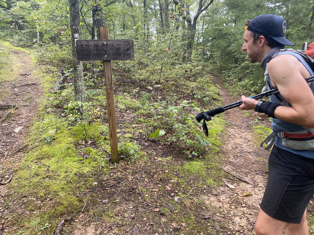
The last time we were on Wild Oak Trail we mistook this intersection for the actual Dowell’s Draft and proceeded to go straight and endure a ridiculously grueling ascent. This time around I wasn’t going to make the same mistake.
COOP: Are you sure?
ME: Absolutely. And if I’m wrong I’ll take full responsibility.
Turns out, I was right, and we arrived at the real Dowell’s Draft intersection 0.75 miles later (and did not have to go back to climb up that godforsaken hill).
From the intersection we hiked/jogged another 120′ of gain over a half mile to a rocky outcropping that provided limited views and a place to check in back home (i.e. provide proof of life). Looking at the map, once we made it over Hankey Mountain, we’d have 5.5 miles of mostly downhill to our second night’s campsite. Bellies now full and legs somewhat rested, we donned our packs, and enjoyed a heaping helping of gravity-assisted running.
We crested Mr. Hankey then stopped to pack away our hiking poles and apply liberal amounts of Squirrel’s Nut Butter to our parts before beginning the long descent to the North River Campground. Three quarters of a mile later we made our way around a gate and onto a gravel-ish road.
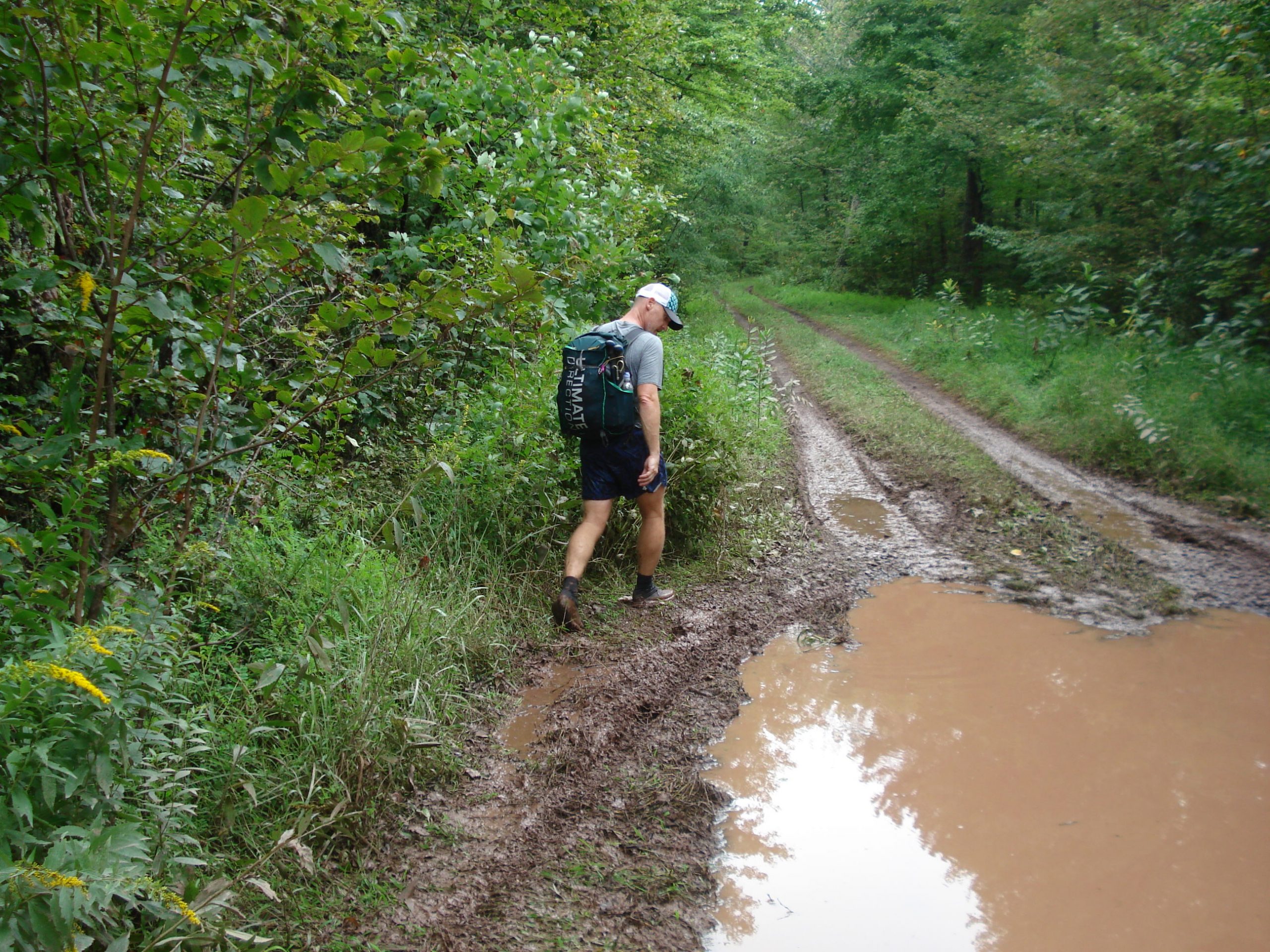
Thanks to the rain and off roaders, the road was a hot mess; huge ruts filled with water, mud on either side, grass down the middle, and pools of nasty AF water every 50 feet. As we briskly navigated the road, we passed a family of off roaders in a huge diesel truck followed by six more trucks of people 20 minutes later. I guess they were all out for a nice afternoon stroll (and definitely not bear hunting).
We reached the Lookout Mountain/FR425 intersection just before 1PM. To the right/northwest, Lookout Mountain Trail follows the ridgeline and eventually dumps out just before the suspension bridge near FR95. To the left/north, FR425 runs down to the North River Campground.
We hung a left and started running again. We ran for most of the time, passed another 4×4 fanatic, and arrived at FS95, a quarter mile from the campground, just shy of 1:30PM.
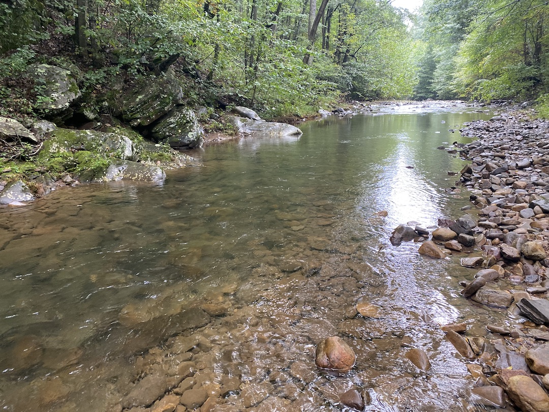
Since we were planning on staying alongside the river, we discussed staying at the $5 a night campground if rain was in the forecast. But, the skies were blue and the weather looked promising, so we moseyed on down around the backside of the campground following the purple-blazed North River Gorge Trail.
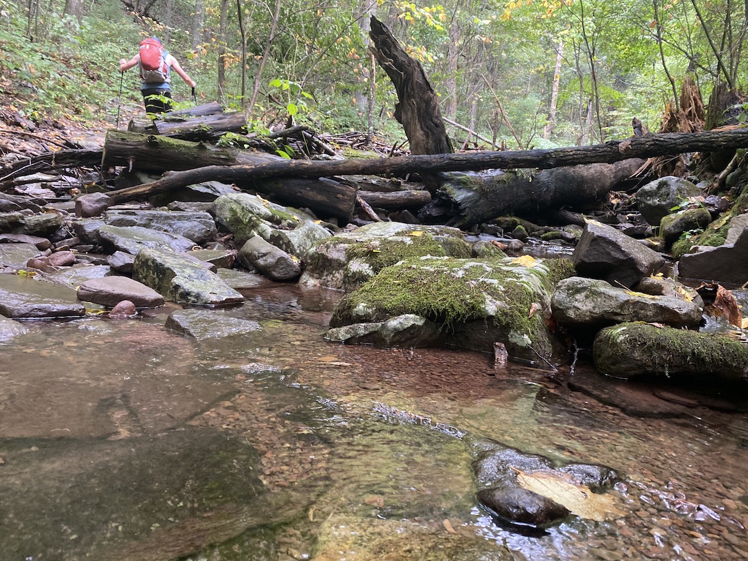
From the trail, we could see a handful of RVs and what looked like a small group of bear hunters at the North River Campground. We pressed on, crossed the river twice, and arrived at our campsite for the night just after the second crossing.
The site was big with a single fire ring in the middle. Coop picked a spot for his tarp and bivy, and I found a couple trees to hang between. After setting up and drinking a ton of water, we walked down to the river and soaked our legs and feet for a good hour.
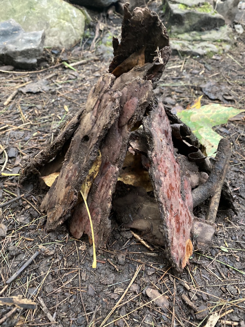
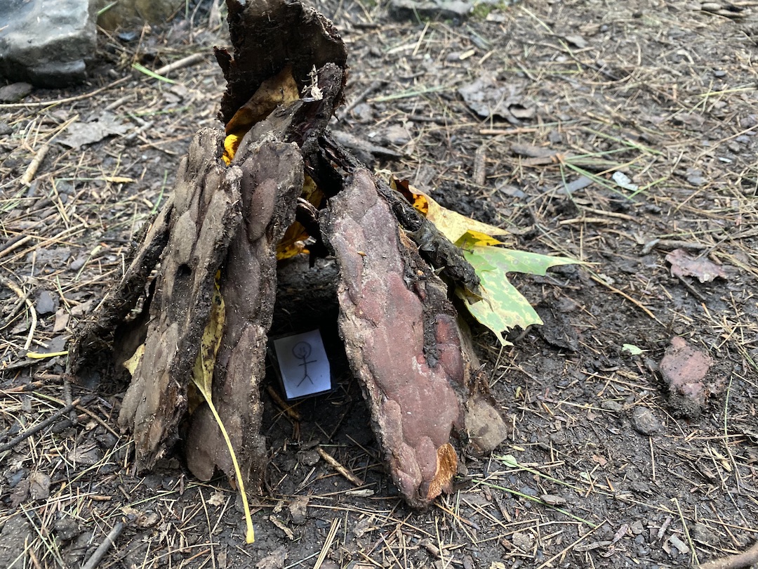
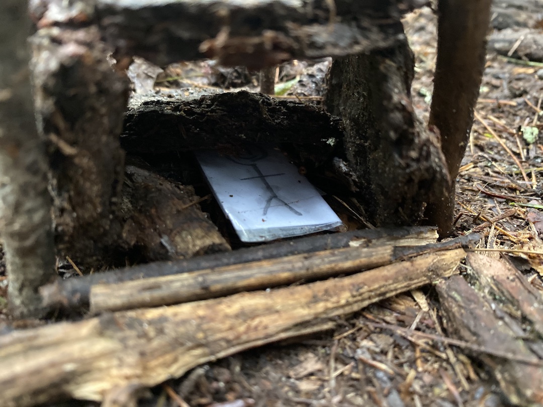
Dinner was followed by a fire which was followed by a couple of games my son made for us. One was a cornhole-type game made from card stock that required sliding sticks into pockets he put on the bottom for support.
The second game was a shelter building challenge where he provided two paper people and we had to build a shelter that would allow our person to survive the night. We played both for a time then returned to doing nothing.
Before turning in, I asked Coop if he’d join me to measure the distance between the two river crossings as I thought that might be a good way to get in a morning run. With headlamps on, we walked from one river bank to the other covering a mere 0.1 miles. Since I needed 1.8 miles at a minimum, I came to the conclusion the morning run was going to be really, really boring to the tune of 9 out-and-back laps.
Day 2 Complete.
DAY 3A (1.86 MI | +194′ GAIN | -194′ LOSS)
I woke at 5AM anxious to get started. Coop and the sun were still asleep so I watched a bit of Godzilla: King of the Monsters until I ultimately decided to start breaking a few things down prior to running. Around 6:30AM, I asked Coop if he wanted to join me, but chafing had caught up to him and he opted out. So off I went, back and forth, for 1.86 miles.
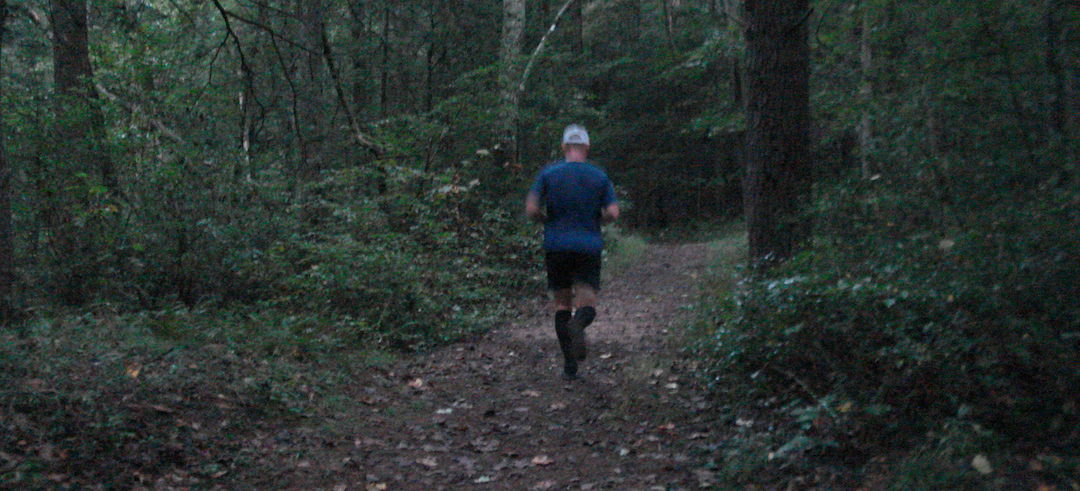
Photo by Coop
DAY 3B (4.39 MI | +75′ GAIN | -292′ LOSS)
After my run, I packed up the rest of my gear, downed a pot of coffee and a bowl of oatmeal, and then Coop and I started our day. The two crossings from the night before were the first of 8 total crossings. That meant we had six more opportunities to enjoy the anti-inflammatory properties of the cold river water.
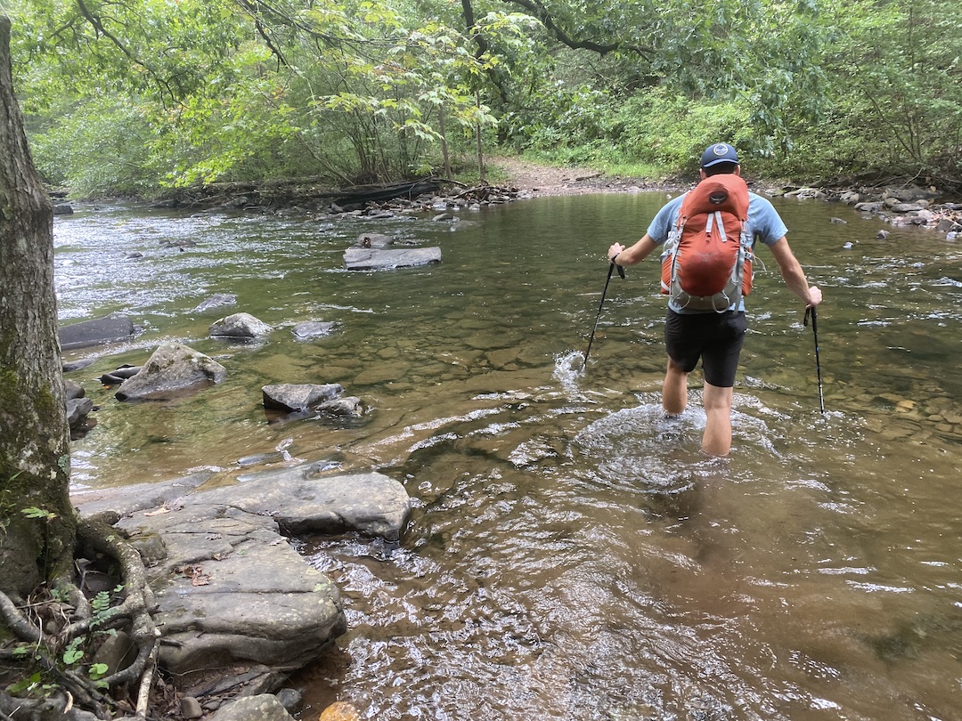
From camp, we ran a tenth of a mile, crossed the river for the third time (first of the day), then ran for 1.5 miles before crossing it a fourth. A short quarter-mile run took us to the fifth crossing. The last time we were here I crossed the river using a fallen tree. This time around, I skipped the tree and pushed straight through the river to the other side. Back on dry land we ran for 0.3 miles and crossed the river for the sixth time (fourth of the day. C’mon, keep up!), then for a seventh time 0.1 miles later, and one final time another 0.1 miles down the trail.
Following our final crossing, we picked up the pace for 1.2 miles, passing the Lookout Mountain Trail/North River Gorge intersection before crossing a suspension bridge that spans the width of the river (if it didn’t it wouldn’t be a bridge now would it?). After the bridge, we ran a half mile to FR95 and wound our way back to our cars 0.3 miles later.
Trip complete.
TOTALS (30.49 MI | +6,775′ GAIN | -6,834′ LOSS)*
*with extra Monday morning run (32.35 | +6,969′ gain | -7,028′ loss)
FINAL THOUGHTS
The Wild Oak National Recreation Trail was a great place for our first fastpacking excursion. Even with stops we managed a 19:46 pace (3.04 MPH) overall. Without the stops, we mustered a 16:19 pace (3.68 MPH); not too shabby. Either way, I’m pleased with how we did, and I’d totally do it again.
The UD Fastpack was great. I’m glad I picked it up and super glad I ignored the reviewers and kept the foam insert in and hip belt attached. The hardest part was dialing in the correct weight distribution. If there was too much weight on one side, the shoulder strap on the other side would creep off my shoulder and get annoying. Once I figured out how to balance my gear it was pretty smooth sailing. Truth be told, my back and shoulders didn’t hurt at all after Little Bald and they felt great the day after my trip. My legs, on the other hand, oof. They were a wee sore and my run the following day was a beast.
Like last time, I thoroughly enjoyed Wild Oak and would definitely go again. And if I did, like I said before, I’d try to branch out into Ramsey’s Draft. Nonetheless, if you’re looking for a place to get out and enjoy yourself, you should definitely check out Wild Oak National Recreation Trail.
For Coop’s perspective check out his trip report. For more information on Wild Oak Trail and the surrounding area contact the North River Ranger District.
Great report. What was the distance from the WOT to North River Campground?
Between 24 and 25 miles depending on 1) how you get to Camp Todd from the Horse Trough Hollow intersection; straight through the river or N/NW to the road/bridge, and 2) whether you take Dowell’s Draft at the Wild Oak/Dowell’s Draft intersection on your way to Hankey Mtn, or go straight up the old/retired Wild Oak. Recently, my buddy and I visited Wild Oak again and took the two longer options which got us to the campground right at 25 miles.
thank you, I read that report too.. I meant the distance after you left the WOT to the North River Campground, mainly because you guys did the North River trail back to your vehicle. I was considering going to the campground so that I have water for my second night, but going back up to the Lookout Mountain trail, just wanted a feel for distance. Your spreadsheet in the second report makes it seem like half a mile.
Ah, OK. It’s about 2 miles/-800′ from WOT to North River Campground at Staunton Road. There’s a trail sign at the intersection. Campground is $5 a night, but you can probably find a place just down the river for free. I updated the spreadsheet and map printout in the newer post to make it a little clearer.
Ok. That’s makes it a tough choice. Carry extra water or add 4 miles round trip.
Do you happen to know the distance from the turn off to the finish on the WOT, ie if I stayed on the lookout mountain trail?
Really appreciate your write up. I am also an ultra runner so good to see you fast pack it.
Tough choice indeed. Apart from the North River area, there’s not much water between Braley Pond Road and the Trailhead. As for the distance, it’s about 6 miles from the road at Hankey (FR425)/Lookout Intersection to the trailhead. (see AllTrails)