Backpacking in the Southeastern United States in the fall can be challenging on account of unpredictable weather conditions and water availability; two things that get particularly interesting as winter nears. Knowing this, I researched a number of trail options before settling on the Wild Oak National Recreation Trail (TWOT) within the George Washington National Forest just west of Staunton, Virginia.
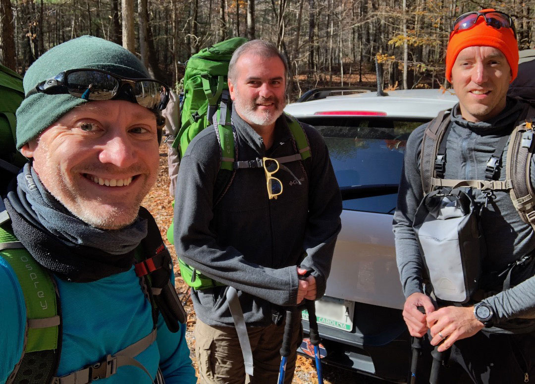
Designated as a National Recreation Trail in 1979, the Wild Oak Trail is a 27-mile loop offering 7,000′ of elevation gain, sweeping views, and a long, wide river that winds its way through the wilderness. I suggested the route and the nearby Triple Crown to my buddy, Coop, and brother-in-law, Ken, and we agreed to hit up Wild Oak for our next adventure.
THE PLAN
Using GAIA GPS, Garmin Connect, and AllTrails I built out possible route options. One followed the Wild Oak loop and included a detour to the Staunton Reservoir due to limited water sources, one added a short hike up Hardscrabble Knob in the neighboring Ramsey’s Draft Wilderness, a third took us up Gordon’s Peak just off Wild Oak, and the fourth option was a variation of the first with an exit strategy down North River Gorge Trail. After several emails we decided on the first route with the option to incorporate portions of the other three should time allow.
Next up, the weather. Ten days out the forecast called for rain all three days and temperatures between 30°F and 45°F. Seven days out, rain was limited to Sunday and Monday, but Saturday’s temperatures ranged 35°F during the day to 25°F at night with winds between 5MPH and 10MPH. Two days out, rain was no longer in the forecast, but Sunday and Monday would be at freezing and Saturday was supposed to dip below 20°F at night with winds nearing 20MPH (and higher at 4,300′).
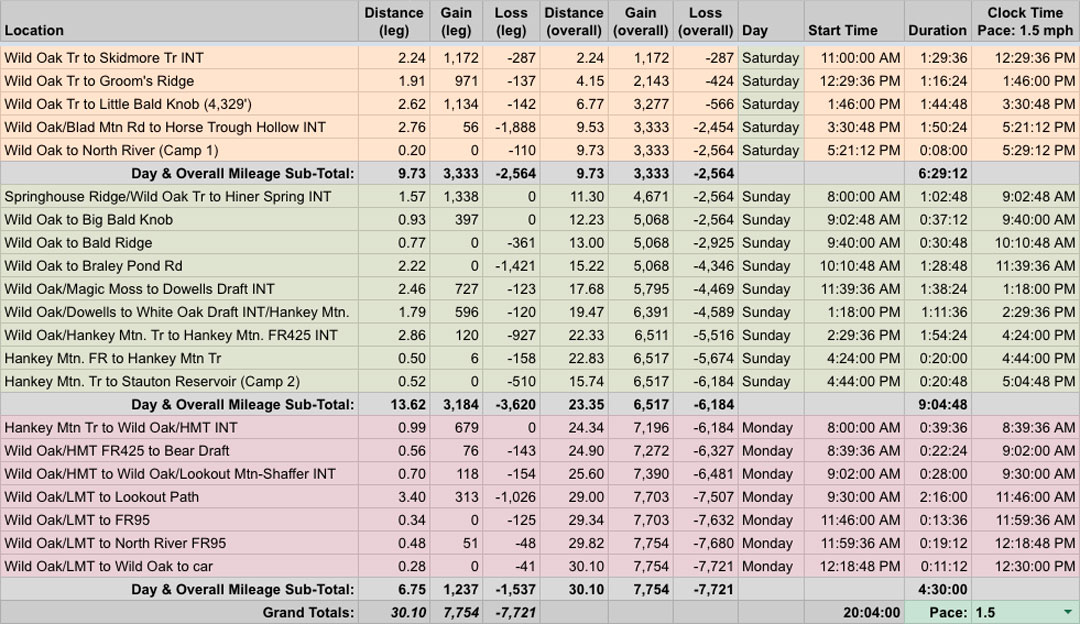
With route and weather information in hand, I built out the trip in our spreadsheet based on a 1.5MPH pace…
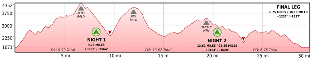
…created an elevation profile using Google Earth
…dropped in the route
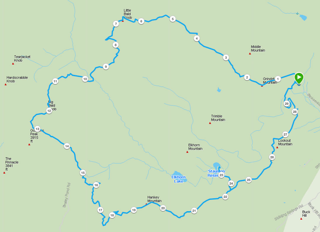
…and packaged it all in a map I printed on TerraSlate paper.
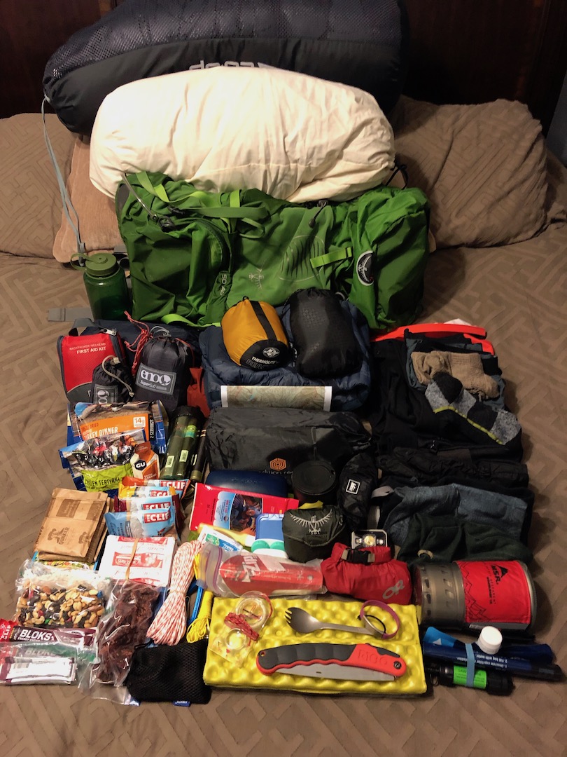
PACKING IT IN
For this trip I was determined to use a hammock. I’ve used ’em several times before, but I wanted to see if there was anything I could do differently to tweak the experience. At first I limited my research to helpful tips via r/hammockcamping. When the forecast changed, my research spiraled into an unhealthy obsession with finding the right cold-weather options (prior hammock experiences never dipped below 40°F). I watched countless Shug videos, read The Ultimate Hang 2 from cover to cover, and culled through hundreds of pages at HammockForums.net.
By the time I finished, I learned a handful of new knots, discovered the value of tarp tensioners, purchased a pair of Dutch Wasps and a WhoopieSlings adjustable structural ridge line, tweaked my hammock setup to just under 2 lbs 5 oz, and decided on bedding to deal with the first night’s single digit wind chill; a Sea to Summit bag liner (8.1 oz), REI Magma (30 oz), ENO Blaze underquilt (24 oz), Nemo pillow (8.8 oz), and an XTherm Max pad (17 oz). Once packed, my shelter and bedding broke the ultralight scales at a whopping 8 lbs 14 oz. Eh, at least I’d be warm.
Beyond shelter and bedding, I opted for luxury in the form of 2 pounds of potatoes and my Helinox Chair Zero (16 oz) which brought my pack weight up to a ridiculous 34 lbs 5.5 oz. My heaviest pack ever! Yay? Ugh. I’m an idiot. On the bright side, my Atmos 50L pack does an excellent job at helping me not feel the weight of my bad decisions.
NOTE: My Fenix 5X suffered from some serious GPS drift. My usual setting is GPS+GLONASS with data recorded every second. After comparing my mileage with the others, I switched to GPS only with Smart Recording and it appeared to limit the drift effect. On my next trip, I’m going to try Garmin’s recommendation of enabling auto-pause as that feature is said to help limit GPS drift. To get the totals noted above, I used the GPS recording of my brother-in-law’s 920XT which was almost identical to Coop’s Fenix 5.
DAY 1 (10.37 MI | +3,724′ GAIN | -2,979′ LOSS)
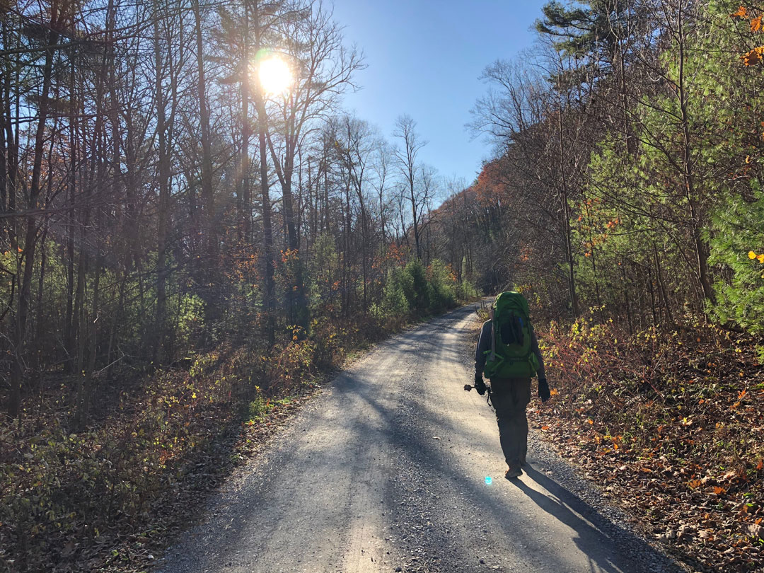
We pulled into the parking lot off FR95 around 10:15AM and loaded up. The wind howled up above, and it was 37°F down below. With a long climb ahead of us, we all opted to layer conservatively to avoid removing layers on the way up as our bodies generated heat.
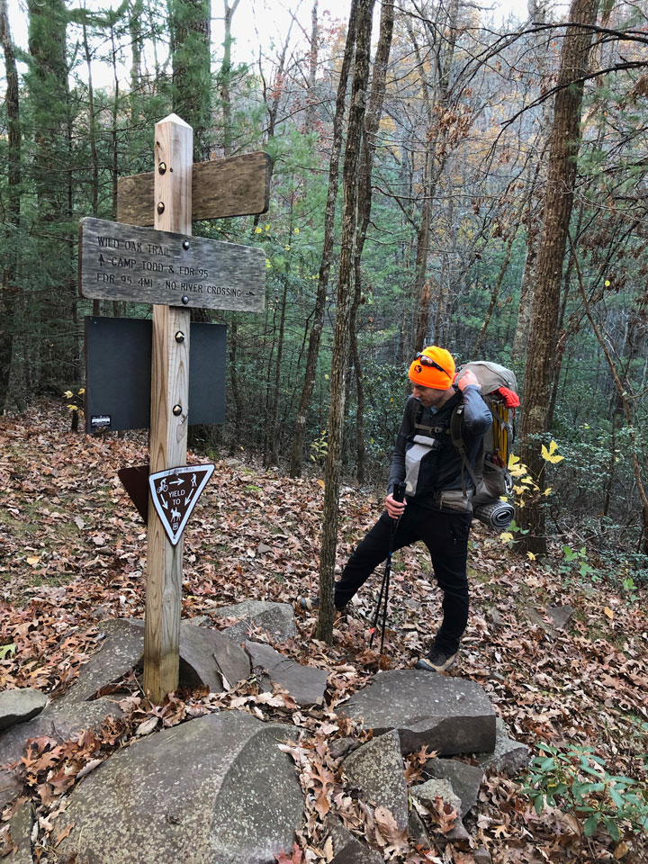
From the car we hiked a couple minutes to the Wild Oak split where Wild Oak Trail runs north/right towards Little Bald and south/left towards North River Gorge Trail and Lookout Mountain Trail. We turned right/north and began the 7-mile ascent to Little Bald.
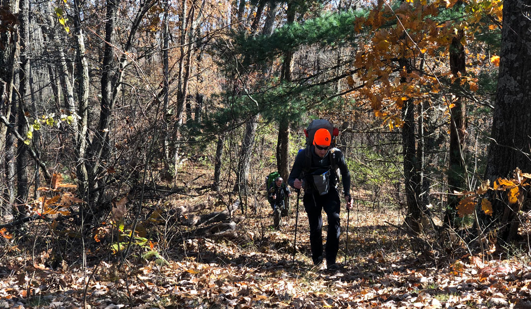
Making our way up the trail, there were loads of downed, dead trees, and many more that were defiantly upright. A half mile and 300′ of gain later, I took off my Buff thanks to the steady stream of sweat dripping down my face. Another thirty minutes of hiking and we reached the top of Grindstone. We took a breather then hiked a bit farther before arriving at the Wild Oak/Skidmore Trail intersection where Skidmore runs from the southwest/left to northwest/right and Wild Oak continues northeast/straight.
From Skidmore, we climbed 1,000′ over 2 miles en route to Groom’s Ridge, a trail that runs off to the northeast. When we arrived, my legs were less than excited. Unfortunately for them, we had another 2.6 miles and 1,110′ of gain until we reached Little Bald. I quickly stuffed my face with a couple of Clif Bloks, downed a few swigs of water, and got back to it. Sorry legs.
After a mile, we reached a gradual incline that took us to the base of Little Bald. I let out a deflated sigh when I saw what we still had to climb (and I was really regretting the 2 pounds of potatoes on my back). After yet another break, I put one foot in front of the other and climbed the remaining 1 mile and 800′ of gain to the top.

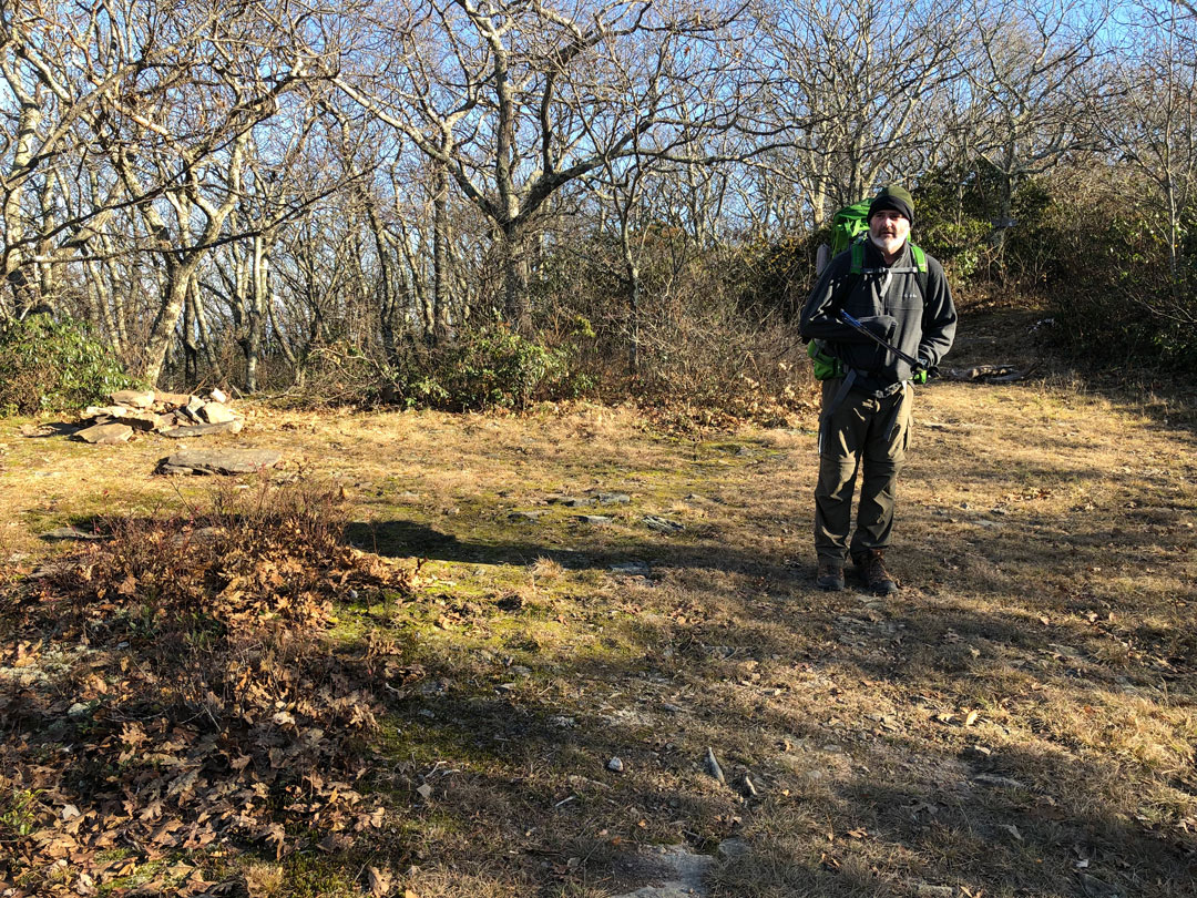
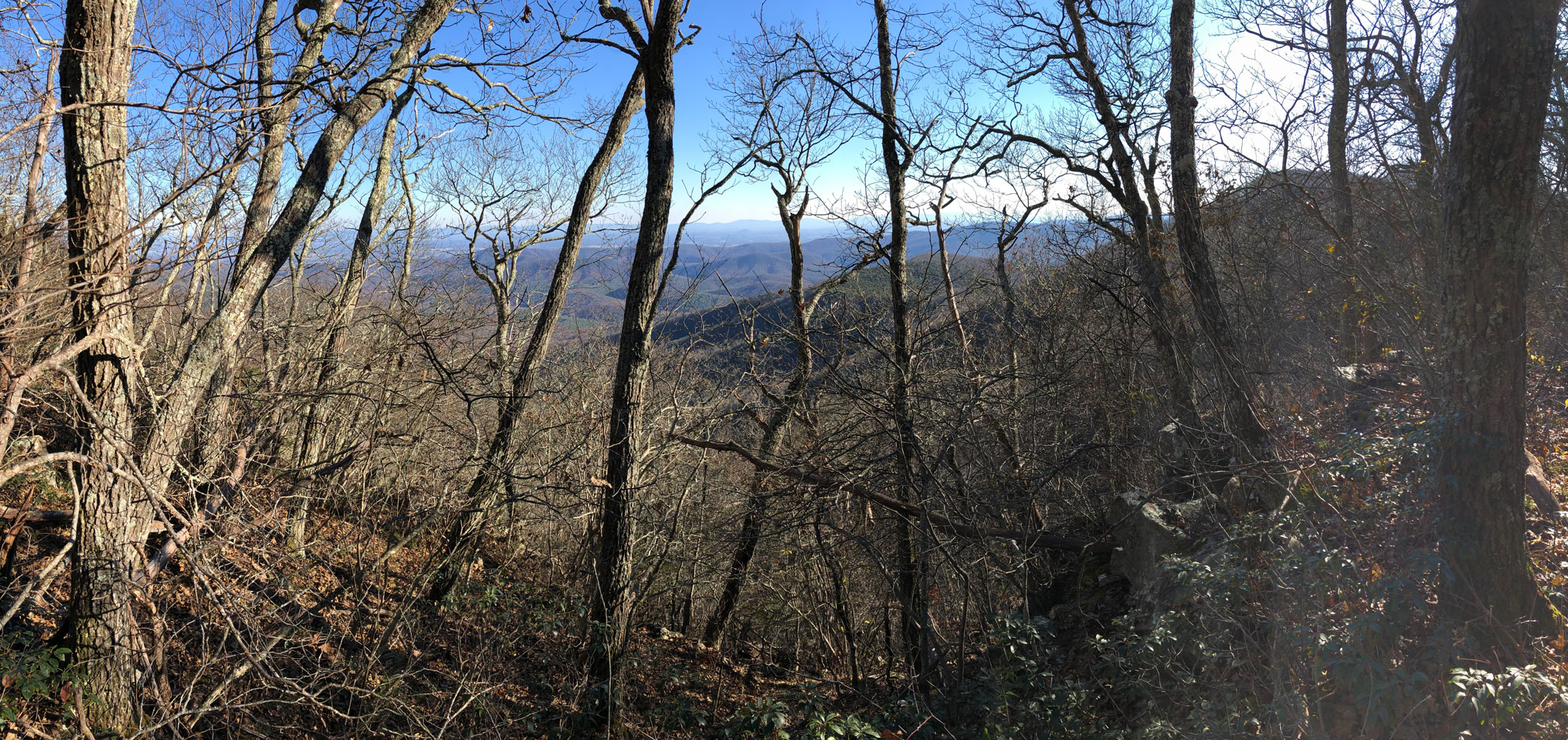
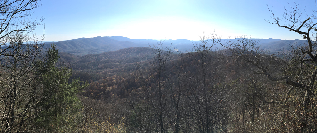
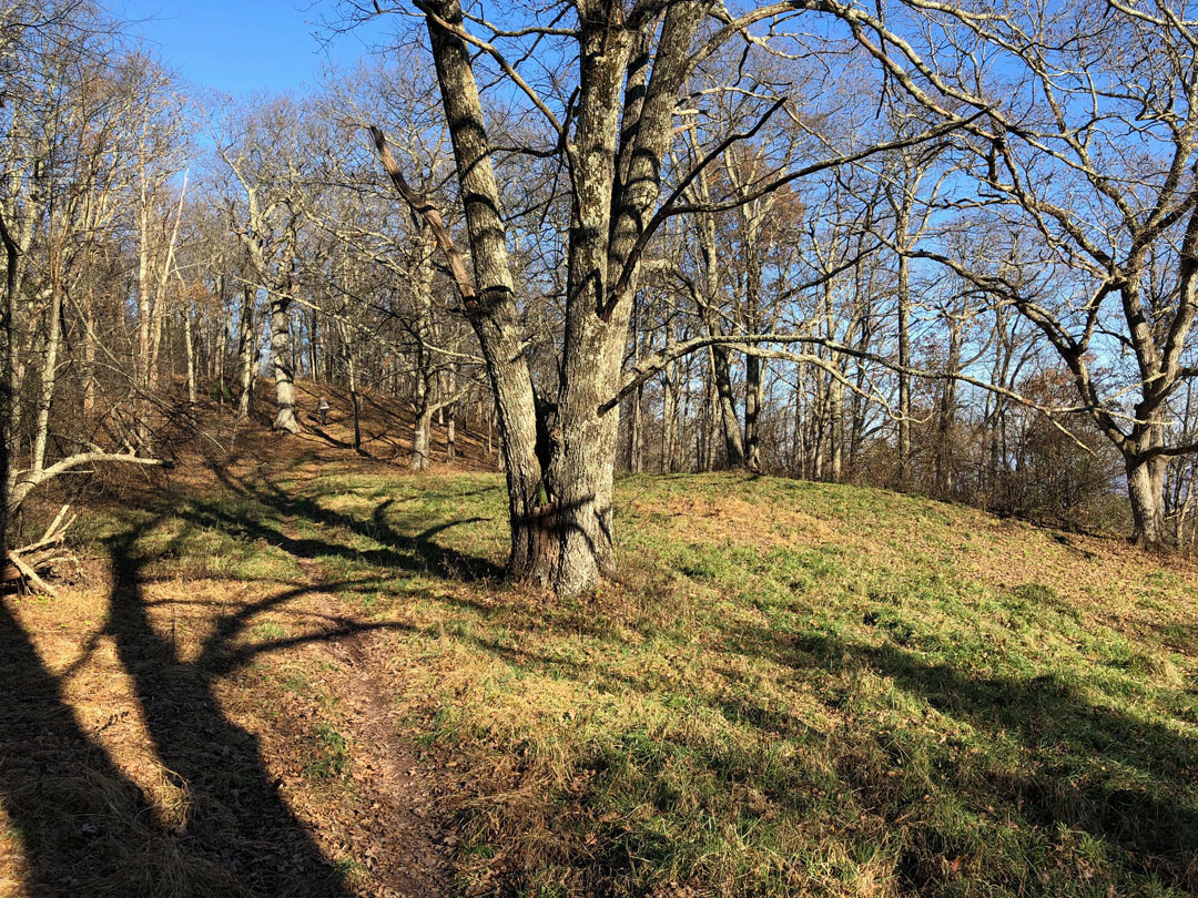
Just shy of the summit, we found a small patch of grass with two campsites surrounded by trees and a trail that took off to the north (Bald Mountain Road). While I waited for Ken to arrive, Coop explored the trail in search of a pond that a previous hiker had mentioned online. A few minutes later Ken arrived, then Coop returned (pond found and it was gross), and we finished the hike up Little Bald where the views to the southeast were amazing and the ones to the northwest were obstructed by trees.
All that remained for the day was a 3-mile descent with 2,000′ of loss to Camp Todd. The hike was bearable, but there were times when I was less than joyful. Like when my quads and knees felt like they were going to explode, or when my fingers started to split, or when the sound of muzzleloaders echoed in the not so distant distance. But then I reminded myself of the end goal…brats. Mmm…brats.
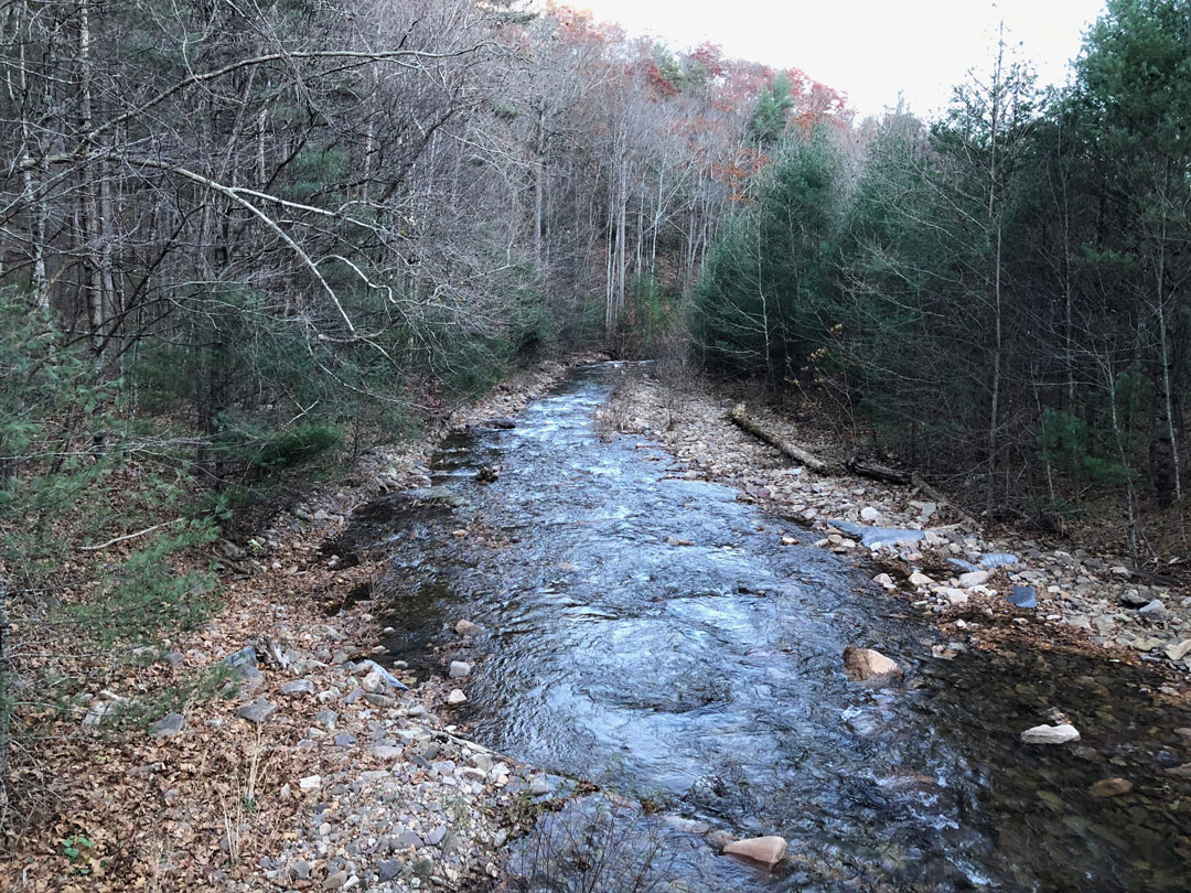
Just before 4PM, the three of us arrived at an intersection where our options to the campsite were split in two. To the southeast/straight, Wild Oak continued for a quarter mile, but required crossing North River. To the northwest/right, the trail required hiking 0.4 mile to FR95 and then another quarter mile to Camp Todd, but without the river crossing. We wrestled briefly with the longer route given it was an hour until sunset. Sure, the longer walk meant we were dry, but we’d have less time to set up camp without headlamps. On the flip side, the shorter route would require crossing a river and none of us wanted to end our day with wet feet. We opted for the drier option, hung a right, and wound our way to a dirt parking lot just shy of the FR95.
At the road, we hung a left and walked southeast over a bridge before happening upon a campsite just off the road about 0.2 mile before Camp Todd. We looked it over, called it home, and began to set up shop.

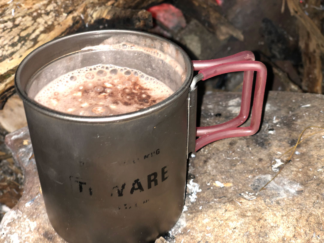
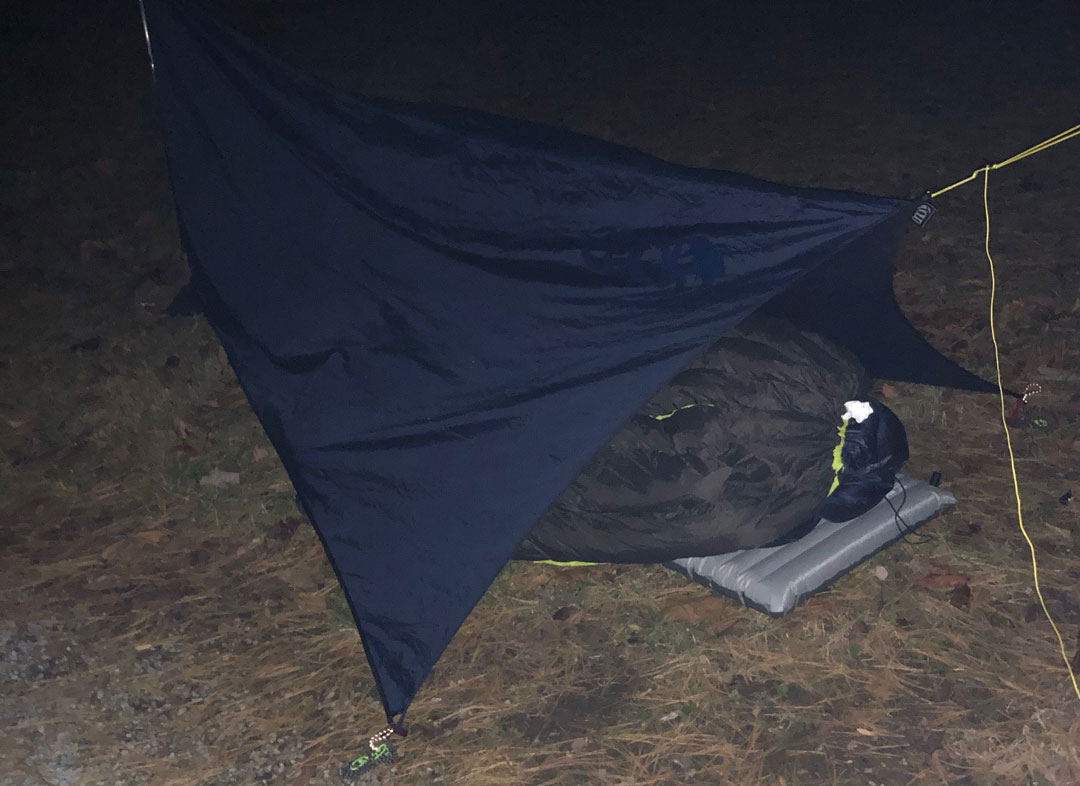
Ken and I put up our shelters while Coop got the fire going. I was excited to hang my hammock. The Dutch Wasps worked flawlessly as did the tensioners I added to my tarp prior to the trip. Given the rocky ground, I tied two of the guylines to trees and the other two required the use of a Deadman. When Ken and I finished, we gathered wood and Coop turned his attention to his shelter. Once we completed our respective tasks, we gathered around the fire for dinner. Coop shifted a few coals, laid the grate, and started cooking the brats; I added the potatoes (which I no longer regretted); and Ken boiled water for a delectable pasta primavera dinner. We ate then partook in heart warming beverages and cigars before capping the night off with hot cocoa.
DAY 2 (15.32 MI | +3,445′ GAIN | -3,967′ LOSS)
I woke at 6:30AM and refused to get out of bed thanks to an overly warmed heart. By 7:30AM, Coop and Ken were both up and about and it was only when I saw that they were nearly packed did I began to peel myself from my hammock. It took me forever to get my act together, eat breakfast, and pack up. As I did, I discovered my water had frozen, my contacts had frozen, and my fuel had slid out of my pocket in the middle of the night causing me to warm all three up before I could finish my morning routine. In the end, thanks to me, we were almost an hour behind schedule (sorry about that fellas).
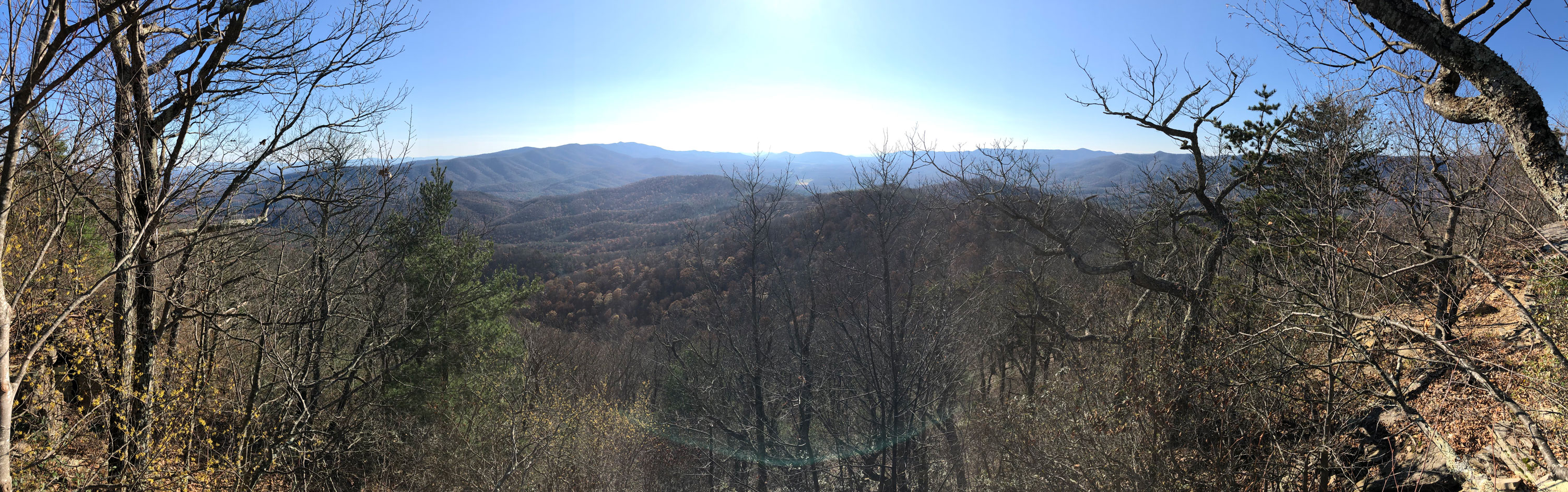
From camp, we hiked the road for a quarter mile to Camp Todd before turning right/southwest onto Springhouse Ridge/Wild Oak Trail en route to Big Bald. For a mile and a half we climbed 1,300′ of elevation to the Hiner Spring intersection before finishing the last 1-mile, 400′ ascent to the top of Bald Ridge. In my head I kept thinking, man the views are gonna be great. The views are gonna be GRRRREAT! This climb is going to be so worth it when I am up there looking out in all directions at nothing but waves of mountains. Well, I was wrong. Very, very wrong. There was maybe one spot where if I pushed my way through the trees I might’ve been able to see some stuff, but I didn’t, so I couldn’t.

From Big Bald, we descended down to a nasty, iced-over pond where the trail ran straight/southeast towards Braley Pond Road and turned right/southwest towards Gordon’s Peak. Since I was guilty of sleeping in, we abandoned Gordon’s Peak and pushed on down Wild Oak for a roadside lunch. The next mile was steep. Much steeper than the backside of Little Bald. My legs and knees were on fire and my toes were cramming into the tips of my boots with every step. Another 1.25 miles later and I was thankfully unbuckling my pack and donning my coat in preparation for a much deserved tuna and trail mix lunch break.
From the road, at least on paper, we had 2.5 miles and 700′ of gain to the Dowell’s Draft/Wild Oak intersection. But when we arrived at the fork we had only hiked 1.75 miles. The trail sign suggested Dowell’s ran to the right around the base of the mountain, and Wild Oak continued straight…up. In my research, I remember someone wrote that Wild Oak was rerouted at this section to avoid climbing up and over the mountain. Our trip map reflected this update. Still, we ignored our map and our guts and pushed forward directly up and over the mountain.
Holy balls the climb was brutal. Instead of enjoying a leisurely 1-mile, 460′ gain reroute, we followed Wild Oak for 0.4 mile and 540′ of gain…and regretted every [expletive] step of it. After 25 painstaking minutes we reached the top. Word to the wise. If you come to this intersection, take Dowell’s Draft. Unless, of course, you’re the kind of person that likes to build in a ridiculously challenging hike in the middle of a 15-mile day.
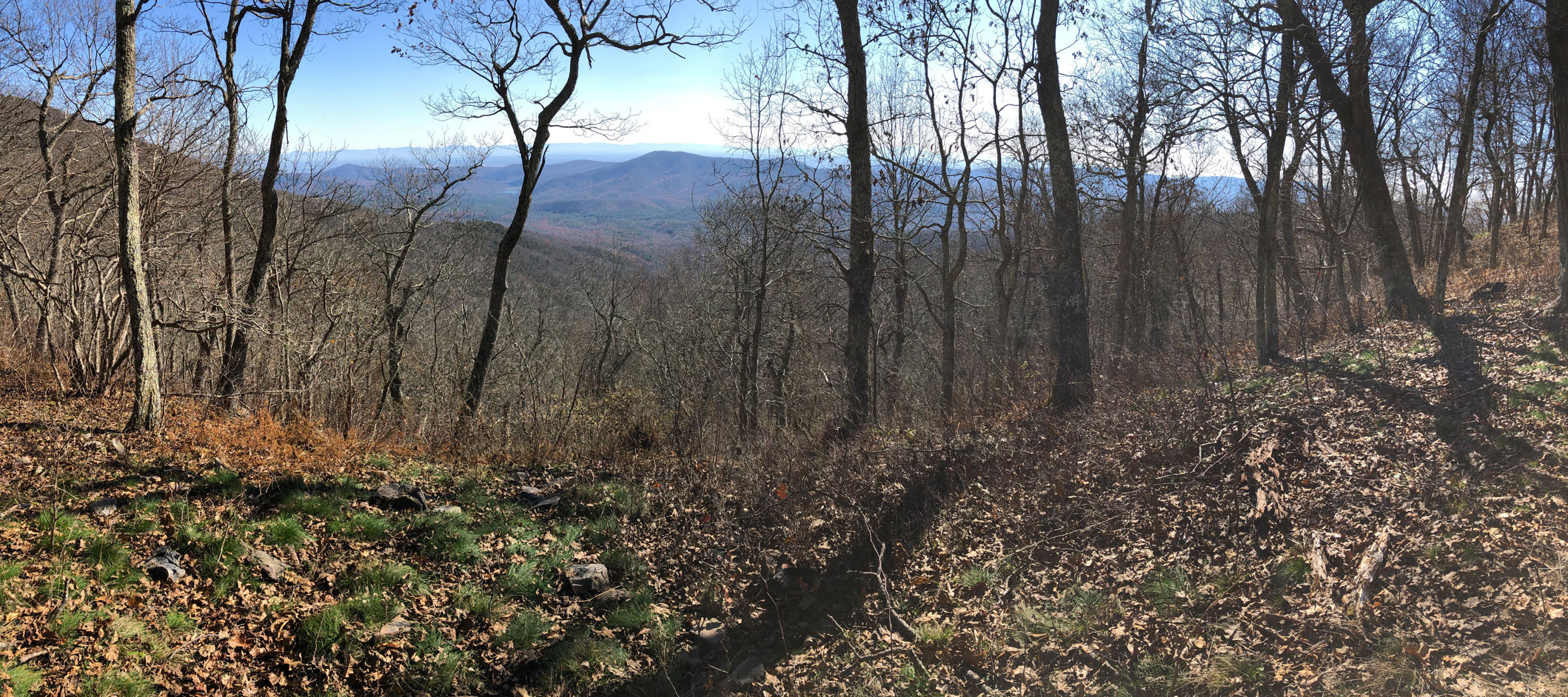
From the top, we passed the Dowell’s reroute about 20 yards down the trail then climbed another 120′ over a half mile to a rocky outcropping that provided spectacular views as well as a place to sit and snack. As we rested, four mountain bikers peddled up and over the outcropping like it was nothing. Seriously, the mountain bikers on Wild Oak are beasts!

My watch read 2:20PM and the map showed we still had another 5 miles to go. If we kept up a 2MPH pace we’d be at camp a few minutes before sunset. On the plus side, once we made it over Hankey Mountain, the remaining 4 miles would be downhill which likely meant we’d be able to pick up the pace a little. With packs on we hit the trail and summited Hankey Mountain after 30 minutes.
A mile later we came upon a gate at the end of a gravel road. I talked to both Coop and Ken about our options. I suggested that if we couldn’t find a campsite at the reservoir we should head over to the North River Campground and find a spot. And, if we stayed at the campground, we should abandon the original plan to hike Lookout Mountain Trail in favor of North River Gorge Trail.
We agreed, continued to walk the mile and a half down the road, passed a truck full of hunters as we did, and arrived at the Lookout Mountain/FR425 intersection a little over an hour after Hankey. To the right/northwest, Lookout Mountain Trail follows the ridgeline and eventually dumps out just before the suspension bridge near FR95. To the left/north, FR425 runs down to Hankey Mountain Trail which leads to the reservoir where we planned to camp.
We hung a left and willed our legs forward just shy of 4PM. According to the map, we’d turn left on Hankey Mountain Trail about a half mile down the road. A half mile came and went and there was no sign of a trail. Perplexed, we continued hiking before Ken chimed in to say that we were off course. We all stopped and quickly realized that we were well past the trail and had all but committed ourselves to following FR425 all the way to the campground.
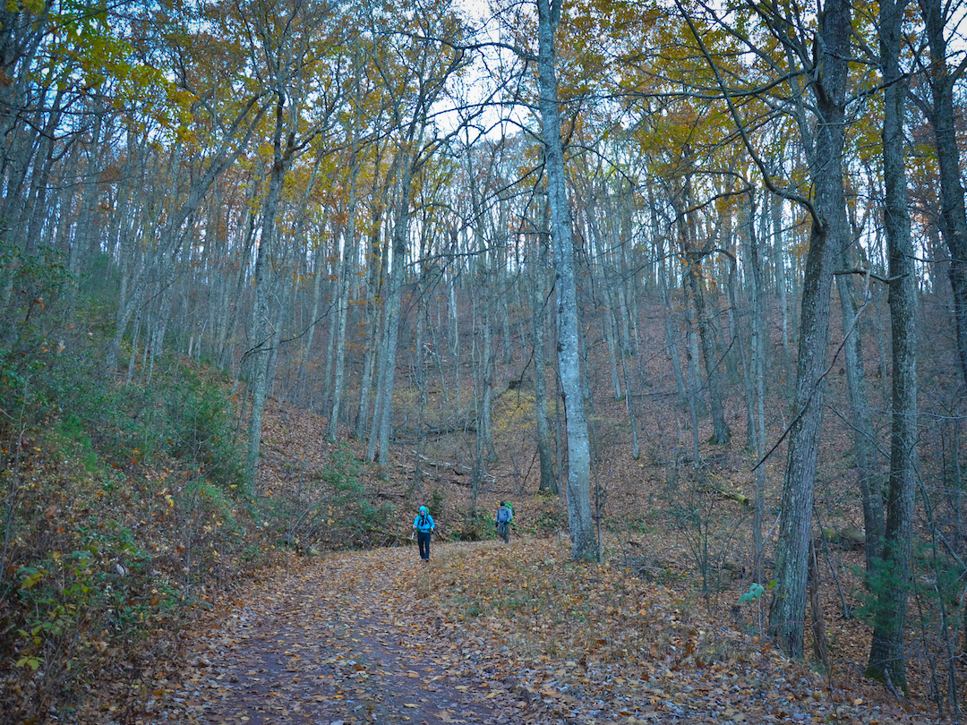
Photo by Coop
Ten minutes later we saw a car driving down Staunton Road off in the distance. Not long after that, two deer sprang from the woods and crossed the road. When we rounded the last big curve we heard the river and saw the campground. The homestretch! At Staunton Road, we hung a right and made our way to the North River Campground where Coop paid the $5 camping fee while Ken and I looked for a site.
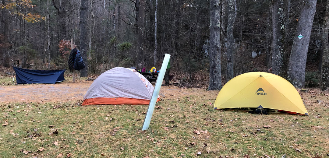
The North River Campground is a big loop with tall, thick trees that are either really close together or really far apart. This was particularly important to me since I needed a place to hang my hammock. I tried to hang in a couple of spots before coming to terms with the fact that I was going to be sleeping on the ground. With night falling, the three of us quickly set up our shelters, took advantage of the campground’s privy (some of us twice), gathered wood, filled pouches, and heated water for dinner.
By 7PM we were sitting around the fire doing our best to stave off the subfreezing air made worse by a gentle breeze blowing across the river that hugged the campground. Around 8:30PM, I called it a night. While I slept, Coop and Ken kept the fire going for a little while longer before stashing our food bags in the campground’s bear dumpsters (a questionably awesome idea) and turning in.
My impromptu shelter worked out pretty well. I was super warm inside my liner, inside my bag, and under my quilt. However, condensation proved an annoyance due in part to the way I set up my tarp. Since there was a breeze, I closed one end which prevented the condensation generated by my breath from evaporating. As a result, the underside of my tarp gathered moisture which dripped onto my quilt as I slept. At one point during the night I figured out what was happening and minimized the issue by a) pulling my Buff over my mouth and b) laying my rain jacket on top of my quilt.
DAY 3 (5.98 MI | +141′ GAIN | -335′ LOSS)
We woke at sunrise and quickly broke camp. It was chilly, but warmer than the previous day (i.e. slightly above freezing). By 8:15AM we were ready to tackle our trip’s remaining 6ish miles. If all went well, we’d be back at the car by 11:15AM.
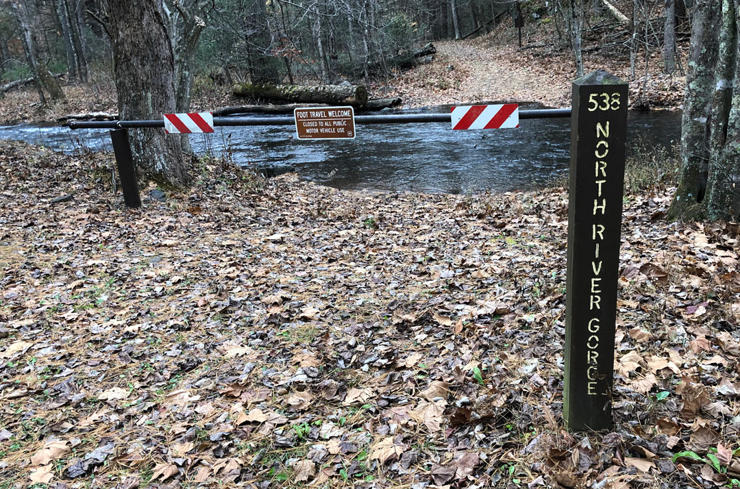
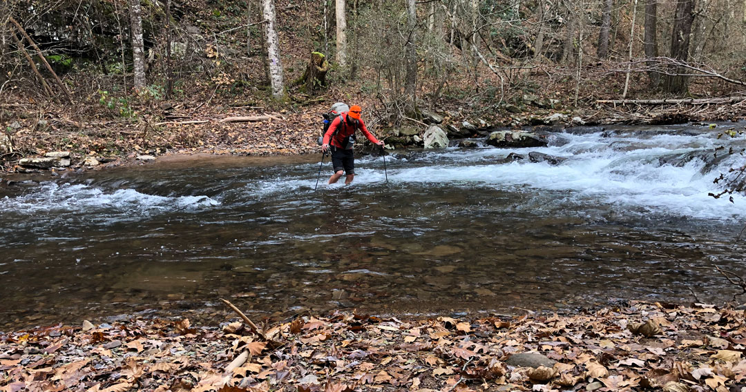
From the campground we headed back to Staunton Road and jumped on the purple-blazed North River Gorge Trail/SR538 just beyond the bridge. The trail wound its way behind the campground before turning east/southeast as it followed the river. A half mile later we stopped. Not because we were tired, but because there was a wide, ice-cold river in front of us. There was no way across but through. We looked at each other, laughed, then began removing socks and boots and rolling up pants. Well, Coop and I did. Ken had brought a pair of sandals and was wearing convertible pants which made things about 2% easier for him.
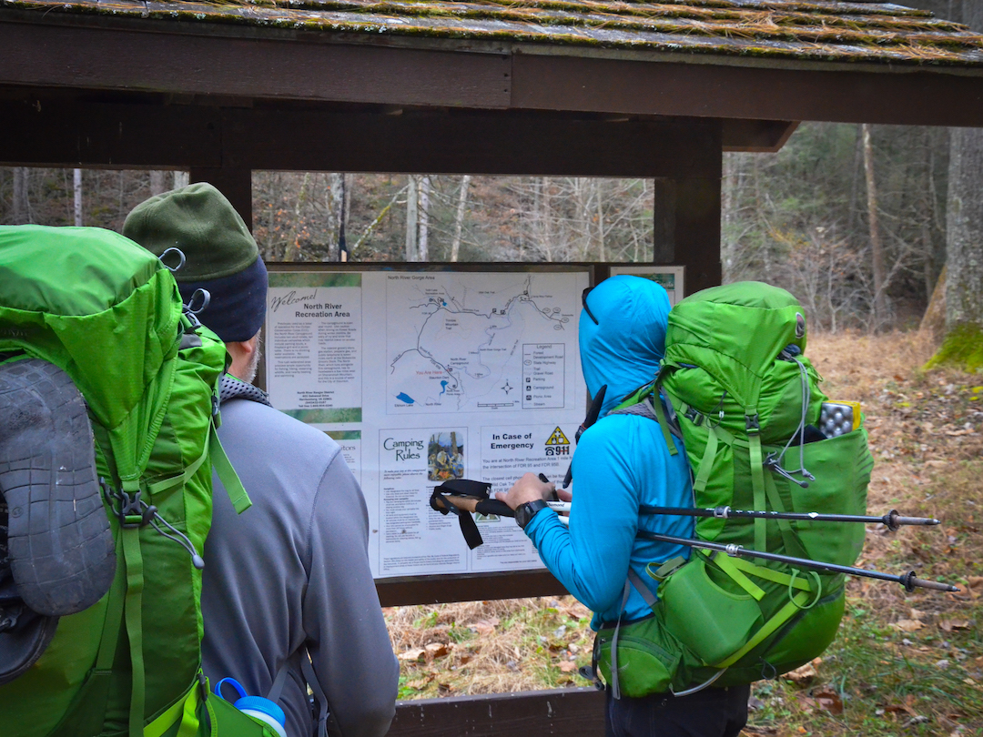
Photo by Coop
My first step into the water sent chills straight to my brain. The rocks were slippery, the current was moderate, and the water ranged from ankle to knee deep. Once we reached the other side, we quickly dried off our legs and feet and slipped our socks and boots back on. BTW, if you ford a river you should unbuckle your chest and hip straps. I didn’t and that is a big no-no because if I fell, my pack would’ve filled up with water and I would’ve had a very difficult time not drowning.
Anyway, we looked at the map to see just how many more times we’d be fording the river. The answer? Seven. We had seven more river crossings. Seven more times that we’d have to remove our boots and force ourselves through the frigid waters. We rationalized the situation by suggesting that fording the river eight times was better than climbing back up FR425 and hiking Lookout Mountain Trail back to the car. But seriously, we had seven more crossings. I really hoped they were all passable (and I really wish I would’ve looked at the map more closely the night before).
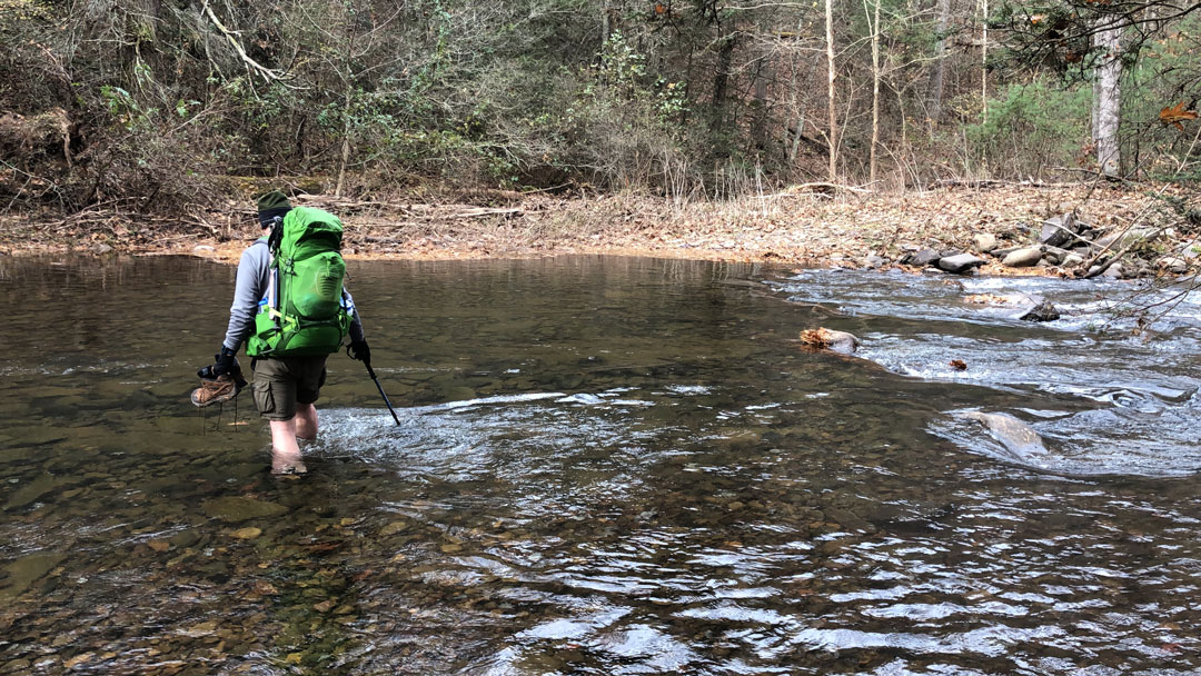
The second crossing came a half mile later, the third was a mile and a quarter after the second, and the remaining crossings were spaced out about a quarter mile from one another. When I crossed the river for the fourth time, I nearly drowned my boot. As it happened, I was crossing with my boots in one hand and my poles in another when I lost my footing and threw my boots to the other side so I could catch my balance. When they landed, one boot bounced further up the trail while the other began to roll back towards the water. Eventually it stopped just shy of sadness, but the sock inside that boot began unraveling itself until it stopped and tested the water’s temperature. Not wanting another similar situation, I decided to use a carabiner to clip my boots to my pack for the remaining crossings. At the fifth crossing, we had the option to walk across a tree (which Ken and I gladly did). Thankfully, and without issue, we completed the sixth, seventh, and eighth crossings without issue and turned our attention to the remaining mile and a half.

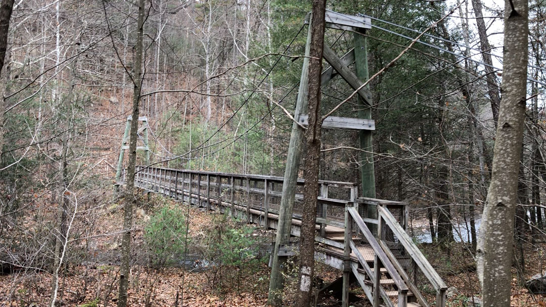
After a mile, we hit the Lookout Mountain Trail/North River Gorge intersection and picked up our original exit strategy. A couple minutes later we crossed the suspension bridge, hiked up the trail for a half mile, crossed FR95, wound our way past the Little Bald/Wild Oak intersection, and arrived at the car at 11:30AM.
Trip complete.
TOTALS (31.67 MI | +7,310′ GAIN | -7,281′ LOSS)
FINAL THOUGHTS
The Wild Oak National Recreation Trail was a fun and challenging experience. The ascents provided warmth in the form of elevated heart rates. The descents provided reprieve and pain. And the river provided plenty of drinking water and a renewed appreciation for bridges.
As for my hammock experience, my obsessive researching paid off. The adjustable structural ridge line worked great, the line tensioners picked up the guylines’ slack, and the Dutch Wasps made it particularly easy to set up my tarp on both nights when my fingers were frozen. I slept quite warm in my hammock inside my liner, in my bag, on top of my pad and quilt on the first night, and my pad allowed me the option to sleep on the ground comfortably on the second. OCD FTW!
I had a good time and would definitely consider backpacking Wild Oak again. Heck, I might even work in Ramsey’s Draft which is just west of Wild Oak and includes the Shenandoah Mountain Trail. The combination of the two seems like it’d be a lot of fun. Regardless, if you’re looking for a place to get out there and enjoy yourself, you should definitely consider Wild Oak National Recreation Trail.
For more information on Wild Oak Trail and the surrounding area contact the North River Ranger District. To read Coop’s account check out his post “Wild Oak Trail Adventure“.
Thanks for the detailed write up. I’m also looking at backpacking the WOT in the future with some friends and this is helpful. We would probably devote 4 days/3 nights to the trail. Based on your description, a possible 4 day itinerary is as follows:
Day 1: North River Gap trailhead to Little Bald Knob campsites
Day 2: Little Bald Knob to Hyner Spring
Day 3: Hyner Spring to the North River campground
Day 4: North River campground to the North River Gap trailhead
Obviously we would have to carry extra water as we’d be staying in at least 1 dry site (Little Bald Knob). Staying at Hyner Spring in the Ramsey’s Draft Wilderness would add some mileage to the overall route, but this does seem to be a nice spot (with a reliable water source) that is roughly at the halfway point.
A few questions:
1. Did you happen to notice any campsites along the ridge before reaching the clearing on the summit of Little Bald Knob? Knowing what options we would have to shorten day 1/lengthen day 2 would be helpful.
2. Did you happen to notice any water sources near the FR 96 crossing between Big Bald Knob and Hankey Mountain? The USFS map for the trail shows the WOT following Mitchell Branch closely for a bit as it descends towards the road from Big Bald Knob.
3. Did you see any campsites along the ridge between Hankey and Lookout Mountains that could be use to shortern Day 3/lengthen Day 4? Aerial photos for the area show some clearings along FR 425.
4. Did you see any campsites along the North River Gorge trail that would allow us to camp further down on the river without staying at the campground? Judging from the USGS topo map, it does look like there is at the very least some decent flat ground along the river.
Thanks in advance!
1. Little Bald campsites. There are occasional campsites on the way up to Little Bald from FR95 though they were small from what I can remember (1 maybe 2 people). I don’t recall seeing any on the ridge leading up to Little Bald (but I was also shielding my face from the wind). If you don’t stay in the clearing at Little Bald, Camp Todd may be a better option.
2. For a short time (maybe a half mile from Gordon’s Peak trail) you can hear Mitchell Branch not far off the trail to the north as you hike down Wild Oak towards Braley Pond Rd. Also, Braley Pond Rd is said to have a source if you follow it north, but I did not verify. There’s nothing between Braley Pond Rd and Hankey.
3. Hankey/Lookout. There is a clearing with tall grass at and just before Hankey and a sparsely wooded area to the west but I don’t recall an actual site. From Hankey, the trail becomes road pretty quick so if you don’t camp near Hankey your options are going to be very limited. We turned down the road towards the campground before Lookout Mountain Trail so I can’t say what’s there. Between Braley Pond Rd. and North River campground there is no water.
4. North River Gorge Trail. I recall a campsite on the left of before the first river crossing and a larger one on the right just after the second. Just be sure to pay attention to the weather because a hard rain would probably cause issues with these campsites. Beyond those two sites, I can’t say I saw much.
Have fun and be safe.
Thanks again! 🙂