Winter is arguably the best season for backpacking. Top 4 for certain. Sure, I shake uncontrollably between the fire and my sleeping bag, and my nose runs like an open spigot, and I generally cannot feel my toes, but it’s also peaceful, quiet, and serene. Oh, and let’s not forget about the snow. Man I love snow!
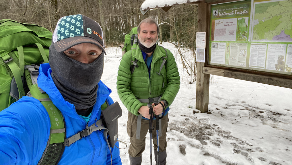
With COVID-19 still running amuck, my brother-in-law, Ken, and I were desperate to stave off cabin fever and get outside. Our only criteria: water and fire. Looking around, we considered Pisgah National Forest, Mt. Rogers National Recreation Area, and Monongahela National Forest before deciding on Mt. Rogers and its nearly 200,000 acres of National Forest in southwestern Virginia.
THE PLAN
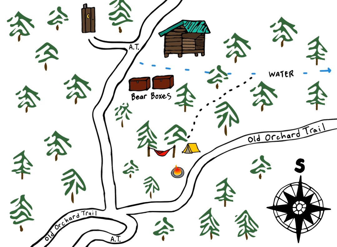
Revisiting old trip maps from the area, I got to thinking about a trip my buddy, Coop, and I did on the north side of Fairwood Valley Road along the Iron Mountain Trail (IMT). What I liked about that area were its two shelters; one along the AT (Hurricane Mountain) and the other on the Iron Mountain Trail (Cherry Tree). Both had water sources nearby, fires were permitted in the Mt. Rogers Recreation Area, and the shelters would also provide extra protection from the harsh winter elements. Check, check, and extra check.
The only consideration left was a wholly selfish one; how to continue a 10K run streak I started back in April 2020. Up until this point I’ve been successful. On one trip, I fastpacked with Coop to keep the streak alive. On a couple of other overnight trips with Ken, I ran before I left and after I got back. For this one, though, we’d be out for three days. This meant I’d need to build in a run in the middle of our trip.
Using a combination of GAIA GPS, Garmin Connect, and AllTrails, I began reworking my old Iron Mountain route. I tried a few different options before settling on a loop that started at the Fox Creek Trailhead. We’d camp at the Hurricane Mountain AT Shelter on Day 1 and Cherry Tree Shelter on Day 2. From the shelter, I’d run an out-and-back 10K down to the Fairwood Trailhead and then to my car at the Fox Creek Trailhead. It’d be rough, but I might, could, maybe pull it off…hopefully. On Day 3, provided I didn’t die, we’d loop up Mt. Rogers Trail and take Lewis Fork Trail past the Old Orchard AT Shelter on the way back to the car. Got it? Good. Next up, the weather.
Using forecasts for Hurricane Mountain and Old Orchard AT shelters along with data from the Wilburn Ridge weather station, I kept an eye out for freezing temps, high winds, and heavy snow. Ten days out the forecast called for rain on Monday, wind on Tuesday, and mostly clear skies on Wednesday. Seven days out, things remained the same with the exception of a snowstorm a couple days before our trip followed by some seriously high winds (55+ MPH) and ridiculously low wind chills (-15°F). Two days out, the snow and wind chill came and went. By the morning of our trip, the forecast over the next few days looked to be mostly clear with a chance for rain on Monday evening and overall temps between 22°F and 42°F. Not too shabby.
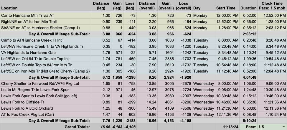
With route and weather information in hand, I built out the trip in our spreadsheet based on a 1.5MPH pace…
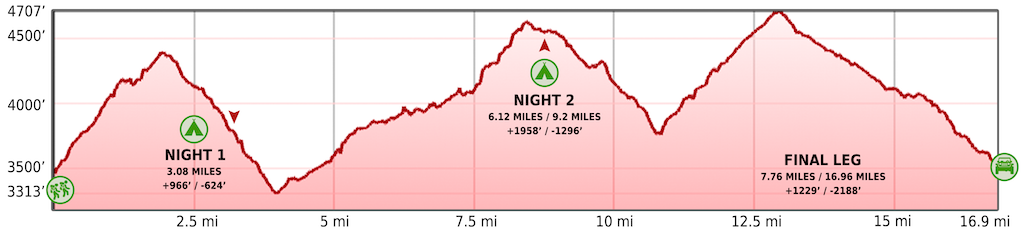
…created an elevation profile using Google Earth
…dropped in the route
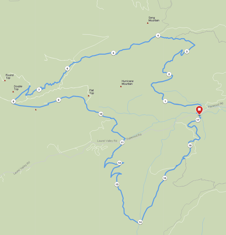
…and packaged it all in a map which I printed on regular paper and laminated like a caveman (because I was out of TerraSlate paper).
PACKING IT IN
My winter packs tend to weigh between 28 and 33 pounds. This trip would be no different. Well, it could’ve been different (i.e. much lighter), but I elected to bring furniture and running gear. You heard me correctly.
For starters, Santa brought me a Helinox Table One (1 lb. 8 oz.). I figured if he went through all the trouble to deliver a table to me all the way from the North Pole, the least I could do was take it with me on this trip. And, well, I couldn’t bring a table and not bring a chair (1 lb.). And, I mostly certainly couldn’t bring a chair and not bring a chair underquilt (6 oz.). I’m not an animal. I am a civilized person.
Then there was the running gear. I’d plan to use my shirt for hiking and running so no extra weight there. But, the shorts (7.6 oz.) would cost me nearly half a pound. I also packed my Houdini windbreaker (3.7 oz.), but I intended to use it for both running and hiking. The part that kept me up at night was the shoes. I was really, really hoping I could get by with hiking and running in just a pair of trail runners. But, with a snowstorm blowing through there was a good chance I’d need boots to keep my feet dry and warm and a separate pair of shoes (1 lb.) just for running.
To top it all off, I packed my rain jacket (1 lb.) and pack cover (3.4 oz) on the off chance the 30% chance of rain became a 100% reality.
In the end, with all that nonsense thrown in with the rest of my gear, my Atmos 50L weighed in at a hefty 30 lbs. 14.1 oz (24 lbs 9.5 oz. pack weight and 6 lbs. 4.6 oz. of food/water).
DAY 1 (3.55 MI | +925′ GAIN | -535′ LOSS)
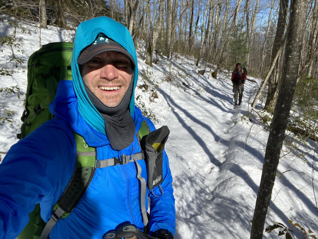
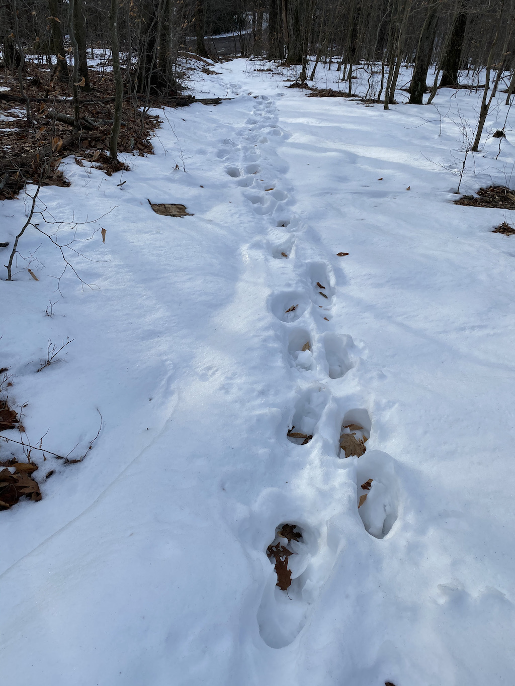
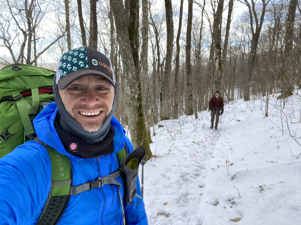
My morning started off with 10K #254 followed by a shower, a nap, and a 2-hour drive to the Fox Creek trailhead parking lot where Ken and I arrived just after noon. The lot, which sits on the Appalachian Trail (AT) between Old Orchard Shelter and Hurricane Mountain Shelter, had a couple other cars and a blanket of snow about four inches deep. Goodbye trail runners. Hello boots and Merrells.
We loaded up then set out at 12:23PM. From the lot we headed north, crossed over VA603/Fairwood Road, and then started up the AT. For about a quarter mile we followed two sets of shoe prints, one adult and one child. Before long, The Child’s prints disappeared and the adult’s prints began to leave a deeper impression. Not much longer after that, the adult’s prints stopped moving forward and started pointing back down the hill. Our best guess, The Child got tired so the adult picked ’em up. Then, the adult got tired of carrying The Child and they both went home. This is the way.
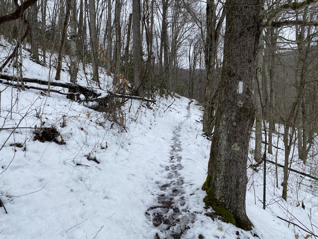
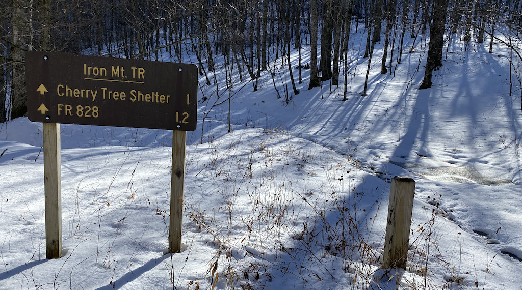
Around 1:30PM, we finished our day’s climbing when we reached the Iron Mountain Trail/AT intersection. To the left/west it was ~1.8 miles to Cherry Tree Shelter. To the right/east it was ~3.25 miles to Comer’s Creek. And straight ahead/north it was about one mile to the Hurricane Mountain AT shelter (a.k.a our destination).
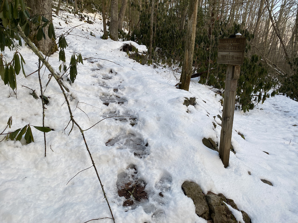
We continued straight through the intersection and down the other side of the mountain for twenty minutes before arriving at the shelter spur. A sign pointed left/northwest to the shelter and right/east to a loud and flowing creek.
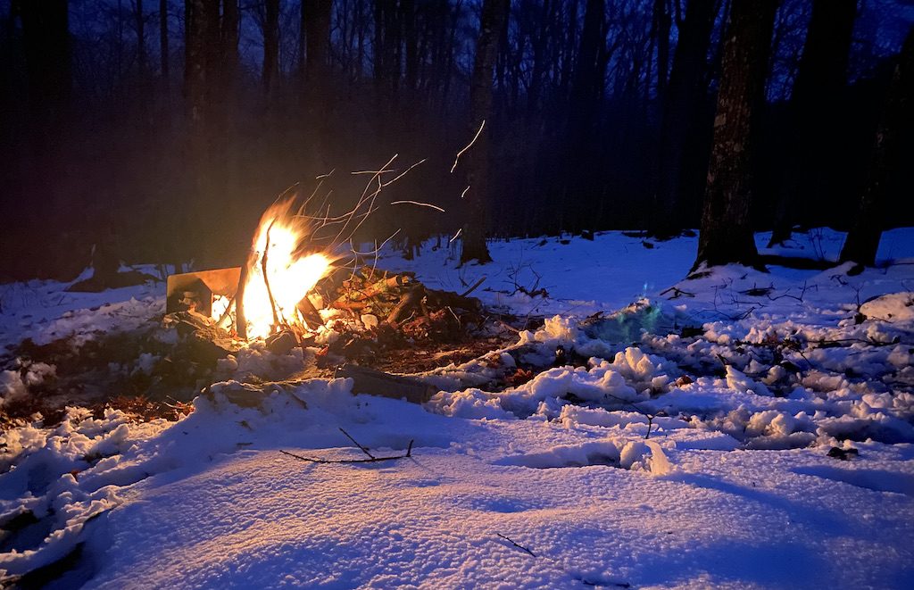
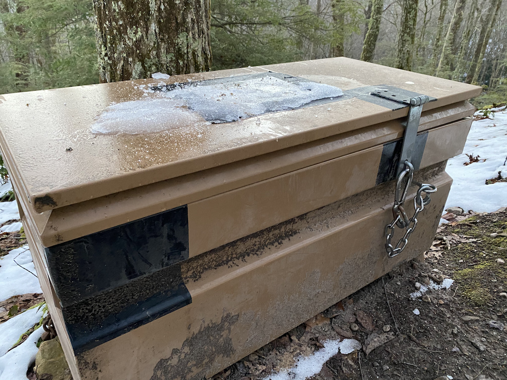
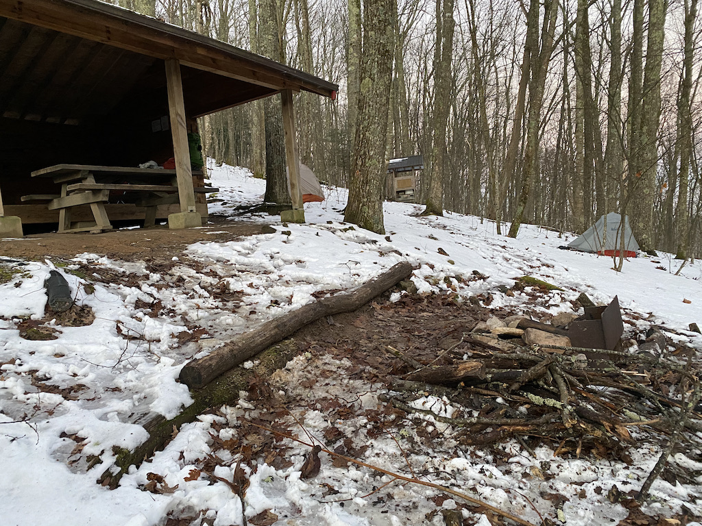
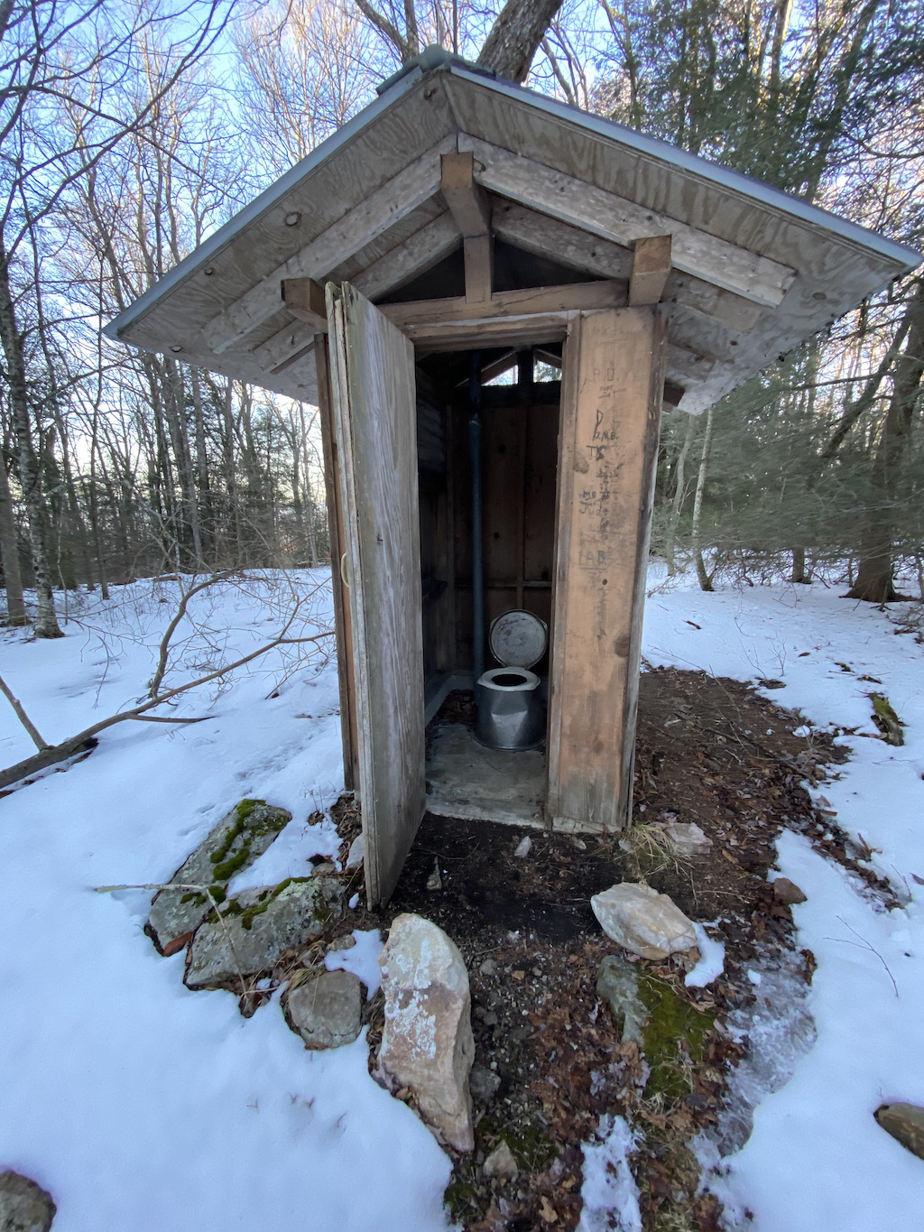
After checking out the water situation we walked the spur for 0.10 miles to the shelter, passing a bear box along the way. The shelter was in pretty good shape with a picnic table and fire ring out front and a moldering privy 30 yards away.
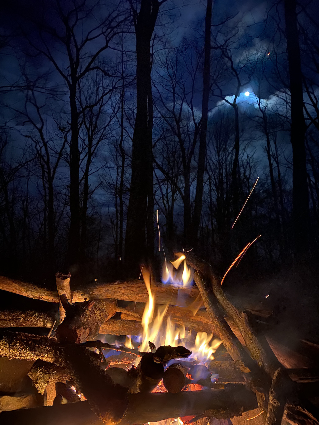
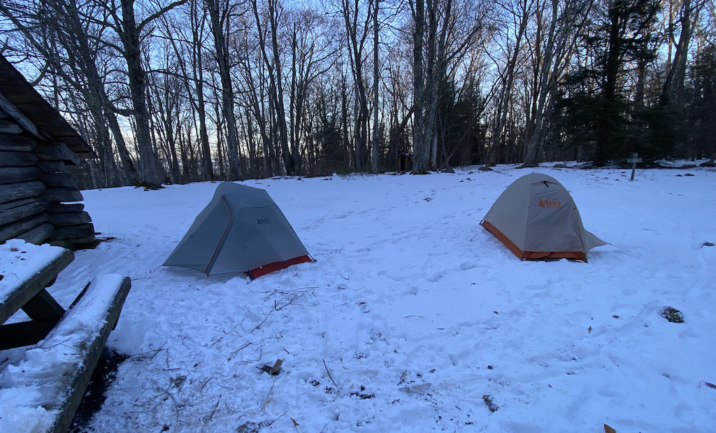
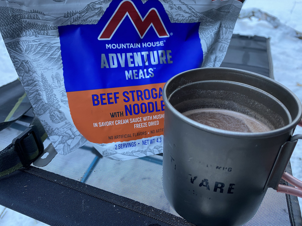
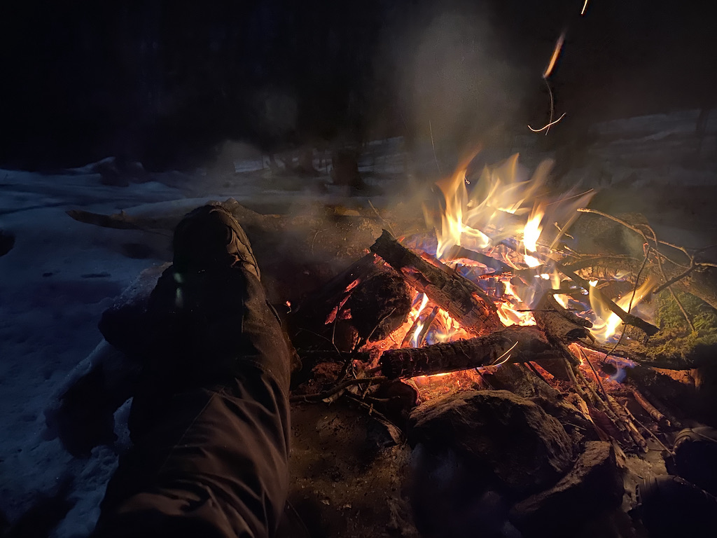
We set up our tents then turned our attention to water and wood. By 3:30PM, our chores were complete and we were relaxing in our chairs inside the shelter. Dinner and hot cocoa was followed by fire and stargazing. It was heavenly. Around 10PM, we doused the fire, put our food in the bear box, and hit the sack.
Day 1 Complete
DAY 2A (6.19 MI | +1,342′ GAIN | -820′ LOSS)
Around 2AM I woke to a blood curdling cry which sounded somewhere between a child yelling out in terror and a cat in heat. Curious, I forced myself out of bed to check things out (and go pee). I searched in and around the shelter, but found no evidence of demonic children or mating cats. No eyes staring back at me. No ritualistic sacrifices. Nothing. I shrugged it off and returned to my tent.
Back in my bag, I continued my regimen of rotisserie sleeping. Sleep for an hour, wake up, turn on my left side. Sleep for an hour, wake up, turn on my back. Sleep for an hour, wake up, turn on my right side. By 7AM I was appropriately browned so I started breaking things down. Once finished, I enjoyed a cup of joe, a bowl of oatmeal, and a visit to the privy.
By 9AM, Ken and I were loaded up and heading back down to the AT where we hung a left/north en route to Hurricane Road/FSR 84 below. Man, I love the smell of downhill in the morning!
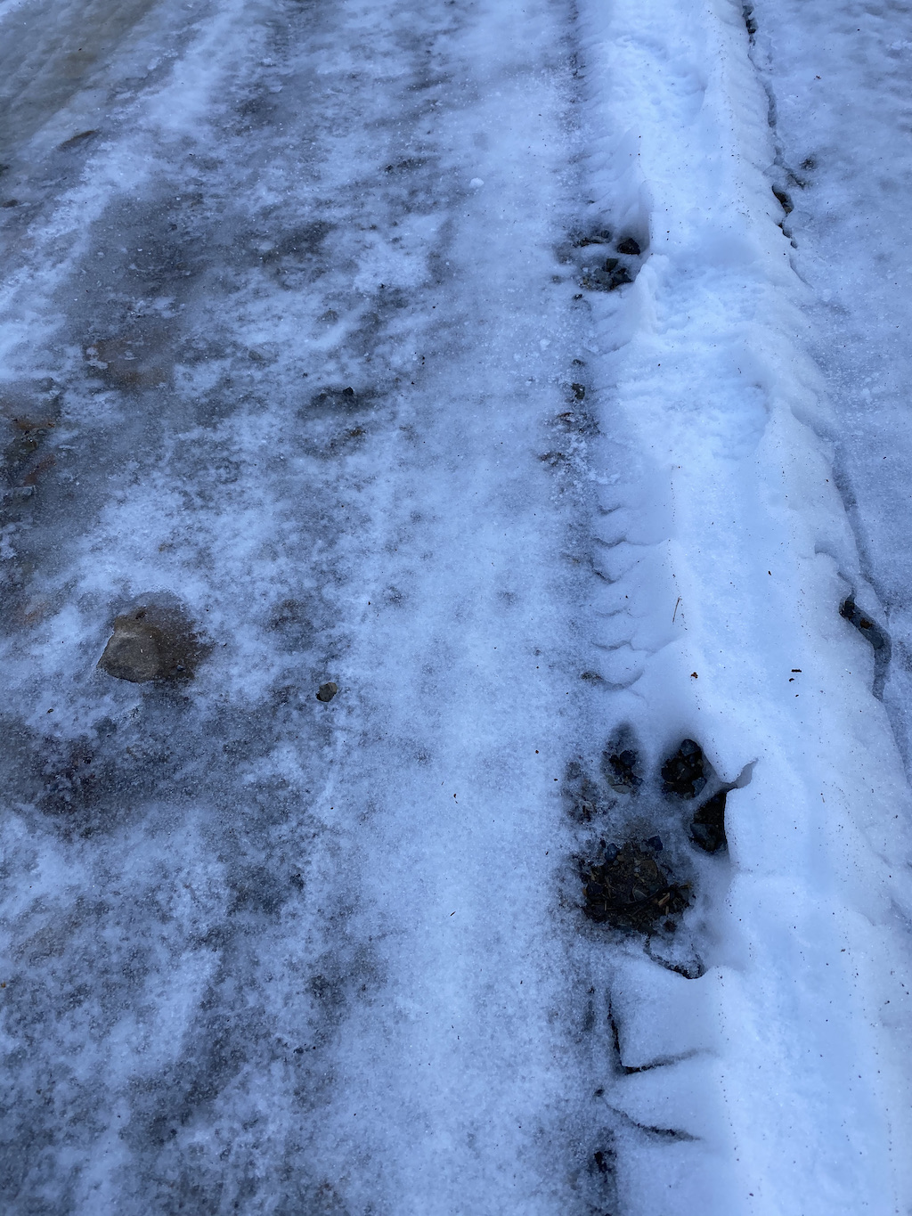
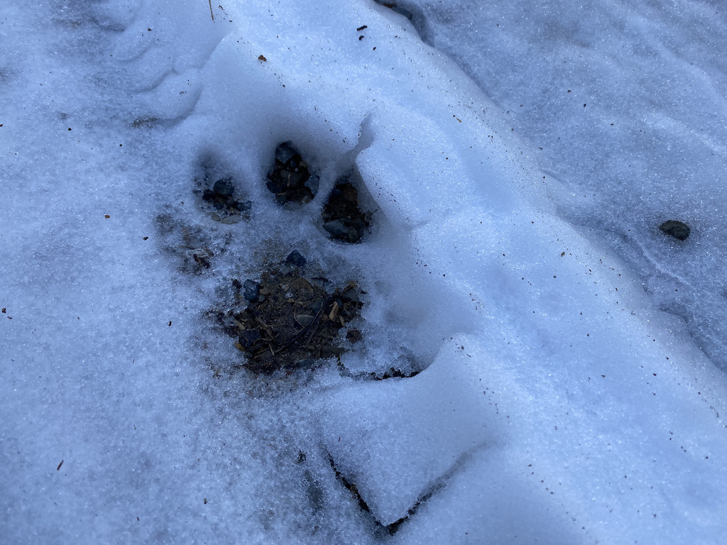
While we walked, we started seeing blood-stained cat tracks heading in our same direction. Perhaps this was the source of the crying, shape-shifting, demon-cat baby.
The tracks veered into the woods just before the AT/Hurricane Creek Trail intersection where we continued straight on Hurricane Creek Trail for another 0.3 miles until reaching Hurricane Road/FSR84.
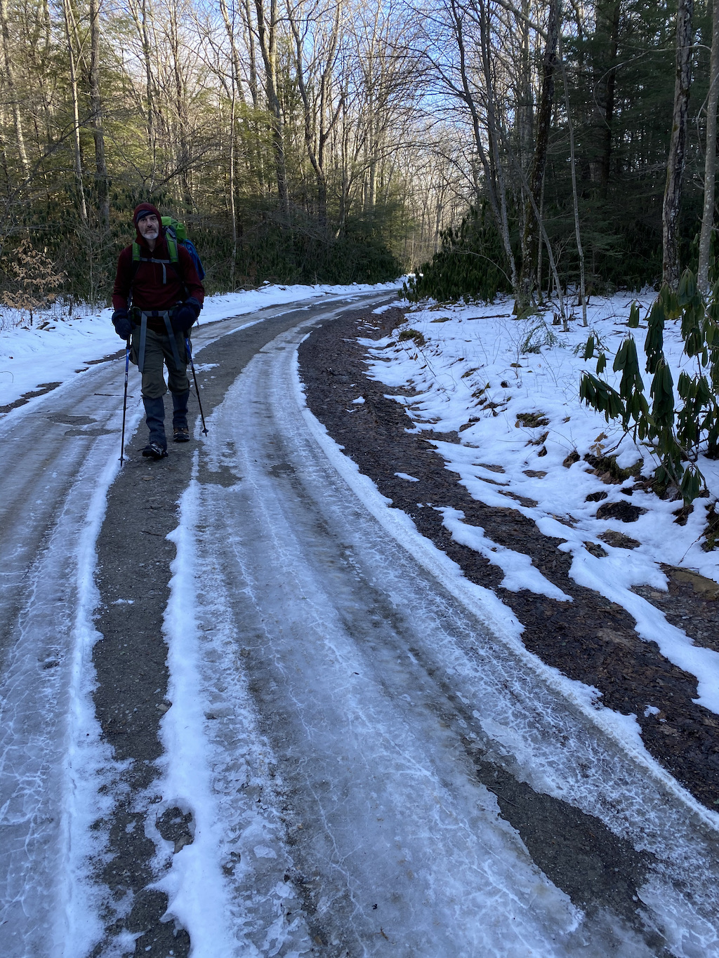
We turned left/west and began our ascent to Old 84 Trail. The road was iced over on both sides where vehicles had passed through, but the middle of the road had a soft crust of snowpack making it a little easier to travel; not just for us, but for all of God’s creatures.
A few minutes up the road we spotted an old fella and a couple of barking dogs sitting in an idling truck. The truck was pointing towards Hurricane Creek as if the guy was looking for something…or maybe at something. We passed him, exchanged waves, and continued up the road.
It wasn’t long before a caravan of trucks came crawling down the road. We stepped off the road and into the woods to let them pass. As they approached, the passenger in the first truck leaned out the front window.
HUNTER: Y’all seen any fresh bear tracks?
ME: Nope. Saw a large cat track going down the road, but no bear tracks. Haven’t seen any up the mountain either.
HUNTER: Well, we crossed some day old tracks back up the road. Maybe they’re done for the season. Just in case, y’all be careful.
He wished us well and went on down the road. The next two trucks passed. Drivers and passengers smiled and waved. Dogs barked and howled. The fourth truck slowed and the passenger leaned out to reiterate what the first guy had said. He wished us well, too, and then joined the rest of his group.
We walked some more before passing a trail that dipped into the woods. It didn’t look familiar, but it felt like we should’ve taken it. A few more steps and I caught a glimpse of a yellow gate about 75 yards from the road. I told Ken that I remembered the gate and seemed to recall it was near where we wanted to be. I broke out the map as we backtracked to the trail. What do you know? It was Old 84 Trail. I was right.
On Old 84, we passed the yellow gate which sat at the intersection of Rowland’s Creek Trail and Old 84. FYI, if we continued on Rowland’s Creek Trail we’d hook up with Rowland Lane which leads to Jerry’s Creek Trail which winds it way back to Old 84 near FSR 84. Got it? No? Whatever. Just look at the map below.
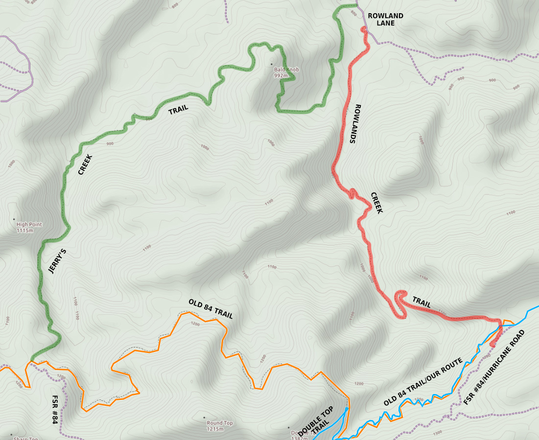
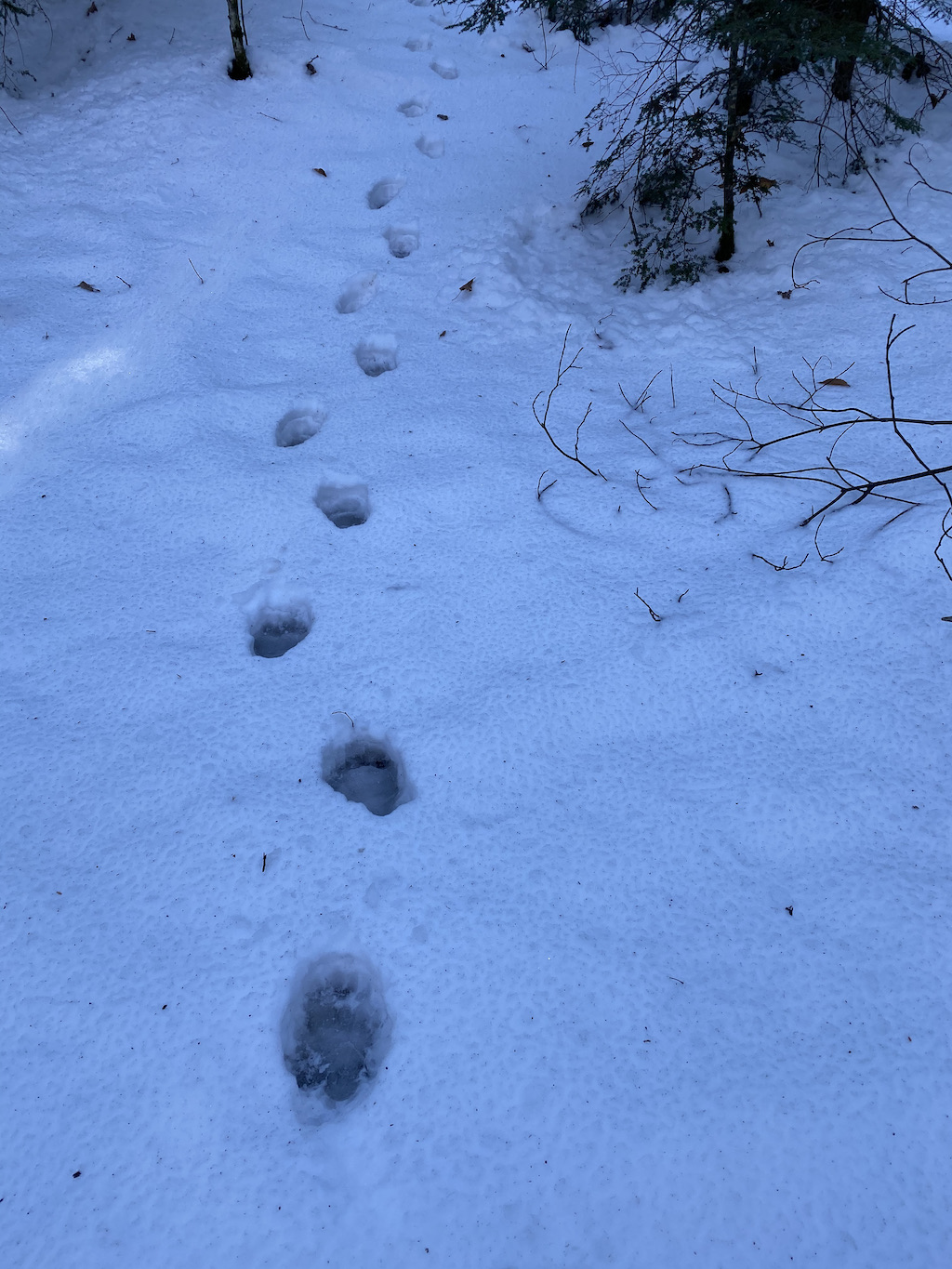
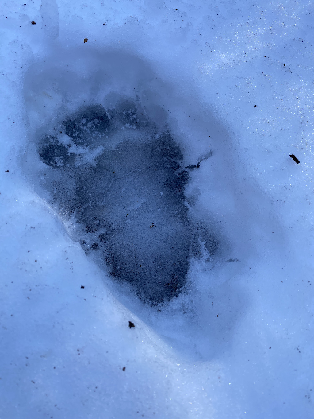
After crunching along Old 84 for a quarter mile we came across a set of bear tracks heading east. Thankfully, we were heading west and the tracks looked to be old. We also guessed the bear tracks were probably from the same bear that crossed FSR 84, but I’m neither a tracker or a hunter, just a guesser.
The trail zigged and zagged for another half mile before turning sharply to the north. That sharp turn meant we had about a quarter mile before the Double Top trail which cut across the mountain. Unfortunately, when I arrived at the spot where I thought it’d be, there was no trail.
I looked around, but couldn’t see anything that would qualify as a trail. Ken caught up to me and suggested we keep going for a bit. Because he tends to be correct in these situations, we walked on up looking to our left for any semblance of a trail. When we reached the next turn (a rather larger turnout in the road I might add) I saw what looked to be a trail. We checked it out and saw signs of trail maintenance. Huzzah! We’d found our shortcut.
The half-mile trail gave us plenty of sunshine and some nice views of the mountains to the east. Along the way there were loads of animal tracks including a single set of bear tracks that crossed over Double Top and continued down towards Old 84. Now, it’s possible, and again, I’m totally guessing here, that the tracks belonged to the same bear from earlier in the day.
Double Top eventually T-boned FSR 84 and Iron Mountain Trail. To the right/west, Iron Mountain Trail and FSR 84 merge for a mile before going their separate ways. To the left/east, the two split almost immediately—FSR 84 descends northeast and Iron Mountain ascends east (which is where we were headed).
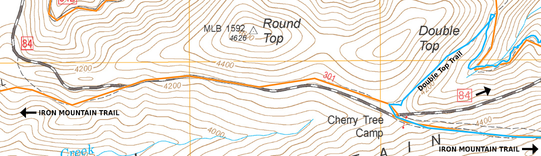
We turned left/east on Iron Mountain Trail, passed a trail sign directing us to Cherry Tree Shelter a mile away, and started to climb. Putting one foot in front of the other in quick succession we reached the shelter just before noon.
Upon arrival, I made a B-line for the water source I had used on a previous trip to make sure it was still flowing. SPOILER ALERT! It was. I returned to share the news with Ken when my phone rang.
SON: Hey dad! How’s it goin’?
ME: Good. How’re you guys doing?
SON: We’re good. We tied up mom.
ME: Uh, OK.
SON: Dad, did you build a snowman yet?
ME: Not yet.
SON: Oh…OK.
Concerned that my wife’s freedom depended on the construction of a snowman I concluded the hostage negotiation by promising my son I’d build one. He agreed and we exchanged goodbyes. Hang in there honey!
DAY 2B (6.50 MI | +1,033′ GAIN | -1,047′ LOSS)
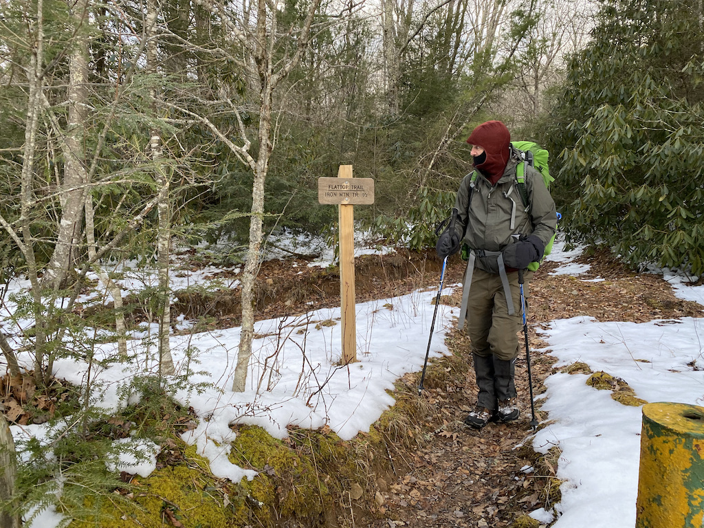
With my wife’s situation on my mind, I tried to refocus my attention on the task at hand—10K #255. First, I needed to get dressed for the occasion. Normally, I’d just wear shorts and a T-shirt, but the weather was deceptively cold on account of the elevation and the stiff breeze.
To that end, I wore my soft shell pants over my running shorts, slipped gaiters over my Merrells, and threw my Houdini over my T-shirt. I went over my route with Ken once more then took off towards Flat Top Trail.
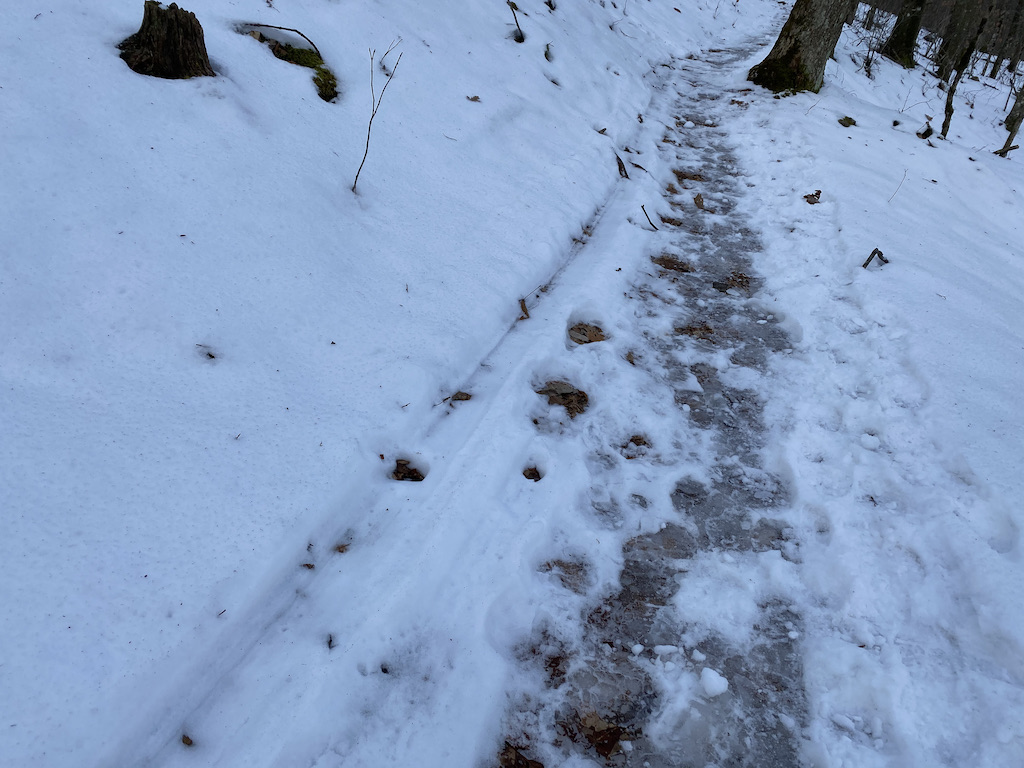
The first quarter mile was rocky, icy, and snow-covered, after which the trail transitioned to an icy, gravel road for the next 0.75 miles. I did my best to stay upright while also trying to keep my pace up because while gravity was in my favor right now, it would be a different story on the way back.
Just shy of the mile mark I turned left off the gravel road, continued down Flat Top, and made my way to the Fairwood Trailhead parking lot 0.75 miles later. There, I was greeted by knee-high snow drifts and pockets of ankle-deep, freezing cold, muddy water.
After some not-so-fancy footwork, I made it to the parking lot where I turned left on Fairwood Road en route to the Fox Creek trailhead about 1.25 miles away.
My legs were feeling great. Like, really great. And then I realized why. I was still going downhill. As in the entire out of my out-and-back was downhill. Slightly bummed, but still feeling good, I arrived at my car a few minutes later and partook in the water and snacks I’d left for me. Thanks me!
Once satiated, I turned around, cursed the gods under my breath, and started back. It…was…brutal and awful and horrible. At one point I got the great idea to take Fairwood Valley Trail thinking it might make things easier being a trail and all. I was wrong. In fact, if I continued down the horse trail I would most definitely elongate my return trip. Uh, no gracias.
I returned to Fairwood Road and made my way to the trailhead where I stopped to take a breath before starting my final climb. Just 1.73 miles of nonsensical incline between me and a chair. Slowly and steadily I walked and jogged my way back to the shelter arriving after a “mere” 1 hour and 19 minutes. Sweet sweaty monkey balls that was painful.
On the plus side, Ken spent his quiet time gathering wood and getting things ready for the night which was nice. God bless him. Seriously, God, please bless Ken.
I rested for a bit, visited the privy, then got busy gathering mas madera. With chores complete, we sat for a while, ate dinner, hung the food, then sat as near to the fire without burning our faces until bedtime beckoned.
Day 2 Complete.
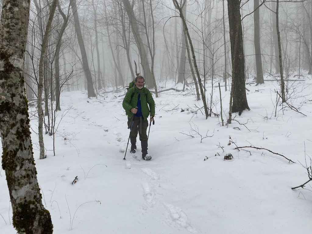
DAY 3 (7.83 MI | +1,024′ GAIN | -1,998′ LOSS)
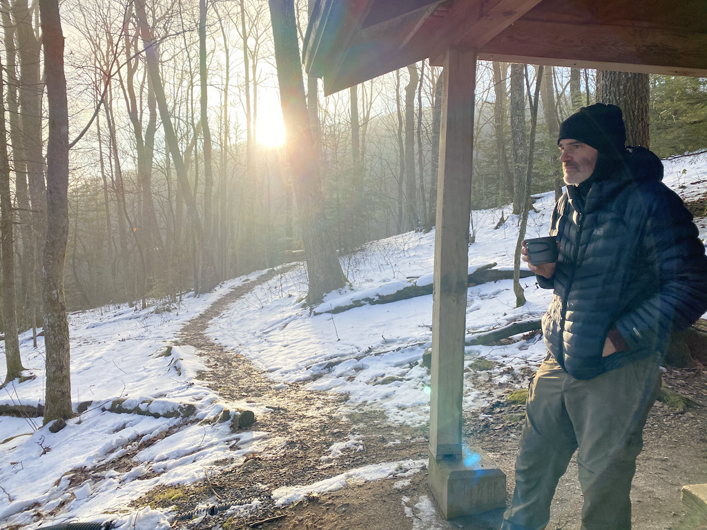
The winds started whipping my tent around midnight and they were still blowing hard when I woke at 6AM. Unable to fall back asleep, I started breaking things down inside my tent before moving everything inside the shelter to finish on account of the relentless, godforsaken wind. Ken followed suit a little while later and we were on the trail by 8AM.
On the way down we passed a couple of hunting dogs looking for bears. And when we crossed Fairwood Road we passed their owner who was also looking for bears…from a distance…by watching his dogs look for bears.
Once across, we started the 2-mile, 1,000′ climb up Mt. Rogers Trail to Lewis Fork Spur. Along the way, Ken and I noticed a pair ski tracks. Yes, someone skied down Mt. Rogers Trail. Well, I suppose they could’ve skied up the mountain backwards, but I’m going with the presumption that they came down. How far down? Not sure, but the tracks continued for as far as I could see.
A short time later, we passed a group of 4 young hikers on their way down. I kept thinking how cold and windy it was at Cherry Tree (4,500′) the night before. If they were up near Thomas Knob Shelter (5,400′) they had to be ever more miserable.
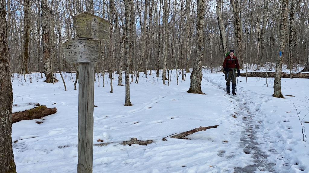
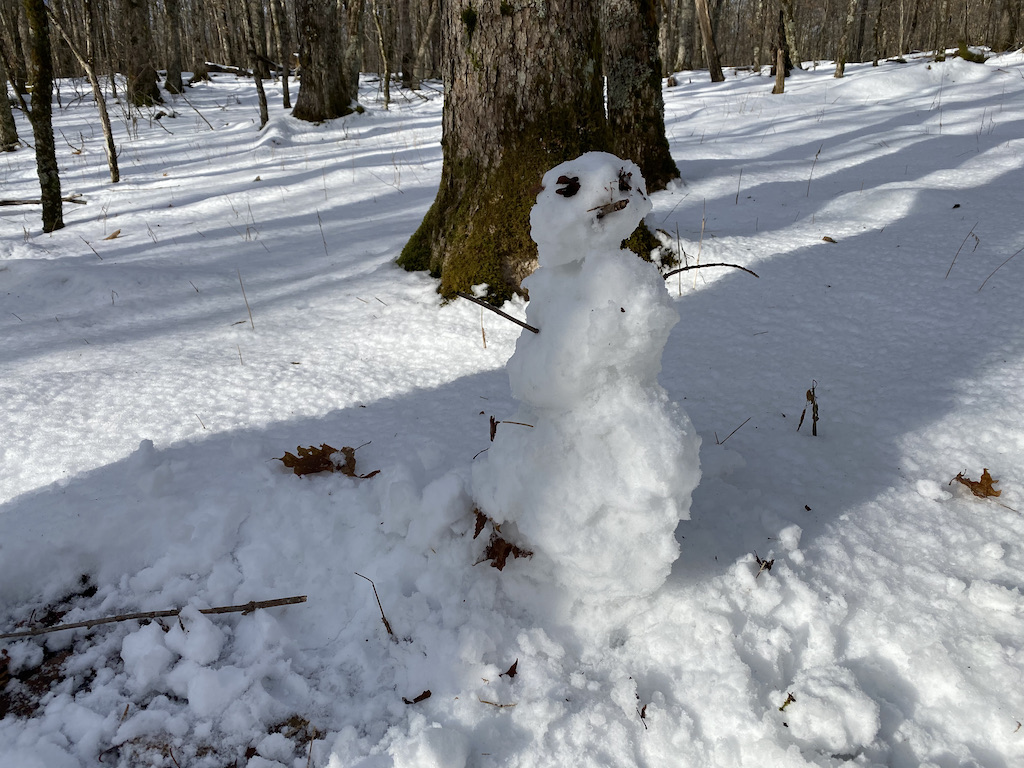
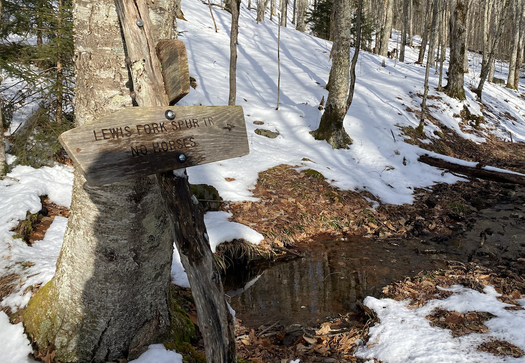
At Lewis Fork Spur we hung a left/west and began the 4-mile, 1,400′ descent to the car. As I walked, I noticed how the snow looked soft and wet. So fluf…ZOMG! My wife! I stopped and assembled Frosty, snapped a photo, and sent it off to my son.
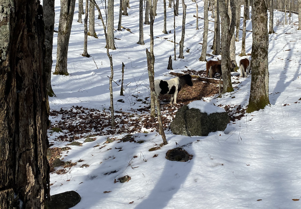
Another quarter mile later, we arrived at a fork in Lewis Fork Spur where a handful of Grayson Highland’s famous horses were hanging out. We waved, they neighed, and we continued left/southeast down the trail.
A mile later, we crossed over Cliffside Trail (a trail which follows Lewis Fork creek down the mountain and ascends up towards Pine Mountain in the other direction) and walked another mile before reaching the Lewis Fork Trail/Old Orchard Trail intersection. To the left/west, Lewis Fork Trail continues down the mountain. To the right/northeast, Old Orchard Trail crosses the AT and eventually dumps into the Virginia Highlands Trail and Fairwood Road.
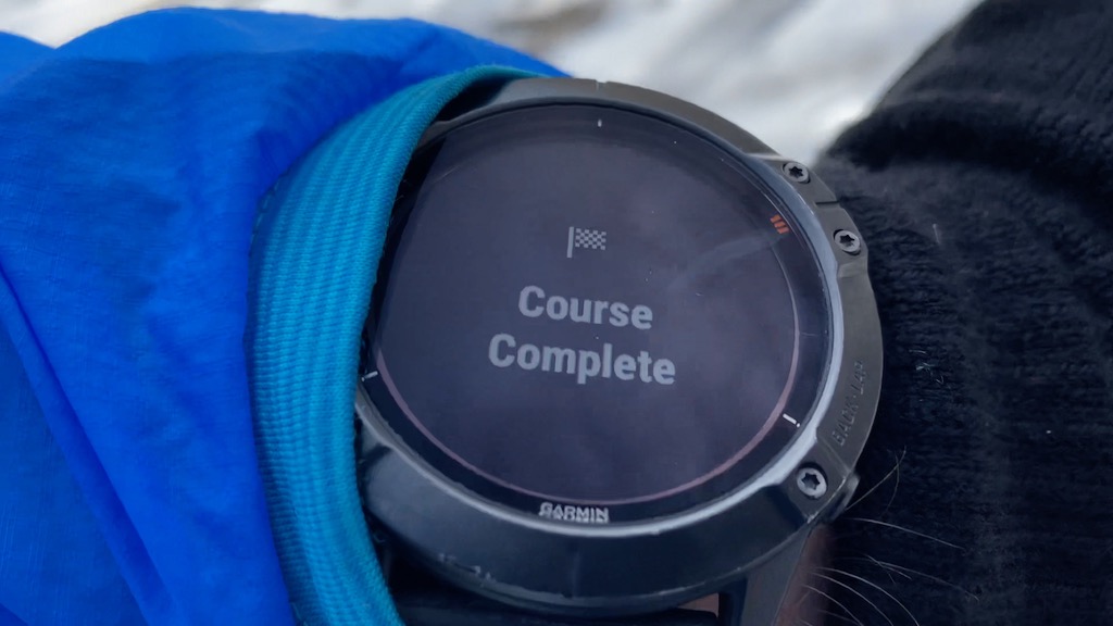
We turned right/east down Old Orchard and walked it a quarter mile, passed our old Memorial Day campsite from a couple years ago, and arrived at the AT shortly thereafter. At the intersection, we turned left/south, hiked the last 1.5 miles to the Fox Creek Trailhead, and arrived back at the car ’round 11:30AM.
Trip complete.
TOTALS (17.57 MI | +3,291′ GAIN | -3,353′ LOSS)*
*with Day 2 run (24.07 miles | +4,324′ gain | -4,400′ loss)
FINAL THOUGHTS
I love winter trips and the Mount Rogers Recreation Area gave us another good one. There was just enough snow on the ground to make boots necessary and snowshoes overkill. It was cold and windy at night, but also sunny and warm during the day. Truly, the backpacking gods looked kindly upon us.
The 5 pounds of gear I probably could’ve left behind worked out just fine. To be honest, the Helinox Table One is actually a pretty sweet (albeit totally unnecessary) piece of gear. The chair and underquilt are sweet and necessary and I will continue to bring them along because I enjoy sitting and my butt enjoys warmth. I’m stoked I went with Merrells and boots because my trail runners would’ve been soaked and my toes frozen. As for the rain gear, it didn’t end up raining, but my rain jacket did a great job cutting down the wind at night.
Overall, I wholeheartedly recommend the Mt. Rogers Recreation Area for your winter excursions. Seriously, if you’re looking for some winter goodness, roll the dice and head up there.