Located in southwest Virginia, the Mount Rogers National Recreation Area (NRA), Grayson Highlands State Park, and surrounding National Forest lands are popular destinations for hikers and backpackers looking to log a few miles, take in breathtaking views, and observe wildlife of all types. In the past year or so, particularly along the Appalachian Trail (AT), the area has also become popular among black bears.
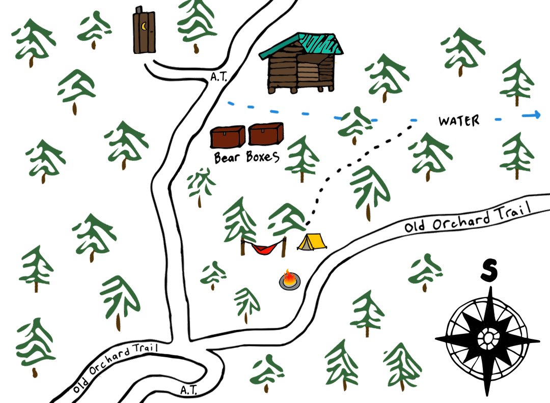
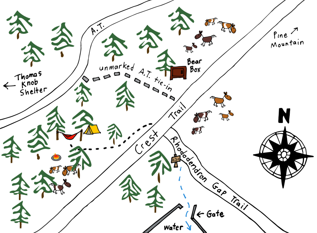
According to the Appalachian Trail Conservancy’s 2018 Bear Incident report, black bears have successfully retrieved more than 70 food bags hung in trees and damaged packs and tents as far south as Thomas Knob Shelter. As a result, the Forest Service closed the area for a time and, with the help of the Mount Rogers Appalachian Trail club, installed bear boxes at 6 sites: Thomas Knob Shelter, Rhododendron Gap between the AT and the Crest Trail, Wise Shelter, Old Orchard Shelter, Hurricane Mountain Shelter, and Trimpi Shelter.
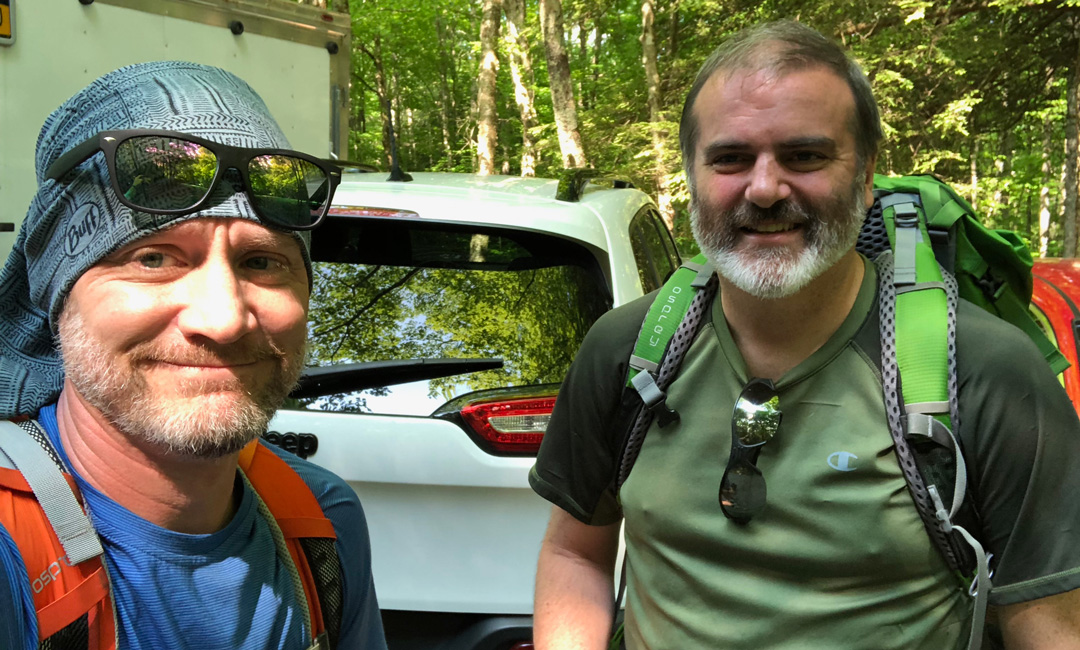
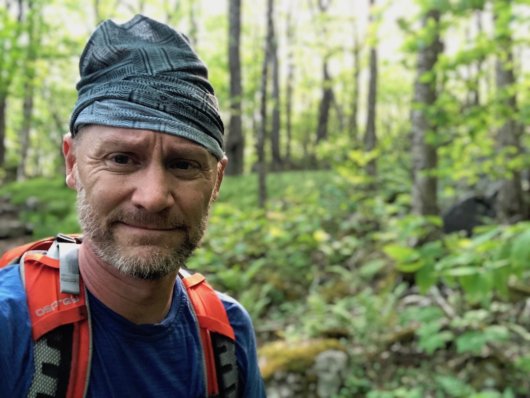
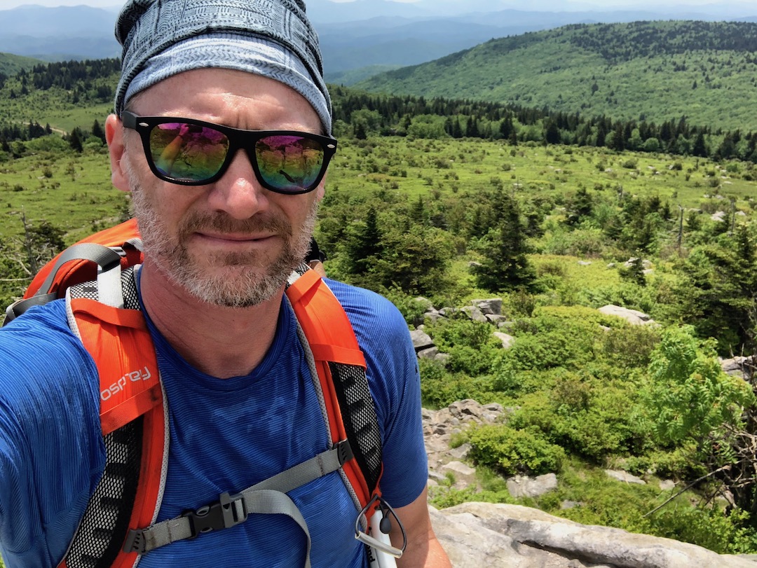
With this in mind, my brother-in-law, Ken, and I decided to assume the risks and brave the crowds and bears for a Memorial Day weekend backpacking trip to the Mount Rogers National Recreation Area.
THE PLAN
Back in February 2015, my buddy, Coop, and I attempted to complete a 25-mile loop from Grindstone up to Iron Mountain and then through the NRA via the AT. Unfortunately, snow was deep and we were forced to cut our trip short. For this trip, I thought we could take a similar route minus the Iron Mountain bit since bear boxes were provided on the south side of Fairview Road. I ran it by Ken, he agreed, and we turned our attention to the weather.
The AT Shelter forecasts called for daytime temps in the upper 70s, overnight lows in the 50s, winds between 8MPH and 15MPH, and a 50% chance of scattered showers throughout the weekend. Not bad at all!
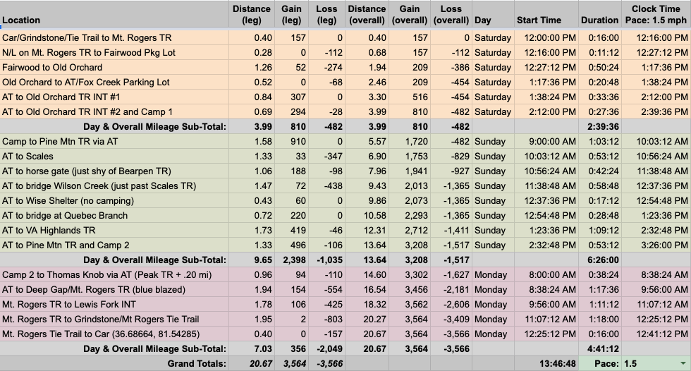
We then finalized our plan and built out the trip in a spreadsheet based on a 1.5MPH pace…
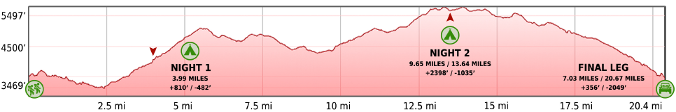
…created an elevation profile using Google Earth
…dropped in the route
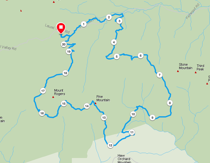
…and packaged it all in a map I printed on TerraSlate paper.
PACKING IT IN
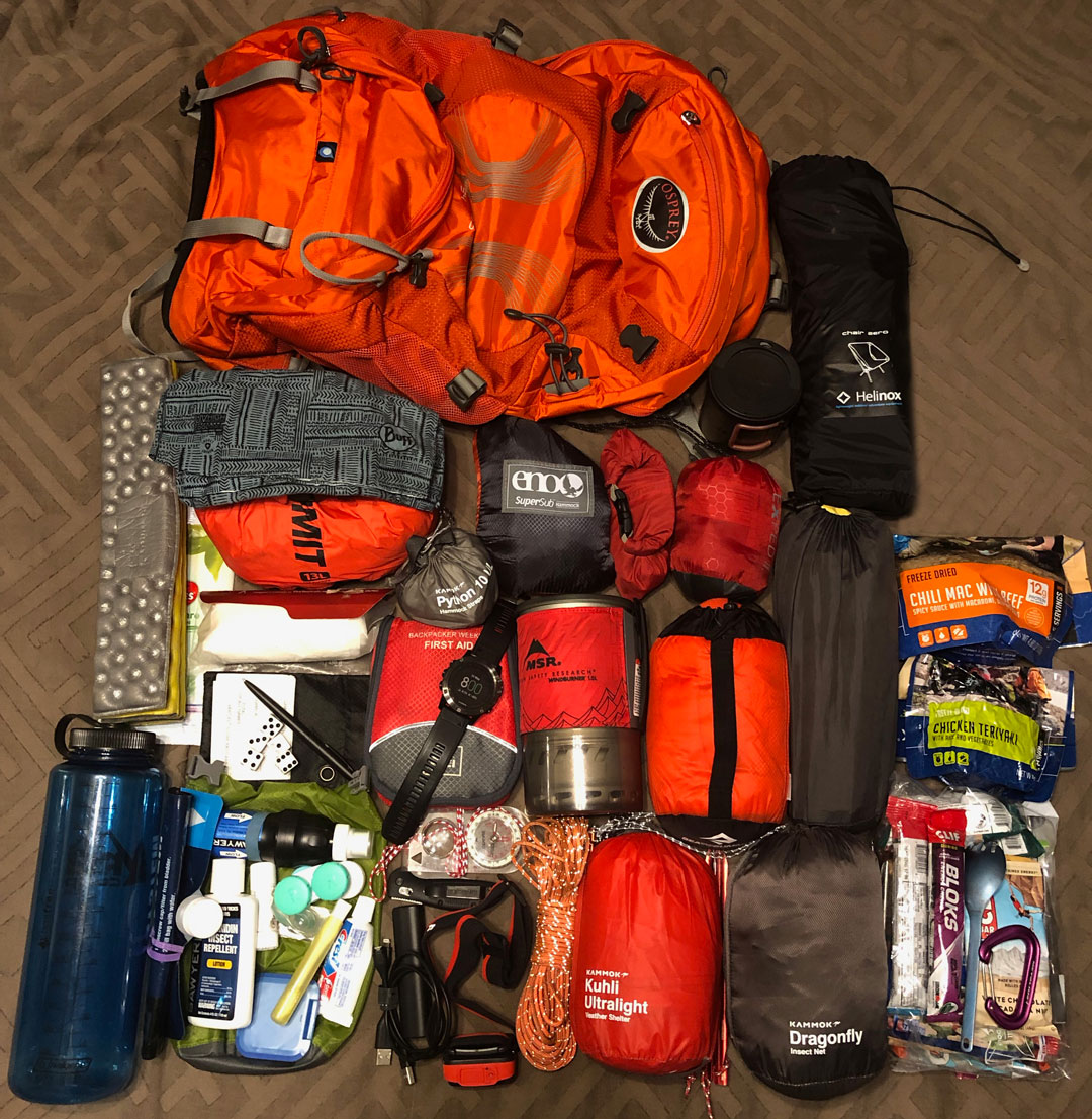
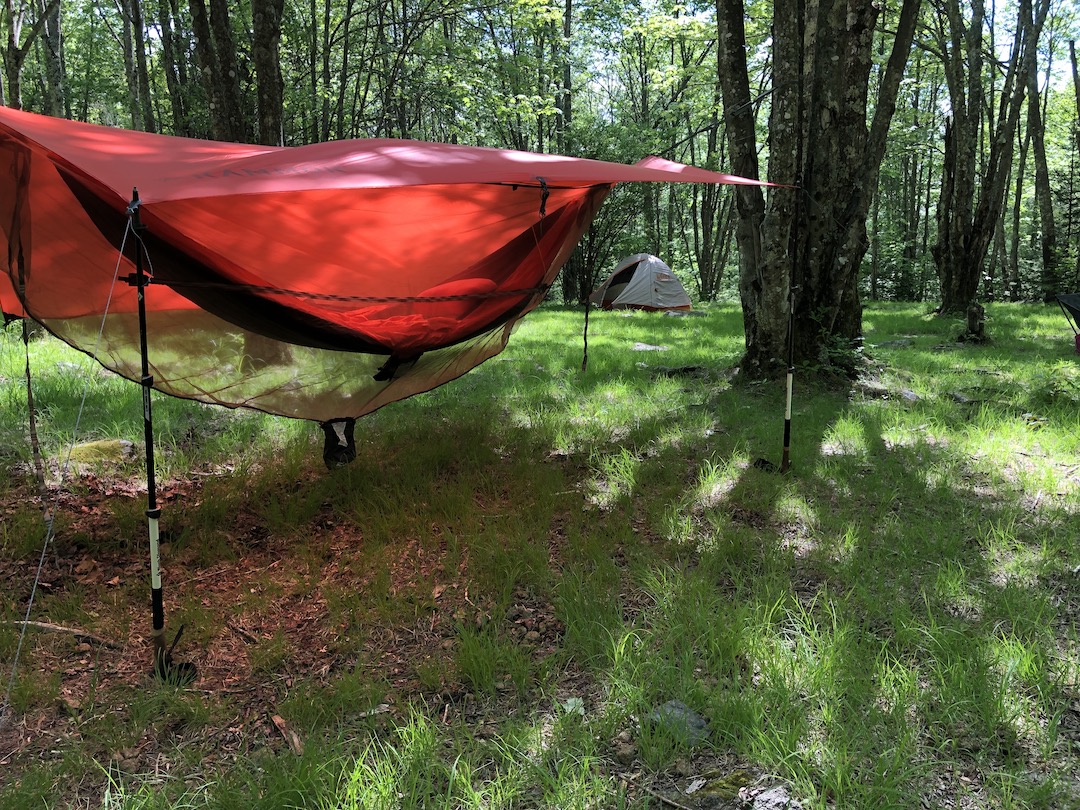
Since the weather was forecasted to be mild, I opted for my lighter 34L pack and a hammock. I went back and forth with bringing a rain jacket (1 lb.) and rain pants (10.9 oz.), but ultimately packed ’em because I don’t like being wet. To deal with the bears, I packed my Bear Vault 450 (2 lbs. 1 oz.) and bear spray (11 oz.) only to ditch the bear canister the night before after reading the Forest Service’s recommendation to place bear canisters inside a bear box. I mean, why bother? With two fewer pounds, I threw in my Helinox Zero chair and a bag of dice. When everything was loaded, my 34L Stratos weighed in at 22 lbs. 14.6 oz.
Feel free to download a complete list of things I brought.
DAY 1 (4.15 MI | +735′ GAIN | -427′ LOSS)
We pulled into Grindstone Campground just after 10AM, stopped at the gate, and talked to the attendant, Darrell, for a bit. He pointed out the location of the Mount Rogers tie-in trail, mentioned that bears weren’t bothering the shelters anymore in favor of the campground, and directed us to the bathrooms. From the gate we stopped to TCOB then made our way to the parking lot ($5/night). Ten minutes later we were headed down the road to the tie-in.
The half-mile tie-in starts out wide with plenty of shoulder room, slims for a bit, and then opens back up before it T-bones into the blue-blazed Mount Rogers Trail. At the tie-in/MRT intersection we hung a left and hiked south ~0.25 miles to Fairwood Road where cars were already lining the northern shoulder. We crossed the road and walked a hundred feet or so to a very full parking lot with two trail options: Flat Top Trail which runs N/NW towards Cherry Tree Shelter (off Iron Mountain) and Fairwood Valley Trail which runs E/NE towards the AT at Fox Creek parking lot.
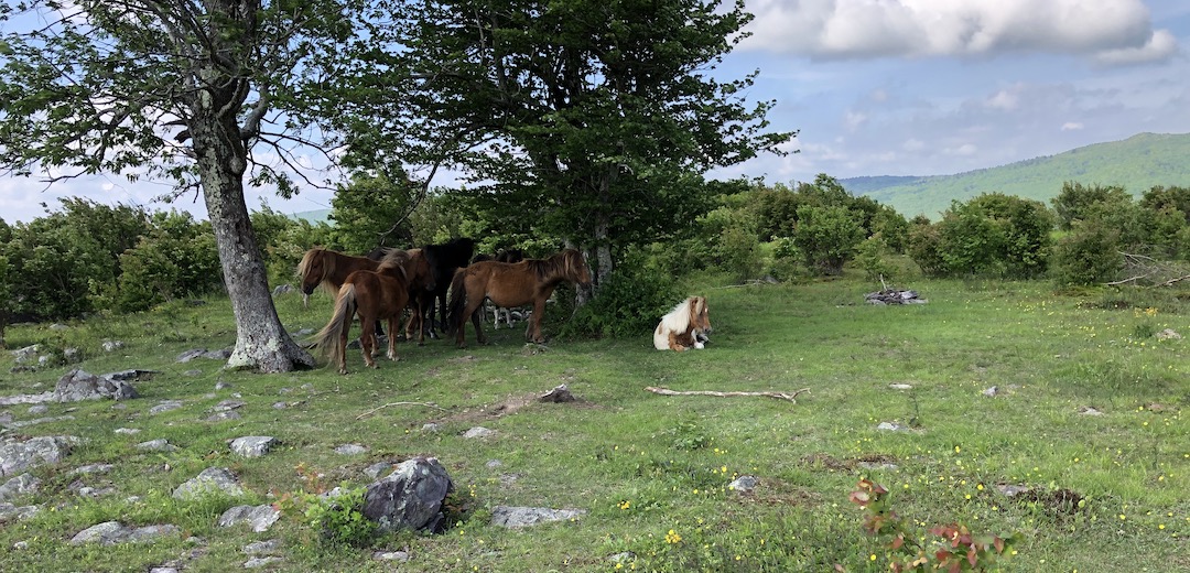
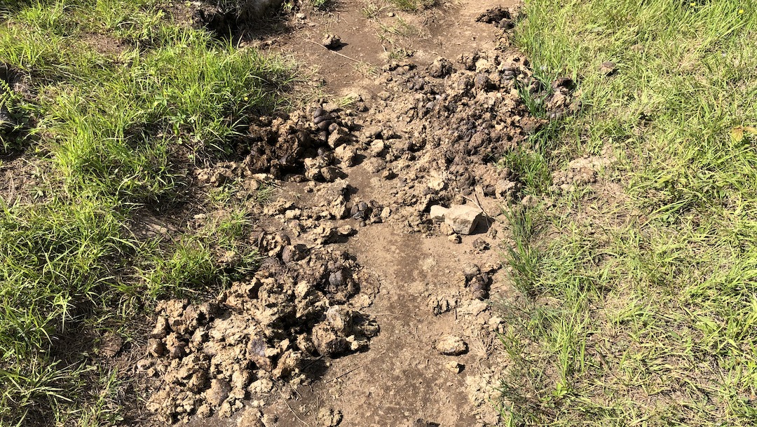
We continued through the lot and joined Fairwood Valley Trail just before 11AM. A few steps in and we were dodging our first of hundreds of piles of horse turds that covered our route’s trails.
About 0.75 miles from the Fox Creek parking lot we rock-hopped across Fox Creek and made our way to a gate which opened to a cow pasture (if you cut through the grass to the south you’d run into Fairwood Road and a trailhead for Lewis Fork Trail). The trail wound through the pasture until it dumped back into the trees via a second gate. En route, we passed an enormous cow patty with a full human footprint inside. Yeah, I have no idea, but there’s got to be a reasonable explanation.
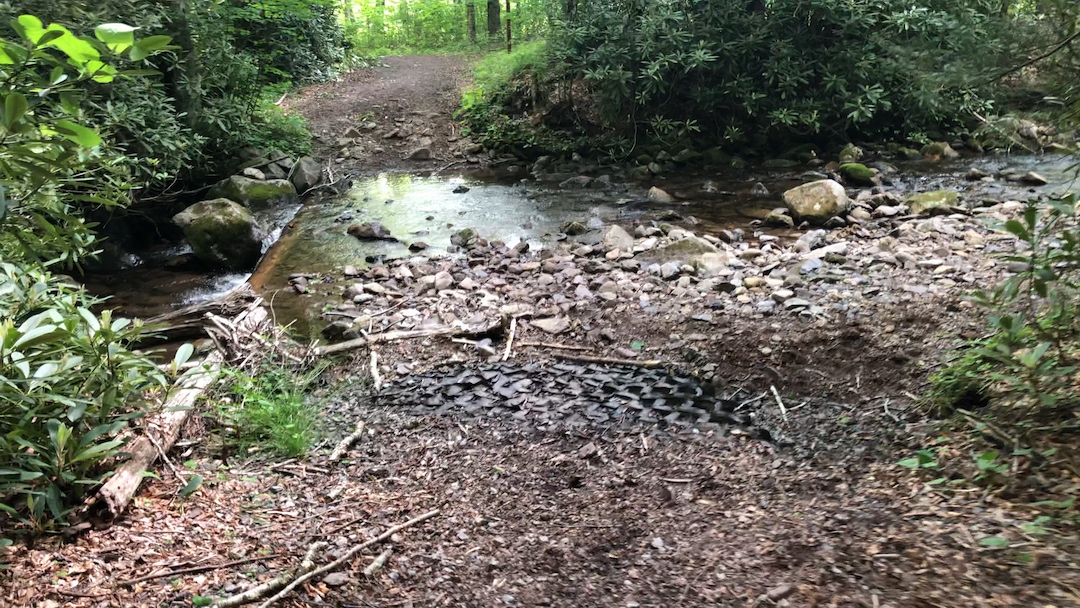
From the second gate, the trail intersects Lewis Fork Trail and continues on for about a quarter mile where it forks. To the right (south) is an option for a high water trail around the Lewis Fork creek crossing. To the left (north) Fairwood Valley continues straight and eventually intersects the creek. We opted to take our chances and continue straight on Fairview Valley. When we arrived at the creek, it wasn’t deep, but there weren’t any dry crossing options. We hiked right/south until we found a line of rocks that would get us across without getting wet.


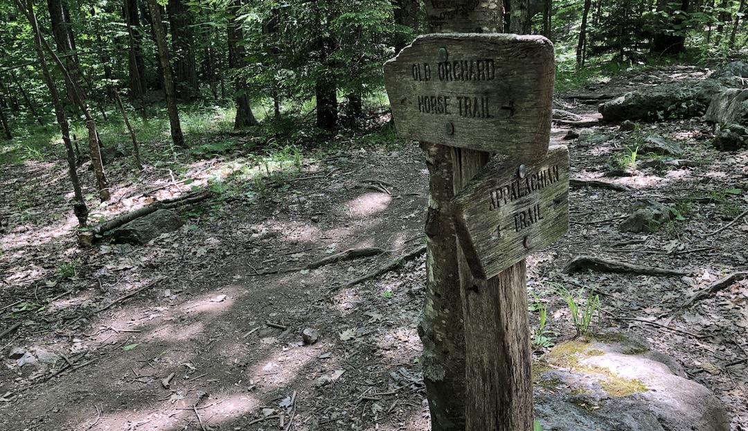
From the creek we followed Fairwood Valley for another half mile to the AT which ran north to Hurricane Mountain and south towards Old Orchard Shelter. We turned right/south, crossed Fairwood Road, passed through a parking lot full of cars, hikers, and backpackers, and started the 1.5 mile hike up to our first campsite at Old Orchard.
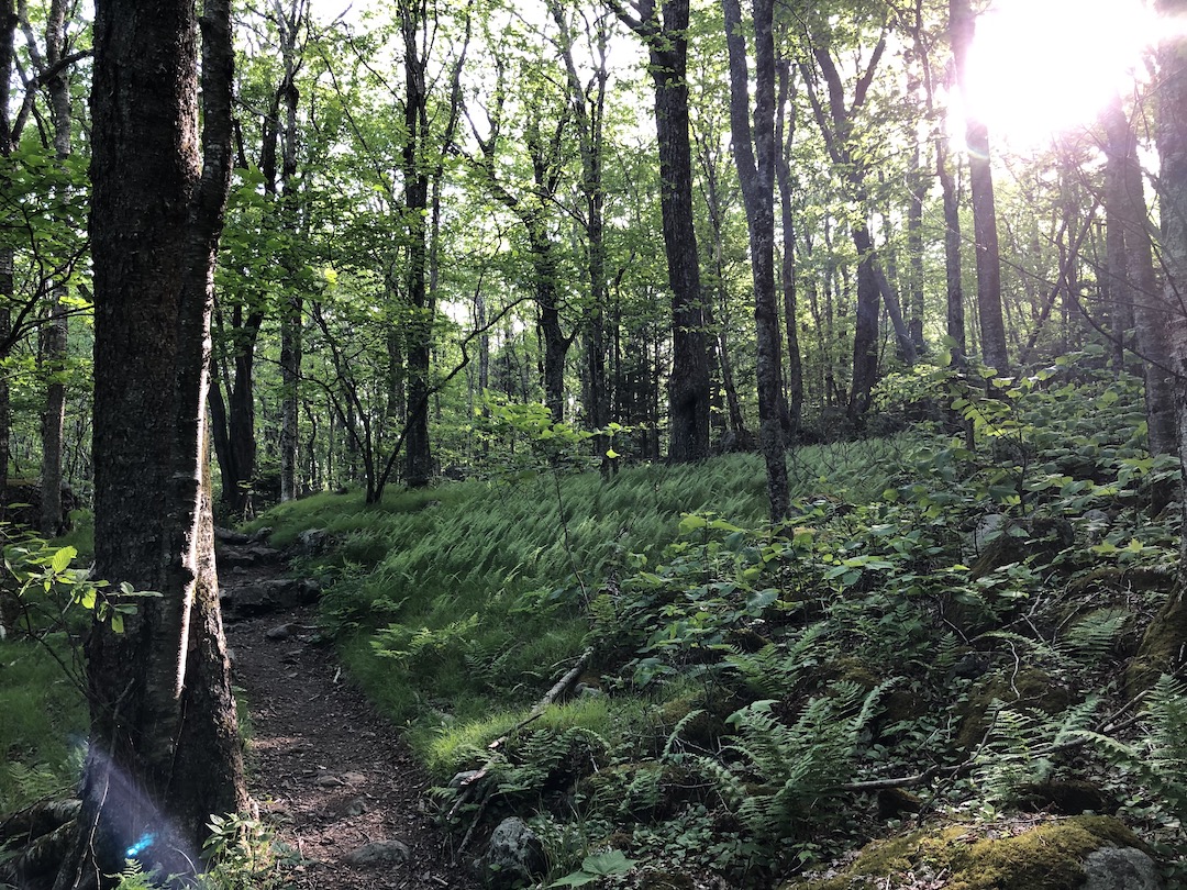
The 600′ ascent to the shelter was fairly uneventful. We passed a few hikers, enjoyed the occasional breeze, and ditched our hang gliders (which unbeknownst to us are not allowed in the wilderness area) just before our first Old Orchard Trail crossing 0.8 miles up the trail. With a lighter load we finished the remaining 0.7 miles to Old Orchard Shelter around 12:15PM and began looking for a spot to set up.

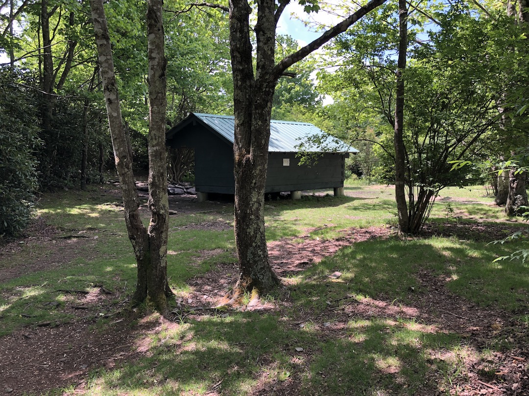
While the Old Orchard shelter was pretty much occupied, and the area around the shelter’s two bear boxes was as well, there were still plenty of vacant spots in the surrounding area.
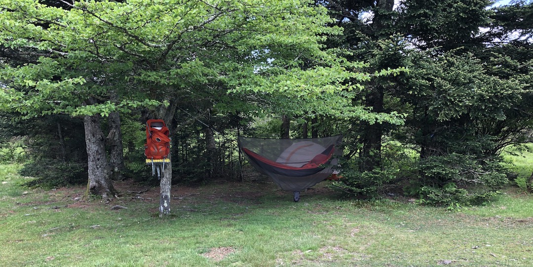
We walked around and picked a spot to the west of the AT and south of Old Orchard Trail that had a huge open area, a nice fire ring, and a side trail to the water source. Once set up, we assembled our camp chairs and sat for a very, very long time doing absolutely nothing. It was lovely.
A couple of hours later, we stopped being lazy long enough to fill bottles and gather wood, and then plopped back in our chairs once our chores were complete. We watched as folks rode horses down Old Orchard Trail, observed a group of Boy Scouts headed south up the AT towards Pine Mountain, and listened to dogs bark at everyone and everything that moved.
By 5PM, our not-so-secluded site was filled and folks began to gather ’round our fire ring for dinner. Once satiated, all but one backpacker (a fella named James) returned to their tents. Shortly thereafter, I got the fire going and the three of us sat around talking. When bedtime approached, we walked our food bags to the overly filled bear boxes and retired to our respective shelters.
Around 10:15PM I was nice and cozy in my hammock. Fifteen minutes later the rain started. By 10:45PM I was sound asleep.
Day 1 complete.
DAY 2 (10.60 MI | +2,503′ GAIN | -1,145′ LOSS)
I woke around 6:15AM to the sound of Ken fixing breakfast and decided to grab my food so I could make my own. On the way up to the bear boxes I started counting tents, tarps, and hammocks. Ten turned to twenty which made its way to fifty and then I just stopped counting. This place was hemorrhaging campers.
Back at our site I completed my morning routine and grabbed water as my oatmeal soaked. After breakfast, Ken and I broke down our shelters and packed ’em up just as James was waking up. By 7:45AM we said our goodbyes and hit the trail.
On our way out we saw more folks getting ready for the day including a few who were waiting in line for the privy and a couple of others who were digging their own catholes. From the moons of Old Orchard we followed the AT for 1.9 miles and 900′ of gain to the AT/Pine Mtn. Trail intersection. Along the way we passed about 20 people making their way down the trail, including the group of Boy Scouts from the night before.

At the intersection, Pine Mtn Trails runs west (right) 2 miles to Rhododendron Gap while the AT runs south before hitting a gate where, on the other side, the trail forks. Straight ahead (south) and through a field the trail joins Crest Trail (which runs between Scales and Rhododendron Gap) and to the left/east the AT meanders on to Scales.
FYI, Scales is a big grassy, fenced-in area used by campers and horse riders. Back in the day (like 100 years ago) it was the place where ranchers brought their livestock to weigh (on scales) before selling them. Yay history!
We hung a left and followed the AT for 1.44 miles before reaching Scales around 9:40AM.
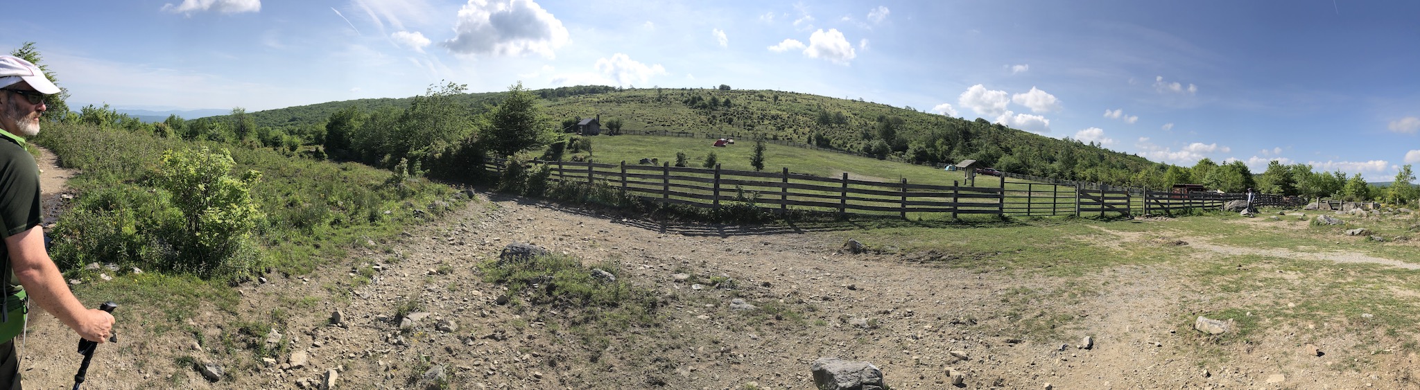
On the map it looked like we should go through the fenced-in area, but there weren’t any signs directing AT traffic. There were, however, signs for every other available trail. Virginia Highlands Horse Trail (SW to NE), Crest Trail (NW), Scales TR (S/SW), First Peak (E/NE), and the AT (NW/SE). A bit confused, we followed the fence in a westerly-turned-southernly-turned-easternly fashion before Ken spotted the AT trail sign on the south end of the fenced-in area (10 points Ken!)
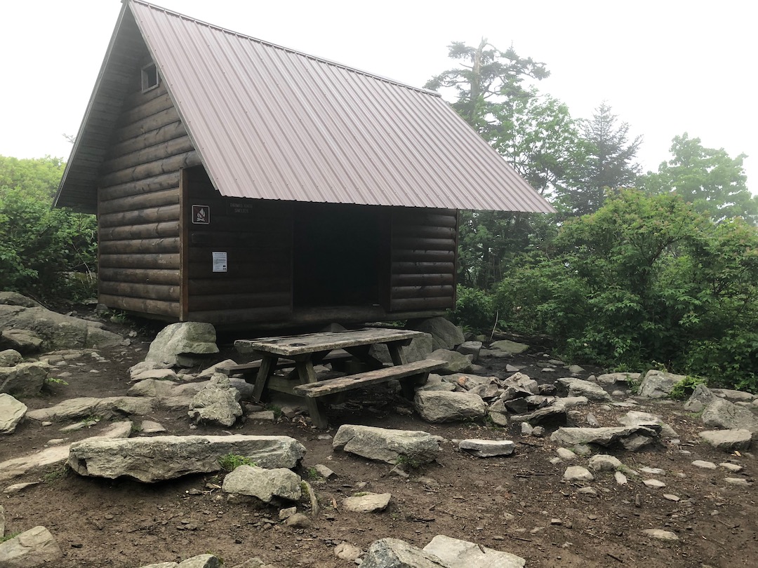
We followed the AT up to the top of Stone Mountain, climbed over and around mound after mound of horse turds, and descended down the mountain to Bearpen Trail where we grabbed a snack around 10:30AM. From Bearpen, we continued down the AT for another 1.3 miles and 300′ of loss to Wilson Creek and then Wise Shelter a half mile later. More people, more poop, more horses, and even a random cow. At the shelter we spotted a ton of great sites as well as a bear box with a family-sized can of Beef Raviolis and a privy that was ripe for the sniffin’.
From Wise we had about 4 miles and 1,110′ of gain before we reached our campsite. We willed ourselves up the AT, crossed a big bridge at Quebec Branch, and grabbed another bite just shy of Wilburn Ridge.

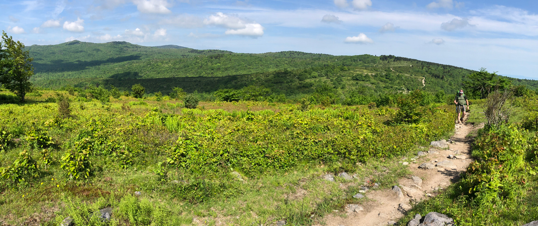
Since the skies were blue we decided to hike down to the Virginia Highlands Trail area and ditch the AT in favor of the Wilburn Ridge Trail (WRT) as it is supposed to have great views. A half mile later we came off the rocks and onto the ridge where there were people everywhere. People carrying coolers. People carrying babies. People with dogs in their backpacks. Even a shirtless dude carrying nothing but a bundle of wood. A bundle of f**king wood! Who does that? Where was he going? How was he not questioning his life choices?
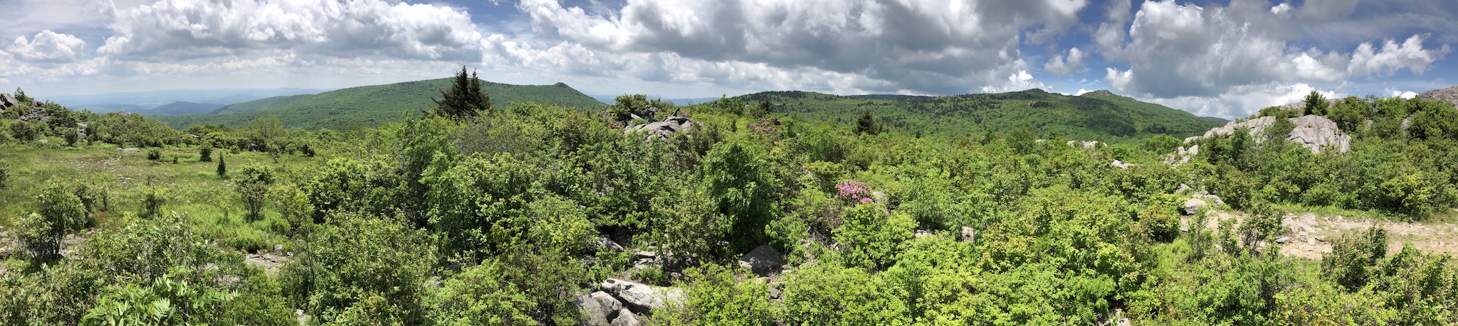
Ken and I put on our horse blinders and continued along the AT before switching to Wilburn Ridge Trail. On the downside, WRT is not so much a trail as much as it is a bunch of gigantic, stacked boulders with blazes painted on them. On the plus side, the trail has some really, really spectacular views. As we soaked it all in we thought about the remainder of our hike. From the top of the trail, we saw where WRT intersected Rhododendron Gap Trail (RGT) and where it continued on to the AT.
If we stuck to the original plan we’d probably see a bunch of cool stuff from atop Pine Mountain. However, if we took the shorter, less traveled RGT, we’d probably beat the campsite rush. Given the number of people at Old Orchard Shelter the previous night we opted to take the shortcut. Twenty minutes, eight horses, and three hundred turds later we arrived at the Crest Trail/RGT intersection and surveyed the area.
To the south on Rhododendron Gap Trail about 10 yards down, a trail sign pointed to a water source down the hill; to the east, a bear box sat about 20 yards from the intersection; and for a tenth of a mile in all directions…potential campsites.
We walked about 40 yards W/NW of the Crest Trail/RGT intersection and picked a somewhat secluded spot. Within a few hours, the “No Vacancy” sign went up as the place was now packed with families, solo hikers, and that group of Boy Scouts that seemed to hike the entire recreation area over the course of two days.
I set up my hammock sans tarp because I didn’t think rain or wind was going to be an issue (i.e. I was being lazy). After we set up, we grabbed water, played a few games of Yahtzee, and decided not to start a fire because neither of us wanted to slog back down and up the trail to get water needed to douse said fire. Instead, we sat around talking, ate dinner, and layered on the clothes in preparation for a potentially chilly evening.
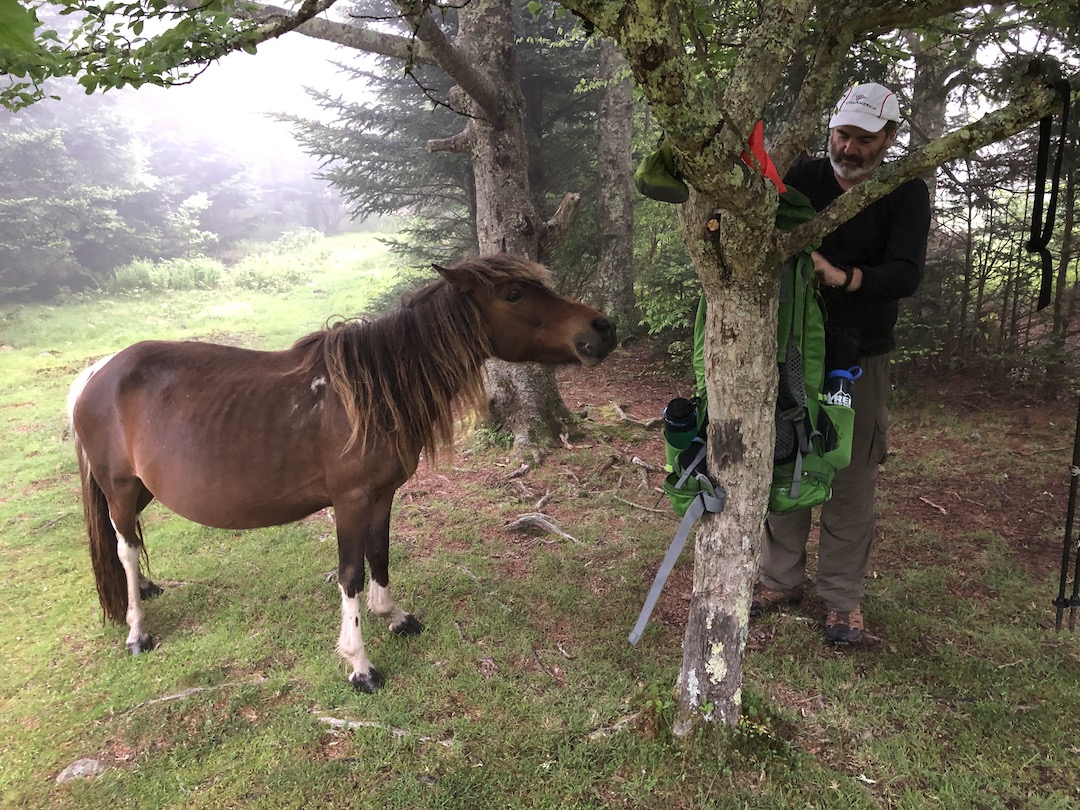
At 8PM we called it a night. At 10PM, as if by some premonition, I awoke from my slumber just minutes before the rain started. I sat for a moment thinking the rain would pass. When it didn’t, I sprang from my hammock and set a personal record for hanging a tarp. I then settled back in only to be woken up around 1:30AM by a horse who was sniffing and licking my feet through my tarp. At first, I didn’t know if it was a horse or a bear. Then, after a minute or so I heard it making horse sounds (you know like “neigh” or “Wilbur”) and fell back asleep 84% sure I wasn’t going to be eaten by a bear who was acting like a horse.
Day 2 complete.
DAY 3 (7.09 MI | +430′ GAIN | -2,133′ LOSS)
We woke at 6AM to foggy skies and horses. We broke things down, talked about skipping breakfast, actually skipped breakfast, fended off a few overly curious horses, and hit the trail around 6:45AM. A couple hundred feet north of our site, we picked up the AT and headed west towards Thomas Knob Shelter.
As we neared the shelter there were tons of occupied sites and only a handful of vacant ones. Within a quarter mile we spotted our first live person who was retrieving two handfuls of food bags from the shelter’s bear box. The dude was clearly not a morning person and obviously less than pumped about drawing the short straw to get the food bags. A minute or so later, a much happier dude was carrying a single food bag down the trail.
At Thomas Knob Shelter I noticed a couple of people sleeping inside and mentioned something to Ken. to that effect. No sooner than I had finished talking, I heard what sounded like a “Shhhh” coming from inside the shelter. When the shush persisted I realized it was just a sleeping pad being deflated because no one can shush someone for that long. Right? RIGHT?!
A few steps later we saw a group of backpackers who were eating breakfast alongside a couple of equine guests. Their dog barked as we passed by which, in turn, spooked one of the horses causing it to nearly run me over.


We arrived at the Mount Rogers summit trailhead a quarter-mile later, hung a left, and continued west towards Deep Gap two miles away; passing the last of the occupied campsites we’d see for the day. At the intersection of Mount Rogers Trail and the AT, we stopped for a snack and relished in the fact that we had a mere four downhill miles to go. Two to Lewis Fork and two to the car. Shortly after Lewis Fork Trail, we hit the switchbacks and picked up speed. With half a mile to go, we turned left/west onto the Mount Rogers tie-in trail, allowed a snake to cross the trail about midway down, and finished our hike in 2 hours 59 minutes and 59 seconds.
Trip complete.
TOTALS (21.84 MI | +3,668′ GAIN | -3,705′ LOSS)
FINAL THOUGHTS
After bailing on the loop in 2015, I am glad that I took another shot at it. The views were spectacular. Horses (and poop) were aplenty. And the bears weren’t an issue. I was a little put off by the sheer number of people on the trails, but I can’t complain because I was one of those people and…and everyone was extremely pleasant and respectful.
If you’re thinking of hitting up the Mount Rogers Nat’l Rec Area you definitely should. Just plan on staying near the bear boxes, leave the horses alone, and enjoy yourself. It’s truly a remarkable experience.