Click to enlarge
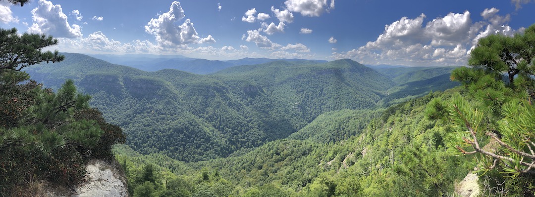
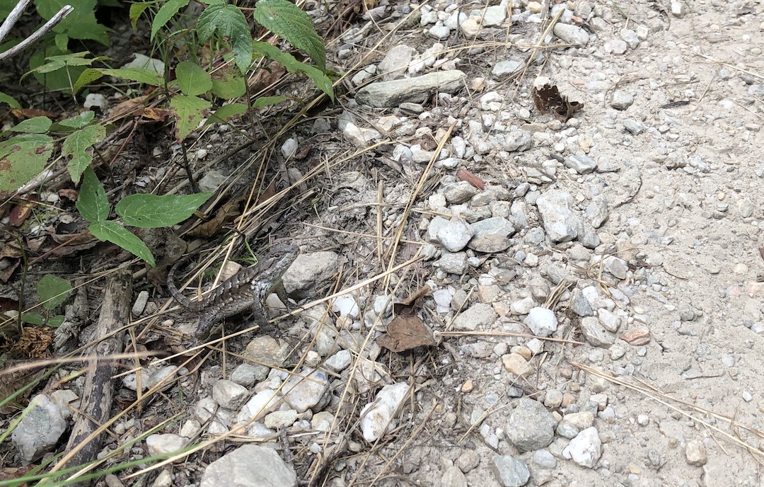
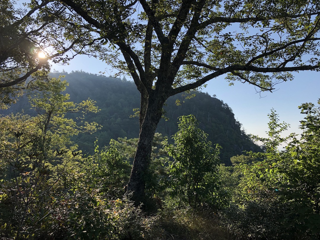
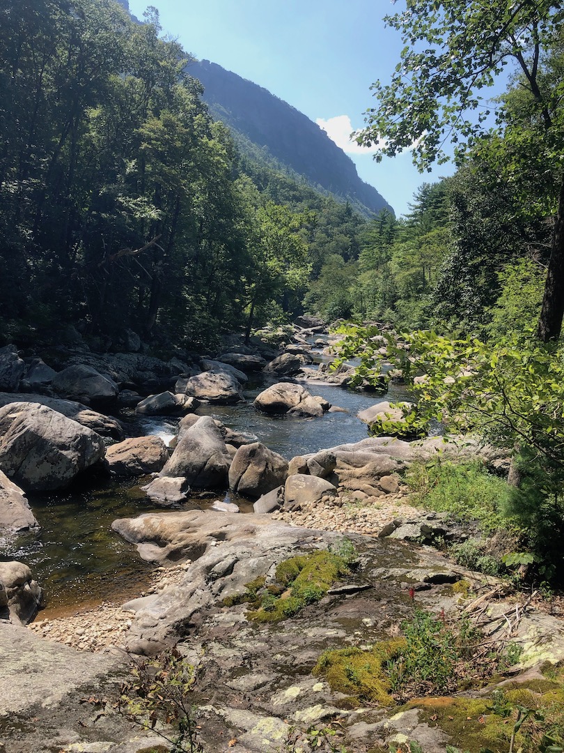
The Linville Gorge Wilderness (LGW) is located within the Pisgah National Forest in the mountains of Western North Carolina. Nicknamed the “Grand Canyon of North Carolina”, it is formed by Jonas Ridge on the east and Linville Mountain on the west and is bisected by the Linville River which drops 2,000 feet into the valleys below. The nearly 12,000 acres of wilderness is unforgivingly steep, incredibly rugged, and is home to black bears, rattlesnakes, copperheads, and 80% of the world’s tick population.
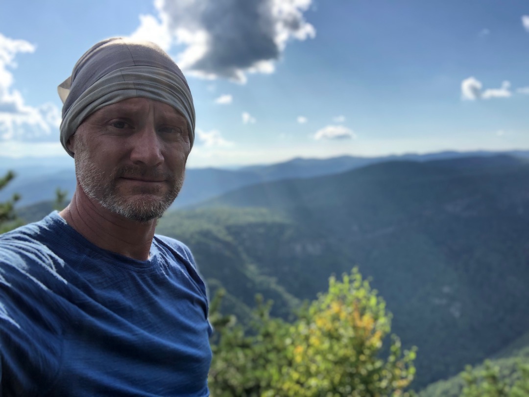
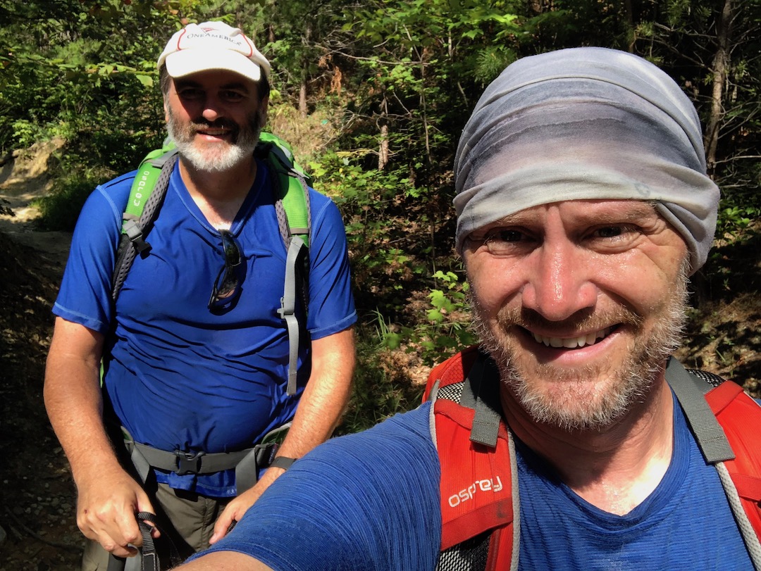
Linville Gorge has been on my bucket list for years. This year, however, was going to be the year I actually went. In the springtime, I researched the area and decided to plan a May trip. As luck would have it, when I called the National Forest Service to secure a permit for my brother-in-law, Ken, and I, I was told there were no available permits. Undeterred, I called back two months later, and was able to reserve a permit for the second weekend in August.
Linville Gorge here we come!
THE PLAN
I usually rely on AllTrails and Gaia GPS for maps and planning, but the more I read about the gorge, the more I learned about lgmaps.org and LinvilleGorge.net. Simply put, these two websites are the best resources on the Linville Gorge Wilderness. LGMAPS includes a wealth of information including weather forecasts, water levels at Linville River, and links to some seriously detailed (and accurate) maps including a four pager created and updated by LinvilleGorge.net.
Based on what I knew, I suggested to Ken that we start the 22-mile loop at Wolf Pit and hike the gorge counterclockwise, stopping near Table Rock the first night and Blue Hole on the second night. In the event we were unable to cross the river (i.e. it rains) we would still camp at the same spots, but we’d backtrack to Cambric Branch from Table Rock, cross the river, and pick up our original course from there. He agreed.
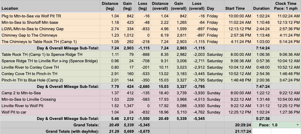
I then built out the trip in a spreadsheet based on a 1.0 MPH pace…
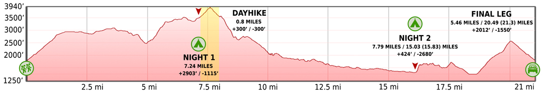
…created an elevation profile using Google Earth
…dropped in the route
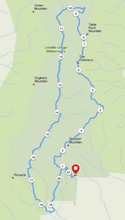
…and packaged it all in a map I printed on TerraSlate paper.
NOTE: The actual map used for my trip was the LinvilleGorge.net map from lgmaps.org.
PACKING IT IN
Historically, in August, the temperature in Linville Gorge Wilderness ranges from the high 80s to the low 50s. Ten days out, it looked like this was going to hold true for our trip so I planned on taking my quilt. Three days out, the forecast turned warm, calling for daytime temps in the mid-90s and nighttime temps in the mid-60s. Quilt out, bag liner in.
In addition to the rising temperatures, humidity suggested heat indices would be in the 100°F range. To ensure I’d be well-hydrated, I added a 21oz bottle to compliment the 48oz Nalgene I was already taking. I also double-checked water sources and kept an eye on recent trip reports to make sure we’d be able to refill along the way.
Next up, bugs. Given the number of times I read the words “overgrown” and “ticks” I decided to spray down my shorts, shirts, and socks with permethrin. The spray, combined with picaridin on my skin, would hopefully keep me bug free through the weekend.
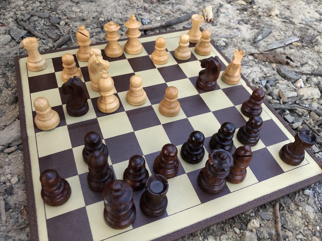
My last item was wholly unnecessary. You see, I like to bring different games to play at camp like cards, checkers, or Yahtzee. For this trip, I packed my Chess House 9″ magnetic chess. It’s fairly small and “only” weighs 13.4 oz (or about 6 Clif Bars). Stop judging!
When everything was loaded, including water, my 34L Stratos weighed in at 26 lbs. 1.8 oz.
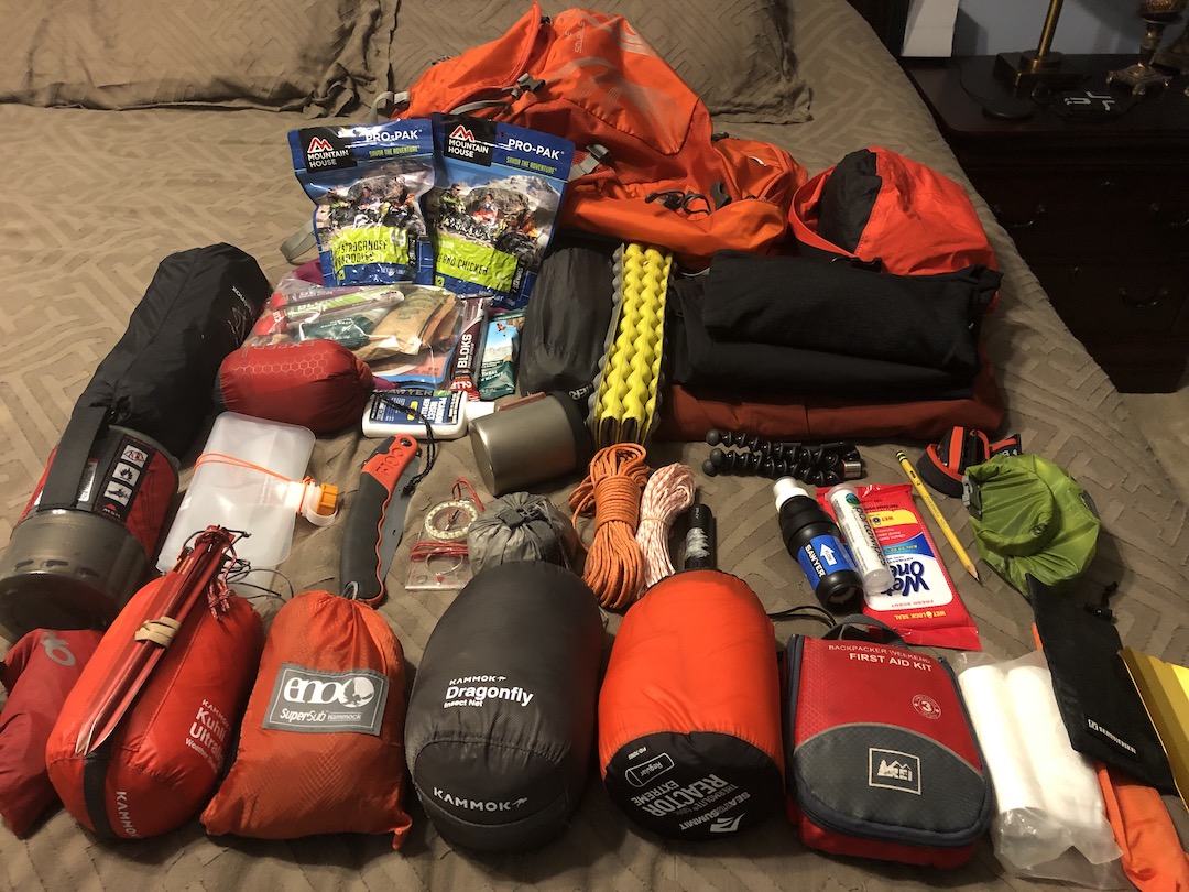
Feel free to download my complete gear list.
DAY 1 (9.41 MI | +3,084′ GAIN | -1,427′ LOSS)
Weather: High 91°F | Low 61°F | Heat Index +/-100°F | No rain
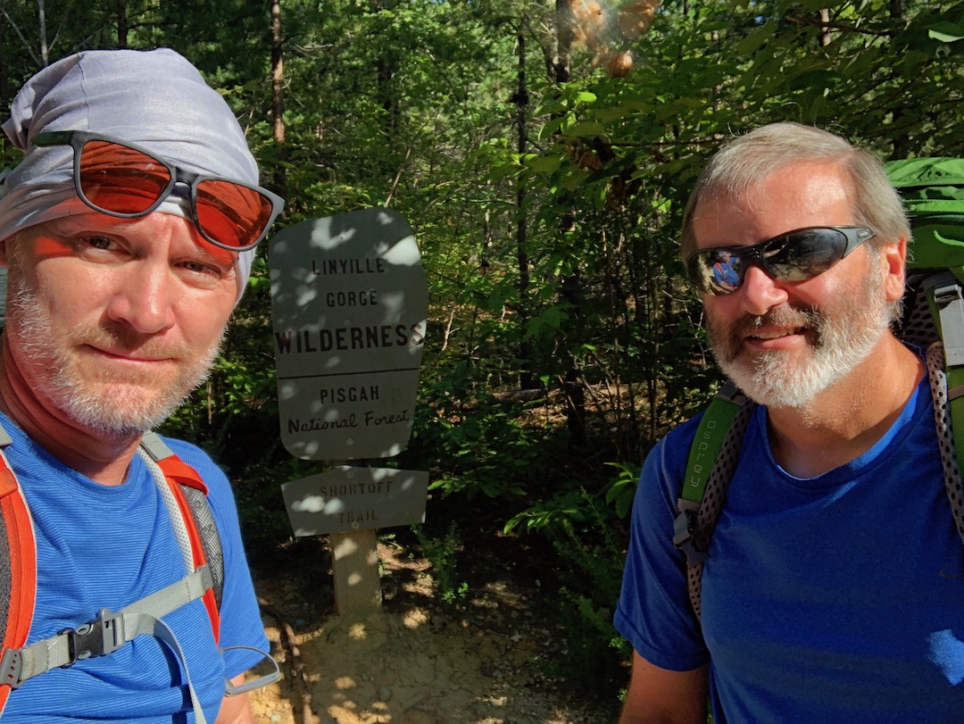
We pulled into the Wolf Pit Trailhead lot at 8:45AM, parked at the end of a row of three other cars, geared up, and headed out just after 9AM. We hiked up for a couple of minutes to the Faulkner Flats/Wolf Pit intersection and turned right/northwest. Almost immediately, we passed our first backpacker of the day. After another quarter mile, two runners and a dog came barreling past us. We exchanged greetings and started a short series of switchbacks which provided great views of Lake James to the south. Upon completing the last switchback we saw a hiker making his way down the trail, waved in his general direction, and continued on to our next intersection 0.2 miles up the trail.
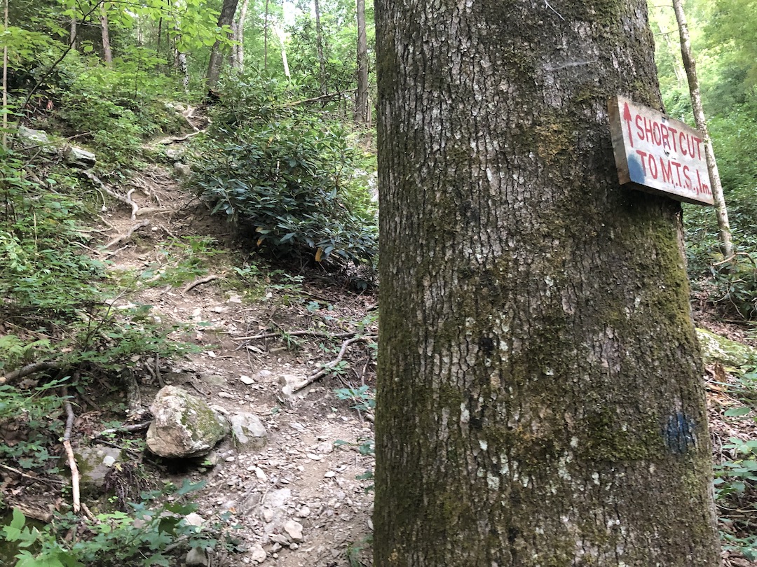
On the map, the intersection is pretty straightforward. To the north/right, Mountains-to-Sea (MTS) Trail cuts straight up the mountain; to the south/left, MTS runs down to the Linville River; to the southwest/left, Olson Trail meanders down and around the gorge’s edge, and to the west/right-ish, the path to Shortoff continues.
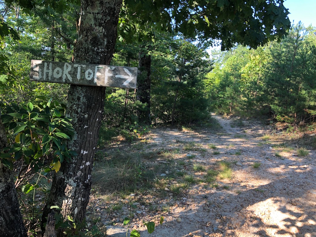


In person, it wasn’t so clear. We looked around and didn’t see where MTS ran to the north. We assumed the trail to the right was MTS and the one in between it and the southbound MTS was Shortoff. Where was Olson? No idea. We stuck to the middle-left trail for a minute before realizing we were headed too far south (i.e. we were on Olson).
ME: Don’t move.
KEN: Why?
ME: I heard something.
KEN: What?
ME: [pointing to a tree about five feet off the trail] Over there.
My brain filled with the recent stories I’d read and heard about rattlesnake encounters in the gorge. I lifted my sunglasses, scanned the area, and stared intensely into the grass. After a long pause, I heard it again.
ME: There…that…oh…just a grasshopper. Sorry about that. I guess I’m a little on edge.
Back at the intersection, we found the missing fourth trail, figured out which trail we needed to follow, and started back up. We followed the eastern rim of the gorge, passed the other end of Olson Trail, spotted a water source, a campsite, and eventually rejoined the MTS just before 10AM.

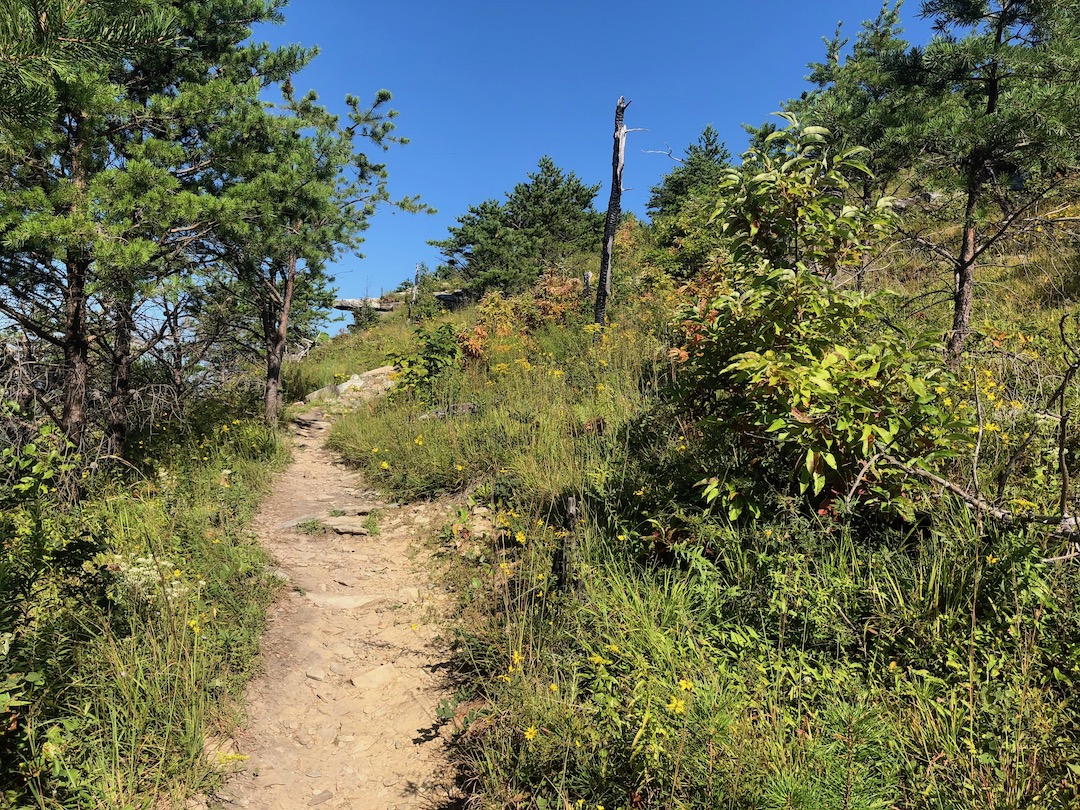
A bit more up and a few more spectacular views later, we reached a very dry Shortoff Pond. Shortly thereafter, we arrived at Shortoff Mountain and stopped for a snack and some much needed agua. From Shortoff, we continued northeast along overgrown paths until the trail turned into a giant tunnel of flora as it swung back northwest and down.
KEN: [something something]
ME: What?
KEN: [SOMETHING SOMETHING]
When I turned to hear what Ken was saying, a runner came trotting down the trail. The guy was clearly in a hurry, and from the looks of it, only had enough water to go a short distance.
ME: That dude is going to run out of water.
KEN: Probably.
ME: Wait, I’m going to run out of water.
KEN: Probably.
Looking at the map, it appeared there was a water source just past Cambric Branch Trail at Saddle Camp. Ken and I agreed to locate the source because we needed to refill our bottles prior to climbing up The Chimneys.
Twenty minutes later we hit a campsite that had two trails. Ah ha! Saddle Camp! To the right, a trail led down. To the left, a trail continued straight. Since the map showed the MTS going right/north, we hung a left/south at the campsite en route to the water source. We passed three campsites, climbed over a bunch of trees, and stopped about 0.4 miles down the trail.
KEN: I think this is Cambric.
I pulled out my map, located Cambric, and identified the three campsites from earlier.
ME: Well that sucks.
Back at the Cambric Branch/MTS intersection, we drank a bit more water leaving a few ounces on the off chance we were unable to find the actual source near the actual Saddle Camp. Semi-rehydrated, we started back down the MTS and crossed paths with the runner from earlier.
The guy stopped for a bit and shared that he was training for the Table Rock Ultra in September. He said that the heat sucked, but he was happy to be on the trail. Amen, brother. We wished him well, then walked a quarter mile downhill before reaching what had to be Saddle Camp. For real this time. I hope.
At the northeast corner of the site we could see the MTS. Since that was the case, the trail to the water source would be on the western edge of the site. It took all of a few seconds to find it; a worn, overgrown path leading down down to Goblin Town.

We pushed through thick foliage and climbed over downed trees for a quarter mile before arriving at the mythical water source. My gluttonous smile couldn’t have been bigger. I polished off the remainder of my water. Filled my 21oz UD bottle. Drank it down. Filled it again. Drank it again. Then filled both my 48oz Nalgene and my UD bottle. We relaxed in the shade until we were both sufficiently rehydrated then began the 0.25 mile climb back to the MTS at Saddle Camp.
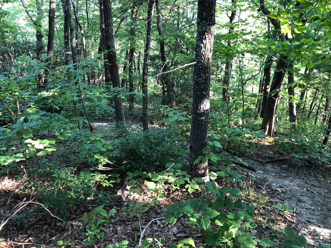
We descended another very overgrown trail for five minutes before it flattened out and widened for another five minutes. The lack of incline and vegetation gave me hope that maybe, just maybe, this climb to The Chimneys wasn’t going to be all that bad. Then the trail turned west, pulled back its leg, and kicked me square in my special parts.
Every trip report I read said the hike up to The Chimneys was a relentless, four-letter challenge that is best tackled in the spring or fall. But there we were. Staring at a trail that would require 1.25 miles of agony up 1,000′ of gain with zero decline in air as thick as mud and temperatures that felt like a thousand suns. I exhaled and began to climb. Here we go.
The first 10 minutes were OK in an untruthful kind of way. The next 10 minutes required heavy breathing and a poop-ton of effort. Ten more and my body decided it was time to sit down in the middle of the trail like a pile of pruned horse turds. I was covered in sweat. My face was flush. I was deflated.
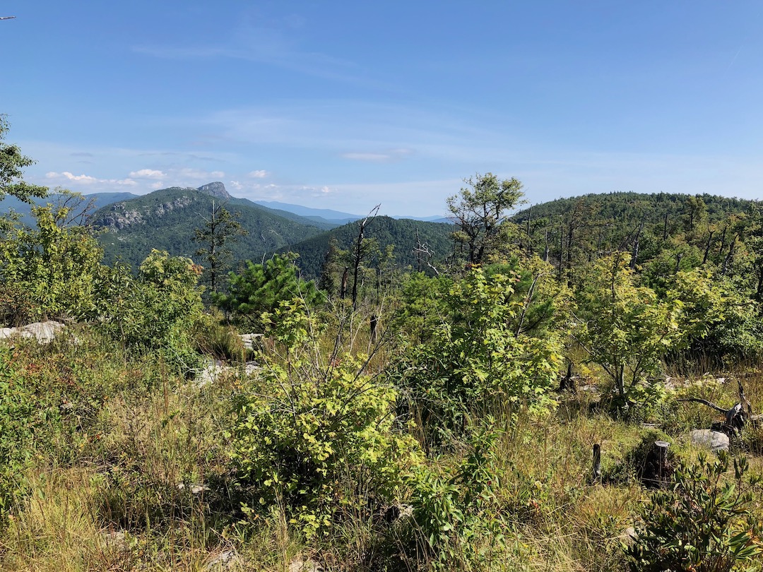
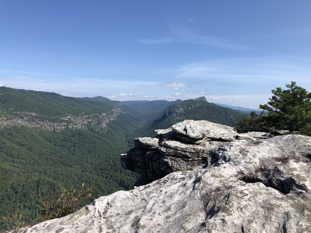
Around 2:30PM, with heat stroke knocking at our door, Ken and I willed ourselves to an outcropping of rocks with a wee bit of shade and a slight breeze. We could see Table Rock in the distance as well as what we had to do to get there including the remaining half mile of broken escalator stairs up to The Chimneys.
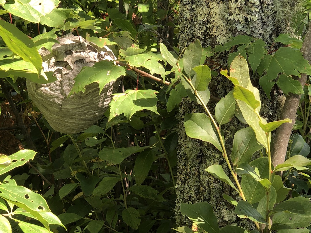
Rest time concluded and we continued to climb at our own paces. Along the way, I stopped for a short break as I waited for Ken to catch up. With my back to the downhill, I pulled out my water, grabbed a sip, and turned my head to see if he was approaching. While I didn’t see him, I did see, not but 2 feet from my face, a nest full of bold-faced hornets (a type of yellow jacket). I immediately stepped back and waited for Ken to rejoin me so I could warn him. He did. I did. Crisis averted.
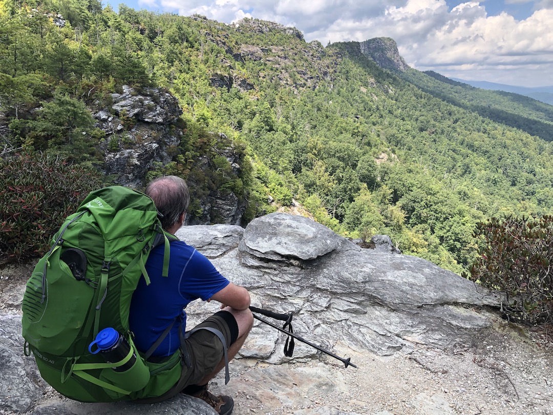


Near the top, the trees provided a few minutes of shade before they gave way to The Chimneys. We climbed around and through the rock formations then descended down the mountain where a long stretch of campsites lined the trail on the left just shy of the Table Rock parking lot. On approach, I kept hoping that some business-minded individual put in a soda machine next to the pit toilets. Sadly, no sodas. Instead, the gorge gave us another climb; 0.5 miles and 300′ of gain.
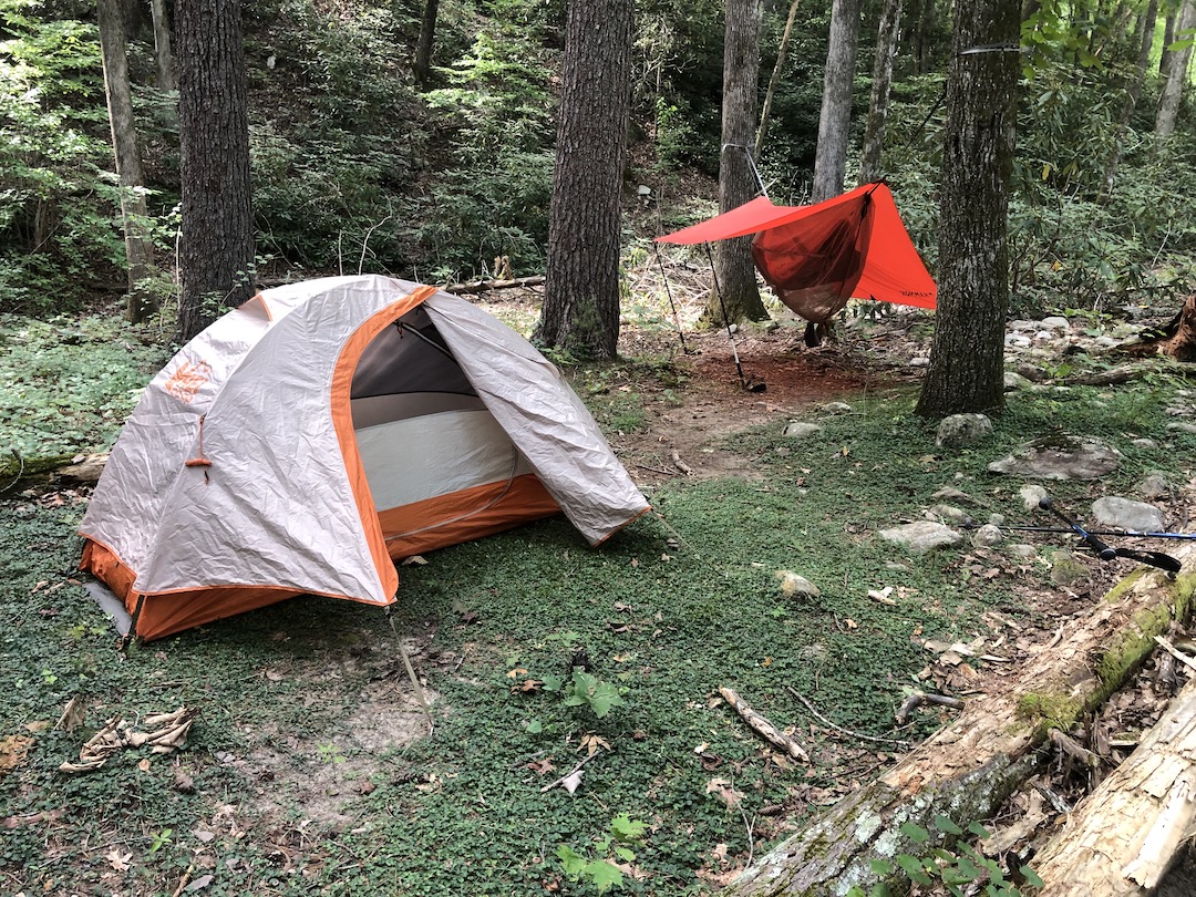
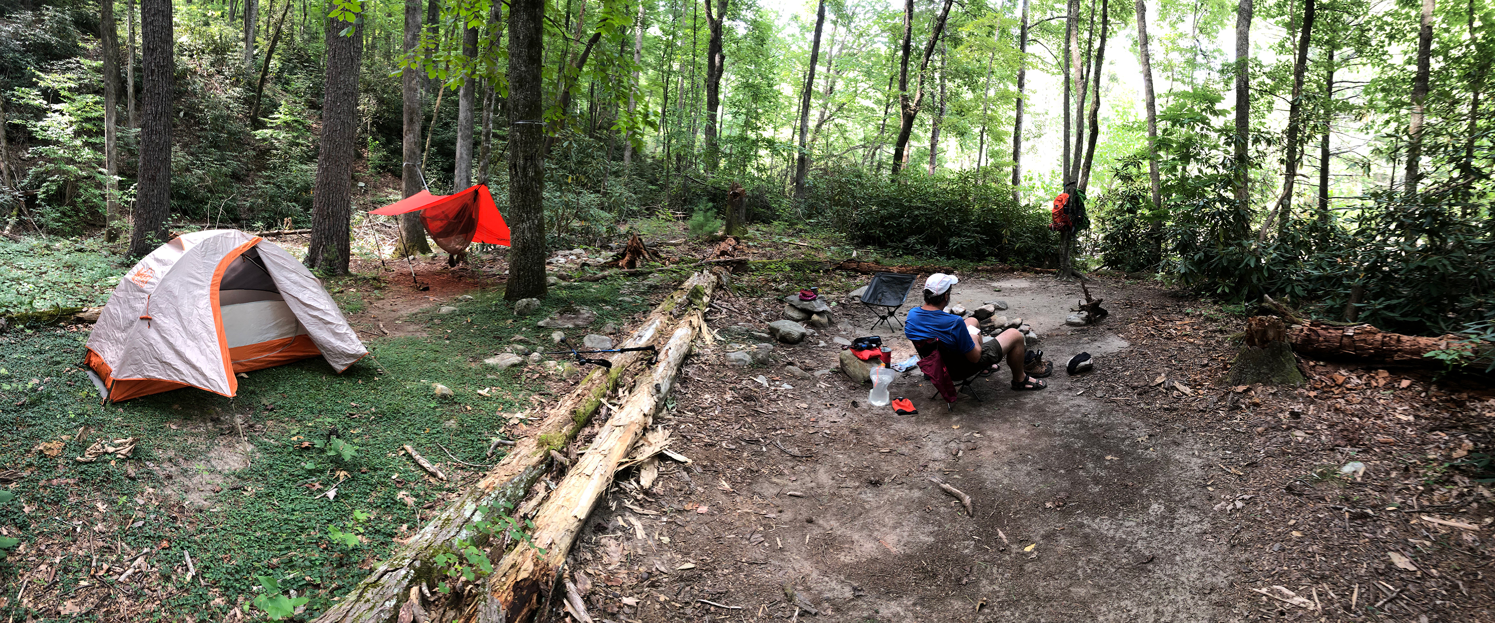
Slowly, we climbed from the parking lot, made our way past the Table Rock Summit Trail, past a trail that led to a water source, and onto Little Table Rock Trail where we climbed one last time to the spur trail leading to our Little Table Rock campsite. After a mere seven hours, we arrived at our destination. Thank you 8 pound, 6 ounce Baby Jesus.
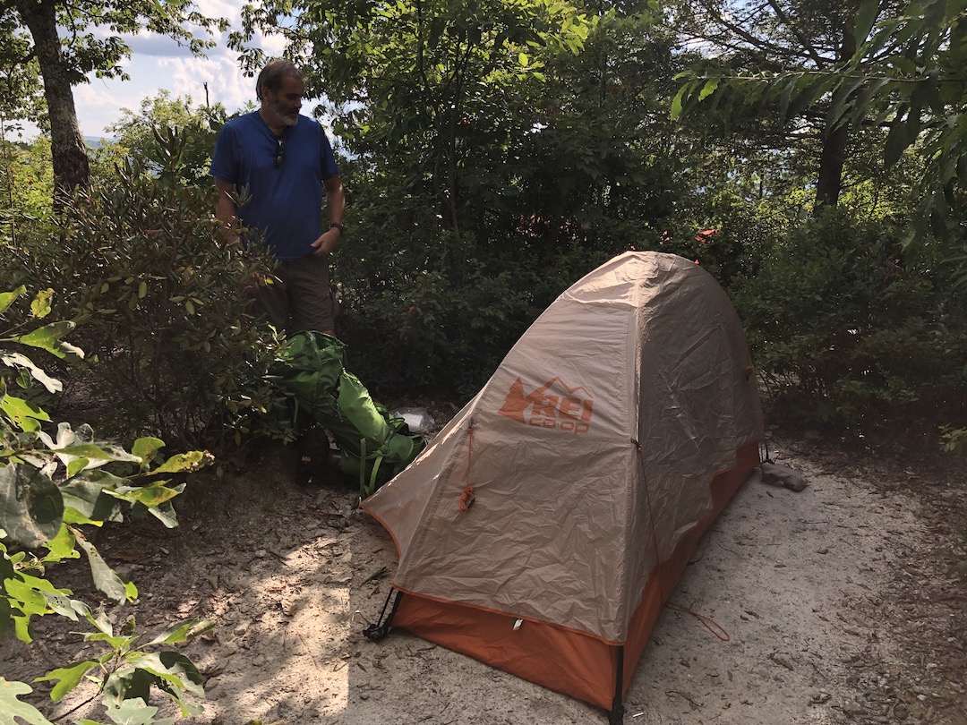
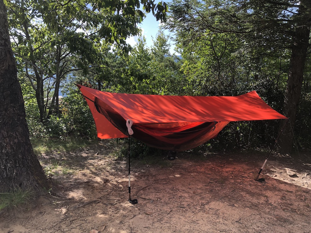
At the site, we removed our packs, set up our chairs, and just sat for a very, very long time. Eventually, I willed myself to my feet long enough to set up my hammock then quickly returned to my downright position. Around 6PM, after a great deal of deliberation, Ken and I decided it was time to get water. Back on our feet, we made our way back to Little Table Rock Trail, hung a right, walked down the hill, then ducked into the woods down a very steep 0.2 mile trail that led us to a creek with a pipe wedged in the rocks.
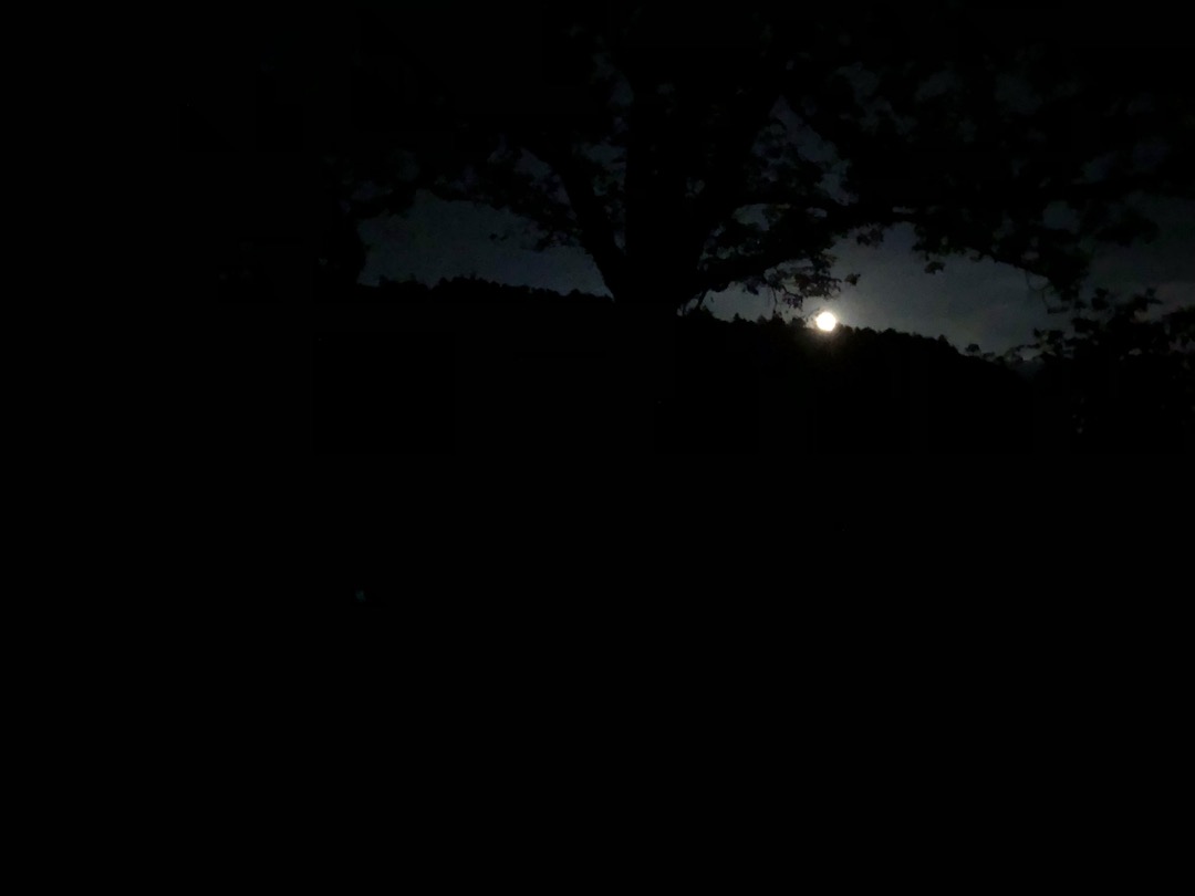
It took us nearly an hour to refill our bellies and bottles given the fact it took about 7 minutes to fill each bag. I’m not complaining. Just saying. Afterwards, we returned to our campsite, ate dinner, broke out the chessboard, hung the bear bags, checked the health of our kidneys, watched bats run into trees, and spent the rest of the evening stargazing.
Day 1 complete.

DAY 2 (9.28 MI | +833′ GAIN | -2,999′ LOSS)
Weather: High 92°F | Low 66°F | Heat Index +/-100°F | No rain
I slept through the night and woke around 6AM shortly before (or perhaps slightly after) Ken. With a dab of haste, we packed up, ate breakfast, and hit the trail. As we were leaving, two kids wearing pajamas came walking down Little Table Rock Trail with cameras in hand. We waved. They waved. Ken and I exited stage right, and the two kids proceeded to take duck-face selfies.
From the spur, we hung a left and headed down a steep trail covered in roots and rocks. In the LGW, you’re either going up a wall or sliding down one. Very few trails are flat. Anywho, the technical descent did wonders for my knees and glutes and the early morning heat and humidity invigorated my pores. Translation: I was miserable and we had only just begun. Twenty minutes and 0.6 miles from camp we arrived at a creek and a rather expansive campsite. We stopped to fill up our bottles and drink a bit before continuing.
We then hiked up 0.3 miles and hung a right/northeast, climbing a wide trail with several downed trees. The trail wound its way east for a quarter mile before splitting to the north (towards Spence Ridge Trail) and northeast (towards a parking lot). We stuck to the left/north and took a sharp left/west to stay on Spence Ridge Trail. From that point it was smooth sailing all the way down.
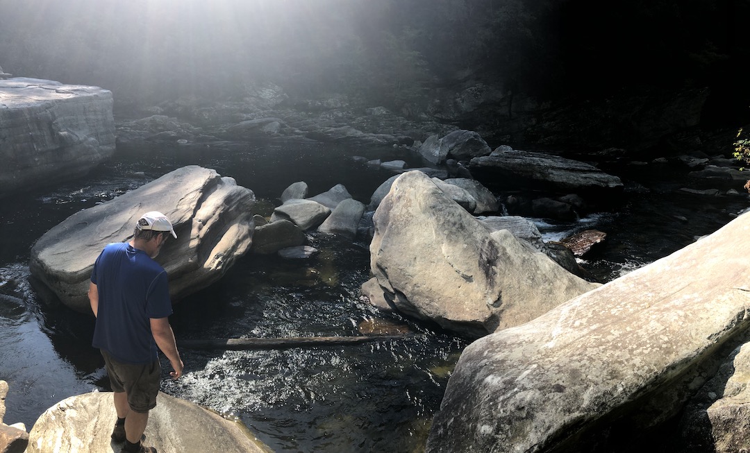
When we arrived at the river I was extremely glad to see that it was low. Not low enough to walk across, but low. The bridge I had read so much about must’ve been a sight before it was washed out. Today, however, a lone platform leading to a boulder positioned halfway between the two river banks is all that remains.
I’d read that most folks opted to ford the chest-high river with their packs over their head. Since neither Ken or I wanted to get that wet, we started thinking about rockhopping. Looking around, we saw a potential path of rocks down river. Ken took a closer look, but two of the rocks were too far apart and the water rushing between them was too strong should we fail to make the jump.
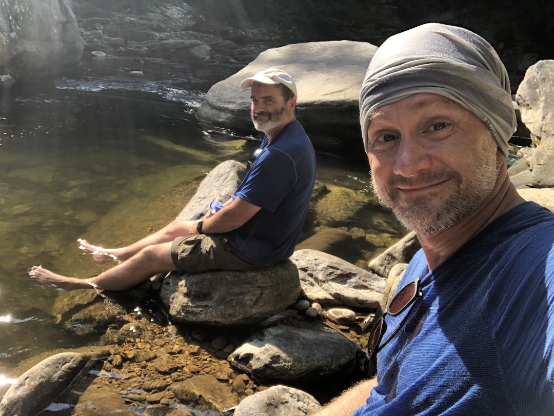
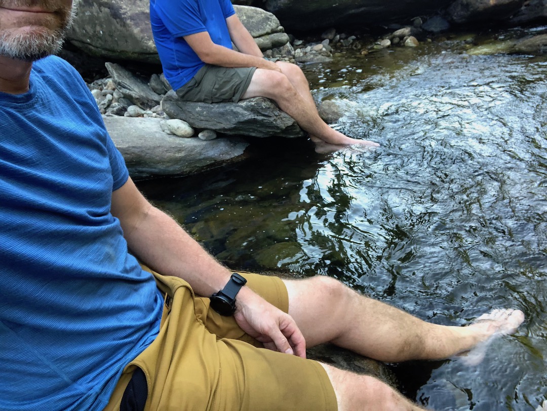
After ruling nearly every option out, we both began eyeing a line of rocks that we agreed was the key to the Matrix. I decided to go first and handed Ken my pack (per his suggestion). After making the leap, Ken handed me both packs and joined me. We proceeded to jump from rock to rock handing gear to each other as we did. One by one we made our way across the rocks to the other side of the river; arriving both dry and unscathed. To celebrate, we removed our socks and shoes, and soaked our feet in the delightfully, cold water.
After lallygagging for a time, we returned to the trail on our way to Conley Cove Trail about 0.75 miles away. Along the way, we encountered several large, downed trees, countless rocks of all shapes and sizes, and about a dozen hikers. From Conley, we walked a quarter mile and waved to a few groups of people still hanging out at their campsites.
As we left the last of the sites, I found a pair of socks under a fallen tree and picked them up so as to pack them out (BTW, they were the most pleasant smelling socks I have ever found on a trail). Three quarters of a mile later we arrived at another series of campsites, ultimately stopping at the last one to break for water.
With bellies full we headed down the trail for a few minutes before we realized we probably weren’t on a trail (the lack of trail was the biggest clue). Looking at my watch, I could see that we were just below where we should’ve been. In theory, we could just hike up and rejoin our route. We bushwhacked our way up the hill for a minute before we concluded it was a stupid idea and returned to the campsite to figure out where we lost the trail.
Back at the camp, we found the trail, and proceeded to hike two miles of ankle-twisting rocks and back-bending trees later to another campsite not too far from Pinch-In. Packs off, we refilled our water, drank an extra bottle or two, and then finished the hike to Pinch-In, passing a half dozen hikers and a runner along the way.

For those playing along on the home game, Pinch-In is near a set of campsites that sit on the west side of the river. If you cross the river you can join Cambric Branch Trail (the trail we mistakenly took as we hiked up to The Chimneys) and take it to the top of the gorge. Since we had no desire to go back up, we returned to Linville Gorge Trail to finish the remaining two miles (one hour, fingers crossed) to our second night’s campsite.
The knowledge that we had “just two miles, maybe one hour” put an extra spring in my step. A rusty spring that’s seen some things, but a spring nonetheless. My eyes moved back and forth between trail and watch. 2 mile…1.5 miles…1.0 miles…0.5 miles. Just shy of our targeted Blue Hole campsite we hit a dry water source. Ew gross. Then a slightly less dry source at White Oak Stand Trail. Uh, still no. Then we arrived at our destination.
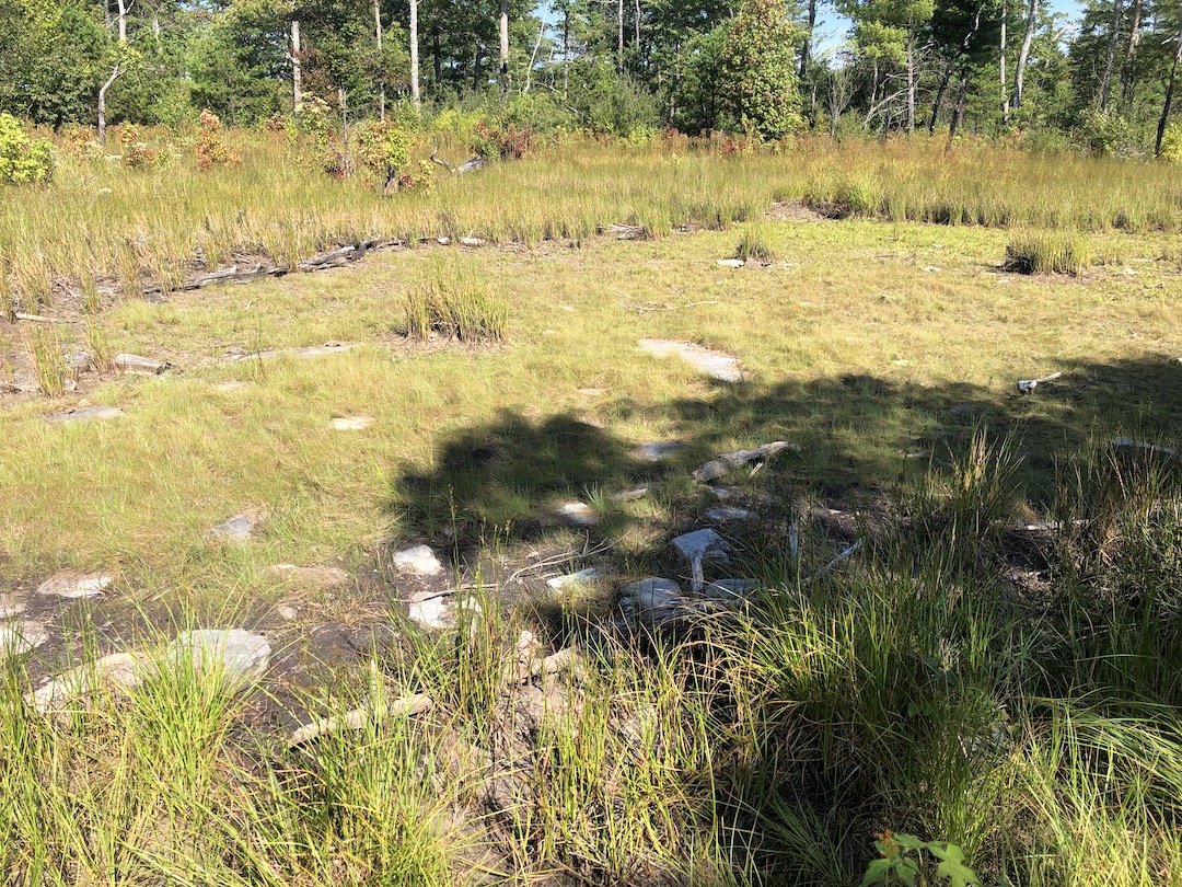
Both Ken and I looked at each other and then at the site in front of us. To the left, an overgrown area near the river where three potatoes and two jalapeños sat resting against a tree. To the right and up a few feet, an overgrown clearing with a sign that read “Ixodida Family Reunion”.
KEN: How far until the next site?
ME: About a quarter mile.
KEN:
ME:
And on we went.
It didn’t take long to reach the next campsite. It was more appealing for sure, but there was no easy access to water. We took off our packs and sat for a bit. It was only when I drank the last of my water that I decided to get up and check for a water source down the trail.
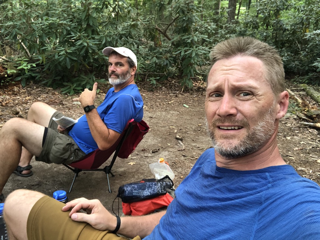
Within a minute or so I found a creek. Unfortunately, getting water from it was proving difficult, so I walked further down the trail to see if I could gain access to the creek from below. As I did, the trail opened up to the river and continued on through a campsite just up the hill. I returned to the river, filled my water, and rejoined Ken to share the news. We both returned to the spot sans packs and surveyed the area. When we arrived, two guys showed up at the riverbank and proceeded to remove their packs and clothing. Before they made the plunge, Ken asked them if they planned to stay. When they said they weren’t, we decided we would.
We returned to the previous site, grabbed our packs, then walked back to the river site where we sat for a bit. Eventually, we peeled ourselves from our chairs just long enough to set up shelters. Don’t kid yourselves. As soon as we were set up, we promptly returned to our seats. My stomach began to growl. I looked at my watch and decided that 4:50PM was the perfect time for dinner.
While our food rehydrated, the guys from earlier, now dressed and ready to head out, returned from the river with an offering of a half-eaten can of beans. When we declined, they appeared to begin to look for a place to ditch their beans AT OUR CAMPSITE. When they couldn’t find the proper burial spot, they left. Who knows. Maybe they reconsidered and packed the can out. Maybe a bear ate them (the beans, not the guys).
A short time after Frank and Beans left, three hikers and two dogs came whizzing by. Ten minutes later, two dudes with daypacks showed up. They shared that they’d started at Wolf Pit late in the day (it was about 5:20PM currently) and intended on hiking up Cambric Branch and back down to Wolf Pit by the day’s end. We wished them luck and started doing the math.
The two dudes had hiked 5.5 miles from Wolf Pit to our campsite. They still had to hike 2.5 miles and 400′ of gain to Pinch-In, then cross the river, then hike 1.2 miles and 1,460′ of gain up Cambric Branch, and then take a very overgrown trail 5 miles back to the car. Those dudes would either be setting land-speed records or they were about to do some serious night hiking. You decide.
After the Dayhikers, we continued to do nothing in our chairs. When we got bored of doing nothing at our campsite, we took our nothing show to the river where we sat with our feet in the water whilst doing nothing. And, when doing nothing on a rock started to feel like something, we returned to our chairs to do nothing once more. It was spectacular.
Eventually we decided to take a break from doing nothing in order to discuss our last day’s hike. As it was, we needed to head up and around a privately owned plot of land, then down to the river where we’d cross it and climb MTS to Wolf Pit. Ken suggested that we instead take a less intense route up Faulkner Flats to keep elevation gain down. Sure that meant deviating from the well-thought-out and detailed plan we’d left for our families so they could find us in the event we didn’t return, but we’d hike less up and that was better than being found.
We agreed to agree, gazed at stars for a bit, and turned in for the night around 10:30PM.
Day 2 complete.
DAY 3 (5.43 MI | +1,617′ GAIN | -1,010′ LOSS)
Weather: High 94°F | Low 62°F | Heat Index +/-100°F | No rain
Following another good night’s sleep, I broke camp and had a delicious tuna breakfast with a cold coffee chaser. By 7:15 we were back on the trail, a good 45 minutes ahead of schedule. By 7:20 we were headed up the Shortcut Trail to MTS. By 7:21, I was looking for a realtor so I could buy the privately owned land and reroute the trail along the river. Seriously, for a little over a mile we were either going straight up or straight down. There was no flat. Heck there was barely anything less than an 85° angle. By the time we reached MTS we were both covered in sweat and dripping in misery. So much for early morning temps.
Considering the nonsense we just hiked, the mile-long descent down the MTS was a welcome reprieve. Unfortunately, what goes down, must go up, and we went back up the MTS gaining 200′ over 0.2 miles to a campsite resting at the top of Mount FML. After rehydrating once more, we descended the MTS for 0.7 miles, crossed a gravel road, and made our way to the river about a quarter mile away.
Ken donned his sandals, I slipped on my new “river” socks, and the two of us crossed the river through knee-deep water. The water was cool, but not cold, and the rocks weren’t slippery in the least (contrary to what Frank and Beans had shared). Once across, we walked to the right/southeast in search of Faulkner Flats. When we couldn’t find a way to access the trail, we decided to just take MTS up to Schoonover Crossover Trail and then take it over to Faulkner Flats. The trail up to Schoonerover was a quick 0.25 miles, but it was ridiculously overgrown. Thankfully, Schoonover was blazed blue making it easy to find. What wasn’t so apparent was where it cut straight across to Faulkner.


On the map, Schoonover Crossover continues east and runs right into Faulkner. In person, when it intersects MTS Connector, it disappears. Instead of pushing through the trees, we opted to take the MTS Connector down to Faulkner. It wasn’t bad, but the trail went down which meant we’d have to go back up which meant more gain than we’d planned (but still less gain than if we’d taken MTS…so…win?).
Once we hit Faulkner I was feeling pretty good. Just 2.5 miles and 600′ of gain to Wolf Pit. I kept telling myself this was going to be easy, well, easier. And, for the first 1.5 miles it wasn’t that bad. But then it got steep…and hot…and my entire body was sweating like a showerhead. I began counting down the remaining mileage. 5,280…5,279…5,278. Dear God make it stop. On and on and on and on. Left foot. Right foot. Left foot. Right foot. And then, after three and a half hours, we arrived at the Wolf Pit intersection. Two minutes later, we were back at the car celebrating our achievement with Wet Wipes and dry clothes. Good bye Linville Gorge Wilderness. Hello breakfast!
Trip Complete.
TOTALS (24.12 MI | +5,534′ GAIN | -5,436′ LOSS)
FINAL THOUGHTS
The Linville Gorge Wilderness is amazing, remarkable, stupendous, and extraordinary. I’m very grateful to have finally had the chance to hike it, and super pumped that the weather was ridiculously gorgeous. The views from above and below were breathtaking. We had no encounters with bears, no run-ins with copperheads or rattlesnakes, no ticks, no mosquitos, and we did not suffer any serious injuries. We did get off trail a few times, but we were able to correct ourselves with a map, compass, GPS, and Ken’s common sense.
On the downside, the weather, while perfect, was also a hinderance to my ability to stay energized and hydrated. In total, I estimate that I drank around 635oz or almost 20 Nalgene bottles over the three days. Even more, when I arrived home I was down four pounds (despite stopping at Denny’s for breakfast which included a glass of tomato juice, two glasses of water, two Diet Cokes, an omelette, and a Grand Slam). I’m better now, thanks for asking.
If you ever have an opportunity to get your feet wet in the Linville Gorge Wilderness, go for it. You won’t be disappointed.