If you’ve hiked the Appalachian Trail (AT) or seen photos of other people hiking the AT chances are you’ve seen Virginia’s Triple Crown. Located in the Roanoke Valley in Virginia’s Blue Ridge Mountains, the Triple Crown is comprised of three legs: Tinker Cliffs, McAfee Knob, and Dragon’s Tooth. As a loop, the Triple Crown is 35.1 miles long with almost ~8,000′ of gain making for a challenging day hike or a manageable 2- or 3-day trip.
I considered the Triple Crown for a trip back in August, but opted for Linville Gorge due to 100° heat indices and lack of available water sources. With temps on the decline, my buddy, Coop, and I prayed for rain and started planning our trip.
THE PLAN
Having hiked Triple Crown before, Coop took the lead on planning and suggested a few options for an overnight excursion. We considered hiking the full loop (which includes North Mountain and no water) as well as a few point-to-point routes before settling on the latter given the forecasted temperatures and recent reports of available H2O.
With the type of route decided, Coop put together a few options in CalTopo before we whittled ’em down to one route that started at the Andy Layne Trailhead and ended at Dragon’s Tooth Trailhead. He then built out the trip in a spreadsheet based on a 2.0 MPH pace…
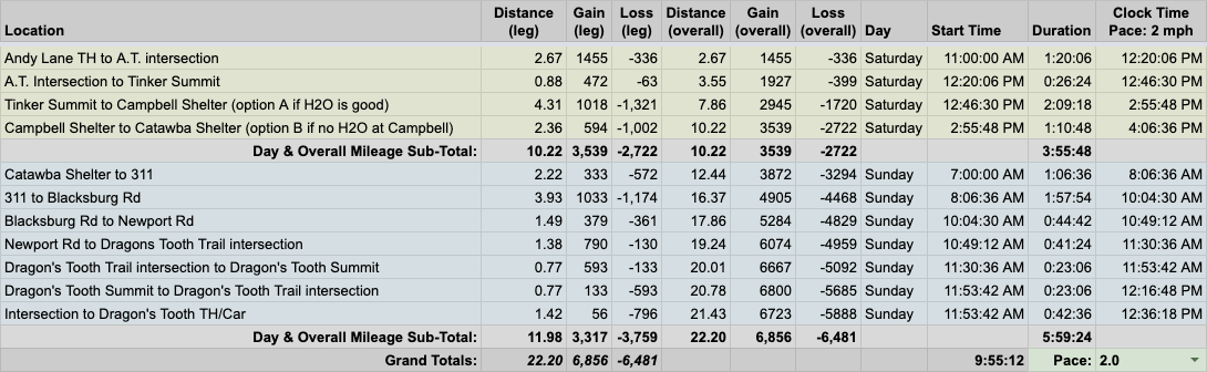
…created an elevation profile

…dropped in the route
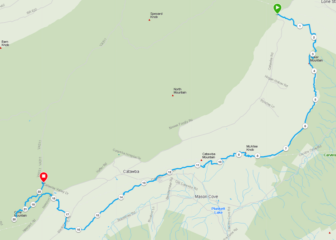
…and packaged it all in a map that he printed on TerraSlate paper.
PACKING IT IN
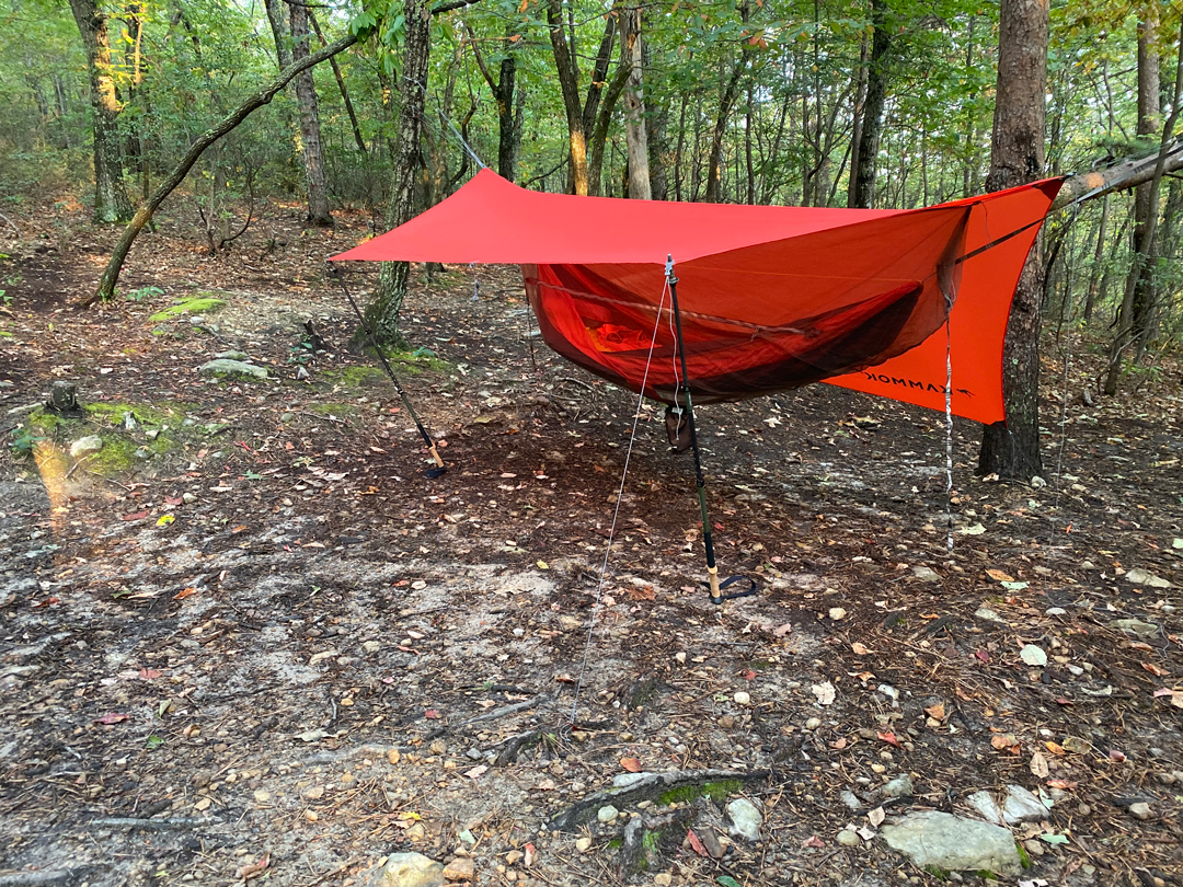
The temperature was supposed to max out at 89°F on both days and bottom out in the mid 60s on Sunday morning. Rain was in the forecast, but only for a few hours of the first day. With this in mind, I opted to pack in my rain gear and put on summer attire (after coating it with plenty o’ permethrin). Given the high temps and lackluster water outlook, we planned to stash water and grab it the morning of the second day. To lighten my load, I ditched my usual MSR WindBurner in favor of a Pocket Rocket 2 and TOAKS 750mL pot. Lastly, I opted for hammock over tent, blanket over bag, took some dice and a Yahtzee scoresheet, and brought along my Helinox Zero because I wanted to.
With everything loaded, including water, my 34L Stratos weighed in at 23 lbs. 4 oz.
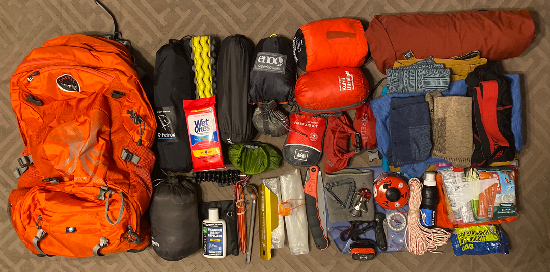
Feel free to download my complete gear list.
DAY 1 (10.56 MI | +3,156′ GAIN | -2,470′ LOSS)
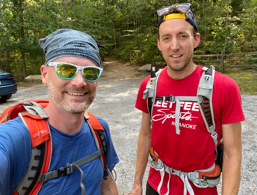
As planned, we stashed a couple gallons of water at McAfee Knob trailhead parking lot off 311, dropped Coop’s car at Dragon’s Tooth Trailhead, then parked my car in the Andy Layne’s Tinker Cliff Trailhead parking lot at 11:25AM. Upon arrival, the sun was shining, the sky was blue, and it was hot as h-e double hockey sticks. From our vantage point there was no immediate need for rain gear, but the National Weather Service was tracking an incoming rain shower. With packs on, we hit the trails around 11:40AM.

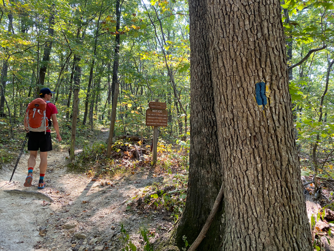
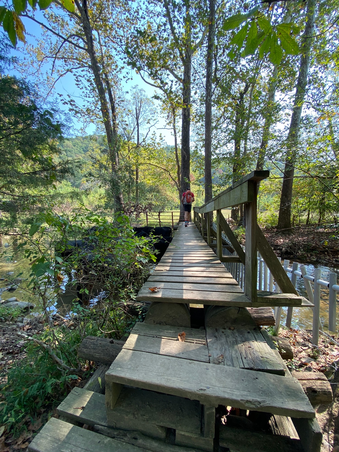
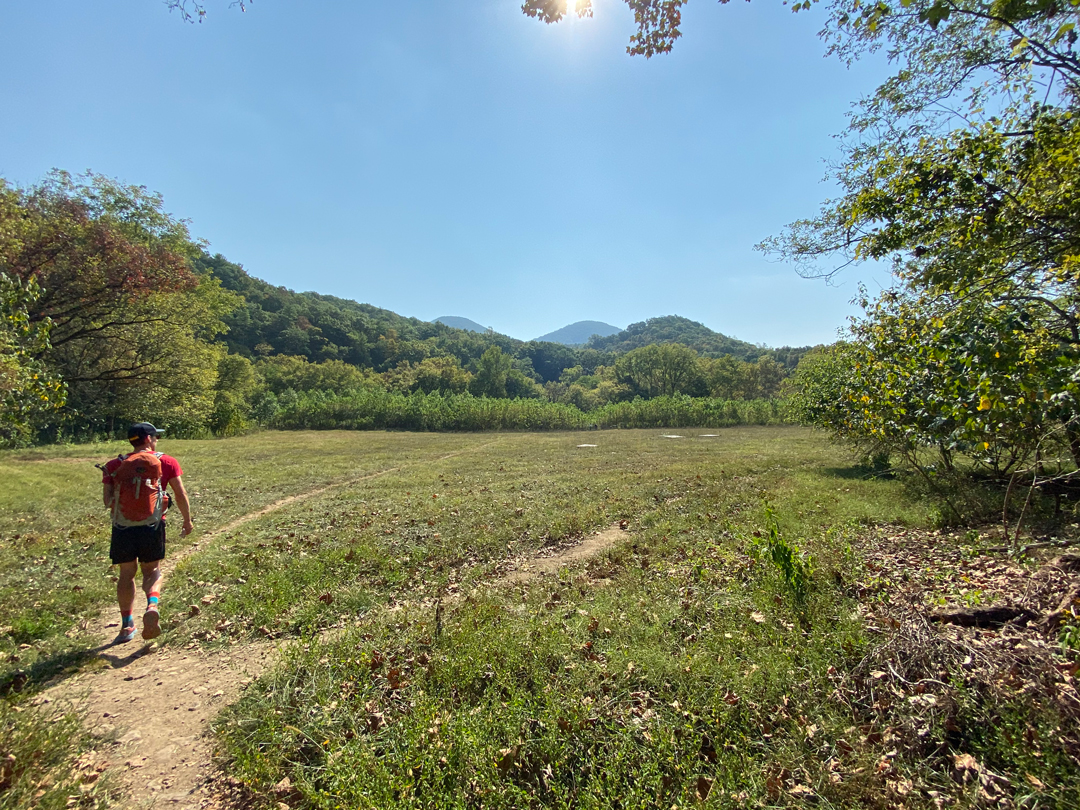
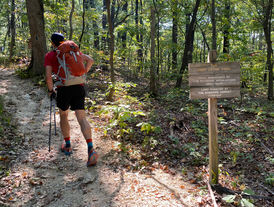
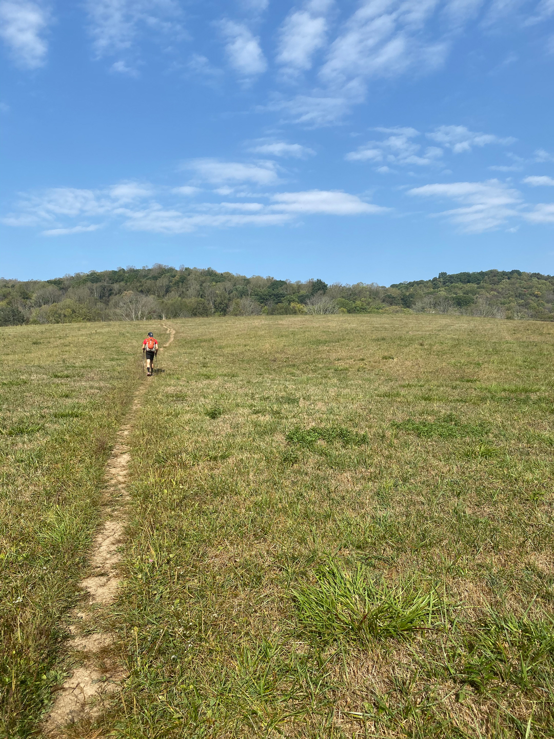
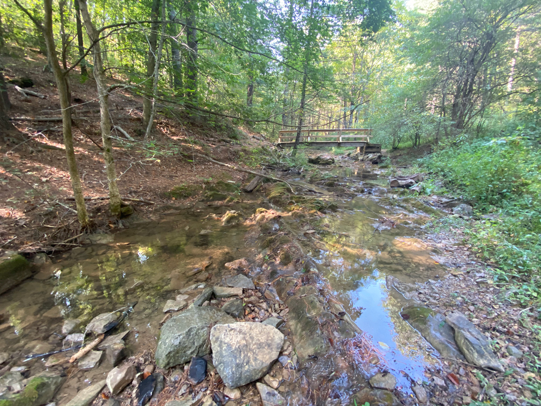
A few minutes into the hike we passed a sign stating that Andy Layne Trail continued for three miles through private land where it intersected the AT. From the sign, we walked a bit more until we interrupted a bovine retreat, begged their pardon, crossed their troll-less bridge, cut through a field, crossed another bridge, and then started our ascent to the cliffs. Almost immediately, we heard a very loud and very ominous horn in the not-so-distant distance.
ME: Lunch time?
COOP: Tornado warning?
ME: Oh…wait.
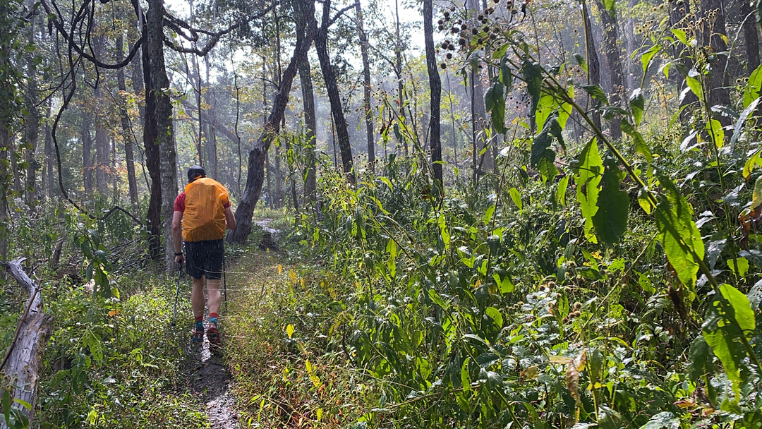
The private land we were walking through is owned by Roanoke Cement Company and that sound was a boom boom fixin’ to blow. With an extra spring in our step, we proceeded to walk up a short series of switchbacks and away from our potential gravesite. Ten minutes later, thunder welcomed in the rain and we soaked it up all the way to the AT.
At the AT/Andy Layne intersection we took a break, talked to a slightly unenthusiastic passerby, then continued on to Tinker Cliffs; completing the half-mile climb around 1:15PM. The views from the cliffs were obscured by rain clouds, and the wind and cold obscured the heat. To stave off the elements and potential hypothermia we slipped on our jackets and got back to moving. On our way out we passed a couple of hikers who seemed unprepared for the weather (shorts, flip flops, T-shirts, no jackets, and no water). We offered assistance (water, jacket, hand warmers), but they said they were fine and were headed back to their car in light of the current circumstance.
Two and a half hours into our hike, as we looked out at Carvins Cove Reservoir, we came across a group of 5 or 6 hikers that in that moment realized two of their group members had strayed from the pack. We offered to help them look, but they seemed to think the two hikers were nearby. We told ’em we’d keep our eyes peeled and then headed off towards McAfee Knob.
A half mile later, we spotted two hikers hanging out at a bend in the trail. Coop commented that perhaps the two were the missing two hikers. He called out to them and sure enough they were the two. He let ’em know that their friends were looking for them and we went on our way.
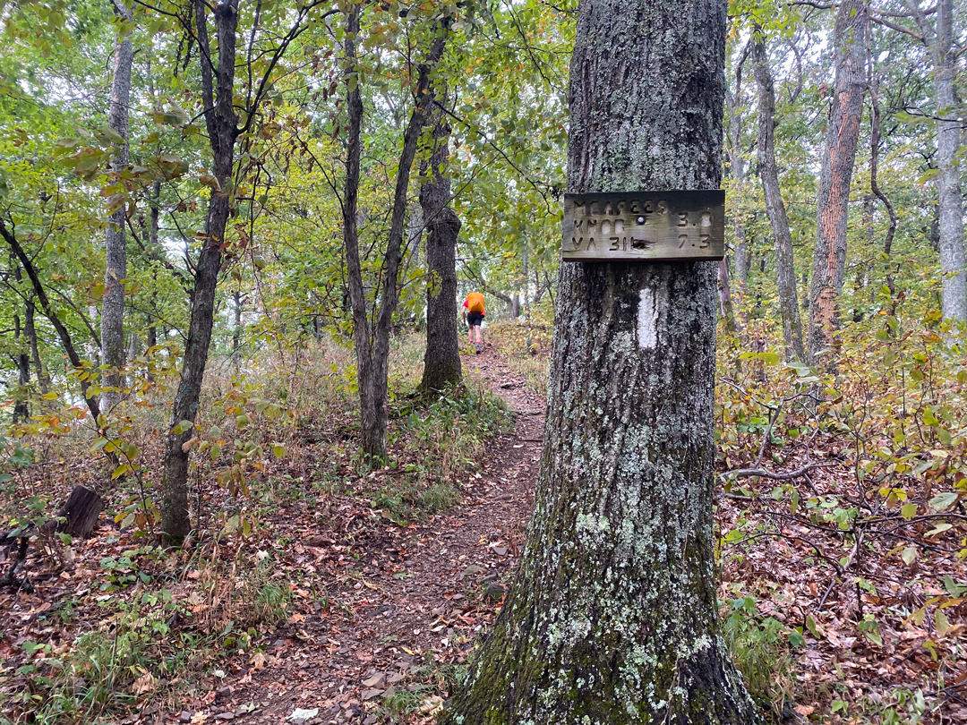
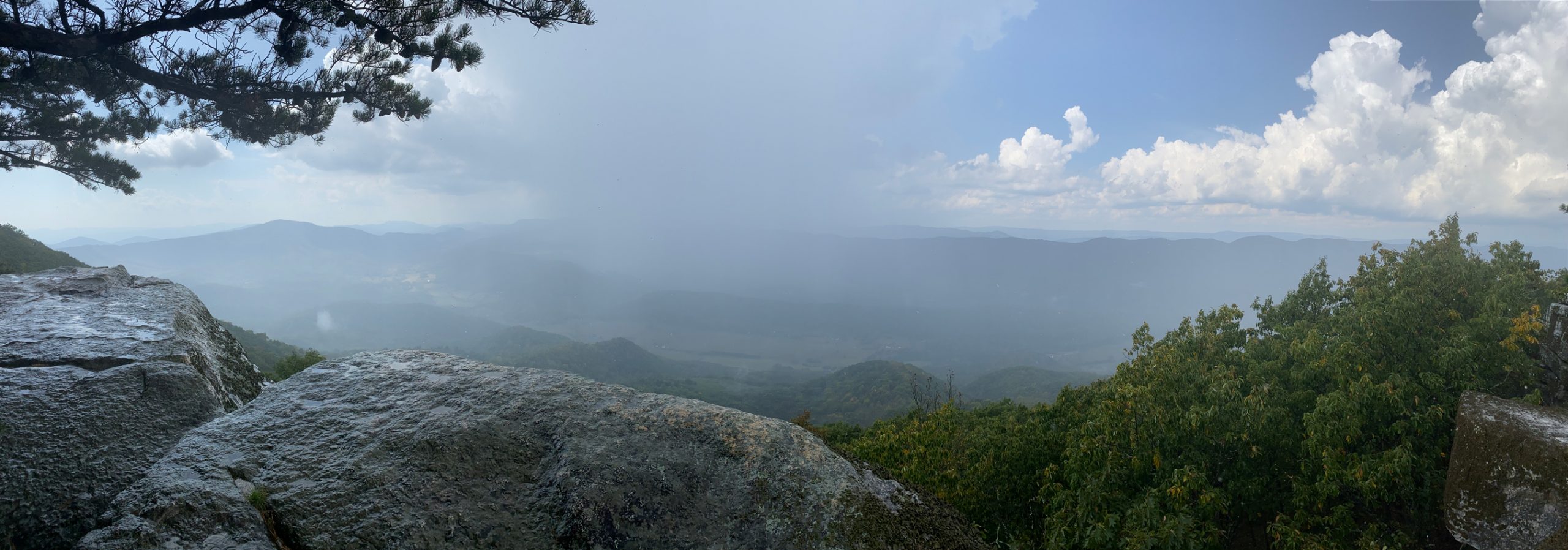
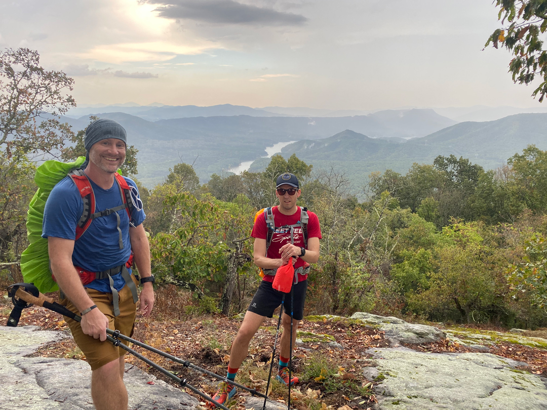
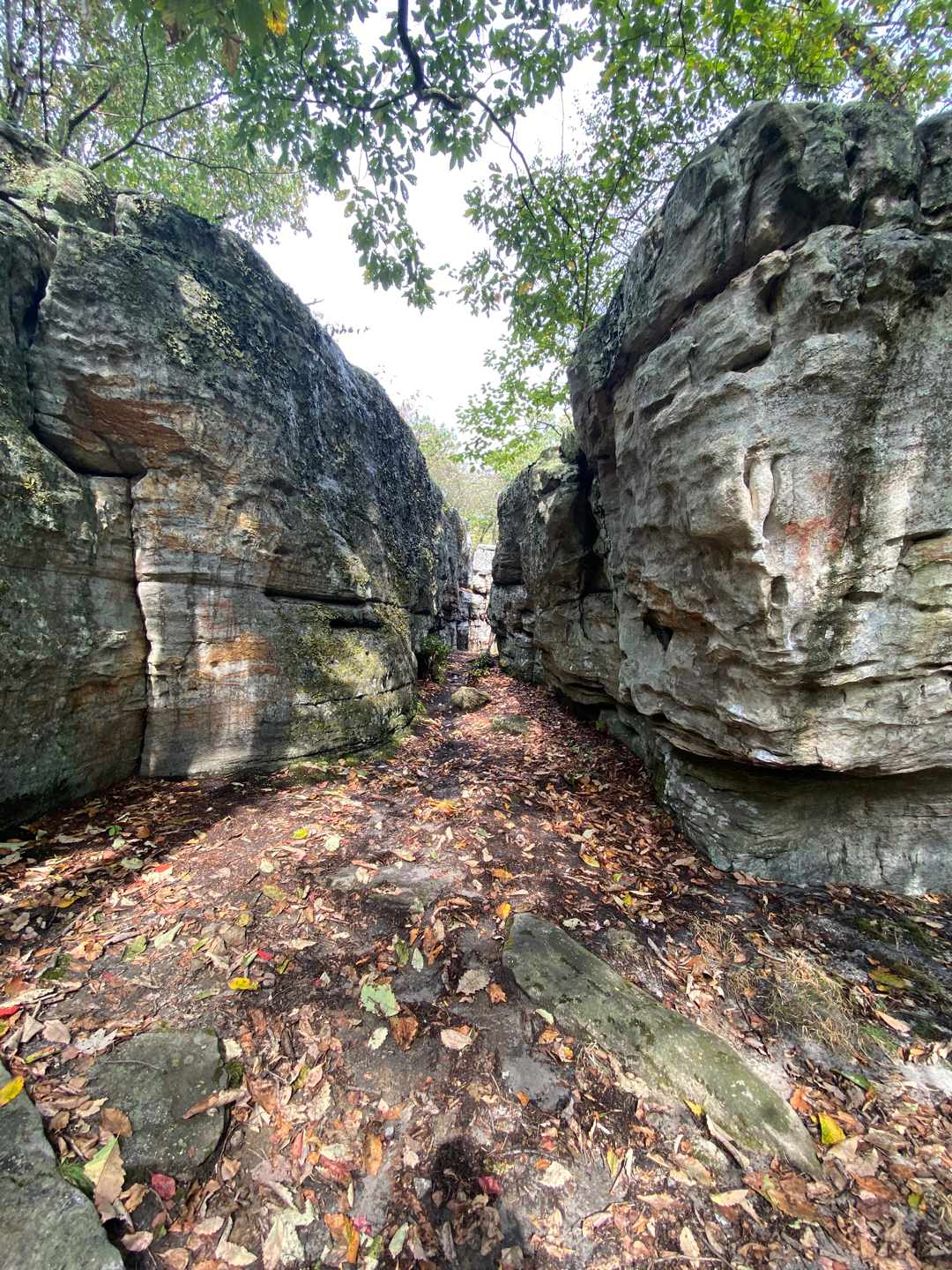
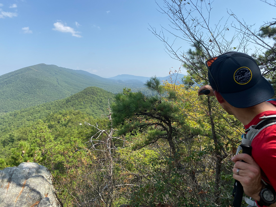
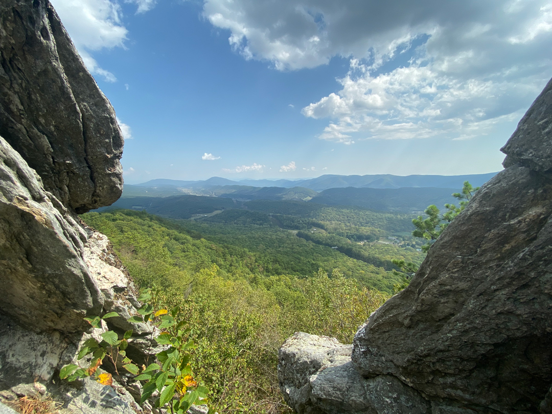
Around 3:15PM we reached Campbell Shelter where two backpackers were hanging out in the shelter. We considered stopping, but our legs felt pretty good and we only had about 2.25 miles to the Catawba Shelter so we decided we’d wave in their general direction and keep moving. Another half mile and we arrived at some sweet rock formations just shy of McAfee Knob. We explored them for a bit then followed the cacophony of voices to McAfee Knob where a small city’s worth of people were hanging out.
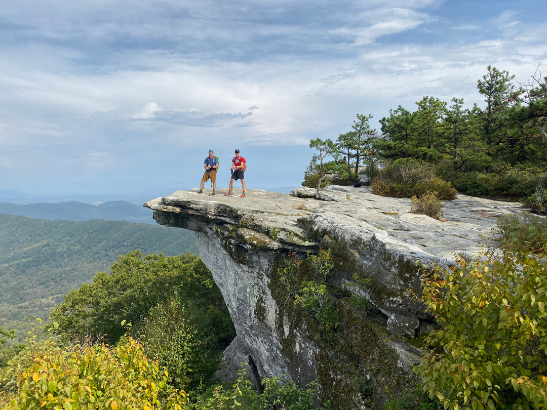
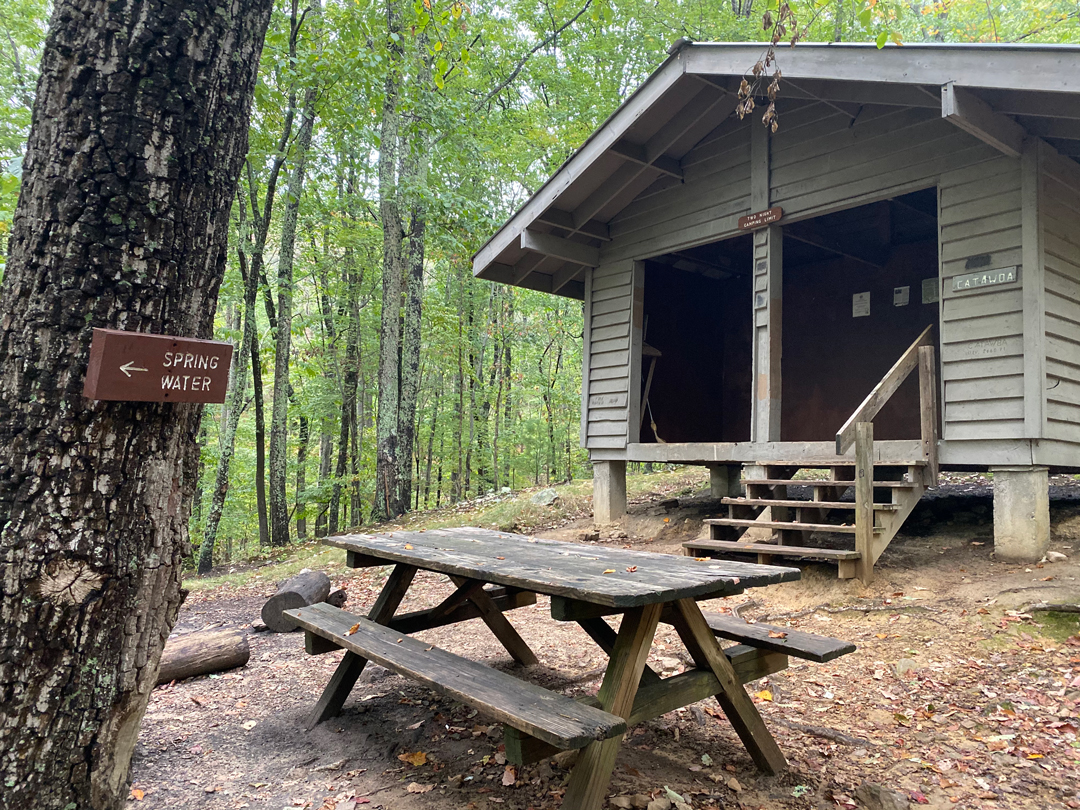
We snapped a photo of a group and they returned the favor. The views were amazing. We soaked ’em in a bit more and then began the 1.5 mile descent to Catawba Shelter. From the summit, we crossed McAfee Knob trail (a trail that winds its way up/down the mountain and crosses the AT twice) and made our way down an easy, albeit crowded, trail. For serious, the entire time we walked we were either passing people on their way down from the Knob or passing people on their way up to the Knob. About 0.75 miles from the top we crossed under a utility line, and another 0.75 miles later we crossed back over McAfee Knob trail where we followed the AT for another quarter mile until we arrived at Catawba Shelter; our campsite for the night.
With our water supply nearly depleted, we skipped setting up camp in favor of locating a filling station. The search wasn’t too difficult as a sign pointed us towards the spring. The only downside, the spring was more of a trickle and the pool it was filling wasn’t exactly screaming “Drink me!” That said, we threw caution to the wind and filled bags and bottles before returning to the shelter to cook dinner and talk about next steps.
While we ate, Coop and I agreed to leave our smelly stuff in the shelter’s bear box and camp about 100 yards back up the trail (which was about 75 yards from the privy). Once shelters were up, we rooted ourselves in our chairs until turning in around 10PM.

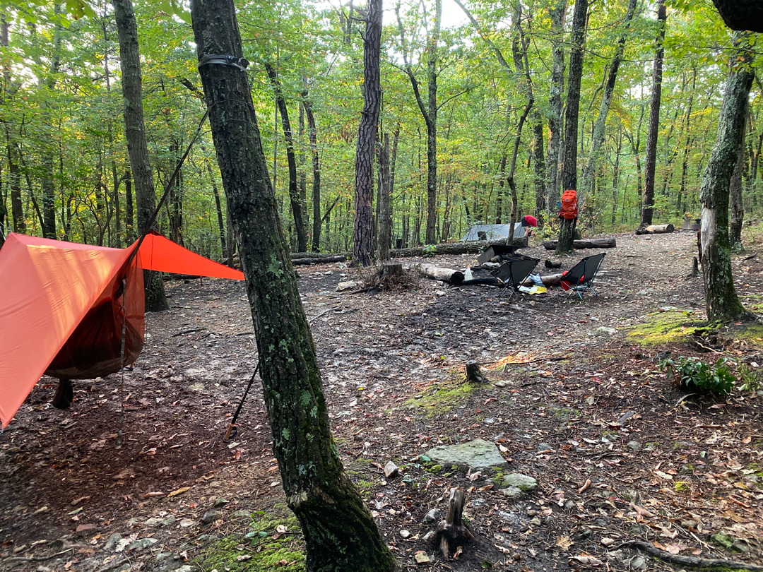

At exactly 2:16AM (I know because I looked) I lost count of sheep when two dudes came up the trail blazing headlamps. I fumbled for my glasses, put ’em on, and watched as the dudes came within 10 feet of my hammock.
ME: (a tad bit annoyed) Can I help you guys?
DUDE #1: We’re just getting in.
DUDE #2 (to DUDE #1): Should we stay here?
DUDE #1: Probably not. I think they’re sleeping.
DUDE #2: (to me) Sorry man.
I didn’t respond, but I did watch as the two dudes turned around and walked 20 feet up the trail towards McAfee before settling in for the night very, very noisily. Eventually, I fell back asleep only to be woken up two hours later by the same dudes who were now packing up and heading out. Annoyed, I willed myself to sleep once more. Unfortunately for me, Hypnos was upset with me for some reason because at 5:30AM he sent two totally different and totally uncool dudes up the AT blazing headlamps and blaring tunes. As they drew nearer, I could hear one dude tell his DJ companion to turn down the music, but the DJ wasn’t having it and he even laughed at the suggestion. Not cool bro. Not cool.
After this last interruption, I decided to forgo sleep in favor of getting my morning started.
DAY 2 (12.71 MI | +3,232′ GAIN | -3,619′ LOSS)
Following breakfast and an interesting privy experience with a spider named Chunk, we broke camp and headed out around 7:35AM. We passed John’s Spring Shelter around 8:08AM, greeted a handful of hikers headed up the trail at 8:15AM, talked to an RATC volunteer who was checking water sources around 8:30AM, and reached Catawba Valley Dr/VA-311 around 8:40AM. At the parking lot, we hit up our stash of water and then made our way through a very busy parking lot to the Dragon’s Tooth Trail 10 minutes later.

The 4-mile hike to Blacksburg Road was an easy, shaded stretch. At Blacksburg, we stopped for a snack on the side of the road (and were nearly hit by a few NASCAR enthusiasts) before pressing forward through a pasture en route to Newport Road. From the pasture we turned left/northwest and followed a creek for a few minutes. With my eyes on the creek, I heard something off the trail to my left and turned to see a black snake inches from my foot. My heart skipped. The snake took off. And Coop and I took the opportunity to laugh and refill our bottles. Back on the trail, we reached a series of switchbacks after 0.75 miles, followed ’em down for a bit, and arrived at Newport Road around 11:30AM.
From Newport Road it’s about 1.5 miles of nothing but up to the Dragon’s Tooth Trail intersection (NE to the parking lot and S/SW to the summit). We took a breather at a nearby campsite and started in on the ascent. Almost immediately, the trail became technical.
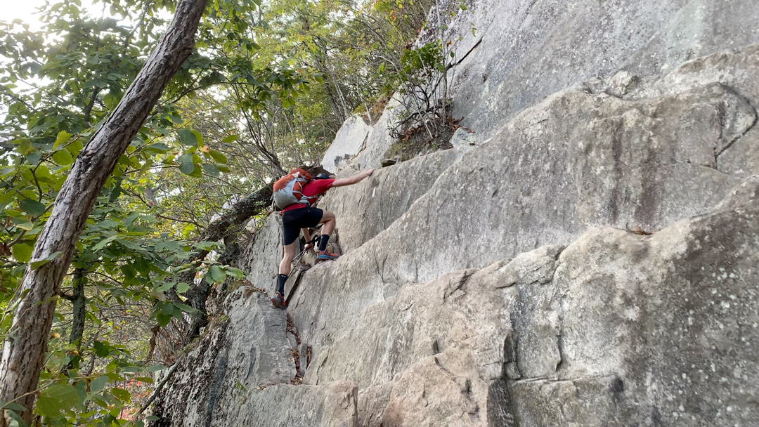
A quarter mile in we crossed paths with an older fella who was section hiking the AT. He talked to us a bit and mostly inquired about water sources. We mentioned the creek near Blacksburg as well as what remained of our stash near the McAfee Trailhead parking lot. He said thanks and we parted ways. Over the next half mile, as we crawled up rock faces and climbed metal ladders, we passed several groups of people—some as large as 8. What was particularly interesting about many of the folks we passed was their lack of water and proper footwear. Seriously, I saw very few water bottles and way too many flip flops.
Anyway, we eventually reached the top, hung a left/south (the AT continues north), and glided to the teeth of the dragon a tenth of a mile down the hill. When we arrived, a couple of families were hanging out in a dirt clearing and a pair of hikers were climbing in and around the rocks. Elated to reach the third crown, Coop and I slid off our packs, took in the moment, and then headed back.
The way down required extra mental effort as the ground beneath was constantly shifting. About a half mile down we passed a trio of hikers followed by two of their companions. The duo included a dude and his mom. She didn’t look so good and didn’t appear to be feeling the hike. We offered water and assistance, but they both said they were fine. As I walked away I couldn’t help but wonder if she finished the climb or just waited for her group to come back down.
Around 1:40PM, we turned left/northeast down Dragon’s Tooth Trail and started the 1.7-mile descent to the parking lot. It was hot and I was ready to get back to the comfort of an air conditioned vehicle (no judging please). A mile down the trail we spotted a dude sitting on a log looking pretty deflated. We stopped to check on him. He said he was tired and that he was out of water. I gladly offered him mine and suggested he refill his bladder. He took a drink, but declined to refill as he just wanted to rest a few more minutes before finishing the final 0.75 miles. We hung with the dude for a couple more minutes, wished him well, and moseyed on down to the parking lot where we arrived around 2:10PM.
Trip complete.
TOTALS (23.27 MI | +6,388′ GAIN | -6,089′ LOSS)
FINAL THOUGHTS
What an amazing trip. I’ve wanted to knock out the Virginia Triple Crown and while we didn’t go the full loop over North Mountain (it connects Dragon’s Tooth with Andy Layne) we did hit the three peaks in spectacular fashion. We were prepared for the lack of water, the hot weather, and the technical terrain. The number of people on the trail wasn’t an issue (even though I was totally annoyed by the dudes who forget to read the chapter on trail etiquette). I’d totally visit the Triple Crown again and hopefully next time we’ll tackle the loop. As for you, if you’re headed to the area be sure to plan ahead, read the latest trip reports, and bring plenty of water. Oh, and have fun, but that should be easy…unless, of course, you’re wearing flip flops.
Thanks for this amazing path! We followed it except for one change. Took the boys scout path to Dragon Tooth parking lot. Did that section up and back without packs. I am over 50! I needed the mental boost of no pack. Just completed the hike on June 21-22 2024. Bring water! It was plus 90 degrees both days.
Good call on the Boy Scout Path spur to the parking lot. If you’re going to dump weight and then hike up that’s a great way to modify this route. Glad you had a good time. And you’re 100% correct on water. When it’s hot, it’s scarce.