The Monongahela National Forest in West Virginia is home to some of the best backpacking options on the east coast. My buddy, Coop, and I had already visited Dolly Sods and Roaring Plains within the forest, but we hadn’t had a chance to check out the 47,815 acre Cranberry Wilderness.
Situated between the Highland Scenic Highway to the east, the Williams River to the north, and the Cranberry River to the south and west, the Cranberry Wilderness includes more than 15 interconnected, unblazed, and well-maintained trails covering over 75 miles with elevations ranging from 2,400 to over 4,600 feet. Black bears are abundant and share the Wilderness with deer, turkeys, rabbits, mink, grouse, bobcats, and foxes.
Sounds awesome, right? Absolutely, that’s why we went.
THE PLAN
In the winter, wherever you are, conditions can go from bad to worse in minutes. In the Monongahela Nat’l Forest, this is particularly true all year long. Thankfully, the Cranberry Wilderness has miles of trails which allowed us to plan a single route with multiple bailout options. We just had to make sure we brought all the right navigational tools including a detailed map, compass, and GPS watches with routes pre-loaded since the wilderness is not well marked and getting lost is a real possibility; there are trail signs at intersections, but no blazes.
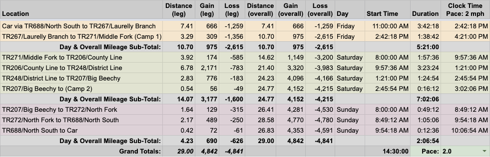
To prepare, we used a slew of tools (AllTrails, GaiaGPS, CalTopo, Garmin Connect, and Google Earth) and the North-South Trailhead off the Highland Science Highway as our entry point. We then plotted a route that took us across the wilderness and back again in a big, dimetrodon-shaped loop. Next, we built out the trip in a spreadsheet based on a 2.0 MPH pace…
…created an elevation profile
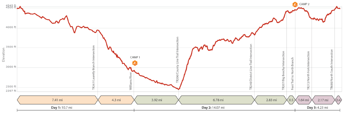
…dropped in the route
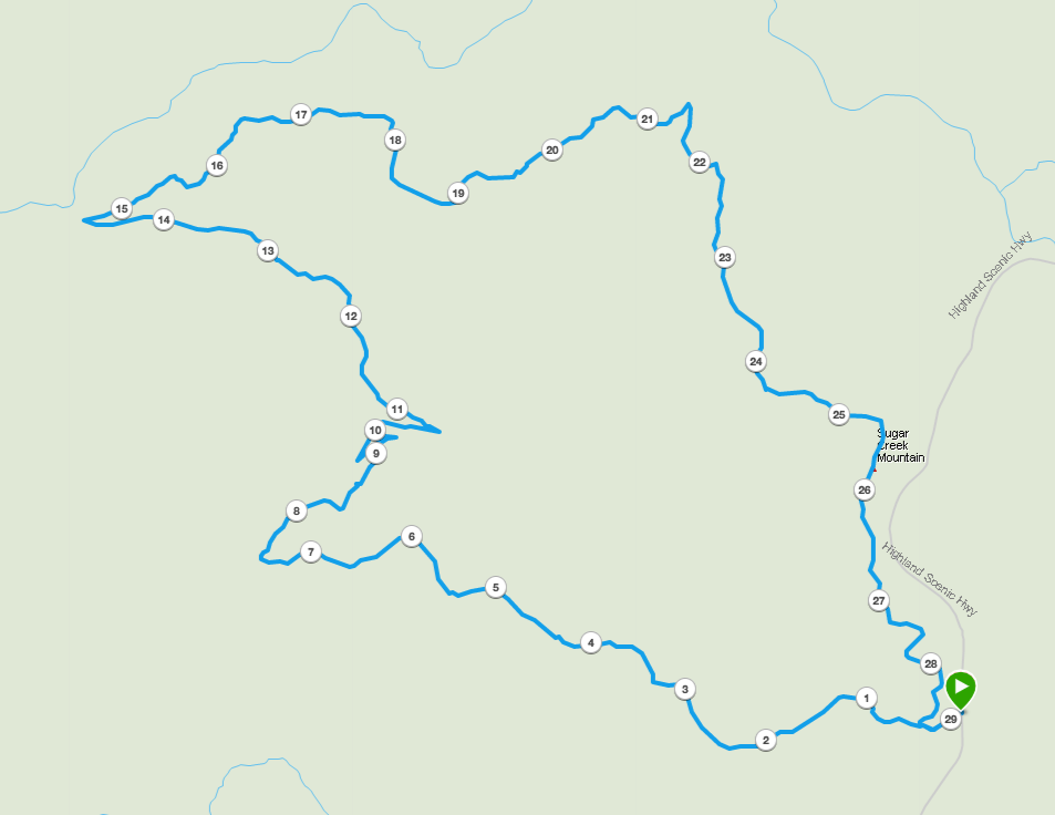
…and packaged it all in a map that we printed on TerraSlate paper.
PACKING IT IN
Forecasting winter weather in the Monongahela Nat’l Forest is a crapshoot. At best, the local meteorologist will be almost right 20% of the time. At worst, you’re going to be unpleasantly surprised with what Mother Nature actually delivers.
Knowing this, and that the weather was predicted to be between 20°F and 47°F (with wind chills in the single digits thanks to 20MPH winds), I elected to cram my pack with extra warmth including a pair of super warm mitts and my chair underquilt. Yes, I brought a chair. No, I didn’t want butt draft, hence the underquilt. Don’t roll your eyes at me.
With everything loaded, including water, brats, and buns, my 50L Atmos weighed in at 32 lbs. 1 oz.
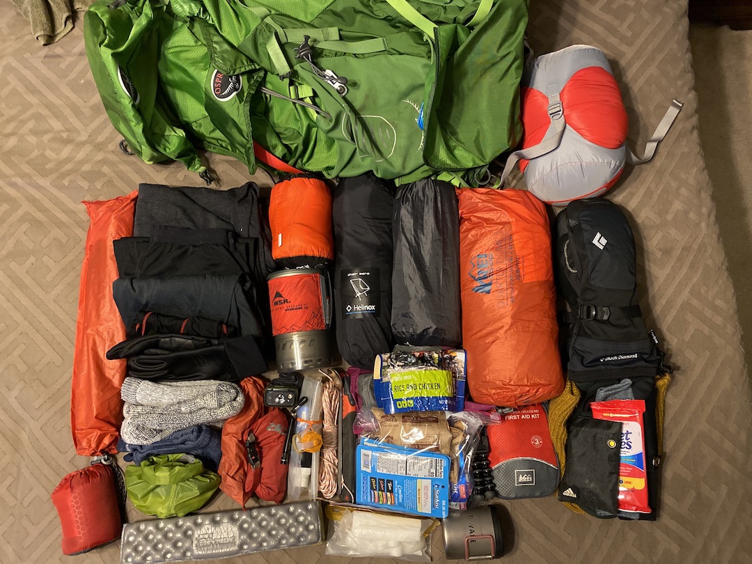
Feel free to download my complete gear list.
DAY 1 (8.43 MI | +850′ GAIN | -1,736′ LOSS)
The night before I left for Cranberry, a winter storm blew into my area carrying snow and ice. The National Weather Service noted unsafe driving conditions through 6AM. While I was planning to leave at 5AM, I had no desire to drive in the wee hours of the morning on the highway over black ice so I let Coop know that I’d be delayed. Eventually, and without incident, I arrived at his house and we were on our way by 8:30AM.
Three hours of more uneventful driving later, we wound our way down the Highland Scenic Highway and pulled into the lot across the road from the North-South Trailhead. As I got ready, I went back and forth between wearing or packing my coat since it was 30°F and windy. It wasn’t supposed to be too much warmer throughout the day, but we’d be moving and generating plenty of heat. With the Magic 8 ball too cloudy to read, I donned my coat fully prepared to pack it up 5 minutes down the trail.
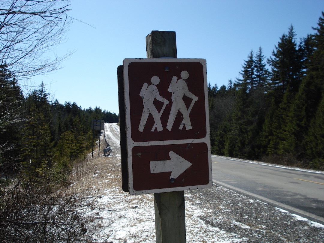
Photo by Coop
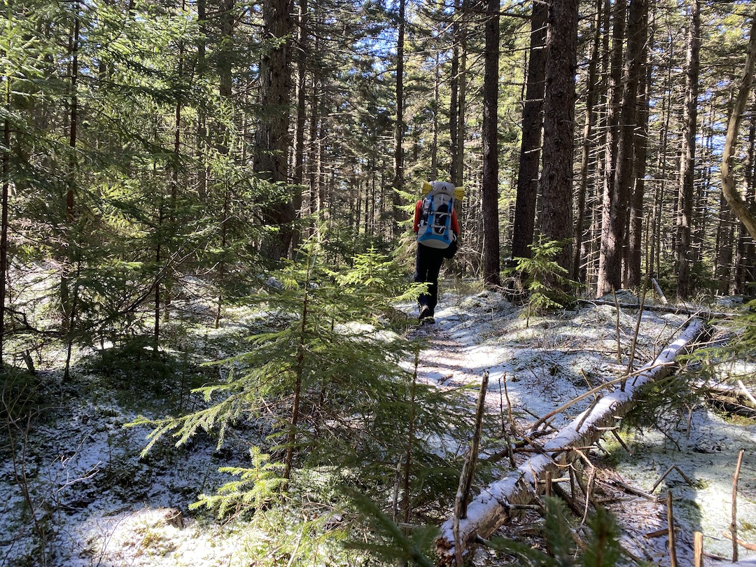
Once geared up, we snapped a quick selfie, took a ceremonious swig of the warm stuff, crossed the road, and disappeared into the woods just before noon. Well, we didn’t actually disappear. How about…we became one with the wilderness. Snuck into serenity? Began our journey? Reverse birthed with nature? Yeah, ew, no. Whatever! We weren’t in our car and were now on the North-South Trail en route to our first night’s campsite.
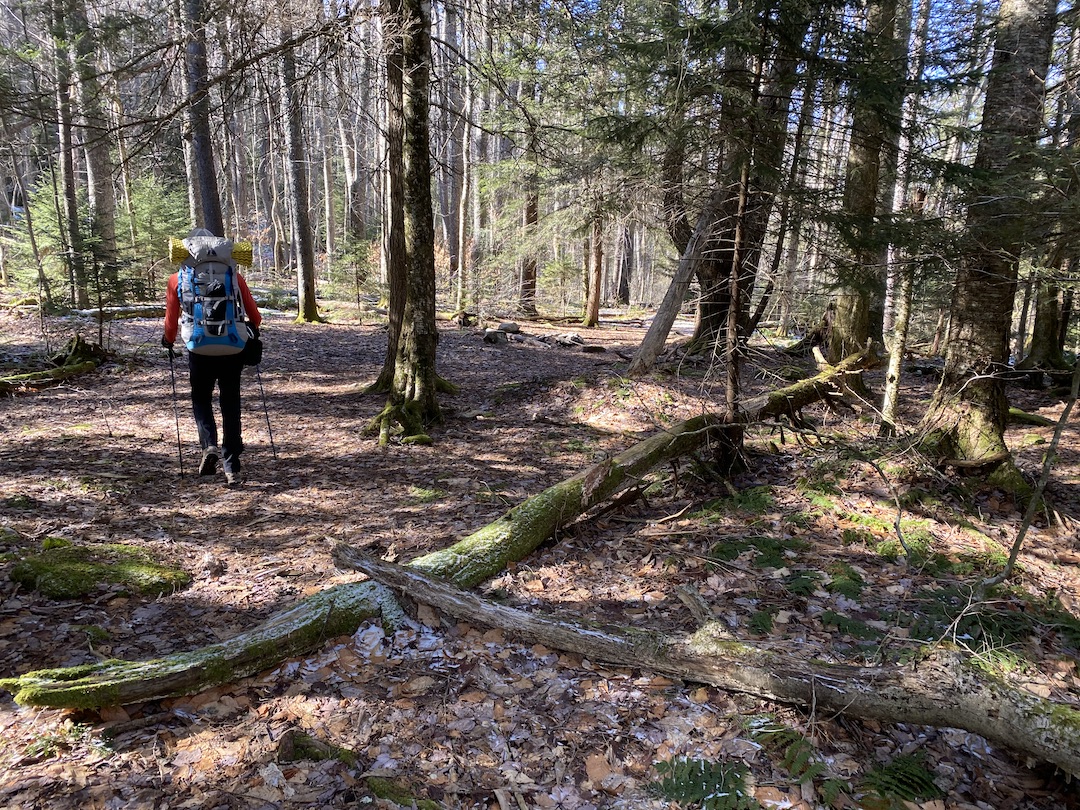
Just inside the woods we passed a series of unoccupied campsites, crossed over TR 272/North Fork a few minutes later, and continued on down the trail. Not long after, I removed my coat. Eight minutes after that, I realized that I dropped a glove whence removing my coat, and turned our twin caravan around to retrieve it. Time lost, warmth saved.
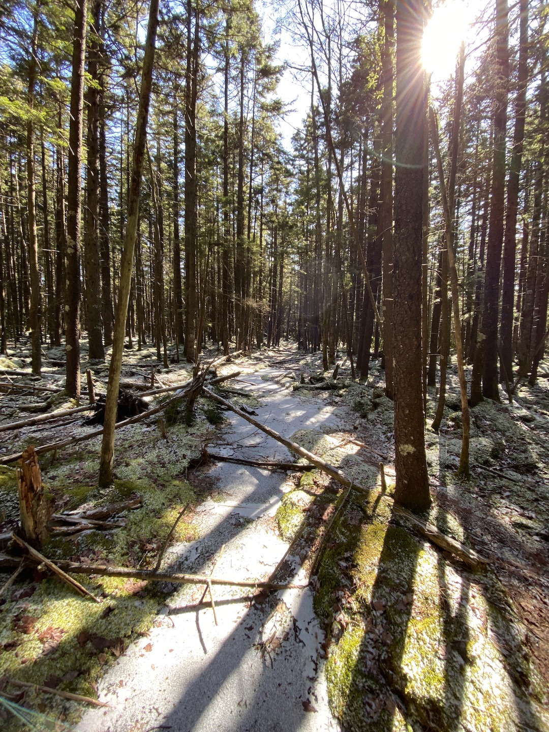
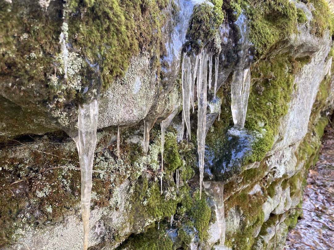
For the majority of our time on the North-South trail, it was either lightly covered in snow or frozen solid from the previous week’s rain. There were no views of rolling mountains. Just a thick wilderness of moss and spruce pines in every direction. It was, you might say, visually delicious.
Around 1:45PM (~4 miles from the car) the trail dumped us into a marshy mess of mud and downed trees all nicely covered with a fresh crust of snow (i.e. the trail disappeared). We studied our maps, aligned our compasses, and pulled up the route on our watches as we looked for any semblance of a trail. We’d crunch one way then slog another. Slop slop slop. Squish squish. Plop. Then, there it was, and off we went.
Twenty minutes later we arrived at the base of a pair of steep hills which promised a couple hundred feet of gain. The descent on the other side was a welcome reprieve, but the energy output on the uphill gave me cause to shed a layer and transition my hat and gloves to my pant pocket. Up, hot. Down, cold. Sunshine, hot. Shade, cold. Mix and match. Seriously, I was removing and donning clothing for most of the day trying to dial in my comfort number. I think it’s forty-two btw.
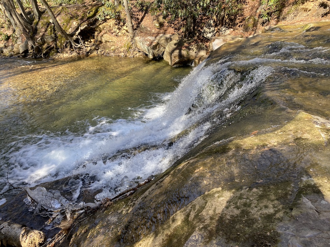
We then crossed TR 214 Tumbling Rock Run which runs 2.5 miles to the southwest to a shelter along the Cranberry River. Just beyond the intersection, there was a huge clearing with a couple fire rings. Sweet campsite. No agua. No matter, we weren’t staying there as our planned site was still another 4ish miles away.
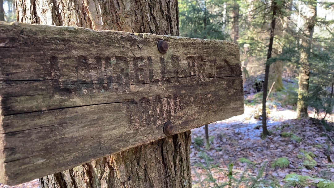
From Tumbling Rock we lost the trail once more, found our way, and slogged up another steep hill for a quarter mile. We walked for another couple hours (losing the trail once more for a few minutes) and eventually arrived at the TR 267 Laurelly Branch intersection. To the west, the trail continues for another 4.6 miles. To the east/northeast (where we were headed) the Laurelly Branch Trail follows a tributary of the same name to Middle Fork Williamson River.
Coop and I stopped to discuss our options. It was 3:50PM and we had approximately 3 miles to go. That meant, if we continued down to Middle Fork we’d be setting up just before dark and collecting wood with the sun no longer shining to build a fire whilst battling a heat deficit. To that end, we decided to hike down Laurelly Branch until we A) found a site or B) arrived at our planned destination. Come on A!
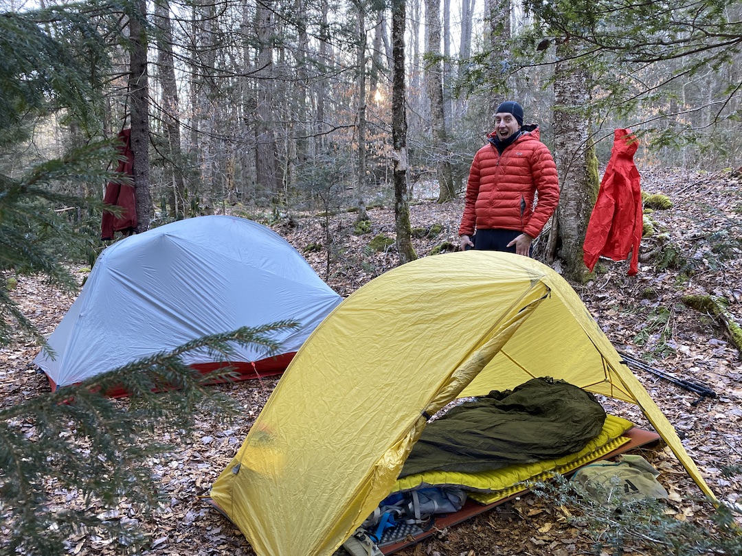
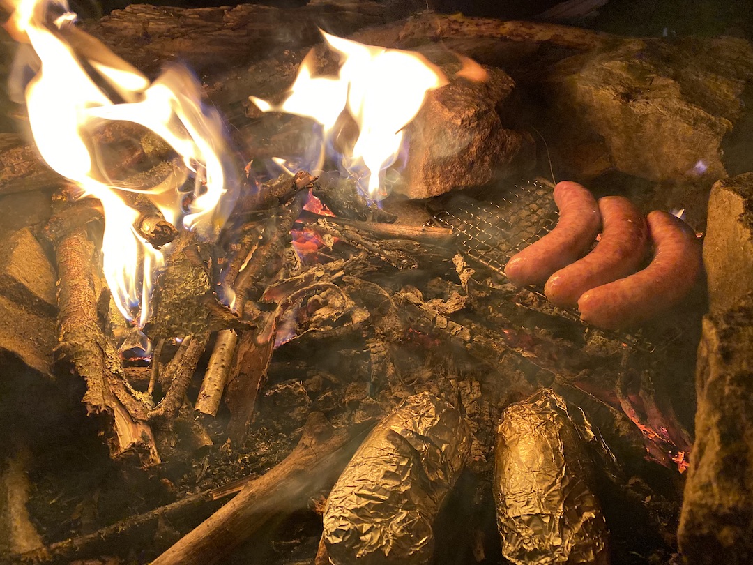
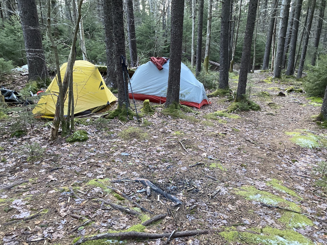
Thankfully, the trail gods smiled upon us and we found a sweet site about 0.6 miles from the North-South/Laurelly Branch Intersection. After giving the site a twice over we set up our tents and then got to work—Coop worked on the fire and food, and I gathered wood and prepped the bear bag line. With our work complete, we filled our bellies, hung out, and shot the breeze before turning in around 9PM.
DAY 2 (14.03 MI | +2,733′ GAIN | -1,762′ LOSS)
I was plenty warm through the night. It wasn’t until I popped my head out of my sleeping bag around 8AM did the 18°F air punch me square in the face. Slowly, and in between blowing warmth back into my fingers, I packed up and proceeded to make breakfast. As I chowed down on a bowl of oatmeal from the comfort of my draft-less chair, I happened to look up and notice a ridiculously prominent widowmaker hanging over our tents. Holy balls, how did we miss that monstrosity, and how did it not fall? Thank you trail gods!
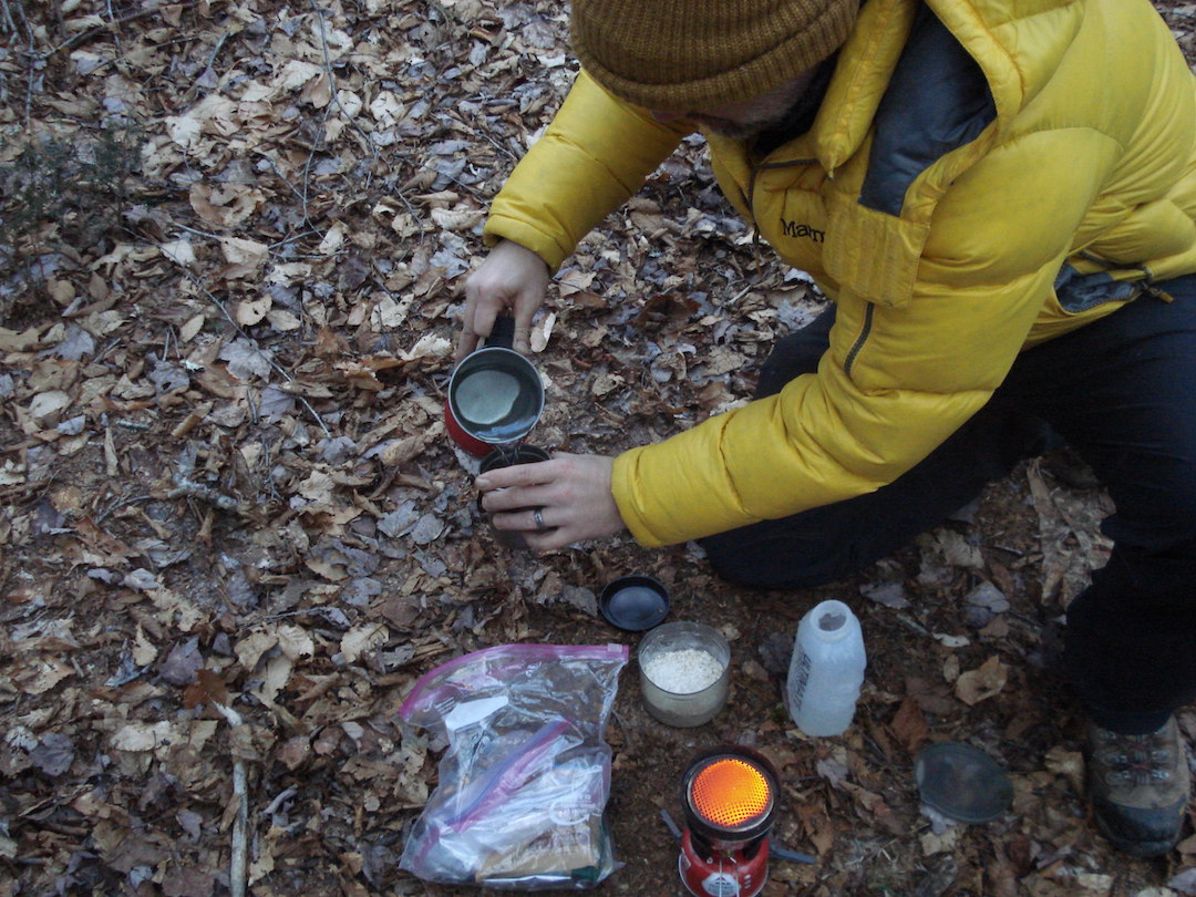
Photo by Coop
Just before 9AM, we were back at it on our way down to the Middle Fork Williams River. It was cold, the trail was solid, and I was badabababa lovin’ it. A mile in, we hit the top of a switch back that zig-zagged down to the river. Another mile later Coop picked up a 4-point deer antler/grappling hook. Then, after nearly 3 miles of down, down to Goblin town, we arrived at Middle Earth…er…Fork and an unwelcome, frigid river crossing around 10:30AM.
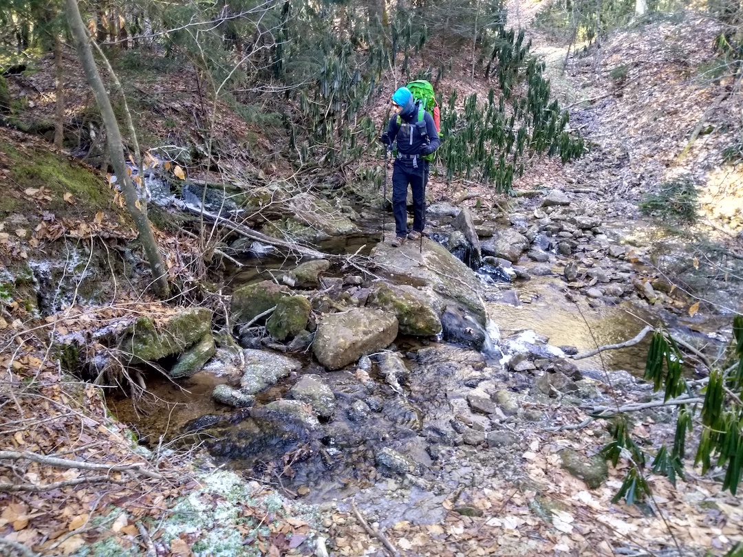
Photo by Coop
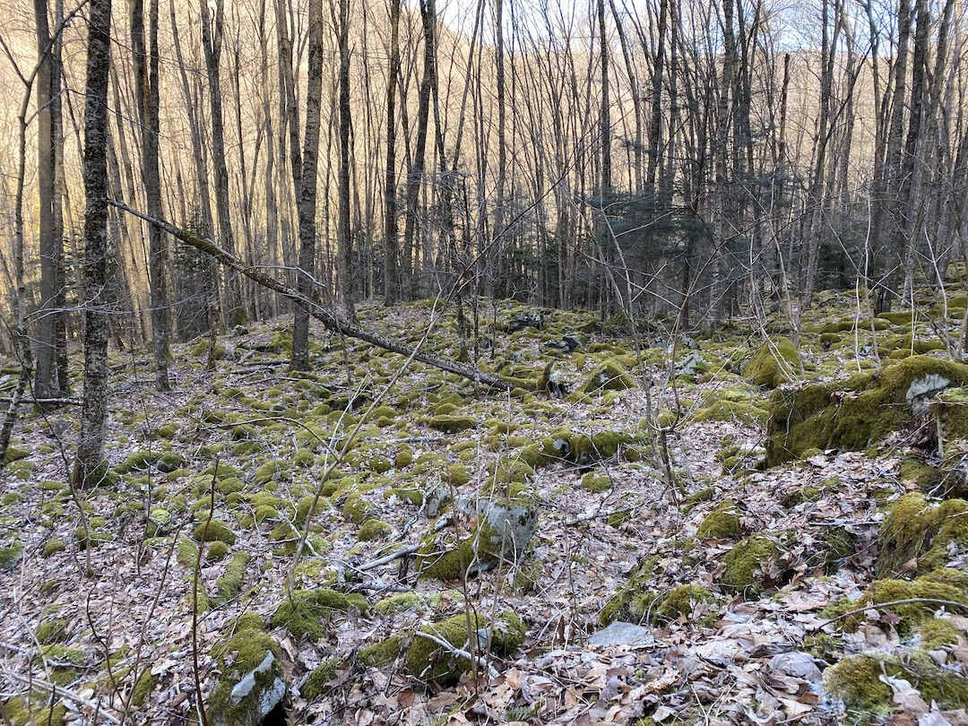
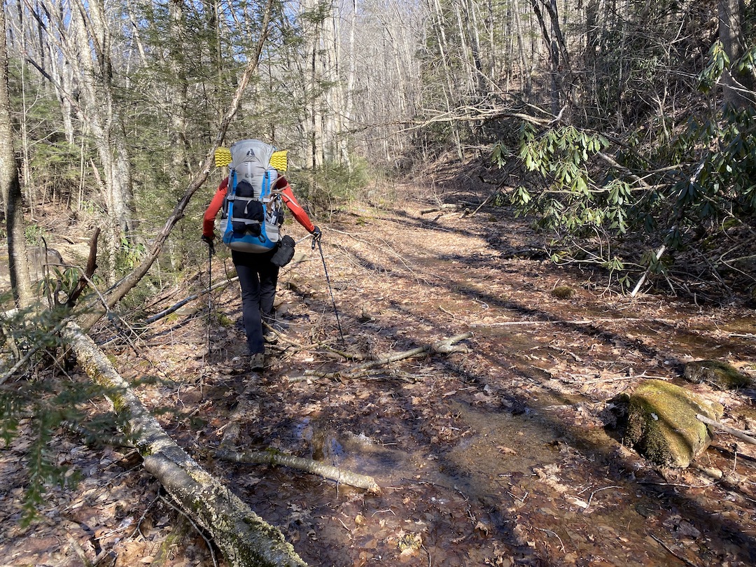
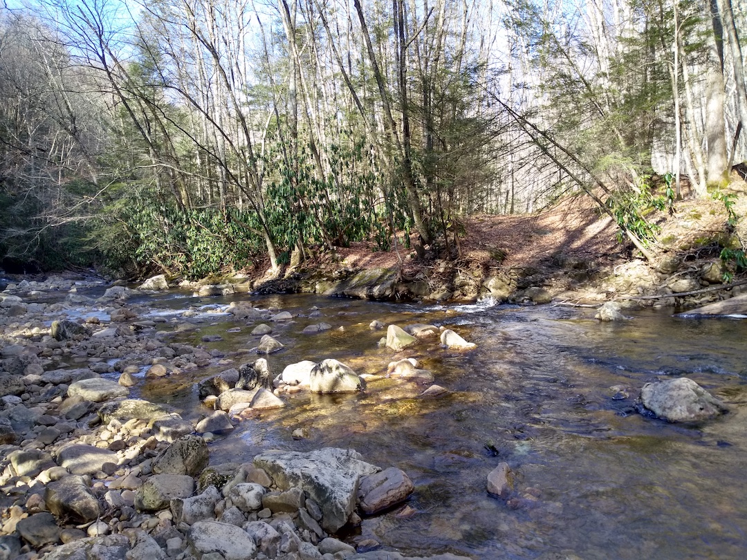
Photo by Coop
Confident (or perhaps adamant) I wouldn’t be getting my feet wet, I turned and walked back up the trail looking for a way to cross. A tenth of a mile up we found it; a long dead tree stretched over the cold, swiftly moving river below.
I crossed first and Coop followed after.
On the other side, we grabbed a quick snack, then continued west on Middle Fork Trail. Along the way, Coop and I chatted about time and elevation. We discussed turning up Big Beechy instead of County Line to cut off some mileage since we stopped short the night before. Neither option was going to be easy, but we’d be able to get to our campsite with time and daylight to spare.
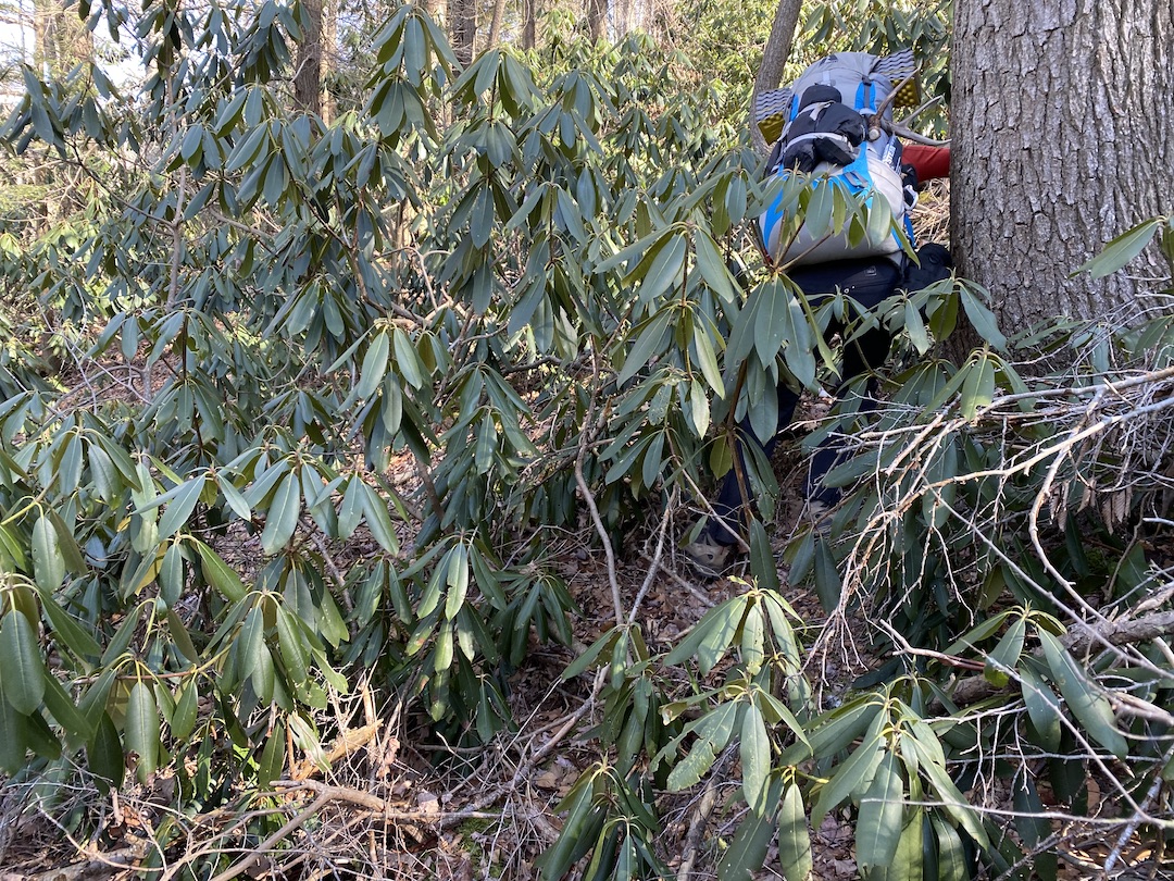
At Big Beechy, the trail continued through a very wide Beechy Run tributary. Lucky for us, Big Beechy Trail turns right/northeast just before the Run. Unlucky for us, Big Beechy was a grueling, steep, single track with countless fallen trees to climb over, around, and under. I’d give it ★★★★☆ and 60,020 upvotes for sheer nonsensical awfulness.
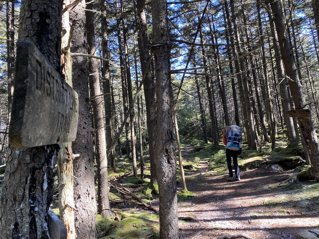
We caught up with TR 248 District Line around 2:30PM and by my calculations were about 10 minutes from the comfort of our campsite for the night. Huzzah! Ten minutes later, no campsite. Poop! No place to camp. No roughed-in spur trail to take us to our night’s water source. NOTHING!
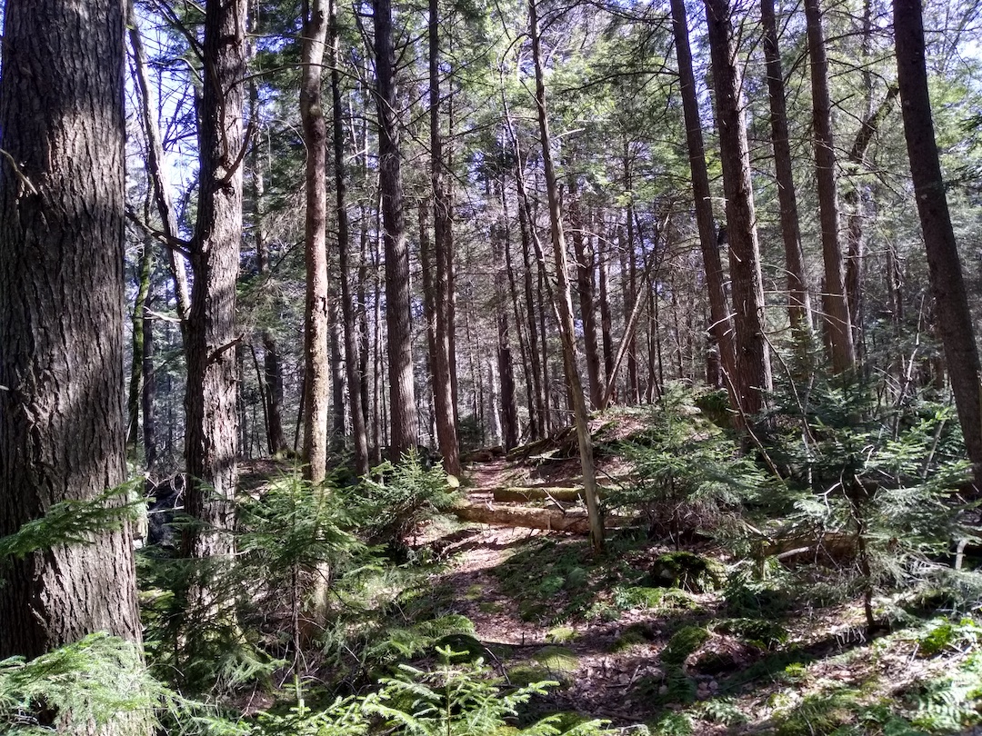
Photo by Coop
At this point, we’d been hiking for about five and a half hours and my brain was in full-on finished-for-the-day-and-put-fat-butt-in-chair mode. Thankfully, I have a switch that I can flip to keep moving that only requires a pouch of tuna, a Clif bar, and a double serving of spite. Besides, what could we do? We were both low on water. There was no place to pitch. We had to keep moving.
As we did, I focused on the map and potential campsites near water sources. In about 3.25 miles we could hang a right/west on Middle Fork Trail and look for a site near the river. We could search for a site between that intersection and the car. Or, we could just hike the full 14 to to the North-South trailhead and find a site near the car. With ideas in brain, I looked up to share them with Coop only to see he was kicking up dirt.
I picked up my pace, caught up with him, and shared my thoughts. He agreed we’d have to look further down the trail, got quiet, and got back to flying. Around mile 10 for the day, the trail turned right/south and paralleled Highland Scenic Highway to the east/left. A mile and half later, we crossed an overgrown road leading to the Big Beechy trailhead and the highway to the left/east, and continues on as North Fork to the right/south.
Thirty minutes later, we arrived at Middle Fork trail and a very welcome sight…water. We looked around for a campsite, but the entire immediate area was pretty thick with trees. Our options became 1) head west on Middle Fork to a site that might exist a mile or so down the trail, or continue south towards the North-South trailhead. Eventually, we decided to head back towards the car and call it a day after 14 miles.
At the campsite near the trailhead, space was limited and there were no fire rings (i.e. no fire). We set up our tents. Set up our chairs. Set up dinner. And we talked for as long as we could before the moisture in my extremities began to solidify.
DAY 3 (0.1 MI | +0′ GAIN | -0′ LOSS)
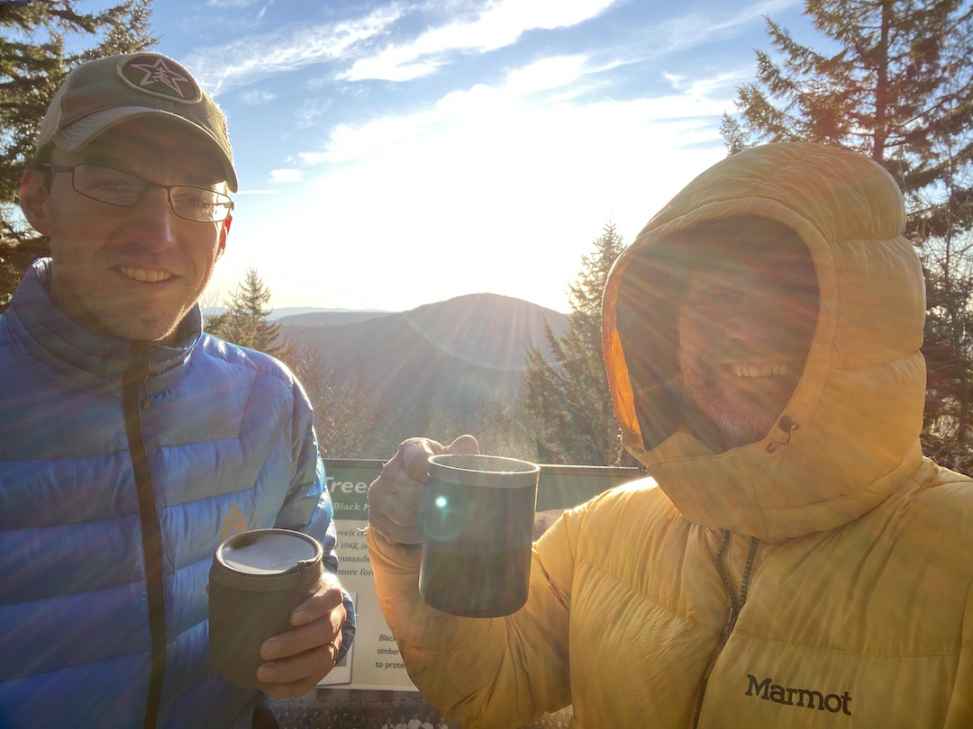
There’s not much to it. We woke, broke camp, and headed to the car. On our way out, we stopped at the Black Mountain Overlook for a cup of coffee and a history lesson. Trip complete!
TOTALS (22.43 MI | +3,583′ GAIN | -3,498′ LOSS)
FINAL THOUGHTS
Cranberry brings solitude in a way most locations do not. I imagine the trails along Cranberry River to the south where shelters sit are more heavily trafficked, but we saw zero people where we hiked. Beyond the silence, the foliage is amazing. Pines throughout with moss as far as the eye can see.
If you plan to visit the Cranberry Wilderness, bring water and plan to get dirty. There is wildlife given the area is within a bear sanctuary so pack your food responsibly. Also, recognize that the area is a designated wilderness area and doesn’t have blazes the way many locations do so be prepared to get lost regularly.
That said, get out there and have some fun! The Cranberry Wilderness awaits!