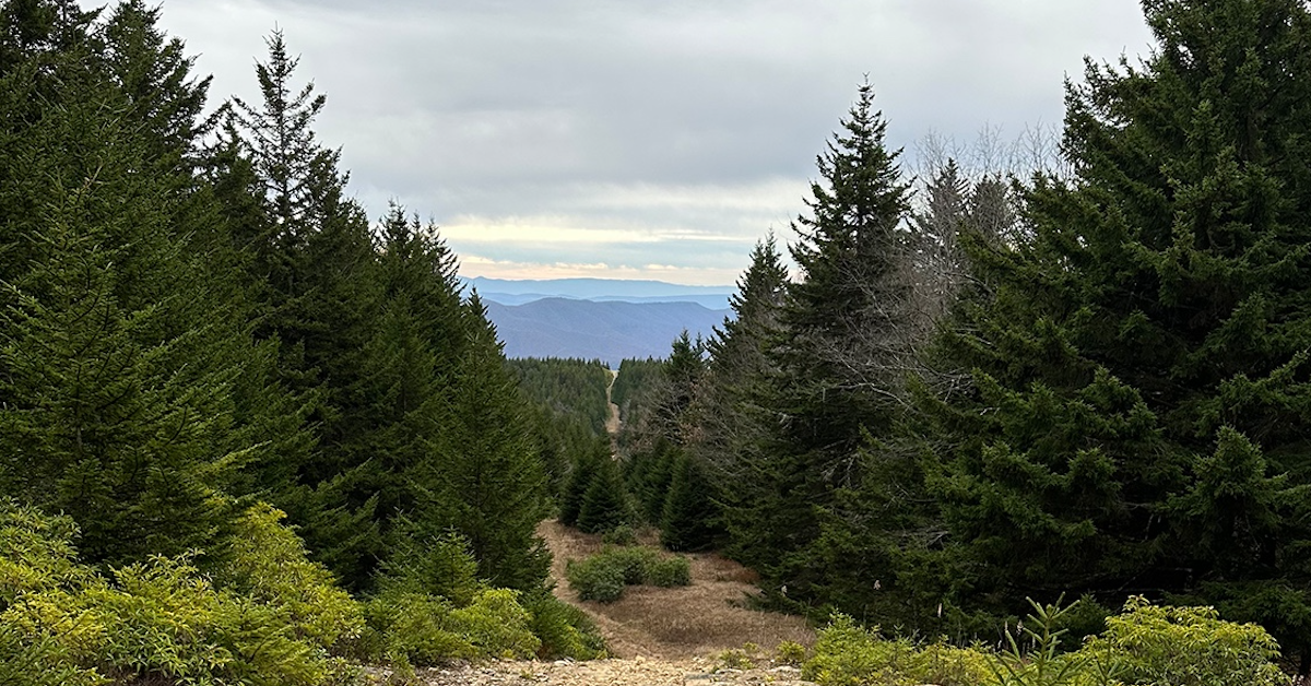
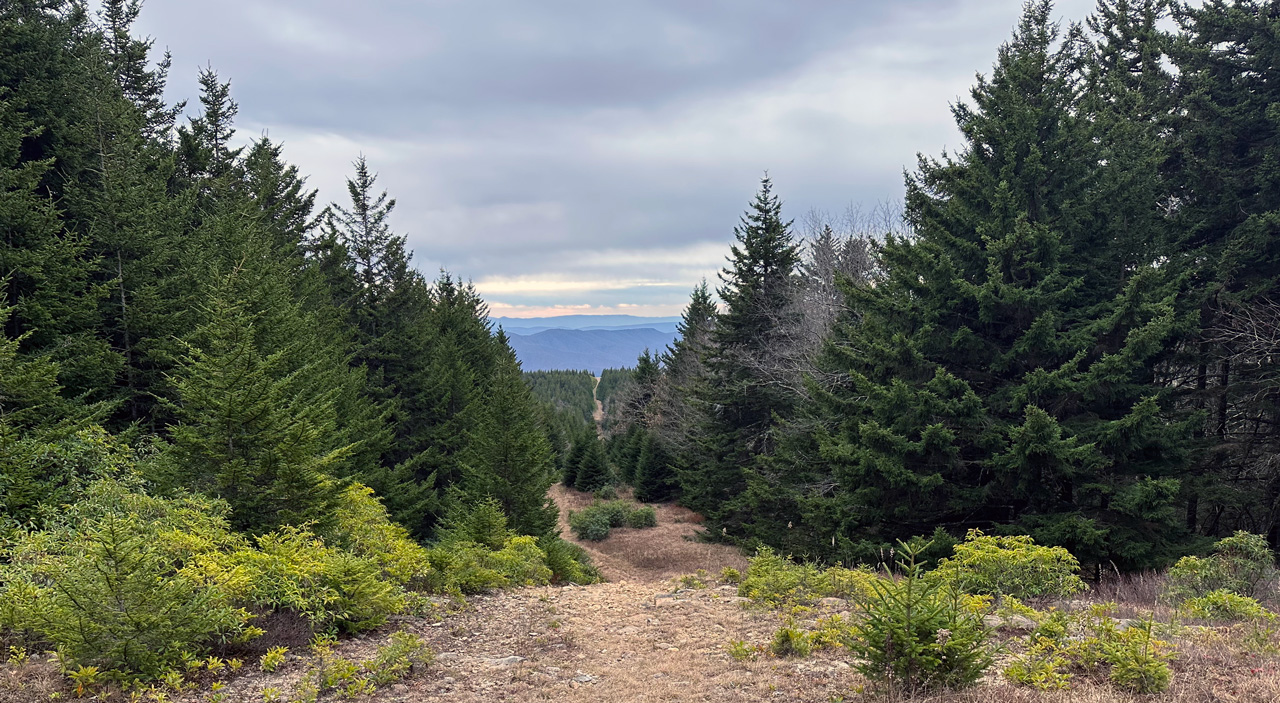
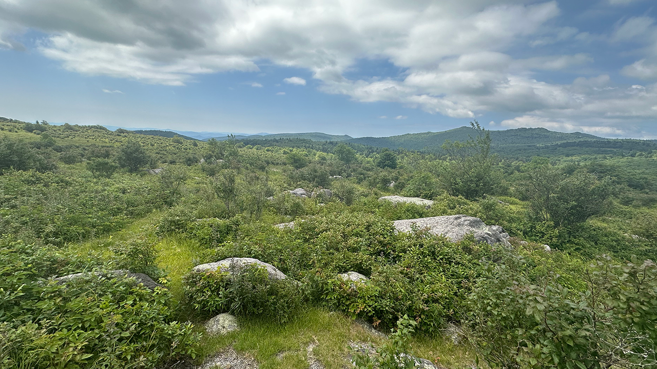
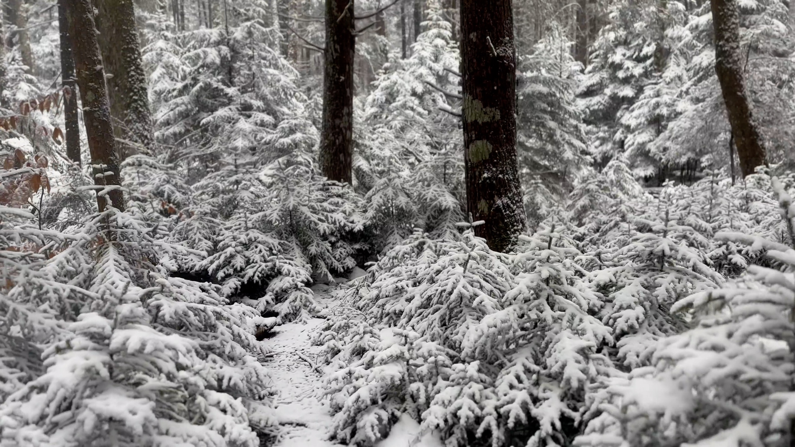
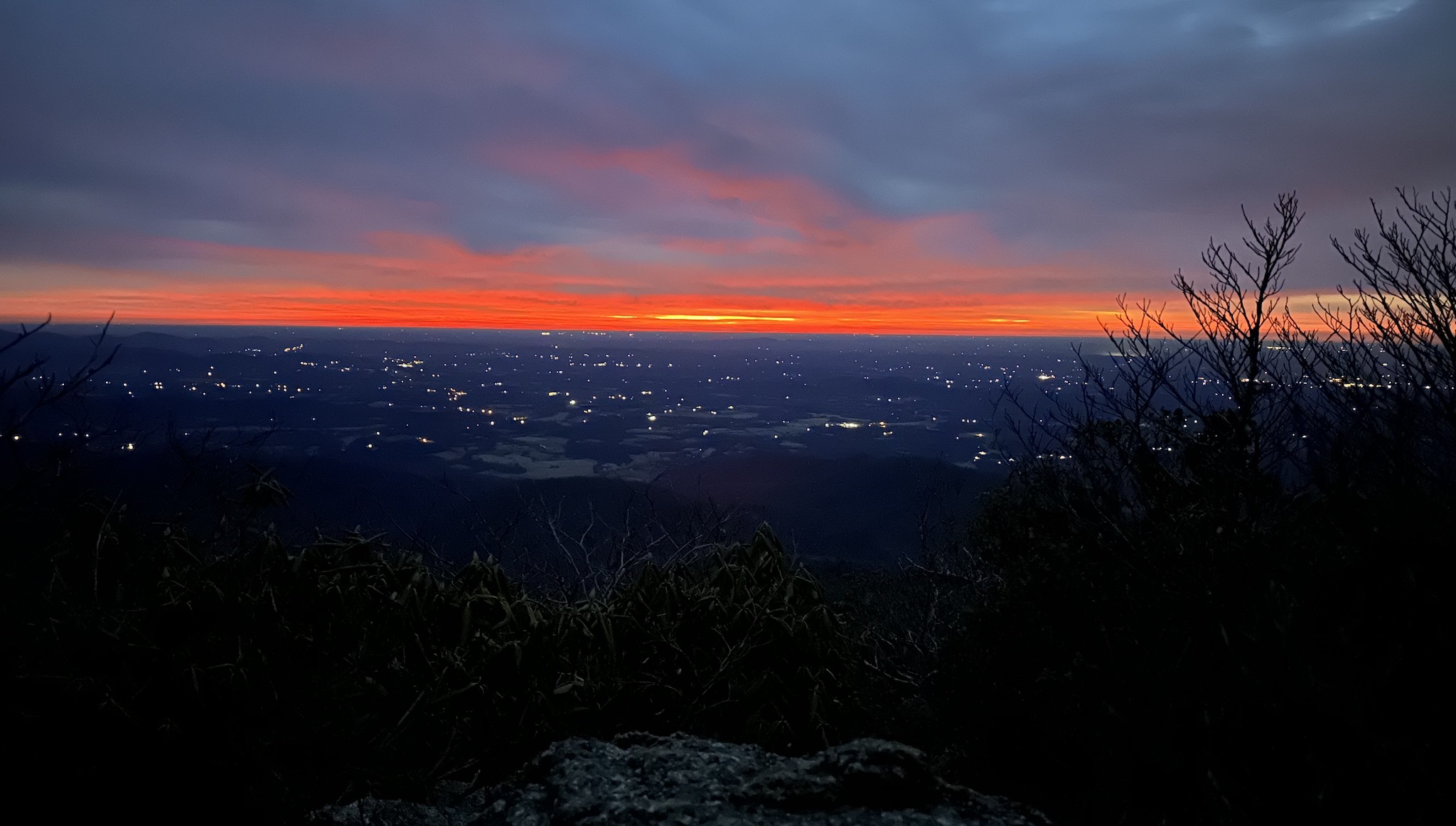
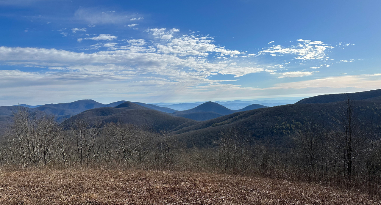
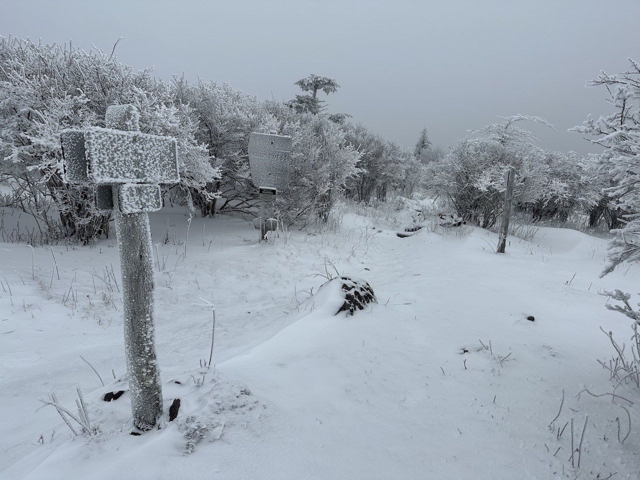
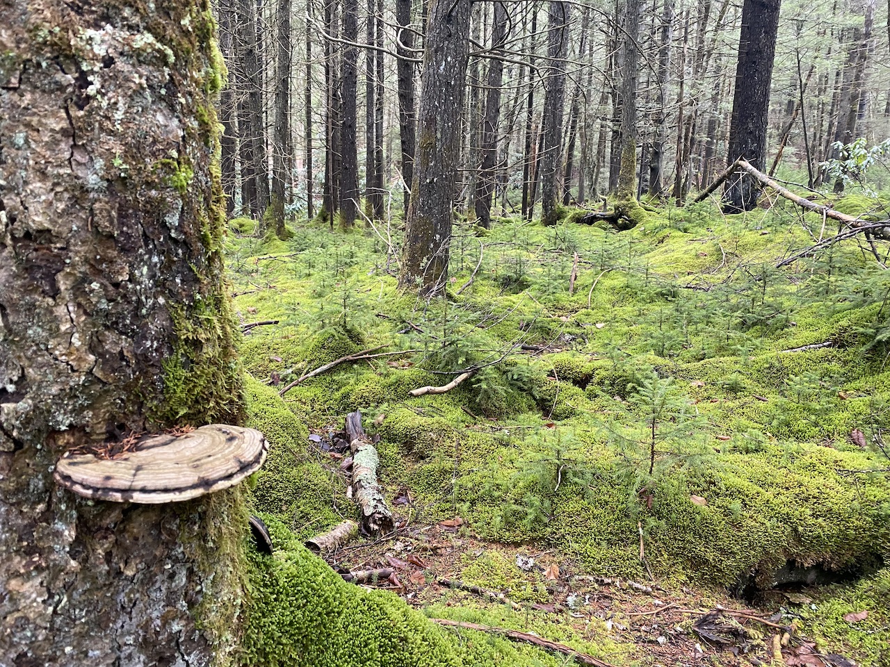
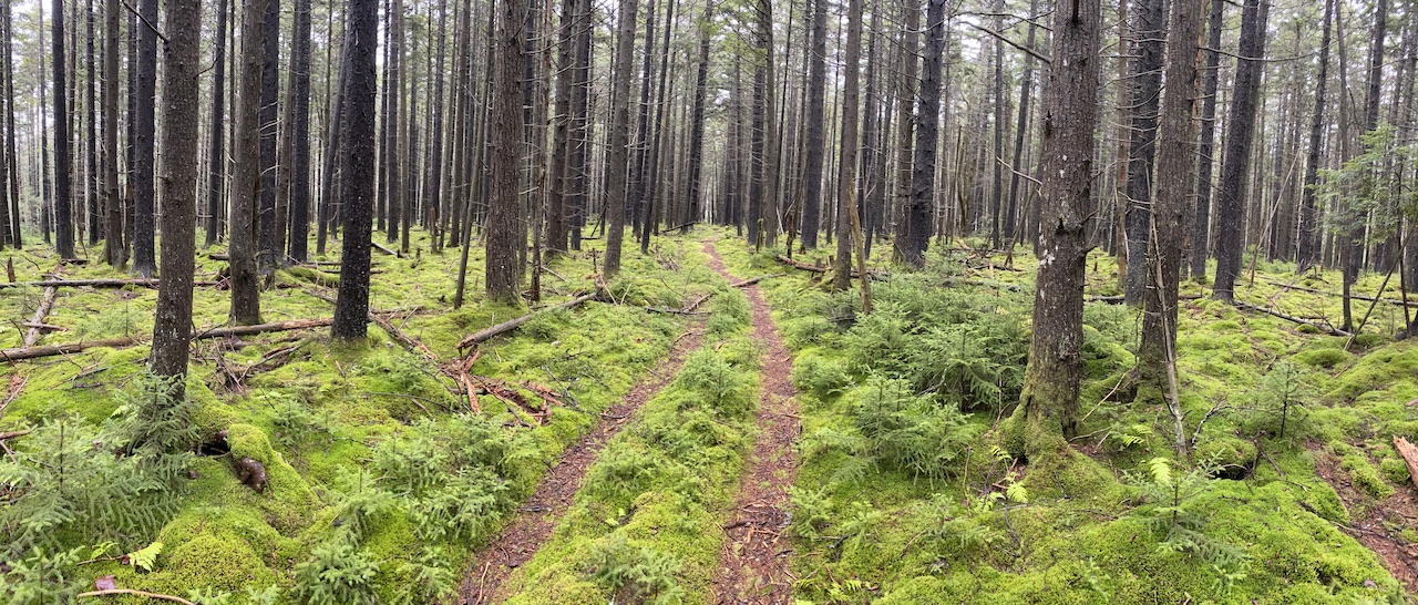
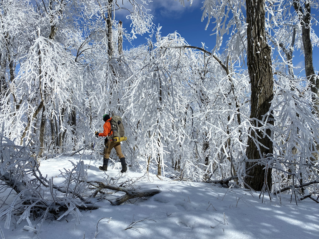
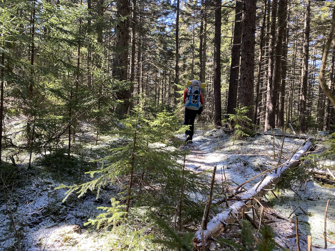
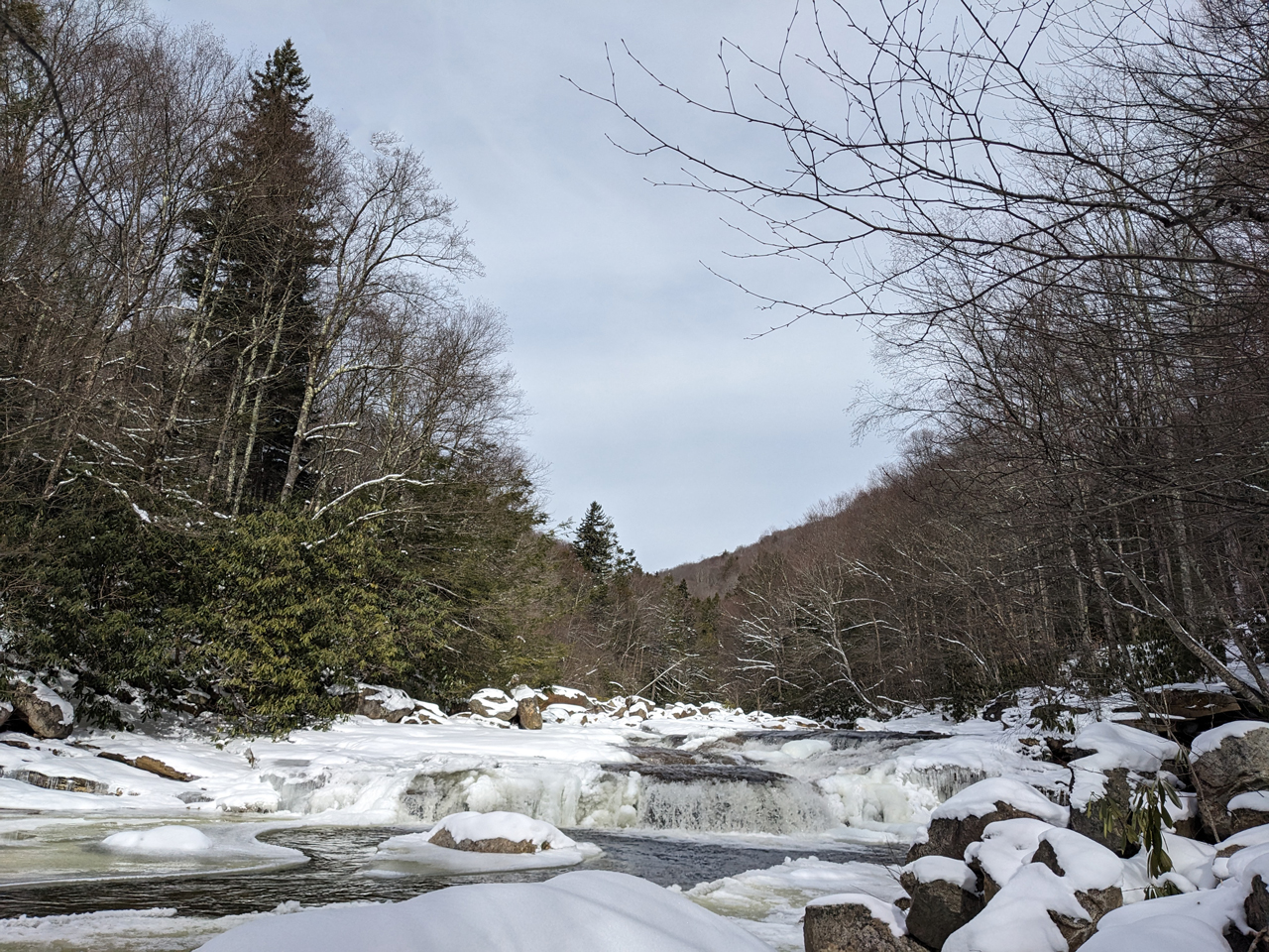
Tag: winter

Backpacking the Cranberry Wilderness: Let it Snow

snow-covered trail
snow-covered trail
A snow-covered North-South Trail (TR 688)

The Monongahela National Forest located in the Allegheny Mountains of east central West Virginia covers more than 920,000 acres and is home to some sweet backpacking destinations including Dolly Sods, Roaring Plains, and the Cranberry Wilderness. For this trip, I invited Rodrigo, and we set our sights on Cranberry.

Situated between the Highland Scenic Highway to the east, the Williams River to the north, and the Cranberry River to the south and west, the Cranberry Wilderness spans 47,815 acres and includes 15 interconnected and unblazed trails covering over 75 miles with elevations ranging from 2,400 to over 4,600 feet. In the winter it’s crazy cold and the chance for snow is always looming overhead.

READ MORE

Backpacking Mt. Pleasant to Seeley-Woodworth AT Shelter

sunrise from a mountaintop
view of mountains from ridgeline
View from Tar Jacket Ridge

In November 2019, I ran the Mountain Masochist 50-mile trail run from Monroe to Montebello, Virginia with my buddy, Coop. During the race, we completed a 5-ish mile loop around Mt. Pleasant, an aptly named national scenic area with picturesque views. As we finished the race, and for the next couple of years, we talked about returning to the area with backpacks, but we never did, until we did.

READ MORE

Backpacking Mt. Rogers and Iron Mountain: The Cold Changes Things

trail junction in the snow
Lewis-Fork Trail/Pine Mountain Trail junction.

The Mount Rogers National Recreation Area (NRA), a nearly 200,000 acre National Forest in southwestern Virginia is one of my favorite backpacking destinations. Sure the terrain can be challenging and the weather is often unpredictable, but there are wild ponies, the Appalachian Trail (AT) runs through the area, the views are magnificent, and it can be exceptionally peaceful when there is snow on the ground. It’s a place I keep coming back to and a place I thought I’d take a friend of a friend, Rodrigo, for his first winter backpacking trip in the southeast.

READ MORE

Backpacking the Cranberry Wilderness: Wet Trails and Bears

mushroom on a tree with ferns in the background
trail through spruce pines with ferns and moss all around
North-South Trail (TR 688) in the Cranberry Wilderness.

The Monongahela National Forest in West Virginia is home to some of the best backpacking options on the east coast including Dolly Sods, Roaring Plains, and the 47,815-acre Cranberry Wilderness. For this trip, my brother-in-law, Ken, and I decided to hit up the latter.

Situated between the Highland Scenic Highway to the east, the Williams River to the north, and the Cranberry River to the south and west, the Cranberry Wilderness includes 15 interconnected, unblazed, and well-maintained trails covering over 75 miles with elevations ranging from 2,400 to over 4,600 feet. The wilderness is home to deer, turkeys, rabbits, mink, grouse, bobcats, and foxes, and is a designated bear sanctuary.

READ MORE

Backpacking the James River Face Wilderness: A frozen wonderland

hiker walking snowy trail with ice-covered trees all around
Walking the AT across Highcock Knob.

When my buddy, Coop, suggested we hit the trails for a February backpacking trip we kicked around some ideas: Cold Mountain and Mt. Mitchell in NC, Cranberry Wilderness in WV, and Mt. Pleasant and Apple Orchard in VA. To refine the list, he put together a handful of options in each location before we ultimately decided on the James River Face Wilderness in Jefferson National Forest between the James River on the north and Blue Ridge Parkway to the south.

The James River Face Wilderness is an 8,907-acre area located near Natural Bridge, Virginia that includes several well-maintained trails including the iconic Appalachian Trail (AT) which passes over the 623 foot James River Foot Bridge, and the Belfast Trail which leads to the Devil’s Marbleyard and its colossal, car-sized Antietam Quartzite boulders.

READ MORE

Backpacking Mt. Rogers Recreation Area: Always a bear track, never a bear

campfire in the snow
Campfire in the snow
Campfire at the Hurricane Mountain AT shelter

Winter is arguably the best season for backpacking. Top 4 for certain. Sure, I shake uncontrollably between the fire and my sleeping bag, and my nose runs like an open spigot, and I generally cannot feel my toes, but it’s also peaceful, quiet, and serene. Oh, and let’s not forget about the snow. Man I love snow!

With COVID-19 still running amuck, my brother-in-law, Ken, and I were desperate to stave off cabin fever and get outside. Our only criteria: water and fire. Looking around, we considered Pisgah National Forest, Mt. Rogers National Recreation Area, and Monongahela National Forest before deciding on Mt. Rogers and its nearly 200,000 acres of National Forest in southwestern Virginia.

READ MORE

Backpacking the Cranberry Wilderness: Whole lotta yes!

hiker walking down an icy trail
Headed out on North-South Trail

The Monongahela National Forest in West Virginia is home to some of the best backpacking options on the east coast. My buddy, Coop, and I had already visited Dolly Sods and Roaring Plains within the forest, but we hadn’t had a chance to check out the 47,815 acre Cranberry Wilderness.

Situated between the Highland Scenic Highway to the east, the Williams River to the north, and the Cranberry River to the south and west, the Cranberry Wilderness includes more than 15 interconnected, unblazed, and well-maintained trails covering over 75 miles with elevations ranging from 2,400 to over 4,600 feet. Black bears are abundant and share the Wilderness with deer, turkeys, rabbits, mink, grouse, bobcats, and foxes.

Sounds awesome, right? Absolutely, that’s why we went.

READ MORE

Backpacking the Birkhead Mountains Wilderness: Gnats, gnats, and more gnats

father and son camping
boy backpacks through woods
Hiking in the Birkhead Mountains Wilderness.

The Uwharrie National Forest was the destination for my son’s first two backpacking trips. It’s close to home, the trails are manageable for a young backpacker, and the chances of being eaten by a bear are next to zero. For his third trip, I was thinking of heading up north to Grayson Highlands or west towards Pisgah, but opted to suggest a return to Uwharrie via the Birkhead Mountains Wilderness as we were expecting a couple other people to join us.

Established by the 1984 North Carolina Wilderness Act, the Birkhead Mountains Wilderness includes 5,000+ acres at the northern end of the oldest mountains on the North American Continent, the Uwharrie Mountains. It was used by early Native Americans over 12,000 years ago, explored by Europeans in the late 1600s, settled in 1760, and expanded by John Watson, son of the Birkhead family, in the late 19th century. Today, the Birkhead Mountains Wilderness has over 16 miles of designated hiking trails (i.e. horses, motorized vehicles, and mountain bikes are prohibited) that are enjoyed by hikers, backpackers, and trail runners.

I shared what I knew about the area with my son, broke the news that our two friends had to back out, and let him rethink our destination. In the end he chose Birkhead.

READ MORE

Backpacking Uwharrie from Yates Place with LEGOs and an 8-year-old

hiker smiling
father and son selfie in the woods
The journey begins!

Each year I try to work in a winter backpacking trip. This year, I waited up until the last minute to start asking around and couldn’t get any takers. Determined to still go, I looked into places for a solo overnight trip. To the north, near Mt. Rogers Nat’l Rec Area, the forecasts were calling for temps in the teens, winds between 20 and 30MPH, and 10+ inches of snow. To the south, in the Uwharrie National Forest, temps were forecasted between 50°F and 60°F and rain was a certainty. The latter got me thinking.

Since the weather to the south was forecasted to be mild, I thought maybe, just maybe, my wife would be OK with my son joining me on a winter trip. I asked. She agreed. I asked my son. He agreed. Thank you backpacking gods!

READ MORE

Backpacking Iron Mountain Trail: Crocodiles and Misdirection

Crocodile A-T checks the map
Photo by Coop

Backpacking in the winter can be a challenge due to the uncertainty that accompanies the cold season. However, if you’re willing to accept the risk, the rewards are incredible. For that reason, my buddy Coop and I make it a point to plan a yearly winter trip. More often than not, we find ourselves in the Mount Rogers National Recreation Area (NRA), a nearly 200,000 acre National Forest in southwestern Virginia. This year, Coop suggested we continue the trend and return to the NRA to tackle the northern section of the Iron Mountain Trail (IMT).

The yellow-blazed Iron Mountain Trail spans 47 miles from Highway 91 near Tennessee in the south to VA16 at Iron Mountain Gap in the north. Up until 1972, the IMT was part of the Appalachian Trail when it was relocated to the south to accommodate communication towers and power lines in order to maintain the secluded experience hikers have come to expect from the AT. The IMT is well-maintained thanks to local volunteers, has an old AT shelter in the northern section that’s in great condition, and as it turns out, is also the perfect location for our latest adventure.

READ MORE