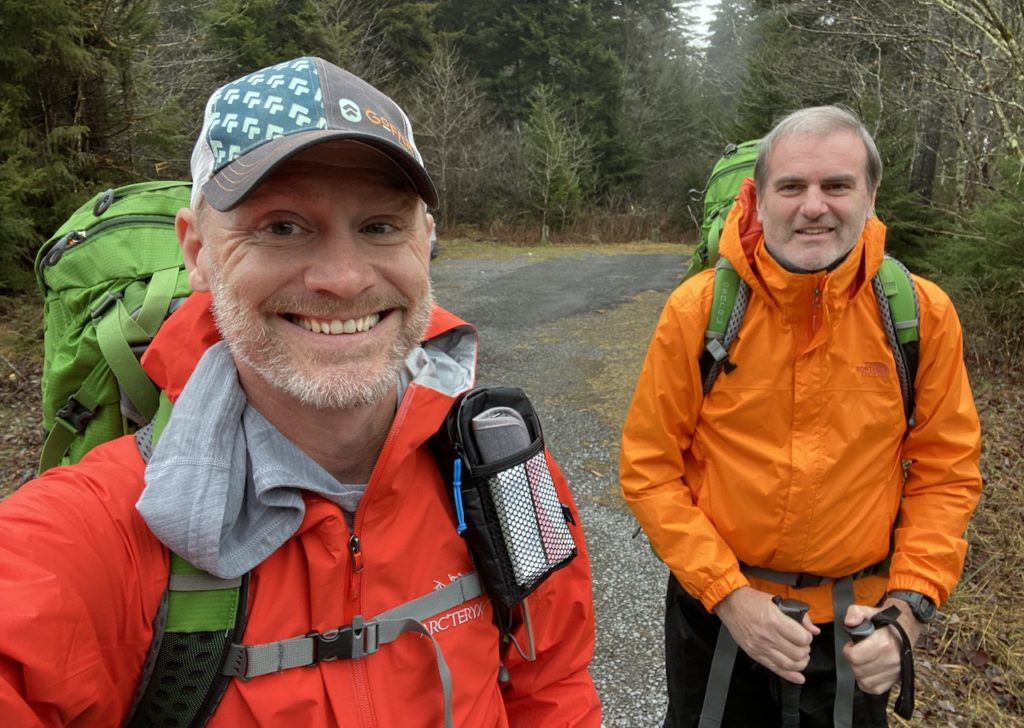
The Monongahela National Forest in West Virginia is home to some of the best backpacking options on the east coast including Dolly Sods, Roaring Plains, and the 47,815-acre Cranberry Wilderness. For this trip, my brother-in-law, Ken, and I decided to hit up the latter.
Situated between the Highland Scenic Highway to the east, the Williams River to the north, and the Cranberry River to the south and west, the Cranberry Wilderness includes 15 interconnected, unblazed, and well-maintained trails covering over 75 miles with elevations ranging from 2,400 to over 4,600 feet. The wilderness is home to deer, turkeys, rabbits, mink, grouse, bobcats, and foxes, and is a designated bear sanctuary.
THE PLAN
Regardless of forecasts, the weather in the Monongahela Nat’l Forest is unpredictable and the Cranberry Wilderness is no exception. Thankfully, Cranberry has many miles of trails which allow for multiple bailout options should weather become an issue. And, since the wilderness is not well marked (signs at trails, but no blazes) and getting lost is a real possibility (I have experience), navigating the trails requires proper navigational tools including a detailed map, compass, and GPS devices with routes pre-loaded.
Using a slew of online resources (AllTrails, GaiaGPS, CalTopo, Garmin Connect, and Google Earth) and the North-South Trailhead off the Highland Science Highway as our entry point, we mapped out a pair of routes. The first, a 20-mile route, took us west on North-South Trail, south/southeast on Birchlog Trail, then back east/northeast following the Cranberry River along North Fork Trail. The second, a 24-mile route, took North-South Trail west for a short bit, north on North Fork Trail, west on Middle Fork River/Trail, south/southwest on Laurelly Branch Trail, west on North-South, south on Birchlog Trail, and finally east/north on North Fork, and North-South back to the car.
After a great deal of consideration, and an obsessive and unhealthy amount of reloading weather forecast webpages, we opted for the 20-mile route since forecasts were calling for a poop ton of rain and we didn’t want to cross swollen rivers. As a backup, we planned to avoid water crossings entirely by picking up Tumbling Rock off North Fork Trail and hiking it up to North-South where we’d take it straight back to the car.
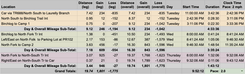
To that end, we built out our 20-mile trip route in a spreadsheet based on a 2.0 MPH pace…
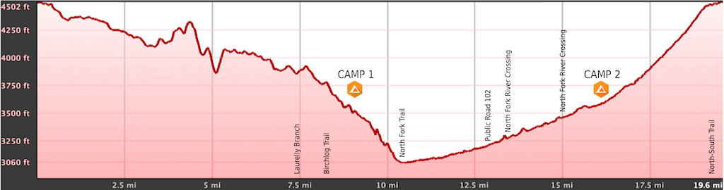
…created an elevation profile
…dropped in the route
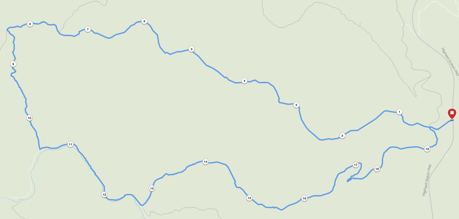
…and packaged it all in a map that we printed on TerraSlate paper.
PACKING IT IN
The decision between hammock and tent came down to how cold it would be as I don’t have an underquilt rated below 30°F. I closely watched the forecast, secretly rooting for warmer-ish weather because my back and shoulders are big fans of hammocks. Big fans.
Ten days out temperatures were forecasted in the teens for the first two days and 20s the third, winds were moderate with gusts between 30-40MPH, and rain chances hovered right around 40% for the whole trip. A week out, the forecasted temperatures ranged between 30°F and 45°F, winds were around the same, and rain chances changed slightly to 60% Day 1, 80% Day 2, and 75% Day 3. Three days out, temperatures were to range between 40°F and 60°F, winds were mild with gusts around 25MPH, and rain chances increased across the board: 80% Day 1, 100% Day 2, and 90% Day 3. The day before our trip, temperatures were still looking good, 40°F-60°F, winds were about the same (mild with moderate gusts), but the prospects of heavy rain became increasingly worrisome; more than 1.6″ of rain forecasted to start the evening of the first day and lasting until we returned to the car on the third.
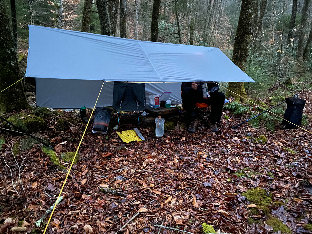
Since it’d be warm, I went with my hammock, 30°F underquilt, and 10°F sleeping bag (on the off chance it wasn’t going to be that warm). To combat the rain I packed a nylofume pack liner, backpack cover, rain pants, rain coat, and a 10′ x 8′ Paria tarp for us to sit under at camp. I also brought two extra pairs of socks so I always had a dry (and warm) pair to sleep in.
With everything loaded, including water, rain gear, and food, my 50L Atmos weighed in at 31 lbs. 3.1 oz.
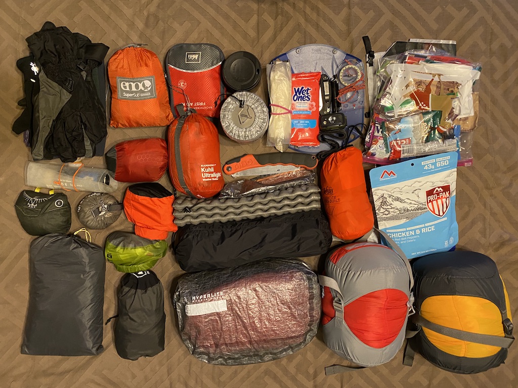
Download my full list of gear I brought
DAY 1 (9.17 MI | +217′ GAIN | -1,541′ LOSS)
We set out at 6AM and made the 4-hour drive to a parking lot across from the North-South (TR 688) Trailhead. Along the way we decided it’d be best to complete our route in reverse so we wouldn’t have to deal with rising water levels on account of the second day’s deluge. Upon arrival, the air was frigid, sky was cloudy, and there was a mist that made everything a wee cooler. Knowing the cold wouldn’t last long, we dressed for warmer temps, loaded up, and hit the trail at 11:23AM.
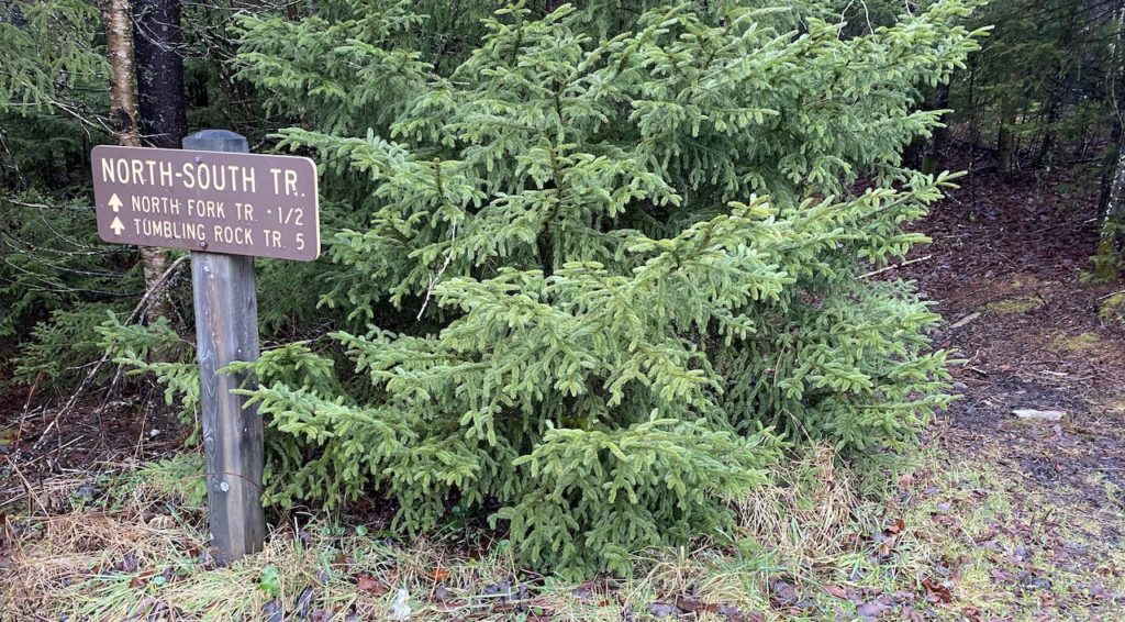
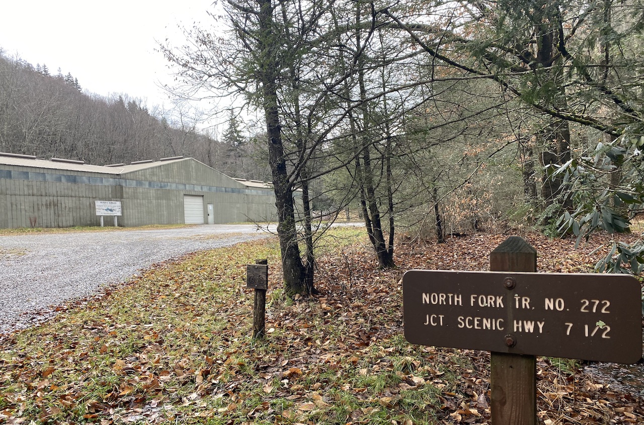
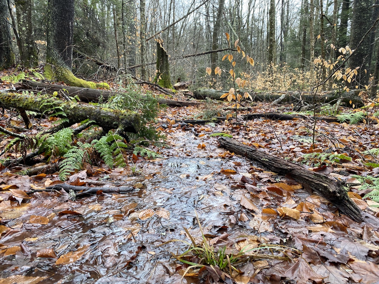
From the North-South Trailhead we headed west along the muddy, puddle-laden trail, passed a campsite and a kiosk with a map of the Cranberry Wilderness a tenth of a mile later, continued for another 0.28 miles, and hung a left/south onto North Fork Trail (TR 272); an old road that was used until the area become a designated wilderness in 1983.
We descended south/southwest on North Fork Trail for 1.3 miles, sloshed around a wide, shallow, and muddy creek, hopped over a rockier creek 0.75 miles later…
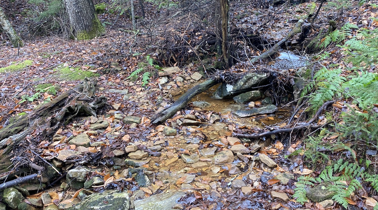
…and eventually arrived at Left Fork (a tributary of the North Fork Cranberry River) 0.2 miles later.
The Left Fork crossing required some technical maneuvering, but wasn’t overly difficult. That said, if the water was higher and flowing harder, I imagine this crossing and the next one at North Fork Cranberry River would be quite difficult and dangerous.

From Left Fork, we followed the trail as it switched back to the south/southwest, stopped to shed our rain jackets, and then continued on down the old road. Around the 3.6 mile mark we passed our intended second night’s campsite on the left/south, and a tenth of a mile later we passed another, larger site, also on the left. It’s worth noting that both sites were fairly close to the river and neither would be ideal if it swelled.
About 4.3 miles from the car, a pair of cairns and a handful of logs redirected us up the mountain and around a washed out section of the trail/road. I’d like to say that I saw them at first, but I walked right by them and through thick, foul-smelling mud, before realizing that the trail might not go in the direction that I was headed.
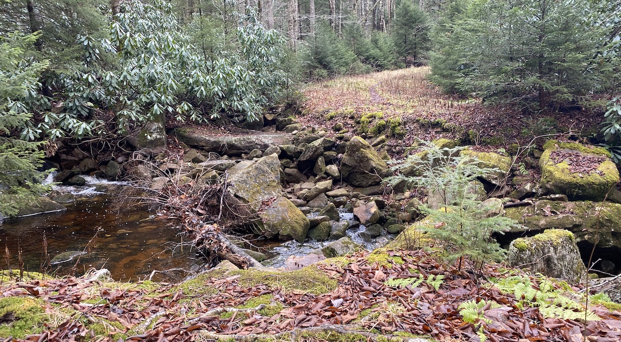
We then retraced our steps and made the short climb up and over to the other side where the road, the river, and a pair of bridge abutments were waiting for us.
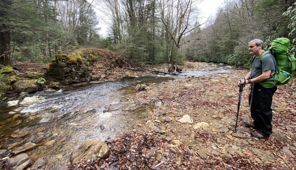
To our delight, the river was calm and seemingly passable. To our dismay, there wasn’t a dry path across so we removed our boots and socks, rolled up our pants, and crossed the frigid, ankle-to-knee deep water in our bare feet.
After carefully shuffling our feet across the slippery rocks, we reached the other side of the river, laced up, and continued west down North Fork Trail. A quarter mile later, around Mile 5, the trail disappeared. As in POOF! Gone.
We looked around, looked at the map, and studied our Garmins, but there was no sign of a trail. The only thing that looked to be a possibility was a thin muddy path of loose rock and mud leading back down to the river’s edge. With nowhere else to go, we took the path and followed the river bank for a tenth of a mile before it was safe enough to climb back up.
When we did, we ended up back on North Fork Trail. To our left/south, the trail appeared to continue back east into a dense thicket of trees. In front of us, a sign pointing to North Fork Trail sat at the bottom of a trail that went up the mountain to the southwest. To the right, the North Fork Trail we came to know and love ran west.
Honestly, I don’t know if the trail leading back east was the North Fork Trail or the trail marked North Fork Trail was the correct path. In any event, we weren’t headed back whence we came so it didn’t matter. What mattered was that we were back on the trail and headed in the right direction (which was west, BTW).
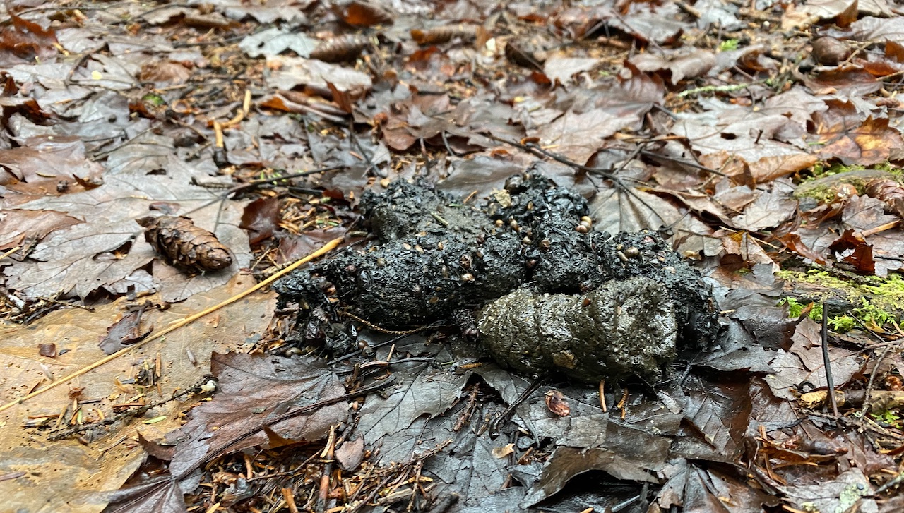
A mile later my heart rate spiked as I spotted a small bear coming out of the woods and crossing the trail not but 10 feet in front of me.
ME: BEAR!
KEN: WHERE?
ME: THERE!
KEN: BEAR!
Within seconds, the bear (who was apparently terrified to learn there was a bear nearby) turned around and sprinted back up the mountain. As we passed we whistled and yelled “Hey bear!” and spent a little extra time looking over our shoulders, you know, just in case.
Some might say, “Eh, it’s just a bear.” But for me, it was my first encounter in my 15 years backpacking. I was stoked. I was also super glad it ran off. Thank you bear!
Around Mile 6.25 we came across a trail sign lying on the ground next to a rock. From what I could tell the sign was the start of the seemingly unmaintained and overgrown Forks By-Pass Trail (TR 273) which leads to the Forks at Cranberry Trailhead. BTW, apart from the Forest Service’s color-coded trail map, the Forks By-Pass Trail didn’t appear on any other map I had seen.
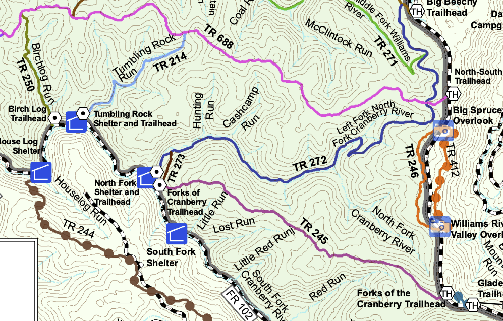
We kept moving west for another half mile before arriving at the Peter E. Zurbuch Cranberry River Neutralization Station (a big structure on the southern side of the river used to restore the PH levels to the waterways AKA “the liming station”).
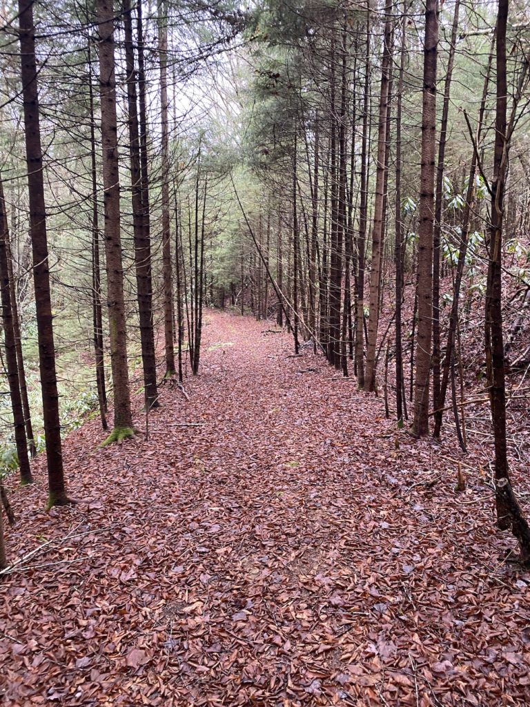
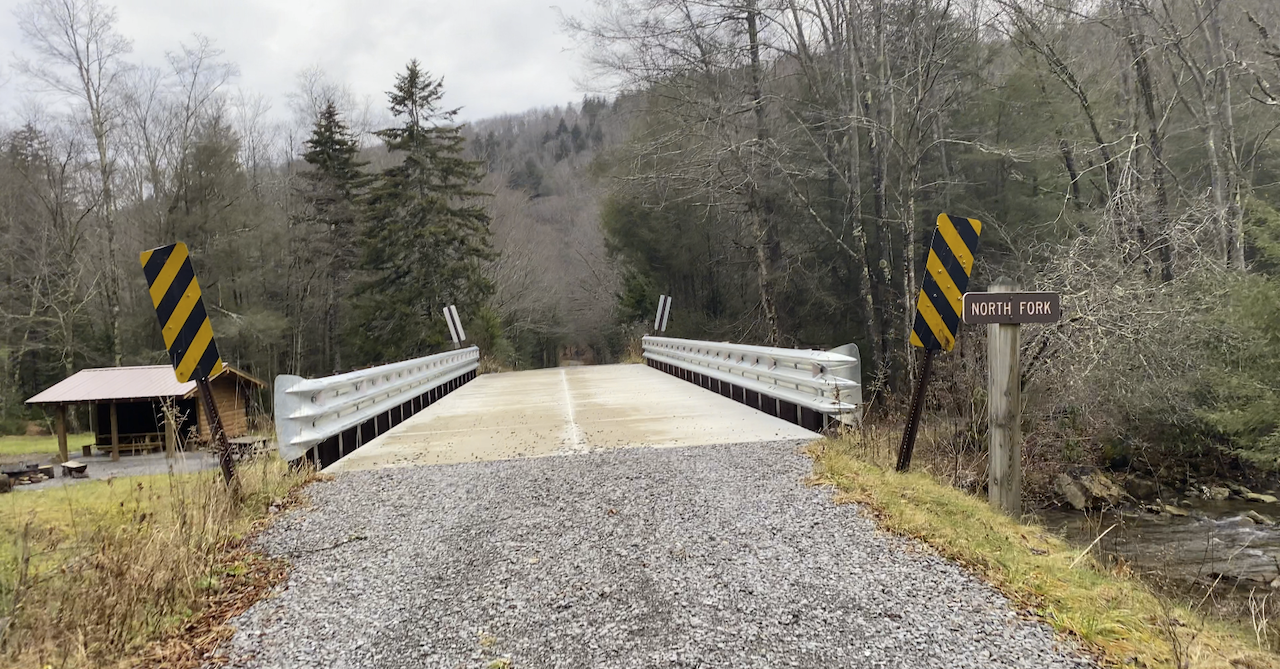
From the liming station we turned right onto Public Road 102, continued north on North Fork Trail (now a gravel road), crossed a bridge, passed the North Fork Shelter and Trailhead, and walked some more.
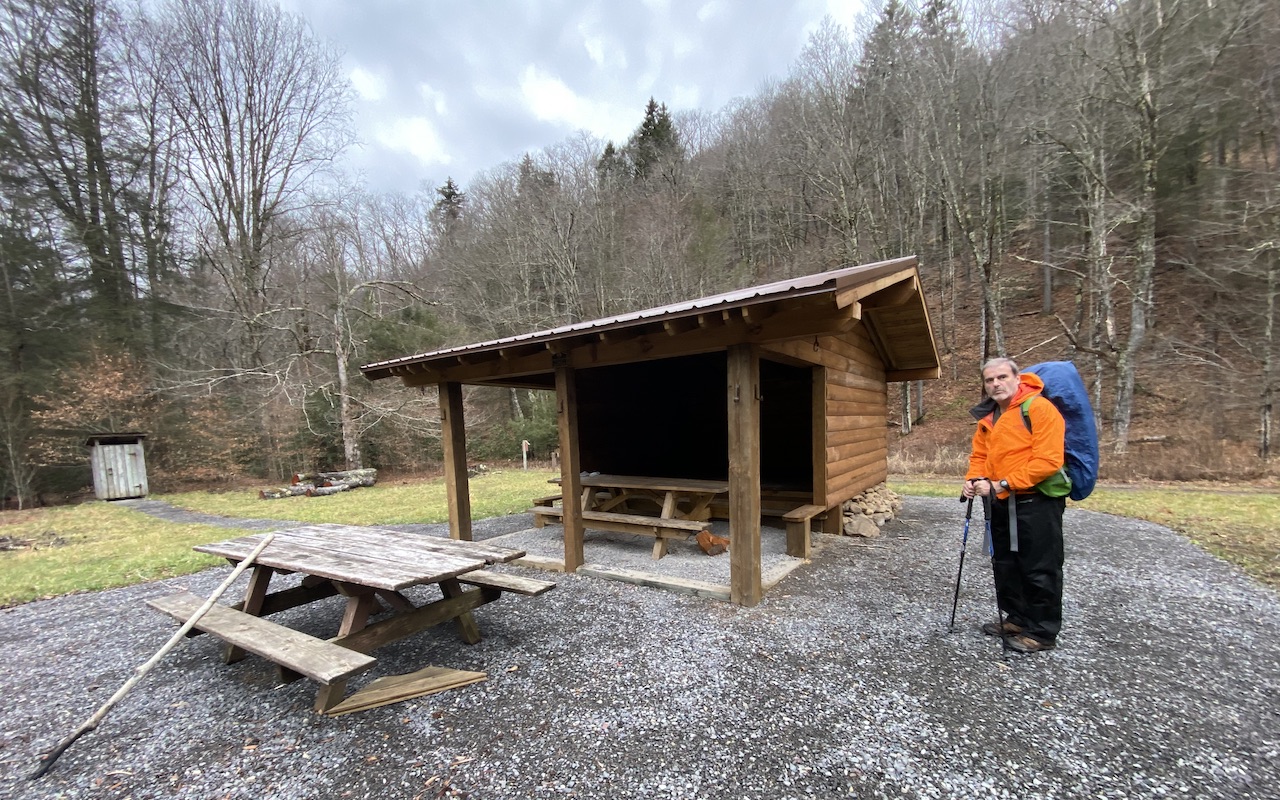
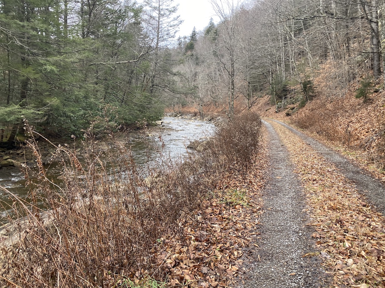
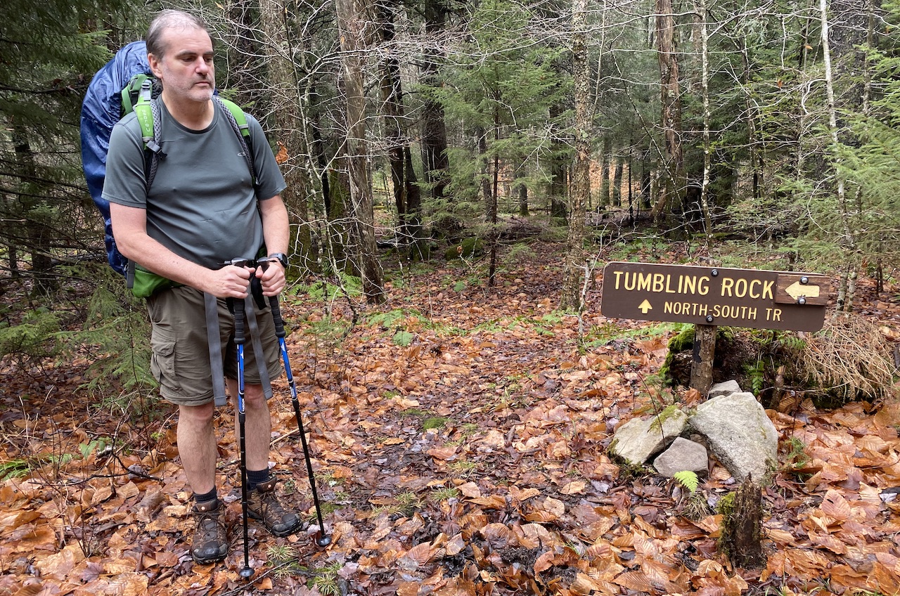
About 2 miles from the station, after passing several campsites along the river and a sign that warned of flooding hazards, we reached the Tumbling Rock Trailhead on the right/north and the Tumbling Rock shelter on the left/south. We chatted about staying at the shelter, but abandoned the idea because A) it wasn’t in the woods, B) it wasn’t ideal for hammocks, and C) if the river flooded we’d be in trouble.
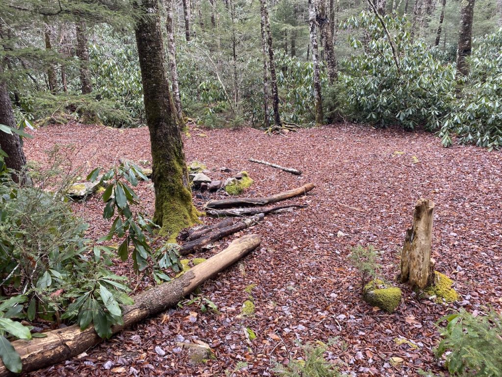
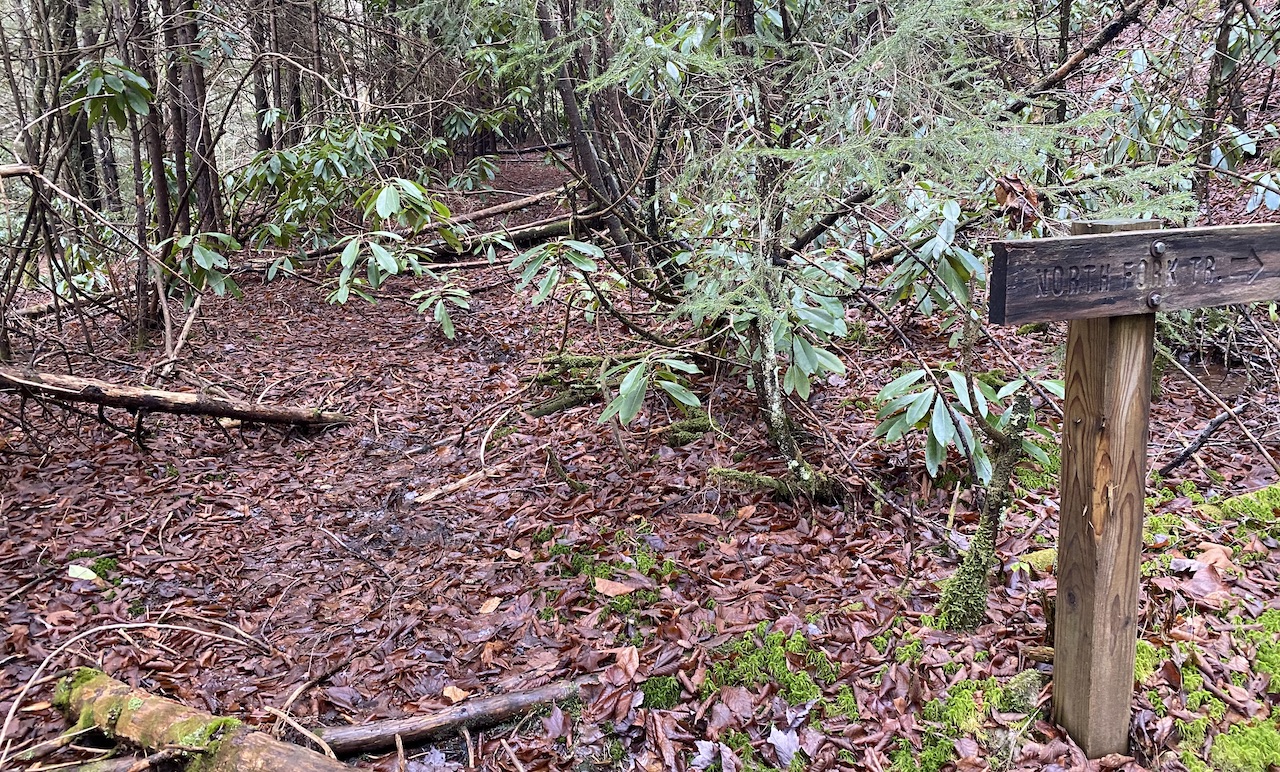
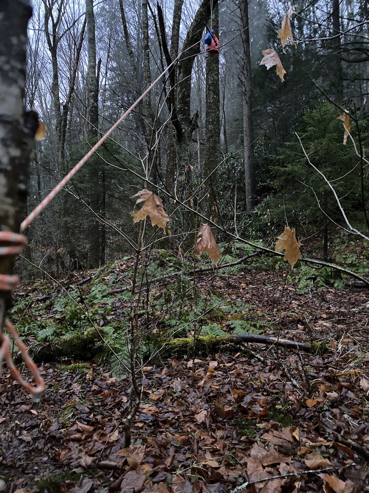
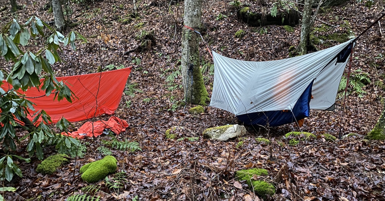
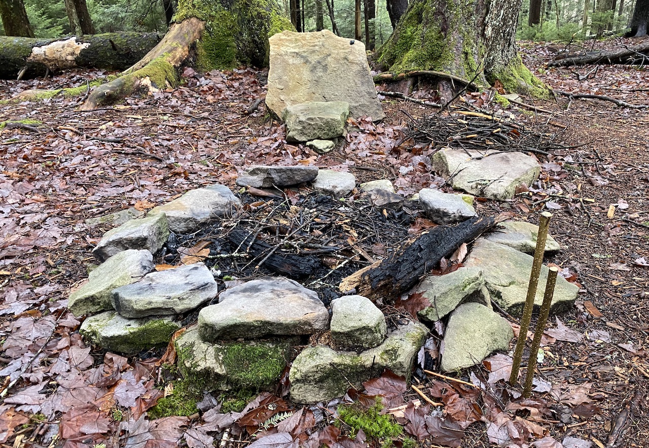
Back on the road we walked another half mile, turned right/north onto Birchlog Trail (TR 250), and began looking for places to camp. Our search lasted about a quarter mile as Ken spotted a nice spot off the trail just as the rain started in.
We quickly set up shelters, hung the tarp, and threw up a bear bag line. Once camp was made, all that was left to do was a whole lot of nothing which we totally nailed for several hours.
DAY 2 (8.24 MI | +2,011′ GAIN | -851′ LOSS)
Rain tapered off by the morning and the temperature hovered in the mid-40s. Around 7AM, with Ken still resting, I started packing up whilst lying in my hammock (I’m not lazy, I’m efficient). Once I had nearly everything broken down, I grabbed the food bags, and started in on breakfast.
We lollygagged for a while, finished packing, and headed out at 9:24AM—pack covers on and rain coats at the ready. From the site, we jumped on Birchlog Trail and began the 2-mile, 500-foot climb to North-South Trail; whistling as we went because we were both fairly satisfied with a single bear sighting.
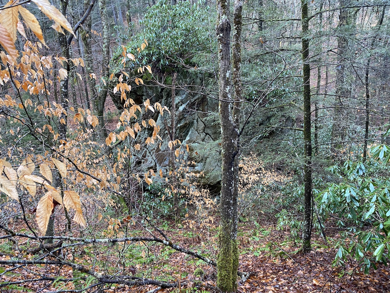
A quarter mile up we passed a campsite down the hill at the base of a huge rock formation. Further up the trail we passed another site next to Birchlog Run about 0.75 miles from North-South, and a third site, also next to the water a tenth of a mile later.
At the North-South/Birchlog intersection, my phone picked up a signal so I attempted to text my wife that we were OK and that we were doing the 20-mile route in reverse. Sure, it would’ve been nice to tell her the day before, but we didn’t have a signal when we arrived or at any point throughout the previous day’s hike and we were still doing the same route I said we were doing just in the opposite direction.
I quickly hit send thinking the cellular gods would take pity on me and let my message pass, but they were clearly still angry with me for grandfathering in an old, cheap data plan because the text didn’t go through any of the three times I tried to send it over the mile we hiked between Birchlog and Laurelly Branch (TR 267).
At Laurelly Branch, as if by some divine clerical error, my message finally made it through to my wife just as I walked through a(nother) muddy section of the trail.
ME: Squish.
KEN: Squish.
ME: Squish.
KEN: It’s a rule that all trails in Wet Virginia must also serve as a water source.
ME: Squish. Squish.
KEN: Squish.
ME: Squish.
Seriously though. If I had to guess (and I can’t imagine a scenario where that would be a reality, but if I was in a life-or-death situation and I did have to guess) I’d say 70% of the trails could be stocked with trout. Just remember, waters in the wilderness area are catch and release.
At the Laurelly Branch Trail/North-South Intersection there are a few campsites. One just west of the intersection, one at the intersection, and one more just up the trail. None of them have water, but there is a reliable source about a half mile down Laurelly Branch (I stayed there on a previous trip to the area).
We passed another two campsites on North-South Trail as we walked the 2.75 miles to Tumbling Rock where a third site sat at the bottom of a very steep hill.
GARMIN: 500 feet ascent. 0.85 miles. Average incline: 9%.
ME: ಠ_ಠ
KEN: ಠ_ಠ
GARMIN: ◕‿↼
KEN: At least it’s not raining.
He was absolutely right. The forecast had called for 100% chance of rain all day with totals nearing an inch and we hadn’t seen a drop. In fact, throughout the day we caught a glimpse of the sun…twice! Silver lining?
Anyway, after what felt like forever, we reached the top of the climb and enjoyed a brief downhill reprieve. We then picked up the pace and discussed our campsite options. We could hike 2 miles to a site that only appeared on a particular CalTopo map layer, or we could hike 4 miles all the way back to the car and stay 0.1 miles from the Scenic Highway. We were both leaning towards the former option. Fingers crossed.
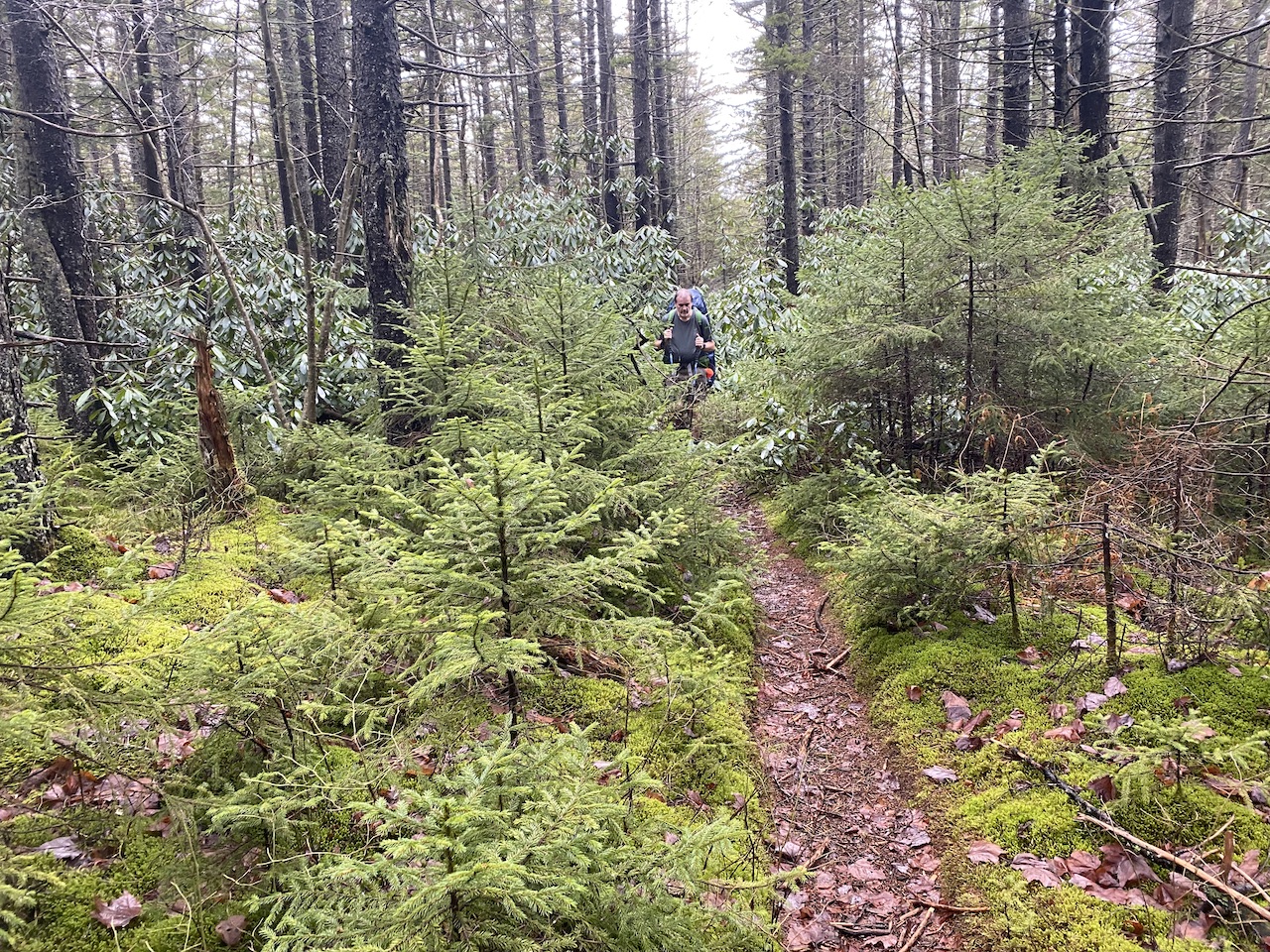
With a mile and a half before we were supposed to arrive at our mythical site the trail became a full-fledged creek (treek? crail? treel?) To get around the ankle-deep water and mud, we followed the paths worn by previous hikers. We took side trails that went around the main trail, and side trails that went around side trails that went around the main trail, and side trails that…you get the idea. No one, not us, not anyone, wanted to walk through water.
Seriously though, if it wasn’t the spruce pines drenching our clothes or the rhododendrons slapping us in the face or the locust trees stabbing us in the arms, legs, and forehead, it was the trails filling our boots with water, soaking our socks, and turning our feet into cold, mushy, prunes.
Anywho, about one mile from our prospective site we saw a really sweet campsite, but kept going. When we were about 0.3 mile from our prospective site we saw another, smaller, but still pretty awesome site, but kept going. When we arrived at the spot where I thought there’d be a campsite, there wasn’t a campsite, so we kept going. Disappointed, we put our heads on a swivel and began looking around for anything that resembled a campsite.
A quarter mile down the trail we spotted a site, walked in, and agreed it would be our home for the night.
ME: Thank you camping gods!
SOTERIA: You’re welcome.
ME: Who are you?
SOTERIA: Soteria, goddess of safety and salvation, deliverance, and preservation from harm.
ME: You mean Eleos?
SOTERIA: Gods no! She’s all about pity and mercy and clemency. I’m all about love and camping and, you know, stuff.
ME: Oh. OK. Well, uh, thanks.
The rain started in when we arrived and stopped once we were finished setting up. Grateful for the rain’s departure, we finished our camp duties and hunkered down under our tarp for some well-earned R&R.
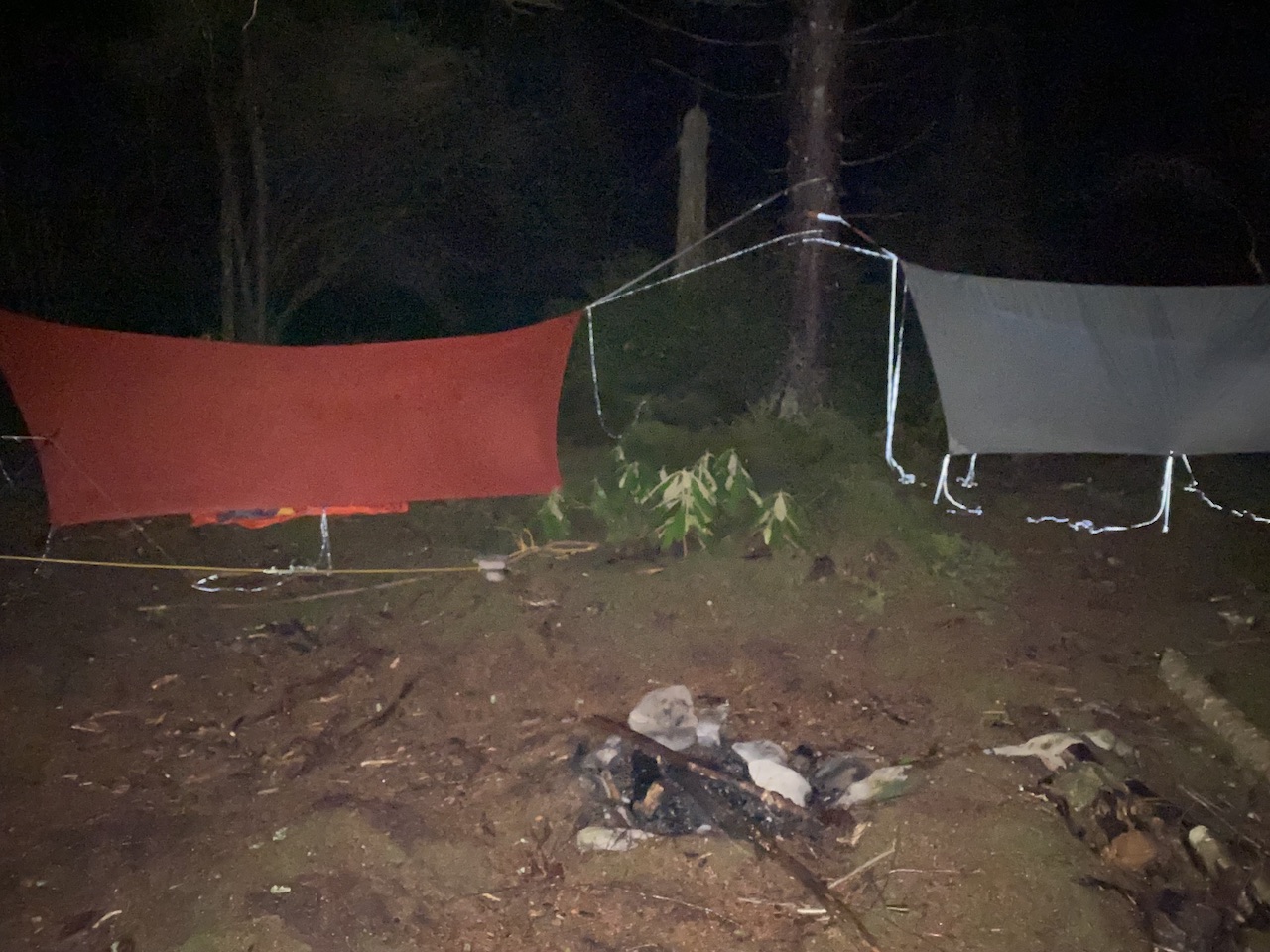
As night fell it took the temperature with it; 39°F according to my trusty keychain thermometer. By 6PM I was putting on long johns and a second wool mid-layer (I also changed my undies and T-shirt because feeling fresh is refreshing). By 7:30PM, our cold boots, body shivers, and lack of fire became too much to endure. Time to turn in.
For the record, I usually go to bed early, but 7:30PM is really, really early. Still, my hammock meant warmth and I was cold so off to bed I went. At some point I woke up feeling rested, warm, and rejuvenated. It was still dark, but I fully expected Ken to be waking up any moment. Then I looked at my watch—10:12PM. Son of a…
Annoyed, I returned to sleep only to wake again around 3:30AM to scream at a monster that wasn’t there (and to pee), and then again around 7AM, when I woke up for real.
DAY 3 (1.83 MI | +229′ GAIN | -60′ LOSS)
We broke camp just as the sun was coming up, skipped breakfast, and were back on the trail by 7:57AM. It was a cool 48°F, slightly foggy, and the air was incredibly still. In the 38 minutes it took us to cover the 1.83 miles back to the car we slid and sloshed our way through and over the muddy, wet trails whistling 80s show tunes and classic rock songs along the way. When we made it back to the car we were greeted by a fresh change of clothes, a pack of wet wipes, and more rain.
Trip complete!
TOTALS (19.2 MI | +2,457′ GAIN | -2,452′ LOSS)
FINAL THOUGHTS
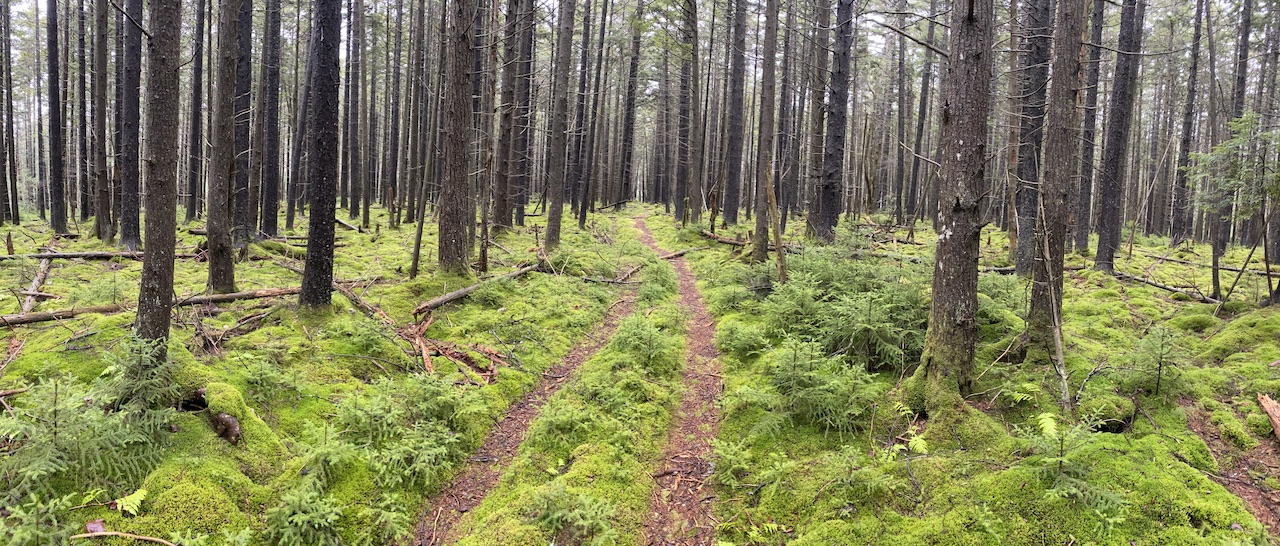
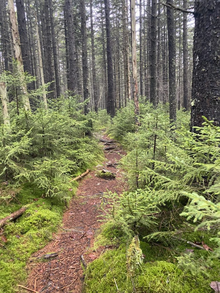
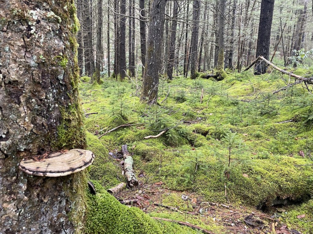
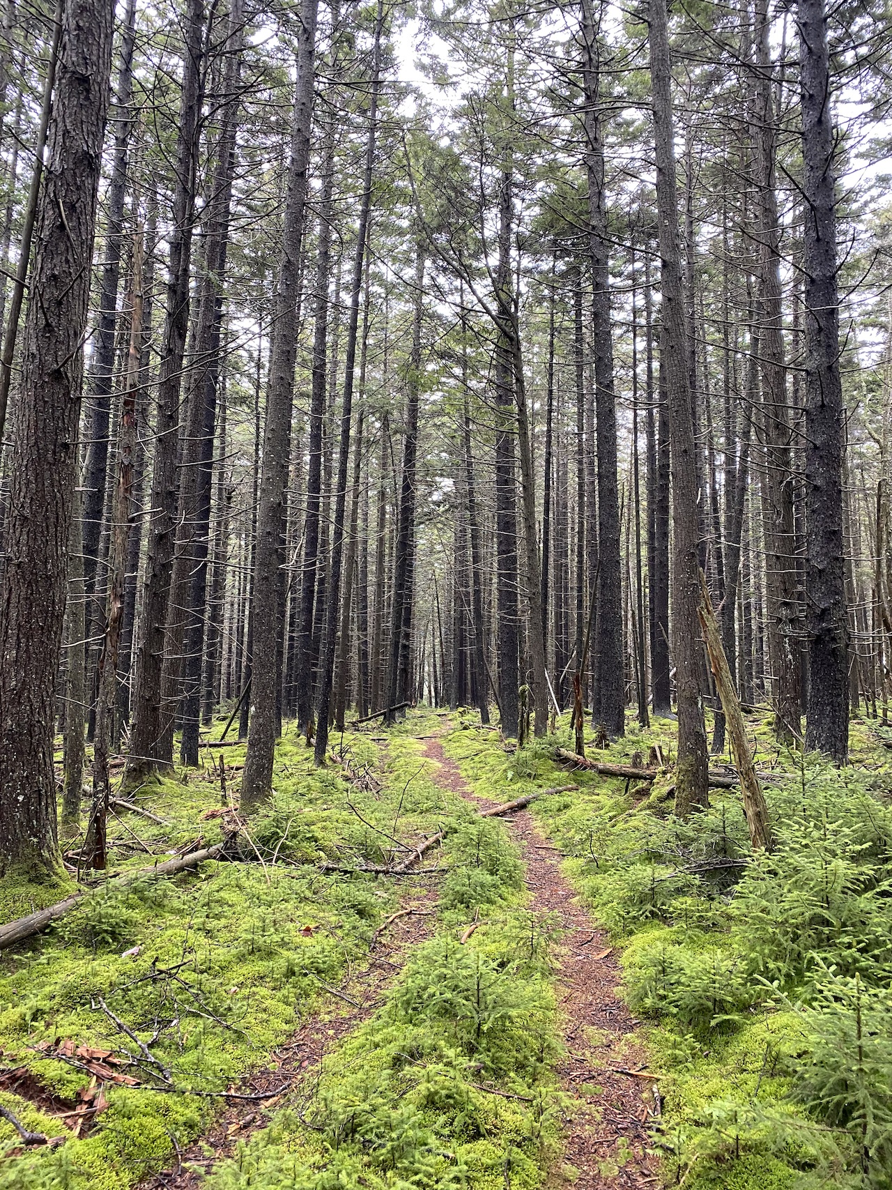
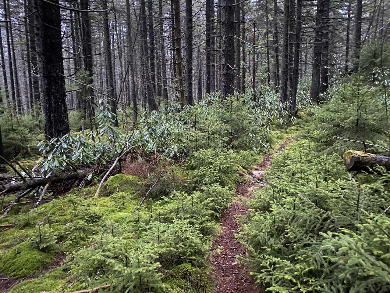
Cranberry is one of the quietest, most breathtaking and serene backpacking destinations I’ve ever visited. As was the case the first time I visited, and in spite of the single set of footprints that marked the trails, we saw no other humans throughout our trip. Beyond the silence and solitude, the flora was amazing. Spruce pines, locust trees, and birch throughout with moss and ferns covering much of the ground. Simply stunning.
If you plan to visit the Cranberry Wilderness, bring water and plan to get dirty (especially if rain is anywhere near the forecast). There is wildlife so eat and store your food responsibly. Also, recognize that the area is a designated wilderness area and doesn’t have blazes the way many locations do so be prepared to get lost regularly, and be sure you have a map, compass, and a GPS device of some kind.
That said, get out there and have some fun! The Cranberry Wilderness awaits!
Would you mind sharing the details behind your spreadsheet and how you create your map (in particular, the mileage marks). Thanks.
Sure thing. I create the route in a mapping application (All Trails, GaiaGPS, CalTopo, etc), export the route as a GPX track, and import the GPX track into Garmin Connect as a course (under Training). On the Garmin Connect site, I click and drag the route sections to highlight them one at a time and the site will display the section’s distance, gain, and loss. Then, I record that information in the spreadsheet and repeat the process for the entire route. The Clock Time and Duration for the spreadsheet uses formulas to calculate the duration based on a start time and pace that I set. To display the mileage marks (as seen in this post) I check a box in Garmin Connect to show/hide them.