Summer is an interesting time to head into the backcountry. Finicky water sources, exhausting heat, pop-up thunderstorms, thirsty ticks, and relentlessly buzzing gnats, skeeters, and flies. But, even with all of its complications, summer is also an awesome time to get outdoors. To that end, my buddy, Coop, and I put together a list of options before agreeing on a section of the iconic Mountains-to-Sea Trail (MST).
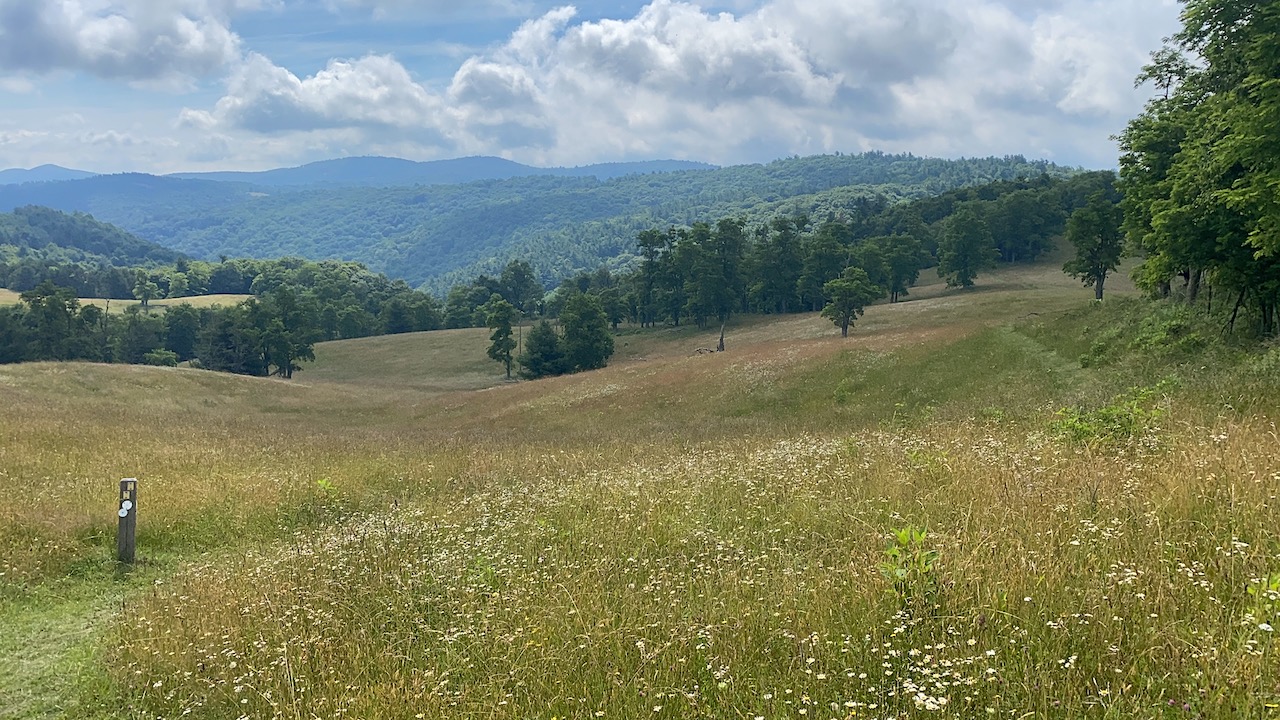
Stretching 1,175 miles from the Great Smoky Mountains to the Outer Banks, the MST includes some of the best of what North Carolina has to offer: mountain vistas, grassy meadows, coastal swamps, dense forests, and miles of shoreline. Currently, the MST is a mix of road and trail, but the North Carolina Division of Parks and Recreation intends to develop the MST into a 1,400 mile continuous, off-road trail.
With so much to offer, Coop further refined our chosen location and put together a lollipop route from Stone Mountain State Park to Doughton Park and back again.
THE PLAN
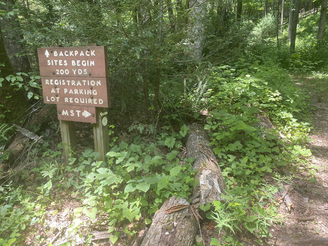
Our route started at Widows Creek Trailhead, took us along the MST to the Basin Cove backcountry campground the first night, then back along the MST to Widows Creek Campground the second. Adding to the fun, dispersed camping is not permitted in either Stone Mountain or Doughton Park, and backcountry campsites require first-come-first-serve permits. Not to worry, permits for Basin Cove are free and permits for Widows Creek Campground (which can only be reserved at the trailhead the day of your stay) are a reasonable $12/night.
With route in place, we kept our eyes on the weather. Ten days out, rain was in for all three days with temps reaching the upper 80s. A week out, rain was pushed to Saturday and Sunday and temps looked to be a tad cooler. The day before our trip, rain chances dropped to an uncertain 40% on Saturday night and Sunday morning with overall temps between 62°F and 81°F. Not bad.
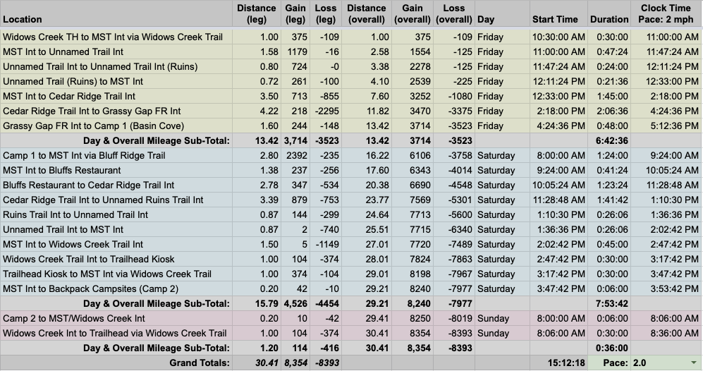
Once the plan was complete, we built out the trip in our spreadsheet based on a 2.0 MPH pace…
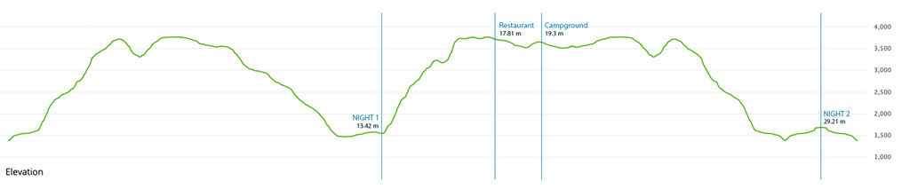
…created an elevation profile
…dropped in the route
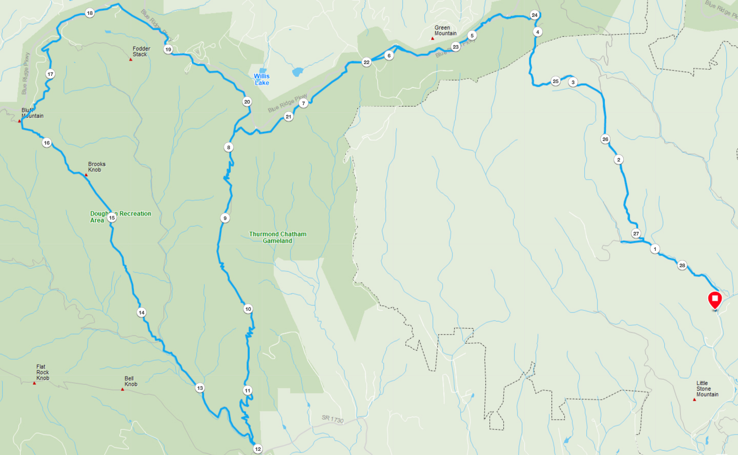
…and packaged it all in a map I printed on TerraSlate paper.
PACKING IT IN
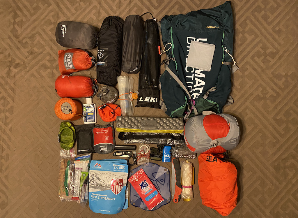
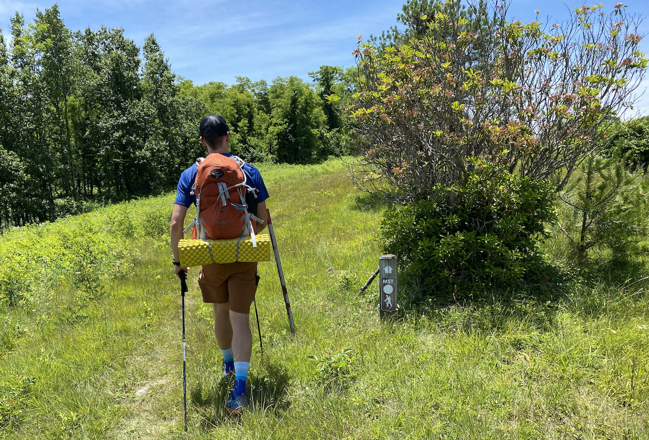
Since my 10K+ run streak was still intact, I wanted to get in at least a day of fastpacking (i.e. running with backpacks) with 10K bumpers on days 1 and 3 (and triple checked that Coop was good with that plan). To plan out my gear, I leveraged what we learned from our fastpacking trip to Wild Oak Trail. The main difference between the two trips was the amount of stuff I’d be taking.
When we hit up Wild Oak, we split up gear allowing my pack to come in around 18 pounds. For this trip, since we weren’t intending to run the entire time, I needed to carry a few extra things in addition to everything else.
For the three days, temps were forecasted between 62°F and 81°F, our overall elevation gain was supposed to be around 8,000 feet, and running was more in than out. So, I chose top quilt over bag liner; brought along my Salomon Bonatti rain jacket and Outdoor Research Helium pants; and wore a pair of 5″ shorts and a Patagonia Cool Daily tee. And, because sitting after a long day of hiking and running is awesome, I packed my Helinox Chair Zero.
In the end, my Ultimate Direction 34L weighed in at 21 lbs. 4.3 oz (13 lbs. 15.7 oz. pack weight and 7 lbs 4.7 oz. of food/water).
DAY 1 (14.54 MI | +3,556′ GAIN | -3,340′ LOSS)
I started my morning with a 10K (Day 433) then drove out to the Widows Creek Trailhead. Upon arrival, I hit up the trailhead info board, completed the campsite registration form, and waited for Coop to arrive to confirm the registration.
You see, we were planning on staying at Basin Cove (15 miles away) the first night and Widows Creek the second, but Stone Mountain State Park rules don’t allow for registering for Widows Creek campsites in advance. I needed to confirm with Coop that we’d be reserving two nights (per the ranger’s advice) to ensure we had a place to stay on our second night.
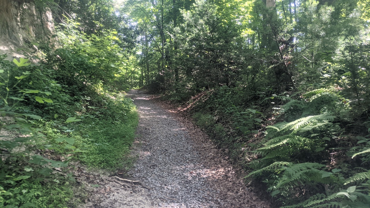
Once he arrived and confirmed the two-night reservation approach, we put $24 in an envelope, and I dropped it into the lock box. A few minutes later we were packed up and headed up the trail. The sky was clear, it was warm, and the air was only mildly thick. In other words, it was a pretty nice day for a hike.
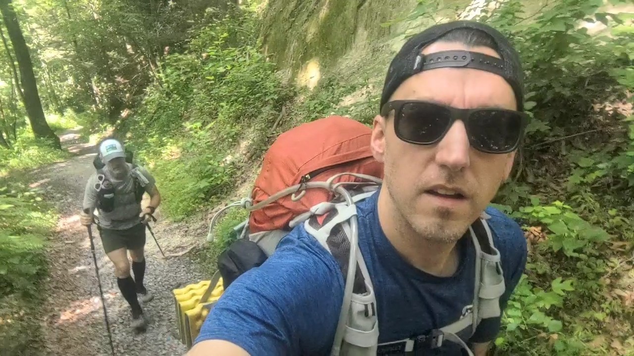
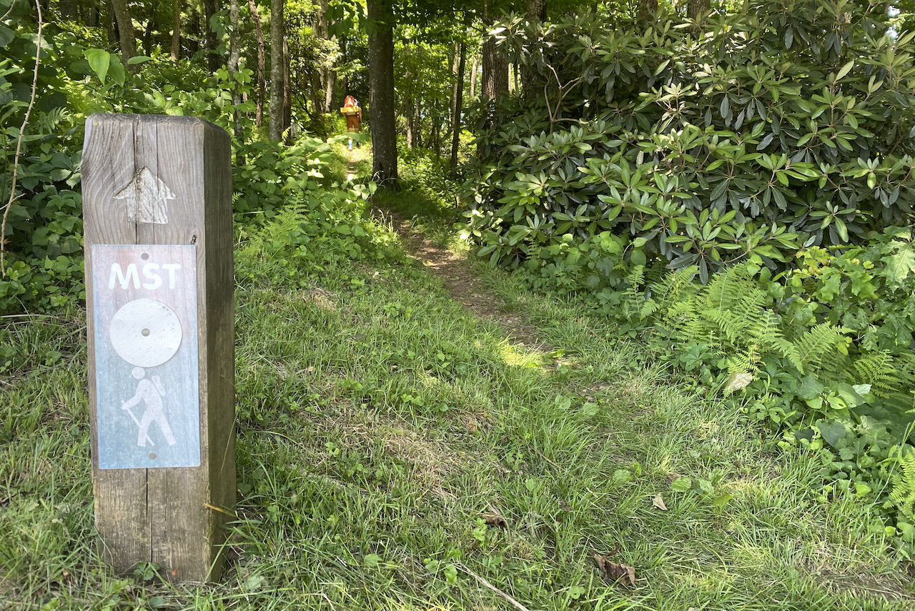
After climbing for a mile we reached an intersection. To the left/northwest, a spur led to campsites A-D (FYI, sites E and F are closed indefinitely). To the right/north, the MST continued. Since we were staying at Basin Cove the first night, we turned right and followed the MST.
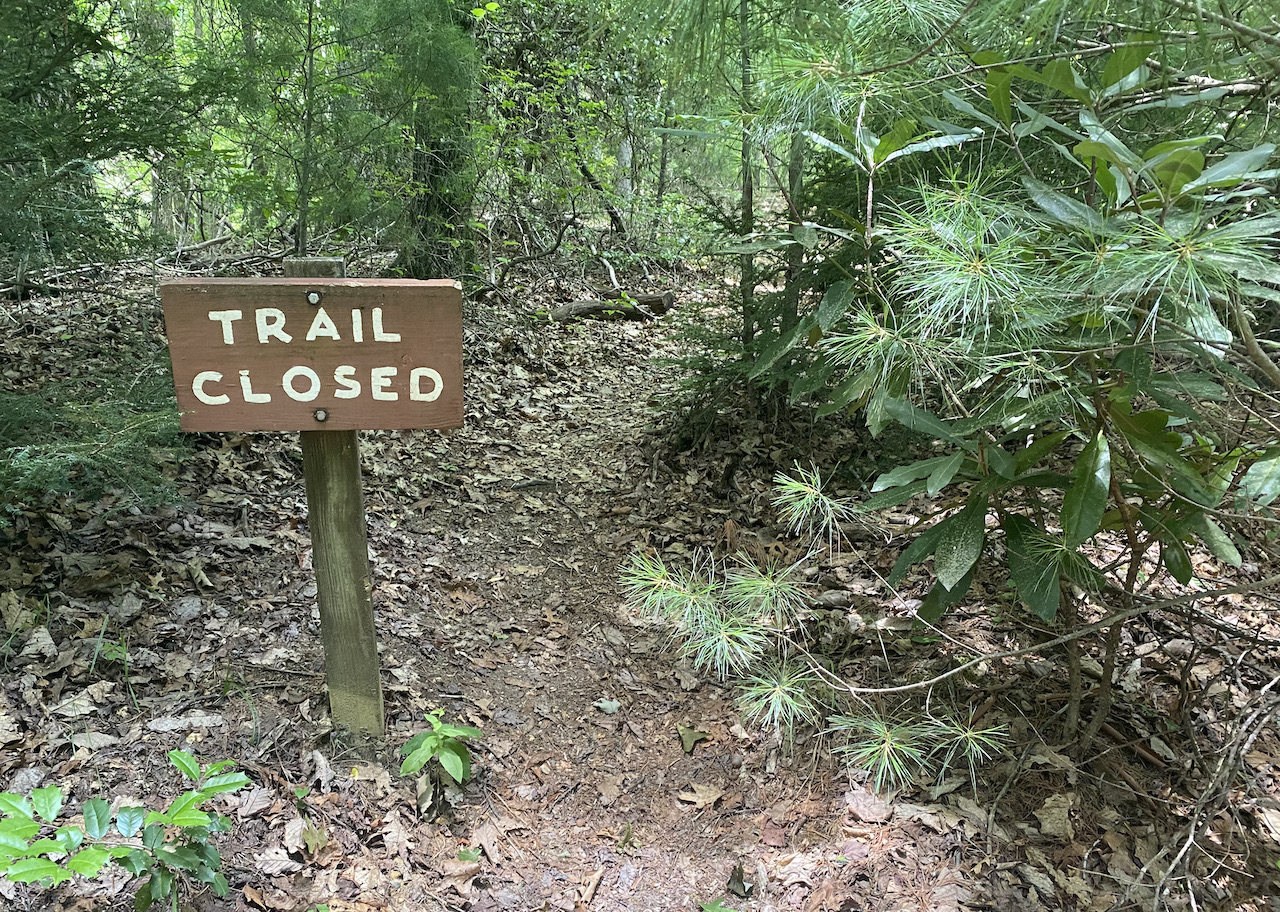
We reached another intersection after ascending a mile and a half. To the left, a sign labeled “Trail Closed” was staked in the middle of the trail (which happened to be the trail we were planning on following). To the right, the MST. With two options narrowed to one, we turned right and continued up the trail.
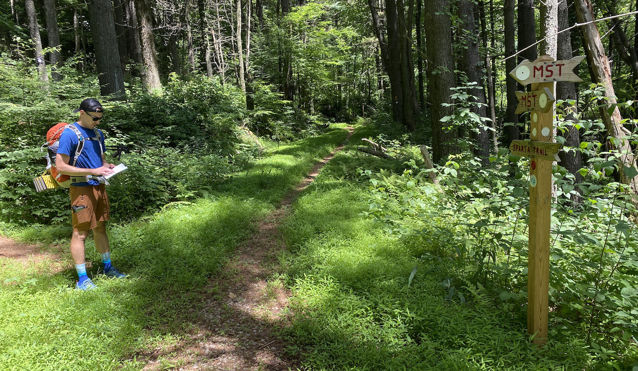
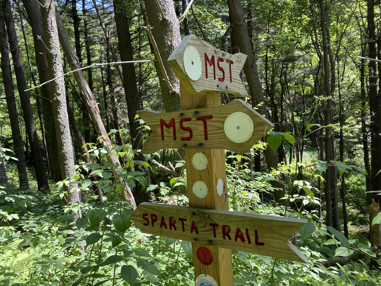
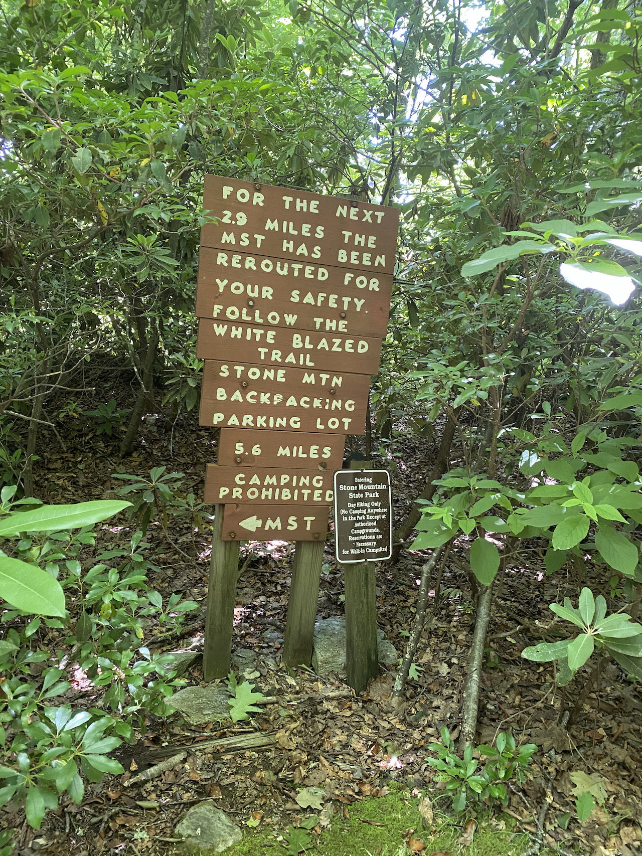
About two miles later (4.5 miles from the trailhead) we hit another intersection. Left/West to MST. Straight/North on Sparta Trail towards (in a roundabout way) Mahogany Rock. We hung a left and followed the MST for about 0.8 miles where we arrived at the intersection of the tail end of the earlier closed trail and the MST. At the intersection, a huge sign stated that the trail was rerouted for our safety.
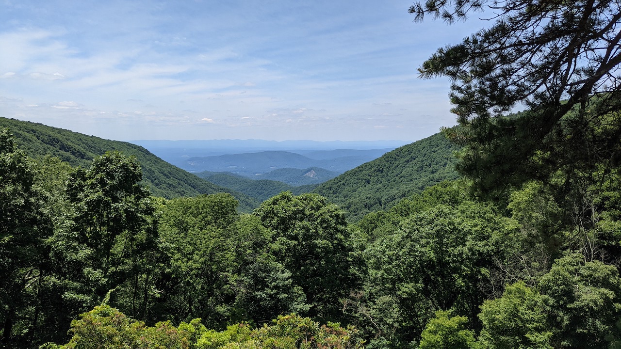
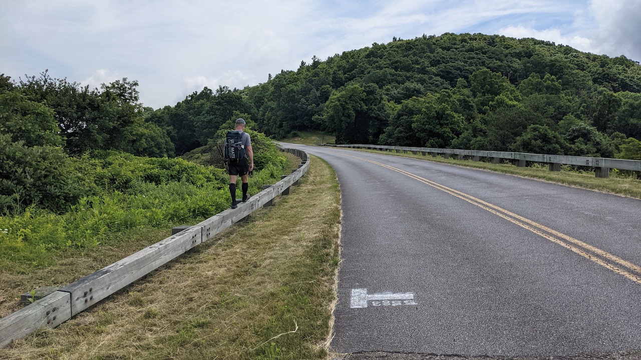
For our safety, we turned right/north and hiked about a half mile until we reached the Blue Ridge Parkway. Our climbing for the day was over (well, at least the hard part).
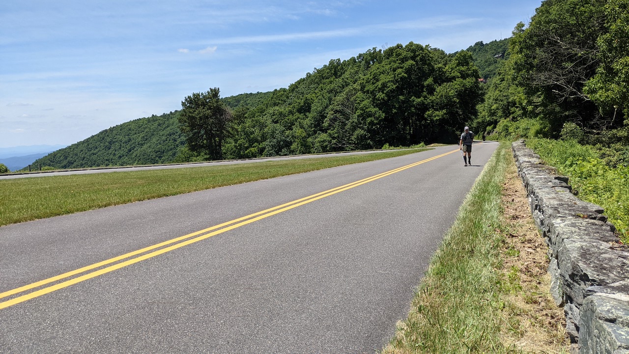
At the Parkway we took a few pics of some really impressive vistas then crossed over the road to pick up the MST. Once we rejoined the trail, we followed the MST which ran parallel to the Parkway for 1.25 miles before crossing back over the it just shy of Air Bellows Overlook.
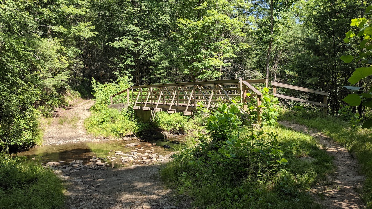
A half mile later we took a bridge over Air Bellows Gap Road and walked the Parkway 0.2 miles to a grassy trail on the other side of the road where the MST picked back up.
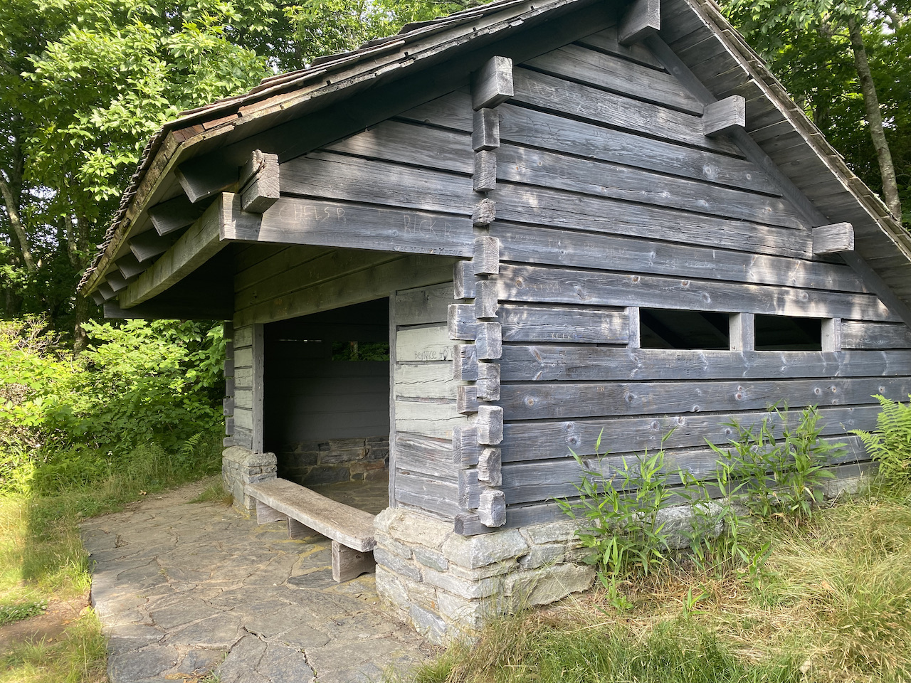
At this point, the MST dumped back into the woods (a bear sanctuary, I might add) and continued southwest for 1.2 miles to Brinegar Cabin. At the cabin we passed a ranger providing a tour to a couple groups of people then parked ourselves next to a sign for a short snack break.
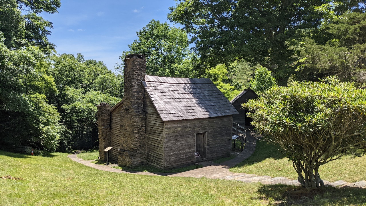
(Photo by Coop)
With health meters full, we walked past Brinegar Cabin’s fenced garden and through a small parking lot, rejoining the MST after a minute or two. A third of a mile later we reached the Bluff Mountain Trail (right/north)/Cedar Ridge Trail (left/south) intersection. We hung a left and started the knee-busting 2,295′ descent to Grassy Gap Fire Road below.
On the way down, we got to talking about the songs our kids sing which led to me sing Bohemian Rhapsody (to, uh, keep the bears away) which, in turn, led to a couple letting us pass them because (and I’m guessing here) my rendition of Freddy Mercury did not live up to their standards.
I apologized for my poor singing and thanked them for letting us pass. An hour later, we arrived at the fire road which ran right/north towards Basin Cove and left/south to Longbottom Road.

At the road, we turned right/northwest and started our final 1.5 miles to Basin Cove backcountry campground. On the right/north, the woods and all of its uphill glory stared down at us. On the left/south, Basin Creek.
The creek grew particularly loud a tenth of a mile from the intersection on account of a dam that smelled like farts. No lie. Actual farts. We explored it, but there was less than a zero percent chance I’d be getting my feet wet.
As we continued up the road we saw sporadic signs of life. Well, I did anyway. I saw and waved to a fisherman. Coop did not. A few minutes later, I spotted a dude walking up ahead. Coop didn’t see him either. He thought I was imagining things. The only rational explanation as to why Coop didn’t see the guy was that he wasn’t a guy at all, he was…a zombie.
I ran through that scenario in my head. The zomb…err…dude sees me looking at him and then scurries into the woods. Moments later, he attempts to ambush us by jumping from a tree branch. To prevent him from eating my brain, I duck my head and thrust my hiking pole into his soft, mushy skull.
Then I imagined explaining the incident to the authorities. As we talked, I learned that the dude was not a zombie, but a scared fella who bolted up a tree because he thought we were after him. And when the branch he was hiding on broke, he fell from the tree, which is when I impaled him with my pole. I was charged with murder and Coop finished the trip solo.
My imagination was never realized as the zombie ended up being not one, but two living people out for a stroll. Eventually, we caught up with the two totally human people just shy of the campsite as we crossed a footbridge that took us over Basin Creek.
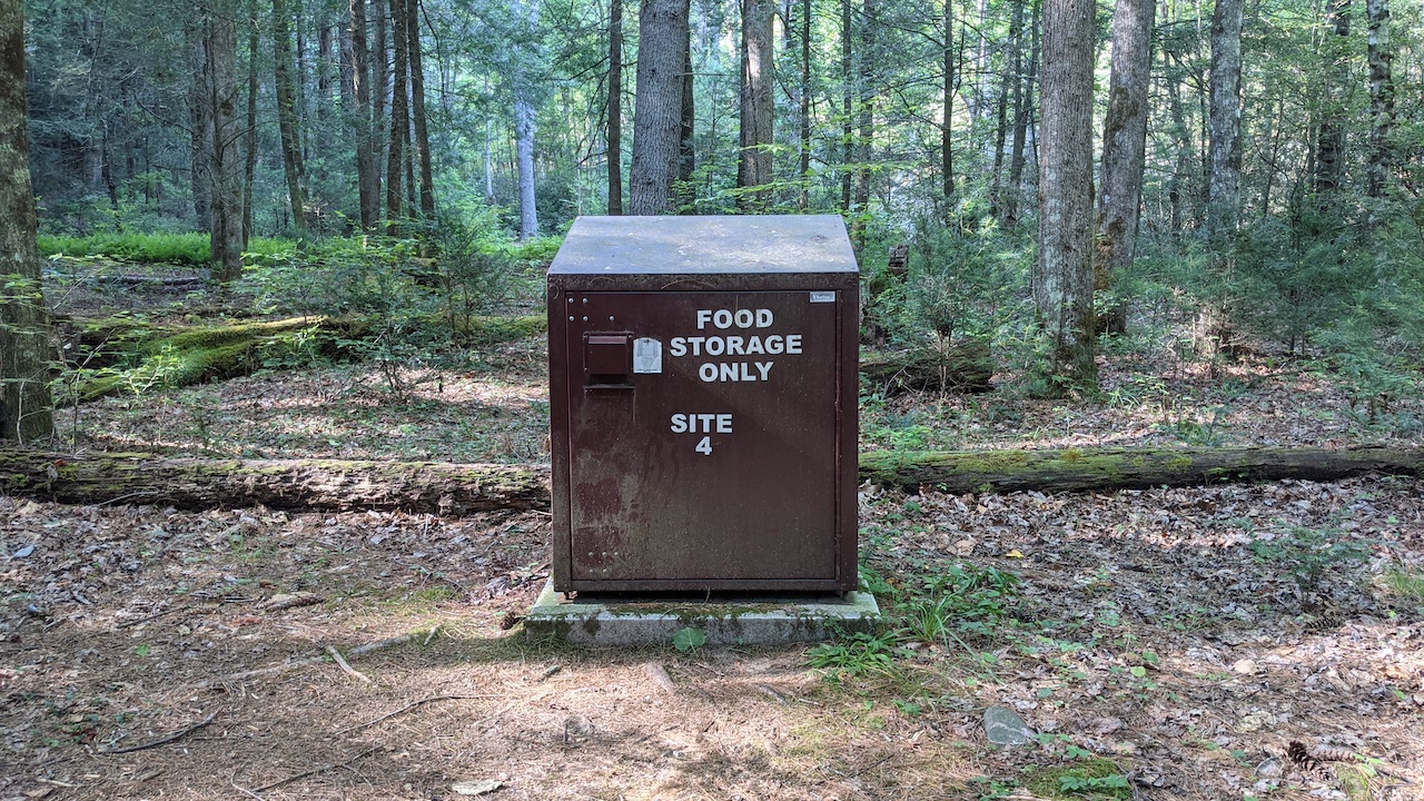
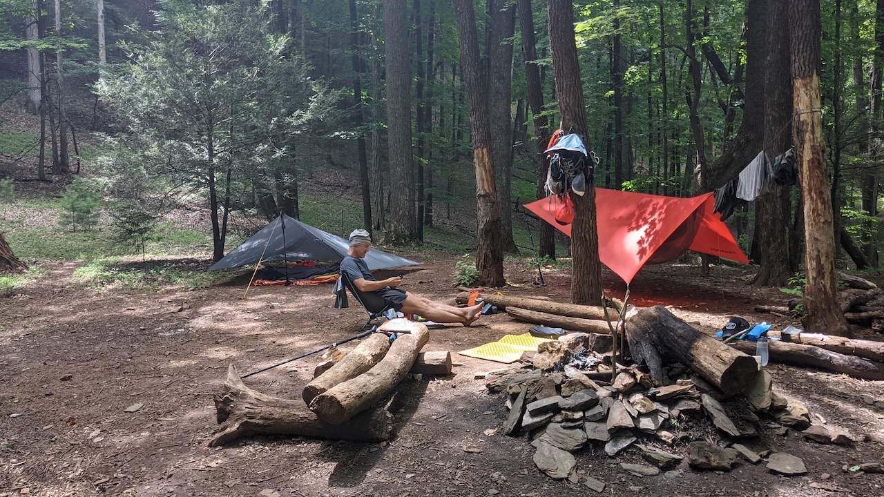
From the bridge, we walked 20 yards or so to the campsite which sat on the left/west of the trail with 5 or 6 sites, each with a fire ring and a bear box. Even better, we were the only ones spending the night.
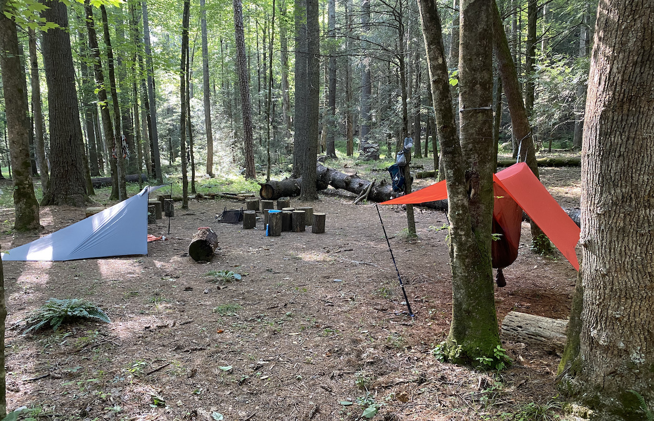
We set up our respective shelters, gathered wood, and grabbed water. After dinner, the air chilled, and the fire became a bit more useful. Before turning in we discussed fastpacking the majority of the next day’s route.
Coop suggested taking the fire road instead of the primitive trail thinking the road would be a little kinder to our feet and legs. But, as we looked more closely at the map, taking the road would add a lot of distance (part of which would include an additional long walk along the Parkway before rejoining the MST) to an already tough day.
Instead, we agreed to stick with original plan, shot the breeze for a little while longer, doused the fire, and turned in.
Day 1 Complete
DAY 2 (15.09 MI | +4,164′ GAIN | -3,773′ LOSS)
I woke a couple of times throughout the night because the temperature dipped causing my butt to get cold since I had left my sleeping pad in my pack. Truth be told, I slept better without the pad, it was just a little cooler.
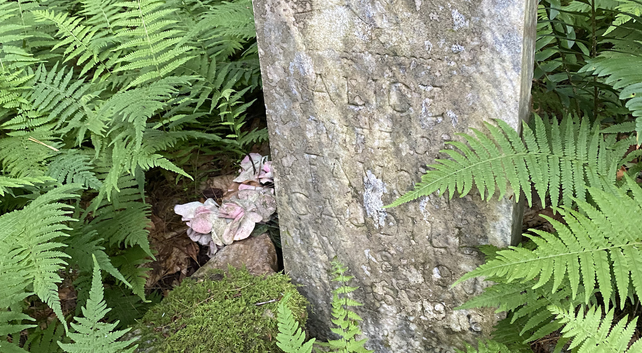
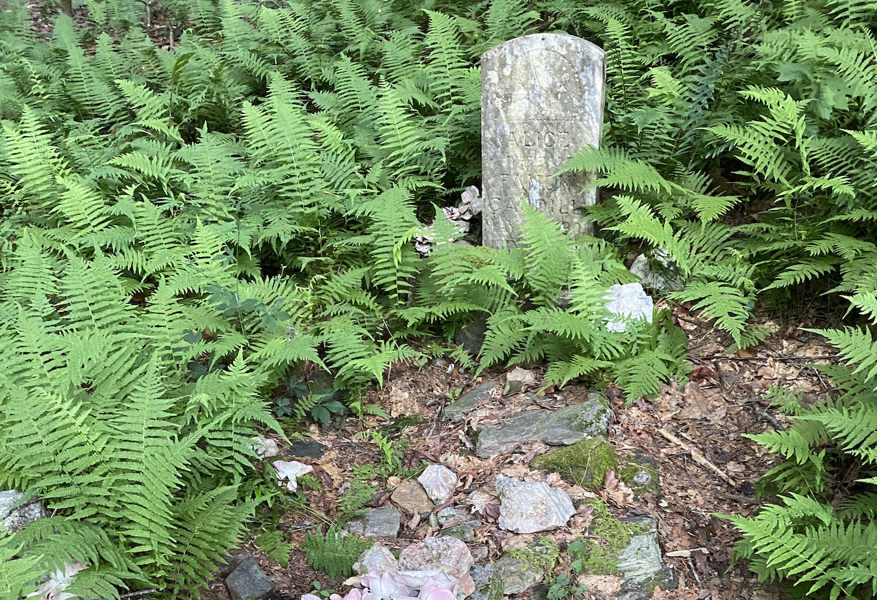
Once we formerly arose from our respective slumbers, we broke things down and loaded up on calories before heading out. From the campsite we walked north/northwest for a couple of minutes until we arrived at an intersection with the gravesite of Alice Adams Caudill; a newly-married 16-year-old bride of Linnie Famon Caudill who was killed in the flood of 1916 that decimated the area. Yay history!
From the gravesite there are three trail options. The first, Basin Creek Trail, runs 3.5 miles north/northwest to the one-room Caudill Cabin, the last surviving structure of Basin Cove. The second, Grassy Gap Fire Road, runs west/northwest up to Bluff Mountain Trail just shy of the Blue Ridge Parkway. The third, Bluff Ridge Primitive Trail, runs north/northwest directly up the mountain passing Brooks Knob en route to Bluff Mountain Trail. We went with the third option and began the ridiculously strenuous 2.8 mile, 2,400′ climb.
The climb was, to put it mildly, brutal. At times it felt like we were walking up a wall. As we shuffled our feet along the trail, we passed two older (than me) dudes about a half mile up. One was wearing running clothes and a bladder pack. The other was decked out in street clothes. I think the former did not fully inform the latter of their day’s excursion.
Another 20 minutes or so and we got to talking about The Bluffs restaurant; a small place about 1.4 miles from the top. Somehow the conversation turned to eating ice cream and using the bathroom which devolved further into naming businesses that offered a primary service as well as bathroom accommodations.
Scoop and Poop, Home Depoo Home Impoovement, Shirts ‘n Squirts, Continence Corral, The Boweling Alley, Crack Stack, the Dia Regional Airport, and more!
Now, before you judge us for our use of immature bathroom humor, the discussion (and resulting laughter) truly carried us to the top and made the climb much more palatable. Besides, who wouldn’t want to eat ice cream AND poop at the same time?
We arrived at a shelter near Bluff Mountain after climbing for an hour and twenty minutes, caught our breath, then walked the MST to a field northeast of Bluff Mountain where we powered up before starting in on fastpacking.
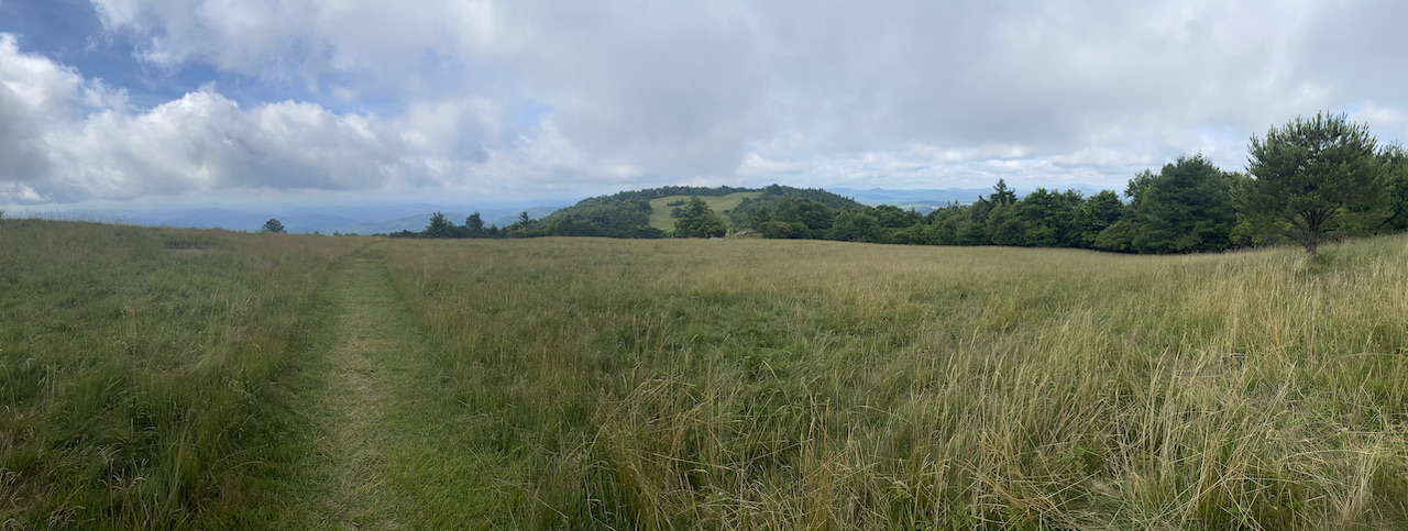
From Bluff Mountain we ran through a field, passed through a parking lot, then ran up the hill to another winding trail that followed a ridgeline with gorgeous views, some cow turds, and a few cows to boot. At the end of the field we passed through a gate and took a switchback to another bald which led us past a group of hikers.
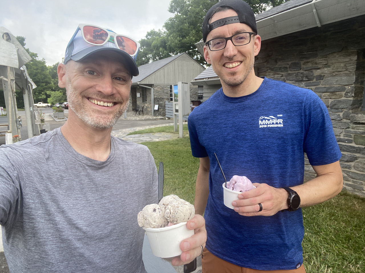
We crossed a road which led to The Bluffs Lodge and made our way across the Blue Ridge Parkway and eventually to The Bluffs restaurant where our dreams of heaping scoops of ice cream were realized. Black cherry for Coop. Cookies and Cream and Strawberry for me.
While we ate, we chatted with a couple of elderly hikers who told us about an Aerial Tram near Mahagony Rock (more on the tram’s location can be found on hikingupward.com). Interesting, but out of the way.
From the restaurant we returned to running. First through a parking lot, then through a gate leading to another field, and eventually back into the woods where pine needles and soft ground soothed our barking dogs.
Once out of the woods, we crossed over the Parkway, passed through Doughton Park Campground, crossed back over the Parkway, skirted through an RV park, then returned to the woods where a turkey gobbled at us from a distance.
The trail continued for another mile before we reached the Bluff Mountain Trail/Cedar Ridge Trail intersection just west of Brinegar Cabin. For the next seven miles we retraced our route from the previous day all the way to the Widows Creek Trail campsite spur.
At the spur, Site A was about 200 yards down the trail; a huge site with a big creek on its southern edge, a bridge, and a nearby waterfall. We kept walking, crossed a bridge, and followed the trail up towards the next site.
We passed Site B a quarter mile after A. It was smaller in size with a water source on the western and northern edges. Finally, after walking up for another quarter mile we reached Site C where no water and lots of trash were waiting.
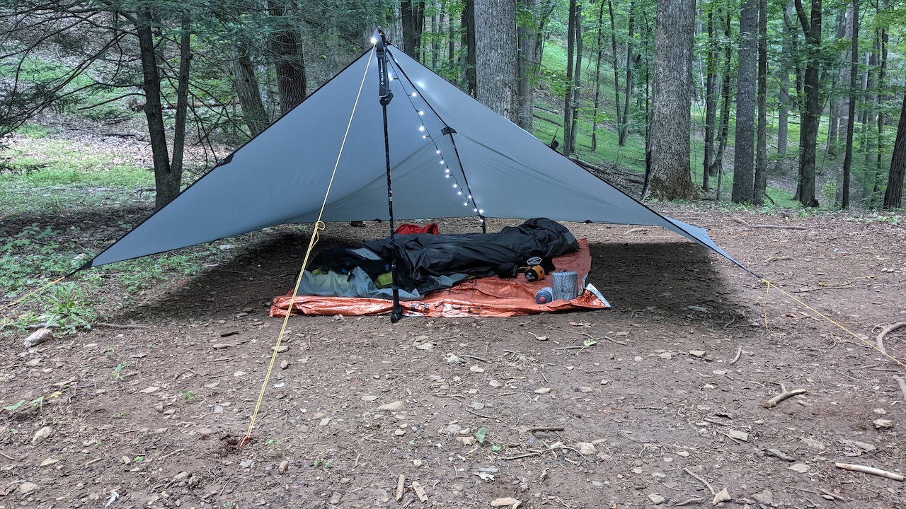
Surveying the site, we picked out our respective spots, set up, then walked back down to Site B for water. Along the way, we passed four hikers en route to Site D. All had backpacks and one dude was carrying his sleeping bag in his hand.
Returning to camp, we sat around and listened to wood thrushes belting out 1980s era bird ballads. It was nice at first, but my earballs started to bleed after hearing it for the thousandth time. I mean, c’mon, isn’t there a B-side to that record? I’m joking, it was wonderful. Seriously. I loved it.
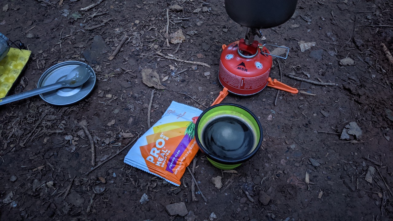
The more I sat, the more I needed to rest, so I took a quick two-snore nap. Just before my third snore, I woke up and rejoined Coop in time to hang the bear bag line and boil water for dinner.
While we sat around doing a lot of nothing, a couple of guys from Site B came up looking for a lighter. Coop gave them a spare and we both offered some firestarters. They thanked us and off they went.
Just before 9PM, we discussed getting an early 5AM start on the day so we could be on the trail by 6AM. I asked Coop if he wanted to join me for another 4.25 miles to complete the day’s 10K. He agreed.
Day 2 Complete
DAY 3A (1.61 MI | +49′ GAIN | -617′ LOSS)
Around 3:45AM, I was awoken by the sound of Coop clapping followed by something stomping off in the distance. When the footsteps died down, I closed my eyes once more hoping not to become a hammock-wrapped bearrito.
An hour later, I rolled out of bed, packed, and ate. Coop followed suit, and by 6:15AM we were heading out. From the spur trail, we ran the remaining downhill mile and reached the parking lot about 6:40AM.
DAY 3B (4.64 MI | +153′ GAIN | -74′ LOSS)
At the parking lot we dumped our packs and set off down the road to complete the day’s 10K. We ran west towards Longbottom Road, turned around at the gate, headed back towards the trailhead parking lot, continued past the lot until the road turned up, the turned about face once more to finish off the run.
Trip Complete
TOTALS (35.88 MI | +7,922′ GAIN | -7,804′ LOSS)
FINAL THOUGHTS
Before I dig in to my last thoughts on the trip you Backpacking from Stone Mountain State Park to Doughton Park along the Mountains-to-Sea Trail was an incredible experience. The views from the Parkway and meadows were spectacular. The inclines were ridiculous and the downhills were (mostly) welcome. There was never a concern for water. And, the weather was fantastic.
The campsite at Basin Cove was expansive and immaculate, and I really appreciated having a bear box at each site. Widows Creek Campground offered isolation from the trail and a pretty good amount of distance between sites.
Wildlife wasn’t pouring from the woods, but we did see a few deer, a turtle with goiter, a turkey, a bat, and a pileated woodpecker. There were, however, more people on the trail than usual, particularly on Saturday morning near the Parkway between The Bluffs restaurant and Brinegar Cabin.
All in all, the trip was a success, and I’d recommend the area to anyone up for a challenge. Just be sure to bring money for ice cream.
Still not convinced? Want a second opinion? Check out Coop’s trip report. It’s fantastich! Fantastico! Amazing!