Photo by Coop
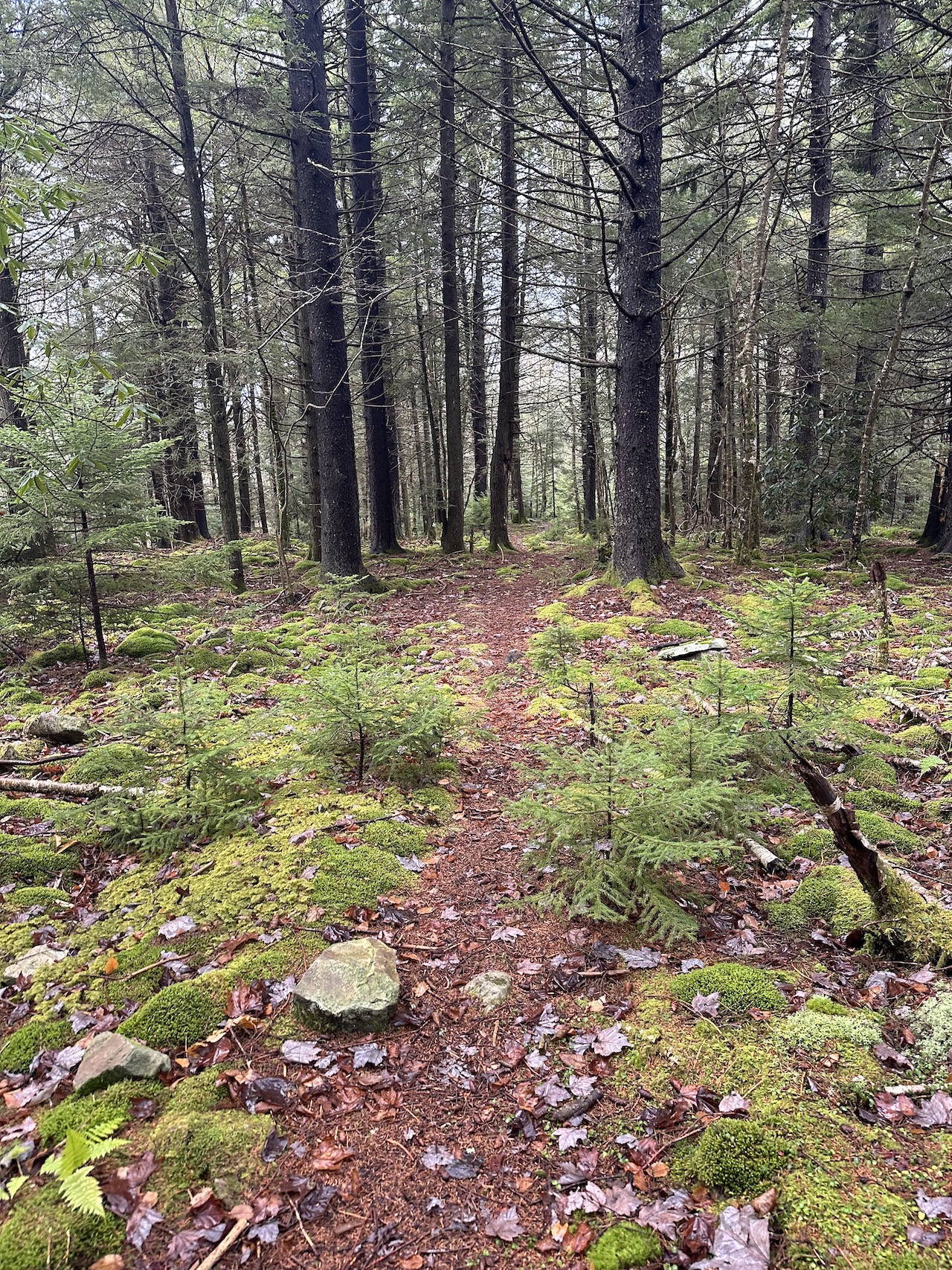
The Monongahela National Forest in West Virginia is one of my favorite places to visit with options that include Dolly Sods, Roaring Plains, and the 47,815-acre Cranberry Wilderness. Located between the Highland Scenic Highway to the east, the Williams River to the north, and the Cranberry River to the south and west, the Cranberry Wilderness includes 15 interconnected, unblazed, and well-maintained trails covering over 75 miles with elevations ranging from 2,400 to over 4,600 feet. The wilderness is home to deer, turkeys, rabbits, mink, grouse, bobcats, and foxes, and is a designated bear sanctuary. Having visited the area before, my buddy, Coop, and I opted to head back to Cranberry to cover some areas we hadn’t explored previously.
THE PLAN
The weather in the Monongahela National Forest is a crapshoot most of the year, and it is particularly wonky as fall nudges closer to winter. For this trip, early forecasts called for temperatures ranging from mid-40s to lower-60s with little sun and lots of rain. Rain is usually good, but in the Cranberry Wilderness when it rains some routes can become impassable (including those that cross rivers and creeks). Thankfully, Cranberry has miles of interwoven trails (i.e. bailout options) should weather become an issue.
With weather and bailout options in mind, Coop mapped out several potential routes using a combination of online mapping resources (GaiaGPS, CalTopo, Google Earth, etc.) and the North-South Trailhead off the Highland Science Highway as our entry point. After a great deal of consideration, we decided on a route that runs west along North-South Trail, north on Little Fork Trail, east on Middle Fork Trail, south on North Fork Trail, and finally east on North-South Trail to the trailhead.
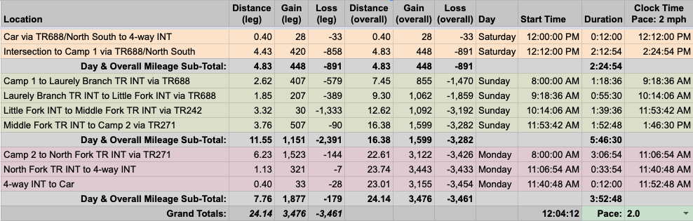
Once finalized, Coop built out our 24-mile trip route in a spreadsheet based on a 2.0 MPH pace…
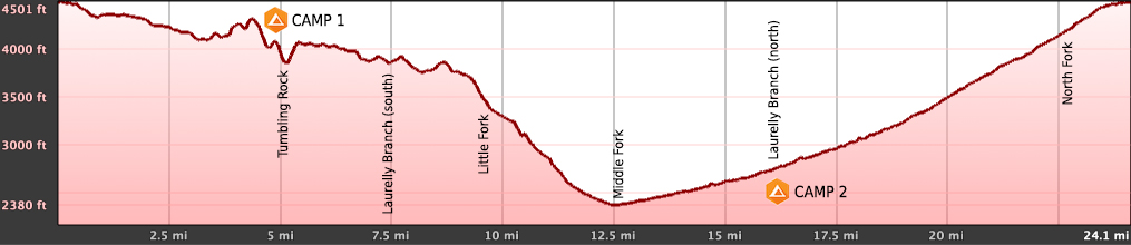
…created an elevation profile
…dropped in the route
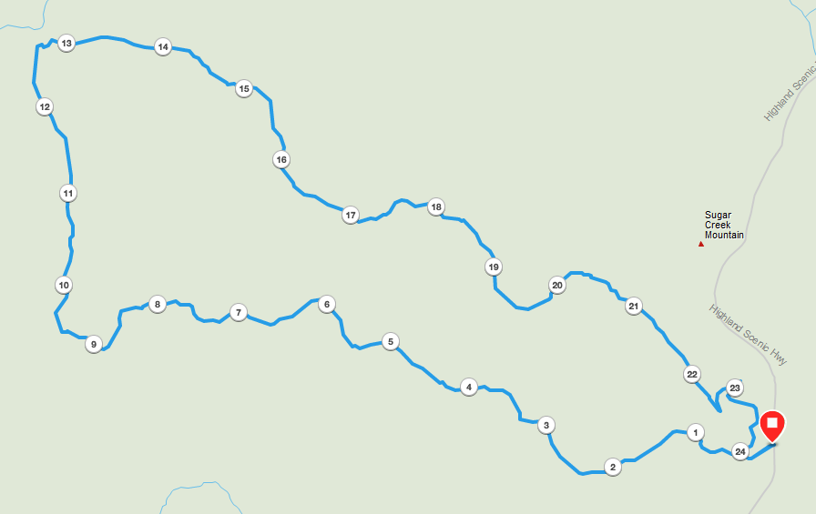
…and packaged it all in a map that we printed on TerraSlate paper.
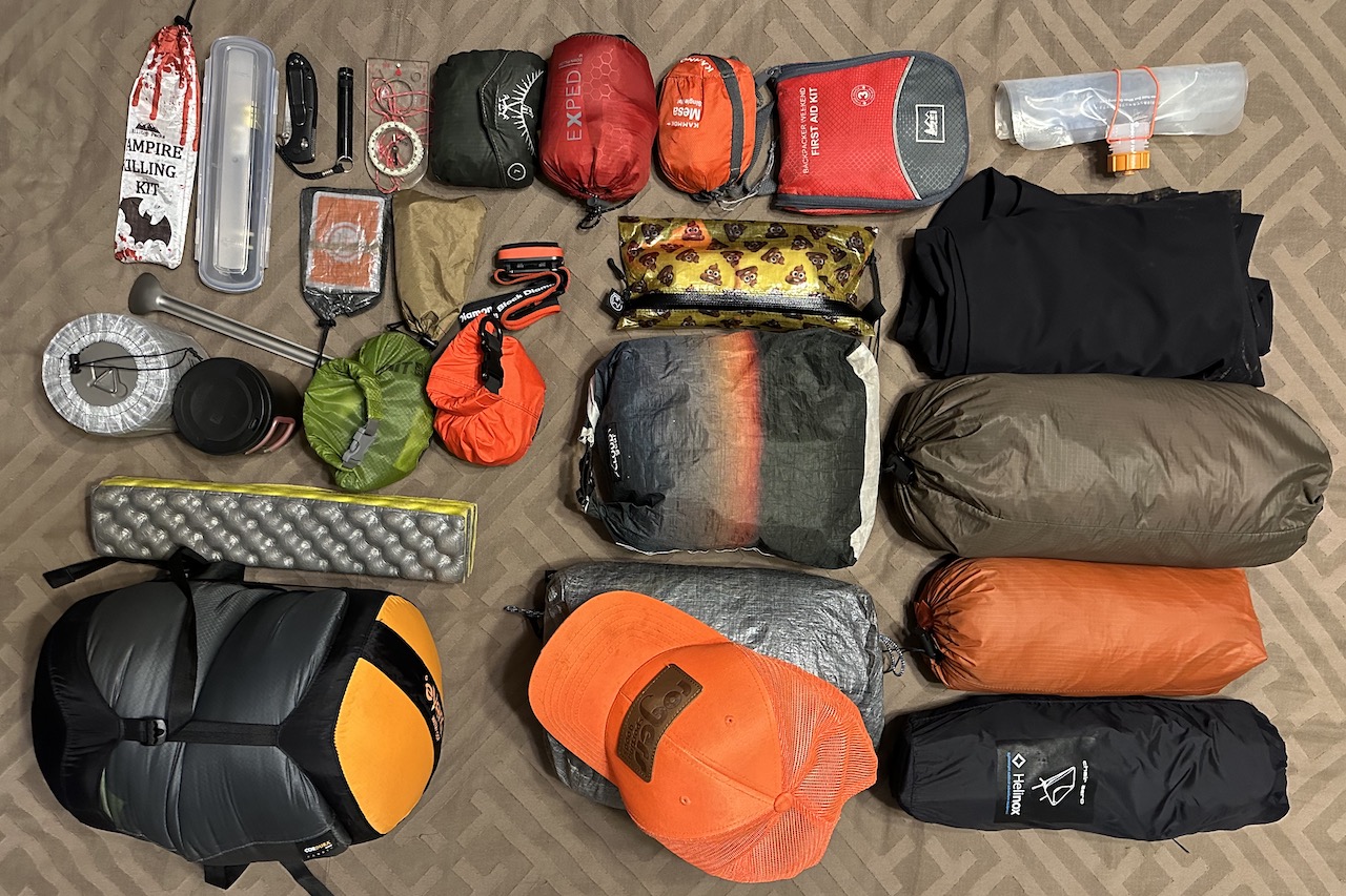
PACKING IT IN
Since it’d be warm-ish, I ditched the tent in favor of my hammock, 30°F underquilt, and 10°F sleeping bag (on the off chance it wasn’t going to be that warm). To combat the rain, I brought a backpack cover, rain pants, and rain jacket, and lined my pack with a nylofume liner for good measure. I also brought a pair of Darn Tough Coolmax socks because everyone should have a delightfully warm pair of sleep socks and a chair because butts should be comfortable after a long day’s hike.
With everything loaded, including water and food, my 50L Atmos weighed in at 29 lbs. 9.4 oz.
DAY 1 (5.19 MI | +466′ GAIN | -1,071′ LOSS)
When we arrived at the North-South (TR 688) Trailhead we parked in the last remaining spot, loaded up just as the rain started to die down, and headed out on the trail around 2PM.
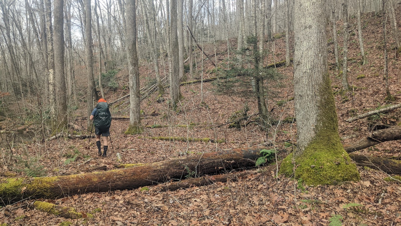
From the trailhead we headed west along North-South Trail, passed a campsite and a kiosk with a map of the Cranberry Wilderness a tenth of a mile later, walked another 0.28 miles to the North Fork Trail (TR 272) intersection (an old road that was used until the area become a designated wilderness in 1983), and continued straight/west along North-South Trail.
We passed a couple and their dog a few minutes later and then about 2 miles from the car we passed the campsite I stayed at on a previous trip. FYI, North-South Trail has a handful of campsites between the trailhead and Little Fork Trail. None of them have water unless you consider a flooded trail to be a water source.
Ten minutes later, we passed a second couple, one of whom commented that they had lost their phone case clip. A few steps later, just as they left our view, old “Eagle Eyes” Coop spotted the clip, handed it to me like a baton in some weird wilderness relay, and I high kneed my way back up the trail to a very grateful hiker.
I joined back up with Coop, shed a layer, and continued west along the trail. For the most part, North-South Trail is pretty straightforward. There were a couple of times where the trail seemed to disappear, but our maps and GPS watches helped us stay on track.
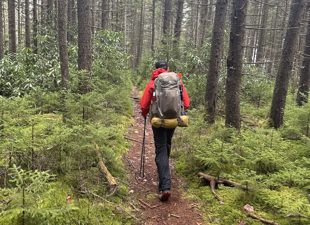
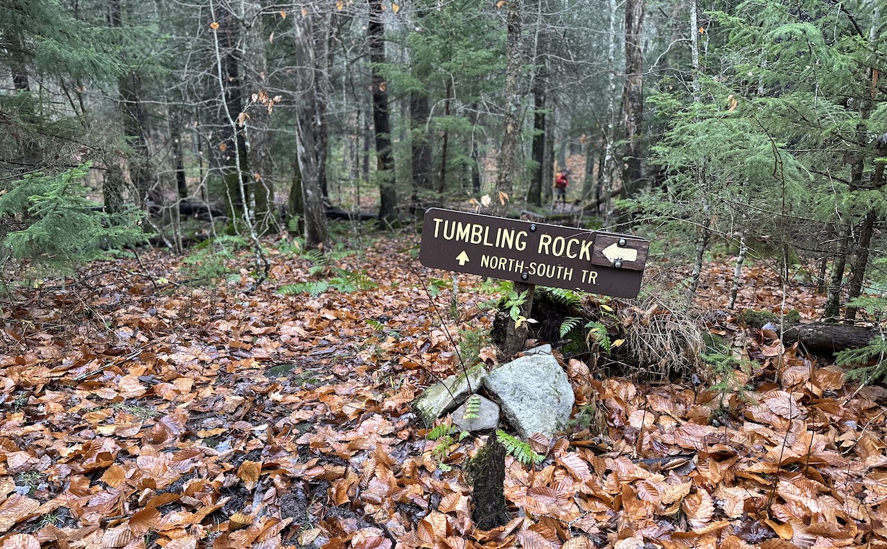
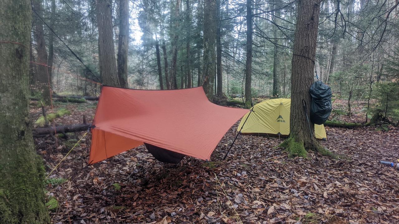
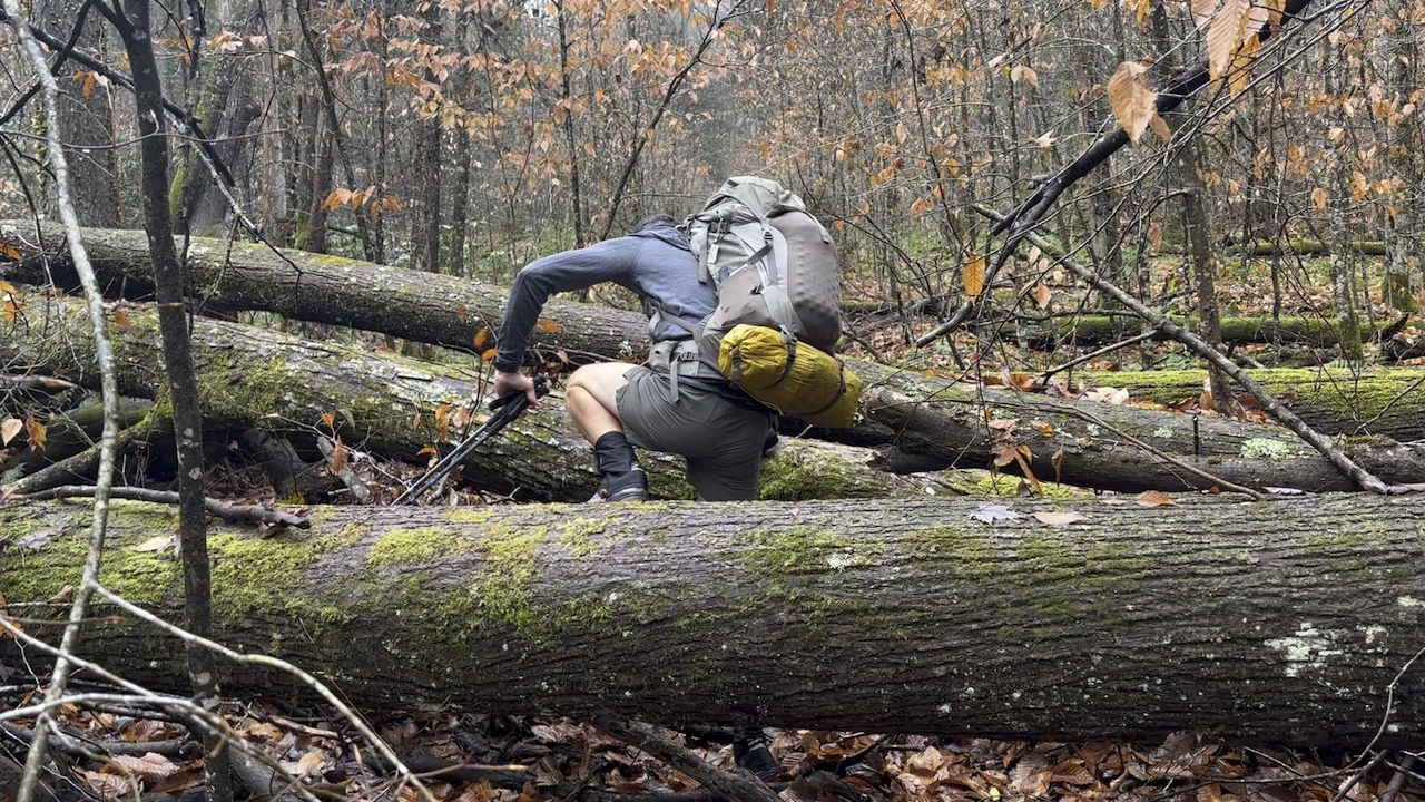
By 4PM, we reached what we intended to be our campsite. However, since the winds were picking up and rain was still in the forecast, we decided to continue on to the Tumbling Rock Trail/North-South Trail intersection which sat at the bottom of a steep, technical, and rocky hill. After 20 minutes of carefully placed steps (and no falls I might add) we arrived at our destination, a campsite about 30 feet up the trail.
Once our shelters were up, we ate and relaxed for a while before hanging our food and turning in around 9PM.
Plot twist!
Just as the two of us had gotten comfortable in our respective shelters, there was a loud crack followed by an ominous thud. My eyeballs shot through my face and my heart pounded. I could hear Coop exiting his tent and could see him shining his light at an area between my hammock and his tent. The culprit…a 4-foot widow maker which had crashed in between the two of us. Thank you backpacking gods!
Day 1 complete
FYI, there is no water source at this campsite. However, if you find yourself at this particular site without two Hs and an O you can try heading down Tumbling Rock Trail where maps show a water source. I walked it in the morning and heard water trickling, but did not walk to the source.
DAY 2 (13.58 MI | +1,168′ GAIN | -1,972′ LOSS)
I woke around 7AM, broke things down, and Coop and I fueled up before hitting the trails around 8:30AM.
From the campsite, we continued west along North-South Trail, climbing 200 feet over a quarter mile where a small campsite sat just off the trail. Two miles later we arrived at another campsite at the Laurelly Branch Trail/North-South Trail intersection. It’s a nice site if you have water, but if you don’t there’s a spot a half mile down Laurelly Branch Trail (which runs north/northwest between North-South Trail and Middle Fork Trail) where Coop and I stayed at on a previous trip.
From Laurelly Branch Trail, we passed Birchlog Trail after a half mile and Rough Run Trail after another half mile before grabbing a snack at the North-South Trail/Little Fork Trail intersection after yet another half mile. FYI, North-South continues on for another 6.7 miles where it ends/starts at Cranberry Campground off Forest Road 76. Once refueled, we said goodbye to North-South Trail and started in on Little Fork Trail.
Little Fork Trail runs north to south between North-South Trail and a parking lot/picnic area at Public Road 108. Getting there isn’t too difficult if you just follow the river. However, if you sing songs about bears and stop paying attention to where you’re headed, you might miss the trail and follow an overgrown road. Sure enough, somewhere between Bearhemian Rhapsody and Breaking the Paw, I steered us to the left/northwest ascending an overgrown road when we should’ve continued straight/north following the trail down.
It took me a moment to figure out my mistake. When I did, I stopped, looked at my map, my watch, and Coop (in that order). Instead of backtracking whence we came, we decided to make a B-line to the trail below (not recommended, btw).
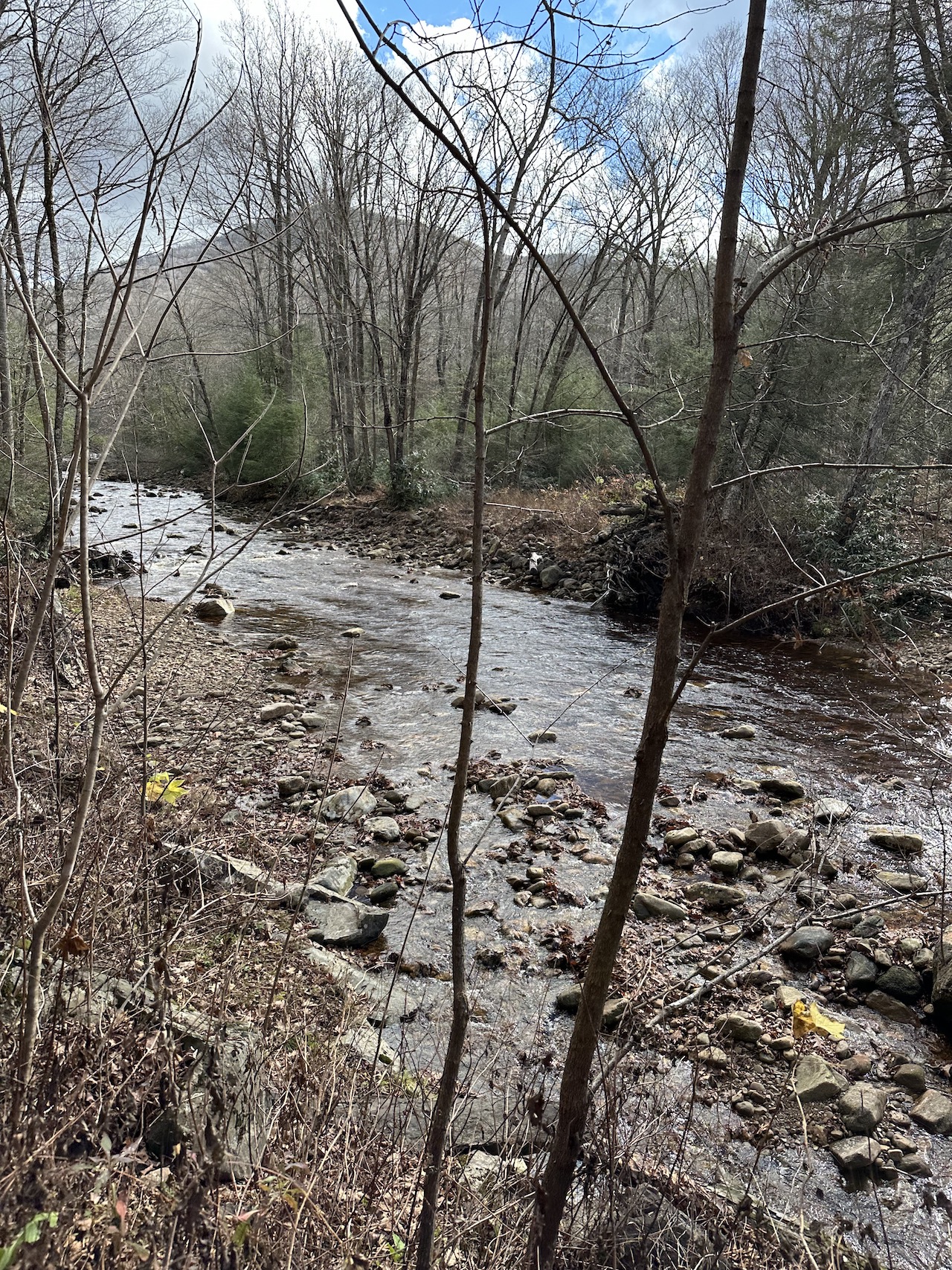
Several slips, scratches, and a spot-on rendition of Led Zeppelin’s Bearway to Heaven later, we reached the trail as it crossed over Little Fork Creek and took the opportunity to refill bottles and bellies. Our break was followed by a quick, steep incline, after which the trail took us down a long descent and dumped us into a flat area that followed and crossed Little Fork Creek a few times before a final, knee-deep, grand finale crossing at Little Fork Creek just before the parking lot at PR108.
The parking lot had picnic/camping sites, each with a trash receptacle, fire ring, and picnic table; with a latrine located just up the road. To the north of the lot, a kiosk sat atop a steep hill at the start of County Line Trail; an 8.8 mile trail that climbs 1,558′ (1,000′ of which is over the first mile or so). And, to the east (where we were headed), Middle Fork Trail. All that stood between us and doing nothing was a mere 4ish-mile hike with 500′ of gain.
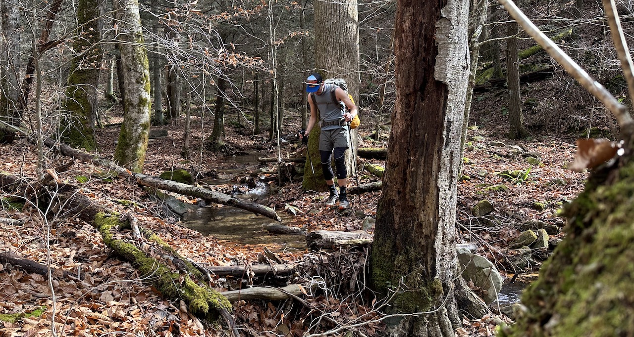
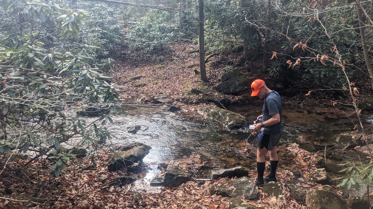
Photo by Coop
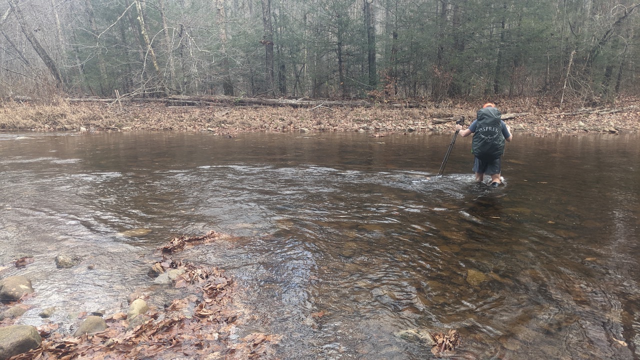
Photo by Coop
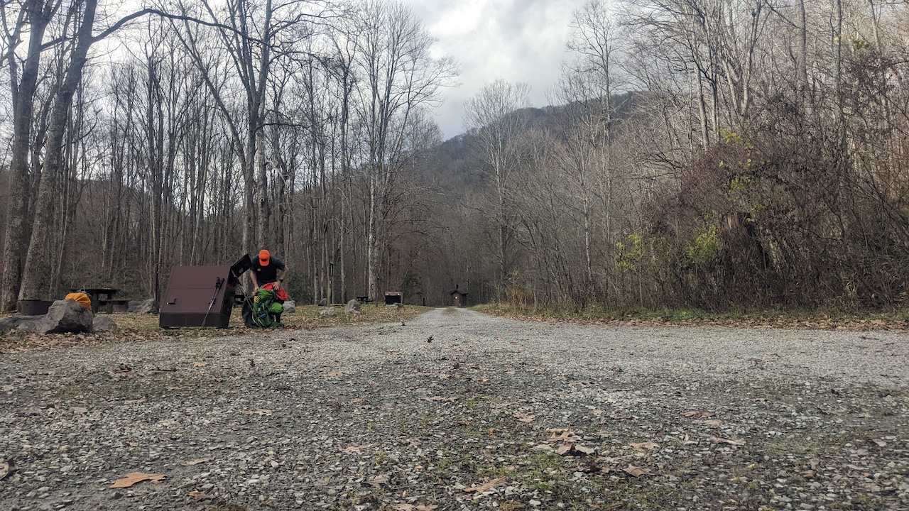
Photo by Coop
Not far down the trail we passed an older-than-us fella carrying a big stick who was walking towards a probably-slightly-younger-than-us fella who was sitting on a log with one sock off whilst rubbing his ankle (the one with the sock off not the other one because that would’ve been weird). We stopped to ask him if he needed anything and he said he was good.
We passed Big Beechy Trail a couple miles later and after another 1.5 miles we reached the northernmost point of Laurelly Branch Trail where we stopped to snack up. It was about 2:45PM and we were 12 miles into our day. We figured we had another mile before we found a site where we could stop and rest for the night. Twenty minutes later, our figuring proved to be incorrect. It wasn’t wrong necessarily, but the site we found was overgrown and riddled with lumps and dead branches waiting to fall from the sky and impale us. We both looked at each other and decided (against our legs’ objections) to keep looking.
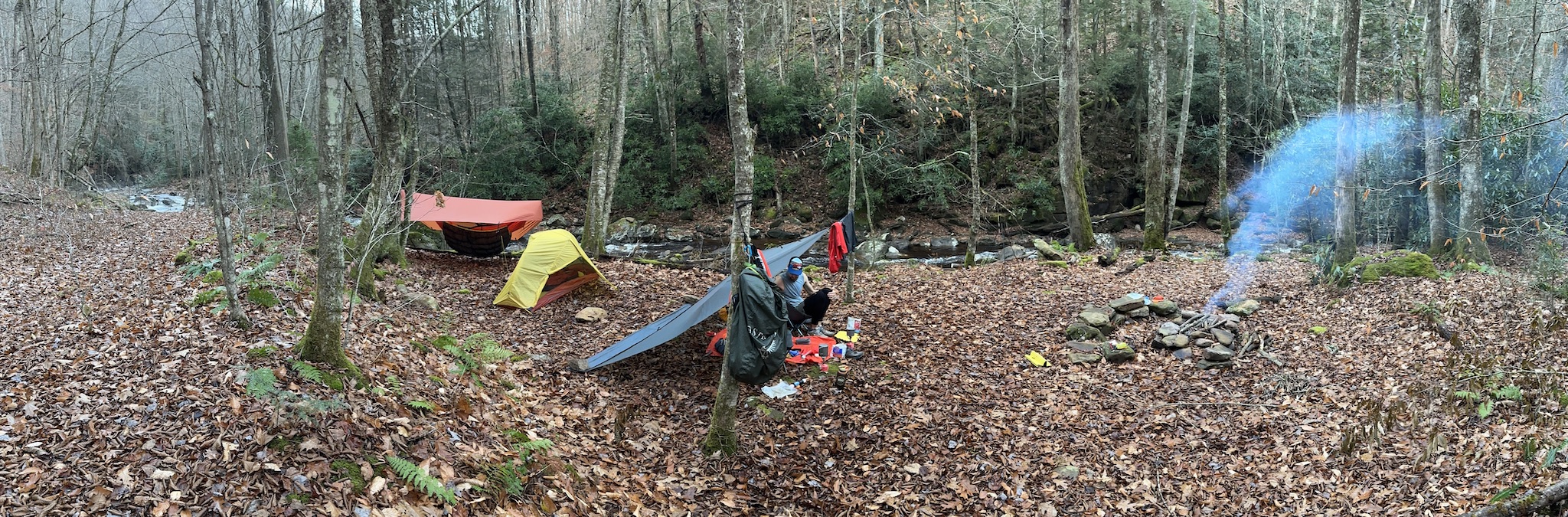
We walked and walked and walked and walked and walked until we found a spot about 0.75 miles from the previous one with zero widow makers and a nice fire ring.
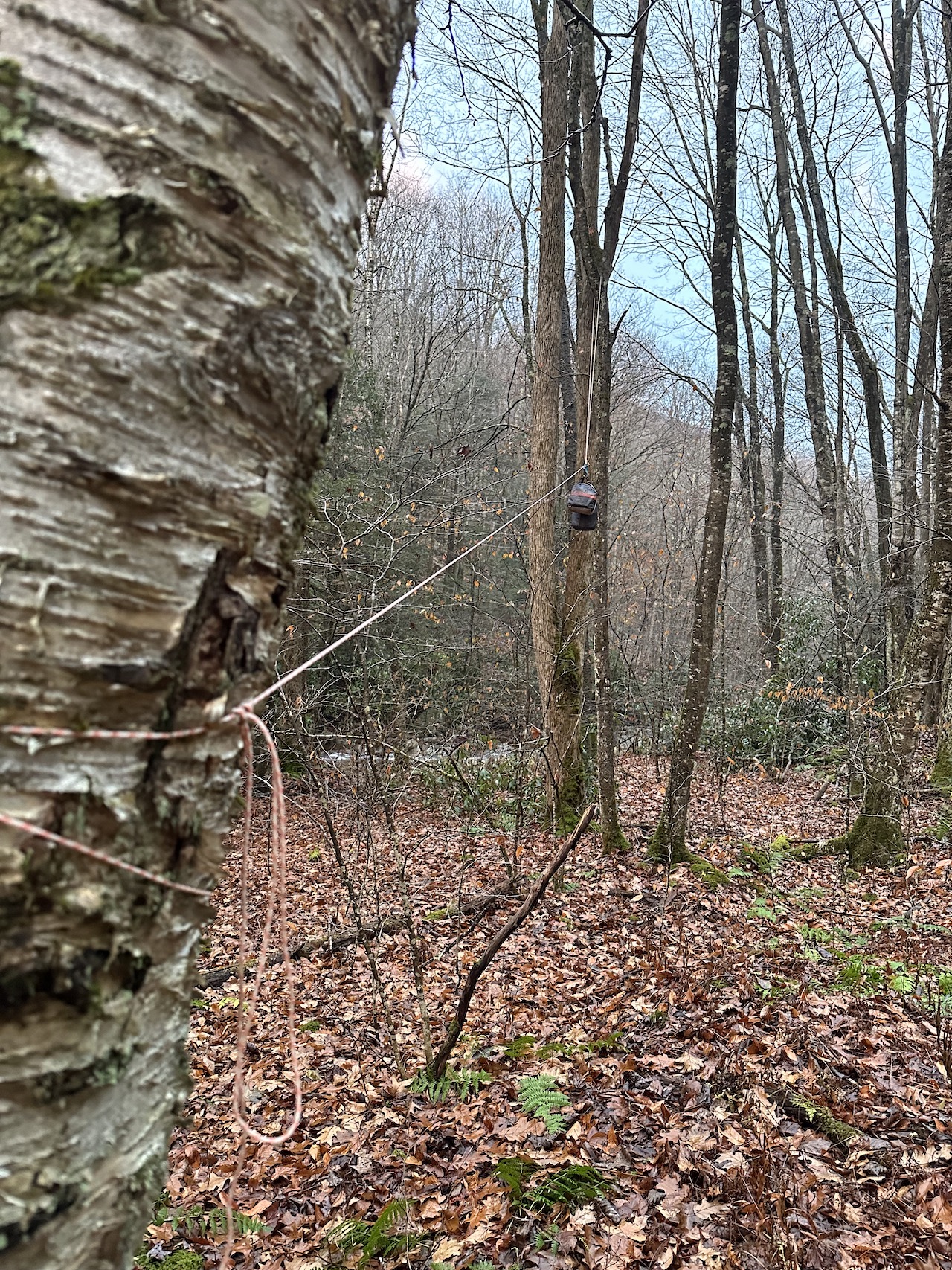
After setting up shelters and gathering wood, Coop worked on the fire and I hung a bear bag line. With camp chores complete, we hung out under Coop’s tarp, ate dinner, and watched the rain douse Coop’s glorious fire around 8PM. An hour later it was lights out.
Day 2 complete.
DAY 3 (6.12 MI | +1,409′ GAIN | -15′ LOSS)
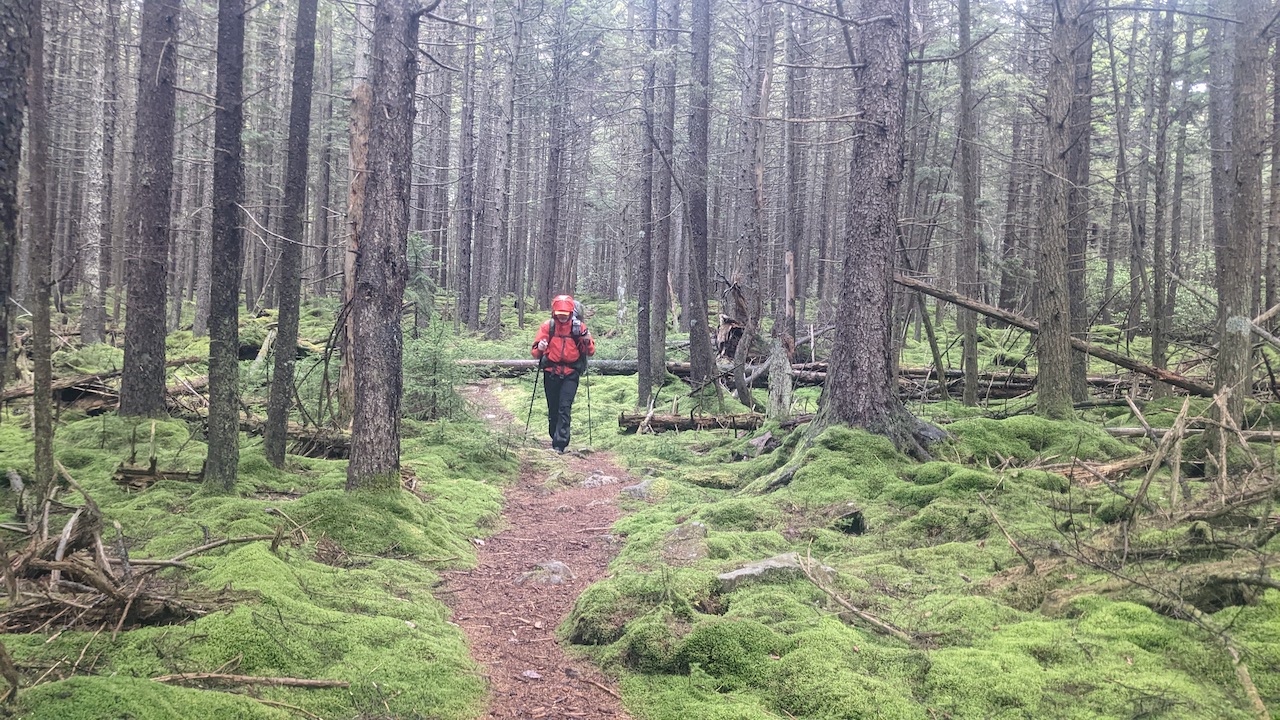
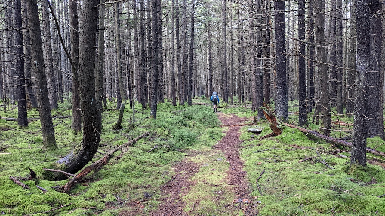
We broke camp around 7AM, ate breakfast, and headed out about 8AM. From our site, we followed Middle Fork Trail to North Fork Trail for 4.62 miles and ~1,300′ of elevation passing multiple campsites along the river to the right/south. We sang songs. Songs about bears. Songs like Bearadise City, Livin’ On a Bear, The Bears Are Back in Town, You Give Bear a Bad Name, Sweet Bear O’ Mine, and Fight For Your Right (to Bearty). It was wonderfully and ridiculously entertaining (and worked really well at keeping the bears away, not to mention all wildlife).
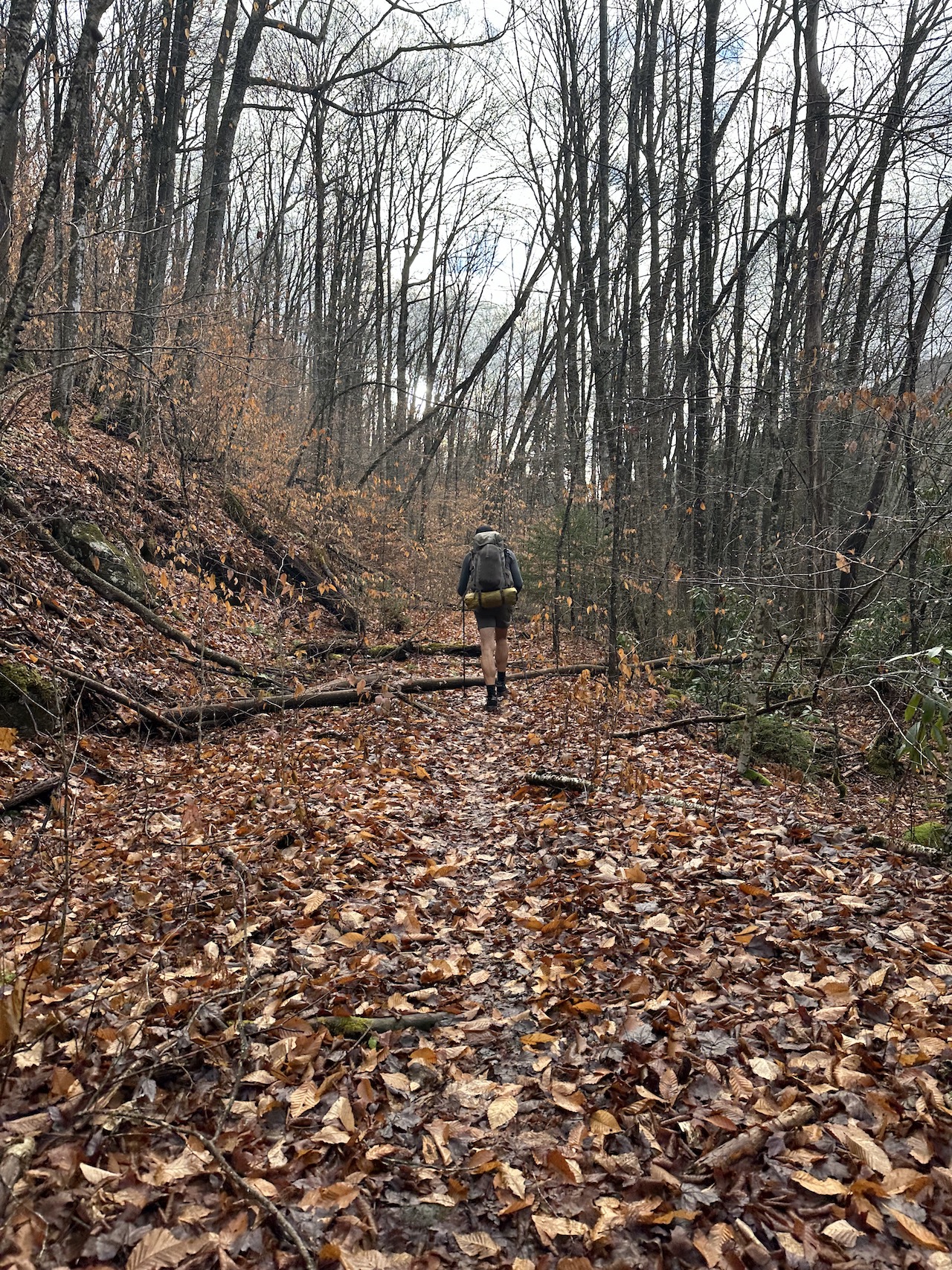
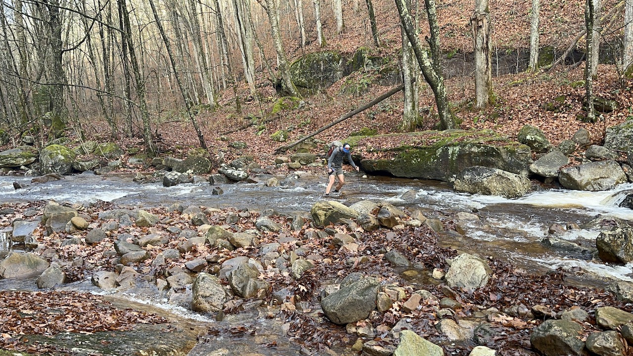
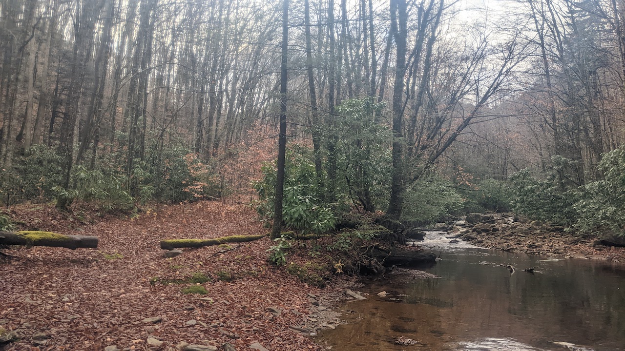
Photo by Coop
Around 9:45AM we turned right/south on North Fork, walked the trail’s mile-long ascent, hung a left/east on North-South Trail, and finished the remaining 0.4 miles back to the car.
Photo by Coop
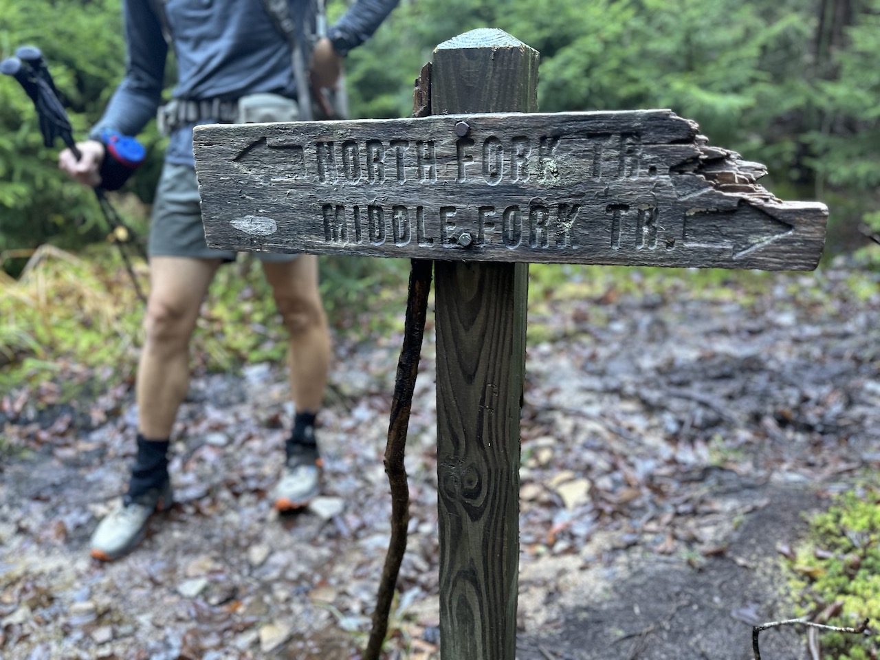
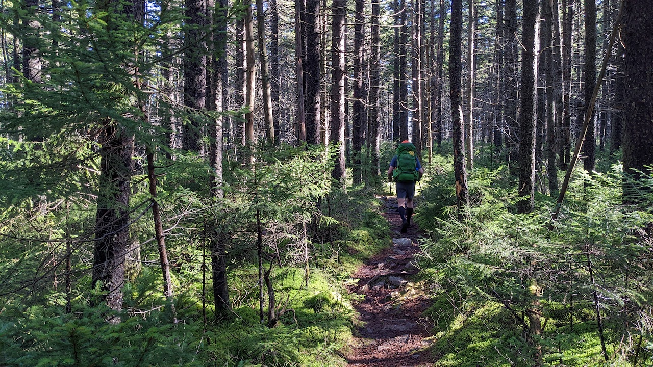
Photo by Coop
Trip complete!
TOTALS (24.89 MI | +3,043′ GAIN | -3,058′ LOSS)
FINAL THOUGHTS
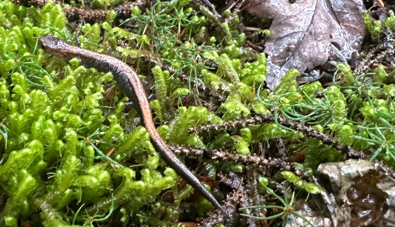
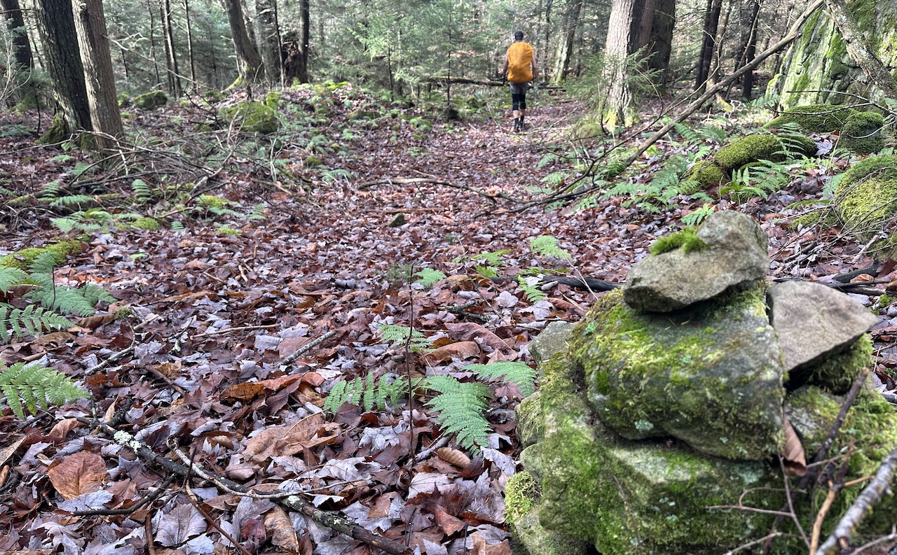
I love me some Cranberry Wilderness. It is hands down one of the most peaceful backpacking destinations I’ve ever visited. OK, sure there are bears, it is a bear sanctuary after all, but I’ve only seen one in the three times I’ve visited. But forget about the bears, there is so much flora to be seen. Spruce pines, birch, locust trees and lest not forget the moss and ferns that cover the ground like a natural carpet. It is amazing!
If you plan to visit the Cranberry Wilderness, make sure you’ve got plenty of water and plan to get dirty (especially if rain is anywhere near the forecast). And, in case you forgot about the bears I mentioned a couple sentences back, please note there are bears (and other wildlife) so eat and store your food responsibly. Lastly, recognize that the area is a designated wilderness area and doesn’t have blazed trails the way many locations do so be prepared to get lost regularly, and be sure you have a map, compass, and a GPS device of some kind with routes preloaded.
That said, get out there and have some fun! The Cranberry Wilderness awaits!