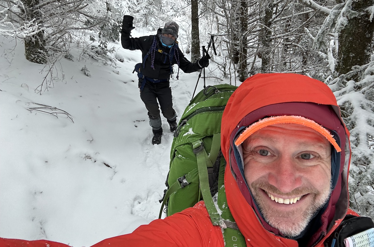
The Mount Rogers National Recreation Area (NRA), a nearly 200,000 acre National Forest in southwestern Virginia is one of my favorite backpacking destinations. Sure the terrain can be challenging and the weather is often unpredictable, but there are wild ponies, the Appalachian Trail (AT) runs through the area, the views are magnificent, and it can be exceptionally peaceful when there is snow on the ground. It’s a place I keep coming back to and a place I thought I’d take a friend of a friend, Rodrigo, for his first winter backpacking trip in the southeast.
THE PLAN
The forecast for Mt. Rogers and the surrounding area called for a high of 16°F the first day with snow showers early, wind gusts in the 40MPH range, and wind chill as low as -13°F. The other two days were slightly warmer and milder, but not by much.
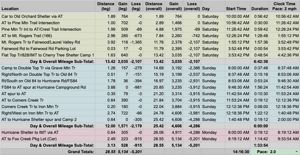
Using AllTrails, GaiaGPS, Garmin Connect, and Google Earth and the Fox Creek Trailhead off Fairwood Road/VA603 as our entry point, I mapped a route that took us up to Pine Mountain Trail and Rhododendron Gap and then back down to Fairwood Road via Mt. Rogers Trail where we’d cross the road and take Flat Top Trail to Cherry Tree Shelter for the first night. Day 2, we’d head west to Double Top, pick up Old 84 east to the AT, hike south to Iron Mountain Trail, east to the AT, and then north to Hurricane Shelter for night 2. Day 3 would be an easy hike south along the AT back to the Fox Creek lot.
After getting Rodrigo’s blessing, I built out our 28-mile route in a spreadsheet based on a 2.0 MPH pace…
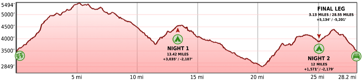
…created an elevation profile
…dropped in the route
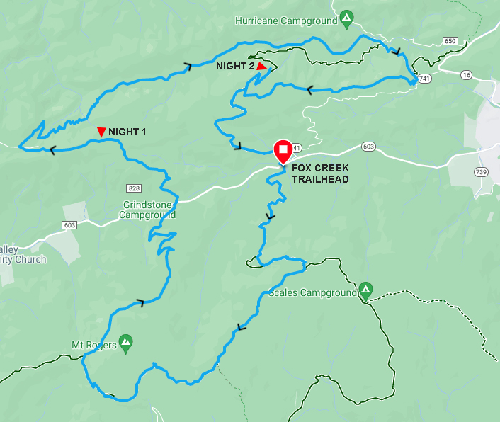
…and packaged it all in a map that I printed on TerraSlate paper.
PACKING IT IN
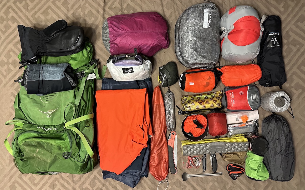
With temperatures forecasted to be below freezing both nights (and the wind chill below 0°F the first), I opted to chose tent over hammock as I don’t have an underquilt rated below 30°F. That, and…bringing a winter sleeping pad and bag in addition to a 30°F underquilt was too much considering I could just sleep on the ground without the need for an underquilt.
I brought two down coats to combat the potentially hazardous cold, a rain jacket to keep the wind off my person, and 3 wool layers for my upper body because cotton is not your friend. Additionally, I packed fleece liners, mittens, a pair of hand warmers for my hands, and soft shell pants, gaiters, and long underwear for my legs. For my feet, three pairs of midweight socks.
Another consideration was how to keep my Sawyer filter and fuel canister warm. Normally, I’d slip both items in my coat as I walk around camp, but hiking with a couple of lumpy pieces of gear is not super comfortable. Instead, I used some Reflectix (donated to me by my buddy, Coop) to craft a pouch for my Sawyer and sleeve for my fuel canister. Lastly, I brought a Nalgene insulated carrier to keep one of my bottles of water from turning to ice while I hiked and slept.
With everything loaded, including water and food, my 50L Atmos weighed in at a whopping (and hopefully worthwhile) 34 lbs. 0.7 oz.
DAY 1 ( 13.37 MI | +2,675′ GAIN | -2,420′ LOSS)
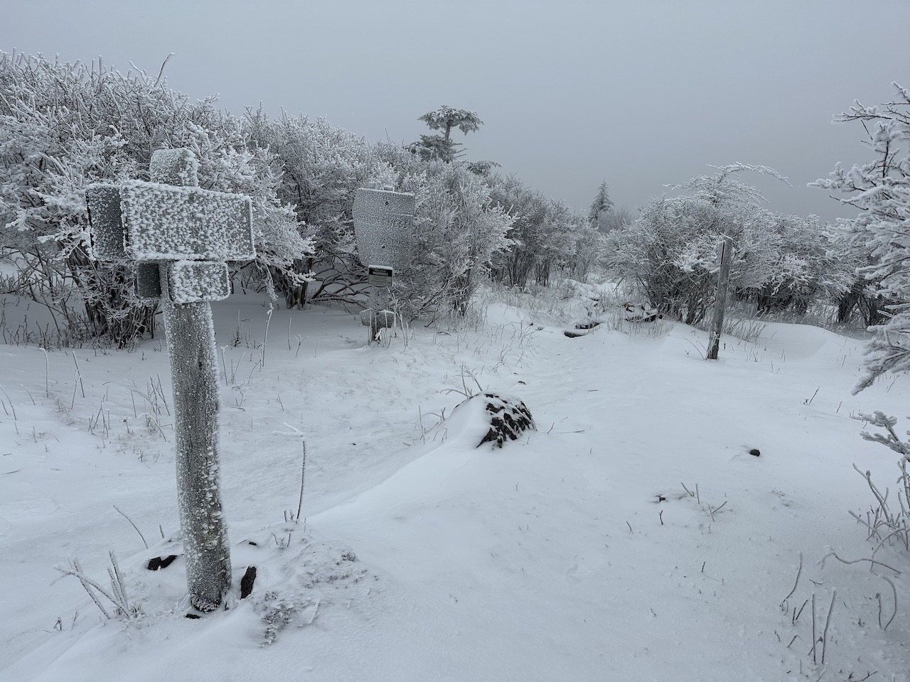
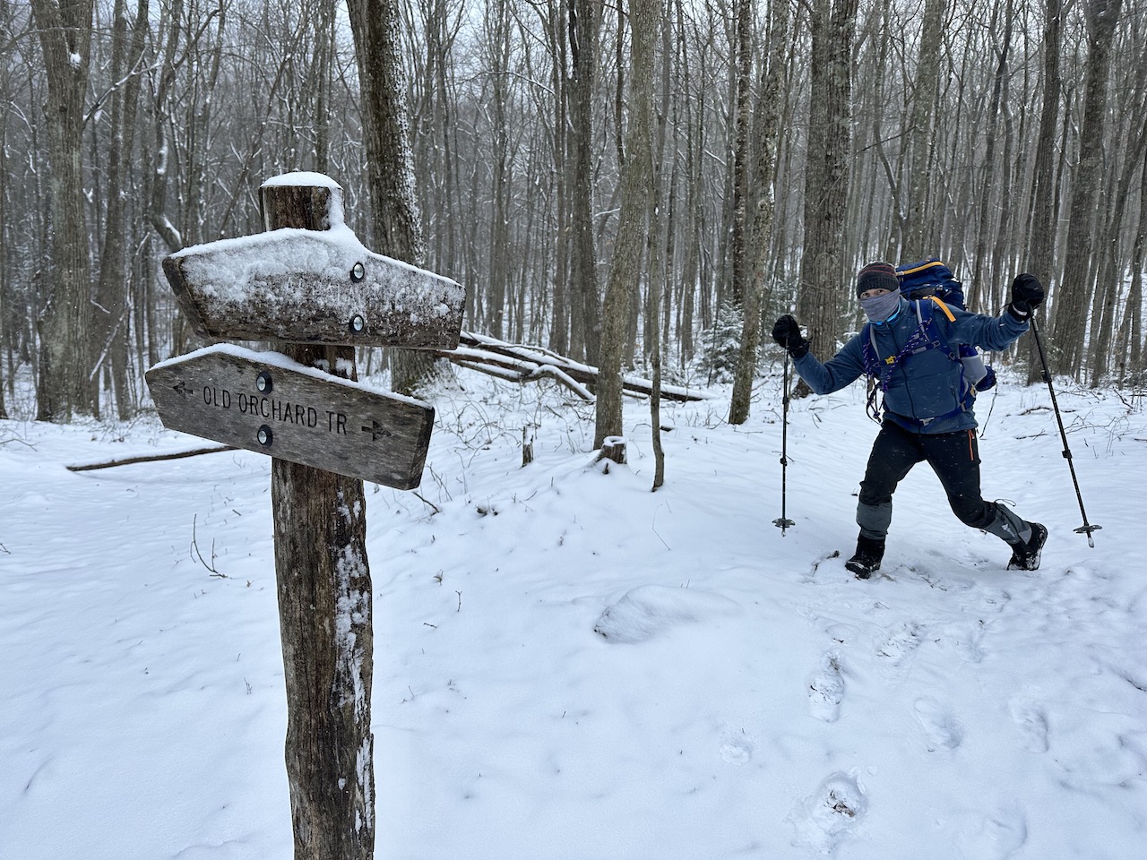
We arrived at the Fox Creek Trailhead off Fairwood Road around 9AM where an inch of snow covered the parking lot. Temperatures were in the teens and the winds were gusting enough to send a shiver down to my crack. Once packed and zipped up, we set off on the Appalachian Trail (AT) en route to the Apple Orchard Shelter about 2 miles away.
In spite of the cold temps, I stopped to shed my down sweater after a half mile. At the shelter, Rodrigo adjusted his boots and signed the journal, then we rejoined the AT for a one-mile hike up to Pine Mountain Trail. As we climbed, the snow got deeper, air colder, and wind, uh, windier; it was a stark contrast to the parking lot below and a taste of what lied ahead.
At the AT/Pine Mountain Trail junction we stopped for a snack before following the blue blazes on the way to Rhododendron Gap about 2 miles away. It was a slog at best thanks to the elements. The snow made the trails difficult to follow, blazes hard to find, and it buried ice-covered rocks and covered snowdodendrons that dumped the white stuff down our backs with every passing step.
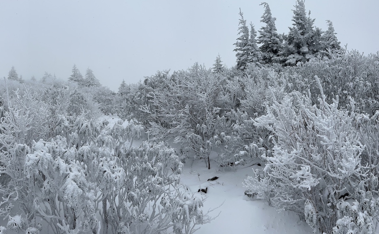
We arrived at the Lewis-Fork/Pine Mountain Trail junction around noon. It was cold, the winds were brutal, and Rodrigo had managed to bend one of his poles. At the junction, I gave Rodrigo the option to continue west along Pine Mountain Trail or take Lewis-Fork Trail or Cliffside Trail north down to Fairwood to avoid the elements (and ultimately shorten our day). He opted to stick to the plan so we continued onward and upward along Pine Mountain Trail where we lost the trail almost immediately.
After wandering for a short bit we spotted a blue blaze and corrected our wrong. We continued our on-and-off trail hiking for a time before, by some divine intervention, we crossed paths with a guy and his dog going in the opposite direction. While it was nice to see other lifeforms, it was even better to have a set of tracks to follow. Huzzah!
Around 1PM we arrived at the Pine Mountain Trail/AT junction, hopped on the AT towards Rhododendron Gap, and took it to the Thomas Knob Shelter where we stopped to warm up and eat lunch.
My thermometer read 0°F. Given the persistent winds the wind chill was easily in the negative double digits. With this in mind, and because my hands were unfathomably cold, I exchanged my wet gloves for dry mittens and hand warmers. Slowly, I could feel the warmth returning to my finger tips as well as the stinging pain that accompanies rapid warming of very cold skin. Once the pain subsided and my hands sufficiently warmed I dug into my snack bag.
Looking at Rodrigo, it was clear he was not warming up as quickly as I had. He was admittedly miserable and needed more time before heading back out. While we waited, a trio of dudes came into the shelter to get their packs from the shelter’s attic. They had come back from an anticlimactic summit trail and were headed down the mountain to an awaiting hot tub. Not sure it was necessary to rub that in our faces, but whatever. Good for them.
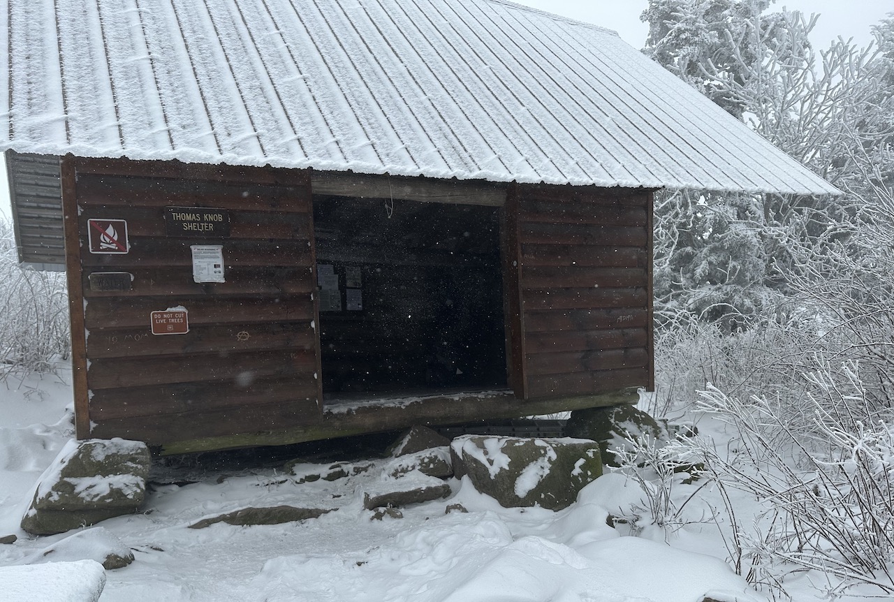
After the dudes left, Rodrigo, still needing a few more minutes to warm up, asked where we were on time. I let him know that we were about an hour behind, but we could likely make up some of that time as we descended the mountain. Ten minutes later, we were making our way along the AT to the Mt. Rogers Trail two miles away.
Along the way, we passed a guy in overalls, flannel shirt, and an honest-to-god wizard’s staff. He asked about the Mt. Rogers summit and I shared there were no views. He was neither thrilled, nor deterred, because he continued up the trail. Minutes later, we passed a second hiker who was backpacking with her dog. She was dressed for the occasion and her dog appeared to be living his best life. Then, about a half mile from the AT/Mt. Rogers Trail junction, we passed a third hiker wearing jeans and a spring jacket. Jeans and a friggin’ spring jacket. While I can’t say for sure, there’s a solid chance that two of the three hikers are still up there.
We reached Mt. Rogers Trail and turned right/north, picking up the pace as we started our descent. At this point we were still about an hour behind which meant we were either going to be setting up in the dark when we arrived at Cherry Tree Shelter in 5.5 miles or we’d find a different spot to settle down for the night along the way. Given the reality of the situation, I stopped and suggested to Rodrigo that he keep his eyes open for a potential site.
Not long after our reassessment, we found a decent spot about 2 miles north of VA603 just off the trail. Fire ring, check. Water source, check. Flat area for two tents, check. I pitched it to Rodrigo and he said to keep moving.
With 3.5 miles to go, we started to move a little more quickly. I became a slave to my watch. I calculated the time and distance to the road and to Cherry Tree at 2MPH, 2.5MPH, and 3MPH. Bottomline, we really needed to get moving if we wanted to make it to Cherry Tree Shelter, or any spot for that matter, before dark.
By 4:30PM, with about an hour ’til sunset, we arrived at the Mt. Rogers Trail/Grindstone Campground spur. I gave Rodrigo two options: 1) Roll the dice and hope we find something along the spur as I knew there was a water source along the way, or 2) Hike a half mile to the road and another 1.6 miles and 600′ of gain to Cherry Shelter.
He chose the spur.
We walked with our heads on a swivel until we found an open area near a creek. We set up our tents and gathered wood. Once those chores were complete (and since Rodrigo’s hands were not cooperating) I boiled water and prepped his dinner whilst eating dry ramen before turning my attention to the fire.
It took several tries before I got the wet wood to take. Unfortunately, 30 minutes later, the fire died out completely as the wood was simply too wet. Since neither of us wanted to sit around a nonexistent fire we retired to the comfort of our sleeping bags around 7PM.
DAY 2 (6.77 MI | +1,083′ GAIN | -1,385′)
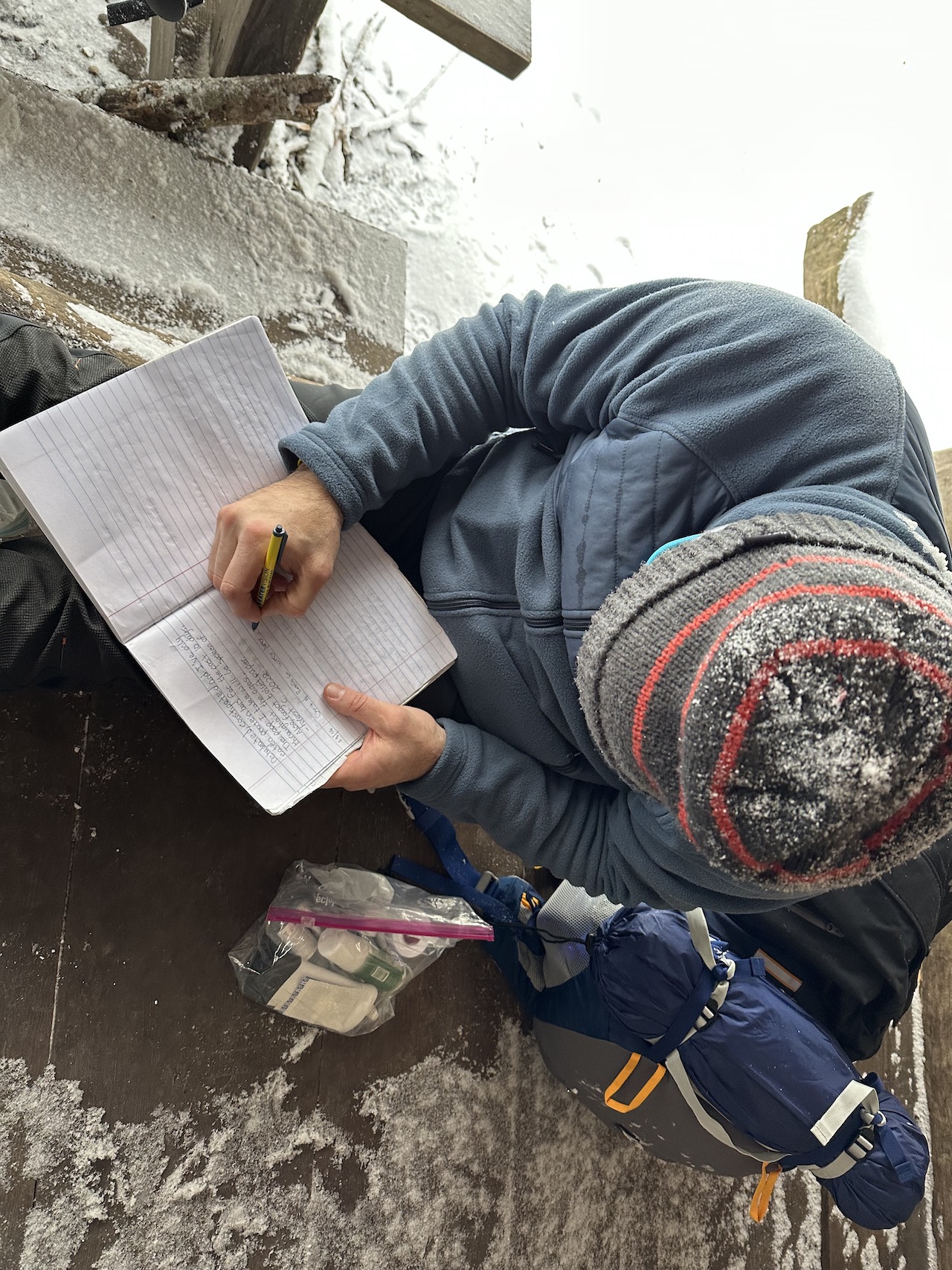
I woke a few times over the course of the night, but forced myself to stay in my tent until the sun came up around 7:30AM. Once up and about, I broke down my tent, ate a hearty breakfast of half-frozen chicken strips and beef sticks, and chased it down with a warm cup of coffee.
As we breakfasted, Rodrigo shared that he didn’t sleep well. That his sleeping bag was wet from the previous day’s hike, that his sleeping pad wasn’t cooperating, and as a result, he was not comfortably warm at night. I suggested an alternate route to Hurricane Shelter and Rodrigo suggested we hike the route, but turn south on the AT at the Iron Mountain/AT junction and hike back to the car. He didn’t think he could manage another night in the cold. No worries. Better safe than miserable.
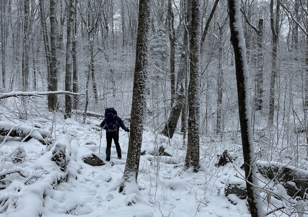
From our camp we made our way through the woods, through the campground, and on to VA 603 where we walked the road to the Flat Top Trailhead. We then took Flat Top up to Cherry Tree Shelter under blue skies and warmer temperatures.
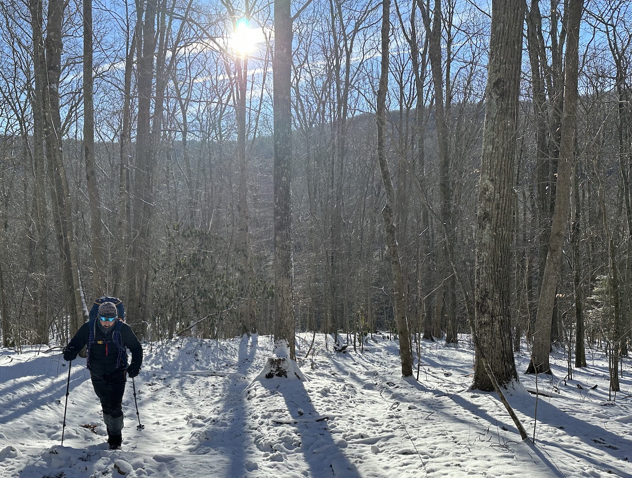
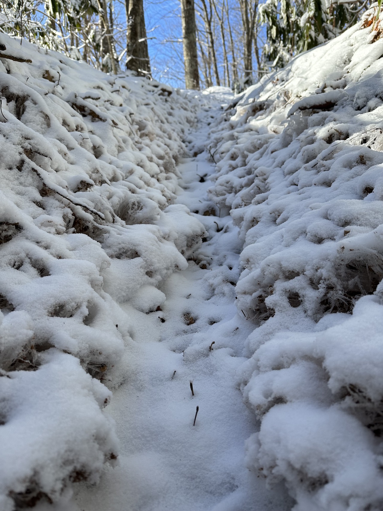
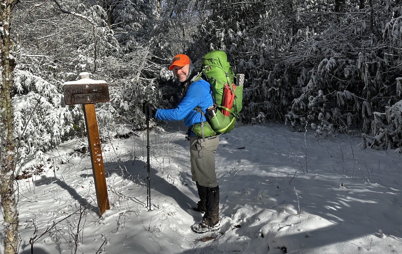
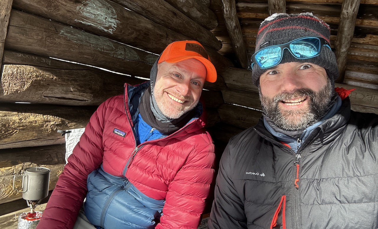
Photo by Rodrigo
At the shelter, I downed a cup of coffee and Rodrigo enjoyed a cup of mate cocido. We ate snacks. We laughed. We smiled. It was delightful. With bellies warm and full, we headed out on the Virginia Highlands Horse Trail which later joined the Iron Mountain Trail.
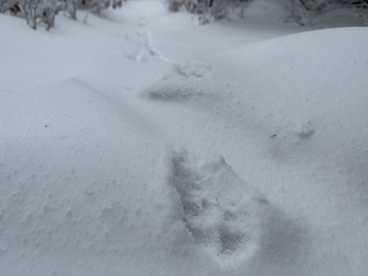
We talked about the bear attack in Montana where a guy survived two attacks from the same grizzly, commented on the countless animal tracks, and made snow angels. At the AT/Iron Mountain Trail junction we hung a right/south, started our remaining 2.25 miles, and arrived back at the car just after noon.
Trip complete.
TOTALS ( 20.14 MI | +3,758′ GAIN | -3,805′ LOSS)
FINAL THOUGHTS
I love winter backpacking. I love the snow and complaining about the cold. I also really enjoy the Mount Rogers National Recreation Area. It’s a bummer that we didn’t complete the entire route, but we made the best decision to ensure our safety. Sure, we could’ve pushed through the day, but it wouldn’t have been enjoyable for everyone. No worries though, we got to hike AND live to do so another day.