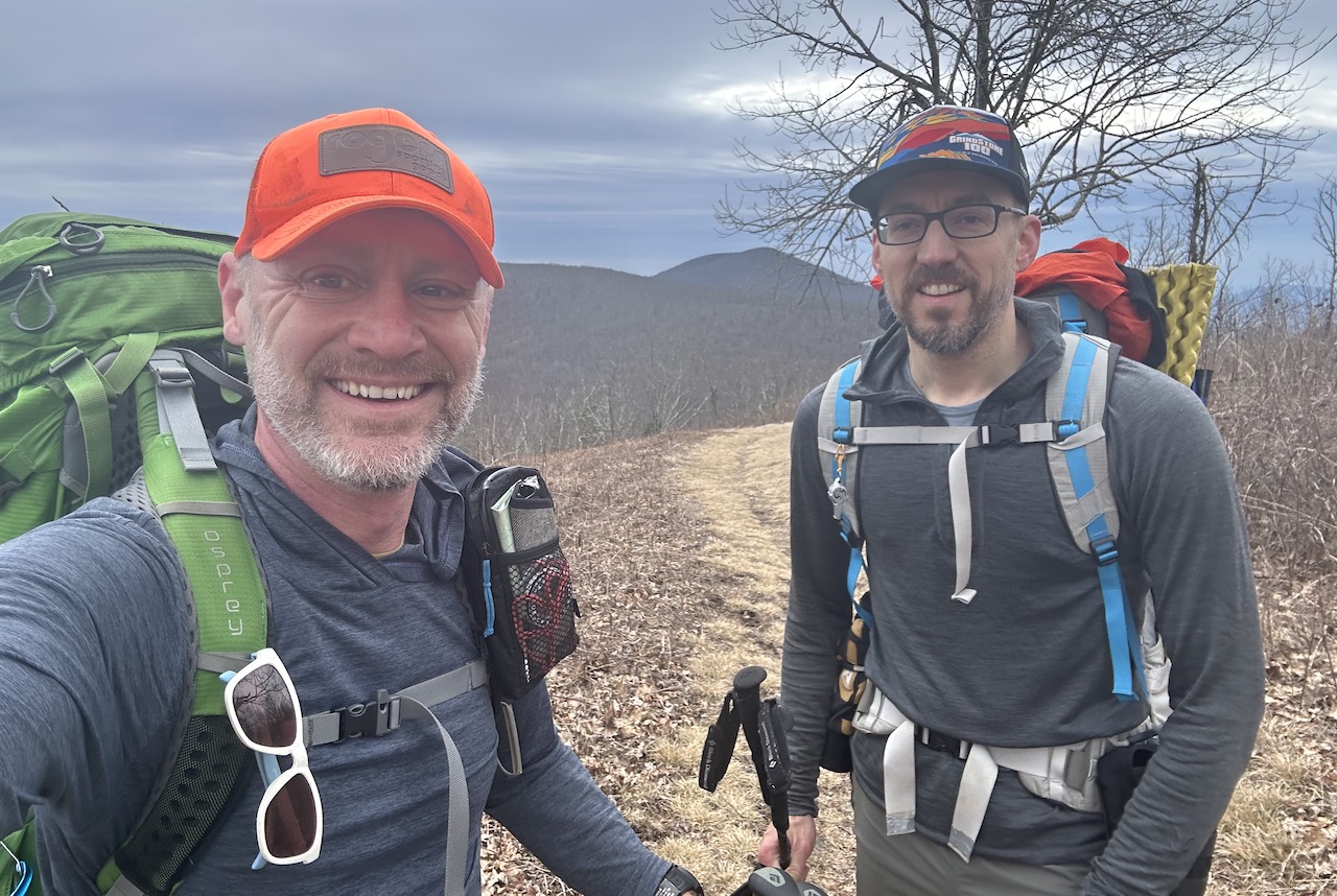
In November 2019, I ran the Mountain Masochist 50-mile trail run from Monroe to Montebello, Virginia with my buddy, Coop. During the race, we completed a 5-ish mile loop around Mt. Pleasant, an aptly named national scenic area with picturesque views. As we finished the race, and for the next couple of years, we talked about returning to the area with backpacks, but we never did, until we did.
THE PLAN
Appalachian winters forecasts are predictions not promises making winter trips to the backcountry a bit unpredictable. With weather at the forefront of our minds, Coop plotted a nonsensical combination of loops and out-n-backs starting from the Mt. Pleasant Trailhead to include Cole Mountain, Mt. Pleasant summit, and a poop ton of ups and downs along the Appalachian Trail.
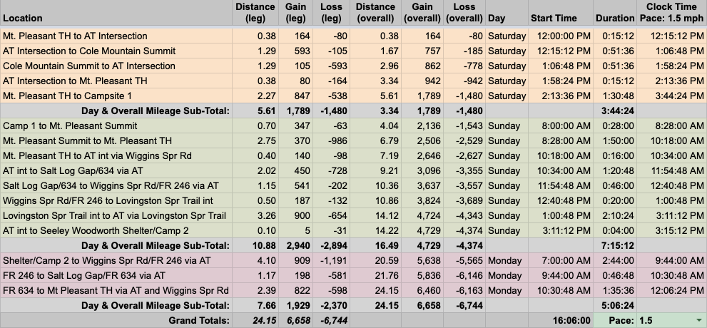
With no further reason to delay the trip any longer, Coop plotted the 24-mile route using CalTopo then dropped the details in a spreadsheet based on a 1.5 MPH pace…
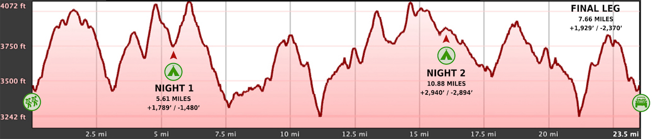
…created an elevation profile
…dropped in the route
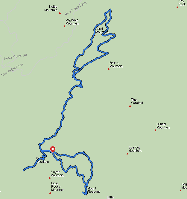
…and packaged it all in a map that we printed on TerraSlate paper.
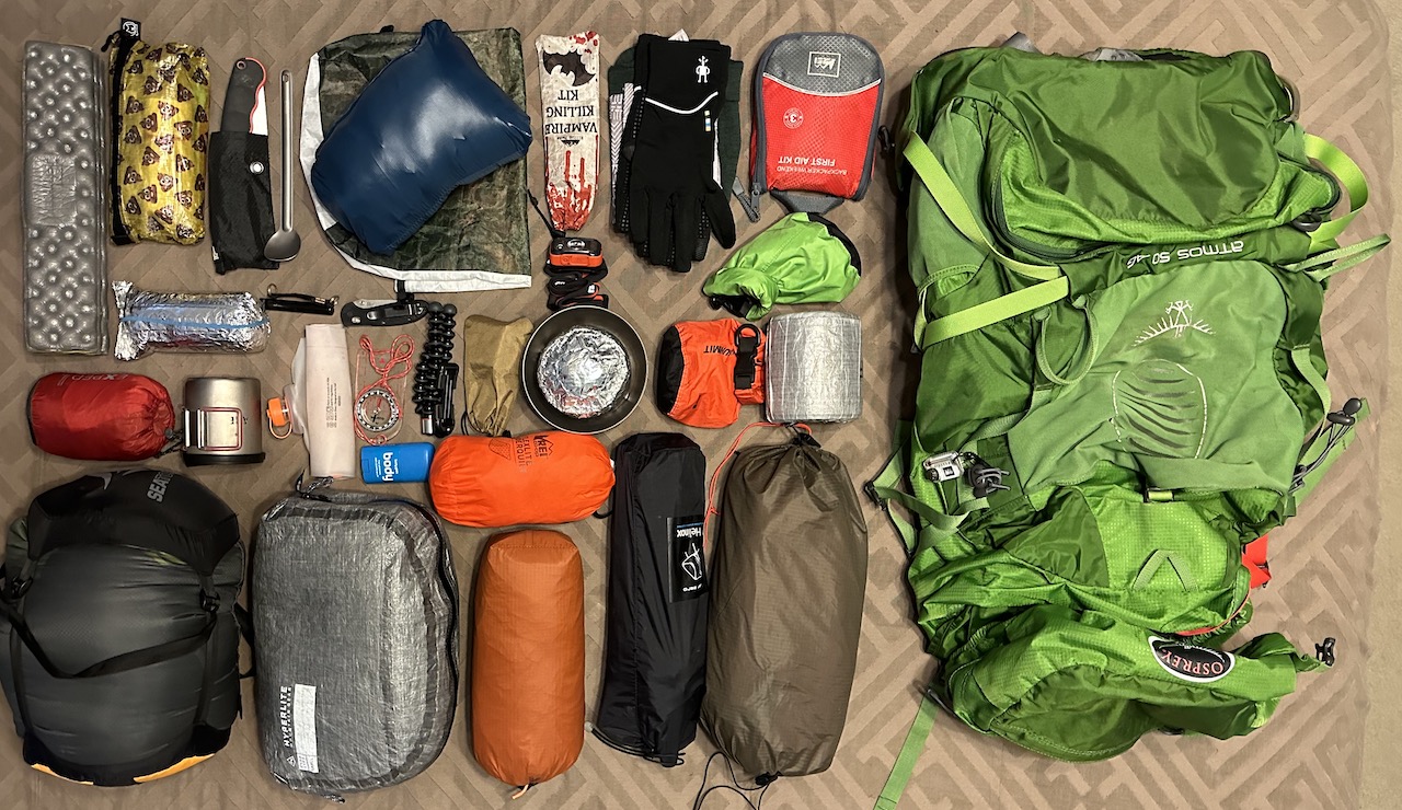
PACKING IT IN
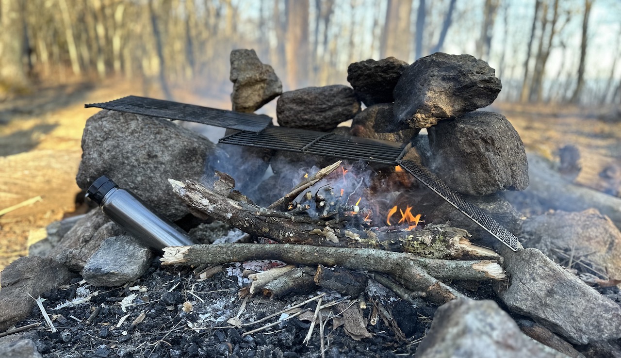
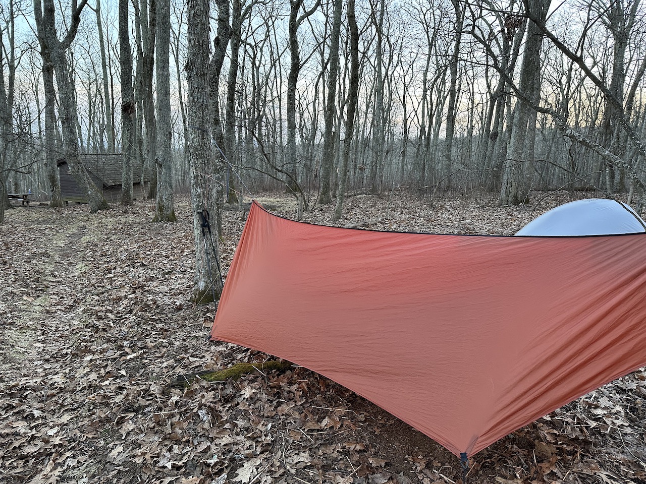
The weather forecast look favorable (for winter anyway). No rain, winds in the teens, gusts in the twenties, daytime temps in the upper 40s, and near-freezing temps each night. This translated to a running kit while hiking and additional layers for lounging. For shelter, I opted for hammock with a 30°F underquilt and 10°F sleeping bag. As for odds and ends, my kids threw in a couple of LEGO minifigures to share in the adventure (3 oz) and my daughter insisted I bring a deck of cards in case Coop and I got bored (5.1 oz). Lastly, Coop and I brought grates to help keep the fire at bay and to keep us in alignment with the restrictions in place.
With everything loaded, including water, nonessentials, and food, my 50L Atmos weighed in at a whopping 31 lbs. 10.6 oz.
DAY 1 (5.77 MI | +1,614′ GAIN | -1,332′ LOSS)
The drive up to the Mt. Pleasant Trailhead was fine until we got to Wiggins Spring Road. I don’t remember exactly when the road turned into a battlefield, but it was some point after the sign that read “End of State Maintenance.” As we drove up the road we literally bounced in our seats thanks to the craters, dips, and giant oil-pan-destroying rocks. Though I drove a 4X4 SUV, the road is doable in two wheel drive as was evident by the number of 2-wheel drive vehicles we saw at the AT/Cole Mountain junction and Mt. Pleasant parking lots.
Anywho, so we’re making our way to the trailhead parking lot when Coop gets quiet, a little too quiet.
COOP: I forgot my coat.
ME: You forgot your coat?
COOP: Yep. I forgot my coat.
ME: Your coat.
COOP: My coat.
ME: …
COOP: …
ME: …
COOP: ….
ME: I have a sweater vest you can use.

With our trip crisis out of the way, I parked and we proceeded to pack up before hitting the trail around noon fifteen.
From the lot, we headed west along Wiggins Spring Road towards the AT for 0.4 miles, hung a left/south on the AT, and continued for a mile and a quarter to the top of Cole Mountain. Along the way I taught Coop some Spanish – dereche, izquierda, derecho, arriba and a bajo, and he taught me some English words like “We should’ve left our packs in the car because we’re going to walk back by it.” Since I already spoke English, it was easy for me to repeat the phrase and understand his wise commentary. Nonetheless, we brought our packs all the way to the top, la cima, of the mountain, and carried them all the way back down the mountain on our way to join the Henry Lanum Memorial Trail (formerly the Mt. Pleasant Trail).
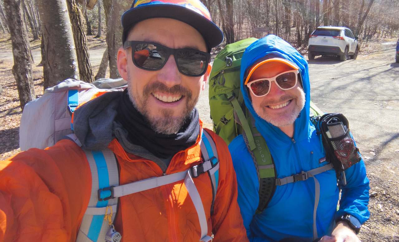
Photo by Coop
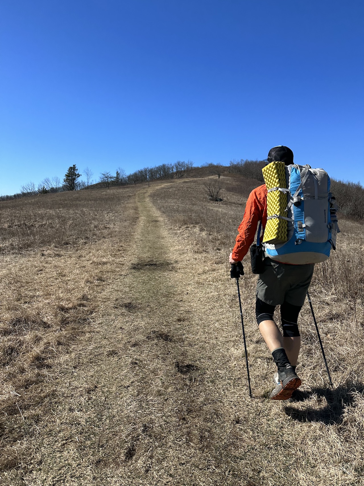
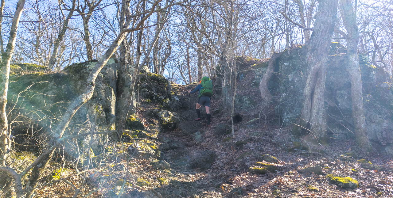
Photo by Coop
We entered the loop from the left and began the 2.27 mile hike and 850′ climb to our Mt. Pleasant Summit Trail campsite. The first three quarters of a mile climbs 400 feet before dipping down a half mile to the base of Pompey Peak. The 0.4 mile, 400 foot climb up Pompey wasn’t a beast, but it was enough to force us to shed a few layers for the remaining 0.75 miles to the campsite.
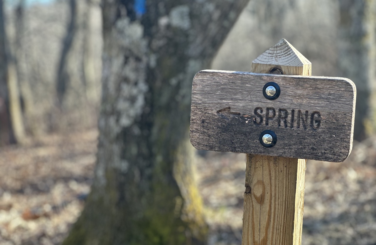
Upon arriving at the clearing near the Summit spur trail, Coop recalled reading about a nearby spring. To confirm its location, we walked the spur 20 feet or so to a sign directing us to a spring that was located down the hill. With the location of water determined, we put a pin in filling up and headed back to the clearing to look for a campsite.

Our quest for a suitable location lasted all of 10 seconds and went something like this:
COOP: There’s a fire ring.
ME: Let’s set up there.
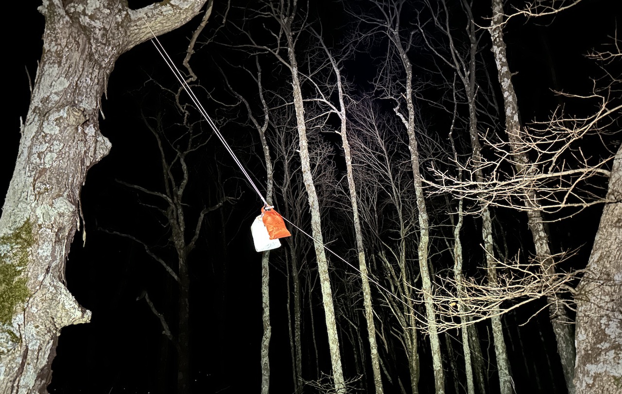
We got to work setting up shelters, gathering wood, and hanging a line for our bear bags before returning to the spring trail to fill our bladders. Once replenished, we headed back to camp and got busy enjoying the best camp duty of all duties: lounging.
From the comfort of our nonessential chairs, we watched a few groups of hikers come and go along the main loop. Just before sunset, one particular group of four, twenty-something hikers came walking down the trail from Pompey in open-toed footwear, shorts, and short sleeves. They stopped and looked around before one of them walked over and asked us how to get back to the trailhead. We pointed out their current location on the map they had pulled up on their phone, let them know they were at the midway point, and suggested continuing west back to the trailhead.
After they left, we sat around the fire for a few more hours before hanging our food and turning in around 10PM.
Day 1 complete.
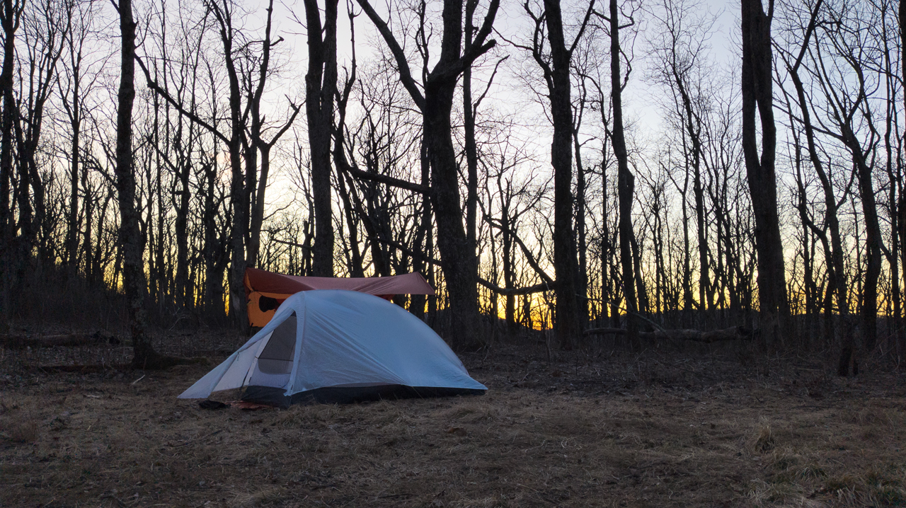
Photo by Coop
DAY 2 (11.73 MI | +2,406′ GAIN | -2,288′ LOSS)
Apart from some intense coyote howling near our campsite, the night was pretty calm. We both woke at 5AM, broke down in the dark, and hit the trails at 6AM so we could catch the sunrise on Mount Pleasant East.
We made the half-mile, 300-foot ascent up the summit trail and made breakfast and coffee as the sun rose.
From the summit we walked back down to Henry Lanum Memorial Trail and headed west/left toward the trailhead. On the way, we refilled water at North Fork Buffalo River about 0.9 miles from the summit trail, and arrived back at the parking lot 1.3 miles later.
From the lot we headed west, again, down Wiggins Spring Rd and turned right/north up the AT at Hog Camp Gap. We followed the AT up to Tar Jacket Ridge and down a steep decline to Salt Log Gap where Coffeytown Rd, Alhambra Rd, FR1176, and Wiggins Spring Road intersect about 2 miles from Hog Camp Gap.
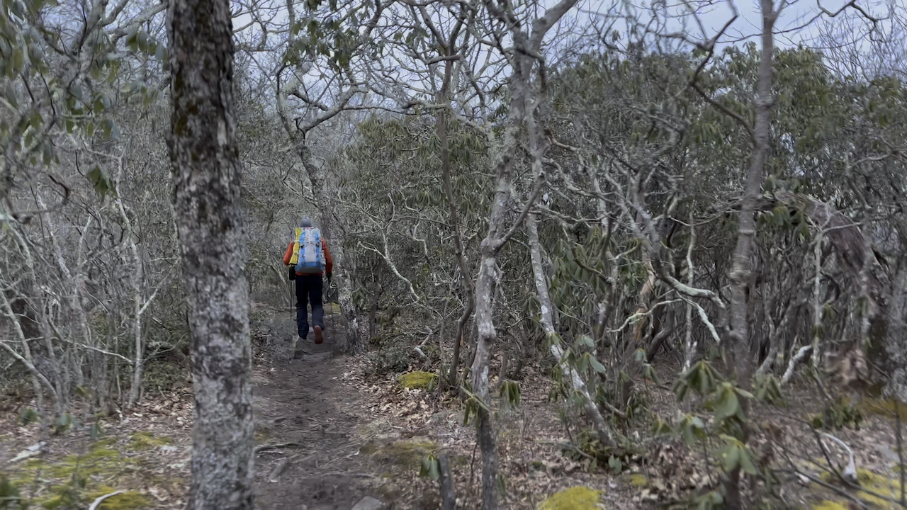
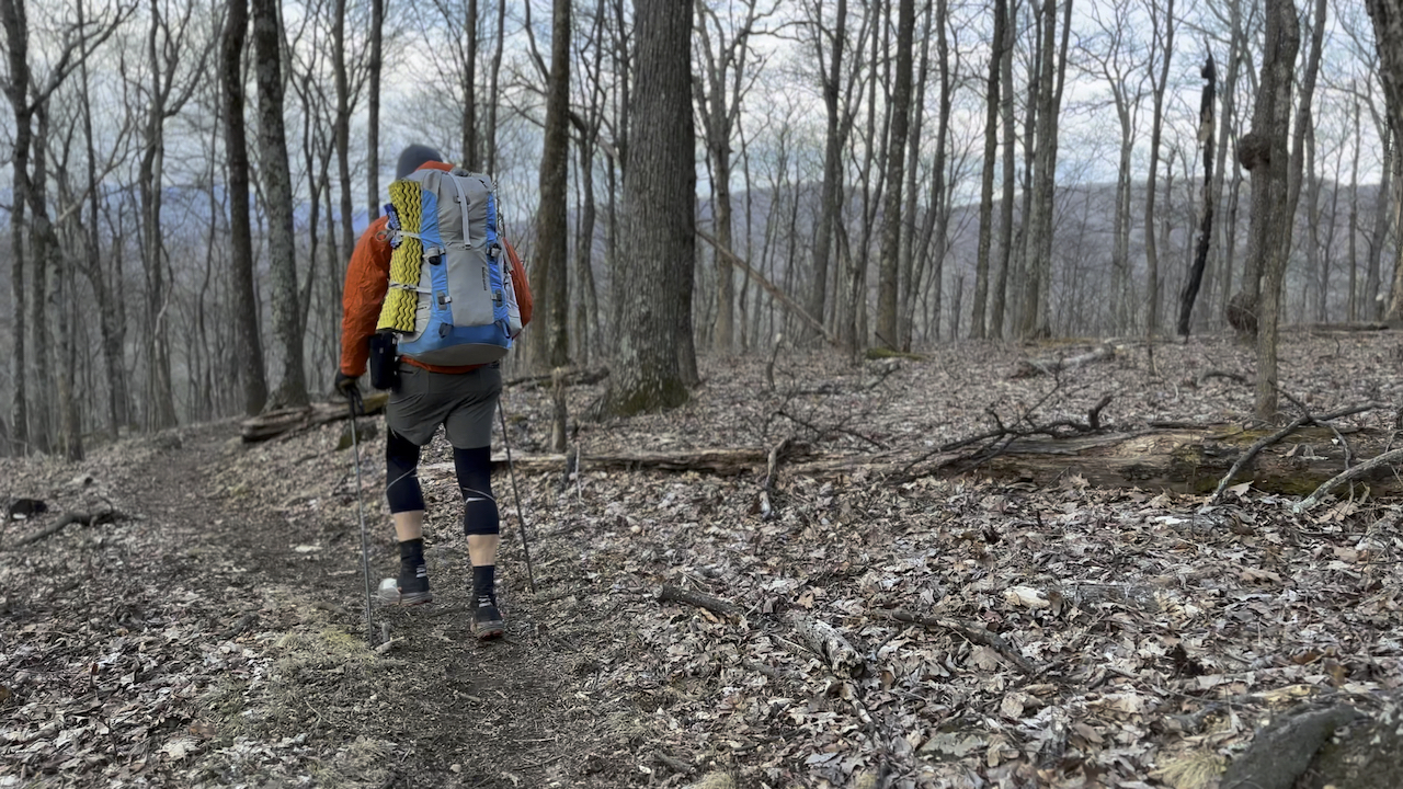
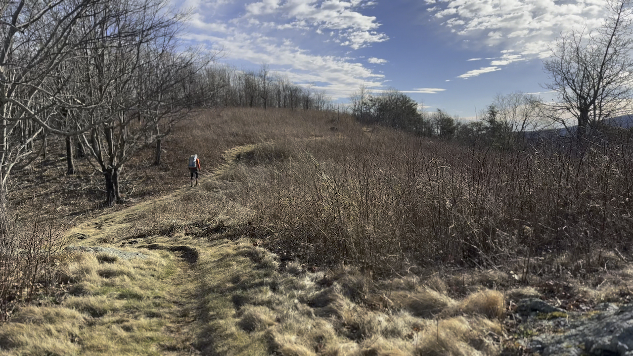
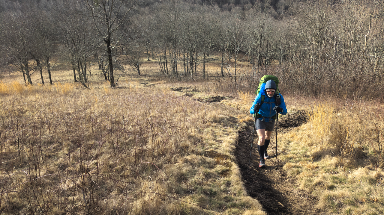
Photo by Coop
From Salt Log Gap, the AT climbs straight up at an 11% grade before settling off over the course of a mile to FR246 where we crossed the road and turned left/north on Lovingston Spring Trail. Around 11AM we stopped for lunch for a short bit before heading back on Lovingston for some more hiking goodness. At some point between not paying attention and staring at the clouds, we left Lovingston in favor of a road that skirted Elk Pond Mountain (4,023′) to the east before magically rejoining Lovingston on the north side of Elk Pond Mountain.
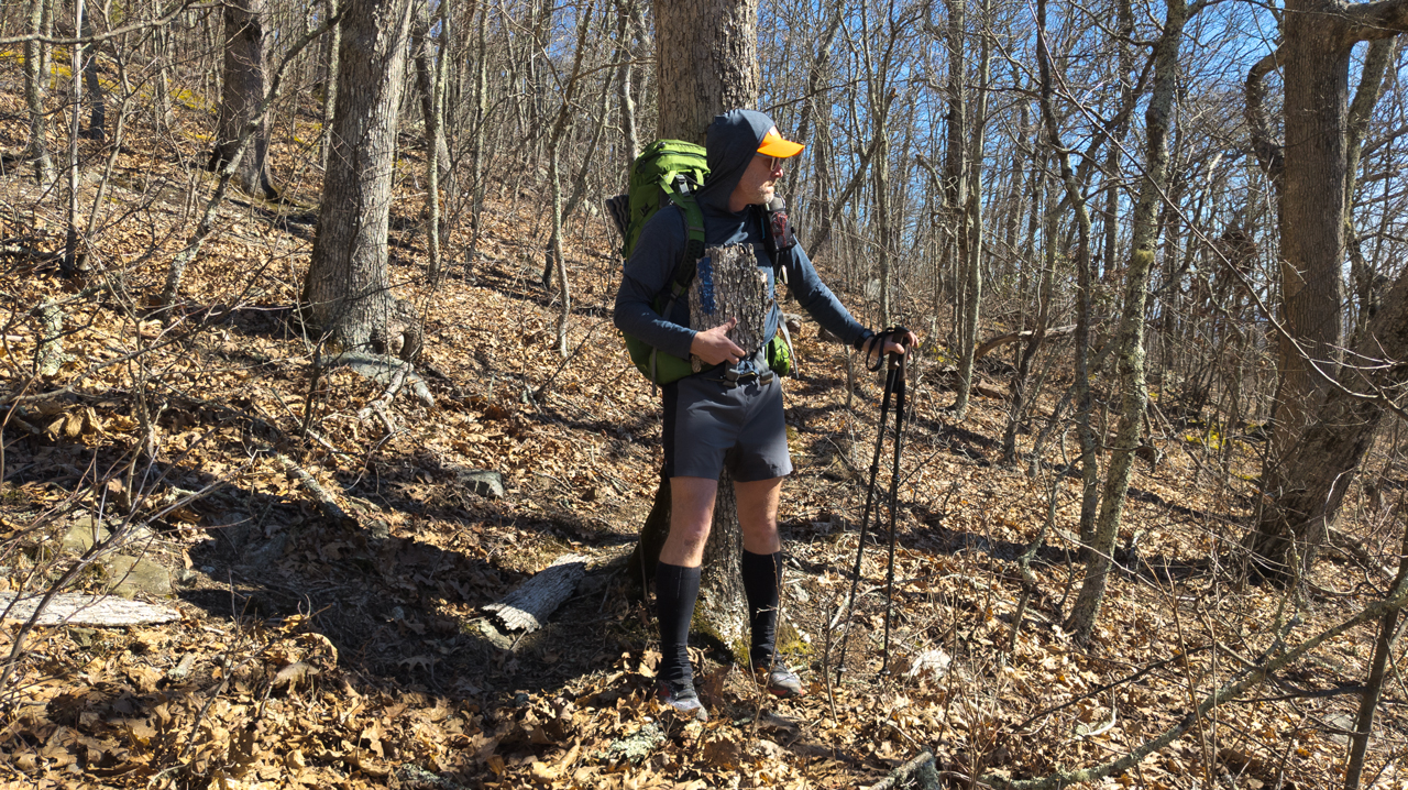
Photo by Coop
After Elk Road Mountain, the road/trail was bordered by red-painted trees marking the boundary line. At one point, the trail split the red-painted trees down the middle as if we were traveling through a bend in space and time. The more we walked, the more confusing our position in relation to the boundary became. Somehow, though, Coop knew.
COOP: blows whistle on backpack
ME: ?
COOP: Out of bounds!
I burst out laughing at the sheer brilliance of Coop’s wit and continued to chuckle to myself as we hiked the in bounds portion of the road/trail until we couldn’t because it came to an abrupt end. Thankfully, someone dropped a trail sign at that exact spot showing us where Lovingston continues on towards the AT. From the AT-Lovingston junction, we walked a few more minutes and turned left/east down the Seeley-Woodworth Shelter spur.
The area around the shelter was littered with widow makers making it particularly difficult to select a site that wouldn’t come crashing down when the already gusty winds picked up speed. Eventually, we found the least awful spot, set up shelters, and turned our attention to wood, water, and food.
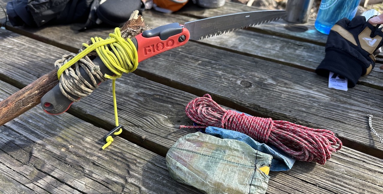
As we collected wood we came across a pair of bear bag lines and throw bags that were stuck in different trees. We considered different ways to get the lines down and carried out three.
- Idea 1. Wrap the line around my hand and pull hard in an attempt to use brute force to break the limb and free the line. This attempt failed miserably AND the I got a pretty gnarly rope burn.
- Idea 2. Throw things at each line to knock ’em loose. This was a really dumb idea, but it allowed us to throw things.
- Idea 3. Lash a folding saw to a long stick and cut each line loose. This idea worked like a charm and earned us one hundred backpacking points.
After removing the lines, we finished collecting firewood and Coop started to get the fire ring ready. No sooner than he had finished making our teepee, the winds picked up. To play it safe, we opted not to start our small fire because it would likely become a much bigger fire.
A little defeated, we grabbed our bladders and followed the blue blazes down to a water source about 500 feet from the shelter and filled up. Back at the shelter we prepped our meals and relaxed. Coop read through the shelter journal and I shivered. I’ve no idea why, but I was really cold. Unable to get shake the shivers, I retired to my hammock at 6:30PM to warm up. By 8PM I was counting sheep.
Day 2 complete.
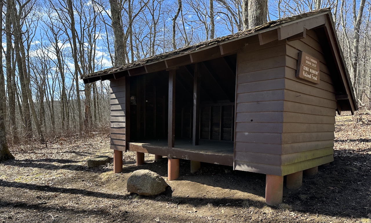
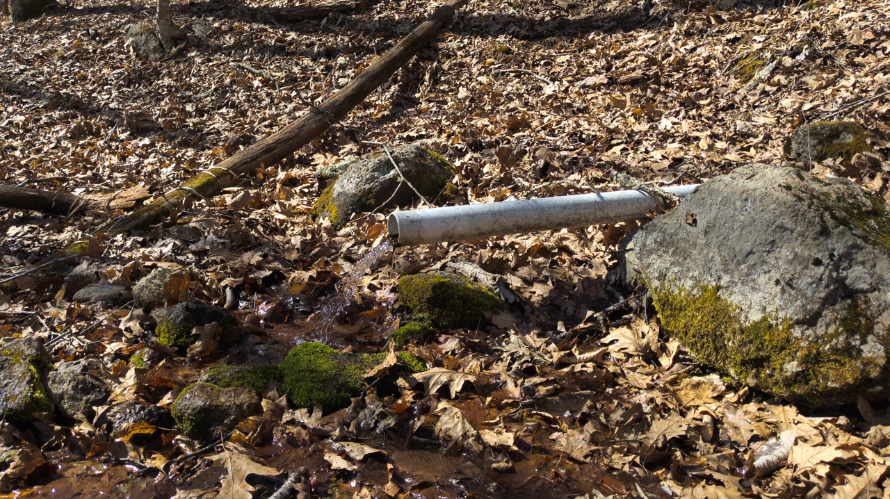
Photo by Coop
DAY 3 (8 MI | +1,368′ GAIN | -1,743′ LOSS)
Overnight, the wind was relentless and aurally unnerving. Throughout the night, the wind would start off in the distance as a faint, whistling howl. Within seconds it’d begin kicking up leaves, snapping branches, and collapsing entire trees as it made its way through our arboreal graveyard. My tarp held back most of the effects, but on occasion, the icy air would find its way through the gaps and send a shiver down my spine.
Despite the wind gods’ efforts to the contrary, I slept fairly well and woke just before 6AM, relaxed and ready for the day. Since the sun and Coop were still asleep, I waited for Coop to show signs of life, before breaking things down and heading to the shelter for oatmeal and coffee. After breakfast, we packed up, swept the site, and made our way up the shelter spur—hanging a left/south on the AT around 7:30AM.
The morning air was crisp, sky was overcast, and the winds were calm. I was feeling great and decided to push the pace. Within 15 minutes we had crossed Elk Pond Branch, a creek just east of Elk Pond Mountain and 0.75 miles south of the shelter spur. A mile later we rockhopped across North Fork Piney River (which is more of a creek than a river). At 8:50AM we arrived at the Lovingston Spring/AT junction and were just about halfway done with our day’s 8-mile hike.
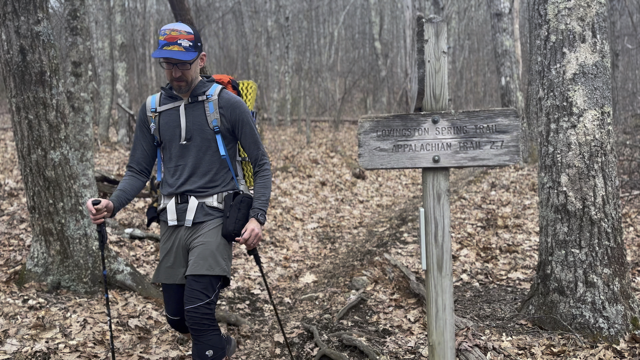
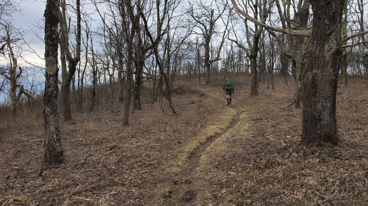
Photo by Coop
We crossed FR246 a few minutes later and made the 1.25 mile, knee-busting descent down to the Salt Log Gap. From there, we had one last (and ridiculous) 1.1 mile, 560 foot ascent up and over Tar Jacket Ridge. While not the steepest climb, my persistence to keep our current pace up the climb’s 8.1% grade did a number of my calves, hamstrings, and glutes.
Once we crested the ridge we took a quick breather before making the final 1.1 mile, 436 foot descent to the car, finishing our 8-mile day in 2 hours and 36 minutes.
While no one else cares, it felt great to challenge ourselves and come out on top.
TOTALS (25.5 MI | +5,388′ GAIN | -5,363′ LOSS)
FINAL THOUGHTS
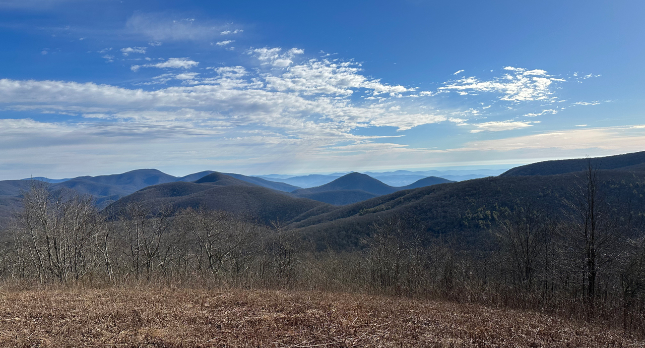
This trip was a blast. It’s hard to believe we put it off for so long. The views from Cole Mountain and Mt. Pleasant East were amazing. Tar Jacket Ridge was challenging, but well worth the pain. And, while the weather was colder and windier than forecasted, I’m thrilled that we were able to pull off a winter trip in Virginia, in February, that allowed us to put in some miles without having to posthole our way along the trail. I was surprised to see so many people on Day 1 near Mt. Pleasant and Cole Mountain, but it’s understandable given the views and how easy it is to access them. Whether you want to blend in with the crowd or seek out isolation, Mt. Pleasant and the surrounding area is a great place to go.