Getting away for a weekend can sometimes be a challenge. Thankfully, there are a handful of places I can quickly access including Doughton Park; the largest recreation area the National Park Service manages on the Blue Ridge Parkway.
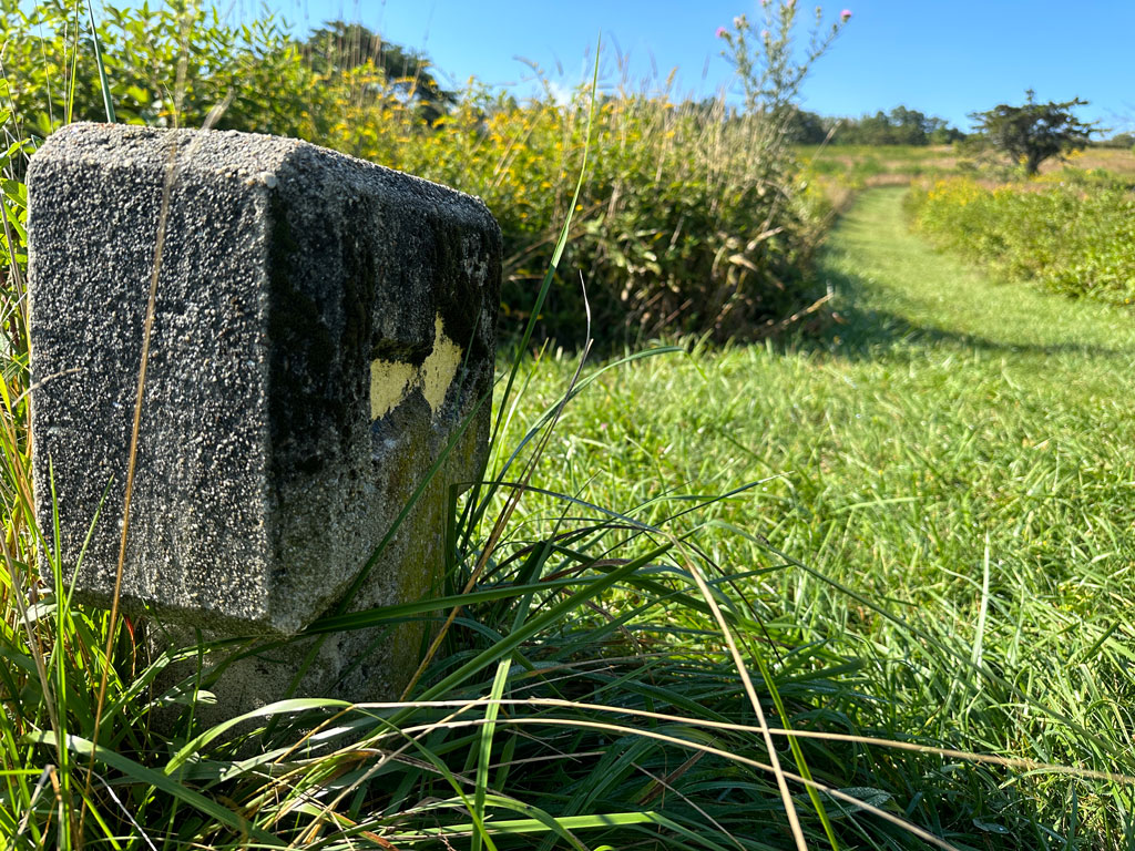
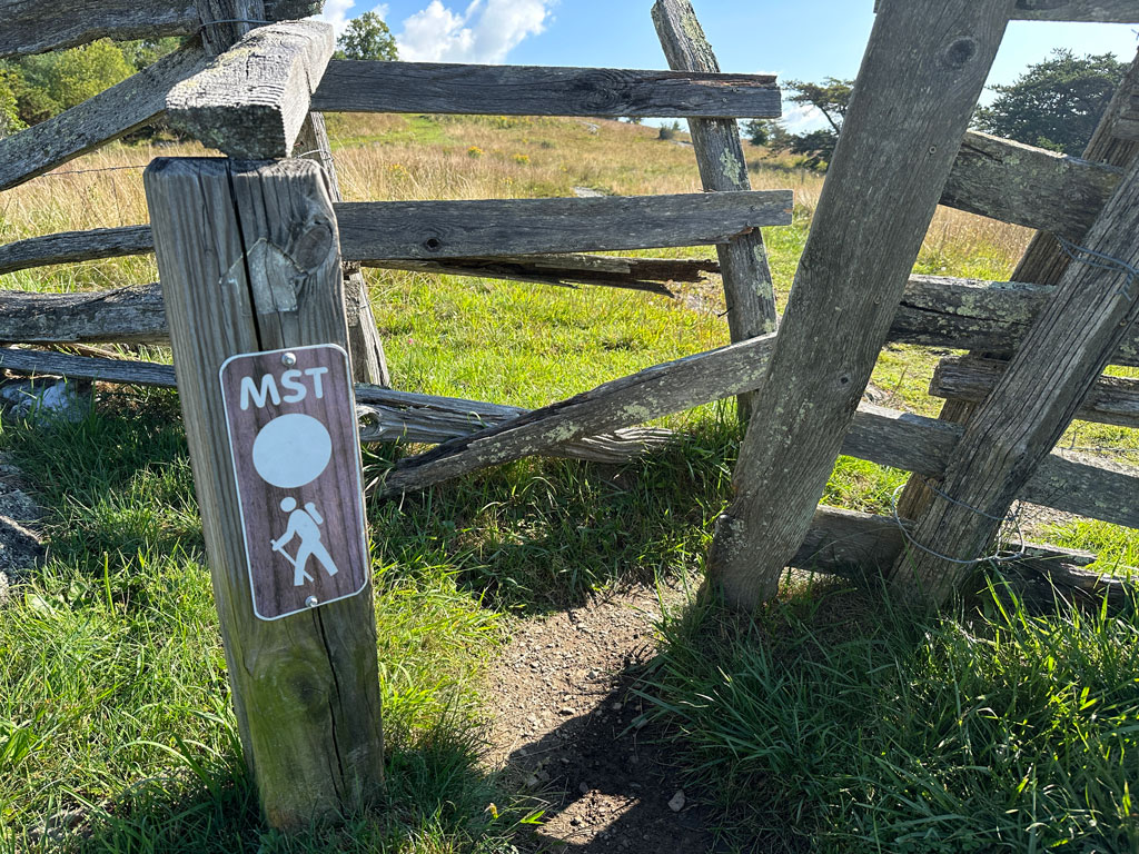
Located just west of Stone Mountain between Wilkes and Alleghancy Counties in North Carolina, Doughton Park consists of incredible views, wide open meadows, and some really challenging inclines. Additionally, part of the iconic 1,175 mile Mountains-to-Sea Trail (MST) passes through the park and passing by some breathtaking vistas. Having been to Doughton Park before, given the campsite at Basin Cove and the challenging trails, I opted to return to the area for a weekend solo trip.
THE PLAN
Campsites in and around Doughton Park are limited so to keep it simple I applied for a free permit to stay both nights at the primitive campground at Basin Cove 1.7 miles from the Grassy Gap parking lot.
Using my prior knowledge of the area, along with AllTrails and GaiaGPS, I plotted a route from Grassy Gap to the campground via Grassy Gap Fire Road where I’d stay the first night. On the second day, I’d follow the Bluff Ridge Primitive Trail up to the MST, take it back east towards Cedar Ridge Trail, and then descend Cedar Ridge to the bottom where I’d hop back on Grassy Gap Fire Road back to the campground. The third day would be an easy 1.7 miles back down the fire road to the Grassy Gap lot.
The only potential wrench in the plan was the forecast. If it rained, I’d probably be good. If it stormed, there’d be a chance the campground and the fire road would flood. I guess I’d just have to play it by ear.
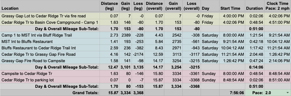
With my plan set, I built out a 16-mile trip route in a spreadsheet based on a 2.0 MPH pace…
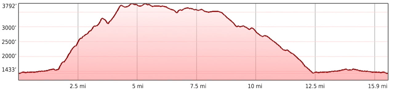
…created an elevation profile
…dropped in the route
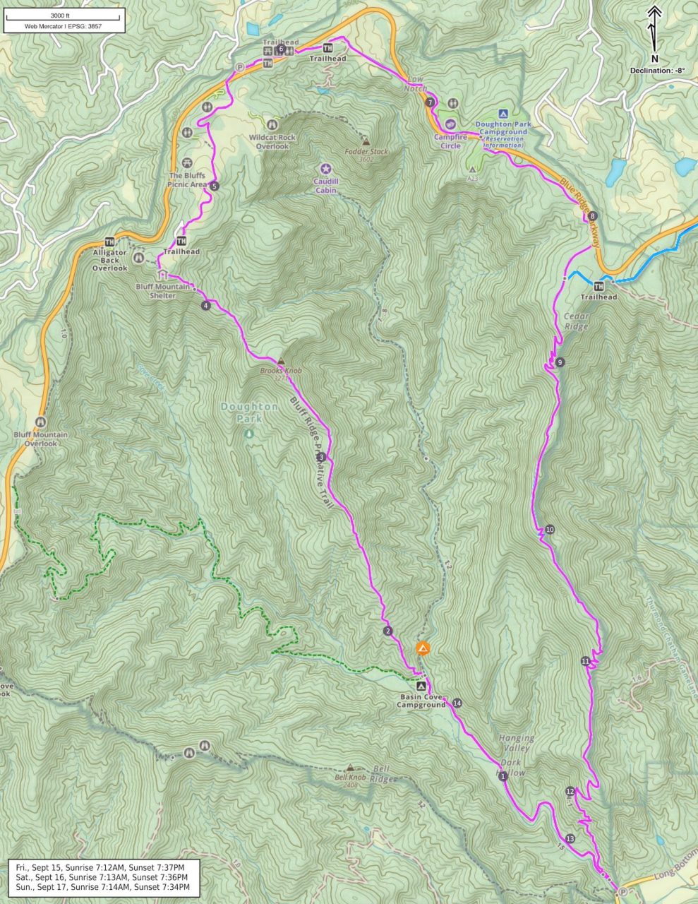
…and packaged it all in a map that I printed on TerraSlate paper.
PACKING IT IN
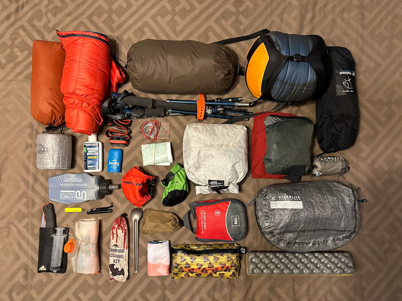
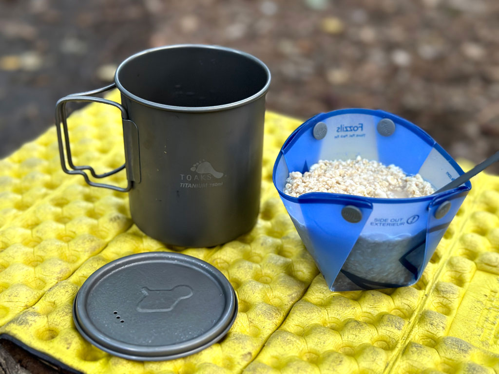
Download my complete trip gear list
With rain in the forecast and overnight lows in the upper 40s, I opted for hammock along with top and under quilts. The night before I left, the forecast got worse: thunderstorm and flood watches for Saturday evening into Sunday morning. To that end, I brought along my Outdoor Research Helium rain pants, Arc’teryx Zeta jacket, and a stuff sack full of humility.
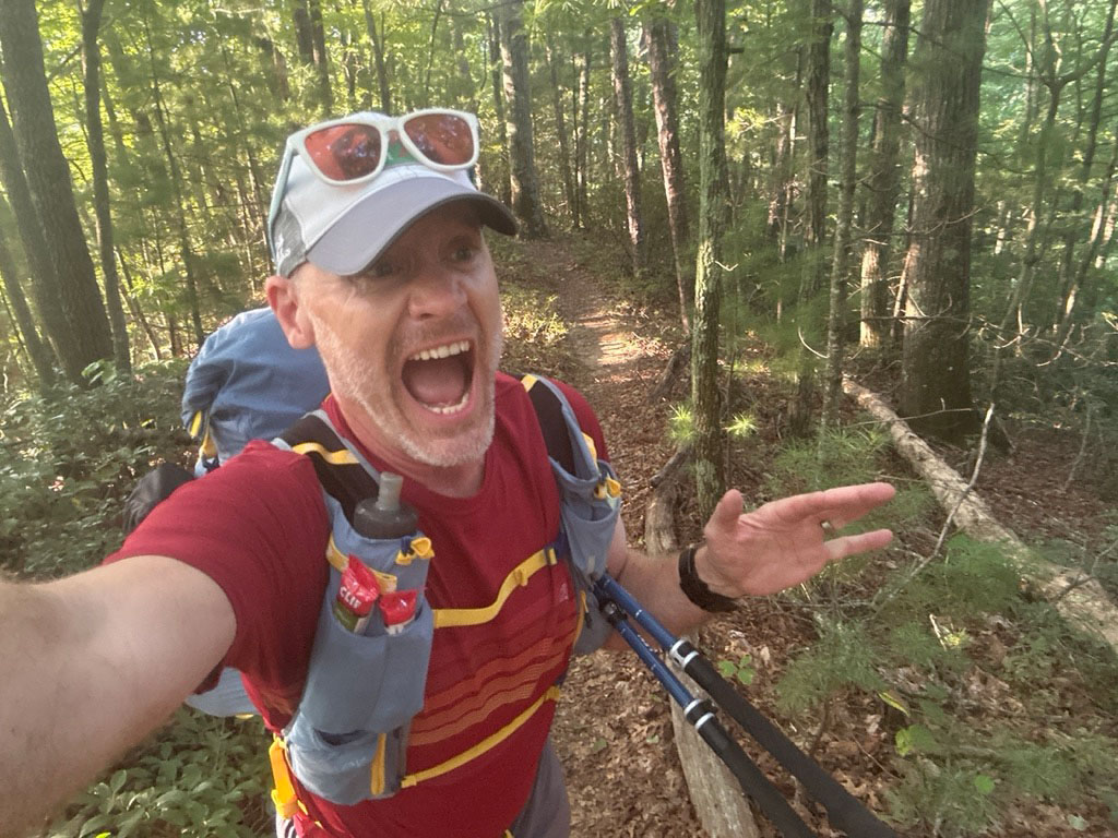
Because I enjoy running, my plan for the second day was to fastpack as much of the 13-mile leg as possible. To keep things light (and comfortable), I left a few things back so I could bring my down sweater vest and wool hoody to stay warm and my Helinox Zero to keep my bum comfy.
With everything loaded, including water, rain gear, and food, my 30L UD Fastpack weighed in at 20 lbs. 8.6 oz.
DAY 1 (1.69 MI | +223′ GAIN | -58′ LOSS)
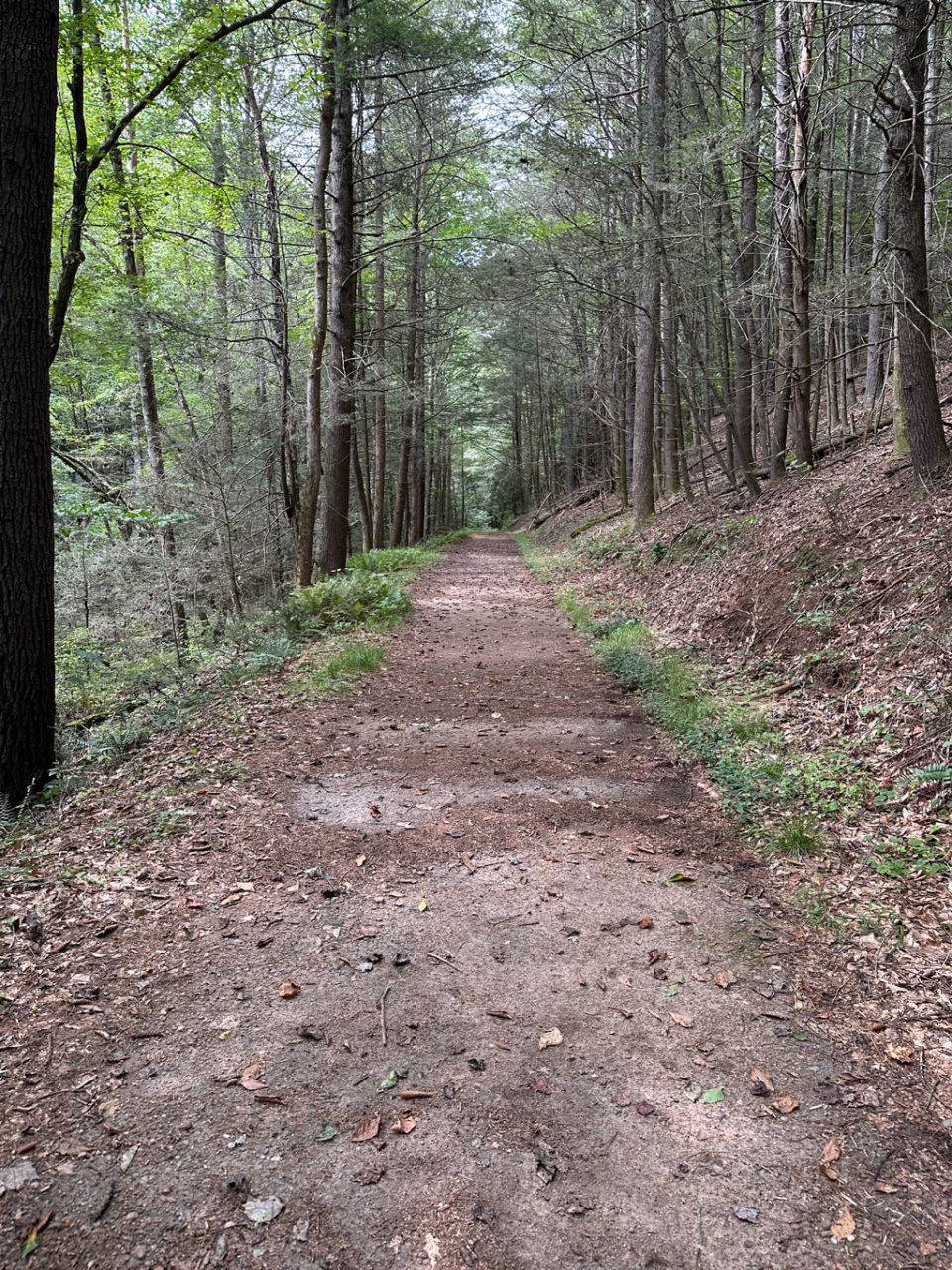
I arrived at the Grassy Gap lot at 2PM and headed out a few minutes later. From the lot I crossed Longbottom Road and joined Grassy Gap Fire Road. A half mile in, I passed a runner huffing it in the other direction. Another mile after that, I passed a hiker who was also headed in the opposite direction. By 2:41PM, I arrived at an empty Basin Cove campground just as two hikers and a dog came down the fire road from the west/northwest on their way up Basin Creek Trail to Caudill Cabin.
Caudill Cabin is arguably the main attraction within Doughton Park. And, while there’s no one particular way to get there, all trails to the cabin go through the Basin Cove campground. From there, the Basin Creek Trail climbs 1,200 feet over 3 miles with a poop ton of creek crossings en route to the cabin’s front door.
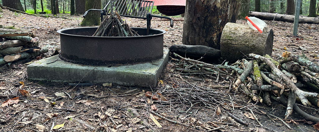
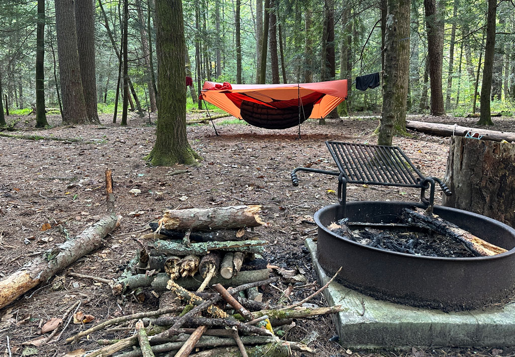
Anyway, with no campsite competition, I selected a site, set up camp, completed my chores (shelter, wood, and water), and proceeded to do nothing. I sat and did nothing. Stood and did nothing. Sometimes, I got up to do nothing then came back and continued to do nothing. And while that might sound like I was doing something. I was, in fact, doing nothing.
Around 3:50PM, while my buckets of nothing spilled over, a hiker came up the fire road from Grassy Gap on his way to Caudill Cabin.
After the hiker passed by, I returned to staring at the ground. The closer I looked the more clear it was that if there was heavy rain there’d likely be a lot of standing water. I got to thinking about Saturday night’s forecast—showers and thunderstorms starting around 2AM with rain lasting through most of the morning. Maybe it’d blow over.
I shifted my pondering thoughts to calculating the Caudill Cabin hikers return time. Given the incline and the creek crossings I estimated 2 MPH out (1 hr 30 min) and 3 MPH down (1 hour) with 15 minutes to check out the cabin. Using these estimates, the first hikers would be back around 5:26PM and the second hiker would be back around 6:35PM.
Around 4:35PM, two deer made their way along the fire road to the north/northwest, checked me out for a couple of minutes, then darted into the woods. Thirty minutes later, the second hiker came walking down the road. I did some mental math and either that guy was clocking in at nearly 5MPH or he turned around before he reached the top.
I started fixing dinner around 5:20PM. Still no sign of the first hikers. I mean, they still had a couple of hours before sunset, so they had plenty of time, right? Yes, but they also had another 4.3 miles of near total ascent from the campground to the nearest parking lot off the Blue Ridge Parkway. Right. Right. Maybe I just missed ’em when I was doing nothing.
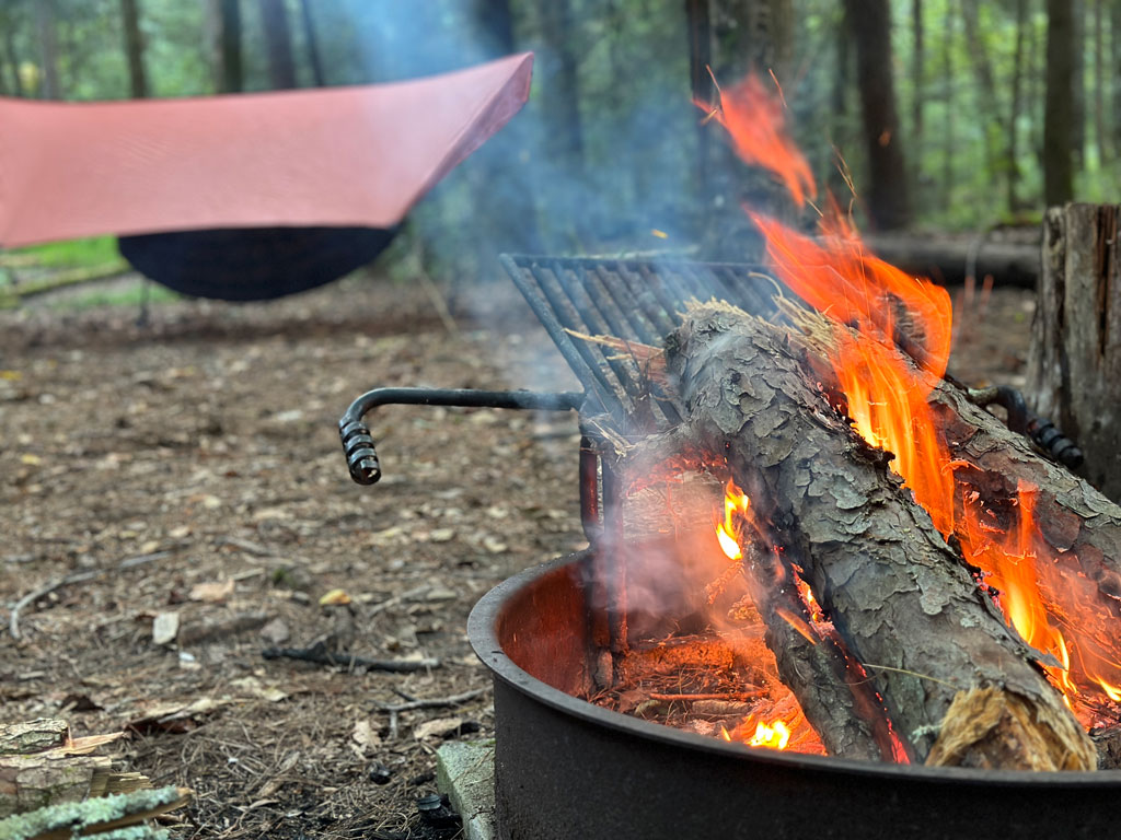
With light in the heavily wooded campground starting to die down and the air getting a little chilly, I started a fire at 6:10PM. By 9PM, I gave up on seeing people from the past, present, or future, and turned in.
Day 1 complete.
DAY 2 (13.23 MI | +3,197′ GAIN | -3,184′ LOSS)
I got up to see a man about a horse around 1AM. Per usual, I shined my headlamp around looking for things that might want to eat me. As I did, my light caught something. I wasn’t wearing my glasses. They didn’t look like eyes, but I don’t remember seeing anything shiny before. Eh, probably just a sign on the bridge.
A few hours later I either woke up or was having the most surreal dream. I thought I heard something clawing at the food storage box sitting 50 feet from my site. Then, I thought something was messing with my backpack hanging 5 feet from my hammock. My heart pounding, I yelled out “Hey!“, clapped twice, and then got up to look around. I didn’t see or hear anything. I chalked it up to my imagination and grabbed my keys and wallet from my pack just to be safe.
I woke at 6AM and began my usual routine. It was at that moment that I realized the reflection I had seen at 1AM was not a sign on the bridge, but someone’s tent a couple sites over that must’ve been set up late. Sorry folks!
After breakfast, I swept my site and headed out towards Bluff Ridge Trail; a trail that intersects the fire road just outside of camp. While the trail is the shortest distance between the campground and the Blue Ridge Parkway, it is a doozy—2.73 miles and 2,389 feet of incline. I had hiked it before with Coop so I knew what I was getting into, but man did it bring back miseries…I mean, memories.
Twenty minutes up the trail, my phone chimed in with several missed texts from my son. Since I didn’t have a signal last night, I couldn’t check in as I usually do, so he was a little worried. I sent him a proof-of-life photo and kept moving.
After a long slog, I reached the Bluff Mountain Shelter. That’s when I felt a little tug on my heel.
ACHILLES: Hey man, you know we weren’t feeling great coming into this so why did you just do that to me?
ME: Oh, hey, Achilles. Yeah, sorry. I didn’t see you there.
ACHILLES: Well I am and I know what you’re thinking. You want to fastpack the MST back to Cedar Ridge Trail.
ME: Well, yeah. That’s the plan.
ACHILLES: ಠ_ಠ
ME: ʘ‿ʘ
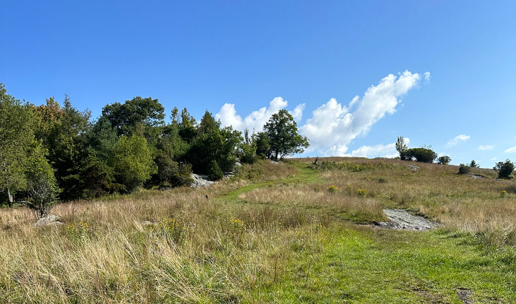
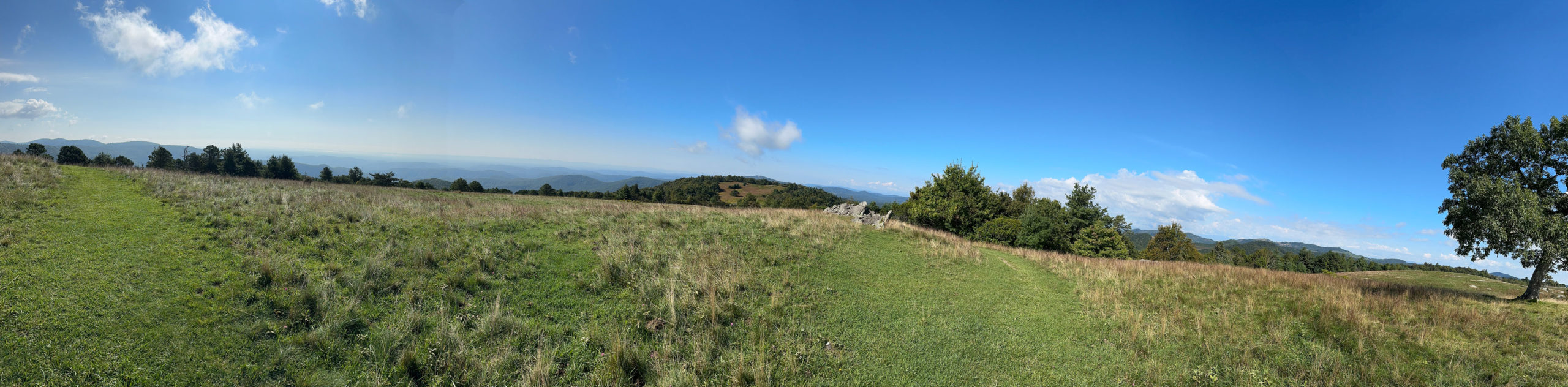
I passed the shelter and through a pasture of tall grass, wildflowers, butterflies. I ate a snack, downed some water, and cinched down my pack before starting in with a light jog after reaching a picnic area.

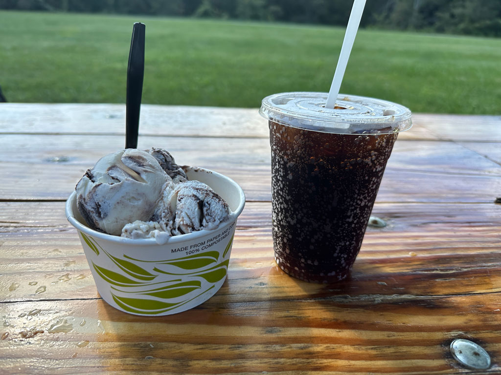
Before long I arrived at Bluff Restaurant where I got a scoop of coffee ice cream, a scoop of Moose Tracks, and an ice cold root beer. Man, I was in heaven…well, until I saw the forecast.
The current conditions were sunny and cool. Tonight, however, was going to be brutal. Severe thunderstorms and a flash flood watch were all but solidified. Given the areas history and the fact that the Basin Cove campground sat at the base of the mountain where Basin Creek clearly spills over, I would definitely need to consider my options. Later. Not now. Now I had to get back to the campground and my heel was starting to bark a little louder.
From the restaurant, I jumped back on the MST and walked/jogged my way to the Brinegar Cabin Trail/Cedar Ridge Trail junction. Instead of immediately continuing down Cedar Ridge, I snuck a peek at Brinegar via the spur before returning to Cedar Ridge for the final descent.
When I started back in on Cedar Ridge the pain in my heel became constant. I was hoping I’d be able to push through for the full 4 miles and 2,174 feet of descent down to the fire road, but I was wrong. I ended up walking most of the way down, and arrived at Grassy Gap fire road about an hour and a half later.
Back on the road, my heel was cursing up a storm. I really needed to get back to camp and rest my foot. Thirty minutes later, my wish was granted.
On arrival, I set up with the intent of staying the night. It wasn’t until a brief encounter with an old timer that I changed my mind. You see, I was sitting there when this older fella stopped by and started talking to me. He knew people who used to live in Doughton Park before the big flood. He shared stories of his grandfather’s neighbor. Talked about the tragedy of the flood. And ended with, “If it storms like they say it’s going to, this is the last place I’d want to be.” Then he was gone. Like Poof! gone.
I thought very briefly about what I was going to do. Between my foot and the weather, I decided I’d hang out for another couple of hours and soak in the outdoors before breaking down and calling it.
DAY 2B (1.64 MI | +83′ GAIN | -200′ LOSS)
Around 5PM, I packed up and headed back down the trail. 40 minutes later, I was in my car and headed home.
Trip complete
TOTALS (16.56 MI | +3,503′ GAIN | -3,442′ LOSS)
FINAL THOUGHTS
I love Doughton Park. The Basin Cove campground is fantastic and the views from the MST near the parkway are unbelievable. And for cabin lovers there’s Caudill and Brinegar. Of course, it’s also nice there’s a restaurant that has ice cream. I’m bummed I couldn’t stick it out for a second night, but I feel like I made the right decision. As for my heel, I ended up seeing a doctor later in the week who put me in a boot and took me out of commission for a couple of months. Sorry Achilles. You were right.