The Monongahela National Forest located in the Allegheny Mountains of east central West Virginia covers more than 920,000 acres and is home to some sweet backpacking destinations including Dolly Sods, Roaring Plains, and the Cranberry Wilderness. For this trip, I invited Rodrigo, and we set our sights on Cranberry.
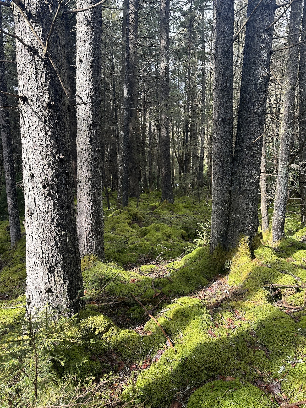
Situated between the Highland Scenic Highway to the east, the Williams River to the north, and the Cranberry River to the south and west, the Cranberry Wilderness spans 47,815 acres and includes 15 interconnected and unblazed trails covering over 75 miles with elevations ranging from 2,400 to over 4,600 feet. In the winter it’s crazy cold and the chance for snow is always looming overhead.
THE PLAN
Using AllTrails and GaiaGPS, and the North-South Trailhead off the Highland Science Highway as our entry point, I mapped out a pair of routes. The first, a 20-mile route, that went west/northwest on North-South Trail, south/southeast on Birchlog Trail, then back east/northeast following the Cranberry River along North Fork Trail. The second, a 17-mile route, followed the same path, but took Tumbling Rock down to North Fork instead of Birchlog.
Rodrigo and I watched the weather closely before committing to a route. A few days out, Friday looked to be pretty nice during the day (48°F/34°F) with rain moving in overnight and transitioning to snow while we slept. The snow was expected to last until 5PM on Saturday and accumulate up to 5 inches. Saturday would be cold, and the overnight into Sunday would dip to 15°F with wind chills in the single digits. Given the snow, the river crossing, and how easy it is to lose the trail in fair weather, we opted for the shorter route; and contemplated doing it in reverse.
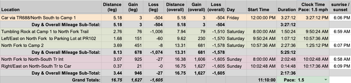
With route chosen, I built out our 17-mile trip in a spreadsheet based on a 1.5 MPH pace…
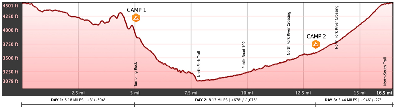
…created an elevation profile
…dropped in the route
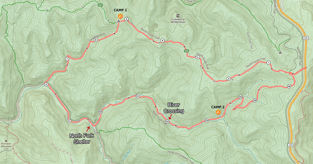
…and packaged it all in a map that I printed on TerraSlate’s waterproof, tear-proof paper.
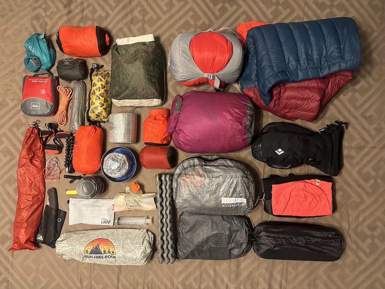
PACKING IT IN
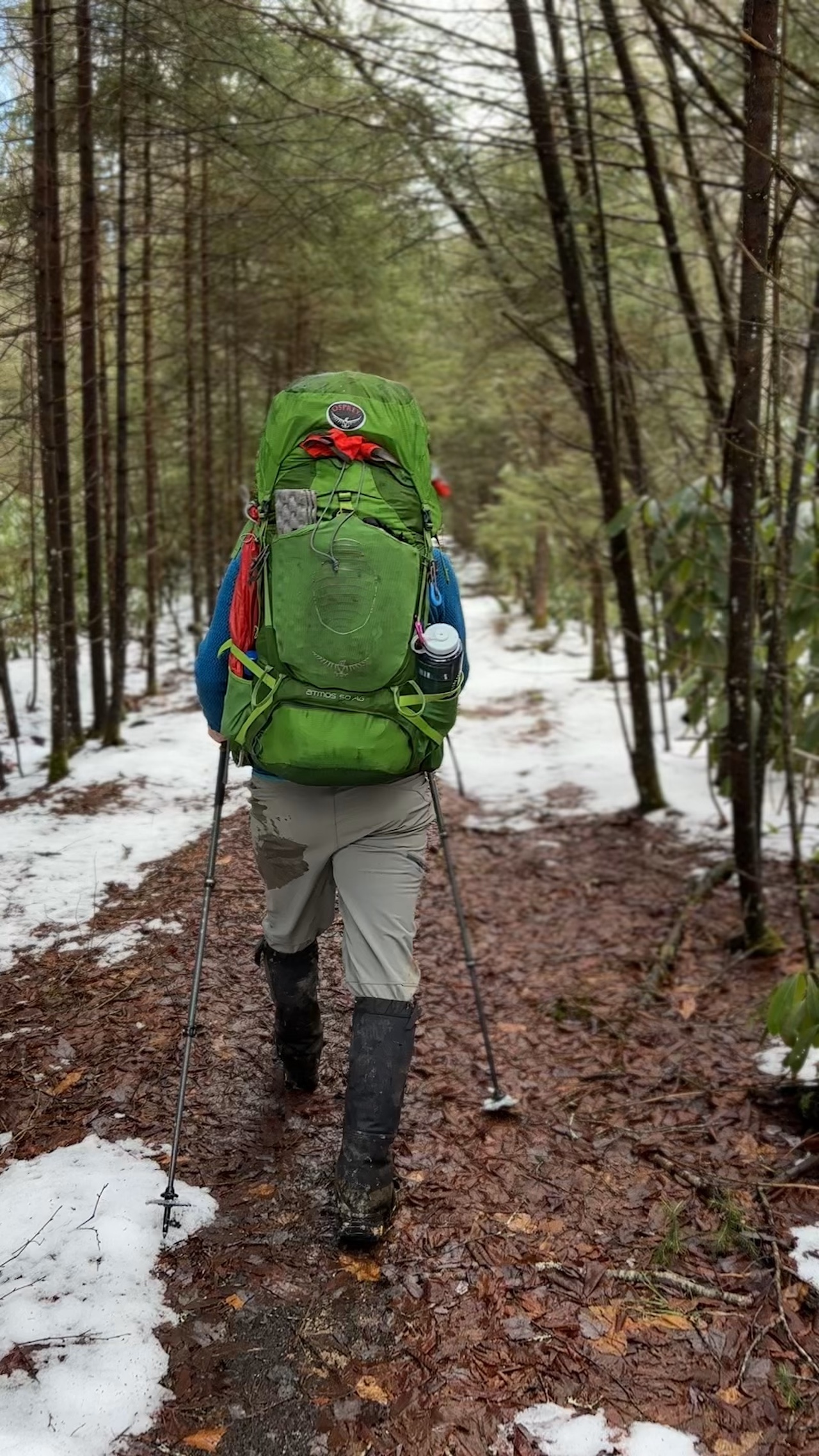
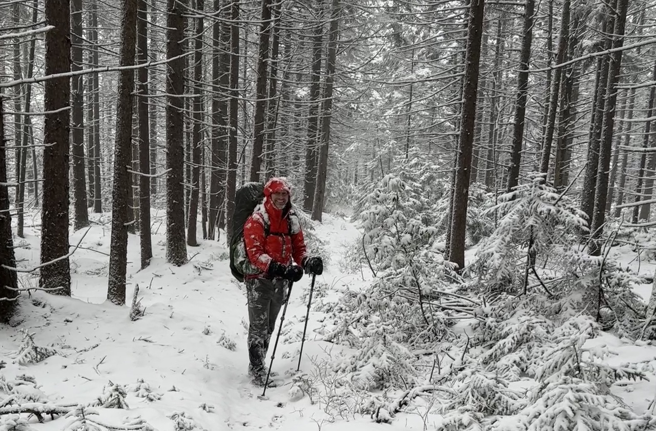
With the potential for single-digit wind chills, rain, and snow and my lack of confidence in my winter hammocking kit, I packed my one-man tent, added a tarp and cordage to keep us dry at camp the first night, and loaded up on layers because being cold is no bueno. With everything loaded, including water and food, my 50L Atmos weighed in at 33 lbs. 4.1 oz.
The night before we left, rain and snow accumulation from Friday evening through Saturday afternoon were predicted to be higher than initially forecasted causing me to reconsider the direction of our route. If we followed North-South to the Tumbling Rock campsite, our feet would stay a little drier and the path would be a easier to follow without the snow, but we’d have to cross a river that might swell as a result of the rain and snow (and if we couldn’t we’d have to backtrack). Alternatively, if we reversed the route we could cross the river on Day 1 and switch our campsite to the North Fork Shelter, but we’d have to deal with a snow-covered North-South trail and all the fun that it would bring. I texted Rodrigo and suggested we reverse our route. He agreed.
DAY 1 (7.88 MI | +128′ GAIN | -1,473′ LOSS)
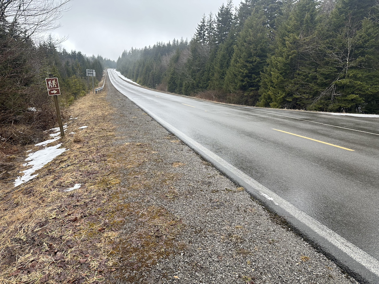
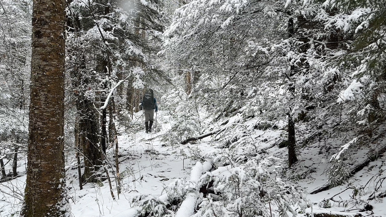
We arrived at the lot off Highland Scenic Highway just before noon to patchy snow and cold air. It took a little longer than usual, but once we geared up, we crossed the highway and joined North-South Trail (TR688) around 12:15PM.
Logistically, the day was pretty straightforward. Follow North-South (TR 688) to North Fork (TR 272) and hike it all the way down to our campsite. Lemon squeezy.
Just inside the woods, we passed a campsite and then a kiosk a tenth of a mile later. About a half mile in we reached the North-South/North Fork junction and turned left onto the old logging road turned trail. We hiked down for another two miles following the curvature of the trail; crossing a few creeks along the way.
Around the 3.3 mile mark we passed a campsite I hadn’t seen on previous trips. Another quarter mile later we passed the site we originally planned to stay at the second night, but given its close proximity to the trailhead and our current time, it was not where we were going to stay on the first. Instead, we intended to cross the river and stay at the North Fork Shelter 4 miles away.
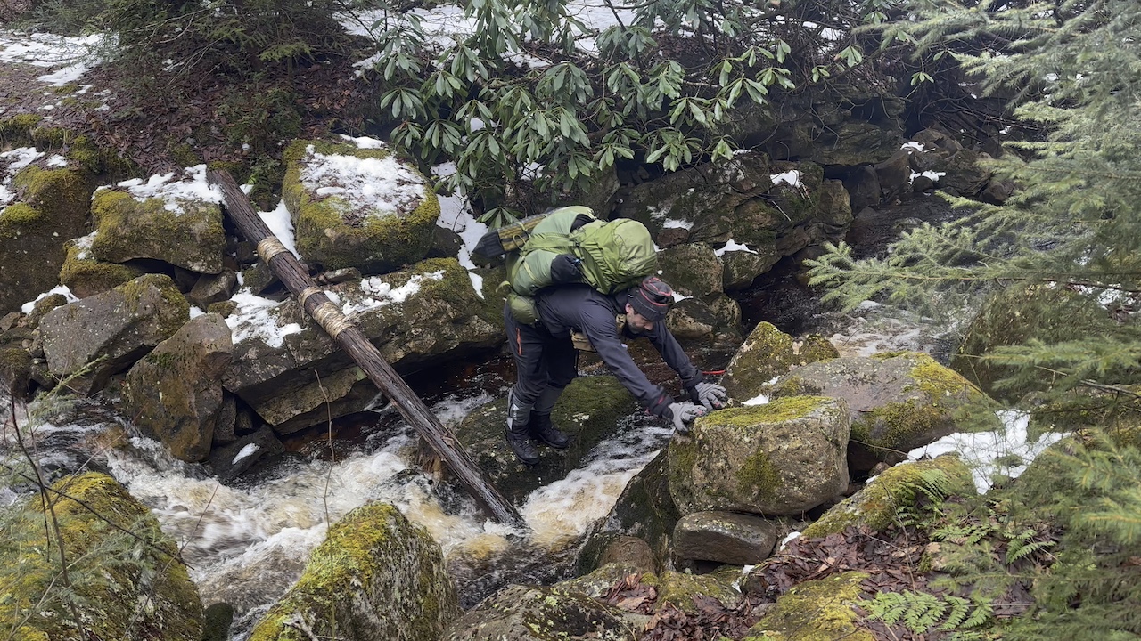
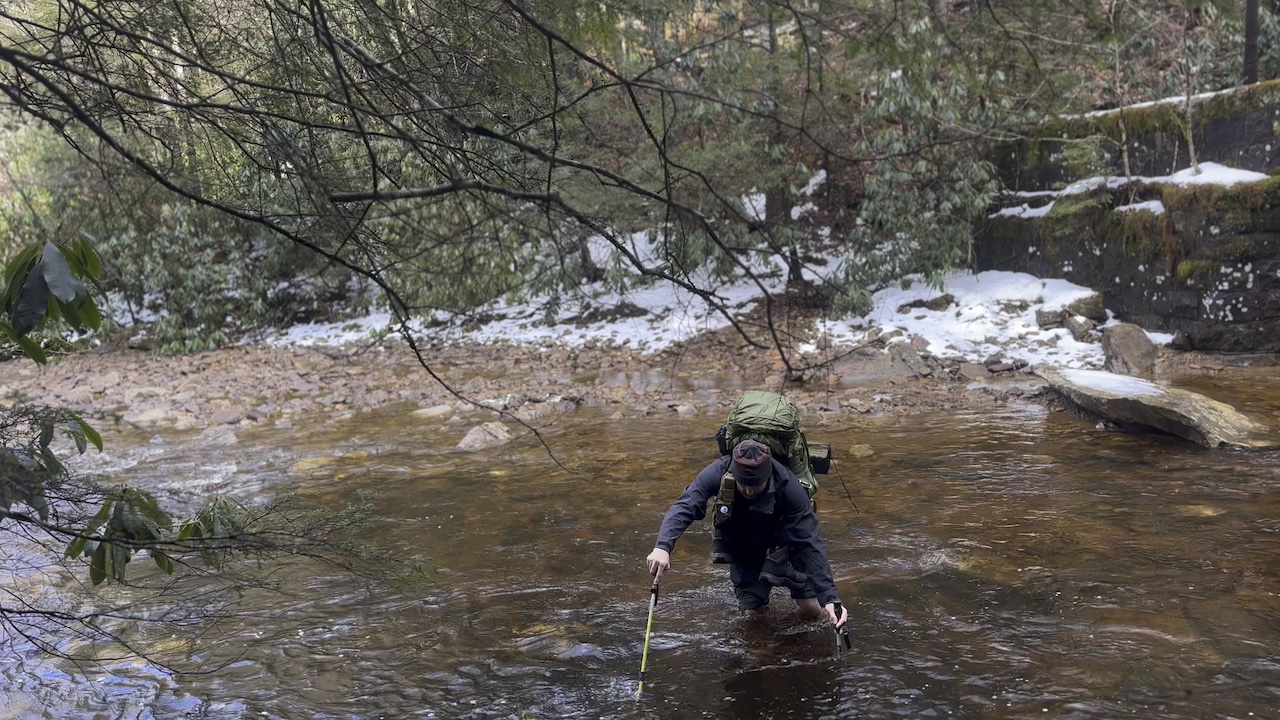
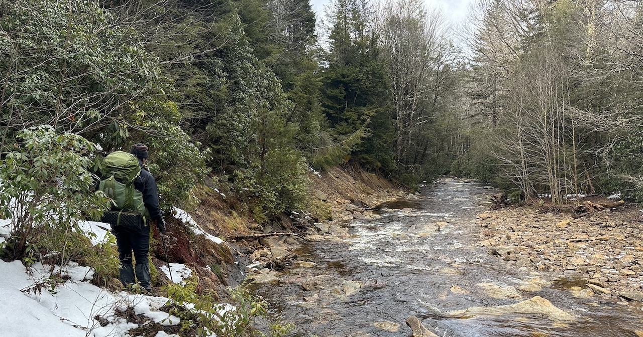
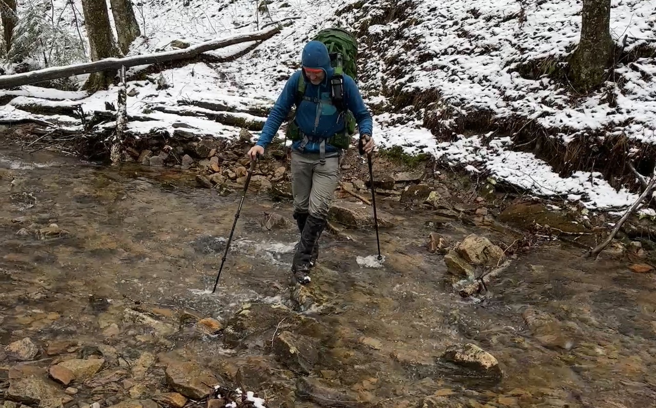
We followed the trail with the river on our left for another mile before leaving the trail and taking the literal high road for a half mile before descending to a washed-out bridge and our day’s water crossing. The crossing is not difficult, but there is no way to rock hop across. Instead, it’s shoes off and pants up. I went first.
The rocks weren’t slippery, but the water was numbingly cold (which worked wonders on my aches of pains). After a couple of minutes I made my way across and up to the other side. Shortly thereafter, Rodrigo successfully crossed as well.
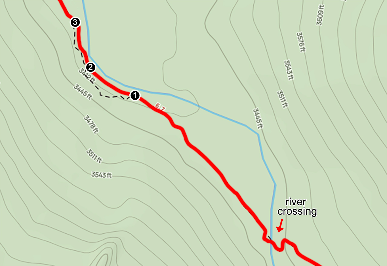
Once we were both on the other side, we ate lunch (thanks Rodrigo for the sandwiches!) and continued down North Fork. A quarter mile from the river the trail went cold. Based on the map, it is supposed to go up and over, but all I saw was down and around. Looking back, from what I could tell, we passed the trail that went up (No. 1) and followed what appeared to be a trail until we scooted down the embankment (No. 2).
As we walked the bank, dirt turned to clay which transitioned to a gray, slick muck that was impossible to walk on. I know this because I took a step and slipped straight into the water. One foot went in and the second was able to reach a rock. From there I hopped my way back to shore and turned to guide Rodrigo.
I let him know that he could go back and find the trail, find a way up and through the thick brush, or slide down the bank into the water and join me at my current location. He didn’t want to go back, and couldn’t find a way up, so he opted to take my route. Lucky for him, he was able to reach the rock I had used, and, in turn, stayed dry altogether. Bravo!
We scurried back up the bank to North Fork Trail and looked around. To our left/south, the trail appeared to continue back east into a thicket of trees. In front of us, a sign pointing to North Fork Trail sat at the bottom of a trail that went up the mountain to the southwest (No. 3). And, to the right, North Fork Trail ran west.
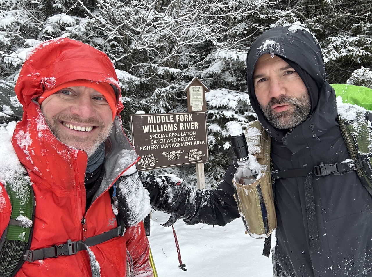
Since we weren’t going back down, left, or up and to the left, we continued right/west. We hiked another 2 miles before arriving at the Peter E. Zurbuch Cranberry River Neutralization Station AKA “The Liming Station”; a building on the southern side of the river used to restore the PH levels to the waterways.
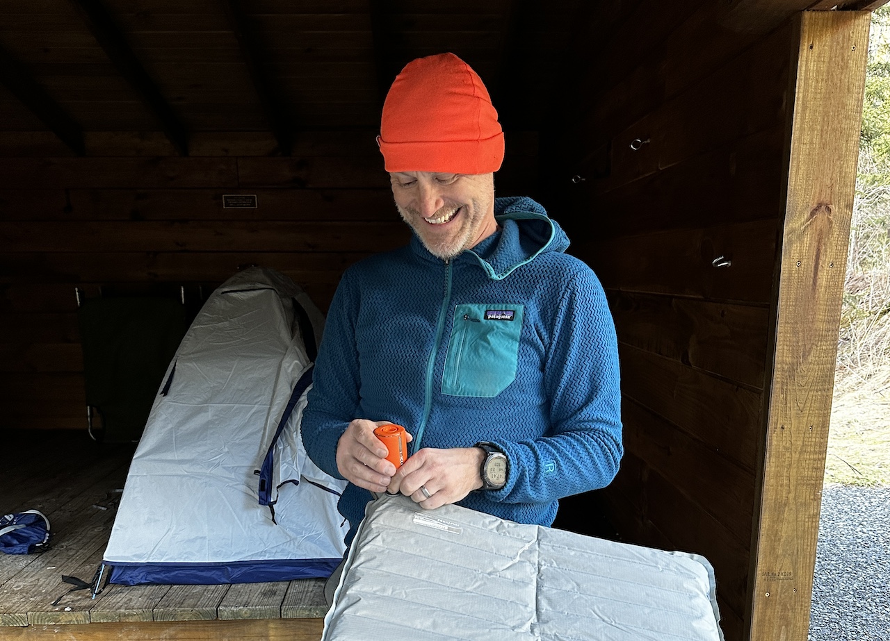
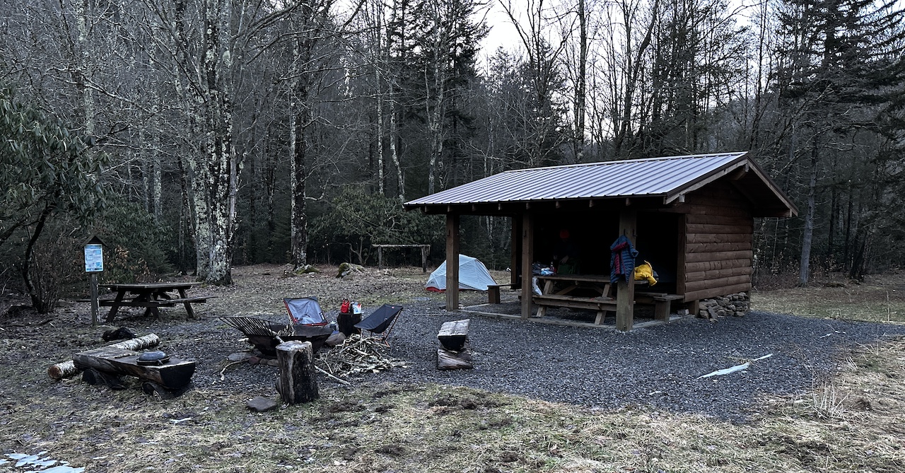
From the liming station it was a quick walk up Public Road 102 and across a bridge to the North Fork Shelter, our camp for the night. The shelter was one of the nicest I’ve ever visited. A plastic container with fire starters, dry wood on the front step, and a pair of folding chairs against the back wall. Yeah, it was really nice.
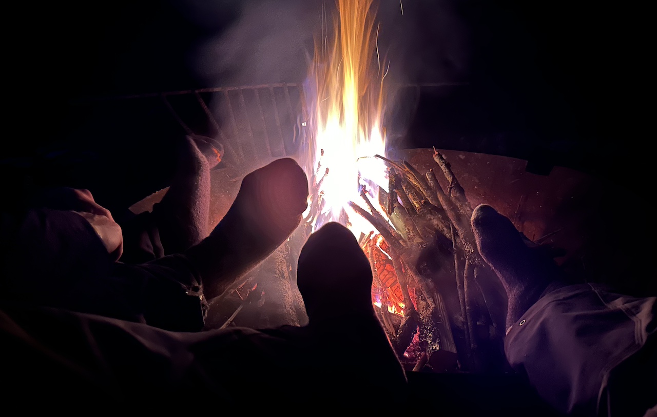
At the shelter, I picked a spot on the west side to block the wind while Rodrigo set up in the shelter. Afterward, we gathered wood, waved to a passing Forest Ranger who checked in on us from the warmth of his truck, ate our respective rehydrated meals, and sat around the fire under an incredibly bright full moon until 9PM.
Day 1 Complete
DAY 2 (10.30 MI | +1,989′ GAIN | -668′ LOSS)
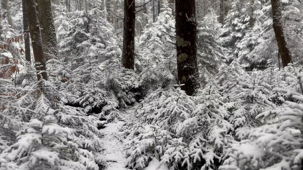
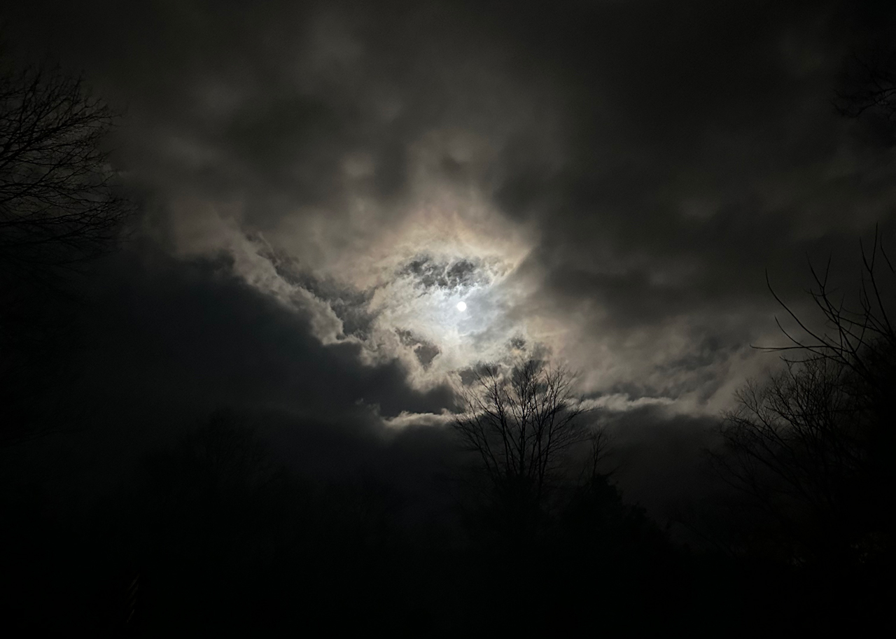
I woke to pee around 3AM and noticed snow under my tent door. When I got outside the entire area was covered in snow and lit up by the full moon. It was amazing.
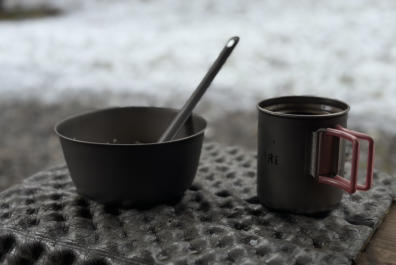
I returned to bed and woke for good around 6AM. I then quietly packed up before stepping outside to break down my tent. As I did, the snow began to fall once more. Once finished, I made breakfast, hit the head (there’s a super nice privy up the road), and waited for Rodrigo to do the same.
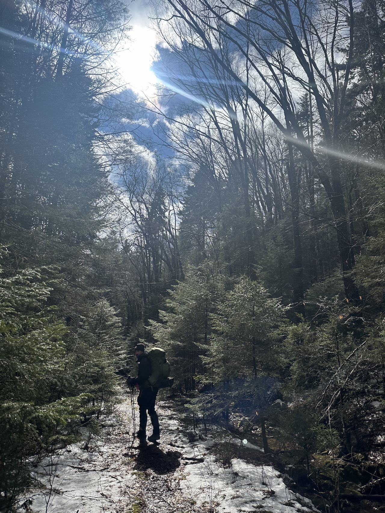
By 9:15AM, we started the 1.5 mile hike up North Fork Trail to the Tumbling Rock (TR 214) trailhead. We shed layers and began the 2.6 mile, 1,000 foot climb to the North-South/Tumbling Rock junction.
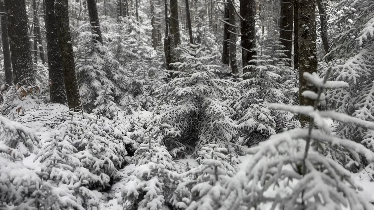
For the most part, and even with the snow, the trail was fairly easy to follow. Well, except for a short bit about a mile up the trail where the trail went Poof!. Except for that part, the trail was good. Shortly after Poof!, we found the trail and crossed a creek.
As we continued to walk up the hill, the snow was coming down a little harder and the weight of the snow was causing branches to bend.

Since we planned to camp along North-South (and there aren’t any water sources along that trail) I stopped at a creek 0.8 miles from the junction and filled my bladder. As I did, Rodrigo shared that his gloves were wet and his hands were having a hard time staying warm even with hand warmers. I suggested we find a campsite soon so we can start a fire and get warm.
At the North-South/Tumbling Rock junction I pointed out the campsite nearby, but Rodrigo wanted to move on. I let him know that things were about to get hairy. On a good day, this section of North-South gets confusing. When it’s covered in snow and blocked by snow-heavy branches and fallen debris it’d likely be a mess. SPOILER ALERT: It was.
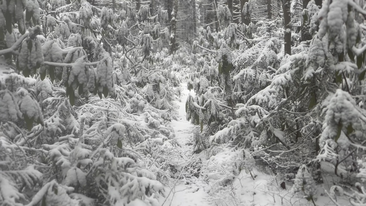
From the junction, the trail went straight up. At the top, it vanished. We zigged and zagged until alas the trail made itself known just shy of a campsite.

And then we lost it again.

Out came the compass, map, and watch…again.
We wandered through snow-covered pine branches for another mile finding and losing the trail and passing another campsite that was barely recognizable under the fresh snow. I suggested the site to Rodrigo who did not take me up on the offer.

From our current location, we were about 4 miles from the car and I knew of at least 4 more campsites between here and there (5 if you consider the site at the trailhead). Onward!
We pushed our way through countless snow-covered pines and rhododendrons and stopped at the next site for a snack and a chance to warm up. I swapped my wet fleece for a wool quarter zip, put on a pair of fleece liners and mitts, and stuffed a hand warmer inside each glove. Rodrigo changed his top, but had no dry gloves to swap. His wet gloves and the cold air were making his hands, and him, uncomfortable. I suggested we hike down the trail and either make camp at the last site (around Mile 2) or stay at the one at the trailhead. We agreed to agree and we moved on.
Ten minutes later, we passed another site. Pass. Twenty minutes more, another site and another nope. After another ten minutes I turned back to Rodrigo and pointed out the last site along North-South near Mile 2. It was a hard “No.” Trailhead campsite it is!
We yo-yo’d the remaining two miles until reaching the trailhead site just shy of the parking lot. Upon arrival, it was clear Rodrigo was finished and we were headed home. Silver lining, we stopped for burgers and fries along the way.
Trip complete.
TOTALS (18.18 MI | +2,117′ GAIN | -2,141′ LOSS)
FINAL THOUGHTS
Cranberry is an amazing backpacking destination; both peaceful and breathtakingly serene. We saw only one person, the ranger at North Fork Shelter. No animals, but plenty of poop and prints.
As many have said before, do not go into the Cranberry Wilderness without a map, compass, and GPS device. The trails are not blazed, and navigating becomes difficult when snow and debris cover them up, especially on North-South. That being said, if you go prepared you’ll love what Cranberry has to offer.