When my buddy, Coop, suggested we hit the trails for a February backpacking trip we kicked around some ideas: Cold Mountain and Mt. Mitchell in NC, Cranberry Wilderness in WV, and Mt. Pleasant and Apple Orchard in VA. To refine the list, he put together a handful of options in each location before we ultimately decided on the James River Face Wilderness in Jefferson National Forest between the James River on the north and Blue Ridge Parkway to the south.
The James River Face Wilderness is an 8,907-acre area located near Natural Bridge, Virginia that includes several well-maintained trails including the iconic Appalachian Trail (AT) which passes over the 623 foot James River Foot Bridge, and the Belfast Trail which leads to the Devil’s Marbleyard and its colossal, car-sized Antietam Quartzite boulders.
THE PLAN
Over the years we’ve come to appreciate the unpredictability of winter trips and the need for bailout options. To that end, Coop built out three versions (long, short, and snow) using a combination of GAIA GPS, Garmin Connect, and Google Earth. And, because my 10K+ run streak was still going, he created a route for each option. Thanks Coop!
- Long (25.16 mi | 8,000′ gain). Starts at the Piney Ridge Trailhead off Hunt Club Road with campsites at Thunder Hill AT Shelter and the Devil’s Marbleyard area off Belfast Creek, and an out-and-back 10K (6.96 mi | 2,631′ gain) from the shelter to the Terrapin Mountain Summit.
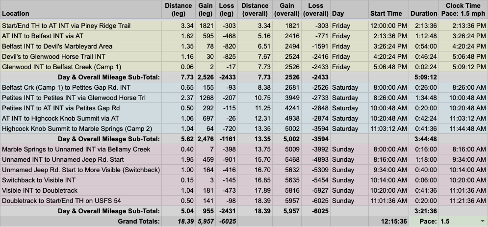
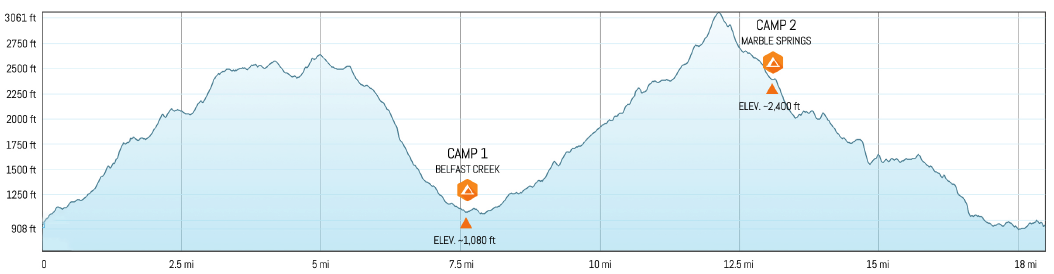
- Short (18.39 mi | 5,957′ gain). Starts at Piney Ridge Trailhead, but travels north with campsites at Belfast Creek near Glenwood Horsetrail and another at Marble Spring off the AT. The 10K (7.01 mi | 2,170′ gain) route leaves the Belfast Creek site, follows Petites Gap Road to Glenwood Horsetrail, then heads back down to the campsite via Petites Gap Road.
- Snow (18.05 mi | 5,923′ gain). Starts on the north end of the AT foot bridge with campsites at Marble Spring off the AT and Matt’s Creek AT Shelter. The 10K (6.41 mi | 2,106′ gain) would require bushwhacking to the Blue Ridge Parkway, Parkway to Glenwood Horsetrail, Glenwood to Goff Mountain Road, Goff to the Parkway, and finally our bushwhacked trail back to camp.
Bottomline, we had options.
Using forecasts for the Thunder Hill and Matt’s Creek AT shelters along with Mountain-Forecast data from Apple Orchard Mountain, we kept an eye out for freezing temps, high winds, and heavy snow. Ten days prior, a huge ice storm with gale force winds blew through the area. Seven days out, weather psychics forecasted a foot of snow two days before we arrived. Two days out, ice replaced snow and temps were holding in the single digits for Friday and Saturday with wind chills below 0°F. The night before our trip, the forecast turned for the better. Snow and ice switched to frigid rain on Friday morning, teen temps on Friday and Saturday night, and cloudy skies on Friday with sunshine on Saturday and Sunday.
With route and weather information in hand, Coop built out the trip in our spreadsheet based on a 1.5MPH pace…
…created an elevation profile
…dropped in the route
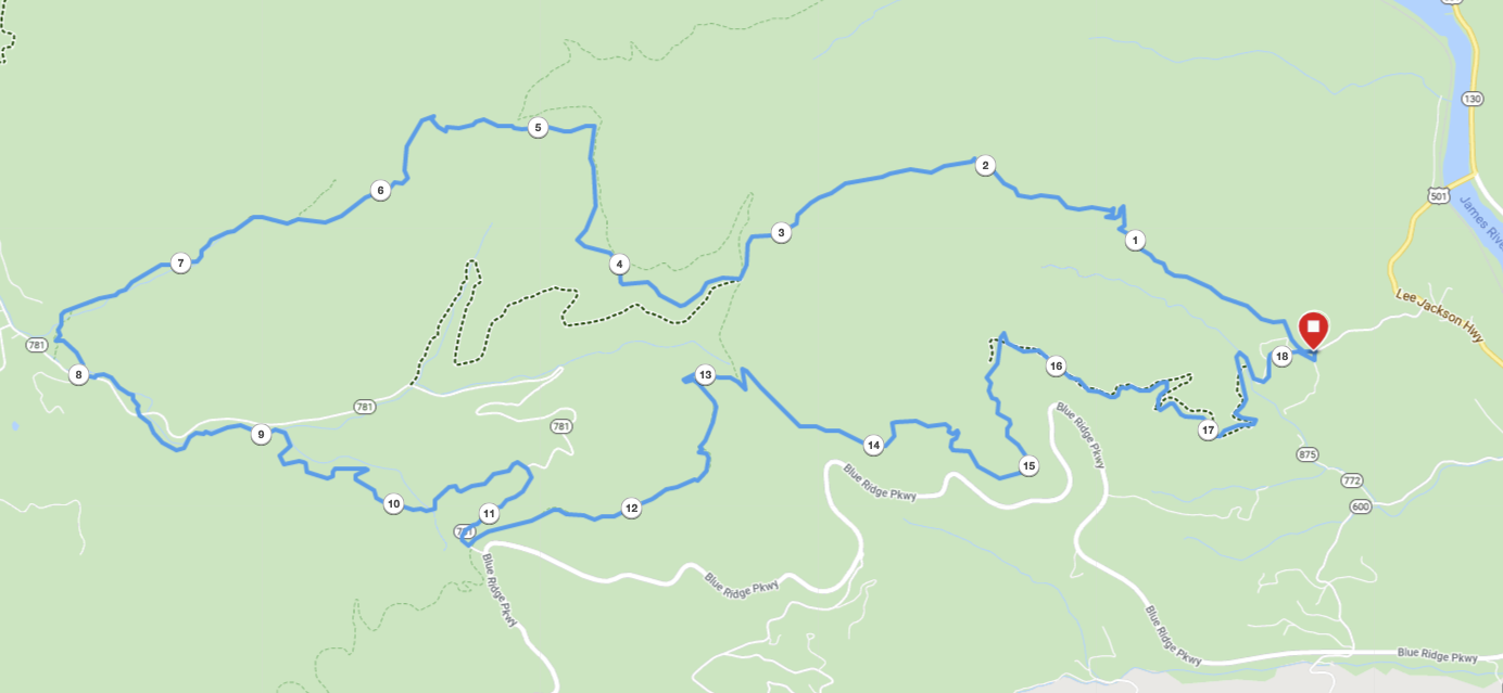
…and packaged it all in a map which he printed on TerraSlate paper.
PACKING IT IN
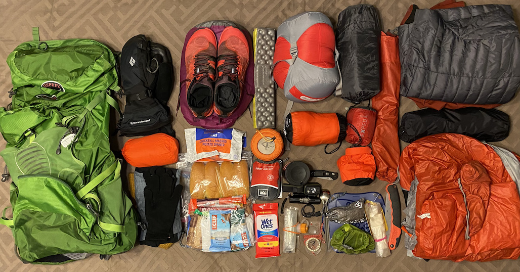
My pack weight from my most recent winter trip to the Mount Rogers National Recreation Area in Virginia came in just under 31 pounds. It was warmer and I brought a table. Since this trip was going to be significantly colder, I ditched the table in favor of another coat. And, since real food tastes real good, I brought hot dogs for Coop and I to cook over the fire (or boil them if fire was an issue).
For my 10K run, I brought a pair of Fourlaps 7″ shorts (7.6 oz.), a Patagonia Capilene Cool Daily tee, a Houdini windbreaker (3.7 oz.), and a pair of Merrell Trail Gloves (16 oz). I left the running pants behind in favor of KÜHL softshells which I used to run in when I visited Mt. Rogers.
In the end, with an extra coat and a running kit added to my usual winter gear, my Atmos 50L weighed in at 30 lbs. 15.8 oz (24 lbs. pack weight and 6 lbs. 15.8 oz. of food/water).
DAY 1 (7.94 MI | +2,021′ GAIN | -2,005′ LOSS)
Around 11:45AM, we pulled onto Hunt Club Road off US 501 just past the James River, drove by a lodge on the left, and parked at the Piney Ridge Trailhead lot just up the hill. The skies were cloudy, winds were calm, and the air hovered around the freezing mark. Within 20 minutes we were packed up and headed up the road, passing a gate that welcomed foot travel en route to the Piney Ridge Trailhead 0.10 miles away.
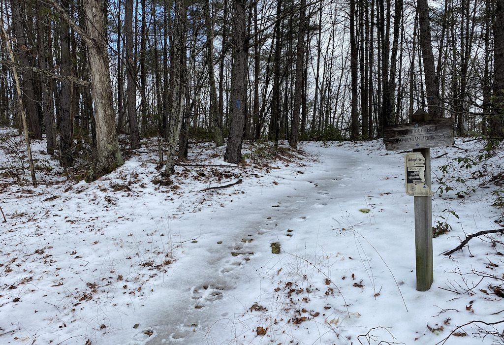
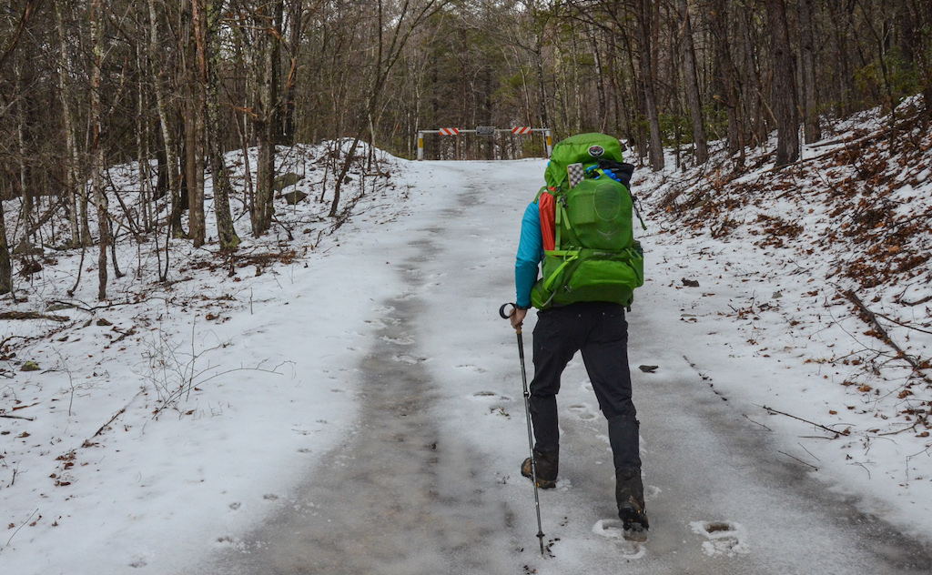
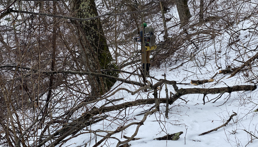
Photo by Coop
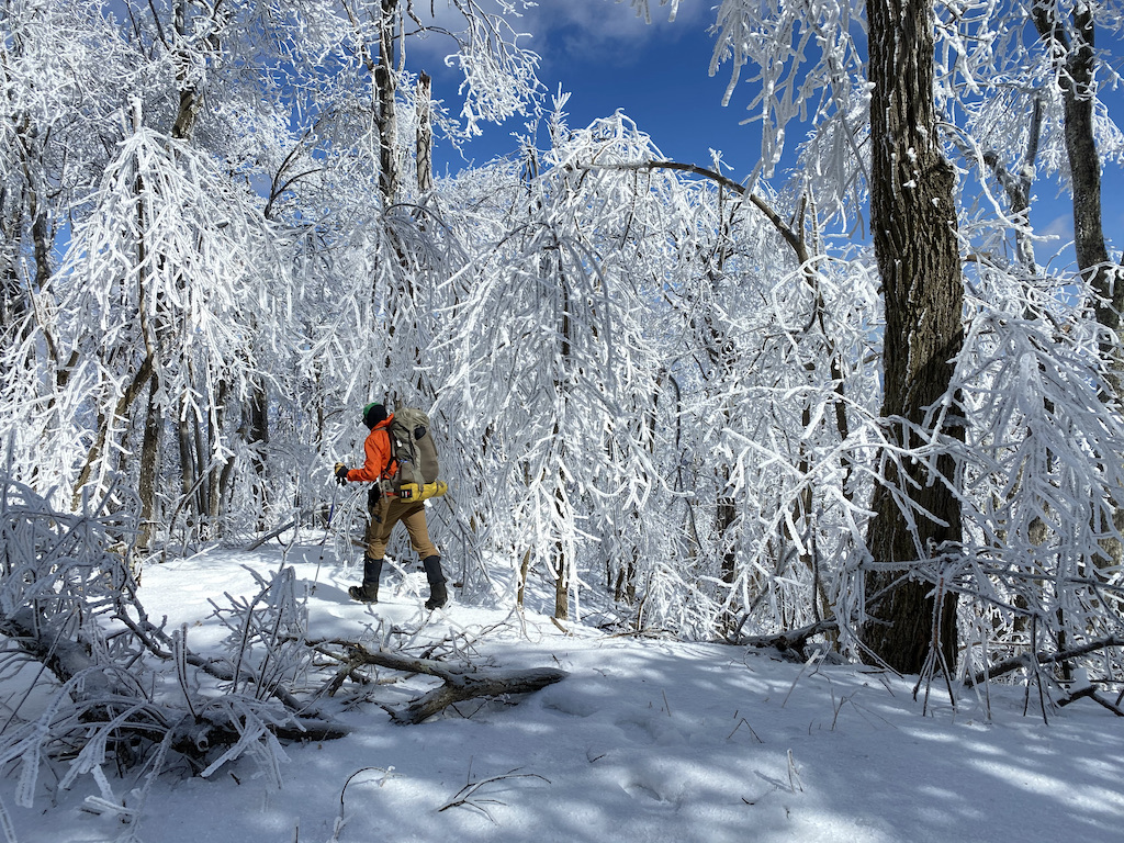
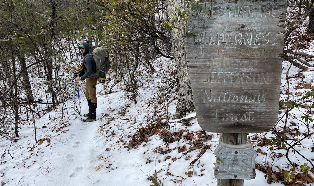
Following blue blazes, we crunched our way up the ice-covered trail for a mile, ascended a short series of switchbacks, and reached the entrance to the James River Face Wilderness 0.50 miles later. Contrary to what I was told, there was no fanfare upon our arrival. No balloons, no wildlife greeting party, just an old, wooden sign that clearly wanted us off its lawn.
A quarter mile later we began to see the first of hundreds of downed trees and branches that littered the wilderness. For the next 0.75 miles we climbed over, around, up, down, and through the debris. It was slow going, but with the exception of the occasional scratch or coat snag, was relatively uneventful.
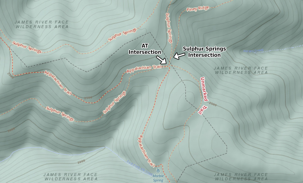
After another 1.5 miles and 800 feet of gain we reached the Sulphur Springs Trail intersection where Piney Ridge continues west/southwest, and Sulphur Springs cuts back east before joining up with the AT a couple miles later. While technically we could’ve taken Sulphur Springs north to the AT and then hopped on the southbound AT to Belfast Trail, we opted to pick up the AT at the intersection 0.10 miles down our current trail.
This particular junction is a cartographer’s nightmare. Looking west, the AT runs straight ahead/west towards Belfast Trail and Devil’s Marbleyard and left/south towards Marble Spring. Sulphur Springs Trail runs west/southwest towards Petite’s Gap Road/SR 781 (where you’ll find a sweet overlook 0.5 miles down trail) and northeast from the earlier intersection. And then there’s an unmarked trail between Piney Ridge and the AT that runs southwest/south down to Marble Spring…probably.
We continued straight/west along the AT towards Belfast Trail. The higher we climbed, the more ice and debris we encountered. After an additional 600 feet of gain over 1.8 miles we reached the height of our day’s climbing at the Belfast/AT intersection. From the intersection we walked 0.4 miles down to the Gunther Trail intersection (which leads to the Hellgate parking lot and the start of the Hellgate 100K ultra). From Gunther, we picked up the pace and quickly knocked out the remaining 0.9 miles to Devil’s Marbleyard.
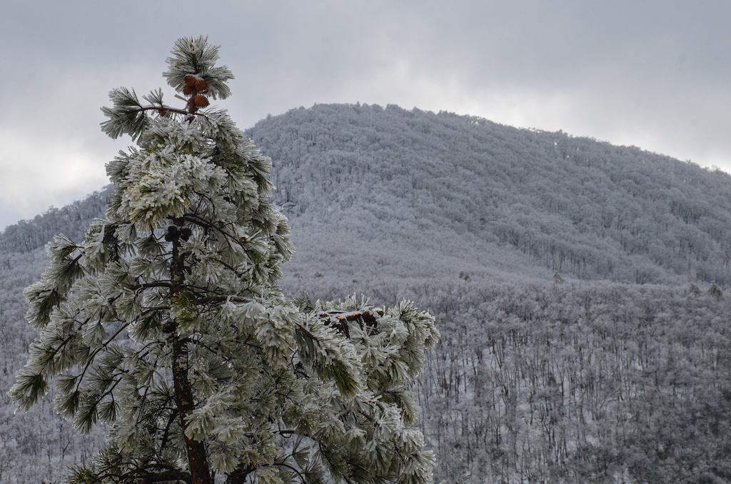
Photo by Coop
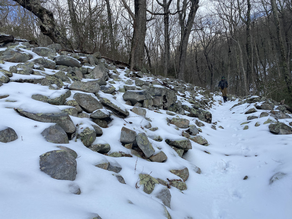
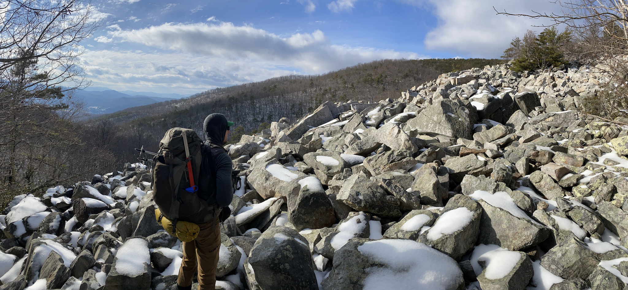
From the trail, the Marbleyard doesn’t seem that big; more like a garden than a yard. It’s only when you step off the trail that the impressiveness of the Marbleyard and the enormity of its boulders are quickly realized.
We took in the sights for a bit before returning to the trail where Belfast’s dirt path gave way to large, water-, ice-, and snow-covered rocks, precariously angled downward. We paused and looked around for an easier, less-dangerous route. Nothing. The only way to get to the bottom was over the rocks; the slick, wet, icy, snow-covered rocks put there by the devil himself.
Staring at the rocks a little while longer I visualized my route and devised a simple plan to wedge one pole tip into a crevice, take a step, wedge the other pole tip, and take another step. Rinse. Repeat. I let out a sigh and got busy living.
For about ten feet the process was going exceedingly well. Then, all good things came to an end when the pole in my left hand slipped out of a rock crevice and I became a case study for Newton’s Second Law. I quickly lowered my right foot in an attempt to catch my balance, but it slipped on a wet rock and I watched in proverbial slow motion as the rock’s surface come closer to my face.
Instinctively (i.e. I fall a lot), I tucked my shoulder and buried my head into my chest hoping my arm and pack would take the brunt of the fall. Upon impact, I stretched out my arms before finally sliding to a stop against another rock a few feet later. Coop, who had seen the event unfold, yelled out to see if I was OK. I did a quick check and nothing appeared to be broken, though my right shoulder, hands, and knees were throbbing, and my shirt and gloves were soaked. Thumbs up Coop!
I returned to my feet and began plotting a new course to the bottom. Unfortunately, my only option was more of the same. A bit deflated and a tad sore, I started attempt number two. A few feet later it was déjà vu all over again. My pole slipped, my feet didn’t catch, and I fell. The only difference, I rolled to a stop on my left shoulder, so I had that going for me, which is nice.
Shaken and stirred, I managed to uneventfully hobble down to the trail below where Coop joined me a few minutes later. After one more check of my well-being, we continued down Belfast Trail (also called Devil’s Marbleyard Trail on some maps) for 1.15 miles, arriving at a group of campsites between Belfast Creek and the Glenwood Horsetrail around 4:45PM; a large site sat to the right/north, and a handful of smaller sites to the left/south.
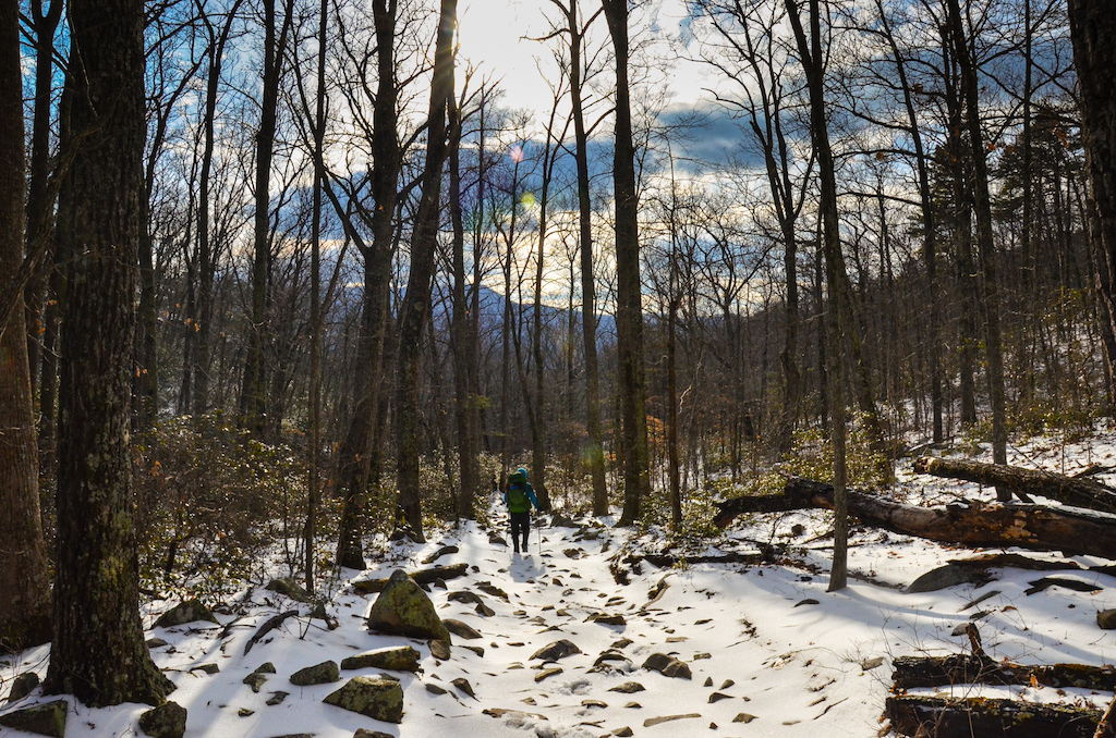
Photo by Coop
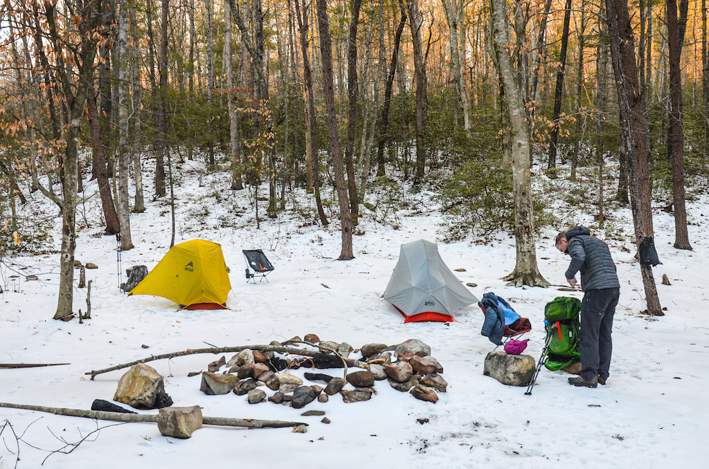
Photo by Coop
We opted for a site (actually two sites) on the left since a) we appeared to be the only ones staying the night, and b) there was a dude with a dog who was walking with a bike that was pulling a trailer at the larger site (you read that correctly). Just to be clear, we weren’t being gluttonous. We’d use one site for our tents and the second to eat and stay warm. Don’t look at me like that. There was no one else camping!
While we unpacked, the dude with the bike stopped by with his dog.
DUDE: Y’all hiking the AT?
ME: No, not thru hiking. Just gettin’ in a loop.
DUDE: You guys sure did pick a nice site.
ME/COOP: Yeah, pretty nice. Good water source. Plenty of wood.
DUDE: Well, a few years ago, at this site, there was a couple that were camping together. She was local and her boyfriend was from Roanoke. Another guy came and set up his tent nearby. In the middle of the night he got up, walked over to the couple’s tent, stuck his .45 semiautomatic inside their tent, and shot ’em. He ended up taking off up through the woods and stole a truck. A couple years later U.S. Marshalls caught him in Texas. I still see the girl every now and again and she’s in a wheelchair now. She’s real nice. Not sure about her boyfriend, but I think he’s in a wheelchair, too.
ME/COOP: Wow, uh, that’s terrible.
DUDE: It really is. I think if they were shot with a .22 they would’ve fared better, but a .45, that’s a big bullet.
ME/COOP: Yeah, it is.
The dude wrapped up the conversation with some recommendations for local restaurants and tips on gathering wood and staying warm, and then took off down the trail towards Petite’s Gap Road/SR 781.
We lifted our jaws off the ground, put our eyeballs back in our heads, and started setting up. Once finished, I changed out of my wet clothes, stuffed my gloves and shirt in my sleeping bag so I could dry them out while I slept, and surveyed the damage from my earlier falls at the Marbleyard.
On the plus side, my shoulders, while sore, functioned. My head looked normal. Punchable, but normal. My legs, knees, elbows, and arms, were scraped, cut, and tender to the touch, but I didn’t have any serious injuries. All in all, I could move, it’d just be uncomfortable for the remainder of the trip.
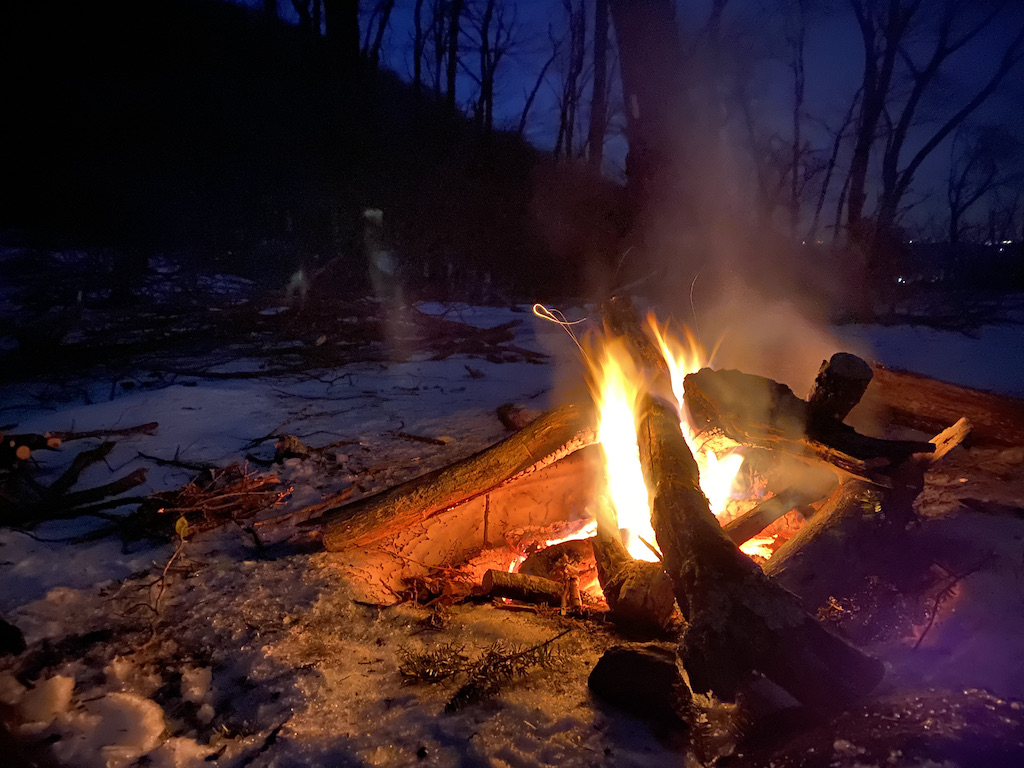
With tents up, Coop turned to getting the fire going and I gathered wood and refilled our water supplies. We roasted our hot dogs, hung the bear bag line, and by nightfall, we had all we needed to keep us in our chairs for a bit of R&R.
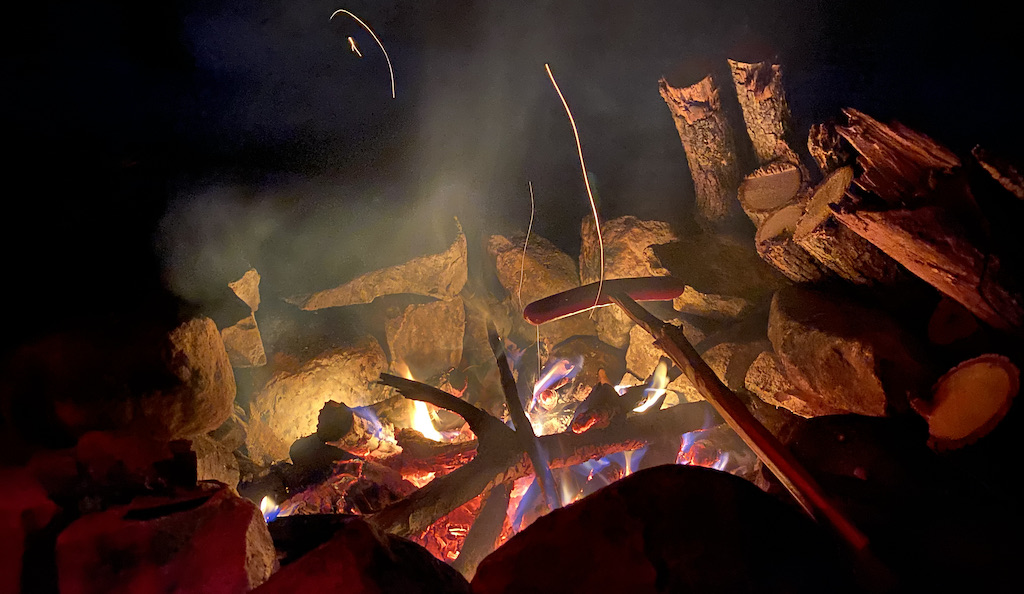
Surprisingly, the weather was not unbearable. It was cold, sure, but there was virtually no wind. For this reason we were able to hang out by the fire for hours before turning in around midnight.
Day 1 Complete
DAY 2A (6.70 MI | +2,376′ GAIN | -1,036′ LOSS)
I woke thinking my tent was being illuminated by Coop’s headlamp only to realize it was 6:30AM and the sun was the culprit.
COOP: We running?
Coop was referring to our original plan to run in the morning, but at the moment I was of the mindset that we should wait until the temps increased enough to thaw the icy trails.
ME: Nah, let’s wait.
COOP: Sounds good.
Not ready to completely bail on the warmth of my bag to face the 20ish temps outside, I packed up inside then held my breath as I stepped outside to breakdown my tent before finally turning my attention to breakfast.
Once eating and packing were complete, we took off down Belfast around 8:30AM, crossed the orange-blazed Glenwood, and continued towards Petites Gap Road.
ME: Our route has us on Glenwood.
COOP: Yeah, but we can just take Petites and rejoin Glenwood.
ME: But how will they find our bodies if we deviate from our original plan?
COOP: OK.
We returned to Glenwood, hung a right/east, and walked down to an impassable East Fork Elk Creek.
COOP: ಠ_ಠ
ME: ๏_๏
COOP: ¬_¬
ME: (◕‸◕ )
We bushwhacked back to Belfast Trail and took the footbridge over to Petites Gap Road. We then walked the icy road for a half mile, hung a right at a gated, gravel road, and rejoined Glenwood about 0.20 miles later. The trail, like the road, was incredibly slippery. Coop put on his microspikes, and I, uh, walked more carefully.
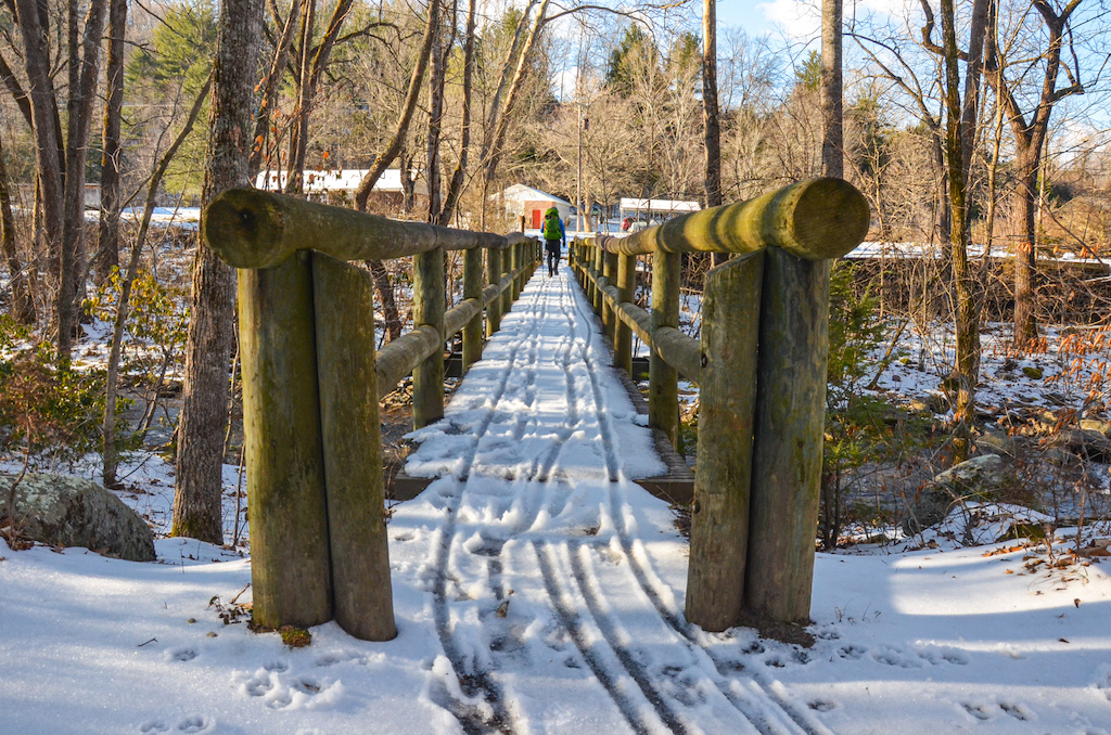
Photo by Coop
Further down the trail, I caught a glimpse of what appeared to be a coyote with dark black hair on top of a hill to the south. We spooked it, and it, in turn, spooked two turkeys who flew up into a nearby tree. We then passed through a series of campsites along East Fork Elk Creek before beginning a long, 2-mile, 1,000 foot climb to Petite’s Gap Road.
We turned right/south and walked a half mile to the AT. The winds were picking up and the cold was setting in. I considered putting the layer back on that I had shed earlier, but I was at that sweet spot where I was just warm and cold enough to be comfortable so I just stuck with what I was wearing.
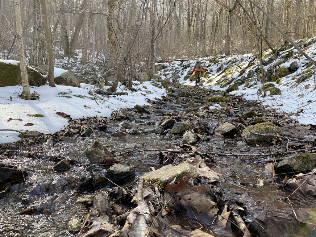
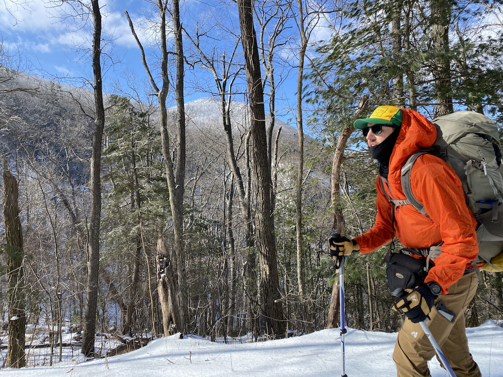
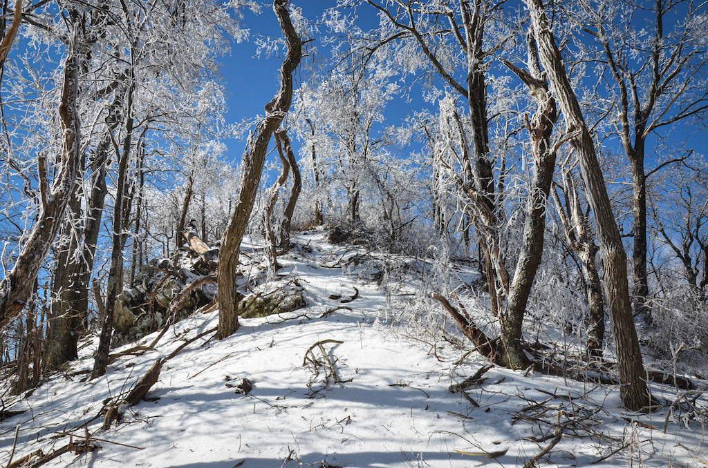
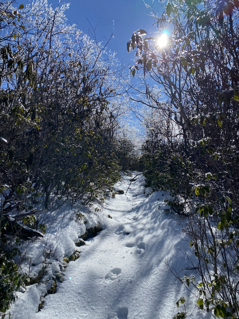
Photo by Coop
At the AT trailhead, we turned left/northeast and started our climb. As we did, we immediately encountered the first of hundreds, if not thousands of downed trees and branches. The debris made sticking to the trail difficult, but thanks to the AT’s signature white blazes and a set of pre-storm footprints, we were able to find our way to Highcock Knob after a mile and 700 feet of gain (seriously, who names these places?).
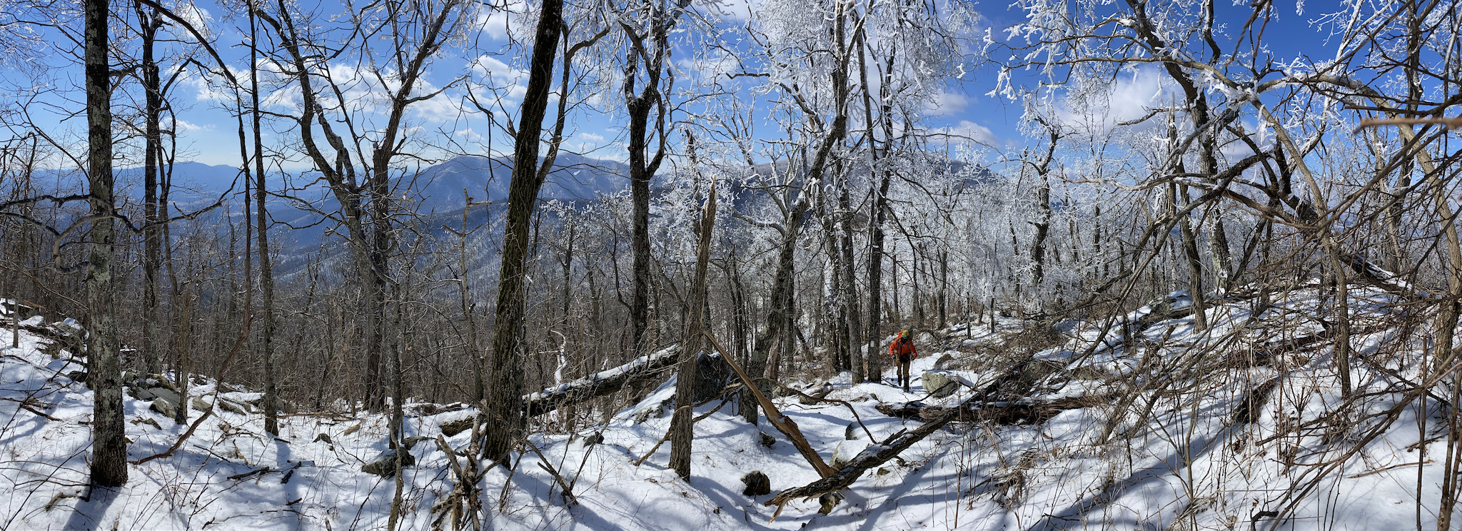
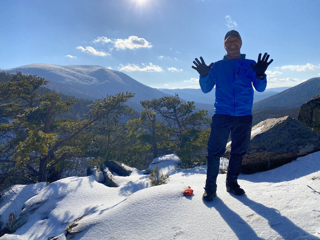
At the summit, the tree tops were thick with ice and my thermometer was showing 10°F. Since the conditions were ripe for a break (i.e. I was tired), we stopped for a snack and I checked in with my son via Facetime to show him the awesomeness in front of me. After the call, Coop and I started in on our final mile-long descent to our second night’s campsite at Marble Spring.
About halfway down, we came across several trees that blocked the path for 15 feet or so. To the right, the uphill slope was rough going. To the left, the downhill slope was precariously tempting. We split the difference. Coop went high and I went low.
I braced my foot on the edge of one pole, grabbed a tree, braced my other foot on the other pole, and then attempted to do the same for the remaining eight feet. It was slow going, but manageable, well, at least until it wasn’t. I hit a patch on the slope where I couldn’t grab hold of a tree, branch, or vine. Even worse, I was starting to slide. Looking around, I spotted a small, pencil-thin tree a few feet over and a couple feet down. I pushed off with my pole and partially snagged the tree with my foot while the rest of my body followed Newton’s First Law of Motion.
I needed an unbalanced force and fast.
Mid-slide, I spotted a vine about two feet away, planted my pole, and pushed off hard. With luck finally in my favor, I was able to grab the vine and shimmy my way up the hillside to the trail. As I caught my breath, Coop completed his own Ninja Warrior course, and the two of us finished the remaining half mile to our campsite at Marble Spring.
Photo by Coop
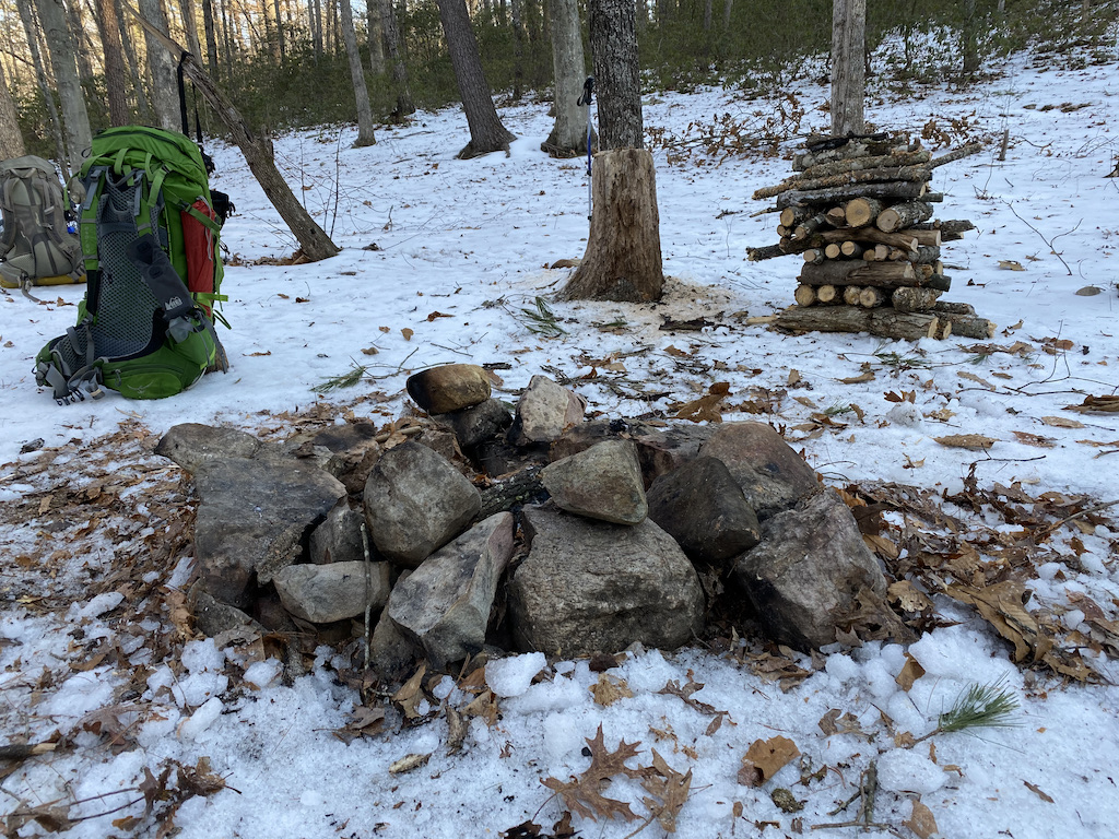
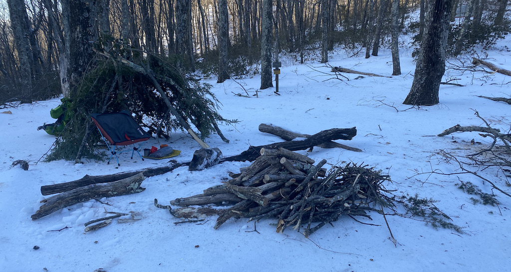
The campsite sits on a large turnout in the trail with an exposed area to the east and a water source 300 feet downhill to the left/west. We confirmed the water source and looked around for a place to set up; eventually settling on a spot near the unnamed trail from Piney Bridge. Once our tents were up, Coop dug out the fire ring and I started gathering wood and building a wind shield. By 2:15PM our camp chores were complete and it was time to run.
DAY 2B (6.38 MI | +1,105′ GAIN | -1,135′ LOSS)
Given the trail conditions, my Merrell Trail Gloves weren’t going to be much use. Instead, I went with my much heavier Merrell Moab boots. In fact, both Coop and I opted to run in boots, our own boots, not like a three-legged race. Although that would’ve made for a pretty extreme mountain event. But, since we didn’t have any Brawndo, we put our own boots on our own feet, and headed out to run individual, two-legged 10Ks around 2:45PM.
The sun was out, the sky was clear, and the views were spectacular. To top it off, my legs were feeling pretty good in spite of the cinder blocks strapped to my feet. To be fair, I was running downhill and gravity was doing most of the work, but I felt good nonetheless.
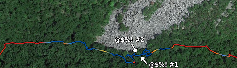
We crossed Sulphur Spring at the 2.7 mile mark, continued on for another 0.4 miles, and made an about face just shy of Petites Gap Road. Just as we started back up, my boot caught a rock and I fell, raking my hands and arms along the rocky ground before coming to a complete stop. Frustrated and tired, I laid there for a moment before eventually willing myself to an upright position.
The rest of the run back up the mountain was the exact opposite of our trip down. All the benefits of heavy boots on the downhill were now impediments on the uphill. Walk, jog, walk, jog, over and over until we finally reached our campsite in almost double the time it took to run down.
Back at camp, we swapped out our running clothes for drier alternatives and got to work on water, fire, and food. A few hours later the sun and all of its perks were gone; replaced with increasing winds and single digit wind chills.
By the warmth of the fire, we talked about our next day’s route. As planned, we’d pick up the unnamed trail at our campsite (the one from the Piney Ridge intersection) and bushwhack it along Bellamy Creek to an unnamed Jeep trail which would ultimately lead us to an unnamed gravel road back to the car. Since the named trails were hard enough to navigate, we decided to abandon our original plan and take the AT up to Piney Ridge and hike it back down to the car. I know, I know, how will our bodies be found? Hopefully we won’t have to worry about that.
Around 8PM, my eyelids were gravitating downward and I was starting to shiver.
With nothing left to give, I turned in.
Day 2 Complete.
DAY 3 (3.78 MI | +141′ GAIN | -1,643′ LOSS)
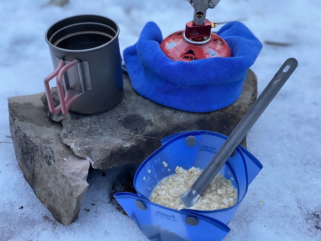
After a long, warm night’s sleep, I forced myself out into the 10°F air just as the sun was coming up. By 7:30AM I was packed and transitioning to our breakfast nook. I downed a few snacks, drank a cup of coffee courtesy of Coop’s boiled water, then proceeded to return our campsite to better-than-you-found-it status. By 8:30AM, we were loaded up and headed out.
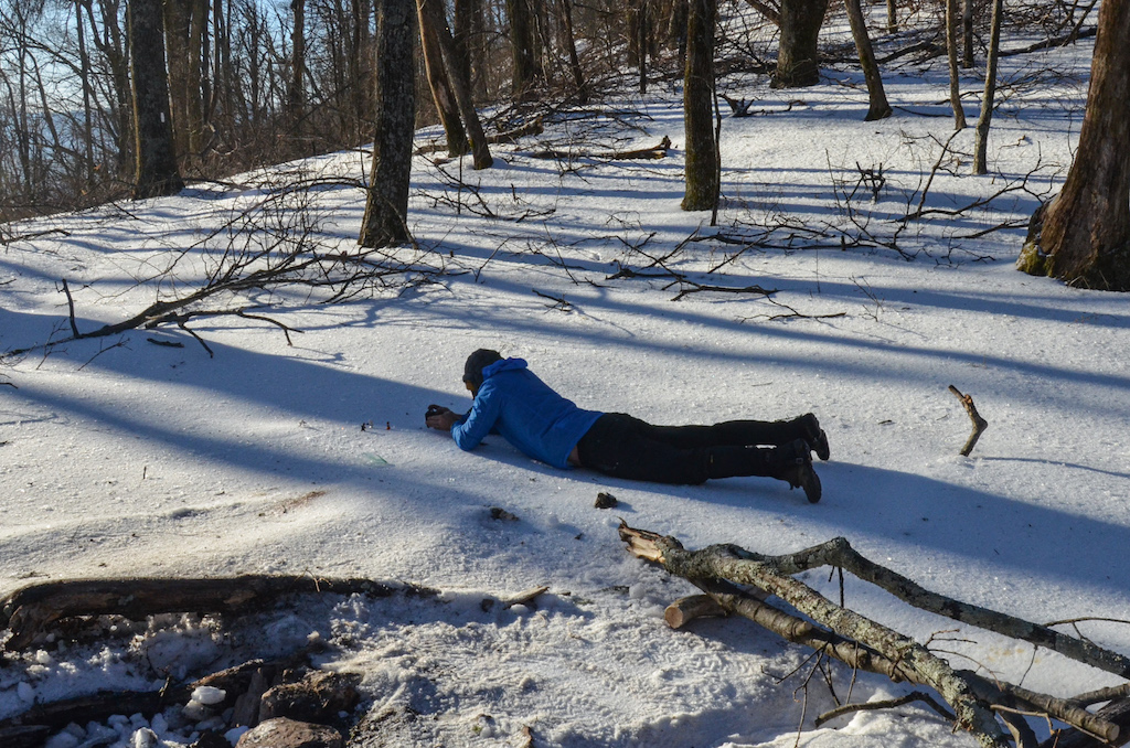
Photo by Coop
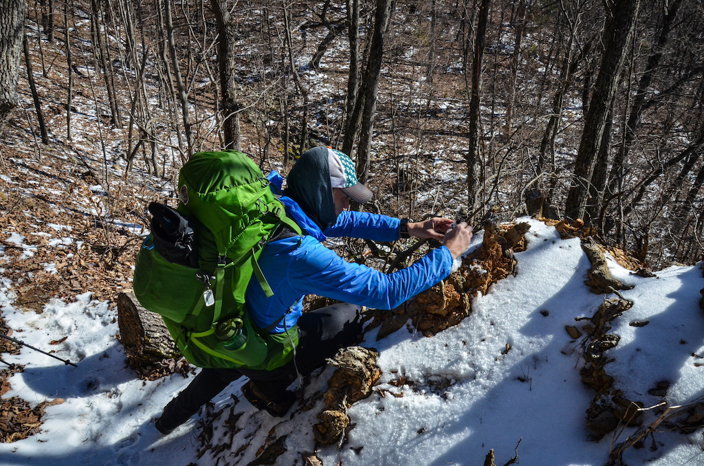
Photo by Coop
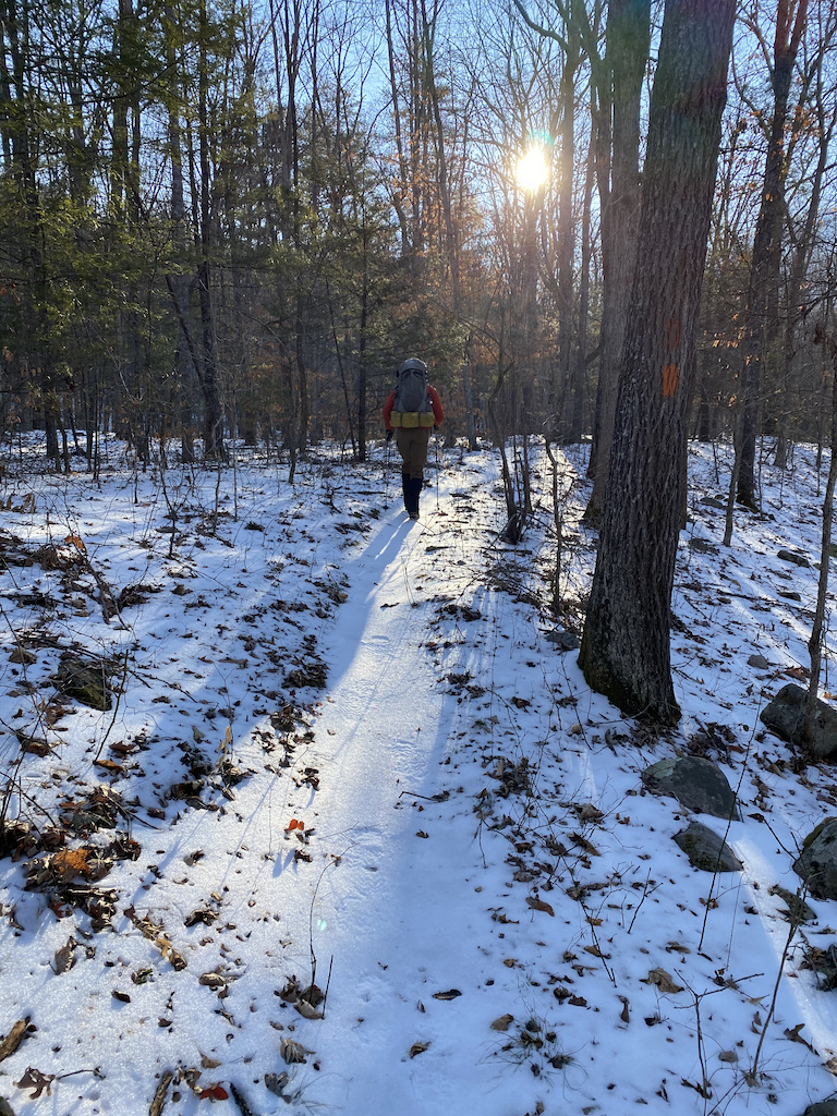
The AT was slippery, but our footprints from the previous day made navigating easier. At the nonsensical Piney Ridge-AT-Sulphur Springs intersection, we turned right/east onto Piney Ridge and began the 3.3 mile, 1,800 foot descent to the car. Before long, we reached the end of the trail, hung a left at the road, and walked back to the car.
Trip Complete
TOTALS (18.42 MI | +4,538′ GAIN | -4,684′ LOSS)
with Day 2 run (24.8 miles | +5,643′ gain | -5,819′ loss)
FINAL THOUGHTS
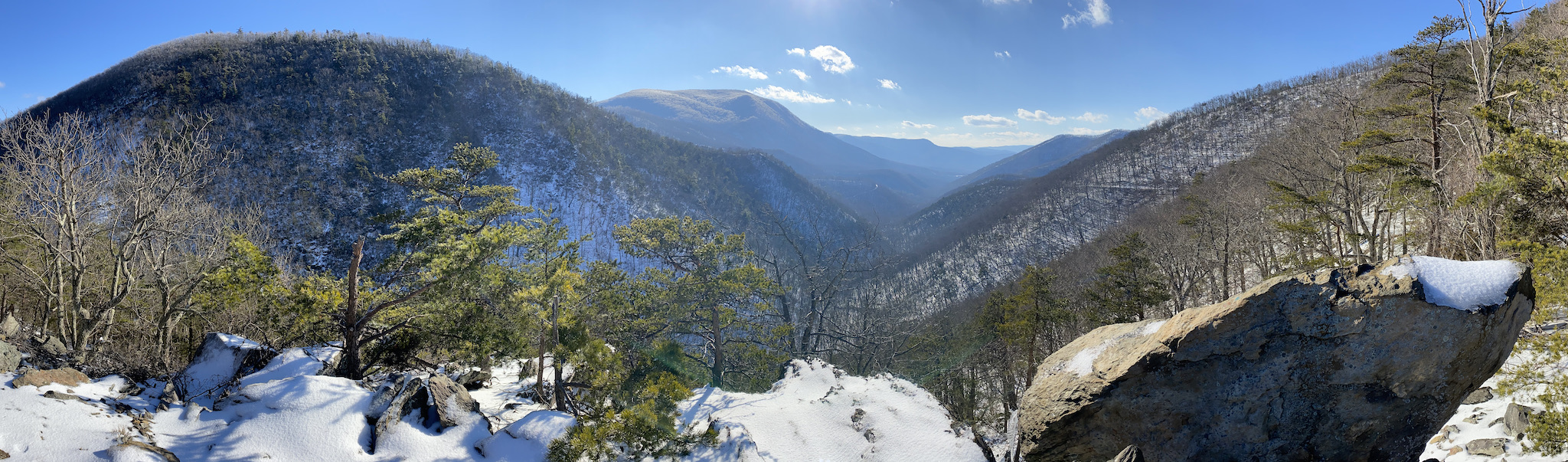
The James River Face Wilderness is incredible. Great views, challenging terrain, and plenty of options. I can imagine the area being overwhelmed in between the shoulders, but winter afforded us a level of unparalleled serenity. Previous trip reports suggested a plethora of campsites, but given the snow cover we only saw three established locations: at the intersection of Belfast and Glenwood Trails, along East Fork Elk Creek (between Petites Gap Road and Glenwood), and off the AT at Marble Spring; all with an ample supply of fresh water.
The icy conditions and the trail debris made for tricky, albeit dangerous situations, not just for us, but for others who were out and about. In fact, that same weekend, three hikers in separate incidents along the AT had to be rescued. The first involved a runner who had fallen 250 feet down an icy portion of the mountainside near Big Island and the James River Foot Bridge in Bedford County just miles from our Marble Spring campsite. The second occurred a couple hours later about a mile from the McAfee Knob parking lot where a hiker fell from the Sawtooth Trail and suffered a head injury. The third rescue took place on Sunday when a hiker fell in Rockbridge County requiring rescuers to cover 7 miles of trail to save him. These unfortunate incidents made me very grateful that my spills only resulted in minor scrapes and sore muscles.
Nevertheless, if you get a chance to visit the James River Face Wilderness, run, don’t walk. Just play it smart, prepare yourself for the worst, and enjoy the best.