The Uwharrie National Forest was the destination for my son’s first two backpacking trips. It’s close to home, the trails are manageable for a young backpacker, and the chances of being eaten by a bear are next to zero. For his third trip, I was thinking of heading up north to Grayson Highlands or west towards Pisgah, but opted to suggest a return to Uwharrie via the Birkhead Mountains Wilderness as we were expecting a couple other people to join us.
Established by the 1984 North Carolina Wilderness Act, the Birkhead Mountains Wilderness includes 5,000+ acres at the northern end of the oldest mountains on the North American Continent, the Uwharrie Mountains. It was used by early Native Americans over 12,000 years ago, explored by Europeans in the late 1600s, settled in 1760, and expanded by John Watson, son of the Birkhead family, in the late 19th century. Today, the Birkhead Mountains Wilderness has over 16 miles of designated hiking trails (i.e. horses, motorized vehicles, and mountain bikes are prohibited) that are enjoyed by hikers, backpackers, and trail runners.
I shared what I knew about the area with my son, broke the news that our two friends had to back out, and let him rethink our destination. In the end he chose Birkhead.
THE PLAN
The Birkhead Mountains Wilderness has three access points: Robbins Branch, Thornburg Farm, and Birkhead. And, within the Wilderness there are 8 campsites originally created by Boy Scouts in the 1970s. Knowing this, and the fact that my son tops out around 5 miles for a day, we looked for route options with a campsite at the midpoint of an 8-10 mile hike. Clicking through AllTrails.com we ended up with a route that started at Robbins Branch, looped around Camp 3, and took us back to the trailhead via Birkhead and Hannah’s Creek.
As for the weather, the forecast called for clear skies and high temps in the mid 50s on both Saturday and Sunday with an overnight low temperature around the freezing mark on Saturday. Not bad for a “winter” trip.
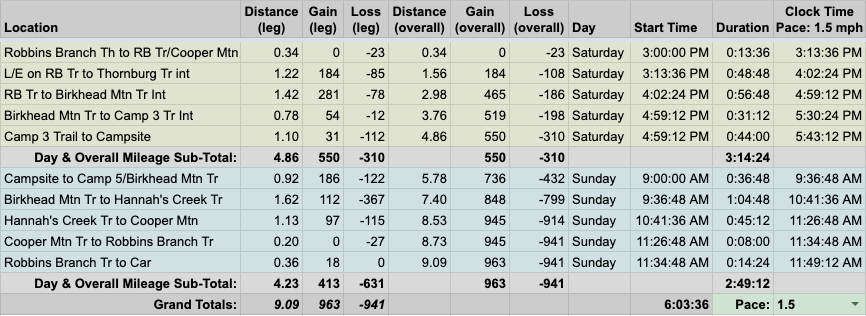
With our plan finalized, we built out the trip in a spreadsheet based on a 1.5MPH pace…
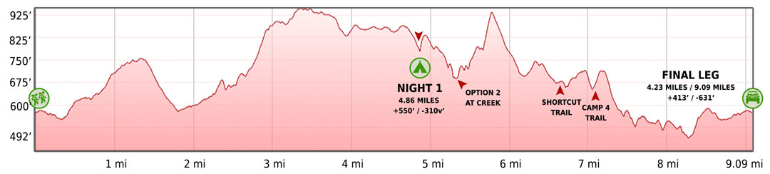
…created an elevation profile using Google Earth
…dropped in the route
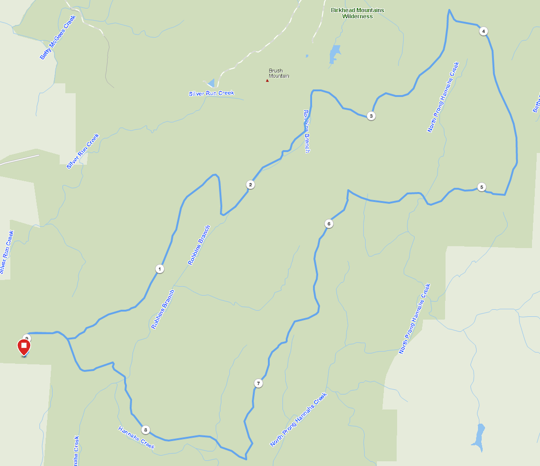
…and packaged it all in a map I printed on TerraSlate paper.
PACKING IT IN
My priority when helping my son select his gear is keeping his pack around or under the 12-pound mark. To that end, I carry the majority of the food, water, as well as pack in the tent, stove, and water filter. All he needs to worry about are his smaller gear items and clothing. The latter is the biggest issue.
On his last two trips he brought his 2-pound winter coat and rain gear thanks to fickle weather. With rain out of the forecast for this trip, he didn’t need his rain gear, but he did need a winter coat. Thanks to gift cards and discounts, I picked him up a 7 oz, 650 down puffy (that I bought big because buying clothes for kids is like burning money). With no rain gear and a lighter coat we were able to bring his pack weight down to 10.5 pounds.
My son was thrilled. Thrilled to have a new coat and a lighter pack.
SON: Could I bring my chair?
ME: If you want to carry it, sure, but it’ll put you just over 12 pounds if you do.
SON: Oh, I’m bringing it. I love my chair! Could I bring UNO?
ME: You can bring all the things you want as long as you carry them and your pack is around 12 pounds.
SON: Can you bring UNO?
ME: Ha, no. I’m carrying checkers and Yahtzee.
SON: OK. I’ll just bring a few LEGOs for my book.
ME: Sounds good.
When everything was packed, my 50L Atmos weighed in at 29 lbs. 4.9 oz and his 38L ACE came in at 12 lbs. 2.4 oz.
Feel free to download a complete list of things we brought: me | my son
DAY 1 (5.37MI | +673′ GAIN | -440′ LOSS)
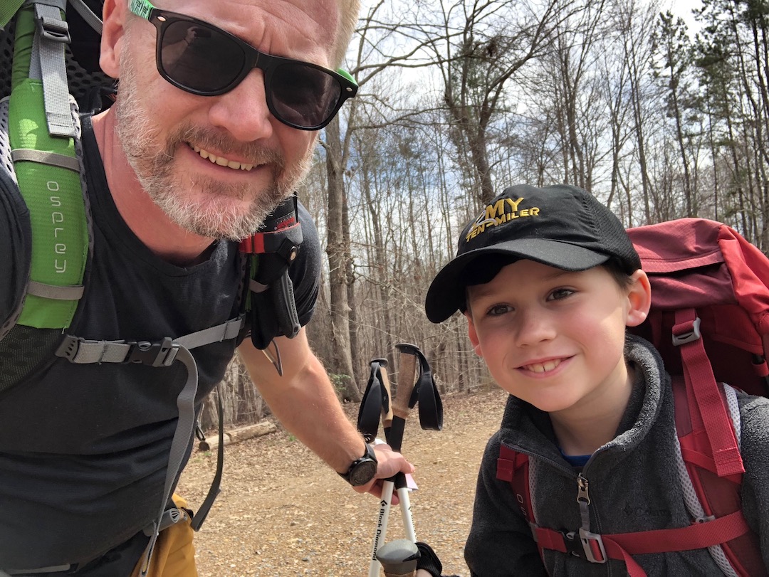
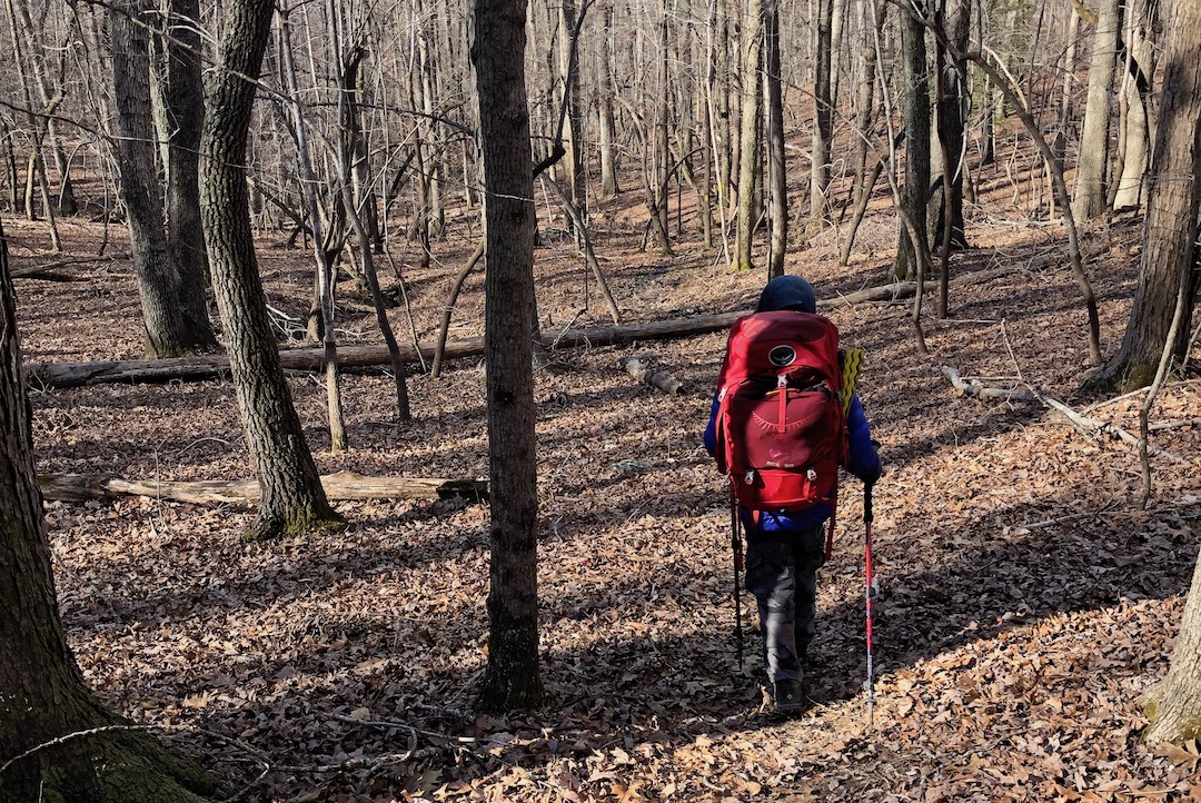
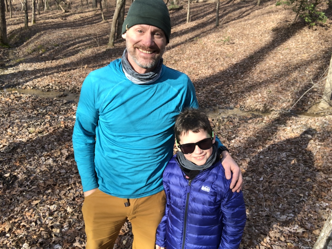
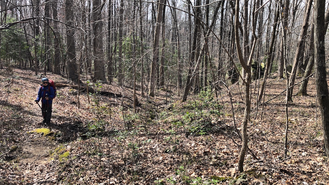
We rolled into the Robbins Branch Trailhead parking lot around 2PM. The sun was shining, temperature was a perfect 54°F, and gnats were everywhere. In our hair, our ears, our nose…everywhere. My son did his best to ignore them as he tied his boots, but when he was hit by not one, not two, but three gnats right in his eye, I thought he was going to lose it. He didn’t. He came close, but he didn’t. Once calm, he fastened his pack, and by 2:21PM we were headed into the Wilderness.
The trail was muddy thanks to a thunderstorm that rolled in the night before. As a result, we spent most of our first steps dodging sinking mud which my son referred to as “stinking” mud on account of the horrid odor that emanated from the ground any time our feet made contact with the muck. We walked another tenth of a mile and turned left/west up Robbins Branch (instead of right/east on Hannah’s Creek Trail towards Cooper Mountain Trail and Birkhead Trail) to begin a mile-long 150 foot climb towards the intersection of Thornburg Farm Trail and Robbins Branch.
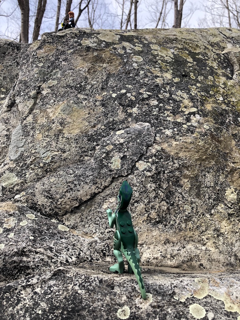
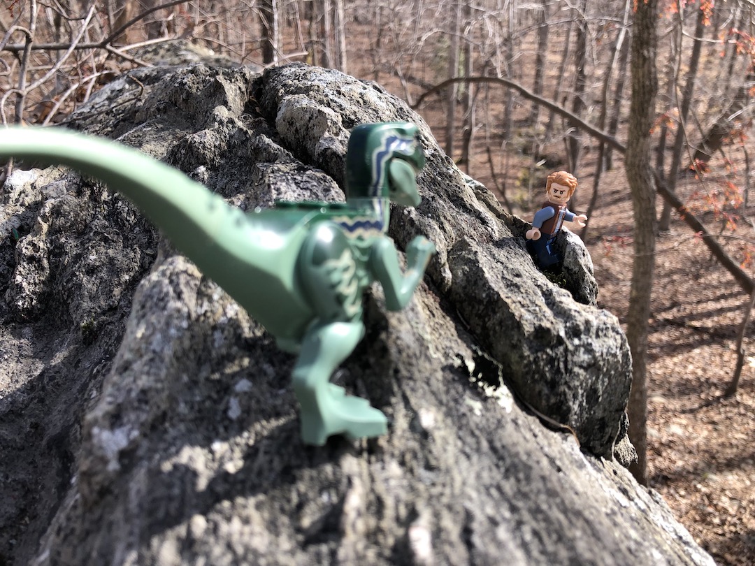
To pass the time, my son suggested a game he called LEGO Ideas. The premise is simple, create and describe a LEGO set that doesn’t exist. He further refined the rules by (initially) limiting sets to the Jurassic Park/World franchise. Fifteen minutes and three sets later we took a break so he could stage his first LEGO photo shoot. While he took photos, a dude passed by wearing a backpack and a confused look. He passed by, my son finished up, and we continued up the trail, arriving at Thornburg around 3:30PM.
Thornburg Farm Trail runs north/northwest to a homestead just shy of the trailhead’s parking lot off Lassiter Mill Road. We, however, stuck to Robbins Branch and hung a sharp right which took us south and downhill. The trail was narrow, covered with downed trees, and contained loads and loads and loads of stanky, nasty muckity muck.
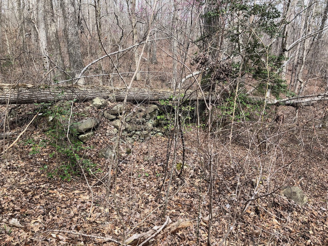
Not far from the intersection we spotted the first of three very old stone walls that were about 30 yards wide, 2-3 feet high, and spaced about 40 yards apart. The two of us pondered their purpose. My son thought it might have been a defensive measure used in a battle, and I thought, maybe, it was used for erosion. When we saw the second and third walls and how close they were to one another he concluded they were definitely not used in a battle, I recanted my erosion theory, and we both figured it was a question better suited for a park ranger.

At the bottom of the hill we turned left/north and were met by several (more) very large felled trees. Some were small enough that my son could climb over unassisted. Others required teamwork. After climbing over the last tree trunk, he managed to scrape the back of his leg on a branch forcing us to stop and apply TLC and a bandage. He milked it for a few more minutes before I continued on with the LEGO Ideas game and his memory of the episode faded.
At the end of Robbins Branch Trail we crossed Robbins Branch Creek, passed a campsite, and stopped for a snack and a LEGO photo shoot. Several minutes later, we continued the long, slow climb towards Camp 3 Trail. Along the way, we passed another campsite near Robbins Branch Creek which my son said was beautiful (the creek not the campsite) and its beauty commanded a photo for mom. FYI, if your child wants to take a picture you should probably agree 50% of the time. If your child wants to take a picture for their mother you better take several, at different angles, and a video, in 4K and in slow motion, 100% of the time.
Around the 3-mile mark we T-boned Birkhead. To the right/southwest, Birkhead runs to Camp 5, but we needed to head left/northwest towards Camp 3. We made the turn and were trotting along happily when a gnat flew a suicide mission directly into my son’s eye causing him to lose…his…shiitake.
After calming him down and assuring him that he wasn’t going to go blind, I gave him my Buff and he gave me his hat. As if by magic, the gnats left him alone and I became their lamppost. Note to self, buy another Buff.

From the intersection we followed the trail, passed a couple carrying a kid in a backpack, and waved to a solo backpacker who was setting up just shy of our turn. We finally reached Camp 3 Trail and I let my son know we were a mere 45 minutes from our destination. He did not cheer or release balloons. He just looked at me and said, “45 minutes?“.
I suggested a break and he took me up on the offer. He ate a snack, drank a bit of water, and we started hiking when he was ready. We stopped and started a few more times before arriving at Camp 3 around 5:45PM. High fives all around!
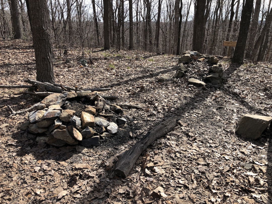
Since you didn’t ask, Camp 3 and the surrounding area is set on a slope. There’s a fire ring and a stone fireplace with a grate at the top of a hill as you come in from the north; a stone-covered spring down the hill to the northwest; and three more fire rings to the south/southwest. Just know that if this place doesn’t tickle your fancy you can keep hiking down the trail towards Camp 5 where you’ll find more water options.

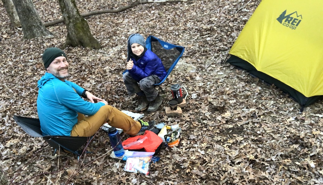

My son picked out a spot and asked if he could sit and relax for a bit. Given our decision not to have a fire and the fact that he’s a super awesome 8-year-old who just hiked 5 miles with 12 pounds on his back, I let him lounge while I set up our tent and got things ready for dinner.
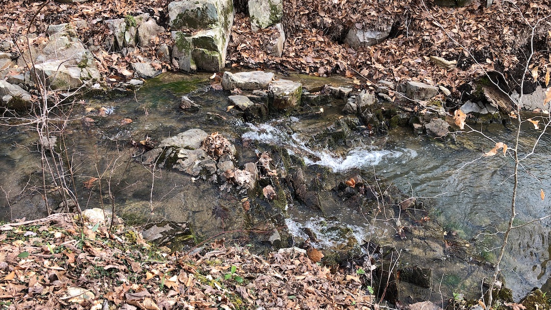
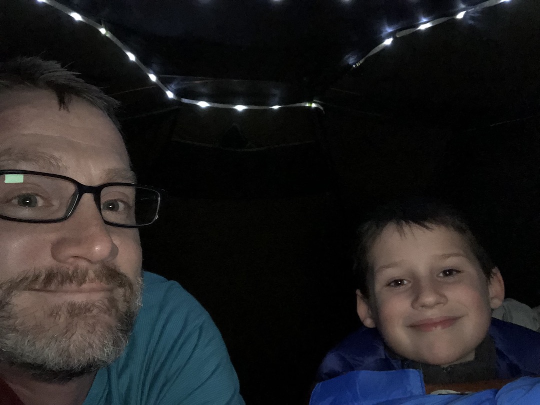
When I finished, we walked over to the spring only to find it stagnant and covered in mosquitos. We followed the source until we saw where water was actually moving and filtered it from there. Back in our chairs, we dined on rehydrated meals, ate a few sweets, and played checkers. When night fell, we retired to the tent and watched a little Star Wars: The Last Jedi before turning in around 9PM.
Day 1 complete.
DAY 2 (4.63 MI | +620′ GAIN | -817′ LOSS)
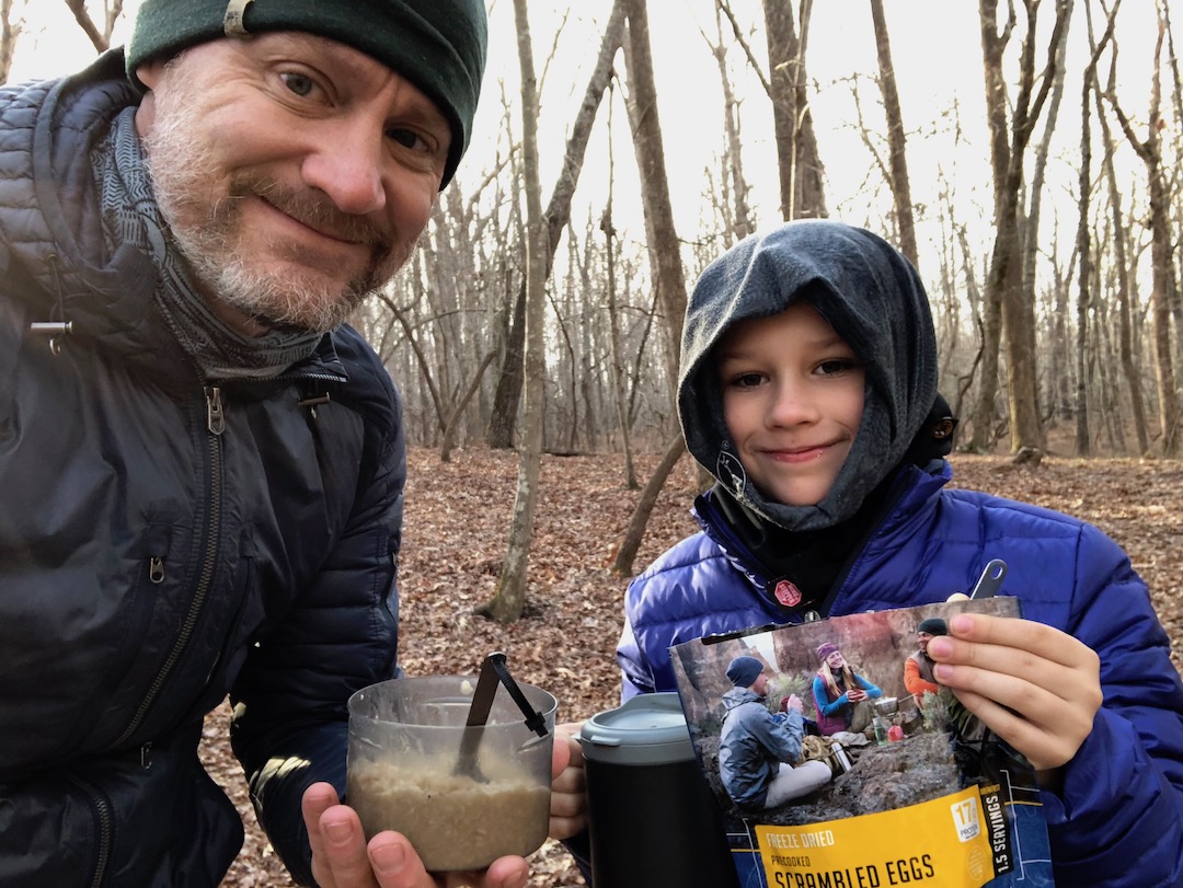
Overnight the temperature dropped from 54°F to a brisk 34°F. Prior to turning in I suggested to my son that he use the bag liner. He declined. As a result, he woke up around 2AM to wake me up to say he was cold. I offered the bag liner again and this time he accepted. Not surprisingly, he didn’t have any further issues with the cold and he didn’t wake up again until 7AM (at which time he asked if he could sleep for another hour). At 8AM, we packed everything up before turning our attention to breakfast—eggs and bacon with hot cocoa for him, oatmeal and coffee for me. We finalized our morning routine with nature-related deposits and headed out at 9:38AM.

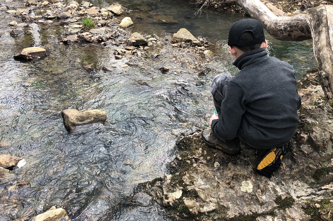
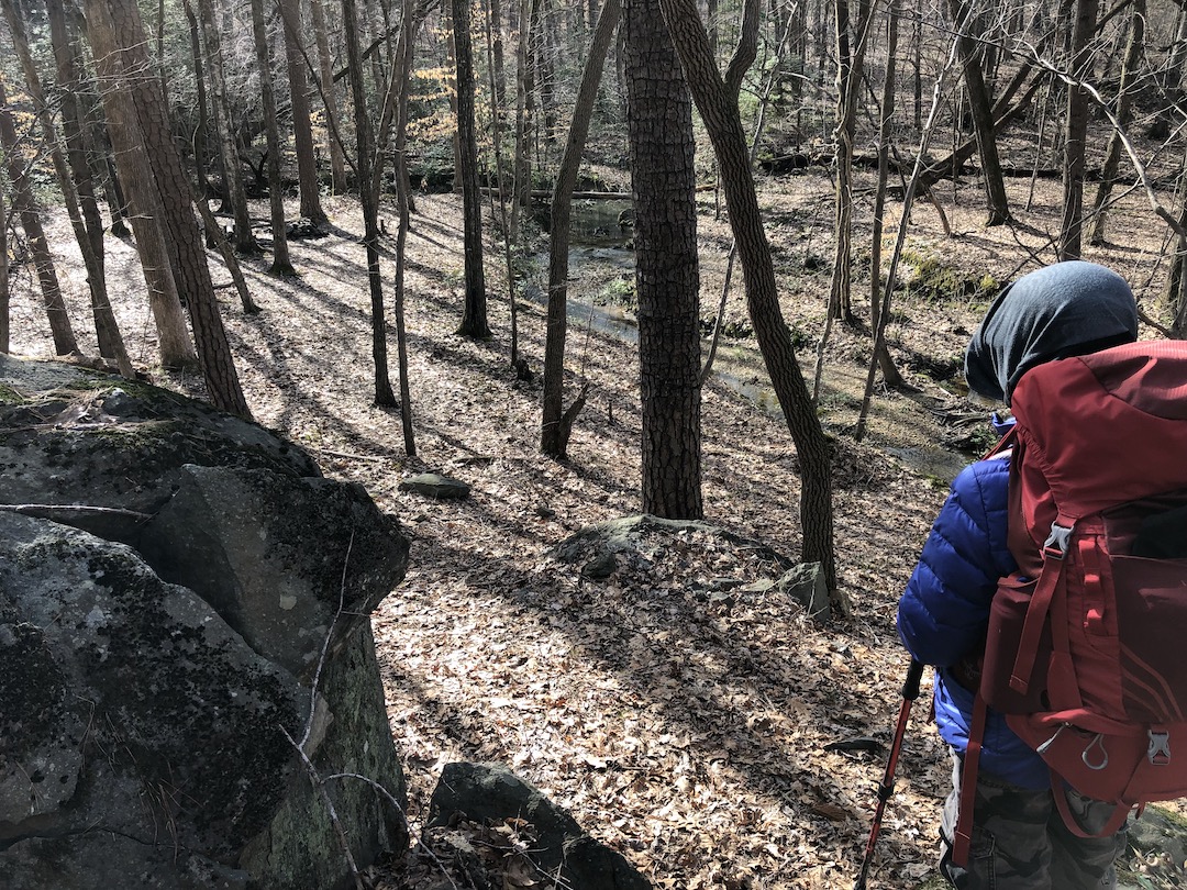
Following the yellow blazes we made our way up and over a short, steep hill and then descended downward through a minefield of downed trees and deep craters. About 0.75 miles from Camp 3 we hit North Prong Hannah’s Creek where we stopped to take pictures of LEGOS, water, and a snail. From the creek, the climb up was short, but it was really steep (like hand-on-my-son’s-back-so-he-doesn’t-fall-backward steep). Another tenth of a mile and we crossed a slightly wider (7-8 feet) section of North Prong Hannah’s Creek and a really awesome campsite that if you have the chance you should totally stay there.
SON: Why didn’t we stay there?
ME: I didn’t know it existed.
SON: It’s right there.
ME: Yeah, but I didn’t know it was right there.
SON: You should have because that campsite is awesome.
We hiked some more, stopped to take photos of LEGOS, and then continued on to Camp 5 (off Birkhead) about 0.25 mile away. Since you didn’t ask about this site either, there’s a fireplace, a fire ring, and a couple spots to set up tents. If you’re thinking of staying there, there isn’t water at the site, but there is a creek about a tenth of a mile back down Camp 3 Trail though I don’t know what it would look like in the warmer months.
I reminded my son of our options for the remainder of the trip: A) Stick to the plan and hike the full 3.25 miles, B) Hike down to Shortcut trail and shave off about half a mile, or C) Hike down to Camp 4 Trail and shave off a tenth. I also mentioned that if he wanted to shorten the day by taking Shortcut Trail we might pick up a few extra feet of elevation gain. The shortened hike was enticing, but he wasn’t ready to commit to the possibility of more climbing. Instead, he said he’d think about it because we still had 0.75 miles before we got to Shortcut.
And then we got to Shortcut.
Shortcut Trail is not maintained nor is it mentioned on most sites and maps. I only knew it existed because I happened to notice it on HikingProject.com when I was researching the area. In fact, when you reach Shortcut Trail, there are rocks and sticks covering the trail to discourage its use and keep people on Birkhead.
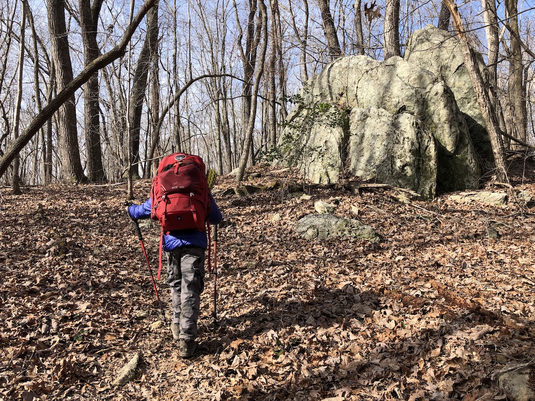
We stood there staring at the two trails for a minute or so before my son just started walking on Shortcut. Of course, if you ask him, he’ll say that I chose Shortcut and it was horrible. In actuality, he led the way and the trail was in pretty good shape considering no one was maintaining it. After 40 minutes and just over a mile of me singing songs of how I loved Shortcut Trail and him singing songs about how Shortcut Trail was a giant turd we joined up with Hannah’s Creek Trail and our original route.
A minute later we reached Hannah’s Creek; 20 feet wide and barely flowing despite the recent rain. My son opted to hop across the rocks in the most indirect zig-zagging fashion, and I opted to cross a felled tree that connected the two banks.
From the creek, the trail goes straight up, and my son was the first to notice. I asked him if he wanted to stop and he said he just wanted to go slow. So we did. But then, after a quarter mile, he just stopped.
SON: That is beautiful.
I followed his eyes and saw that he was referring to the mountains in the distance.
ME: It sure is.
Even though we had about three quarters of a mile to go, I wanted to let him enjoy the moment so we took off our packs, grabbed a snack, and talked for a bit.
ME: I’m proud of you bud. I’m proud of you for making the trip and for giving it your all.
SON: Thanks dad.
ME: I bet not many 8-year-olds are climbing mountains today.
SON: Definitely not any of my friends.
ME: What do you think they’re doing this morning?
SON: Probably sleeping or playing Fortnite.
ME: And look at you. You’re climbing up a mountain and taking in a beautiful view. You are awesome.
SON: Thanks dad.
We sat for a bit longer before he suggested we get moving. Eventually, we reached the top of the hill, passed Cooper Mountain Trail to the left/southwest, and joined back up with Robbins Branch. Seven minutes later, and 3 hours after we left camp, we arrived at the parking lot.
Trip complete.
TOTALS (10.00 MI | +1,565′ GAIN | -1,548′ LOSS)
FINAL THOUGHTS
This trip was awesome. My son continues to impress me with his enthusiasm and determination. He stayed positive in spite of gnats, cold temps, and elevation gain. He is becoming more familiar with backpacking and what works and doesn’t work for him. As for Birkhead, I’ve been to Uwharrie four times now and this is my first time in the Birkhead Mountains Wilderness. It’s a great place to backpack and would likely be a great place for a dayhike and a trail run. There’s plenty of water, loads of campsites (thank you Boy Scouts), and the trails are really well marked. The downed trees made it a challenge at times, but not enough to slight the area. We didn’t hear any gun shots which is a first for me/us in Uwharrie. We did, however, see bike tracks throughout our hike and a pile of horse poop on Robbins Branch which makes me wonder if you can ride a bike or horse on the trails or not. Bottom line, if you get a chance, check out Birkhead.
ADVICE FOR MOMS AND DADS
I’ll continue to reiterate my advice for moms and dads looking to take their kids backpacking.
- Kids want to be involved. From planning to carrying gear to building a fire, let your kids help. My son really wanted to be involved with planning, choosing gear, games, and other activities. Not only was letting him help helpful to both of us, it helped him create ownership of the trip.
- Practice makes practice. We regularly hike trails near our house and the weeks leading up to the trip were no different. The practice hikes helped him prepare for the trip, and helped me gauge his ability. They also provided the perfect opportunity to set expectations and talk about safety.
- Take your time. My son stopped when he wanted to stop, went slow when he wanted to go slow, and went fast when he wanted to go fast. A trip with kids is as much their trip as it is yours. Let them enjoy it.
- Activities are a must. Hiking is only a portion of the trip and my son knows this. For this trip we played his LEGO Ideas game while we hiked and checkers at camp. He also took loads of photos of LEGOs. Truthfully, he did a great job keeping us both busy when we could’ve just sat around staring at trees (not that there’s anything wrong with that).
- Have fun. This goes without saying, but I’m saying it. Have fun.
Great write up!
I don’t recall gnats being an issue when it is this cool.
Btw, the northern trailhead is referred to as Tot Hill TH.
Check out our trail club, Uwharrie Trailblazers.
Thanks David. My son and I enjoy Uwharrie (gnats, not too much). I’ll be sure to check out your club!
Just got back from a 15-ish mile day hike on the Dutchmans Creek, Uwharrie, and Keyauwee Trails, and I was looking for camping info in Birkhead when I discovered this page. As a father of two sons myself, neither of whom really let the backpacking bug bite, I admit I teared up while reading about your interaction with your son. So awesome. Six-ish years later, I hope you’re both still pounding out the miles!
Thanks for sharing. Uwharrie is a great place to pack in the miles, and I love Birkhead for getting folks started. Easing ’em in works as my son and I are still tackling the trails.