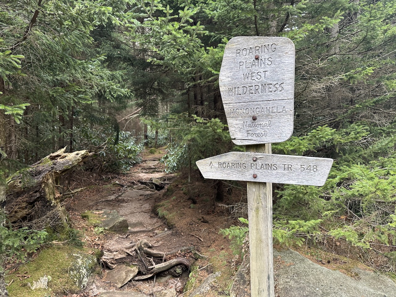
The Roaring Plains West Wilderness (RPW) is a picturesque backpacking destination in eastern West Virginia—3 mile southwest of the Dolly Sods Wilderness and 5 miles south of Canaan Valley State Park. The areas 6,792 acres of mixed hardwoods of red spruce and brush and bogs, grasses and rhododendron, ranges in elevation from 3,000′ along the southern perimeter to over 4,700′ feet’ at the top of Mt. Porte Crayon. The area is part of Roaring Plains, which spans 12,376 acres and is considered backcountry as opposed to RPW’s wilderness designation.
In 2017, my buddy, Coop, his brother-in-law, and I set out to pack the RPW circuit following South Prong to Canyon Rim Trail and down Boar’s Nest to the parking lot. Given the Monongahela National Forest’s fickle and unpredictable weather, we were met with a raging and impassable South Fork Red Creek. Unable to complete the route as planned, Coop and I decided to take another shot.
THE PLAN
Regardless of forecasts, the weather in the Monongahela Nat’l Forest is unpredictable. On average, between October and May, 15 feet of snow falls on the area annually and blizzard conditions can hit the higher elevations above 4,000′. Rains can quickly saturate the ground and swell creeks. And, the winds will pick up enough speed to topple trees. Needless to say, proceed with caution.
Having selected the destination weeks in advance, we paid careful attention to the forecast. As we neared our trip date it appeared we were, for the most part, in the clear. Temps would likely range between 30°F and 60°F with a 50% chance for rain the second day. The part that raised eyebrows was the winds—13MPH sustained with 30MPH gusts in the overnight hours.
With the weather forecast in the back of his mind, Coop mapped out a route starting at the Boar’s Nest Trail Parking Lot off Delta 19. We’d follow FR479, cross South Fork Red Creek, and continue on South Prong Trail to Hidden Passage. At the junction, we’d turn right/west and camp somewhere nearby. On the second day we’d follow Hidden Passage Trail to Canyon Rim Trail, cross the Pipeline Access Road, and continue on Canyon Rim Trail to Tee Pee Trail where we’d camp for the second night. On the third day we’d follow Tee Pee Trail NE to Roaring Plains Trail to Pipeline Access Road and then to Roaring Plains Rd (FS 70) where we’d pick up Boar’s Nest Trail and take it to the parking lot.
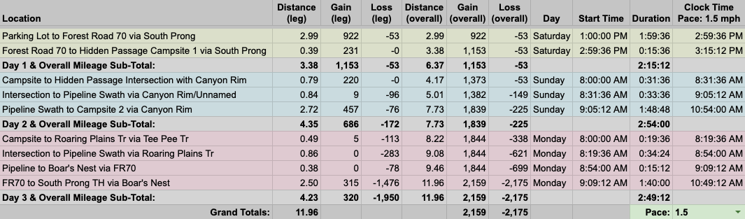
To that end, Coop built out the 12-mile trip route in a spreadsheet based on a 1.5 MPH pace…
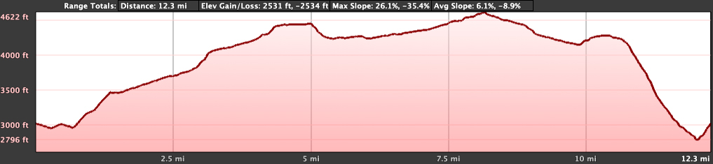
…created an elevation profile
…dropped in the route
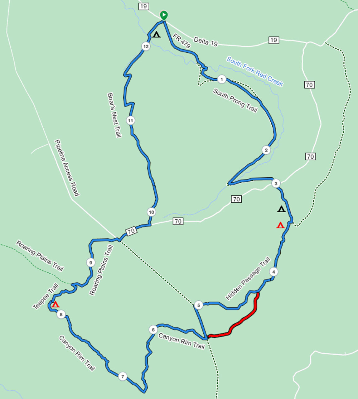
…and packaged it all in a map that Coop printed and laminated.
PACKING IT IN
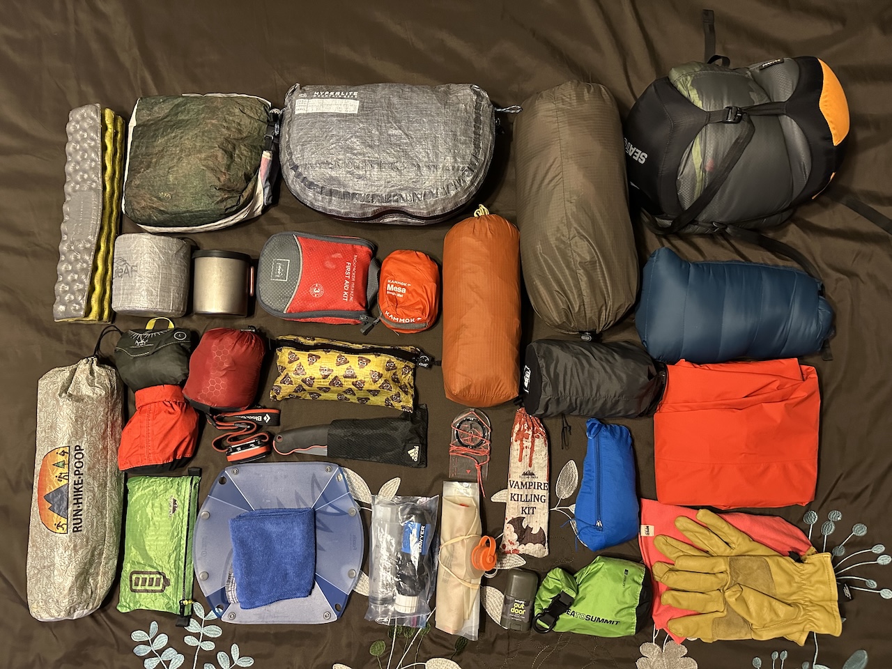
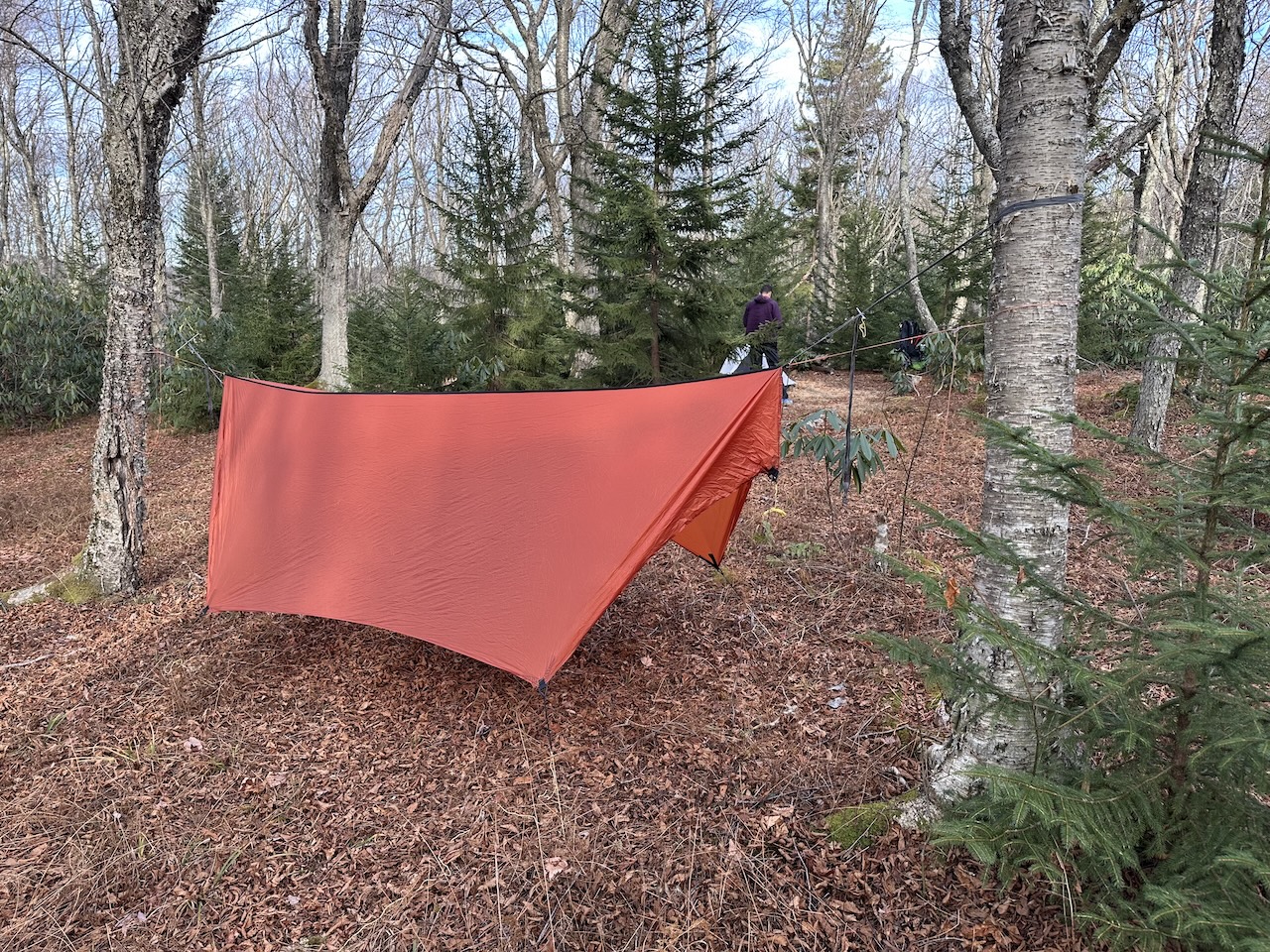
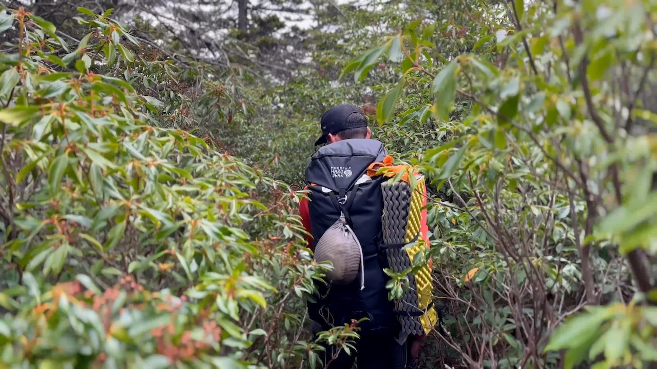
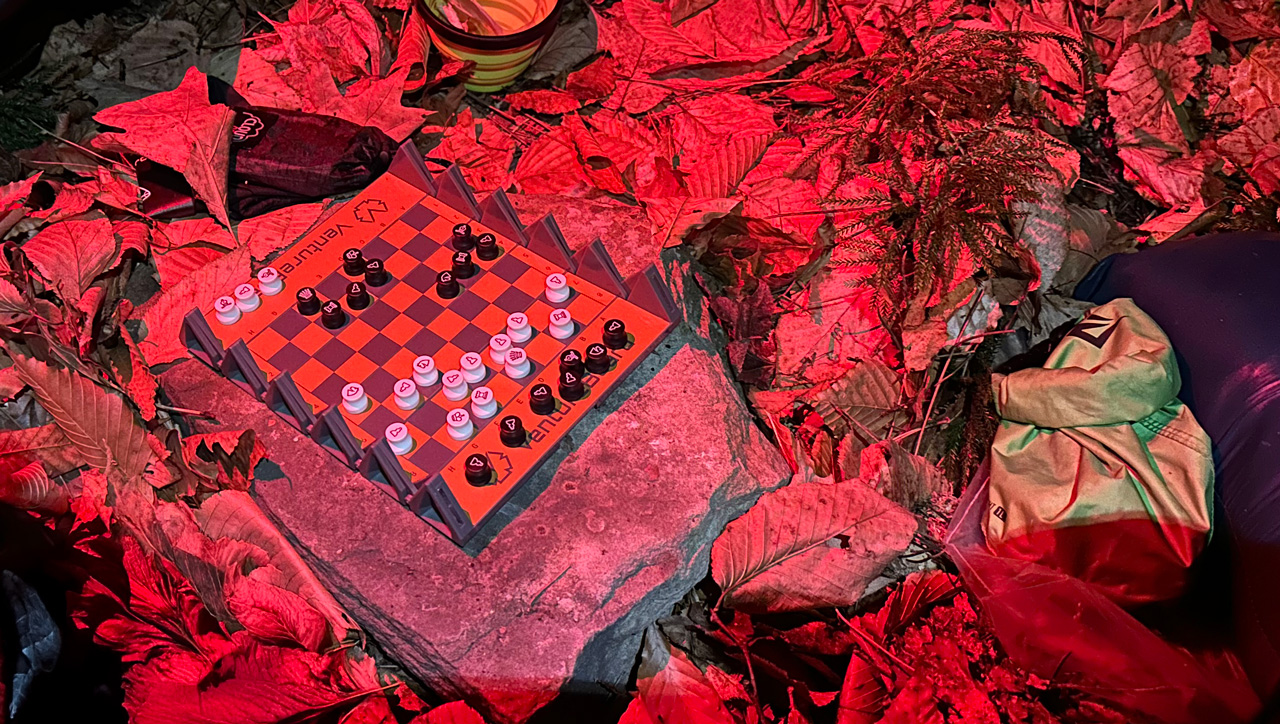
With rain, but no snow and warmer temperatures, I went with my hammock, 30°F underquilt, and 10°F sleeping bag (on the off chance it wasn’t going to be that warm at the top). To combat the rain I packed a backpack cover, rain pants, and rain jacket. To keep dry at camp, Coop brought a tarp, and I brought stakes to secure it to the ground (and split the weight between us). And to pass the time, I threw in a travel chess set at the last minute because, why not?
With everything loaded, including water, rain gear, and food, my 50L Atmos weighed in at 29 lbs. 8.9 oz.
DAY 1 (3.58 MI | +1,144′ GAIN | -122′ LOSS)
The drive up to West Virginia had enough twists and turns that the changing scenery helped time pass quickly. It also helped to have a playlist loaded with stand-up comedians to keep my mind entertained. To add to the fun, I got to take in some wildlife.
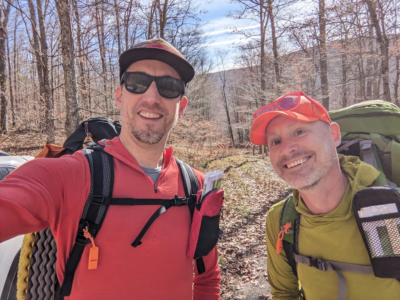
I drove under a rafter of a dozen turkeys flying over the road, and just shy of Seneca Rocks, passed a bobcat that was staring at the rock formation. The bobcat nonchalantly looked at me over its shoulder and then, just as casually, walked across the road and into the woods. Shortly thereafter, I pulled into the Boar’s Nest Trailhead parking lot where Coop was waiting for me.
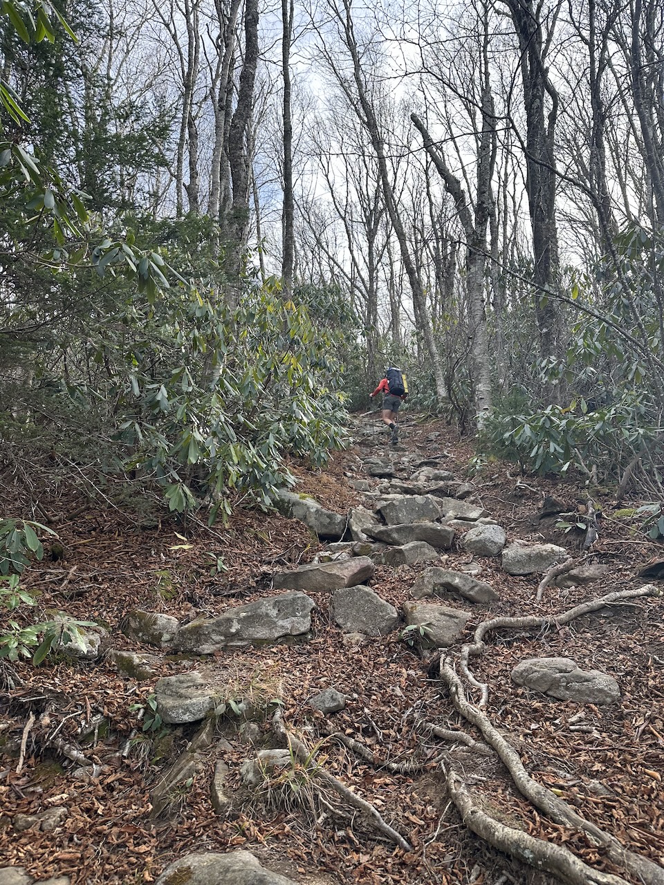
Around noon, we loaded up and headed down Monongahela National Forest Road 479 to South Fork Red Creek, crossed it and picked up South Prong Trail on the other side. From this point, it was nothing but ascent to our campsite 3-ish miles away.
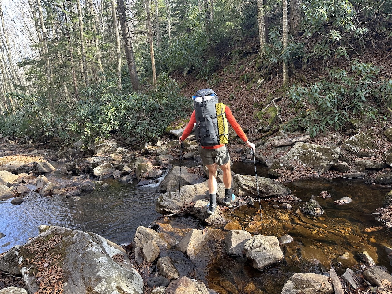
We joked and caught up on life as we climbed the two miles to the next South Fork Red Creek crossing (the creek winds its way all through the wilderness). Truth be told, we actually missed the turn towards the creek initially (due to blabbering), but quickly corrected our wrong and walked down to the creek to fill our extra water bladders on the off chance we wouldn’t have a water source at the campsite.
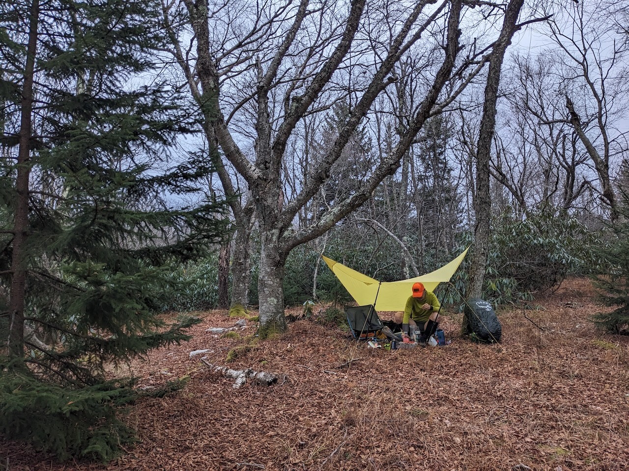
From the creek, we climbed another half mile to Roaring Plains Road, crossed it, and continued on South Prong Trail. About a quarter mile from the road we found a site on the other side of a thicket of rhododendrons. It wasn’t our planned site, and there wasn’t an apparent water source, but we figured we’d stay, make use of the extra water we were carrying, and make up the distance in the morning.
We wandered around the campsite looking for sturdy, live trees amongst the dead and fallen ones. There were plenty of bad options for sure, but eventually we found a couple of options that were good enough (and crossed our fingers that the winds blow elsewhere).
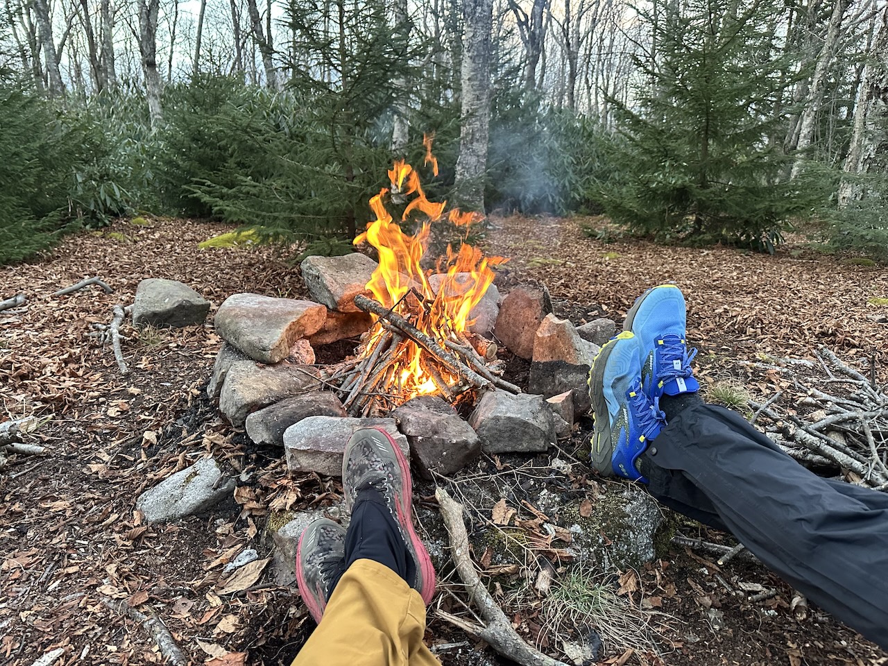
To beat the 5:08PM sunset, we set up camp, collected wood, and prepped for dinner before taking in a caveman movie. Given the sheer number of downed trees and branches, gathering wood was the easiest it’s ever been.
Once our chores were complete, we sat, ate dinner, and warmed up by the fire before dousing it around 10PM. Overnight, the rain never arrived and the wind stayed in the higher elevation. There were, however, hooting owls and large upright animals cutting through the campsite. Probably just a deer. Probably. Or a bear. Or a bear riding a deer. Whatever it was, it paid us no mind.

DAY 2 (10.58 MI | +1,204′ GAIN | -2,383′ LOSS)
In the morning, we broke camp, ate, and cleaned up (leave it better than you found it as they say). Before taking off, I decided to investigate the water sound I’d heard the night before. Turns out, there was a creek about 20 yards up the trail that wasn’t on the map. Doh! On the plus side, we were able to fill up before heading out.
On the trail, we passed a number of other water sources and a few campsites en route to the South Prong/Hidden Passage junction. We turned right/west onto Hidden Passage Trail (which is easy to miss as the name suggests) and passed our planned first night campsite. Nice site. Some water. Maybe next time.
(Photo by Coop)
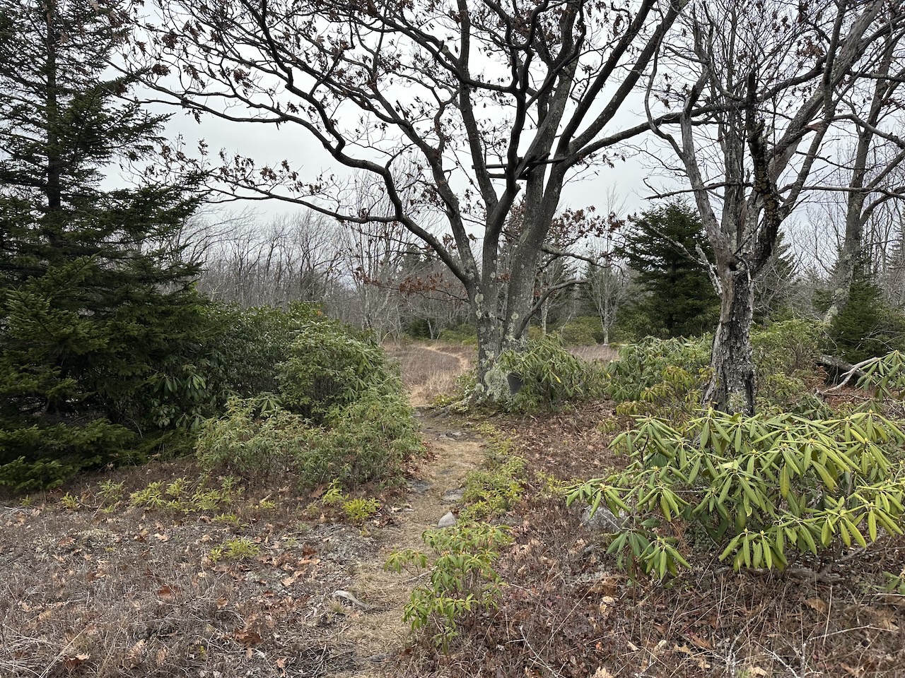
At the top, the trees gave way to tall grasses. We passed an old deer stand we saw on our first trip out to the area, climbed a hill, and hiked through pines before Coop realized we weren’t following his updated route (which I hadn’t loaded into my watch and while I’m being honest, didn’t know we were following). Instead, we were following Coop’s earlier plan that followed Hidden Passage up and across the plateau to Pipeline Access Road instead of deviating from Hidden Passage to Canyon Rim Trail which follows, the, uh, canyon’s rim.
We passed a couple of south-facing campsites, and spotted innumerable game trails cutting through the area in several directions. Before long, we reached Pipeline Access Road, and turned left/southeast.
The muddy access road descended 0.4 mile to Canyon Rim Trail. A thermometer nailed to a tree marked the trail junction and we turned right/west and joined the trail. Almost immediately, the trail turns right/north. We initially missed the turn because it wasn’t apparent.
What caught our attention was the fact that we were going down. Since we were supposed to be on the rim trail and weren’t supposed to be going up or down, at least not that much, we righted our wrong, backtracked up the trail and turned left/northwest through the trees and across a creek.
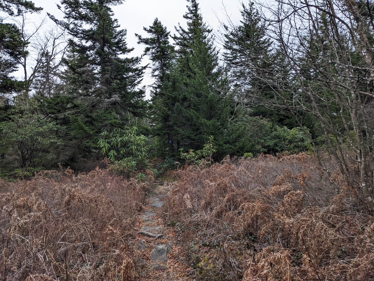
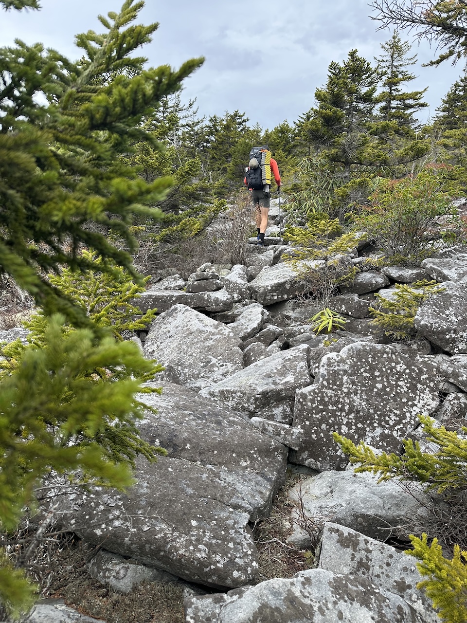
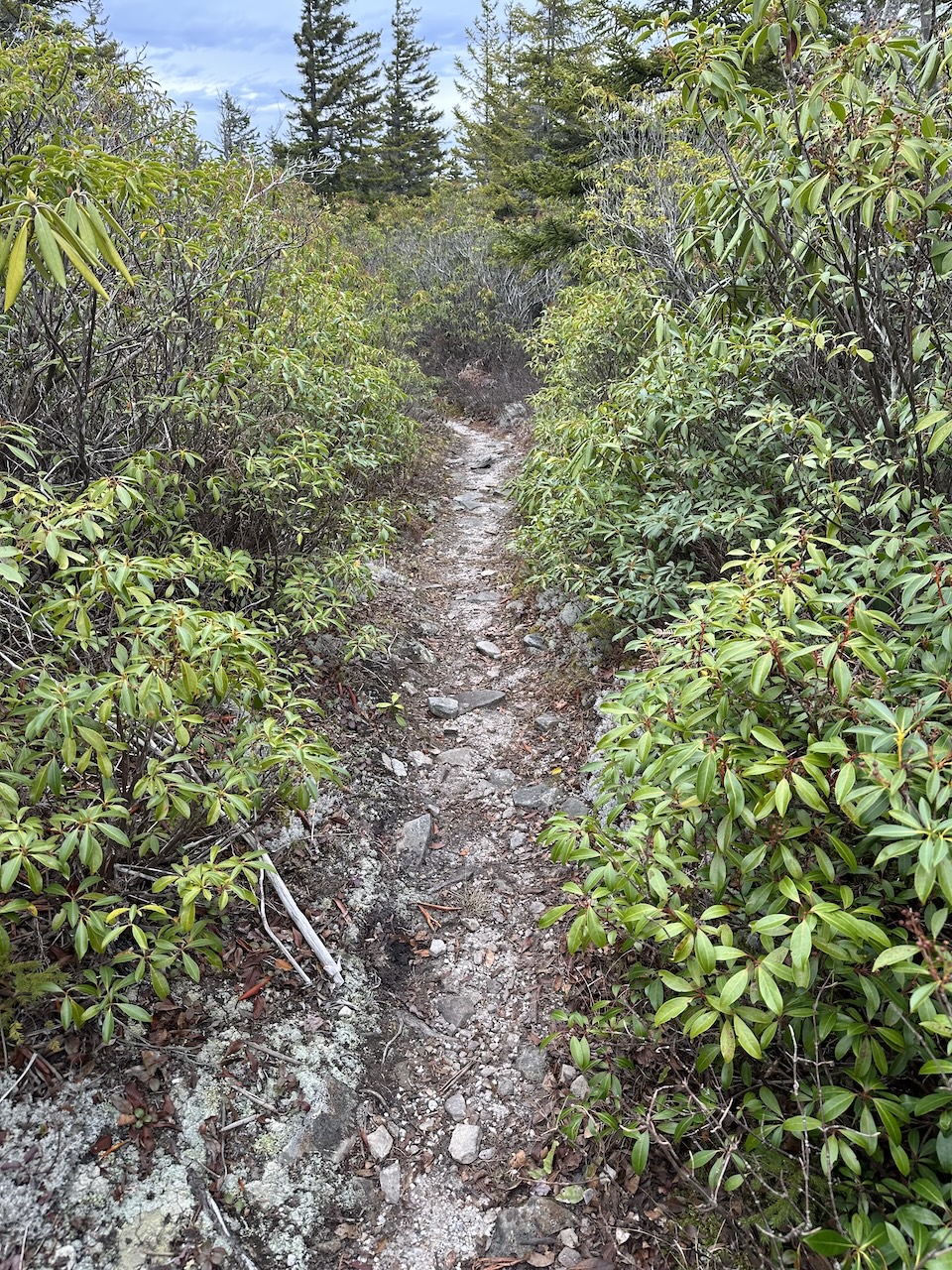
Canyon Rim Trail is mostly single track, but there are loads of rocks and a couple of rock fields. Big rocks. Round ones. Ones that required careful foot placement and balance. And whistling. Man, I love me some whistling.
On the other side of one of the rock fields we passed three dudes that Coop had seen at the parking lot prior to my arrival. We guessed they probably took Boar’s Nest’s gnarly 1.5 mile, 1,500′ ascent and camped somewhere off Canyon Rim Trail.
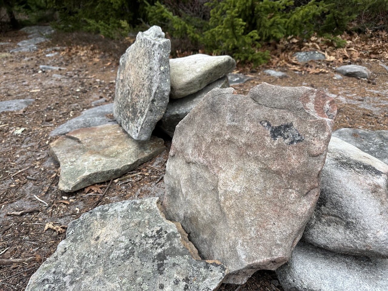
A few minutes later we came across a campsite with a smoldering fire. A smoldering fire. Could this be where the dudes stayed? If so, they didn’t put it out. And there isn’t a nearby water source. And it was windy. C’mon man! Coop dumped water on it, patted it to check for heat, then covered it with dirt and rocks.
As we left, we passed two more dudes who were hiking with a dog and who appeared to be on a dayhike on account of their lack of gear. A short time later Coop found a Blue Ridge Cycling hat. Seriously, what a weird place to ride a bike. OK, not seriously, but seriously, what a weird place to ride a bike.
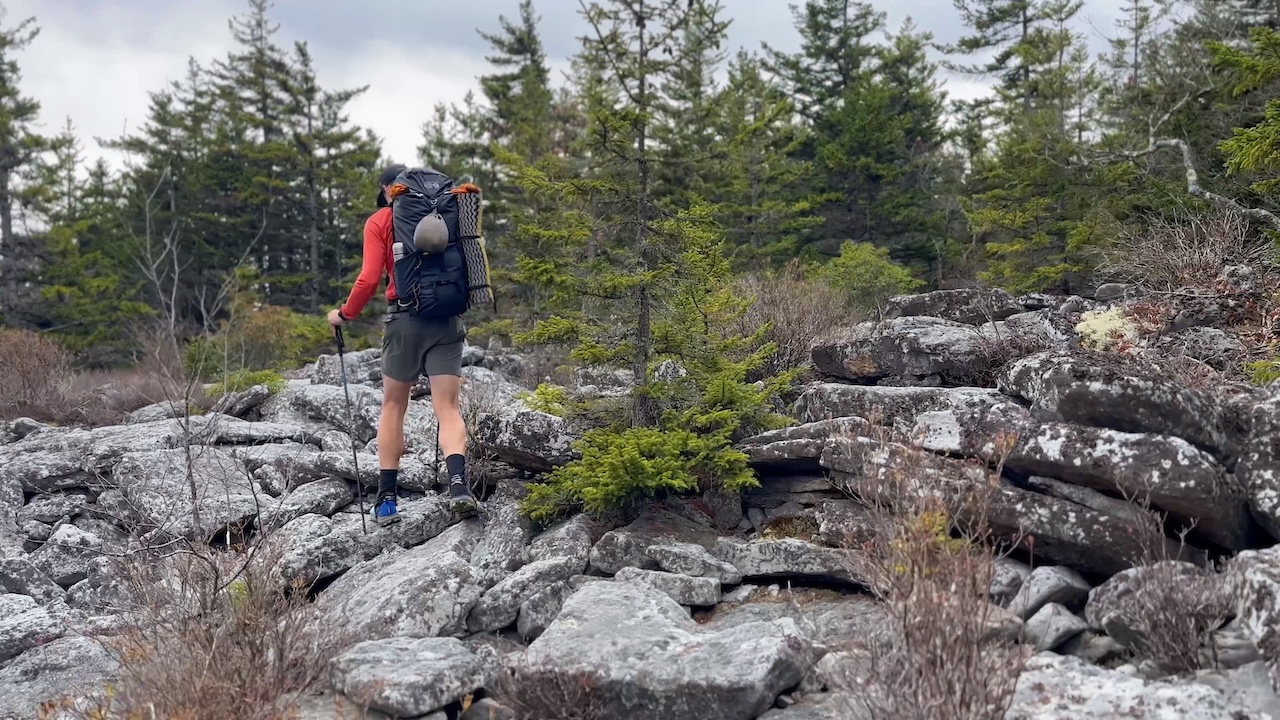
(Photo by Coop)
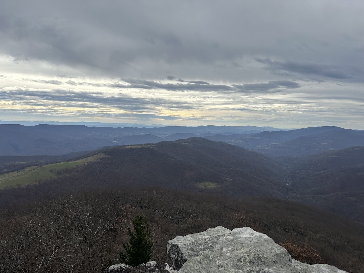
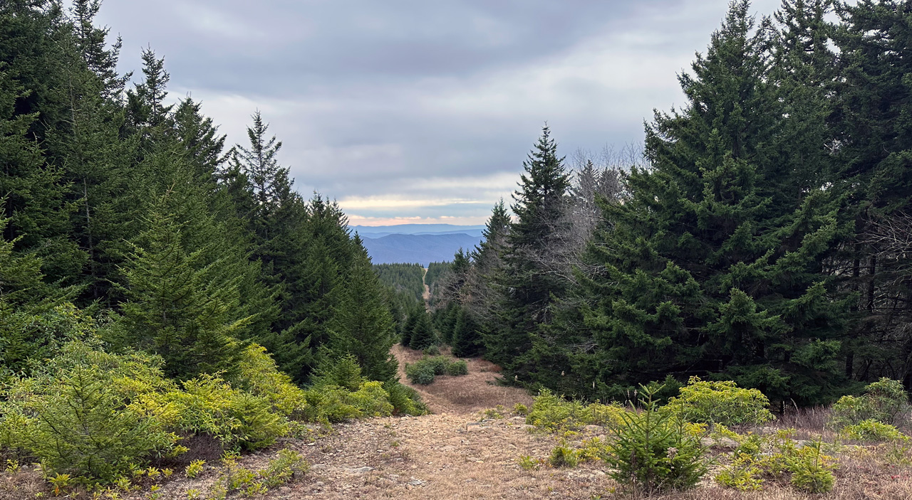
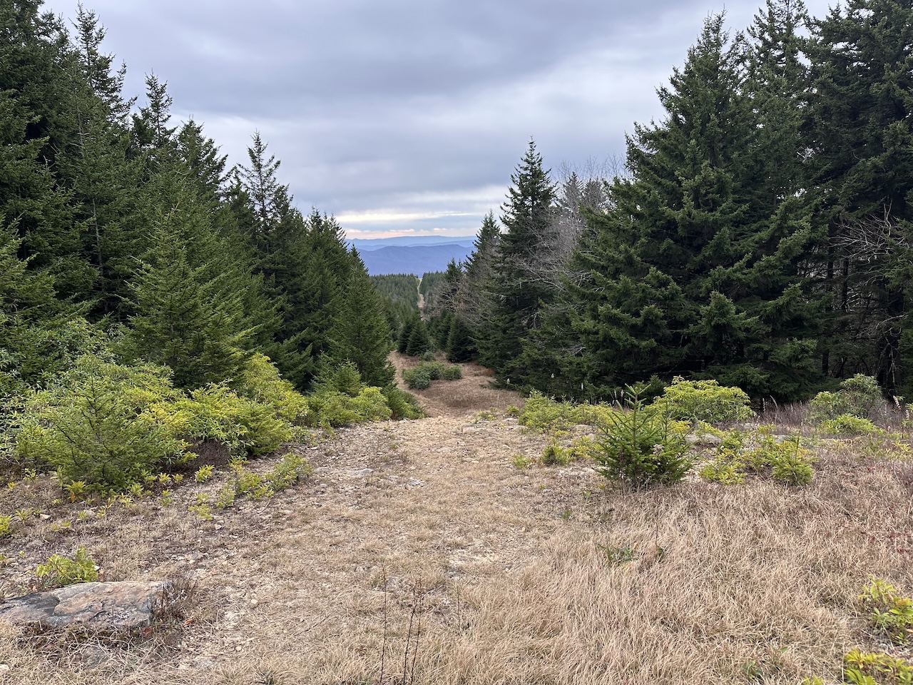
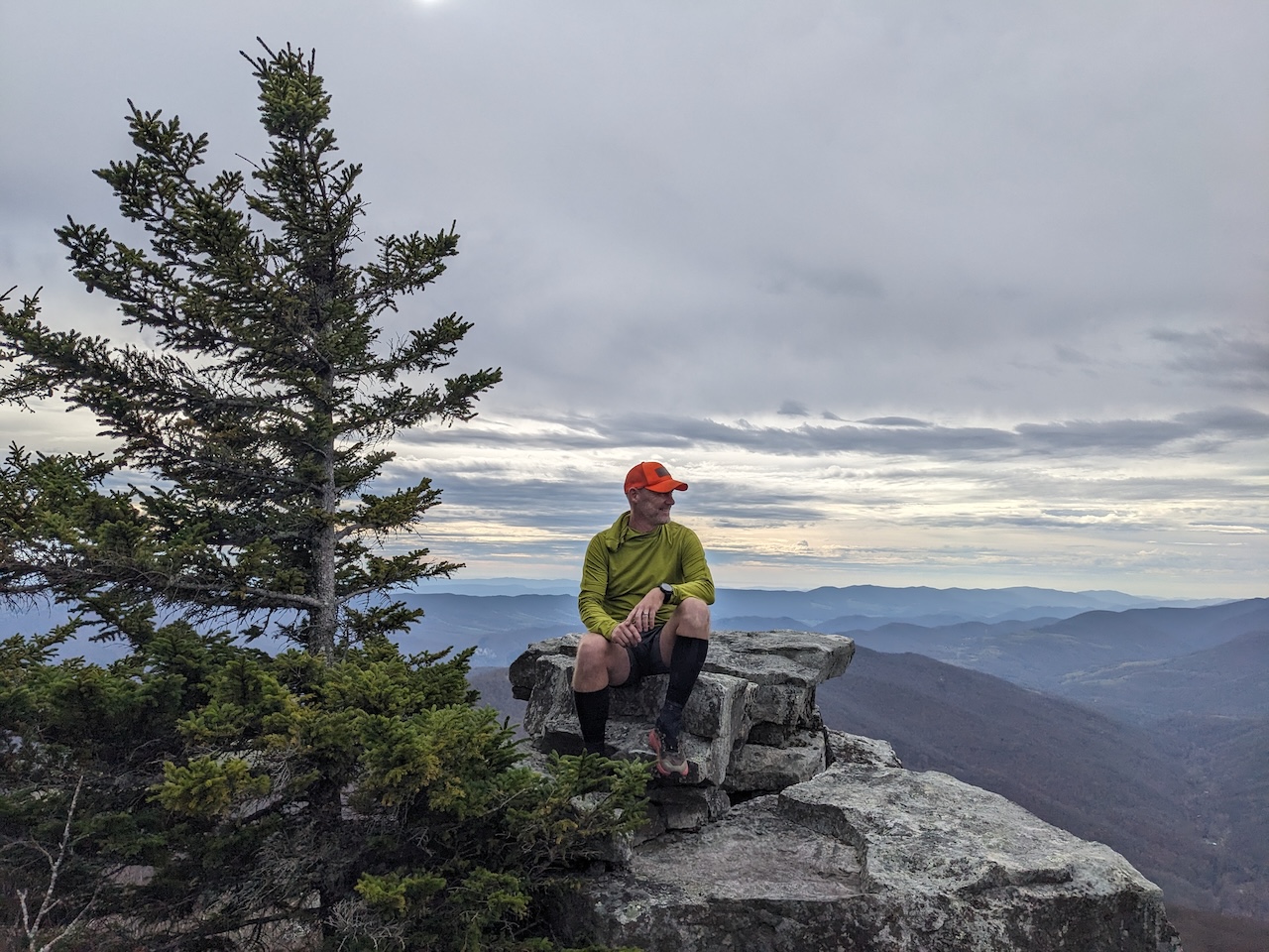
Four miles into our day we reached the southern most point of the Canyon Rim Trail. As good a place as any, we took a break and scrambled across the rocks for a snack and some views. Heads up, you can see Seneca Rocks from this point. Very pretty.
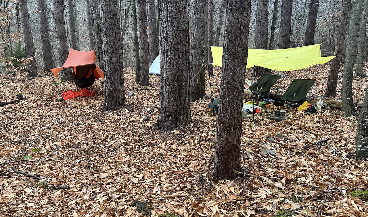
Back on the trail, we walked the trail for another 1.5 miles to the Canyon Rim/Tee Pee Trail junction; our intended campsite for the night. Upon arrival, we found two hammocks, a 30-foot-wide tarp, and a ridiculous amount of gear. Good Lord, I couldn’t imagine carrying all that business up there. If I had to guess, it was the dudes with the dog from earlier. Seriously, there was a lot of stuff. A LOT of stuff.
With our plans dashed, we turned right/north on Tee Pee Trail where we were immediately accosted by overgrown rhododendrons. Lots of sharp branches. Lots of scratches. We endured Tee Pee Trail’s beating for another half mile before it intersected with Roaring Plains Trail.
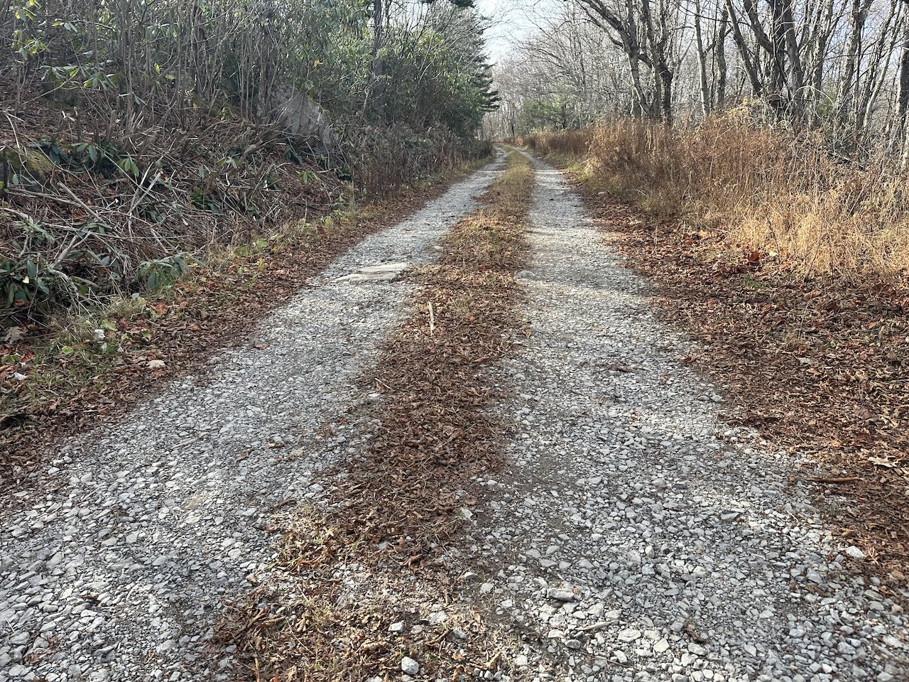
At the junction, we turned right/east and continued along Roaring Plains Trail which transitioned from muddy and overgrown to sandy and beach-esque. We reached Pipeline Access Road after another mile and hung a right/southweast. A few steps later we made a left/northwest through an open gate, passing a parked truck just up the road.
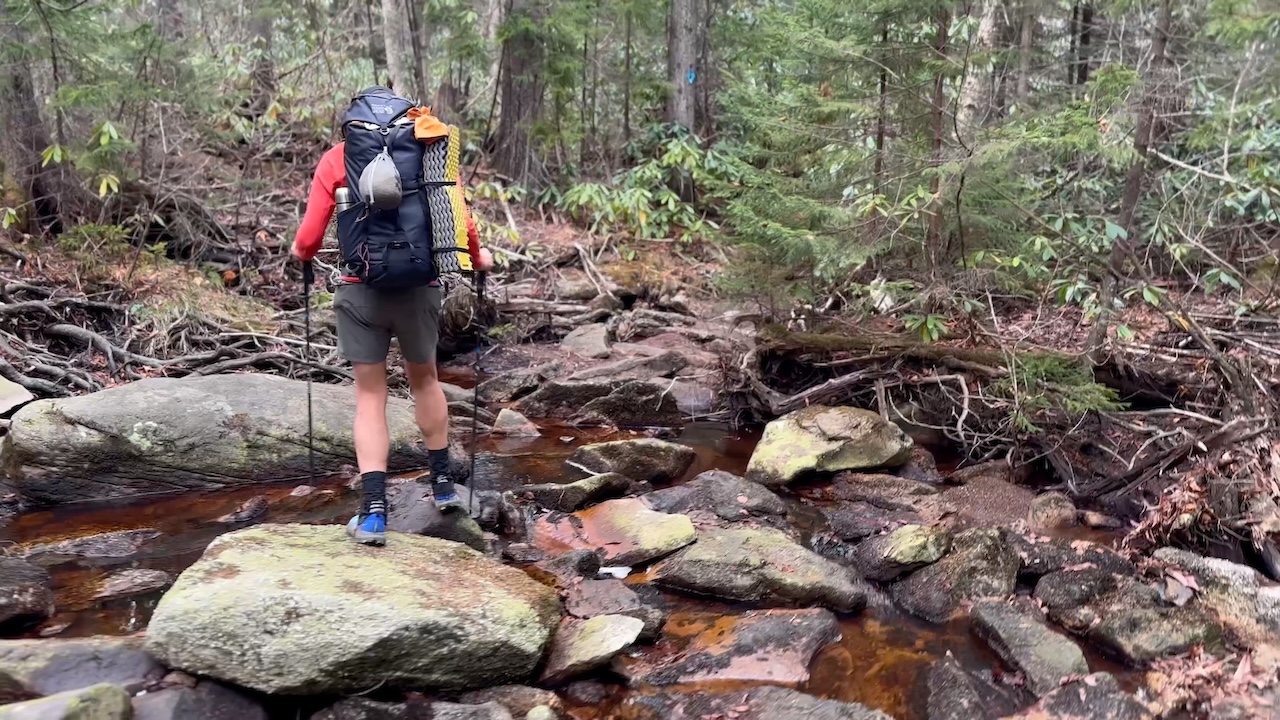
We then followed FS 70 for 0.4 miles and turned left at Boar’s Nest, stopping just shy of South Fork Red Creek (again). At this point, the creek is wide and there are huge rocks which make for an easy path across, though I imagine it’d be impassable in a heavy rain. Once on the other side of the creek we scanned for sites.
Nothing.
Well, Coop could probably pitch his tent, but there’s wasn’t a place for me to hang a hammock, safely. We kept looking. After a quarter mile we decided we ought to backtrack to the creek since there likely wouldn’t be water at the top of the mountain (should we find a site). A half mile and filled bottles and bladders later we continued our climb to the top; finding a potential site just short of the summit. It was cramped, loaded with widow makers, and given the forecasted wind and rain, not a good fit. We stopped, looked at the map, and talked through a new plan. Well, a new, new plan.
The new new plan was to hike down Boar’s Nest Trail and camp near the trailhead on the north side of South Fork Red Creek. A good plan. A solid plan. A plan that we gave four stars and two enthusiastic thumbs up.
From the top, we continued down the trail singing and whistling without a care in the world. Unfortunately, all the good times came to a screeching halt when we began the brutal 1.5 mile, 1,500 foot descent over dead leaves and loose rock. I shuffled my feet. My knees and quads caught fire. I obsessed over every step. Then the rain started in.
A few drops at first, but eventually it was consistent enough to require rain jackets. We threw them on and finished the nonsensical hike down.
(Photo by Coop)
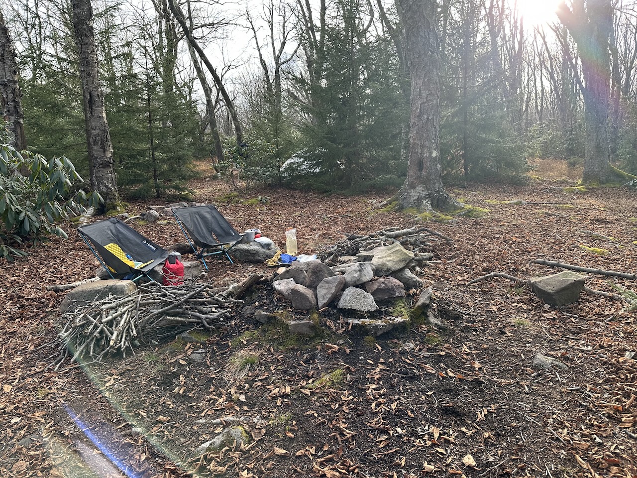
At the bottom, we crossed South Fork Red Creek, and walked around looking of spot. Unfortunately there was nothing but killer trees and widowmakers. Dismayed, we climbed a short, but super steep hill, and turned all of our attention to finding a site since the rain was coming down a little harder. As luck would have it, we were able to find one, but not just any one. The same spot we camped at 8 years ago.
Not much had changed. There was still a fire ring. Still an old grill grate. Still a lot of tall trees. So, so many tall trees. Trees nearing their end of days. Trees with branches waiting to take the plunge. Well, we settled on the least worst options and set up camp.
Afterwards we threw up a bear line and retreated to Coop’s tarp to eat dinner and play a round of chess. By 7PM I was falling asleep in my chair. Time for bed.
DAY 3 (0.23 MI | +187′ GAIN | 0′ LOSS)
I slept well until 2AM when I awoke to the sound of high winds and thrashing rain. I stared at my tarp hoping the winds would subside. My heart rate steadily increased. Moments later I heard the cracking of wood followed by a large, and very close thud. Seconds later, another loud crack followed by another thud. And, just as my heart was calming down, another crack followed by yet another large thud. I laid in my hammock wide awake for the next hour waiting for another tree branch to fall. Thankfully it never did. Better still, I was able to fall back asleep.
Around 6:30AM, I woke to the sound of rain. Since we planned on heading out by 8AM, I got up and broke down under my tarp, then proceeded to join Coop for a cup of coffee. Fully caffeinated, we packed up our remaining gear and headed out; arriving at the parking lot eight minutes later.
Trip complete.
TOTALS (14.39 MI | +2,535′ GAIN | -2,505′ LOSS)
FINAL THOUGHTS
The Roaring Plains West Wilderness is beautiful. The trails are easy enough to find and there’s plenty to enjoy including the miles of views along Canyon Rim Trail. There are plenty of campsites and there are more than enough water sources on the way up the mountain to ensure you’re well hydrated. I am stoked we gave the area another shot and am super happy we opted to go up South Prong Trail instead Boar’s Nest Trail. The wind on the second night was no joke and I’m grateful we were patient in choosing the right site. All in all, it was a great trip. Can’t wait to get back out there.