The summertime is a great time to hit the trails. The best! Well, except for the heat, dried up water sources, things that bite, things that fly and bite, and the heat. Did I mention the heat? Man, I am not a fan of the heat. When my nephew, Joaquin, came to town I wanted to take him on his first backpacking trip and needed to find a location where the conditions were just right (i.e. the aforementioned exceptions could be managed). Enter the Iron Mountain Trail (IMT).
The yellow-blazed Iron Mountain Trail spans 47 miles from Highway 91 near Tennessee in the south to VA16 at Iron Mountain Gap in the north. Up until 1972, the IMT was part of the Appalachian Trail (AT) when it was relocated to the south to accommodate communication towers and power lines in order to maintain the secluded experience hikers have come to expect from the AT.
I hiked the IMT previously and figured its solitude, milder temperatures, and close proximity to Grayson Highlands made it the perfect place to take my nephew.
THE PLAN
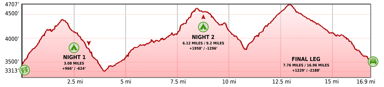
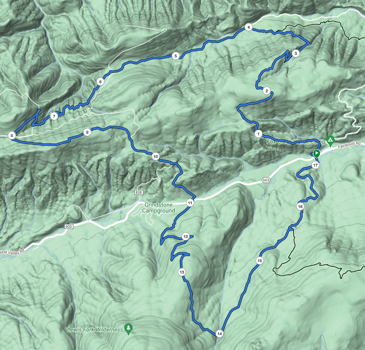
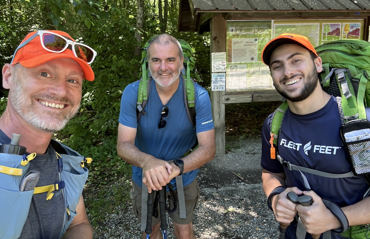
Considering this was Joaquin’s first backpacking trip, I needed a route that was easy and enjoyable. I revisited old trip maps and decided on a 17-mile route my brother-in-law, Ken, and I completed a few years ago in the winter. The route starts at Fox Creek Trailhead with overnights at shelters on the Appalachian Trail (Hurricane Mountain) and Iron Mountain Trail (Cherry Tree). Both shelters are well-maintained and both have nearby water sources.
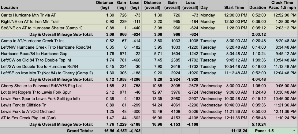
To that end, I invited Ken and built out our 17-mile trip route in a spreadsheet based on a conservative 1.5 MPH pace…
…created an elevation profile
…dropped in the route
…and packaged it all in a map that I printed and laminated at Office Depot.
PACKING IT IN
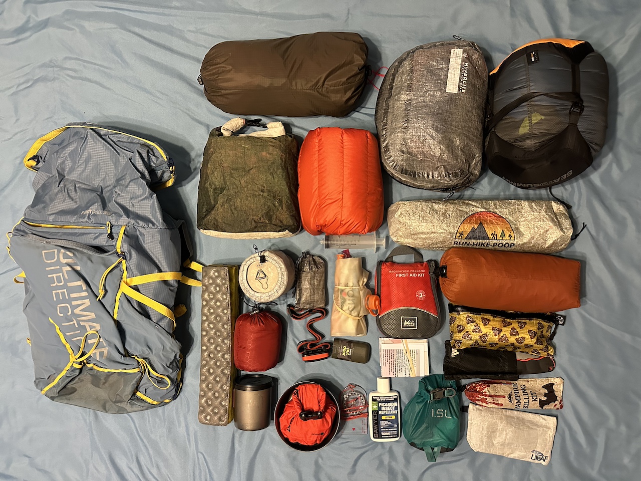
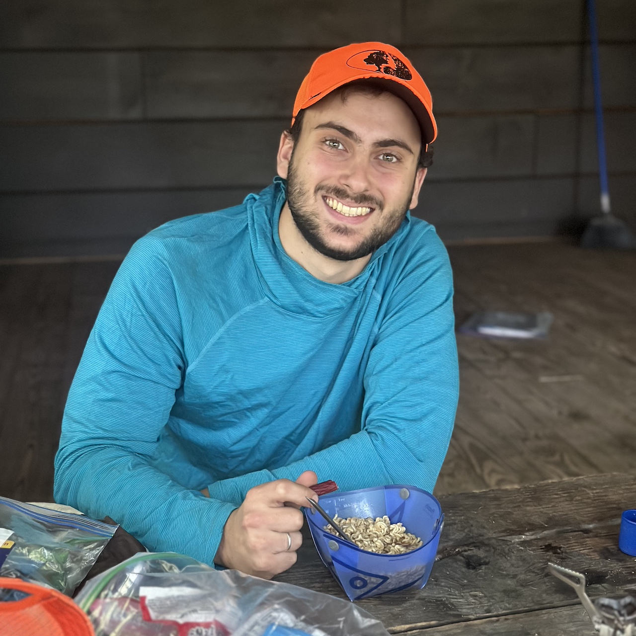
The weather forecast was perfect for a summer trip. Clear skies, no rain, and temps ranging from the low 50s to the upper 70s. The colder temps meant I’d need to bring an underquilt and a topquilt for my hammock along with something to keep me warm around camp. And since Joaquin was going, I’d have to cram all of my things into my smaller, 30L UD Fastpack so he could use my larger, 50L pack.
I tried to keep Joaquin’s base weight down by having him carry only the essentials. Unfortunately for him, some of those essentials were a bit on the heavy side. For shelter, my 1-man tent was out of commission until I could replace the shock cord so he had to take my larger, heavier REI Half Dome 2-man tent (6 lbs.). For bedding, he borrowed my son’s Kelty bag (2 lbs. 6 oz.). And, for a pack, he would use my 50L Atmos (4 lbs) which is overkill, I know, but because he was using bulkier items he couldn’t use my 34L Stratos. Not ideal, but at least he had everything he needed.
With packs loaded, including water and food, my 30L UD Fastpack weighed in at 22 lbs. 8.2 oz, and Joaquin’s 50L Atmos weighed 26 lbs. 5.7 oz.
DAY 1 (3.4 MI | +927′ GAIN | -497′ LOSS)
On the way in, we drove past a very full Fox Creek Horse Campground before arriving at a surprisingly empty Fox Creek Trailhead. Honestly, I was shocked. It was Fourth of July week, temps were in the low 70s, and the skies were totally clear. Oh well, their loss.
Around 12:15PM, we crossed Fairwood Road and followed the AT north over Fox Creek. The day’s hike was straightforward. Two and a quarter miles up the AT to the Virginia Highlands Horse Trail and a mile down the AT to the Hurricane Shelter spur trail—our campsite for the night.
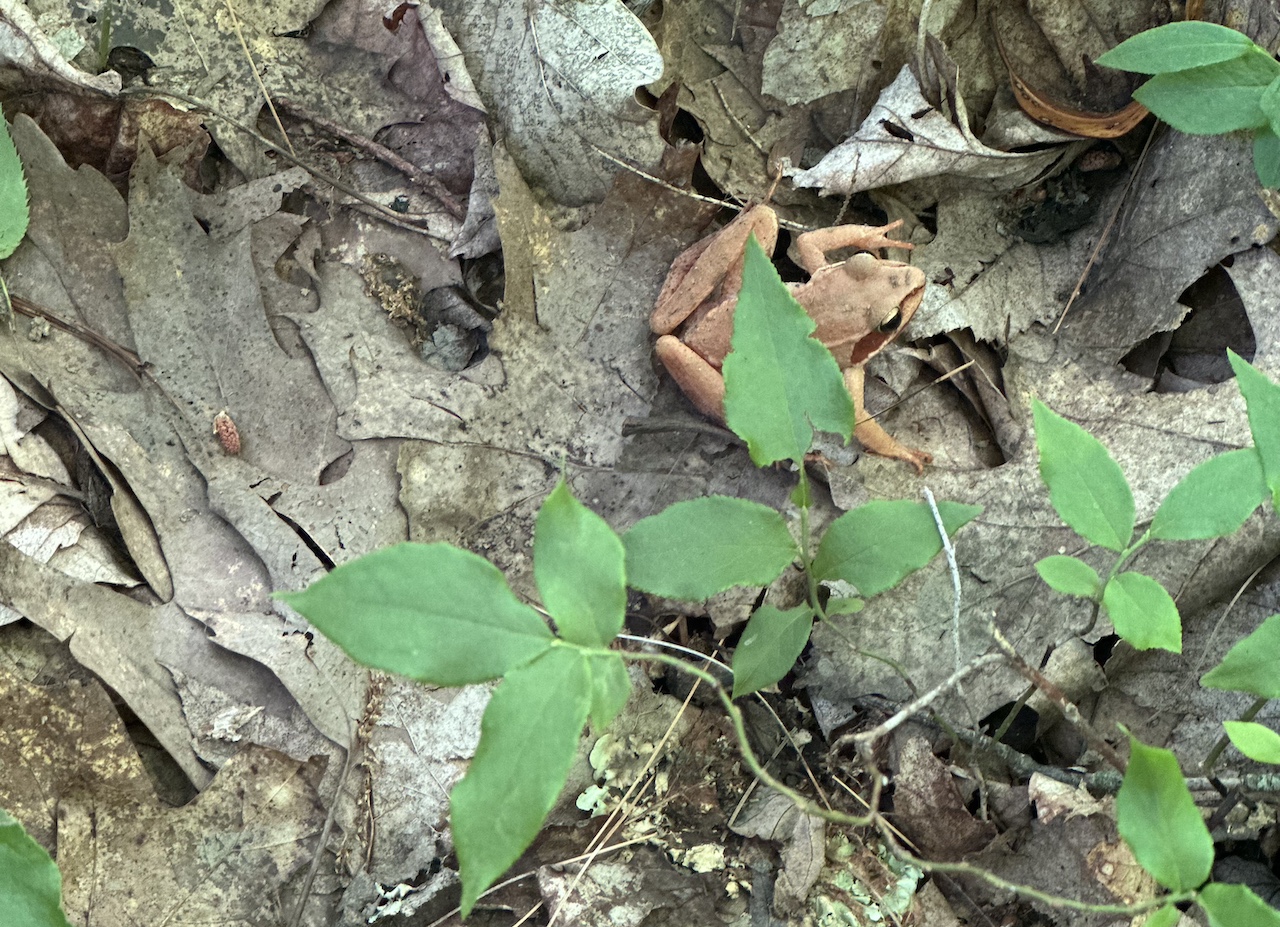
The hike in was pretty chill. Potentially edible shelf mushrooms, a green paper bag to catch spongy moths, and multiple signs warning of KILLER TREES!
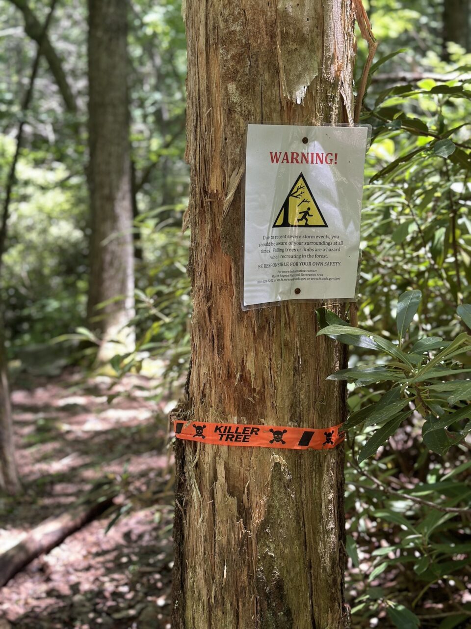
The warning signs were posted on trees that were dead or damaged; trees that would clearly cause harm to anyone camping under their branches during windy weather.
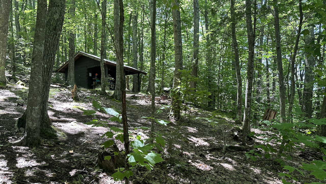
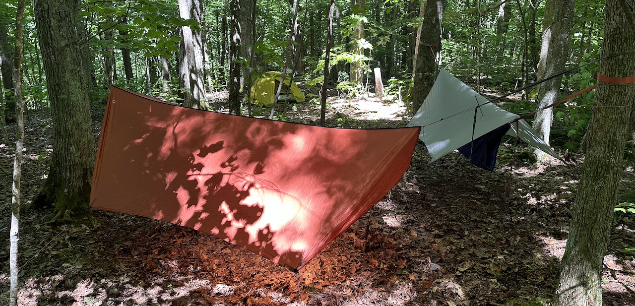
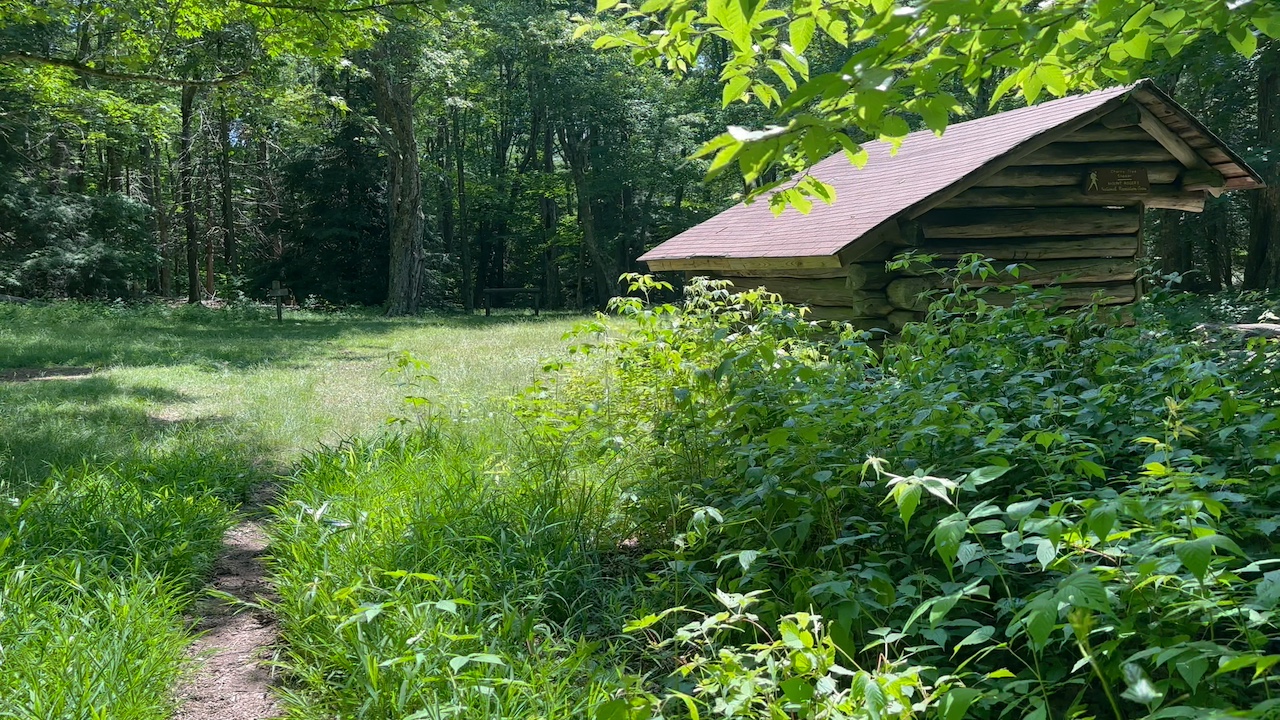
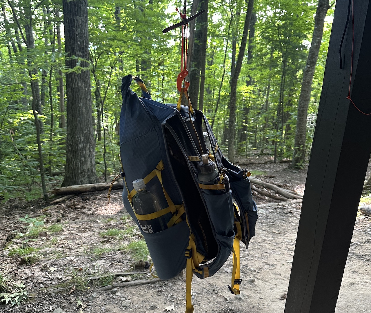
At the spur trail we confirmed the water source before heading up to the shelter. We passed a bear box on the way in and passed a backpacker on his way out when we arrived. The westerly wind meant we couldn’t set up camp on the flat spots between the privy and the shelter and have a fire. Instead, and so we could enjoy a fire, we camped on the hill to the northeast. Not a problem for Ken and I because we had hammocks, but not the best for Joaquin who was in a tent. Don’t worry, he slept fine…mostly.
After getting Joaquin set up, Ken and I looked for a place to hang. There was a really nice spot with a really tall dead tree that we ruled out immediately (see killer tree image above). There was a sort of OK spot with young trees where my butt would be. And there was a decent spot where Ken and I would have to share a tree to make it work. We did. It did. Huzzah!
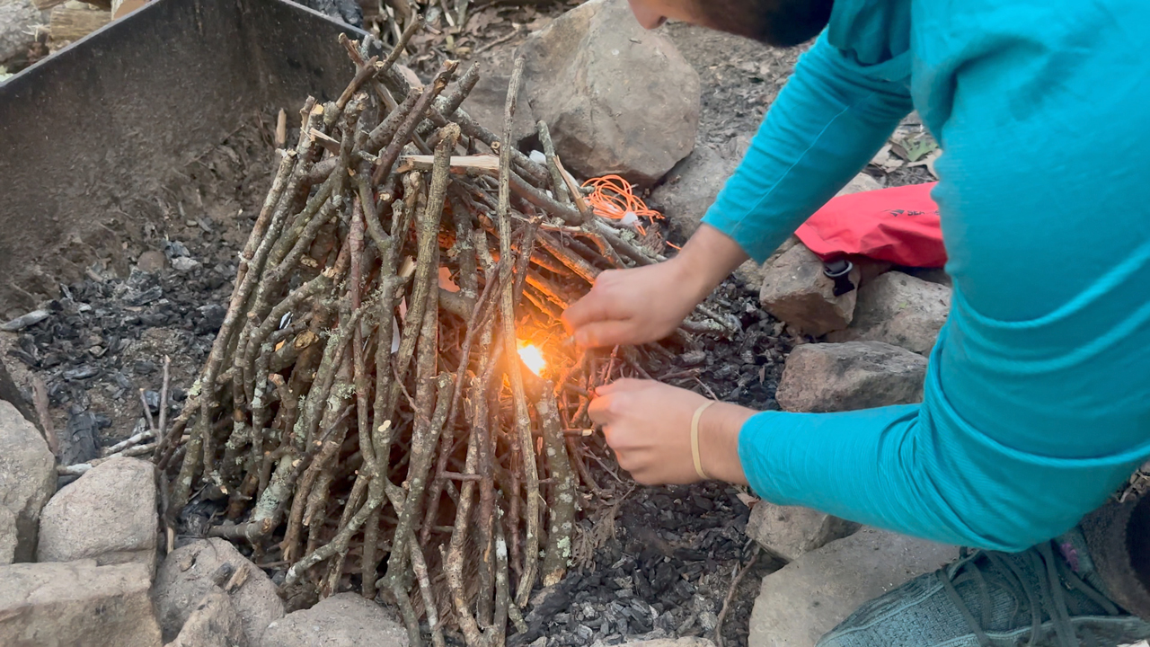
With shelters up, Joaquin and I gathered wood while Ken filled water bladders. Once all chores were finished we sat around, made dinner, then yucked it up for a time.
By 10PM is was lights out.
Day 1 complete
DAY 2 (9.92 MI | +1,564′ GAIN | -1,536′ LOSS)
Around 3AM I woke to the sound of something loud. It didn’t sound like an animal or a fallen branch, but it was enough to raise my heart rate. Given the howling wind, it’s entirely possible it was a branch. Of course, it could’ve also been Bigfoot. I contemplated the possibilities while staring at my tarp; unable to fall back asleep. Before long, my bladder chimed in and suggested I take a look around whilst taking care of business. Nothing of note so back to bed I went.
I slept until 7AM, broke down my hammock, then went down the hill to help Joaquin pack up. After shelters were down we headed up to the shelter for a delicious oatmeal and coffee breakfast.
On our way out an older lady with a pair of hiking poles and a running vest came up the spur trail. She said she was thru-hiking and had to pick up some sections so she drove to a spot nearby and was hiking. As she walked off she dropped an unsolicited, non sequitur J-bomb and let us know she was out there to tell people they were loved. We were all a bit confused.

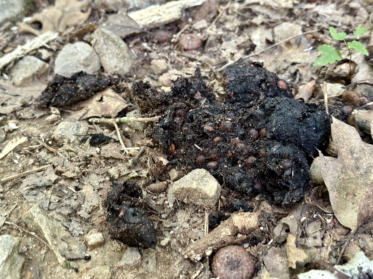
We parted ways and continued down the spur to the AT. At the junction we turned left/north towards Hurricane Road/84. A short bit down the trail there was a pile of bear turds that appeared to be fresh-ish. It had stormed the night before and the poop showed no sign of being rained on.
We hiked a bit more, passed the Hurricane Creek Tr / AT Junction, stepped over the branches discouraging AT hikers from going straight, and walked down to Hurricane Road (84). At the road, we turned left/west towards Hurricane Gap.
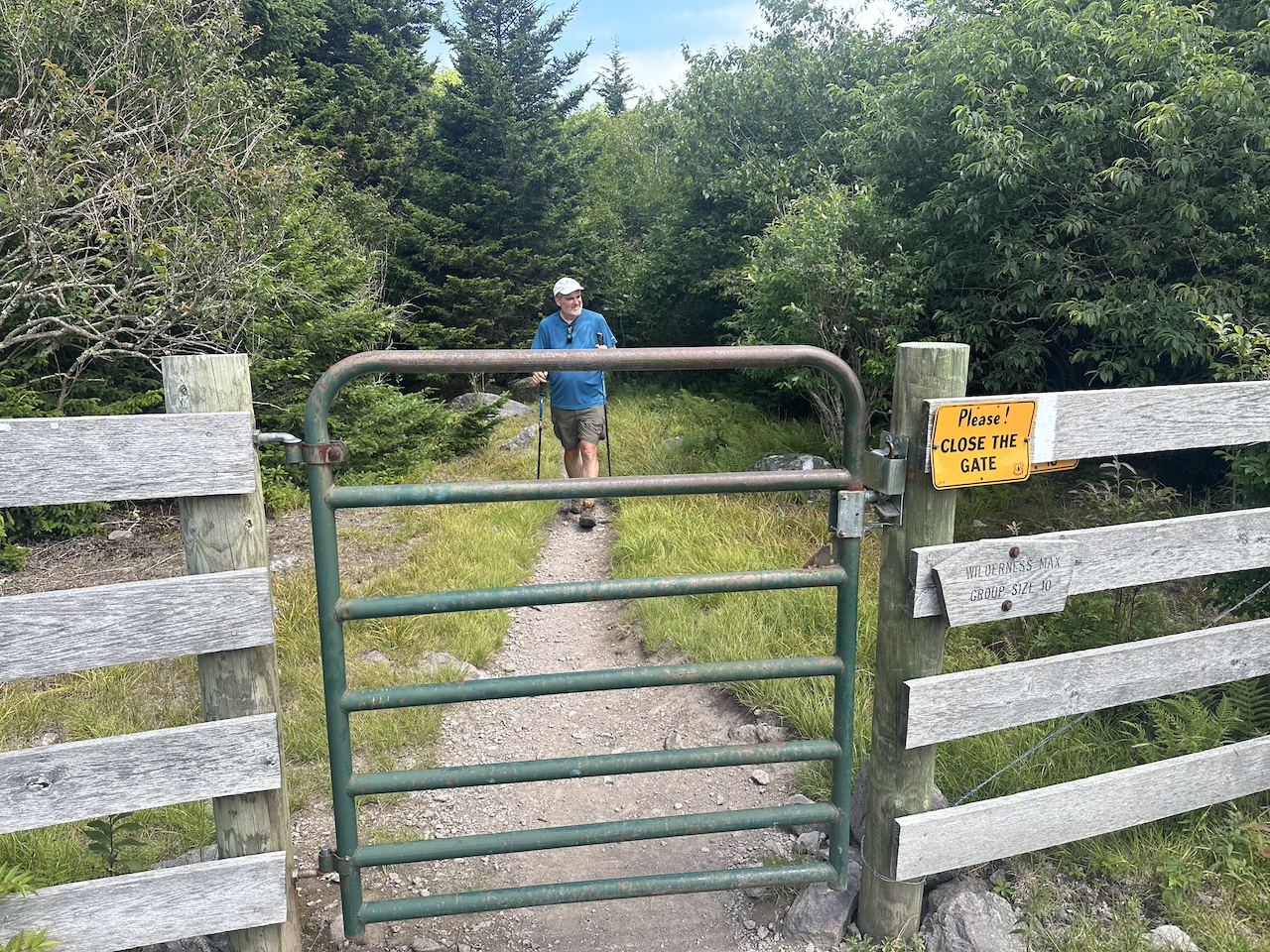
We slogged 1.75 miles uphill to Hurricane Gap where a truck had just pulled off the road. The guy didn’t exchange our greetings and seemed to be fumbling with a large box in the back while wearing nitrile gloves. NITRILE GLOVES! Instead of helping him dispose of the body, we turned right/NW onto Old 84 where we followed it for another 2 miles to Double Top Trail. FYI, if you take this trail be aware it’s right at a bend in Old 84 and can be difficult to find throughout the year.
We turned left/SW and proceeded to step over mounds and mounds of horse poop along the half-mile trail to Hurricane Rd/84. At the road we incorrectly went straight across and into a field before correcting ourselves and circling back to the Hurricane Rd (84) / IMT junction. A few feet in Ken found a pair of sweet Pit Viper glasses causing a mullet and sweet mustache to take shape on his face.
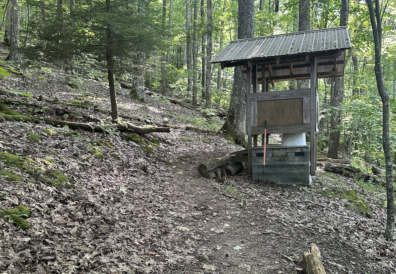
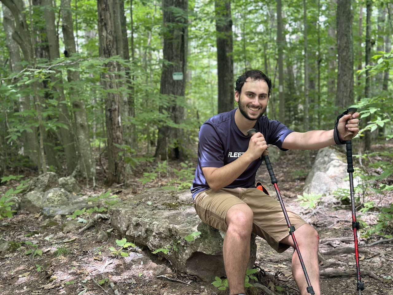
The mile-long hike to Cherry Tree shelter was quiet and uneventful. We arrived just past noon and got to work. I checked out the nearby spring with Joaquin and Ken investigated the privy. The spring wasn’t moving much at the source, but downstream there was a trickle that poured over a piece of bark creating the perfect fountain. At the shelter, Ken shared that the privy was riddled with flies with the majority of them trying to lift the lid. His professional recommendation—dig a hole.
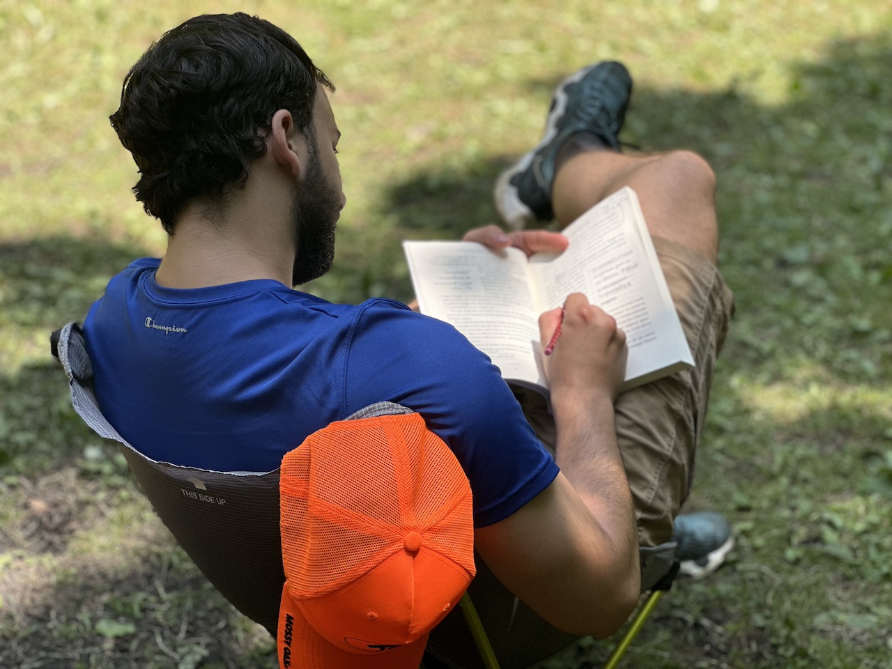
I walked around looking for a place to hang hammocks, Ken explored the woods with a trowel, and Joaquin read a book from the comfort of his camp chair. I walked a good way up Flat Top trail to the north and to the south. I meandered around the wooded area that surrounded the shelter. I reported back to Ken and he also looked around. Much to our chagrin the area was not a good place to hang. Trees were either dead, next to dead trees, or they were surrounded by mounds of horse turds and hoards of flies.
We talked about our options over a light lunch and it came down to:
- Stay put and hang in an unsafe spot at Cherry Tree;
- Follow our route for the next day along Mt. Rogers Trail and Lewis Fork Trail and hike 5 miles to a spot near a water source where there might be a potential campsite; or
- Hike 3.2 miles on the Virginia Highlands Horse Trail/ IMT and the AT back to Hurricane Shelter and figure out a different route for the third day. NOTE: The VA Horse Trail and IMT are often called the same thing for this section of the mountain depending on the map you read.
Staying put could mean killer trees and mutant horse flies. Hiking another 5 miles and 1,000′ of gain to a potential site in an area that Ken and I thought was marshy wasn’t ideal. And, staying back at Hurricane Shelter would be OK, but we’d need to figure out a third day so it wasn’t just a reverse of the first day. After much conversation, contemplation, and silence, we donned our packs and headed back to Hurricane Shelter.
On our way out, five horseback riders showed up and hung out. As we chatted, one of the horses took a big old foamy pee where Joaquin was going to set up and another two dropped deuces nearby. We looked at each other and it was clear we all agreed that we made the right decision to stay elsewhere.
After wrapping up the conversation we parted ways. They headed right/south on Flat Top Trail, and we headed left/north towards Flat Top Road and the yellow-blazed Virginia Highlands Horse Trail/IMT.
We followed Flat Top Trail N/NE for 0.4 miles to Flat Top Road, turned right/east and followed it for a tenth of a mile, and then turned left onto VA Highlands Horse Trail (aka IMT). From there we followed the trail for another 1.5 miles to AT.
As we did, and about 0.25 miles from the AT junction, Joaquin and I heard something big scamper off into the woods some 20 feet from where we were. We all stopped and fixed our eyes on the trees; scanning for big living things. After ten minutes we gave up looking, clapped our hiking poles together, and shouted “Hey Bear!” a few times for good measure.
We finished the remaining quarter mile to the AT with our heads on a swivel, turned left/north on the AT, and started the mile-long hike down to the shelter spur. A few minutes later we came across a guy (who I think was Amish) coming towards us. He had a button up short-sleeved shirt, long pants, a large pack, and a radio fastened to his shoulder strap. He said something about heading to Tennessee with others and then went on his way.
Another 5 or 10 minutes after the previous encounter we came across two more guys (who I’m pretty sure were Amish) asking if we’d seen their buddy. We said we had and told them he had a quarter mile on them. They laughed and went on their way. When we were just about to the spur we crossed paths with another group of 5 guys (who I most definitely think were Amish) asking about their 3 friends. We told them they were way up ahead, they laughed, and they, too, went on their way.
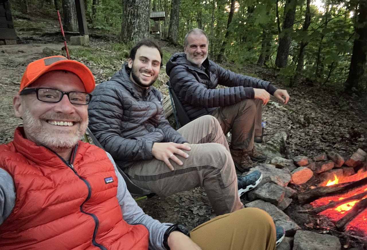
We eventually arrived back at Hurricane Shelter where no one else was waiting, set up shop as we did the night before, gathered wood, filled water, and then sat around chatting until dinner.
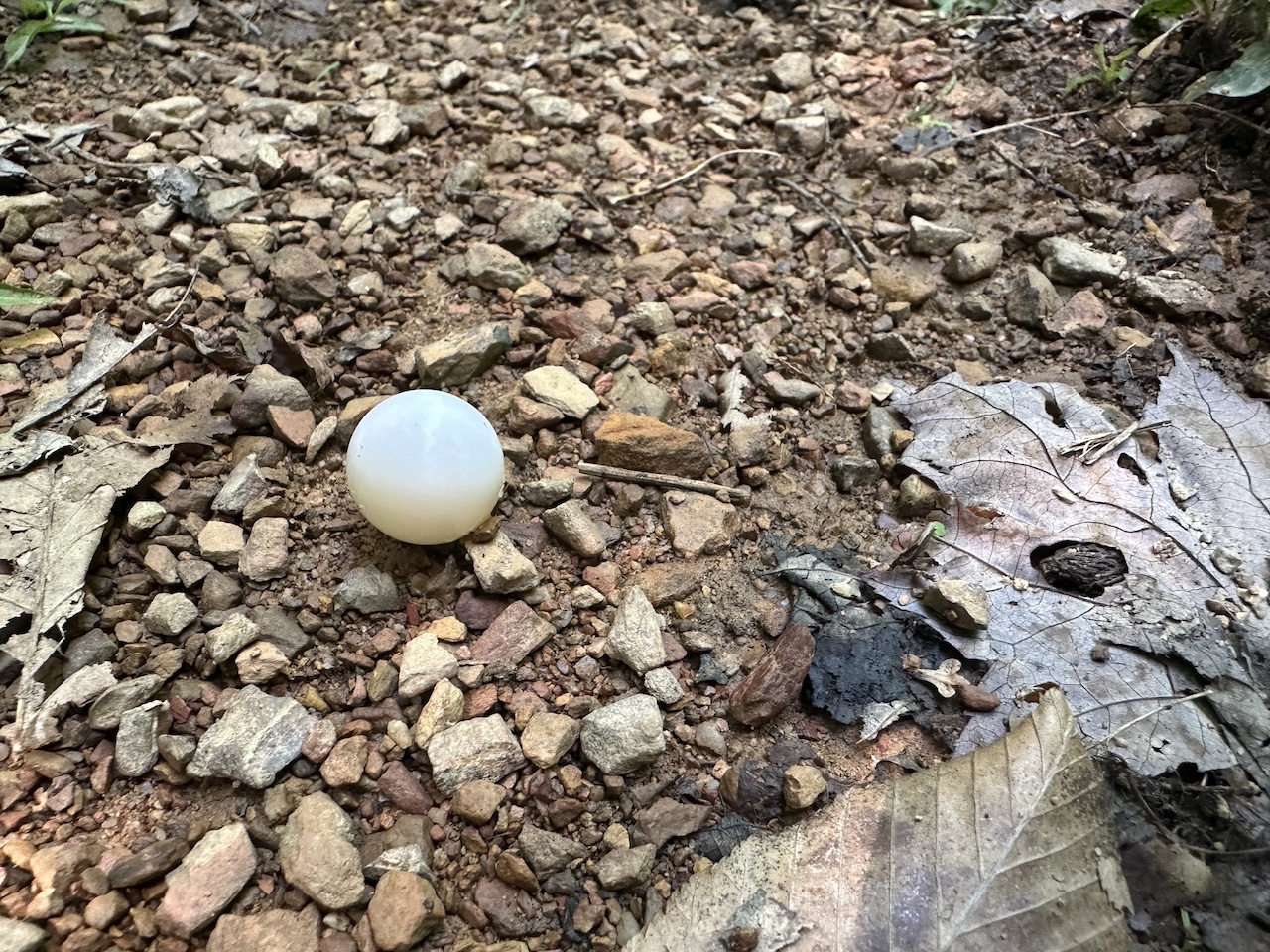
While we talked, I felt an itch on my foot. I removed my shoe and sock and discovered the smallest tick I’ve ever seen digging into the arch of my foot. I’m not sure when it hitched a ride, but I know I needed to get it out. Tick key didn’t work. Tweezers were ineffective. I resorted to gently coaxing the tick with the small blade of my Swiss Army knife. It was going well until the tick exploded. Like there was a tick and then, there wasn’t. I cleaned the wound with an alcohol wipe, covered it with Neosporin, slapped on a Band-Aid, and got back to chatting.
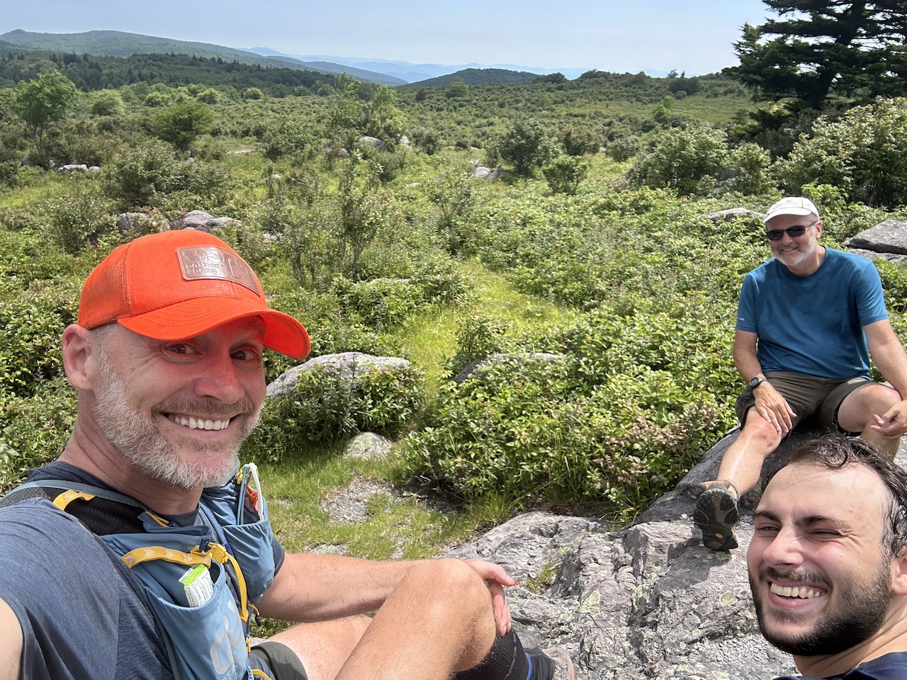
As we did, Ken suggested a route for our third day. We’d head back to the Fox Creek Trailhead where he and Joaquin would dump their packs, and I’d slim mine down to the essentials (water, water filter, poop kit, and first aid). We’d then hike the AT to Crest Trail so Joaquin could take in some views and hopefully score some pony sightings. I pulled up Gaia and charted the route; 8.4 miles and 1,594′ of gain and loss. We all looked at each other before Ken reminded us that the route would be easier because we won’t have packs. And so it was written.
We finished eating, started the fire, then sat around until 10PM before turning in.
Day 2 complete.

DAY 3A (3.29 MI | +497′ GAIN | -927′ LOSS)
In the morning, we broke camp, ate a quick breakfast, then made our way up and down the AT to the parking lot.
DAY 3B (8.77 MI | +1,646′ GAIN | -1,616′ LOSS)
At the car, we dumped packs as planned and started the 3.2 miles and 1,500′ feet of gain along the AT to Crest Trail. It was a lot of up, but once we reached the top it was all downhill for the rest of the day. Silver lining?
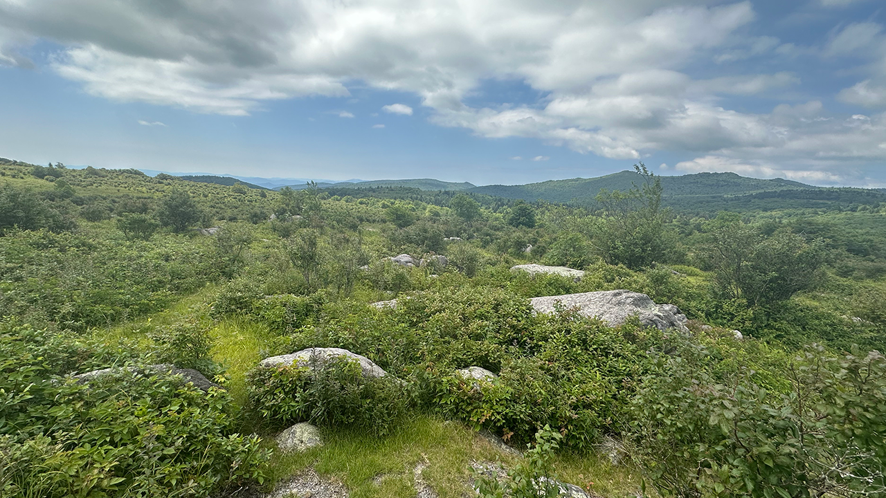
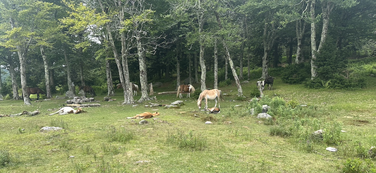
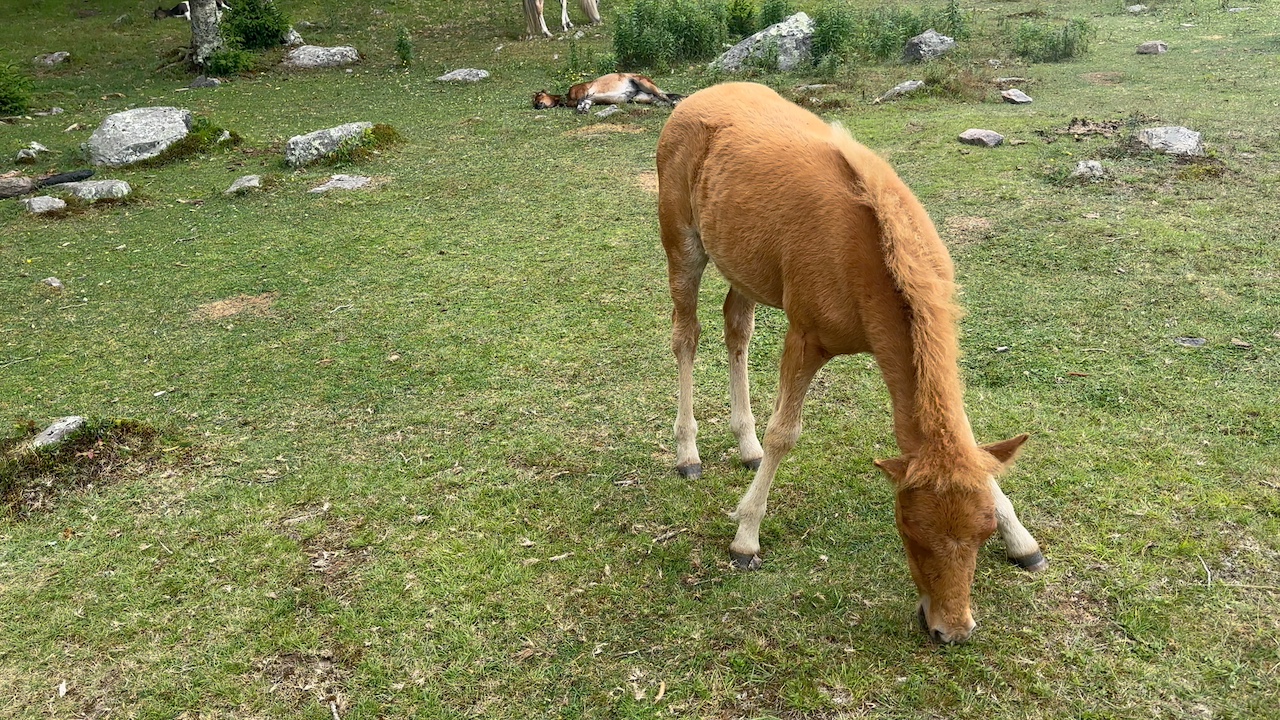
We blazed past Old Orchard Shelter and slowed a bit when the trail got technical (i.e. rocky) and the heat and humidity increased. At Crest Trail, we headed left/southeast to an outcropping and took a break. From the outcropping we hiked the Crest Trail west looking for ponies. The plan was to follow the trail to the junction of Lewis Fork, Cliffside, Pine Mtn, and Crest trails (about a mile) then turn around and head back.
We walked and walked, passing mounds of horse turds, but no ponies. As we reached our turnaround, a herd of pony parents and their foals were sleeping and grazing. Jackpot! We hung out for a bit then followed Crest Trail east to the AT and then the AT north back to the car at Fox Creek.
Trip complete.
TOTALS (25.38 MI | +4,634′ GAIN | -4,576′ LOSS)
FINAL THOUGHTS
I love this area. Great trails, great views, great everything. I’m so glad we opted for this location over the other, hotter ones as we ended up having three gorgeous days and two beautiful nights. Joaquin had a blast and he killed it as a first-time backpacker. As for the tick, that little bugger earned me a trip to the doctor and a round of antibiotics. Oh well. It happens. Still had a great time. Suck it tick!