The 17,371 acre Dolly Sods Wilderness (DSW) in the Monongahela National Forest is a rocky, high-altitude plateau with great views, wind-carved boulders, heath barrens, grassy meadows, and centuries-old sphagnum bogs. And while summers are generally cool and wet, winters are, to put it mildly, brutal. Minimum temperatures can drop to −30°F and the average seasonal snowfall is around 150 inches.
Having visited Dolly Sods in the winter before, my buddy, Coop, and I decided to revisit the area, this time exploring the southern portion, a section we hadn’t yet ventured into.
THE PLAN
In the two weeks leading up to our trip, the area was hit with an onslaught of extreme weather: snowstorms, a full-blown blizzard, flash floods, sub-zero chills, and punishing winds; some exceeding 60MPH. Fortunately, no rain or snow was expected for us, but it looked like we’d be facing some seriously cold temperatures and very strong winds up high.
Further complicating our plans, I’d hurt my back a few months ago. While I was improving, we’d need to limit our trip to short, back-friendly distances.
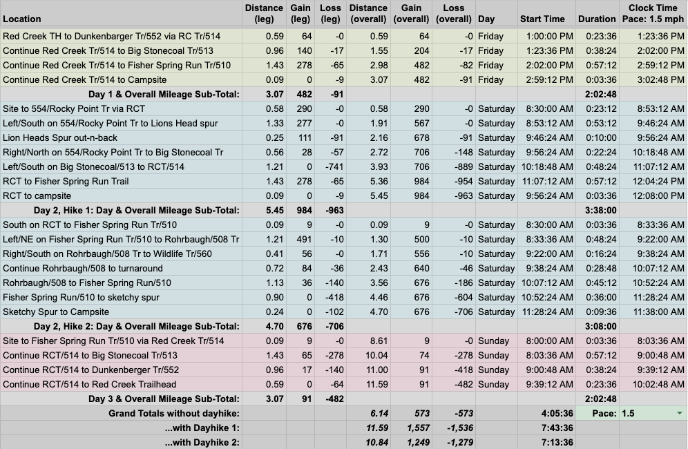
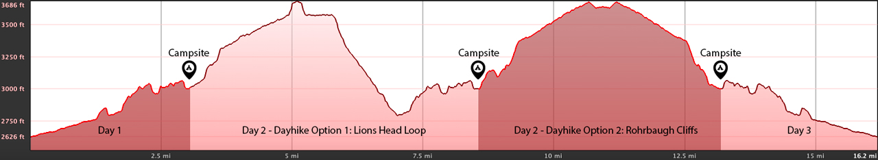
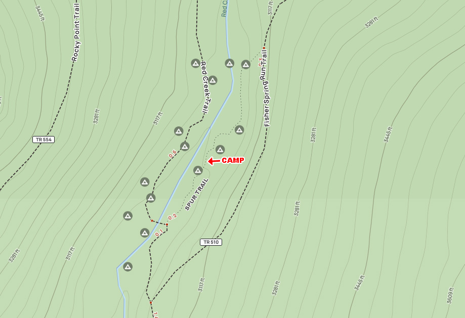
With a promising forecast and my, uh, old man limitations considered, Coop mapped our route using GaiaGPS and CalTopo. Day one would begin at the Red Creek Trailhead and end at a campsite around the 3.5 mile mark. Day two, we’d choose between a loop up to Lion’s Head or an out-n-back to Rohrbaugh Cliffs. Day three, we’d simply retrace our steps back to the parking lot.
To that end, we built out our trip route with both day hike options in a spreadsheet based on a 1.5 MPH pace…
…created an elevation profile
…dropped in the route
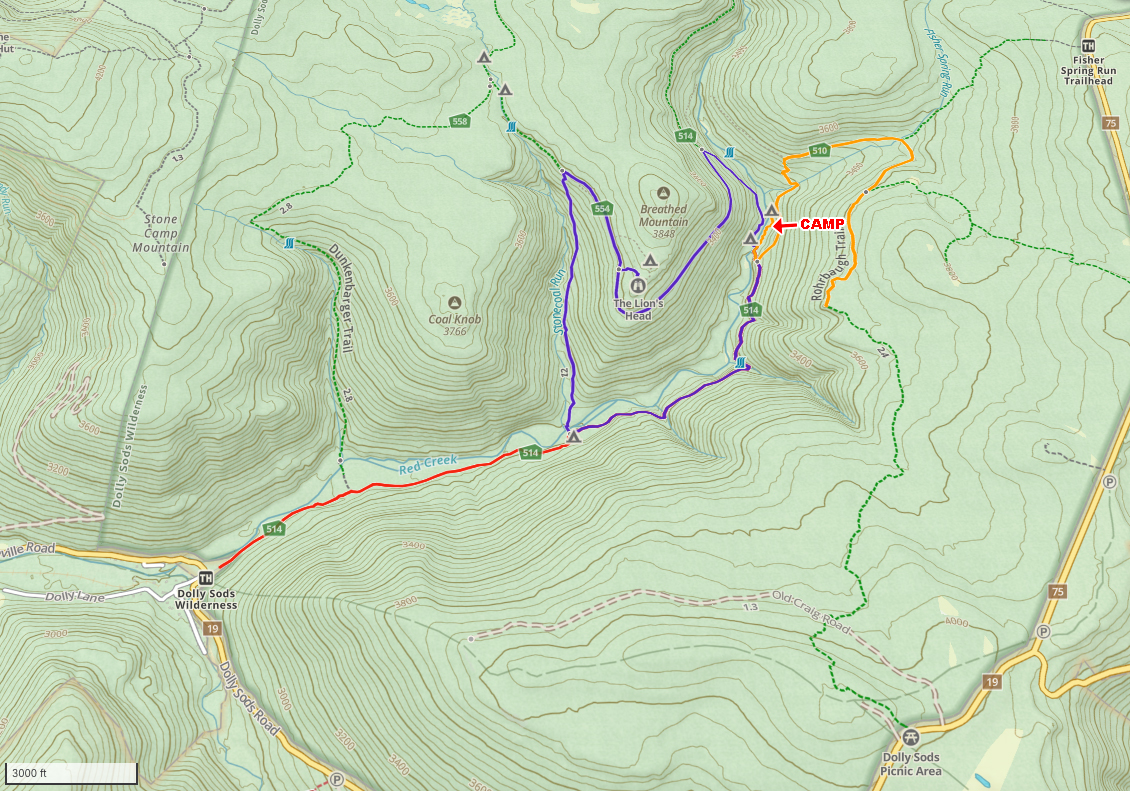
…and packaged it all in a map that Coop printed and laminated.
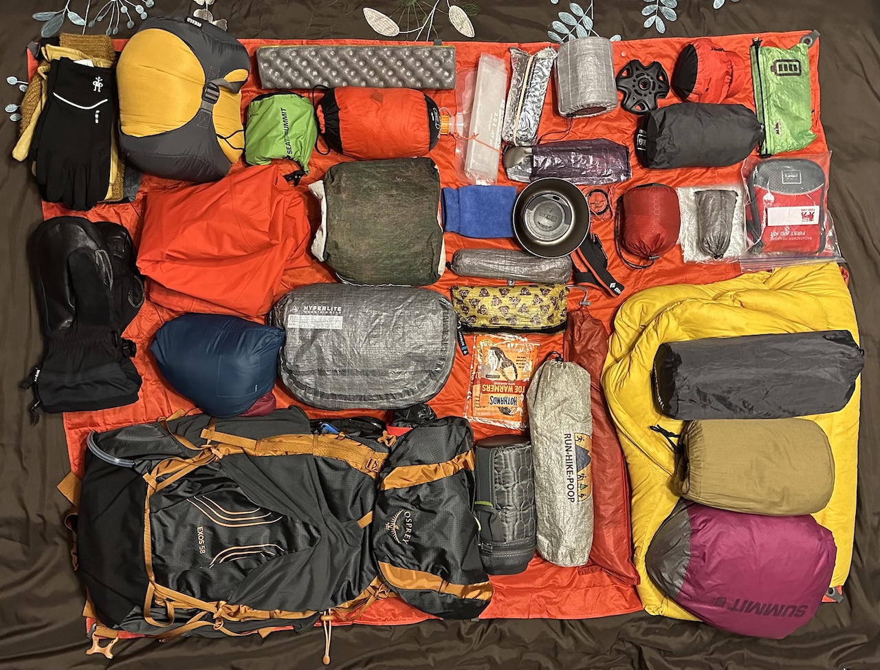
PACKING IT IN
By some favor of the backpacking gods, the forecast held true in the days leading up to our trip. Friday would be cold on arrival, with sub-zero wind chills overnight, but Saturday and Sunday would provide daytime temps in the 30s.
Given the very real chance for a serious case of Cold Butt Syndrome, even with a 0 degree underquilt, I ditched the hammock for tent. No point in risking it. Besides, who likes a cold butt?

To combat the cold, I packed a second down coat, windproof rain gear, and hand and toe warmers because frostbite is no bueno. Additionally I threw in a pair of MSR snowshoes in the car, you know, just in case.
With everything loaded, including water, warm stuff, and oatmeal creme pies, my 58L Osprey Exos weighed in at 31 lbs. 14.8 oz.
DAY 1 ( 3.47 MI | +788′ GAIN | -376′ LOSS)
Coop and I met up at the Harman Post Office where I nearly slid into his car in an attempt to turn into the snow-covered parking lot. Cars unscathed, we drove the remaining 20 minutes to the Red Creek Trailhead and parked next to a trio of cars. I glanced at my thermometer…14°F. With wind chill factored in, it was easily below zero. This was going to be, uh, fun.
I talked to a couple of backpackers who were coming off the trails. They shared that they’d spent the previous night at a campsite at the Big Stonecoal/Red Creek junction on the Red Creek Trail side of the creek. They were able to get a fire going, but the winds were very strong and it was very, very cold overnight. Good times for sure.
We headed out a short time later and caught up and passed two backpackers about 15 minutes down the trail. A few minutes later, we crossed Red Creek and immediately got off track because we followed footprints instead of our map. Rookie mistake.
While we course corrected, we crossed paths with the two backpackers, Nick and Vic, we had passed minutes earlier. They were on their first winter trip and planning to cross Red Creek en route to a campsite near Lion’s Head. We shared our thoughts on the potential dangers of crossing Red Creek and of camping at 3,500′. Between the forecasted high winds and low temperatures, coupled with limited cover, we advised them against doing their planned route and finding a place with a little more cover down low.
They asked where we were headed and we told them we were planning to camp off Red Creek Trail near Fischer Spring Run Trail about 3.5 miles from the trailhead. We told them they were welcome to join us and then we parted ways.
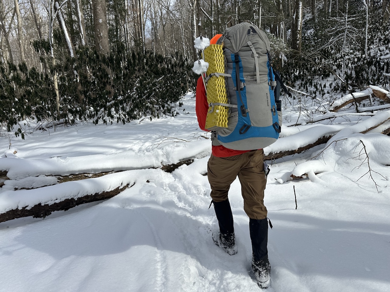
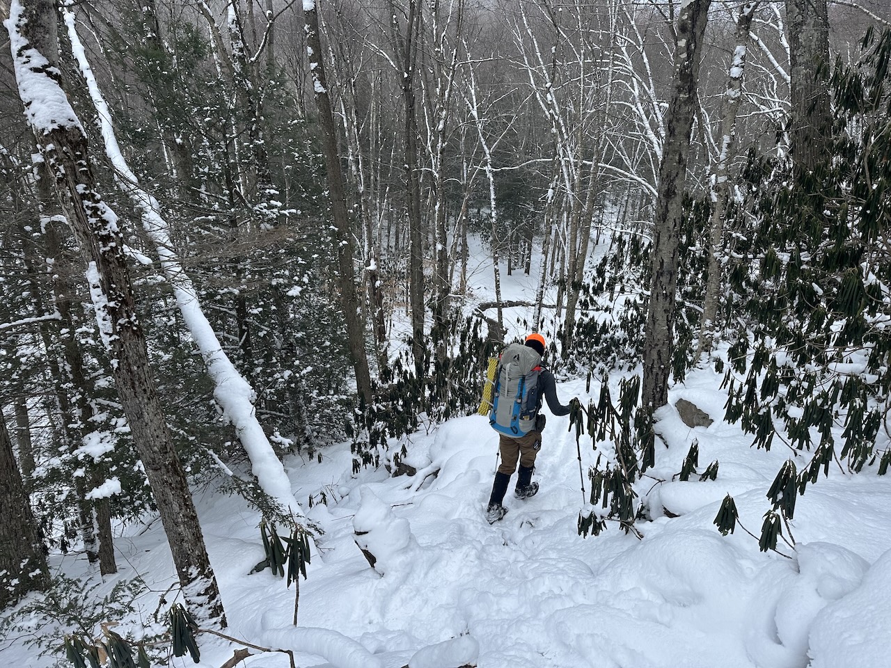
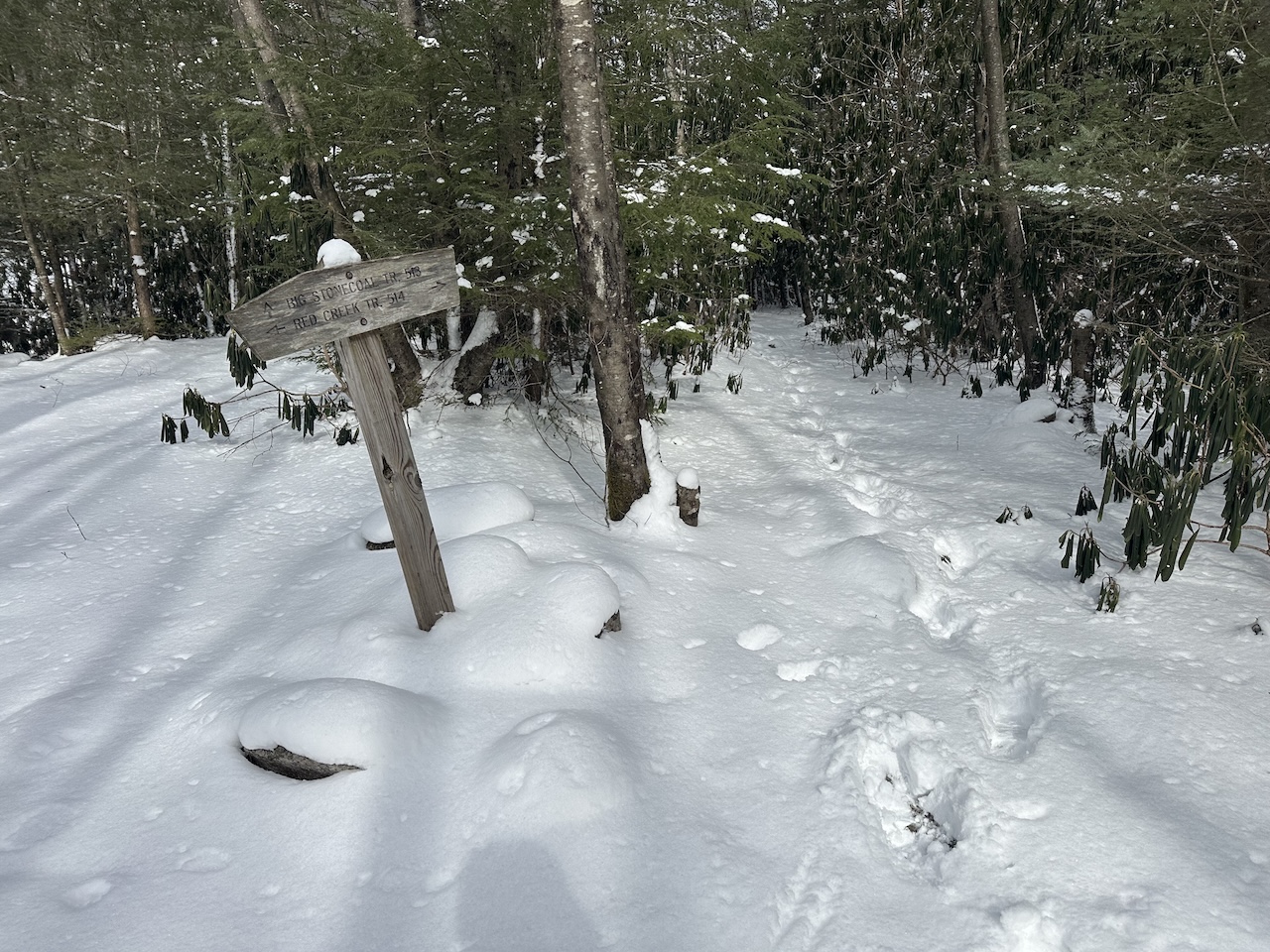
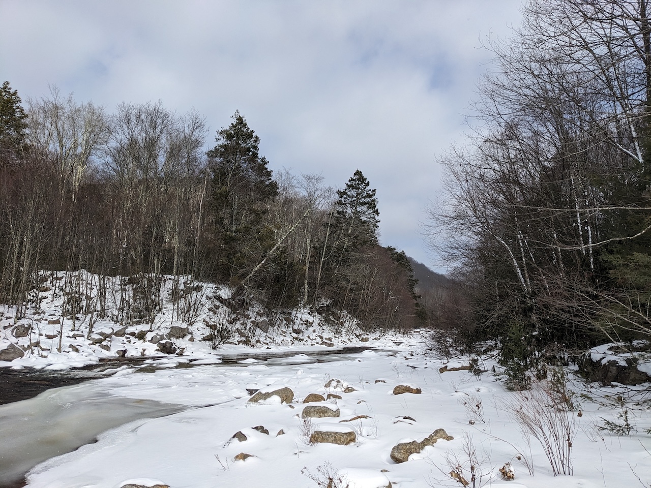
Photo by Coop
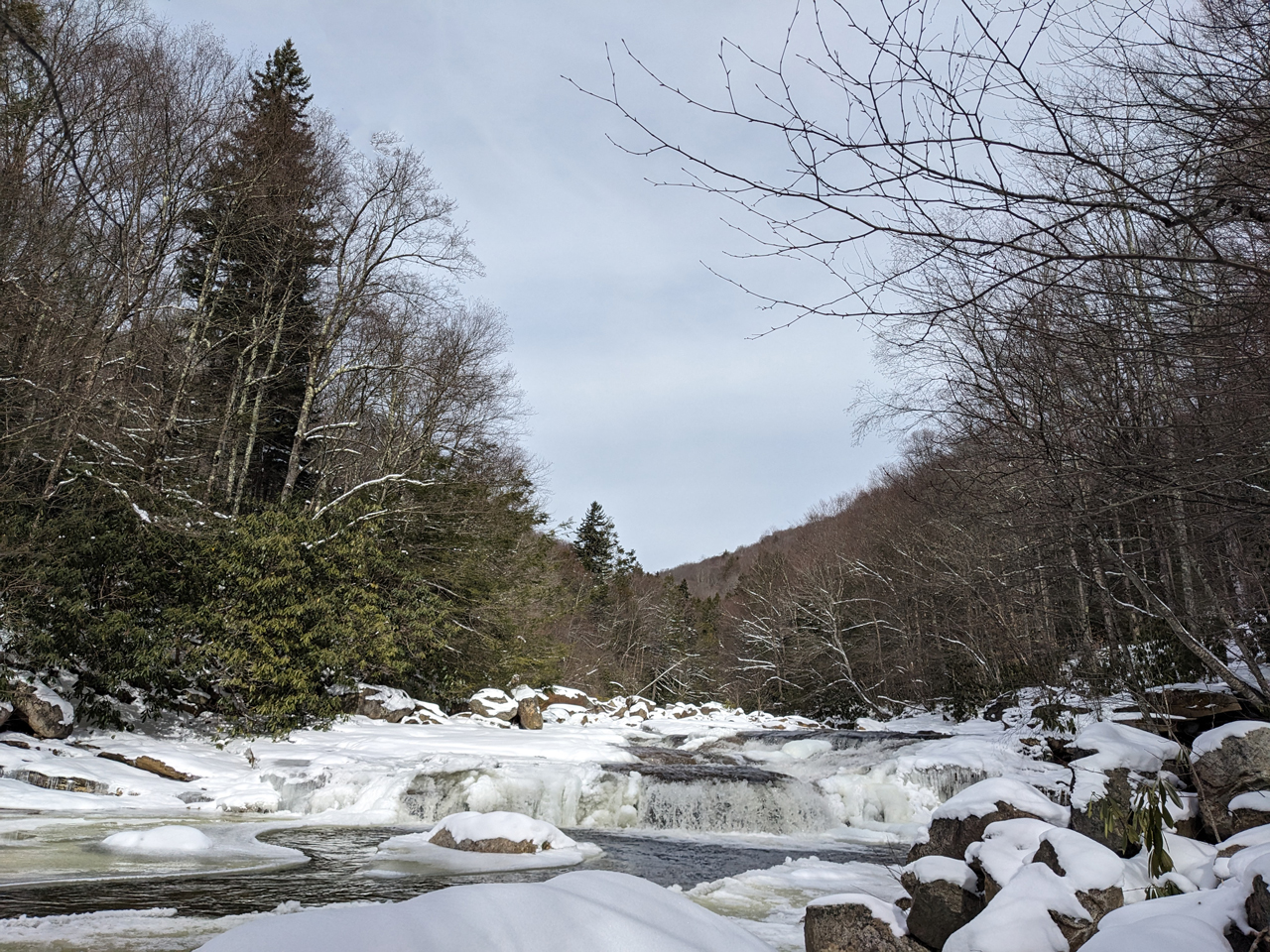
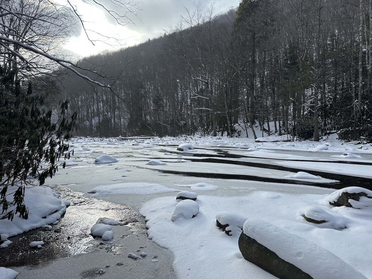
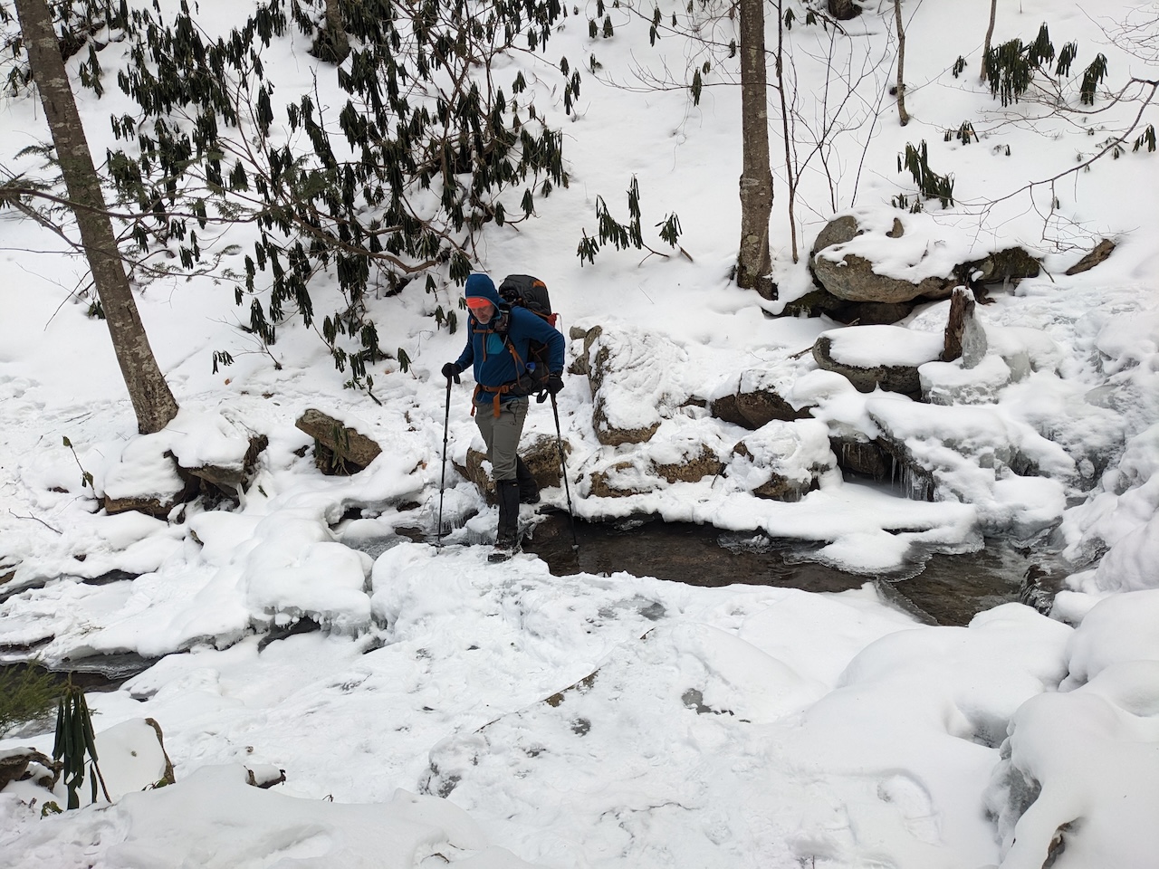
About 1.6 miles from the trailhead we reached the Big Stonecoal junction where the two dudes from the parking lot said they stayed. It was a decent campsite with a great view of Red Creek. By the way, I know it’s called a creek, but this thing rages like a river when swollen, and when covered with ice and snow it’s, how would you say, impassable. Needless to say, we weren’t crossing.
A half mile later, we came across a solo backpacker, Weston, at a creek crossing. He was making his way to Lion’s Head, the same spot where Nick and Vic were headed, but in order to get there he needed a little help getting across the creek in front of us.
The problematic creek crossing was partially frozen over and the rocks were covered with snow making it hard to discern between what was solid and what would give way to the frigid water it was covering.
The three of us looked around before I noticed a set of rabbit footprints that scampered across the ice and onto the trail on the other side. Sure I’m 100 times heavier than a rabbit, but I figured the bunny was onto something. Poking my way forward with my trekking poles, I carefully led the way one step at a time.
Quick sidebar, my repeated taps on the ice caused my Garmin watch’s incident detection alert to go off and it tried to connect with emergency services. Thankfully its attempt failed because there was no cell service. Nice feature, but a wee too sensitive.
Anyway, after a bit of work, I made my way across the creek and was followed by Coop and Weston. After we crossed, Nick and Vic crested the hill behind us. Weston hung back and talked up the other two while Coop and I pressed on.
We followed the bunny tracks for another mile before reaching the Fischer Spring Run/Red Creek Trail junction. To the right/northeast, Fischer Spring Run continues up the mountain towards Rohrbaugh Cliffs. To the left/north, Red Creek Trail continues down the mountain towards the creek. We stuck with Red Creek Trail.
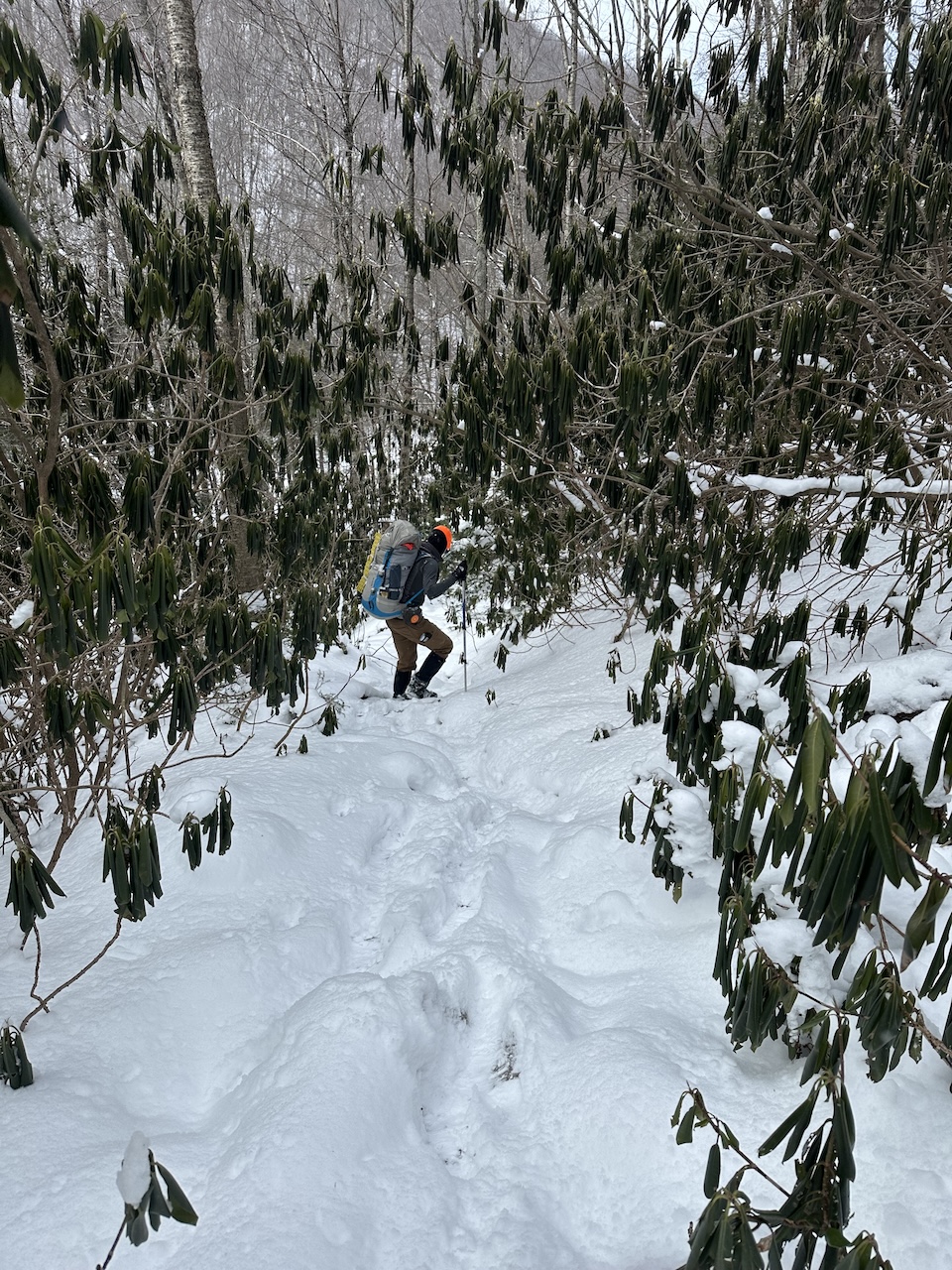
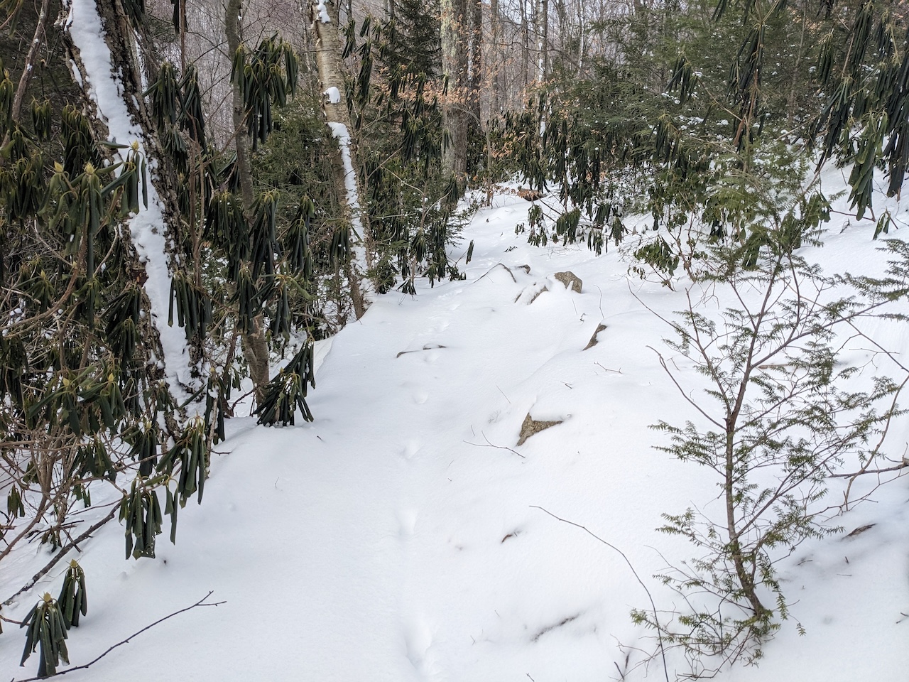
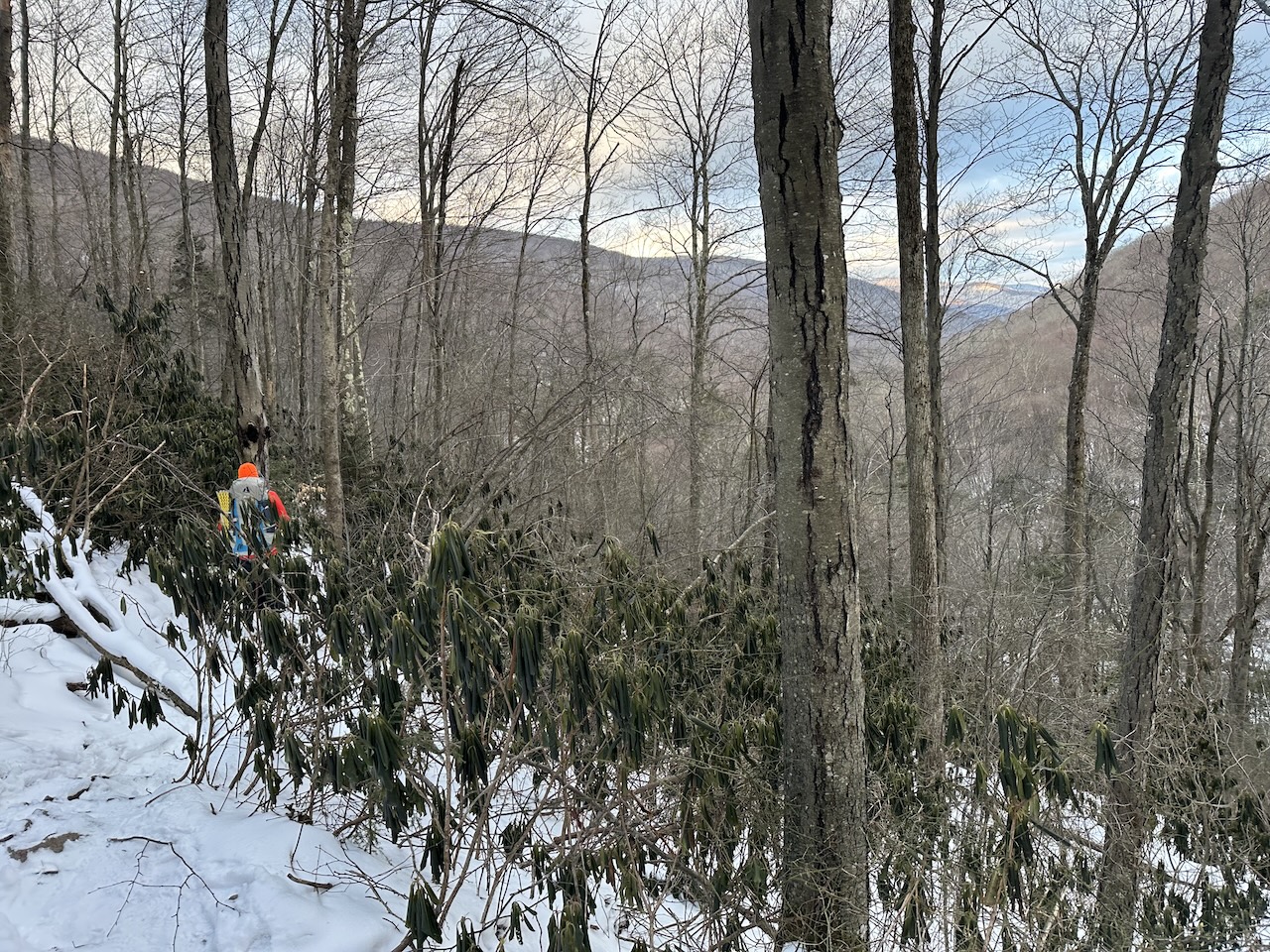
At the bottom of the hill we left Red Creek Trail and followed a spur that runs north/northeast to Fischer Spring Run Trail. Following the spur, we came to an intersection of two rhododendrons thickets: Thicket A continued straight/east and was more open and passable than the other. Thicket B turned left/north, continued in the direction we were looking to go, had less shoulder room, but was the chosen route of our floppy-eared friend.
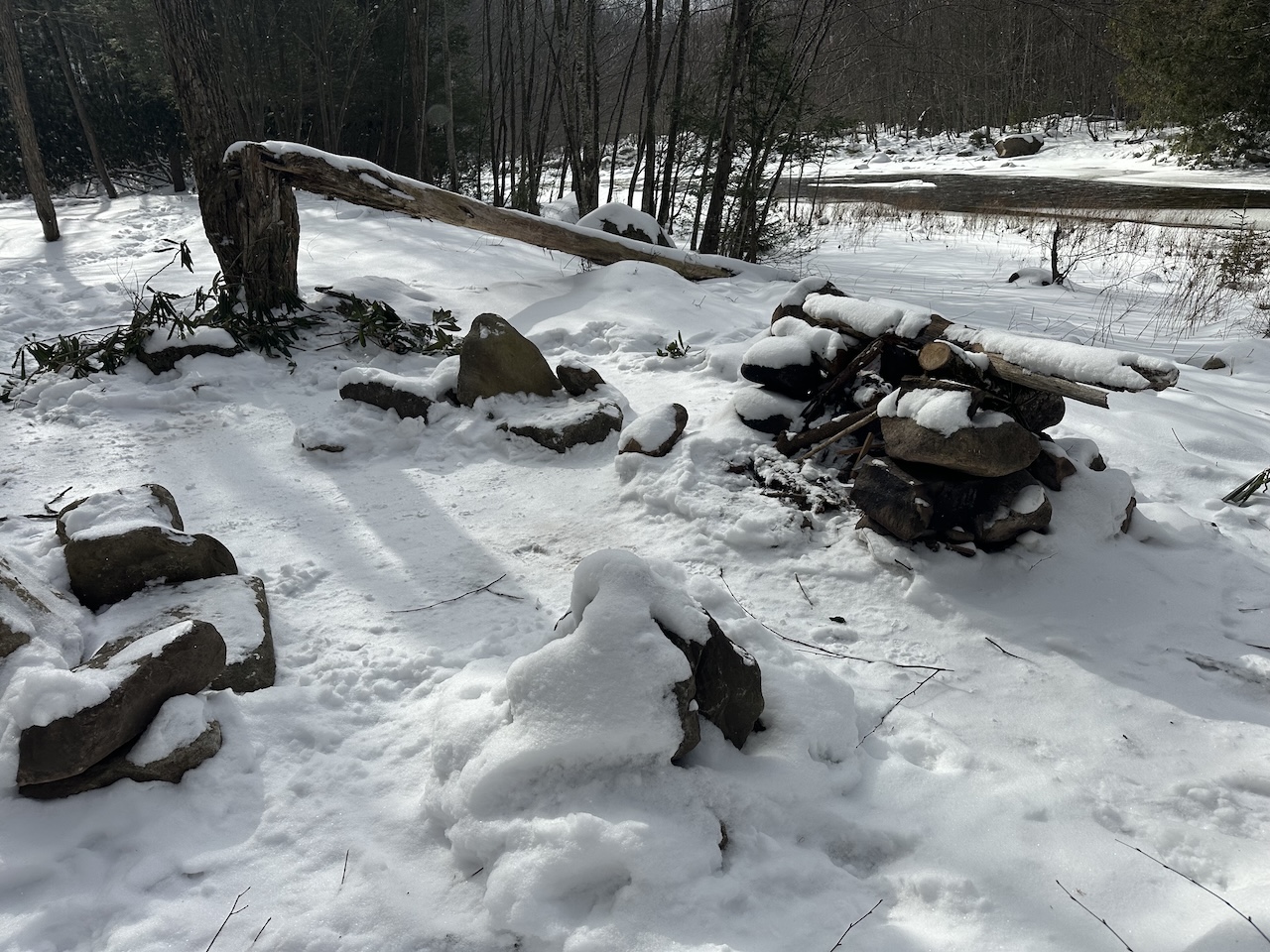
Vic walked through Thicket A and we followed him for a minute before realizing the trail was deviating too far from the creek. Back through Thicket B we followed the bunny prints along Red Creek Trail, across a shallow water crossing, and through a tunnel of rhododendrons. On the other side of the tunnel, we were welcomed by a large, open campsite with a single fire ring, easy access to water, and plenty of room for shelters.
On the map, our current campsite was one of 14 or so potential sites that lined the creek. There were supposed to be 4 on the east side where we were and another 10 on the west side of Red Creek. Since there was no way we were crossing the creek of frozen death we figured we had our current campsite and another 3 yet to be found further up the trail.
To exhaust our options, Coop and I explored the area. Just beyond our campsite, there was a flat area at the top of a short hill. To the left of the hill, and closer to Red Creek, a fire ring, but no spots for tents. Walking the trail a little further still, we found a fire ring and a space for probably two tents. And, just a bit more up the trail, another fire ring at the Fischer Spring Run Trail spur junction.
Given our options, Coop and I decided to stay at the first campsite we had found. And, given the impassability of Red Creek and the available options, the other three backpackers decided to join us. The more the merrier.
With an hour before dusk, we pitched our tents then focused on gathering wood. While we did, a few backpackers came through camp, asked for campsite suggestions, then set up camp further up the trail.
Coop then got the fire going and I hung a bear bag line. When I returned, and in preparation for a lot of sitting, I stuffed my pant and jacket pockets with anything that needed to stay warm: water filter, lighter, stove fuel, contacts, phone, and headlamp. Once loaded up like a shoplifter, I turned my attention to rehydrating my stroganoff.
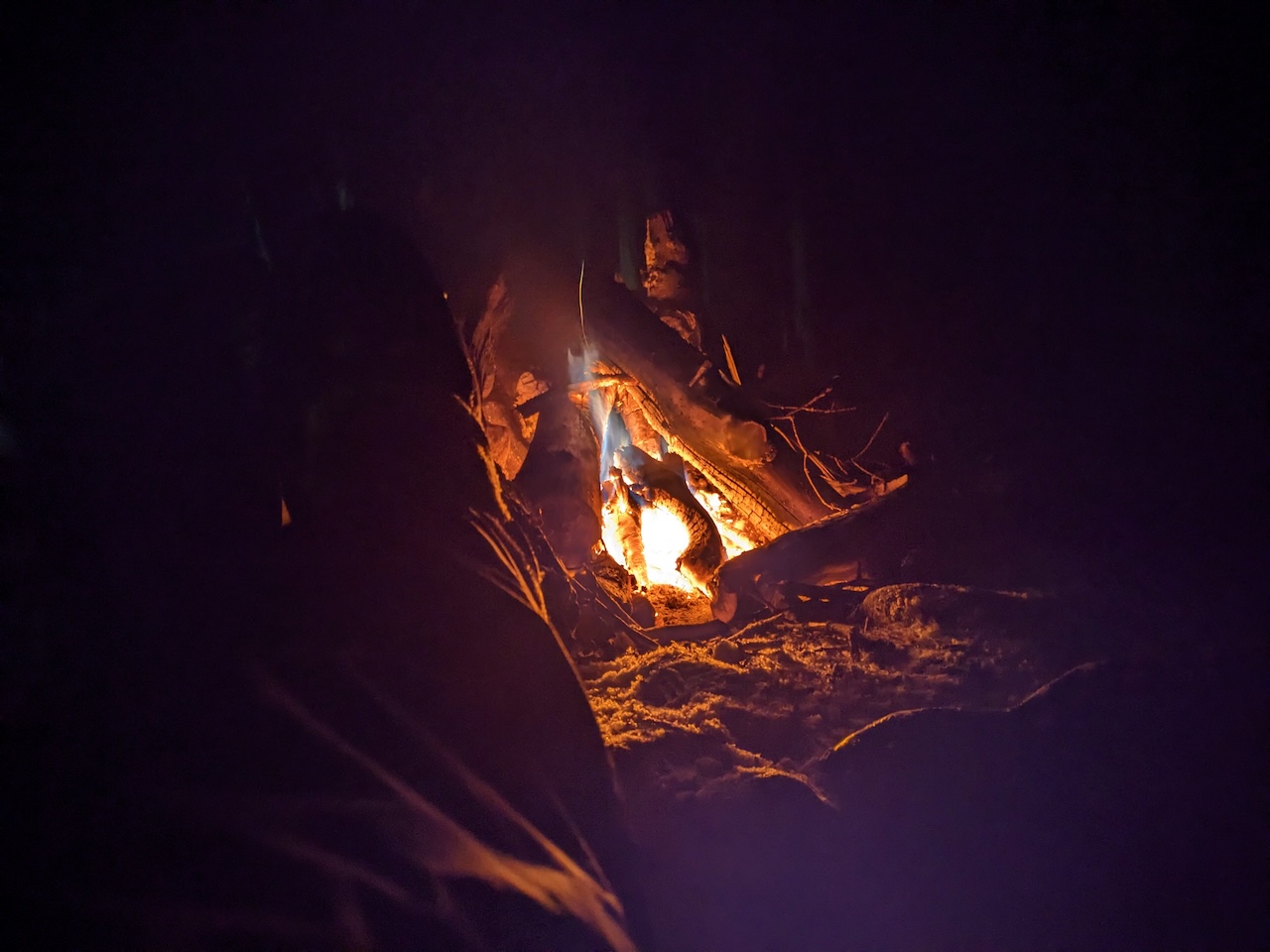
Photo by Coop
Dinner was super chill, we just hung out and talked as the cold settled in. Around 8 PM, Vic, Nick, and Weston went to bed, but Coop and I were enjoying the fire (and spirits) too much to leave. I mean, we did have a nice fire, why not enjoy it? A couple of hours later we doused the fire with snow and turned in.
DAY 2 ( 0.45 MI | +71′ GAIN | -71′ LOSS)
At times throughout the night, I heard the winds blowing outside my tent and if I listened closely, could hear the howling up above. I shuddered to think of the conditions Nick, Vic, and Weston would’ve endured if they had stayed at Lion’s Head.
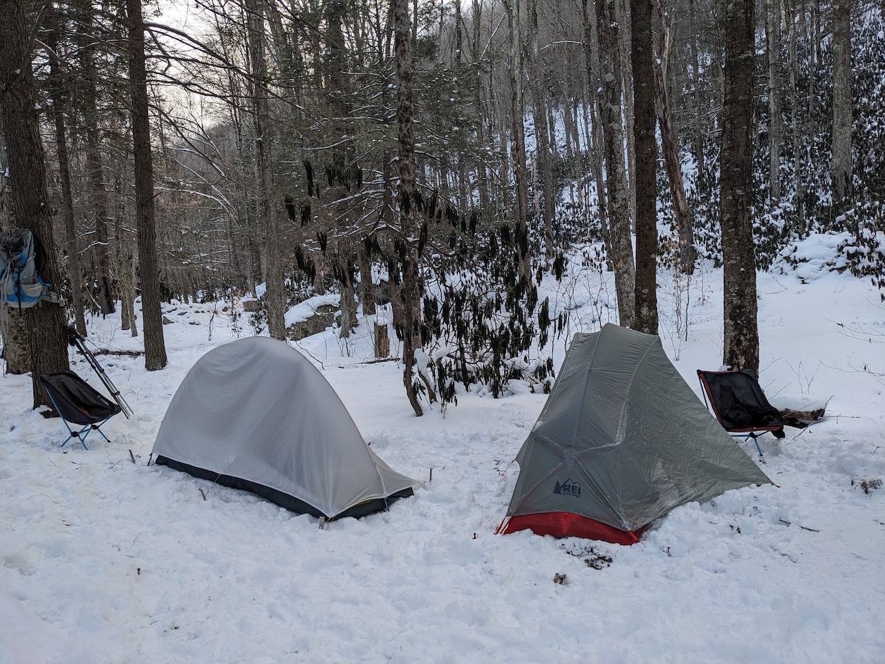
Photo by Coop
When I woke at 6AM, the 4°F temperature kept me cocooned in my sleeping bag. Around 7AM, I braved the now 5°F cold to take care of a biological need, but promptly returned to the warmth of my sleeping bag because I could.
By 7:30 AM, the sounds of Coop stirring in his tent prompted me to finally face the cold. When I did, I was greeted by Nick and Vic as they were leaving. We thanked them for their camaraderie and wished ’em well.
After Nick and Vic left, Coop, Weston, and I had breakfast, with Weston departing around 10AM. My day quickly shifted when a sudden twist of my back sent a wave of pain down my leg. I tried to walk it off. Tried stretching it out. No luck.
I shared the news with Coop and he responded with incredible understanding. He suggested a short hike up Red Creek Trail to have lunch followed by a relaxed afternoon at camp. I felt terrible for disrupting our day hike, but was immensely grateful for his flexibility.
Around 11:30AM we walked up Red Creek Trail to a site near the Fischer Spring Run Trail spur where we enjoyed snacks and tuna push pops around a fire ring. After a relaxing break, we returned to camp to gather wood in preparation for another cold night.
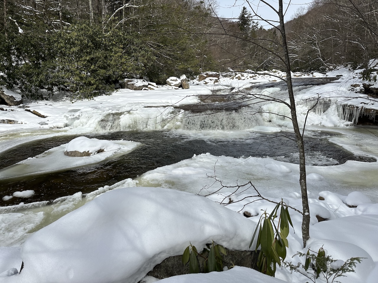
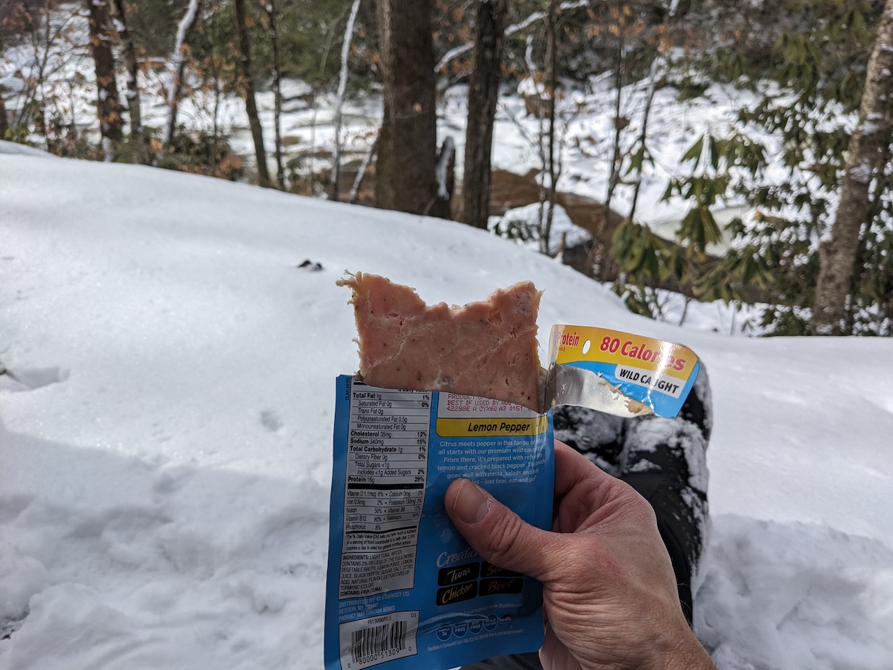
Photo by Coop
Around 3PM, a dog bounded up the trail followed by a dude in Carhartt pants, carrying a daypack and poles, and sporting rubber boots. He asked if we’d found a way across Red Creek. I told him we hadn’t as the cold water and ice made it undesirable and frankly, unsafe, to cross. He responded with a smile and a wink, promising to return in shorts the next day to find a crossing. With that, he disappeared with his dog back down the trail.
We did some exploring and just hung out for a bit before starting up the fire around 3:45PM. We’d gathered plenty of wood, so it burned really well and lasted until we doused it around 8PM.
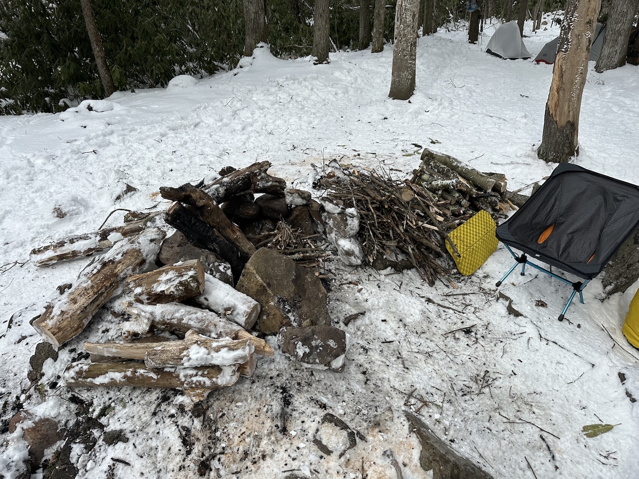
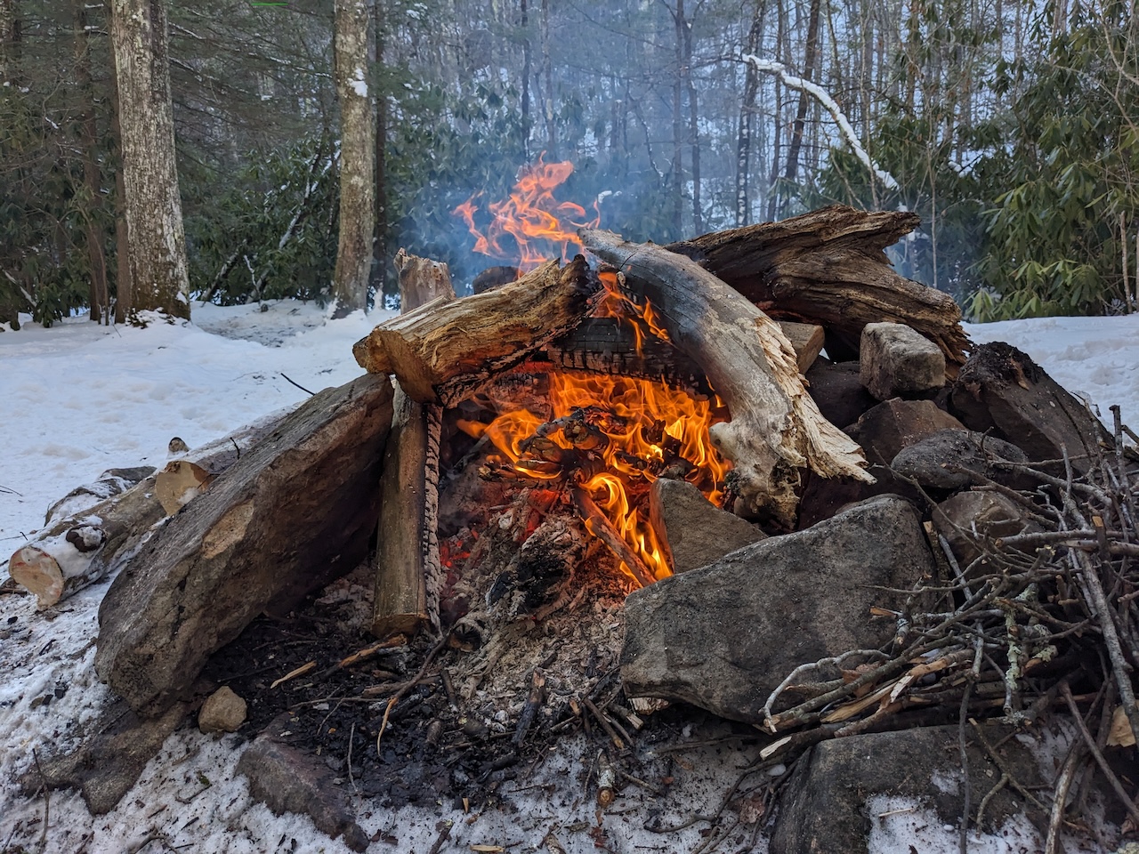
Photo by Coop
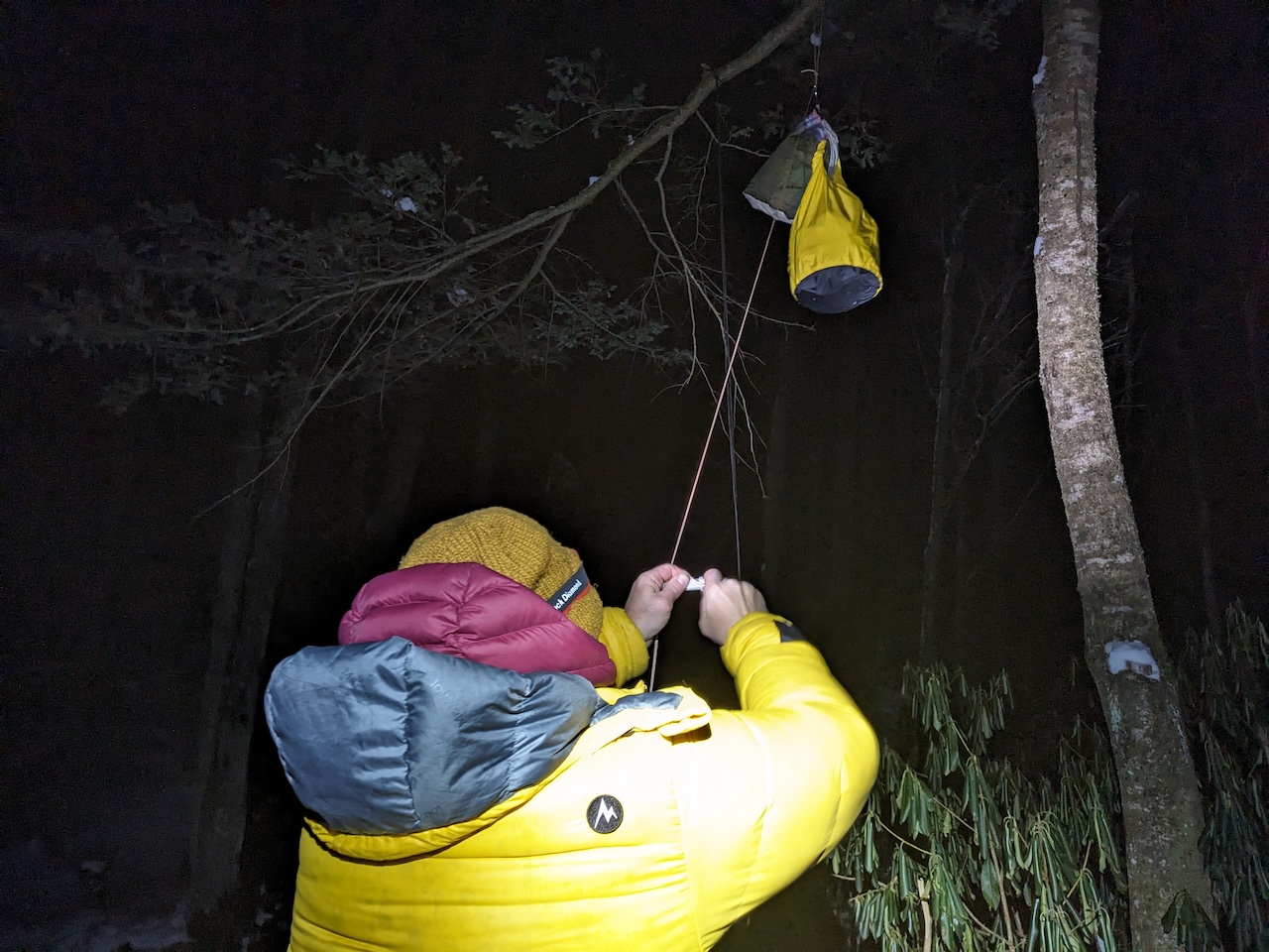
Photo by Coop
DAY 3 ( 4.01 MI | +321′ GAIN | -790′ LOSS)
We woke at 6AM, broke camp, and were on the trail an hour later. The sky was partially sunny and temps were in the low 20s. It was a casual hike, enough that we could take in the sights without fearing our extremities might freeze and fall off.
After an uneventful 2 hour hike, we arrived at the trailhead, signed out on the register, and boiled water for coffee after loading the car. Once our to-go cups were filled, we said our farewells and headed out.
Trip complete.
TOTALS ( 7.93 MI | +1,180′ GAIN | -1,237′ LOSS)
FINAL THOUGHTS
The Dolly Sods Wilderness once again lived up to its brutal winter reputation. Bringing the extra down coat and rain gear really helped to mitigate the wind and low temperatures. I was disappointed that my back prevented us from taking one of our day hikes, but grateful that Coop was flexible. It was also nice to have a few others share the campfire with us as its pretty uncommon that we ever run into anyone let alone have guests. Shout out to Nick, Vic, and Weston! Great trip overall. I’m looking forward to getting back out to the area so we can hit up the waterfalls and walk the trails we intended.