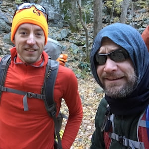
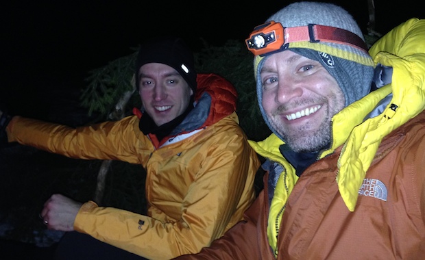
In October 2014, Coop and I planned an ambitious 20-mile hike with nearly 10,000′ of elevation gain through the Three Ridges and Priest Wildernesses. Ambitious because, at the time, I was two months out of shoulder surgery and I hadn’t been particularly active. Still, like my third helping at Thanksgiving, the trip seemed doable.
As the story goes, we hiked 3.2 miles along Mau-Har trail and another 11 miles over Three Ridges until returning to the parking lot at Crabtree. Then my wheels fell off, and we ended up camping about a half mile up the trail. That night, Coop vowed a return trip to finish what we started.
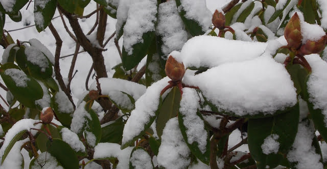
Flash forward a year and a half to a time between new babies and tee-ball practice. Coop asked me if I wanted to give The Priest another go. I agreed and he followed up with a plan that would take us up and over The Priest and onto Spy Rock. We’d spend the night near Spy Rock and hike back down the next day. In total, according to hillmap.com, we’d knock out 14.5 miles with ~5,000′ of elevation gain and loss. Perfect.
My buddy, Coop, was a couple of months from joining the brotherhood of fatherhood. To celebrate (and because it’d probably be a while before we’d be able to go out again) we plotted a course for Apple Orchards Falls; a destination that would keep him close to home, but far enough away from civilization.
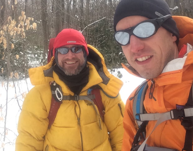
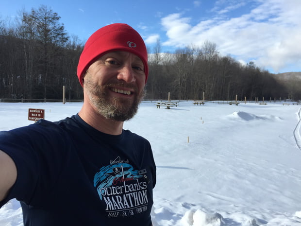
For our annual winter backpacking trip, my buddy, Coop, and I decided on Mt. Rogers Recreation Area. We’d been there in 2011 when we hit up Grayson Highlands to see the wild horses. It’s a great place with great views, and it’s also home to the highest point in Virginia. What makes Mt. Rogers Area a particularly good spot for the winter is the number of trails through and around the area. A must when weather forces routes to change. Something that often happens at Mt. Rogers where winds and temps are known to change in minutes.
Still, we opted to plan our trip ambitiously and play the rest by ear.
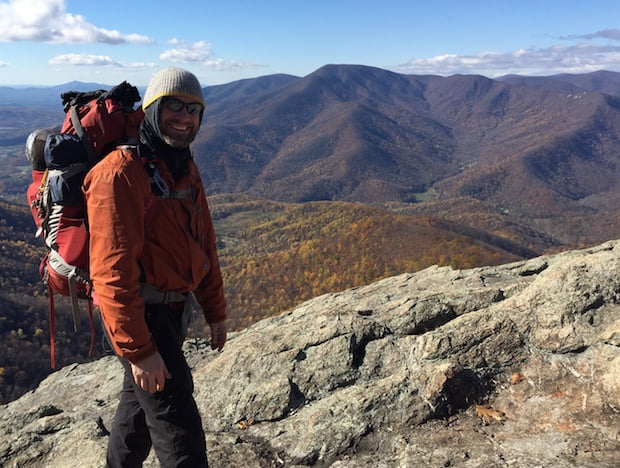
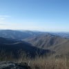
Just past the Northern Knoll of Three Ridges looking at The Priest
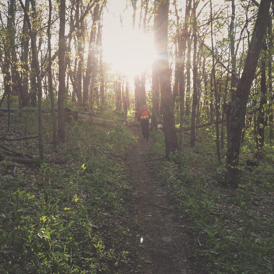
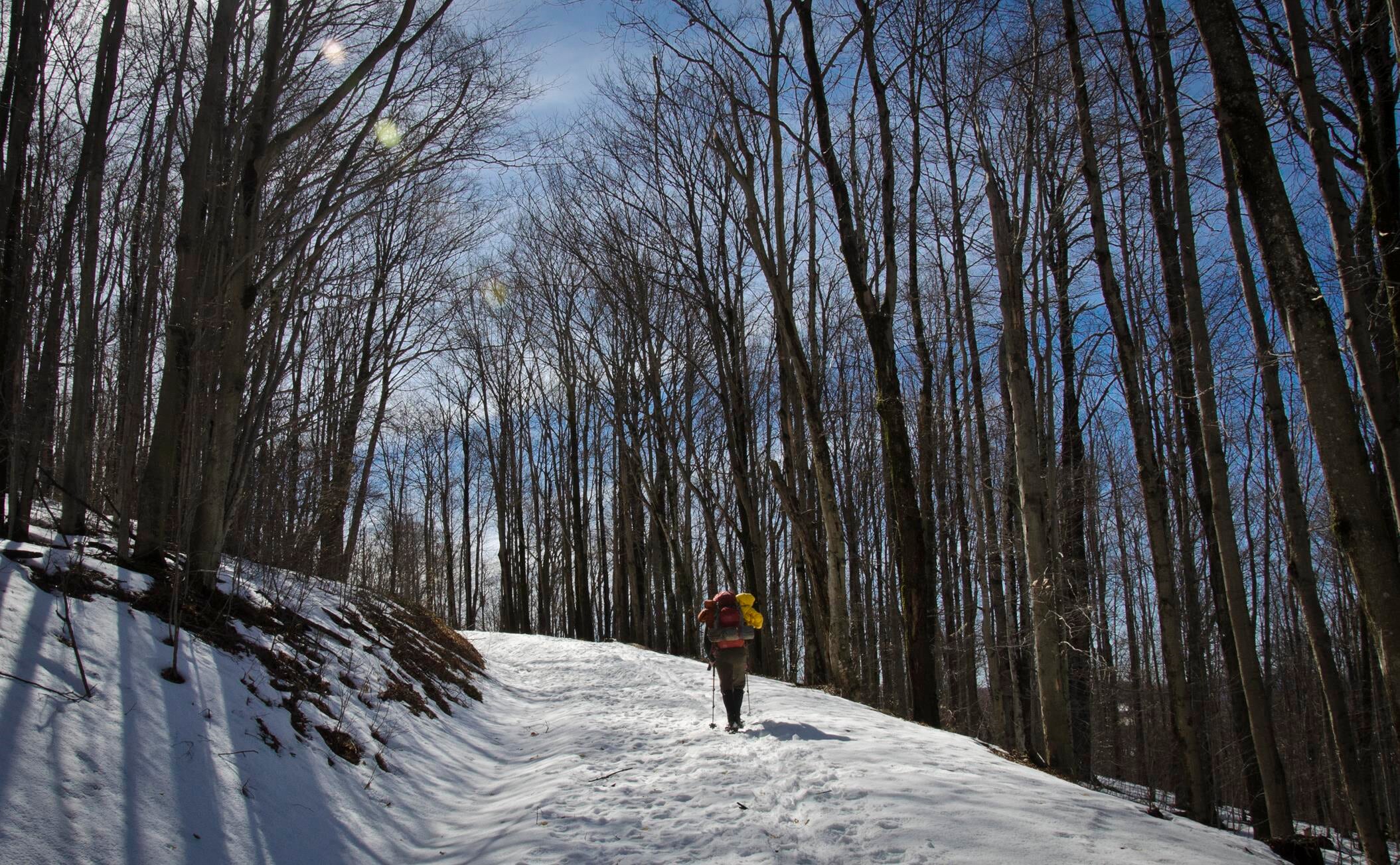
I’ve been itching to go backpacking since my July trip to Panthertown Valley. Four months later, and just two months after shoulder surgery, I got to scratch my itch in the Three Ridges Wilderness, located in the George Washington and Jefferson National Forests. My buddy, Coop, mapped out a sweet 20-mile hike with elevations ranging from 1,000′ to 3,790′ at the summit of Three Ridges Mountain.
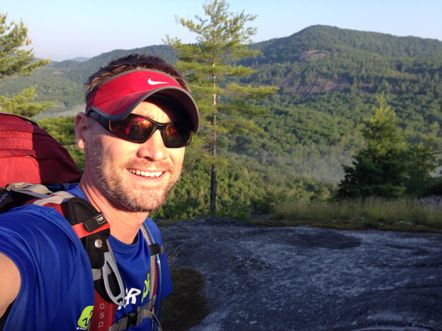
Atop Little Green Mountain overlooking Panthertown Valley
I’ve been tent backpacking for several years and it wasn’t until a recent trip to Tsali Rec Area that I began to consider the alternatives. A list which includes: on the ground, on the ground with a tarp, or above the ground in a hammock.
I’ve slept on the ground in a sleeping bag. It was fine, but the conditions were ideal (i.e. moderate temps, no bugs, and we were on a bald with little wind). However, I had not crossed off tarp or hammock from my backpacking bucket list.
At Tsali, I noticed a lot of people choosing hammocks over tents. Curious, I asked one camper to let me give their hammock a try. It seemed comfortable enough that I thought I could use a hammock on a future backpacking trip. To the Googles!
Turns out, hammocks aren’t all that expensive. Prices ranged from $40 on up to $200 depending on material. I also found that most backpackers recommended using a bug net, rain fly, and sleeping pad along with a bag, quilt, blanket, or bivy. So let me back up. The hammock is between $40 and $200 while the accessories to keep bugs out, rain off, and heat in will collectively run you an additional $400-$600.
I also took a close look at the weight difference between a tent and a hammock. My REI Quarter Dome T1 tent with footprint, poles, stakes, and rainfly weighs 3 pounds 10 ounces. The ENO DoubleNest Hammock (19 oz), bug net (16 oz), rain fly (22 oz), straps (11 oz), and stakes (2.8 oz) weigh in at 4 pounds 4 ounces. Six ounces isn’t a lot, and in the winter months I’d be 16 ounces lighter since I wouldn’t need a bug net. Plus, factoring in how a hammock packs compared to how a tent packs, I was sold on giving the hammock a chance.
With coupon in hand, I purchased an ENO DoubleNest and the above accessories from the local big box store, and gave it a whirl at a family car camping trip a few days later. Set up was a breeze and sleeping was, in my opinion, better than in a tent. I took the hammock with me on a couple day trips with my son and he loved it as much as I did. The real test, however, would come in an upcoming backpacking trip to Panthertown Valley in the southern Appalachian Mountains.
My buddy, Coop, and I have backpacked during the winter months for a few years now. Shining Rock in Western North Carolina, Roan Mountain along the Tennessee-North Carolina border, and most recently Dolly Sods in West Virginia.
We hadn’t traveled north for a winter hike, and it’d be a test for us as Dolly Sods is notorious for year-long crazy weather with an average annual snowfall of 55″. As he always does, Coop researched potential routes and came across White Grass Cross Country Ski Area, a cross country skiing and snowshoeing business in Davis, WV. He emailed Chip, the dude in charge, who kept Coop in the loop about weather and gear (including $15/day snowshoe rental).
Our intent was to park at White Grass and take the Timberline trail to Forest Road 80 where we’d huff it up to 524 Rocky Ridge. From there we’d head east on 511 Blackbird Knob, camp at the intersection of Blackbird and Upper Red Creek, and then head up to Dobbin where we’d join up with Rocky Ridge which would take us back to our car. A fairly straightforward 3-day, 15.5 mile trip. However, thanks to the wintry weather, the actual route we hiked was a slightly different.
I love a good hike. I love the peacefulness it brings. The camaraderie it provides when traveling with friends. And, I enjoy a good challenge. This past weekend I got my wish.
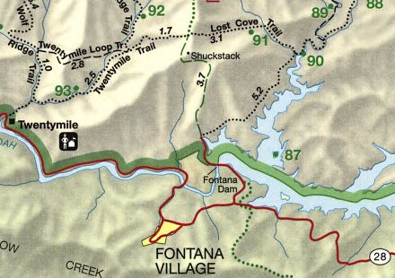
Three buddies and I hiked the Great Smoky Mountains via Fontana Dam. As an added bonus the lot of us hit up Tsali Campground for a couple nights where we swam a bit, fished, got poured on, and hit up the Nantahala River for a ride.
We arrived at Fontana Dam on Saturday around noon, grabbed a permit from the dam welcome center, and began unloading our packs from the car. Within minutes it was evident that the 100° F (37.7° C) temperatures were going to be a factor in our planned 12-mile hike. Every one of us were sweating buckets. Thank God for water bladders and bottles.
In 2010, my buddy, Coop, and I met Chris, a fellow backpacker, at the base of Shining Rock in North Carolina. At the time, Chris had just turned back due to extreme winter conditions, and we were looking for a place to camp before the sky went dark and we froze to death. After surviving the night, the three of us exchanged contact information and suggested we get together again in the future.
This past weekend, almost two years later, the three of us realized the suggestion. Coop and I started at Sam Knob via the Flat Laurel Creek trail off of NC Highway 215/Lake Logan Road on Friday, ran an impromptu 5K to the top of Sam Knob’s 6,055′ peak, and Chris joined us on Saturday morning at the Black Balsam Road parking lot en route to Cold Mountain.
2/23/10, 6AM, Day 4: Our watch alarms go off at 6AM. Daybreak is nearing. Time to break camp, fill bottles, drink coffee, and plot our course. With plenty of sunlight, we can see how to avoid the thickest patches and travel the safest route down the mountain. The downside? The slopes are steep, there’s 3 feet of snow on the ground, there are fallen trees everywhere, and to top it off, there are coyote, bobcat, and mountain lion tracks on both sides of the creek.
2/22/10, 2AM, Day 3 Part 2: Just moments ago Search and Rescue (SNR) told us we were on our own. So much for being airlifted on a chopper. Wonder if we’d have to pay for an air rescue. Not that it matters though. According to SNR, we have to keep walking in the direction we’re headed (which we don’t know). The trail will get steep (i.e. “just shy of cliff.”) And, once we cross the valley and climb the slope we’ll be on Old Butt Knob (maybe). Is that all? Well, shoot. Honey, set me a plate. I’ll be home in a few.
CHRIS: Dude, this totally blows. Let’s get off this mountain before the weather hits.