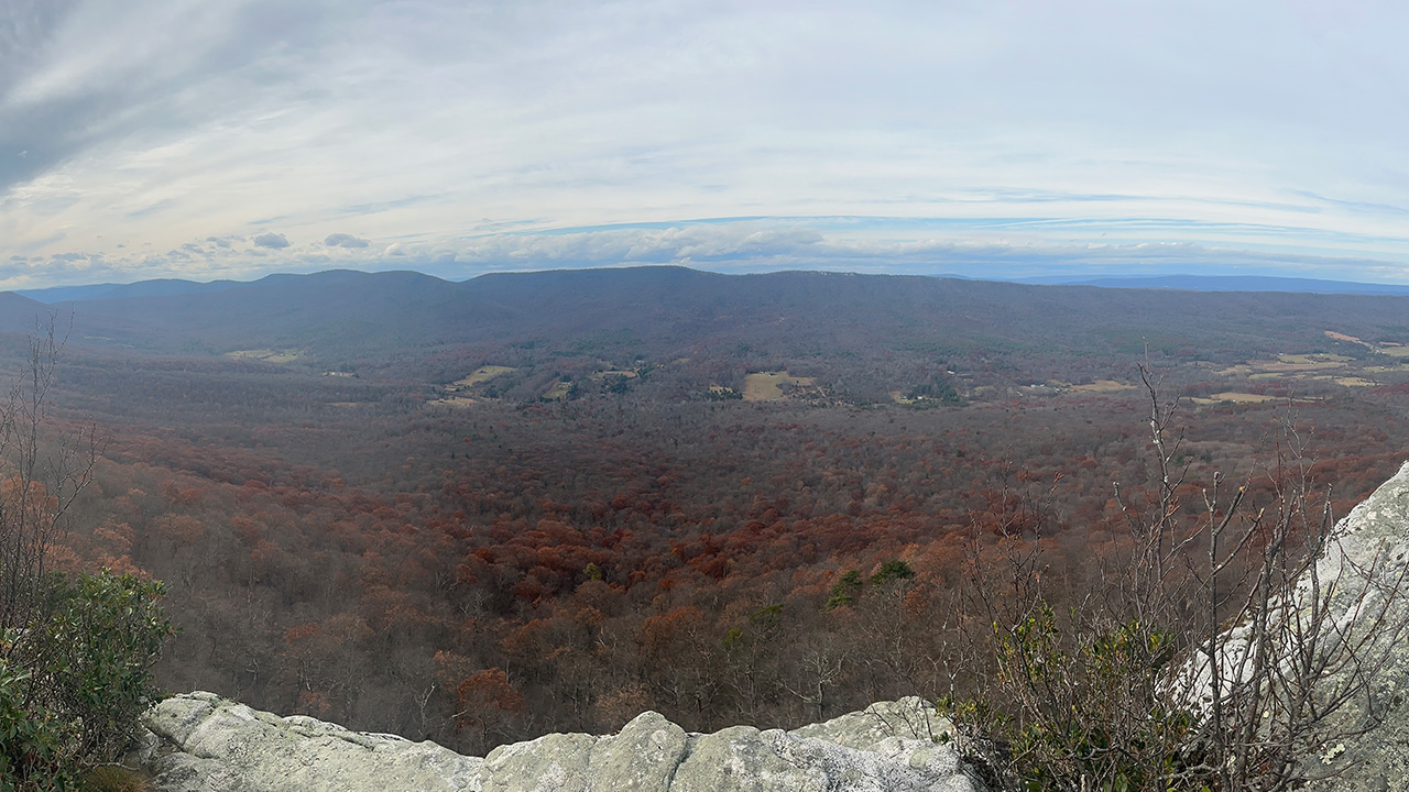
The Perry Valley Loop, also known as the Trout Run Valley Loop, is a demanding 30-ish mile route within the George Washington National Forest in West Virginia, though it briefly traverses the Virginia border and the Wardensville Wildlife Management Area. The strenuous loop features 5,000 feet of elevation gain and is famous for its overlooks at Big Schloss, Tibbet Knob, and Halfmoon Mountain.
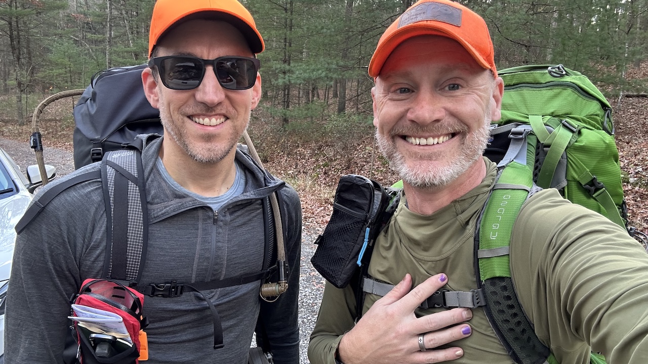
Having visited many a locale in both states previously, my buddy, Coop, and I decided to visit this new, two-state area, with the hopes of catching some views and good times.
THE PLAN
As with any trip, several factors needed consideration to finalize our route, gear, and safety plan. These played directly into our final game plan.
Considerations
Water. The Perry Valley area was under critical to severe drought status leading up to the trip, meaning water scarcity was likely. Trip reports confirmed no reliable sources in the 12 miles between Mill Mountain and Trout Pond Campground. Our solution: stashing water at Wolf Gap Campground (and hoping for the best!).
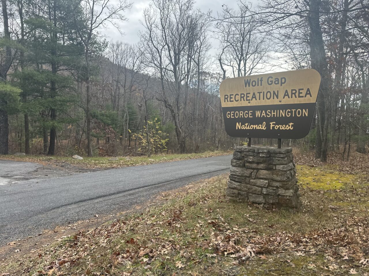
Bailout Options. There are two campgrounds in the vicinity, but only Wolf Gap Recreation Area is open year-round. The campground would serve as our primary bailout option, located right off the Wolf Gap Road between Tibbet Knob and Mill Mountain trails. Sites are available for about $10 on a first-come, first-served basis, payable in an on-site dropbox or via the Recreation.gov mobile app (note: water is not available, but they have pit toilets so it’s a toss up).
Weather. Forecasts for Big Schloss and Baker, WV showed a wide temperature swing (24°F to 67°F) paired with high winds (in the 20 MPH range), creating the potential for single-digit wind chills. A dash of intermittent rain was also expected on Day 2.
Warmth. To combat the cold nights, we planned for a fire. During West Virginia’s Fall Fire Season (Oct 1 – Dec 31) fires are not allowed between 7:00 AM and 5:00 PM unless for food prep, light, or warmth and requires a 10-foot debris-free radius (or one inch of snow cover). The bottom line: a fire was possible, but extreme caution was mandatory.
Bears! While canisters are not mandatory in this area of the George Washington and Jefferson National Forest, proper food storage is required: in a bear canister, vehicle, bear-resistant trash can, or hung 10 feet high and 4 feet from the trunk. Since we love hanging a bear line, this requirement would be easy to meet.
All Things Considered
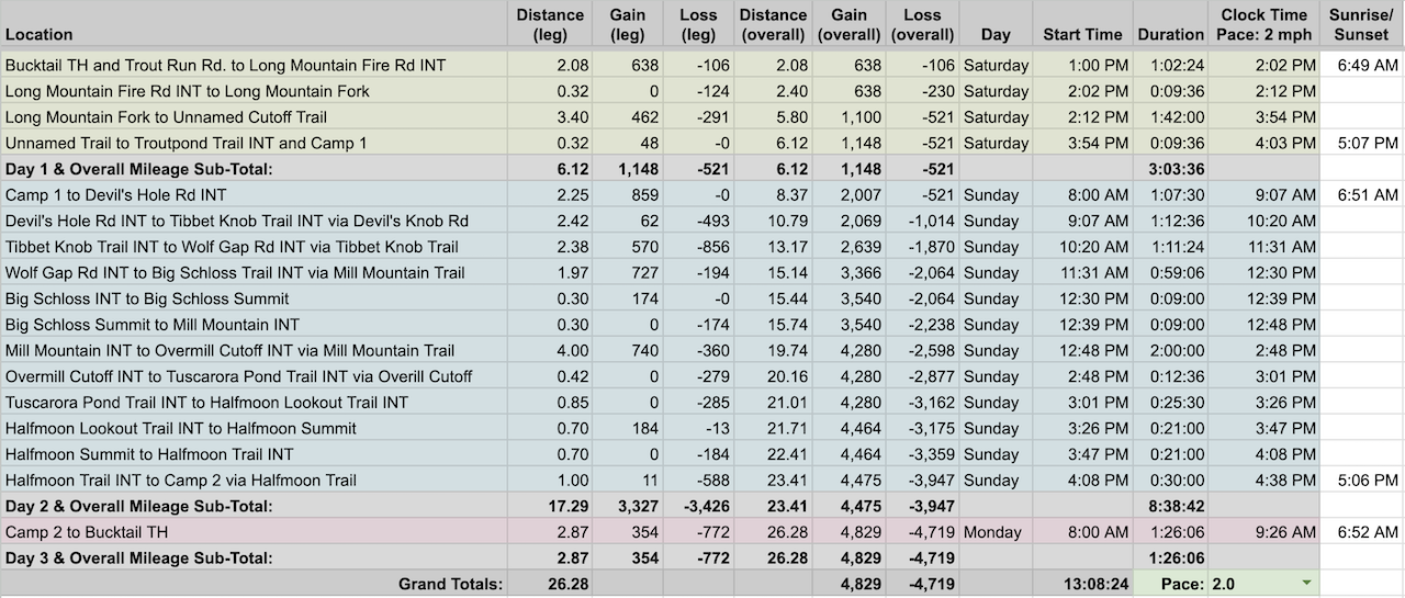
Using GaiaGPS and CalTopo, Coop planned a 27-mile counterclockwise loop beginning at the Bucktail Trailhead. Our planned campsites were about a mile from Trout Pond Recreation Area on Night 1, and off the Bucktail Cutoff about 3 miles from the Bucktail trailhead on Night 2.
The breadcrumb version goes something like: Bucktail Trailhead > Long Mountain Trail > Devil’s Hole Road > Tibbet Knob Trail > Mill Mountain Trail > Big Schloss Trail > Mill Mountain Trail > Overmill Cutoff > Halfmoon Trail > Halfmoon Lookout Trail > Halfmoon Trail > Bucktail Cutoff Trail (1030A) > Bucktail Trailhead.
After finalizing our 27-mile route, we built out a detailed itinerary in a spreadsheet based on an estimated 2.0 MPH pace…
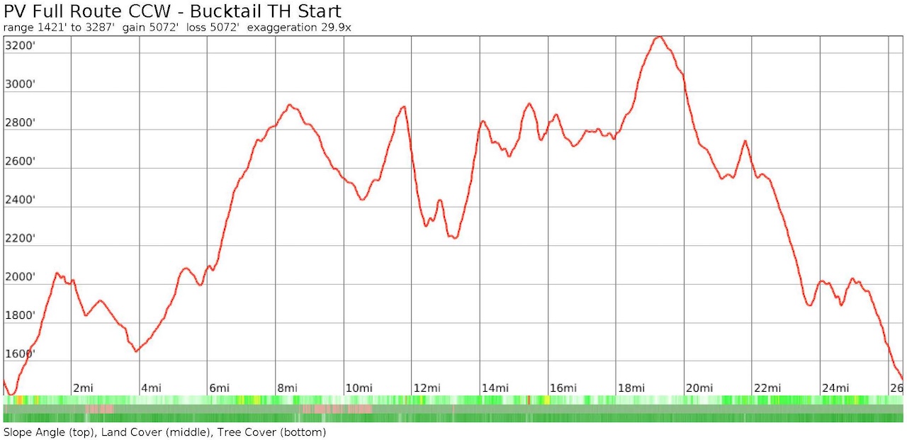
…created an elevation profile
…dropped in the route
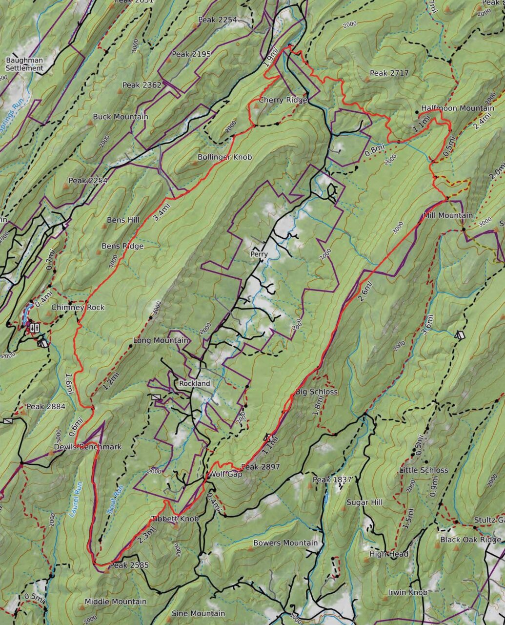
…and packaged it all in a map that we printed and laminated.
PACKING IT IN
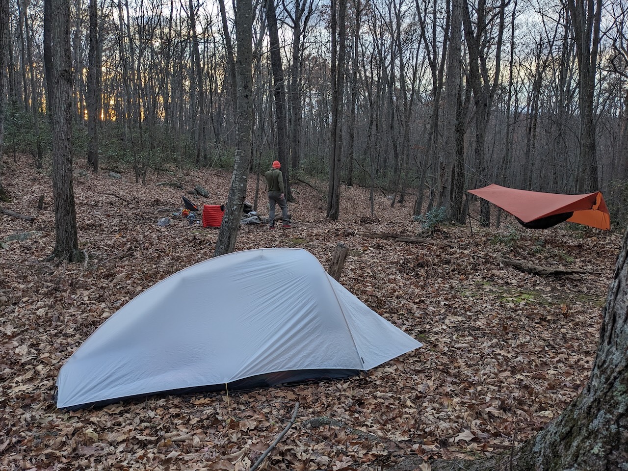
Given the chance for temps in the low 20s and wind chills in the single-digit range, I went with my hammock, paired with a 0°F underquilt and a 10°F sleeping bag. With only a slight chance of rain, I brought a rain jacket and a backpack cover, and opted for softshell pants to serve as both rain protection and warmth.
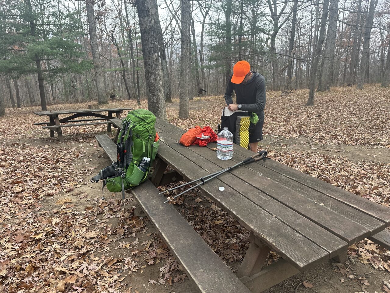
To deal with the drought conditions, I packed a 48oz Nalgene and brought water to stash at Wolf Gap Recreation Area (and campground), the approximate halfway point for Day 2.
And since we could indulge, Coop and I packed hot dogs, buns, and potatoes to eat the first night.
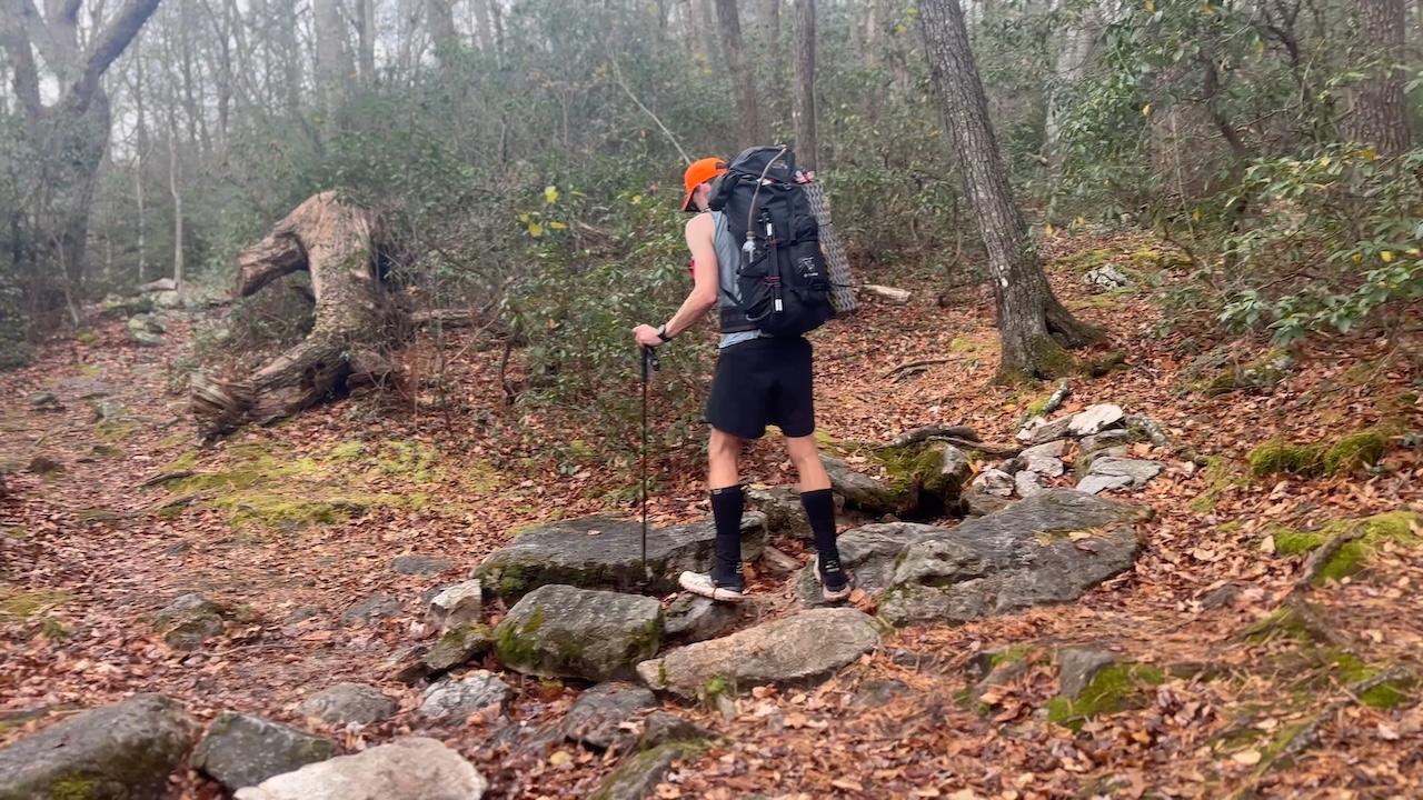
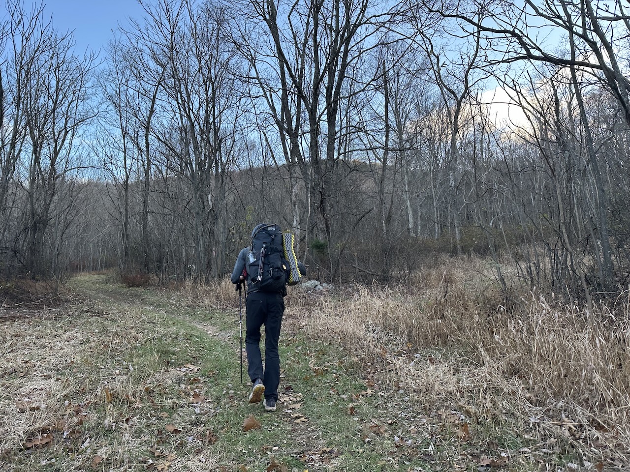
With everything loaded, including water, rain gear, and food, my 50L Atmos weighed in at 31 lbs. 1.6 oz. Not particularly light, but I’d manage.
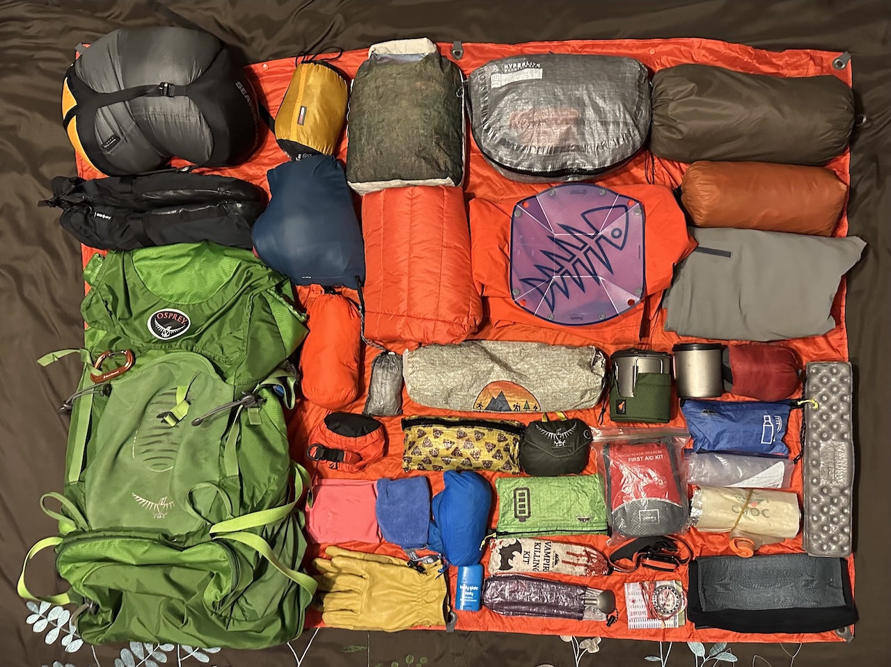
Download my complete trip gear list.
DAY 1 (6.38 MI | +1,310′ GAIN | -700′ LOSS)
Just before noon, I crossed into West Virginia and immediately pulled into the packed Wolf Gap Recreation Area parking lot to stash our water. After that key chore, I drove the final 15 minutes, passing the Halfmoon Mountain Trailhead about halfway, and reached the gravel lot at the Bucktail Trailhead. Coop arrived a short time later, and we were officially on the trail by 12:45 PM.
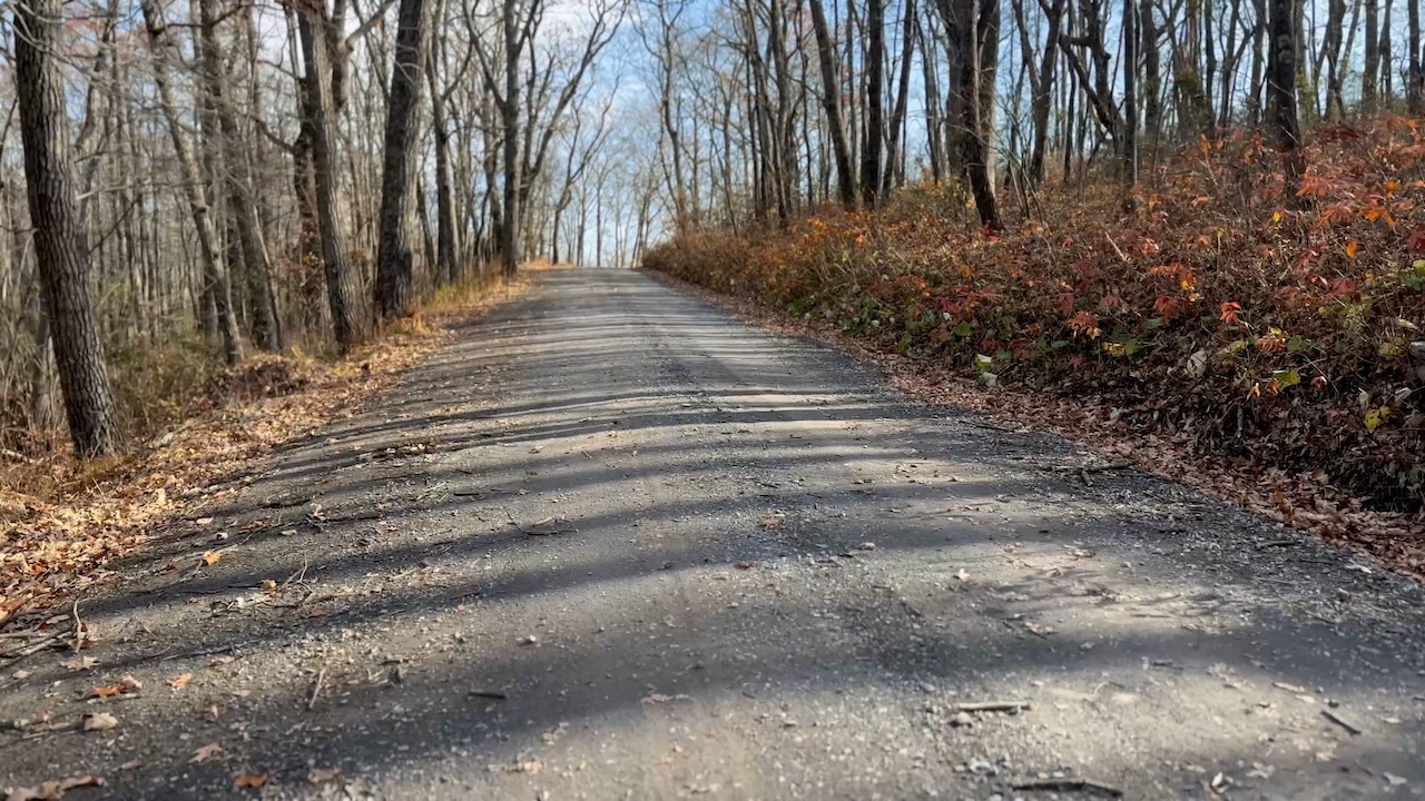
Completing the loop counterclockwise, we first hiked down to Trout Run Road and continued onto Long Mountain Trail. After crossing Trout Run creek about 10 minutes in, we began the stiff 1.5-mile, 600′ climb toward Long Mountain Fire Road (which appears on the map to go down to Trout Run Road). We continued right/west and passed a fork intersecting Long Mountain Road and Long Mountain Trail.
While we hiked we noticed several random circular patches land that were cleared of trees and were now fields of grass. The most likely explanation, aliens. Second place, a farmer with a trac…eh, who am I kidding? It was definitely aliens.
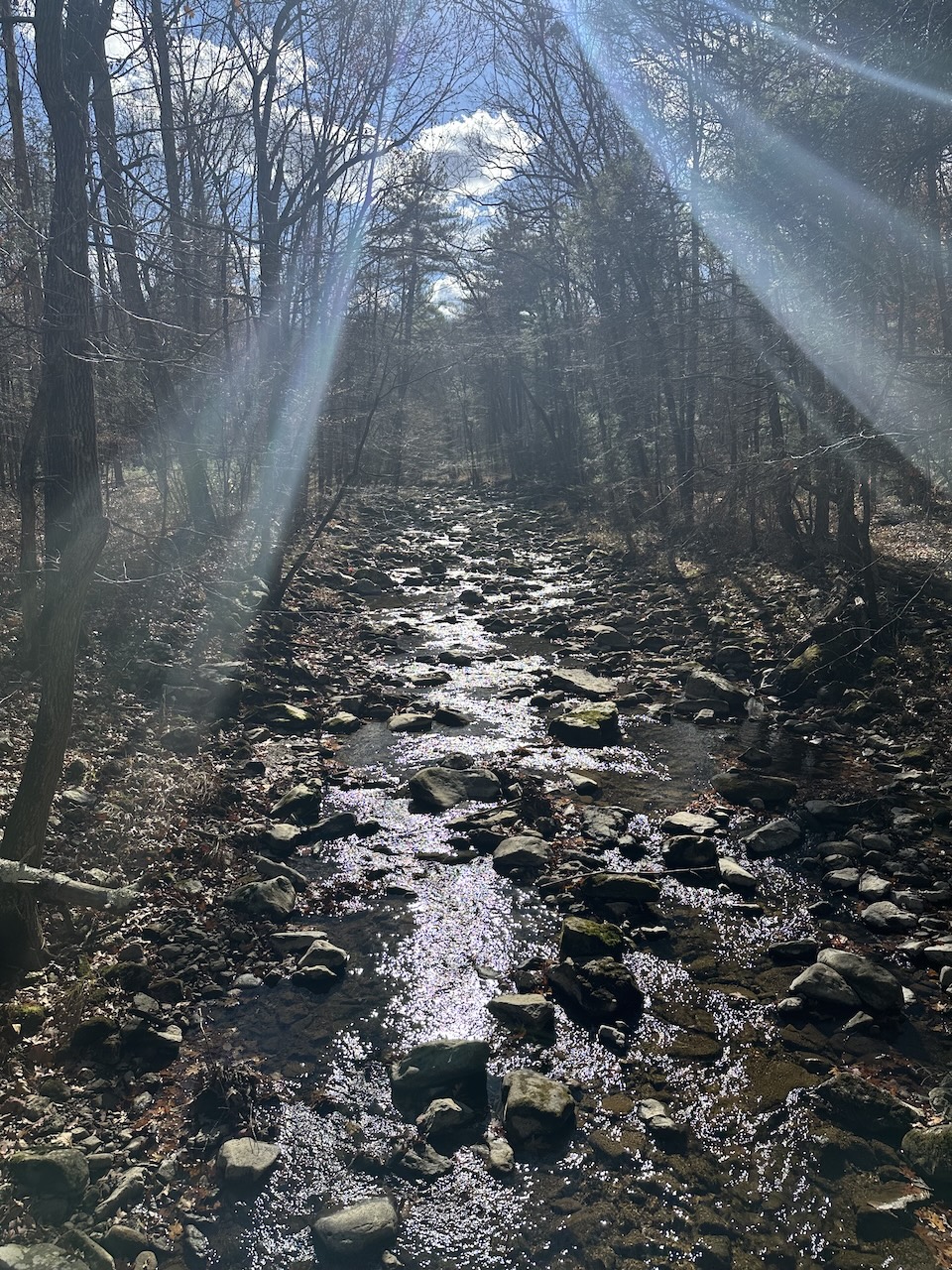
After about 3.5 miles of mild ups and downs we cross an unnamed trail that ran west towards Trout Pond Trail. We continued on Long Mountain Trail for another 0.3 miles and reached Trout Pond Trail and a potential campsite just off Trout Pond Trail around 3:15PM
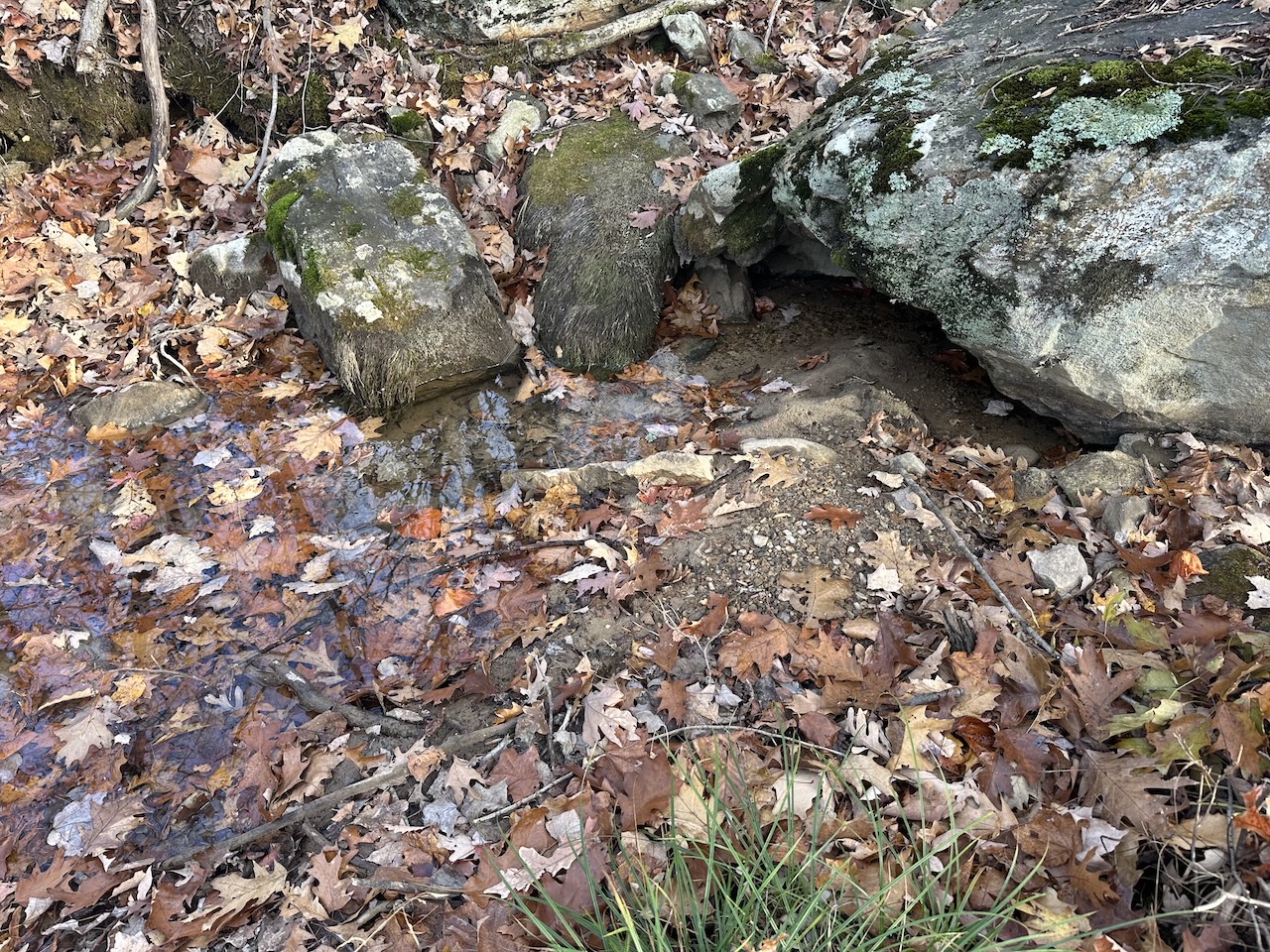
Unsure of potential water sources, Coop continued down Trout Pond Trail, and I searched along Long Mountain Trail. It didn’t take me long to hear the tell-tale trickling of water which I investigated and confirmed to be a slow, clean seep from the hillside (i.e. a solid water source). A short time later, Coop rejoined me at the campsite happy to hear that I’d found water because he had not.
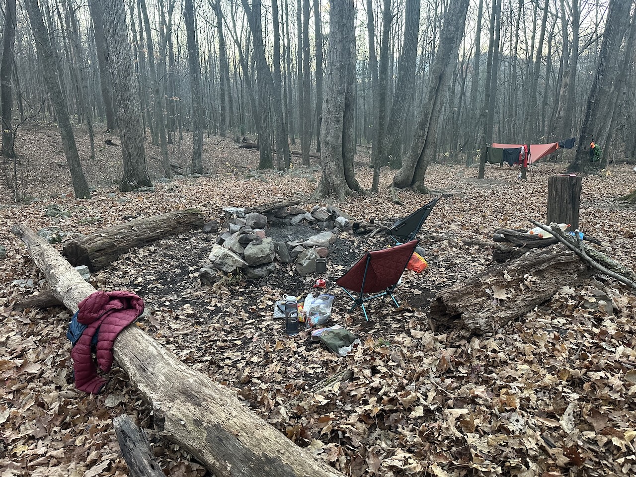
We set up shelters, gathered wood, filled bladders, hung a bear bag line, and settled in for food and fun just as the sun set at 5:07PM.
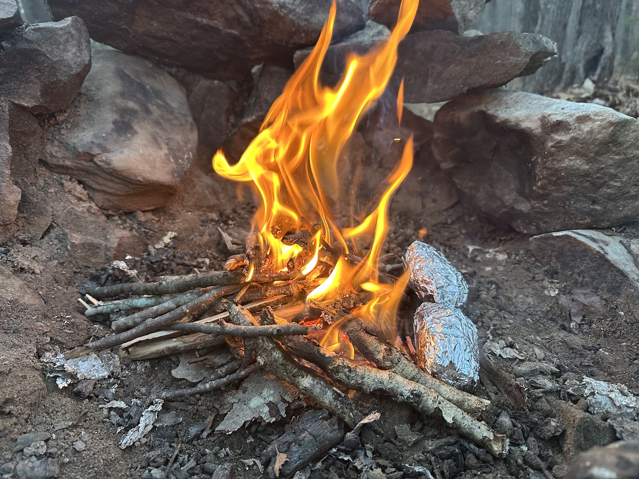
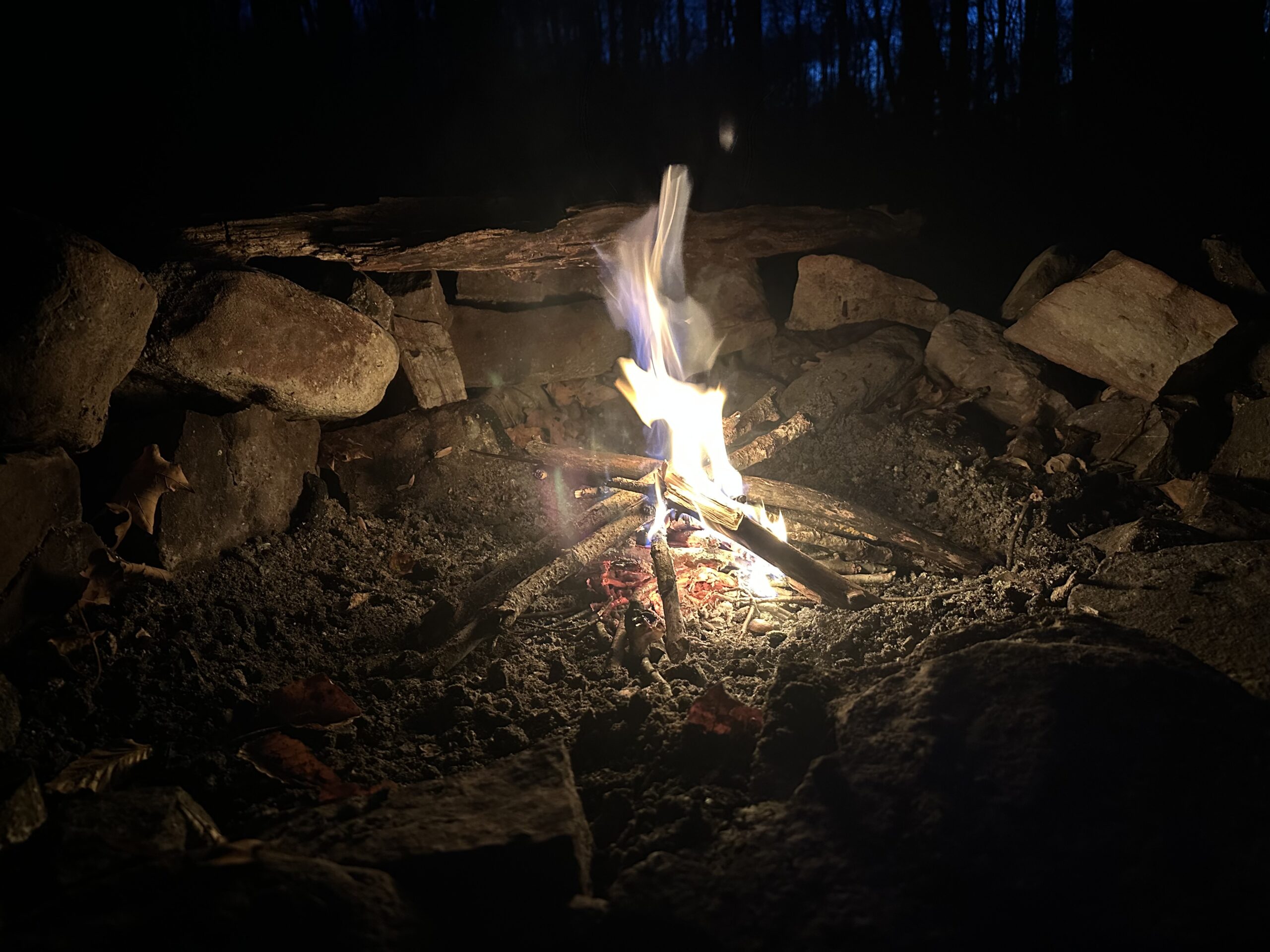
We cooked hot dogs on a whittled two-pronged stick and slow-roasted the potatoes in the coals. An hour later, as the chill started to sneak under my coat, up my back, and into my soul, I chomped my hot potato—a perfect way to combat the ice demons.
After yucking it up, catching up, and looking up (at the stars through the canopy), we hung our food and made two trips to refill water bladders to ensure the fire was completely out.
DAY 2 (17.00 MI | +3,401′ GAIN | -3,534′ LOSS)
Between the early start, the long drive, and Day 1’s hike, I fell asleep instantly. However, I didn’t stay asleep long. At 3:21 AM, a seemingly very close pack of coyotes to the west (down Trout Pond Trail) started a crazy, blood-curdling howl for about five minutes. When they concluded their orchestral number, I muttered, “Well, that was nice,” and fell back asleep.
An hour and a half later, I awoke once more to a pair of coyotes playing Marco Polo off Long Mountain Trail—a loud, close howl followed by a distant reply. The back-and-forth continued until it abruptly stopped.
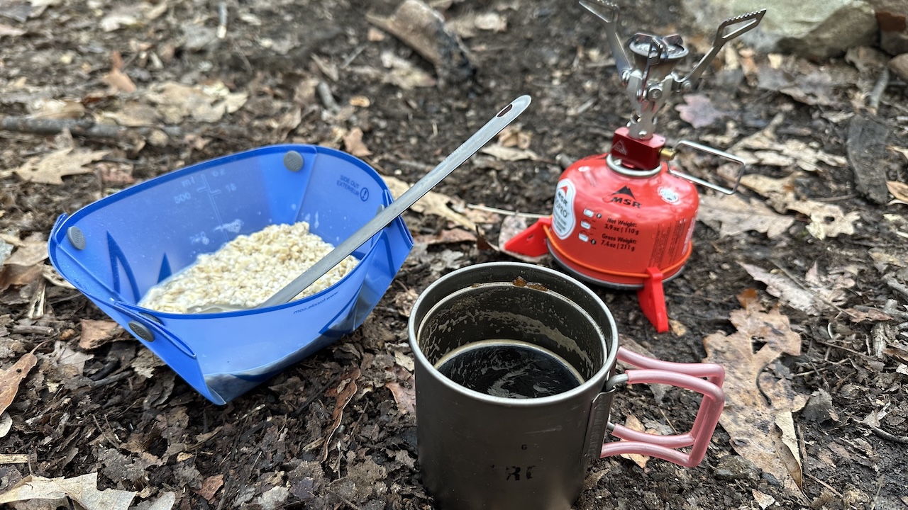
I woke for good around 6:00 AM and packed up under red light. We intended to depart by 7:00 AM, but we managed to stretch our morning coffee and conversation until an 8:10 AM departure.
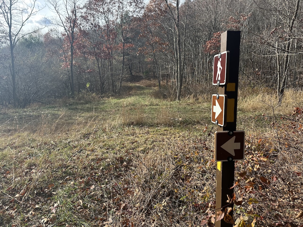
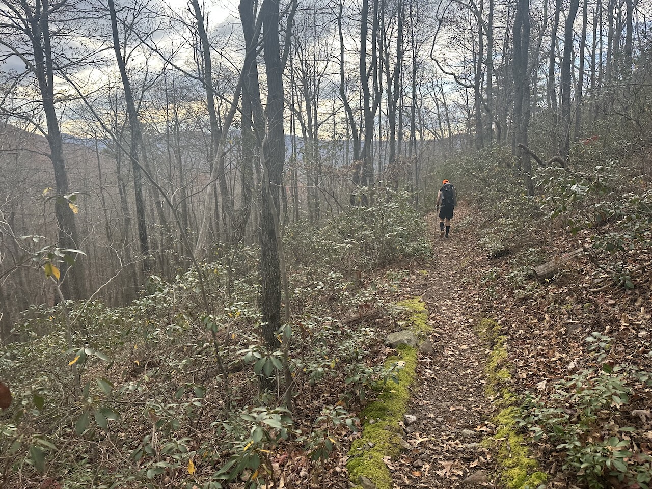
From the campsite we hiked 40 feet up Trout Pond Trail then turned west/right onto Long Mountain Trail where we followed it for 2.25 miles (and 900 feet of gain) to Devil’s Hole Road (aka Judge Rye Road) under partly cloudy, 51°F skies.
Along the way I fumbled to capture the sounds of local birds using Merlin Bird ID. Seriously, why is it that nearly every time I try to capture a bird’s song it stops yapping? By some miracle, I did manage to capture two birds singing. One, the Red Bellied Woodpecker, which neither of us could identify, and the other, a White-Breasted Nuthatch, which Coop identified immediately and without Merlin’s assistance. Nicely done good sir! Or as the nuthatch says, “wha-wha-wha-wha-wha-wha”.
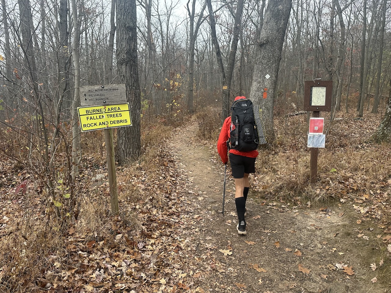
We reached Devil’s Hole Road an hour after we broke camp and were both pleasantly surprised to see gravel instead of pavement. Gravel usually means less people, but it also, sometimes, gets certain people thinking about the possibility of a bikepacking adventure. In related news, I think I’m maybe, definitely going bikepacking, soon, probably!
We shed a few layers and began the 2.5 mile/500′ descent to Tibbet Knob Trail. Along the way, I felt hotspots on both big toes. Sure enough, upon closer inspection, two tiny blisters had formed on the outside of each. The issue was likely a combination of new trail runners and Injinji toe socks even though I don’t usually break in trail runners and Injinji socks are usually my go-to, blister-free option. Whatever the reason, I wrapped my toes with band-aids, changed socks, and we were off once again.
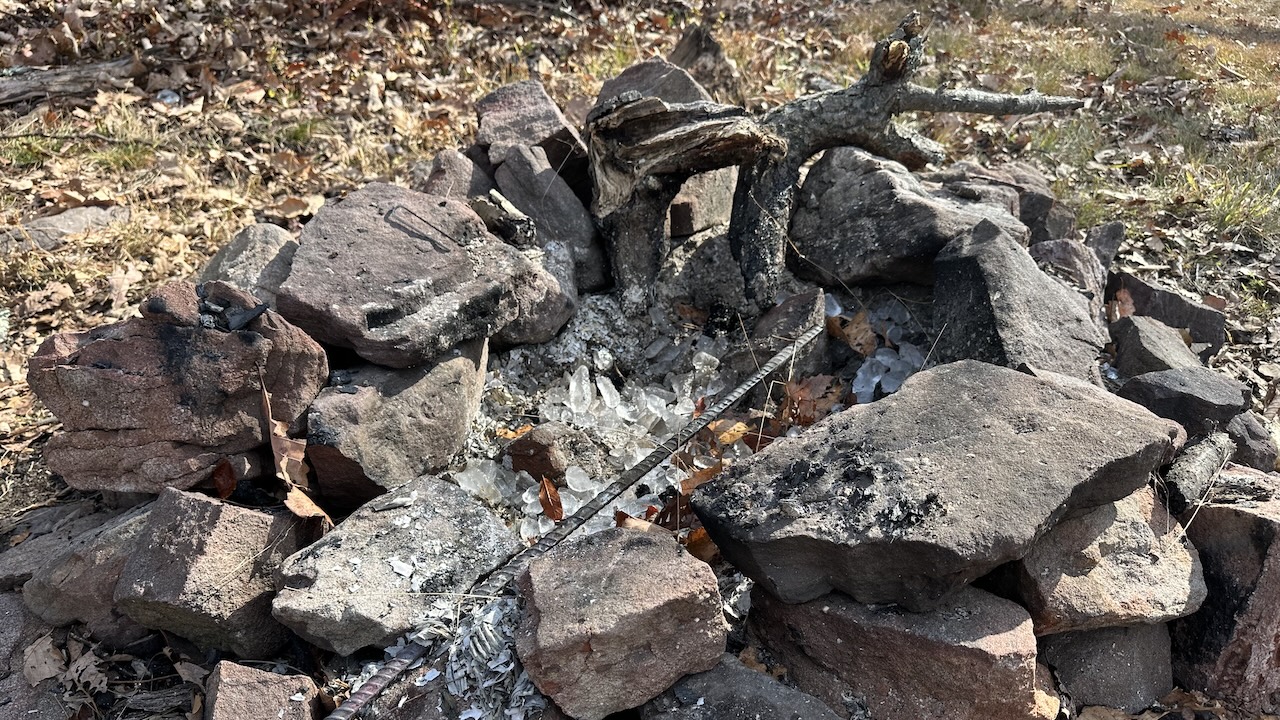
Around 10:00 AM, we left Devil’s Hole Road and started in on Tibbet Knob Trail. About 40 feet from the road the trail passed through a campsite that appeared to have been used the previous night by a pack of wolf people. And by “appeared to be used” I mean there were scraps of toilet paper strewn about the area, a couple of unopened bottles of water, a ping pong ball, and, my personal favorite, a pile of ice next to a STILL SMOLDERING FIRE! We channeled our inner Smokey Bear, using the ice and leftover water, and doused the fire until it was cold to the touch.
We then stuffed our packs with trash from the site and continued on the trail for a mile to Tibbet Knob; where the clouds had moved out and the winds moved in.
From the knob, we hiked another 1.5 miles to Wolf Rock Recreation Area where I had stashed the water. As we did, a familiar tune came from the direction of the guy in front of me.
COOP: The world is split up into continents.
ME: ☉_☉
COOP: There are seven in all.
ME: Oh god, is that…?
COOP: And if you get the gist, we’re gonna make a list, from biggest to small!
COOP/ME: They are Asia, Africa, North and South America, Antarctica, Europe, and finally, Australia!
We refilled our bottles, gave some away to a passing hiker, and then Coop and I hung out to eat lunch at a nearby picnic table. Dry ramen for me. Something more tasty for him.
While we ate, the sky darkened, followed by a light, cold drizzle that forced an unwelcome up my spine. We quickly donned our rain jackets, stuffed the rest of our food in our faces, loaded up, dumped trash in the bear-proof cans, and made our way up a very steep Mill Mountain Trail en route to Big Schloss Spur Trail about 2 miles away.
Trail Sign Discrepancy: The sign at Wolf Rock claimed Mill Mountain was 5 miles away and Big Schloss was 2 miles away. However, the sign at Big Schloss Spur Trail claimed Mill Mountain was 4 miles away. Since 5 – 4 ≠ 2, the sign at Wolf Rock should probably read 6 miles instead of 5. But again, I could be wrong, and maybe not good at trail math.
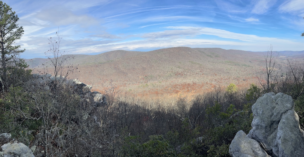
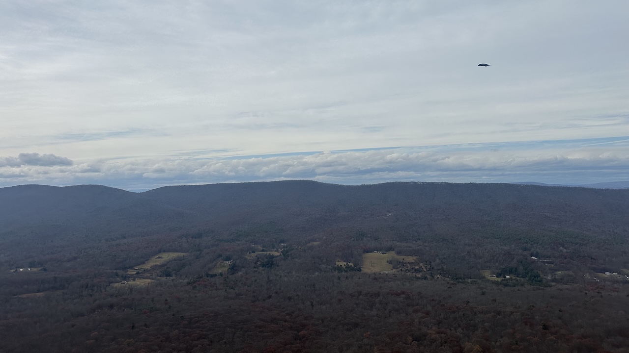
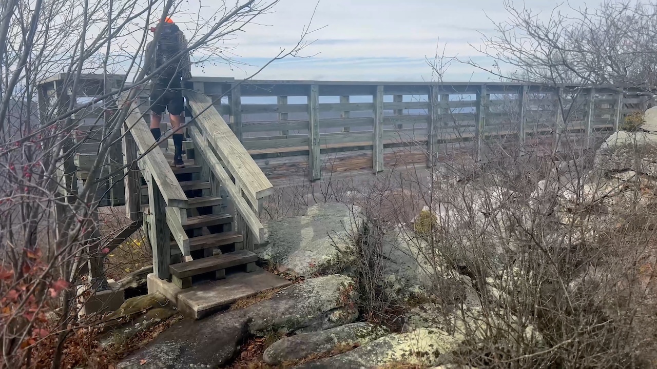
The rain stopped after the initial climb. At the top, we followed the ridgeline to Big Schloss Spur Trail and it to a sweet bridge and some pretty spectacular views. Once our eyeballs were full, we returned to the ridge and hiked 2 miles along Mill Mountain Trail to (an almost dry) Sandstone Spring. The spring sits at the base of a long 2-mile slog which goes up and over Mill Mountain to the Overmill Cutoff Trail/Tuscarora Trail intersection.
FYI, if you follow our route, Sandstone was the only water source we’d seen since we left camp (i.e. in 12 miles). If it was completely dry, the next water stop is Halfmoon Run, 2 miles away.
As we climbed Mill Mountain we made the decision to give our legs a rest and skip the views at Halfmoon Mountain in favor of heading straight to our campsite. This was a great idea because it would:
- Reduce our overall hike by 1.5 miles.
- Provide a 100% descent to camp.
- Allow us to set up before dark.
- All of the above
If you answered, D, you are welcome to join us on a future trip.
We followed Overmill Cutoff, passing the Tuscarora Trail intersection 0.4 miles down the trail, then the Halfmoon Lookout spur another 0.3 miles later. From the Halfmoon Lookout spur it was about a mile to the campsite where Halfmoon Trail cuts south/southwest across at Halfmoon Run (creek) or goes straight/west where it turns into Bucktail Cutoff Trail and eventually leads to the Bucktail Trailhead.
We set up camp, hung a bear line, filled bladders, and settled in for dinner around 5:00 PM. Not but 10 minutes later, as I confirmed the health of my toe blisters, a mountain biker tore up Bucktail Cutoff Trail towards Halfmoon. Then the sun went down. He passed back by around 6:30PM with his headlight blazing and another 2.8 miles of fairly technical trail to the parking lot. God speed broseph!
We ate, hung out for a bit, doused the fire three times, and then hit the hay.
DAY 3 (2.87 MI | +349′ GAIN | -767′ LOSS)
We woke at 6:00 AM and broke camp just before sun-up. By 6:30 AM, we were eating protein bars and knocking back instant coffee. Thirty minutes later, we were loaded up and headed west down the Bucktail Cutoff Trail.
Our conversations meandered more than the trail, covering topics like:
- building a line of outdoor snake apparel (the Serpent Snuggler pullover, the Snaket blanket, and Snakecho poncho),
- thinking through a Rammstein-esque song about Big Schloss to the tune of Du Hast, and
- wondering how the mountain biker from the night before survived this technical trail on two wheels in the dark, uphill, both ways.
The nonsense continued for the entirety of our 2.8 mile descent back to the parking lot.
Trip complete
TOTALS (26.25 MI | +5,060′ GAIN | -5,001′ LOSS)
FINAL THOUGHTS
The Perry Valley Loop was an exceptionally rewarding trip, balancing a strenuous physical challenge with profound backcountry calmness. The route’s 5,060 feet of elevation gain affirmed its demanding nature, but when split up, was more than manageable, even with band-aids on my toes.
The experience critically underscored the importance of meticulous planning, especially regarding water. Given the drought, stashing water at Wolf Gap was essential, confirmed by the dry 12-mile stretch between our first camp and Sandstone Spring. Furthermore, having to extinguish a still-smoldering campfire near the Tibbet Knob trail served as a stark reminder of the responsibility all hikers must acknowledge. As Smokey says, only you can prevent wildfires.
The loop’s iconic overlooks at Tibbet Knob and Big Schloss provided a visual payoff, and our campsites offered uninterrupted solitude (the nocturnal mountain biker, who never acknowledged us, doesn’t count). Overall, the Perry Valley Loop proved demanding yet restorative—a top-tier challenge within the George Washington National Forest that is easily manageable with proper preparation.
For an even better write up of our adventure check out Coop’s trip report.
And, because you didn’t ask, here are the AI-generated “Du Schloss” lyrics for your singing pleasure.
Du Schloss
(Heavy, driving industrial metal beat, reminiscent of Rammstein)
(Till Lindemann-style vocals, deep and rhythmic)
Chorus Du! Du hast! Du hast den Big Schloss! Du! Du hast! Du hast den Big Schloss!
Du hast gefragt, “Ist es steil?” Du hast gefragt, “Ist es steil?” Ich habe nichts gehört, nur Lunge brennt! (I heard nothing, only lungs burning!)
Verse 1 27 to 30 Meilen lang, In West Virginia, the circuit is strong! A Perry Valley Loop you must endure, 6,000 feet, your muscles are poor!
Pines and hardwoods, the flora is dense, Your tired legs make no common sense. You started strong, but now you crawl, To summit vistas, you give your all!
Pre-Chorus Willst du bis der Tag vorbei ist, deine Blasen zählen für alle Tage? (Will you, until the day is over, count your blisters for all days?) Ja! Ja! (Yes! Yes!)
Chorus Du! Du hast! Du hast den Big Schloss! Du! Du hast! Du hast den Big Schloss!
Du hast gefragt, “Ist es steil?” Du hast gefragt, “Ist es steil?” Ich habe nichts gehört, nur Lunge brennt!
Bridge Wolf Gap parking, a critical start, Tibbet Knob will break your weak heart. Then Halfmoon Mountain, a final test, A scenic reward, better than the rest! You love the solitude, the views so great, But every morning, your body you hate!
(Heavy, driving electronic beat fades out)